164 résultats
18861962Helsingfors, 1886/87. 4°, 13 Seiten Text, 172 Seiten Tabellen, 2 farbige Karten und 4 Tafeln; 42 Seiten Text, 195 Seiten Tabellen, 1 Phototafel und 2 Tafeln. Private Pappbände mit Goldprägung.
1843E01482 volumes. xxxvii23878 ad pages with frontispiece woodcuts in text and 7 steel-engraved plates; vi2474 pages with frontispiece woodcuts in texts and 10 steel-engraved plates. Royal octavo 9¼x5½" in publisher's original green cloth spine lettered in gilt covers decorative blind stamped. First Edition.<br /><br />In 1825 Edward Belcher accompanied Frederick William Beechey's expedition to the Pacific and Bering Strait as a surveyor. In 1836. he commanded a surveying ship on the north and west coasts of Africa and in the British seas. Belcher took up the work which Beechey had left unfinished on the Pacific coast of South America. He was on board the bomb vessel HMS Sulphur which was ordered to return to England in 1839 by the Trans-Pacific route. Belcher made various observations at a number of islands which he visited having been delayed by being dispatched to take part in the war in China in 1840. On 26 January 1841 the then Commander Belcher landed on Possession Point at the north shore Hong Kong Island and made the first British survey of Hong Kong harbor. After the war's end in 1842 he reached home and for his services was made a Knight Bachelor in the following year. He was then engaged in HMS Samarang in surveying work in the East Indies the Philippines Geomun-do Port Hamilton and other places until 1847. In 1852 Belcher led the last and largest Admiralty expedition to rescue Sir John Franklin. He was also to look for his former surveying officer in Hong Kong Richard Collinson and Robert McClure whose ships had not been seen after entering the Bering Strait. He did a great deal of sledge exploration rescued McClure and abandoned four of his five ships in the ice. He had five ships: Assistance Belcher Resolute Henry Kellett second mate George Nares the steam tenders PioneerSherard Osborn and Intrepid Leopold McClintock and the depot ship North Star William Pullen. Belcher and one tender were to enter Wellington Channel where Franklin was thought to be while Kellett was to go west to Melville Island and look for Collinson and McClure. North Star was to stay at Beechey Island as a supply base. He left the Nore in April 1850. By early winter Assistanceand Pioneer were frozen in at Northumberland Sound to the north of Wellington Channel while Resolute and Intrepid were frozen in off Melville Island Arctic—the first ships this far west since William Edward Parry in 1819. A great deal of exploration was done by man-hauled sledges. In April 1853 Leopold McClintock and others left the Resolute on sledges and returned 105 days later having covered 1400 miles and discovered Prince Patrick Island. Another party went west and discovered Robert McClure whose ship was frozen in at Mercy Bay. Belcher went north by sledge and found a channel at the northern tip of Devon Island hinting that Franklin might have used it to escape to Baffin Bay. When the ice broke up that summer he pushed his ships up Wellington Channel and became trapped again. By February 1854 Belcher was becoming increasingly worried about the safety of his ships and men. In April he ordered Kellett to abandon his ships and return by sledge to North Star. Belcher abandoned his two ships in late July. Aided by two ships that showed up at Beechey Island Phoenix and Breadalbane the whole party returned to England. Belcher went through a court martial which was automatic for any captain who had lost a ship. He was exonerated but his sword was returned to him 'without observation'. He never again received an active command. Curiously Resolute broke free of the ice and drifted all the way to Davis Strait where it was picked up by an American whaler.<br /><br />Condition:<br /><br />Some staining and wear to covers spines a bit faded ends chipped and worn rear joint of Vol. I with chipping and loss; hinges repaired at endpapers some light foxing and occasional mostly marginal damp staining within the three folding maps which should be loose in a pocket not present; overall good uncommon in the original cloth. Henry Colburn hardcover
182447632Vol. I has a large partial coloured map as frontis and Vol. II has 3 large folding maps in the rear The record of Franklin's first Arctic expedition fraught with hardship and tragedy constitutes one of the classics in the annals of travel literature. In all the party travelled 5500 miles overland and with the aid of canoes exploring the territory from York Factory to the mouth of the Coppermine River on Coronation Gulf east along the Arctic coast as far as Point Turnagain and back across the Barren Lands. Provisions were poor and scant and on the return journey many crew members died of cold and starvation; the young naval artist Robert Hood was murdered and another executed for the crime. The work also includes accounts by Richardson and Back of the last leg of the desperate journey across the Barren Lands. This edition omits the appendix on the natural history of the region and scientific observations on the aurora borealis and the magnetic needle. Arctic Bib. 5195. Sabin 25625. TPL 1249. Lande 1181-82. Peel 151n. John Murray hardcover
1823040517John Murray. Good with no dust jacket. 1823. First Edition. Hardcover. Hardcover; Hardcover. Brown leather boards with gold design at board edges. Title in gold over black leather label on gold decorated spine. Boards are noticeably scuffed and worn. Frayed edges some sunning. Marbleized edges match marbleized endpapers. Occasional foxing throughout. 4 maps 30 plates of which 11 are hand colored. All are in nice condition some light foxing/soil. Always carefully wrapped and shipped in cardboard boxes to protect your purchase.; B/w Illus; 4TO . John Murray hardcover
1831E0132<p>2 volumes. xxi472 pages with three maps two folding and one double page figures and 13 plates; iv452 pages with 10 plates some folding tables and appendices. Octavo 9 1/2" x 5 1/2" Bound in contemporary half leather with marbled boards and gilt lettering to spine. Ferguson 1418; Hill I p. 19; Howes B309; Lada-Mocarski 95; Sabin 4347. Second edition published after quarto edition of the same year.<br /><br />Frederick William Beechey 17 February 1796 – 29 November 1856 was an English naval officer and geographer. He was the son of Sir William Beechey RA and was born in London. 1806 he entered the Royal Navy and saw active service during the wars with France and America. In 1818 he served under Lieutenant afterwards Sir John Franklin in David Buchan's Arctic expedition of which at a later period he published a narrative. In the following year he accompanied Lieutenant W. E. Parry in HMS Hecla. In 1821 he took part in the survey of the Mediterranean coast of Africa under the direction of Captain afterwards Admiral William Henry Smyth. He and his brother Henry William Beechey made an overland survey of this coast and published a full account of their work in 1828 under the title of Proceedings of the Expedition to Explore the Northern Coast of Africa from Tripoly Eastward in 1821-1822. In 1825 Beechey was appointed to command the HMS Blossom. His task was to explore the Bering Strait in concert with Franklin and Parry operating from the east. In the summer of 1826 he passed the strait and a barge from his ship reached 71°23'31" N. and 156°21'30" W. near Point Barrow which he named a point only 146 miles west of that reached by Franklin's expedition from the Mackenzie river. The whole voyage lasted more than three years and in the course of it Beechey discovered several islands in the Pacific and an excellent harbor near Cape Prince of Wales. In July 1826 he named the three islands in the Bering Strait. Two were the Diomede Islands that Vitus Bering had named in 1728: "Ratmanoff Island" Big Diomede and "Krusenstern Island" Little Diomede. Beechey called the uninhabited third islet "Fairway Rock" which is still its contemporary name. One of his crew Petty Officer John Bechervaise gave a detailed account of the voyage in his Thirty Six Years if a Seafaring Life by an Old Quartermaster published privately in 1839. In 1831 there appeared his Narrative of a Voyage to the Pacific and Beering's Strait to Co-operate with the Polar Expeditions 1825-1828. In 1835 and the following year Captain Beechey was employed on the coast survey of South America and from 1837 to 1847 carried on the same work along the Irish coasts. He was appointed in 1850 to preside over the Marine Department of the Board of Trade. In 1854 he was made rear-admiral and in the following year was elected president of the Royal Geographical Society. Beechey Island where Sir John Franklin wintered is named after him.<br /><br /><strong>Condition:</strong><br /><br />Name neatly excised from head corner of titles small inconspicuous stamp to last pages. Inner hinges beginning marble to boards rubbed some stains to map. some toning to some plates some plates not bound in order to the printer but are all accounted for corners gently bumped else about a very good set.</p> Henry Colburn and Richard Bentley hardcover
18541102250022Philadelphia: Blanchard and Lea 1854. Ninth Edition Revised. Leather Bound. Very Good. Published in 1854. Large 8vo. 509 pp. Collated. Complete. Two maps and multiple illustrations all in very good condition. Clean unmarked pages no foxing. Bound in contemporary leather somewhat worn. Covers in good shape with only slight bumping gold gilt spine lettering and imprint on front cover. Back cover looks like it was imprinted as well but the gilt is missing. Binding is in excellent shape. Ships daily. Captain William Francis Lynch commander of the 1847 USN expedition to the Dead Sea wrote this chronicle of the journey upon his return to the United States. A native Virginian he later served in the Confederate Navy but he was repatriated to the United States after the American Civil War. Blanchard and Lea hardcover
1856E0560<p>3 volumes: xvii1537 pages with 90 lithographs plates including the usual expunged bathing plate many in color including 3 "facsimiles" of Japanese woodblock prints 2 folding; 6 maps and charts 2 folding; 79 woodcuts in the text; 2414414-1xi pages with 4 color lithographs of Chinese scenes; 2 uncolored natural history engraved plates; 6 hand-colored lithographs of birds; 10 hand-colored steel-engravings of fish; 5 lithographs of shells 2 hand-colored; 16 diagram plates of winds and currents; 14-page facsimile of Japanese language version of the U.S.-Japan treaty; 17 folding charts on 16 sheets; numerous woodcuts in the text; xliii17051 pages woodcut star charts throughout. Volume III titled "United States Japan Expedition. Observations on the zodiacal light from April 2 1853 to April 22 1855 . by Rev. George Jones A.M. chaplain United States Navy". Quarto 11½ x 8 ¾" bound in the original blind stamped cloth. Volume 1 rebacked with the original cloth spine laid down. Hill 1332; Sabin 30968 Stabbed signature of the author included. First edition of the House Issue.<br /><br />Detailed and profusely illustrated account of Perry's expedition to open Japan to the West; Upon his return to the U.S. his chief duty for the following year was to compile his reports of the expedition aided by Francis Hawks. The first volume has the account of the voyage and lithographs of the travel; the second volume has the natural history reports by D.S. Green and others and includes hand-colored plates of Japanese fishes and shells. In addition to the artist W. Heine from whose drawings a great number of the lithographs were made the daguerreotypist E. Brown Jr. went on the expedition taking what were undoubtedly the earliest photographic images of Japan many of them reproduced lithographically in this work. This copy with the nude bathing plate which was not included on the list of plates and not issued in all copies. <br /><br />In advance of his voyage to the Far East Commodore Perry read widely amongst available books about Tokugawa Japan. His research even included consultation with the increasingly well-known Japanologist Philipp Franz von Siebold who had lived on the Dutch island of Dejima for eight years before retiring to Leiden in the Netherlands. In 1852 Perry embarked from Norfolk Virginia for Japan in command of a squadron in search of a Japanese trade treaty. Aboard a black-hulled steam frigate he ported Mississippi Plymouth Saratoga and Susquehanna at Uraga Harbor near Edo modern Tokyo on July 8 1853. His actions at this crucial juncture were informed by a careful study of Japan's previous contacts with Western ships and what could be known about the Japanese hierarchical culture. He was met by representatives of the Tokugawa Shogunate who told him to proceed to Nagasaki where there was limited trade with the Netherlands and which was the only Japanese port open to foreigners at that time. Perry refused to leave and demanded permission to present a letter from President Millard Fillmore threatening force if he was denied. Perry ordered his ships to attack several buildings around the harbor to demonstrate US naval power. The Commodore was fully prepared for more hostilities if his negotiations with the Japanese failed and threatened to use unrestrained fire if the Japanese refused to negotiate. He sent two white flags to them telling them to hoist the flags when they wished a bombardment from his fleet to cease and to surrender. Perry's ships were equipped with new Paixhans shell guns capable of wreaking great destruction with every shell. The Japanese military forces could not resist Perry's modern weaponry; the term "Black Ships" in Japan would later come to symbolize a threat imposed by Western technology. Perry returned in February 1854 with twice as many ships finding that the delegates had prepared a treaty embodying virtually all the demands in Fillmore's letter. Perry signed the Convention of Kanagawa on March 31 1854 and departed mistakenly believing the agreement had been made with imperial representatives. The agreement was made with the Shogun the de facto ruler of Japan. On his way to Japan Perry anchored off Keelung in Formosa modern day Taiwan for ten days. Perry and crew members landed on Formosa and investigated the potential of mining the coal deposits in that area. He emphasized in his reports that Formosa provided a convenient mid-way trade location. Formosa was also very defensible. It could serve as a base for exploration as Cuba had done for the Spanish in the Americas. Occupying Formosa could help the US to counter European monopolization of the major trade routes. President Franklin Pierce declined the suggestion remarking such a remote possession would be an unnecessary drain of resources and that he would be unlikely to receive the consent of Congress. When Perry returned to the United States in 1855 Congress voted to grant him a reward of $20000 in appreciation of his work in Japan. Perry used part of this money to prepare and publish a report on the expedition in three volumes titled Narrative of the Expedition of an American Squadron to the China Seas and Japan. He was also advanced to the grade of rear-admiral on the retired list when his health began to fail as a reward for his services in the Far East.<br /><br /><strong>Condition: </strong>Wear and fading to cloth large map repair at with archival tape several others with stub tears and splitting to folds; light foxing spine ends rubbed with a few with chips corners bumped and rubbed through. Accompanied with encapsulated and graded signature of the author else good to very good. Due to the size and weight additional postage will be required.</p> A O P Nicholson hardcover
1852019721London: Ingram Cooke. Complete in two volumes. xi 318 pp.; xii 326 pp. Quarter leather and marbled boards. Raised bands attractive spine slips elegant gilt designs in the compartments. Half titles present. All plates and illustrations called for are present. A very small chip on the name plate of both Volume 1 and Volume 2 the first not affecting text the second deleting the small "II" representing Volume II. Covers rubbed edge wear Very Good. A nice set. Six ships with artists scientists and surveyors explored the coasts of North America South America Antarctica and the Pacific Islands. Provenance: Contains the bookplates of J. B. Torry Esq. of Shrub's Hill Sunningdale in Surrey England. . Very Good. Hard Bound. First Edition Thus. 1852. Ingram, Cooke unknown
1898220429Verlag von J.F. Schreiber Braun & Schneider München 1898. Softcover Zustand: keine Beschädigungen Exemplar einer Privatbibliothek mit Kennungen. Rücken Ecken Kanten gut. Verlag von J.F. Schreiber, Braun & Schneider, München, paperback
185546629Gotha Julius Perthes 1855-1874. 4to. Bound in 18 contemp. hcalf some wear to the first 10 vols. some a bit rubbed. Some scattered brownspots to the first volumes. Gilt spines. Wear to top of spines. With a huge amount of original maps plates profiles etc. lithographed and engraved large and folded and mainly in colour. This set does not include the "Ergänzungsbände". <br/><br/><em>The first 19 lacking vol. 14 volumes of this importent periodical from its "Golden Period". "Petermann's Mittheilungen" became the leading geographic publication of the world and remained so until World War I. All the new geographical discoveries all the reports from the latest exploratory expeditions were published and flowed into Petermann's Geographische Anstalt and he took care to see that it was translated into cartographic form as quickly as possible. The maps soon came to have a reputation for containing the latest and the most accurate information available. Not only German but international readers as well came to see the 'Mitteilungen' as an indispensable organ for the world of geographical research. </em> unknown
1852ZB409601Washington: Hamilton printer 1852. 7 pp issued as 32d Congress 1st Session HED 19; extraction roughness at spine now in self wrappers; the surviving American members of the failed Lopez expedition against Cuba have been pardoned and released; their actions were unauthorized but Secretary of State Daniel Webster thinks something should be done to relieve their forlorn and deplorable condition. - If you are reading this this item is actually physically in our stock and ready for shipment once ordered. We are not bookjackers. Buyer is responsible for any additional duties taxes or fees required by recipient's country. Washington: Hamilton, printer, unknown
189820487Adelaide: RSSA 1898. First Edition. Paperback. Fine. Adelaide RSSA 1898. Octavo pages 125-192 plus a tipped-in errata slip with several minor references to this article. Wrappers slightly and uniformly tanned acidic paper; a fine copy uncirculated. Keartland's field notes make this far more interesting than the 'List of Birds' title suggests. For example he concludes his account of the Nankeen kestrel thus: 'I took four eggs from a tree near our camp and was surprised to find the nest lined with pellets of camel dung. This is probably the first time this material has been used for nest-lining'. Indeed. <p>Other articles of more-or-less general interest include KOCH Max: A List of Plants collected on Mount Lyndhurst Run 18 pages; BROWNE J. Harris: Use of the Wedge by the Natives of the Great Barrier Plain 1 page; and the address by the president W.L. Cleland 7 pages essentially on the anthropology of Australia. RSSA paperback
1821138738London: Sir Richard Phillips 1821. Fair. iv 124 p. 23 cm. 3 engraved plates. Disbound. Plates title and Preface detached. Foxing. Map missing. <br/><br/> Sir Richard Phillips unknown
188473300Washington: Government Printing Office 1884. First edition. Octavo. 75 1 pp. plus folding map of the Lena Delta in Russia and four full page heliotypes. Original blue printed wrappers. Small piece missing from outer edge of front wrapper three small and excellent paper repairs to wrappers. A very good and very clean copy in the original wrappers.The heliotypes in this publication are particularly interesting as they show Russian soldiers guarding the graves of the Jeannette crew. The final photograph shows all the coffins loaded into a Russian train."In February 1882 Secretary Thompson had despatched naval lieutenants Giles Harber and William Schuetze to the delta to search for any traces of the lost explorers particularly of Chipp's party. They were unsuccessful but in November received orders from the secretary to supervise the return of the bodies of De Long and his comrades to the United States. Weather and bureaucracy delayed them for a year; finally in November 1883 the bodies were taken from Yakutsk by train to Moscow Berlin and finally Hamburg. Here they were placed on board the U.S. steamer Frisia which arrived in New York in February 1884. The funeral cortège was escorted by naval and military detachments to the Church of the Holy Trinity on Madison Avenue for a memorial service. Afterwards the bodies of Ambler Collins and Boyd were claimed for private burial; those of De Long and six others were taken to Woodlawn Cemetery in the Bronx and buried together there. In October 1890 a large monument to the expedition's dead was unveiled at the United States Naval Academy in Annapolis. Its design is based on the original cairn and cross raised at the burial site on the Lena Delta." Wiki [Government Printing Office] unknown
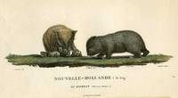
180718812Paris: Imprimerie de Langlois 1807. Very good condition. One of the most attractive prints of wombats a pair of wombats with 4 offspring clambering about. This is plate XXVIII from the work illustrating Nicolas Baudin's expedition. At the time the French were the most progressive at sending teams of artists & scientists around the world with their explorers. Copper engraving with original hand color. Platemark measures 12 1/2 x 9 1/2'' with small margins. A large early representation of the infrequently depicted wombat. Imprimerie de Langlois unknown
188110061DBLeipzig, F. A. Brockhaus, 1881. 8°. 21,5 cm. VIII, 559 (1) Seiten. Blauer Original-Leinenband mit goldgeprägtem Rücken- und Deckeltitel.
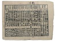
1853347481853. Three woodblock-printed sheets on mulberry paper. Mild edge wear old folds. A detailed revealing group of late Tokugawa samurai reference sheets recording the names ranks stipends heraldry standards and service obligations through which the shogunate and Edo public understood military readiness at the moment of Perry's arrival.<br/> <br/> Commodore Matthew C. Perry anchored off Uraga at the entrance to Edo Bay in July 1853. His arrival made visible the vulnerability of the Tokugawa capital and produced an immediate demand for information about coastal defence domain strength and the lords responsible for guarding the approaches to Edo. Kawaraban and related broadsides answered that demand in compressed visual form combining names crests military symbols income figures and geographical or administrative data. The first printed sheet appears to be an earlier roster of Edo office-holders or guard personnel. Its tabular format with names offices crests and standards records the recognitional system already in place within Tokugawa administration before the Perry crisis sharpened the public appetite for such information. The manuscript sheet is ruled into a large grid with headings formed from the twelve zodiac signs and the four seasons including Rat Ox Tiger Hare and the seasonal headings. The entries appear to record named houses Lords or retainers against recurring seasonal and cyclical categories probably for service attendance or ceremonial obligation. The third sheet is headed "Rekko yushinroku" here translated as "Register of Valiant Retainers of the Lords." It lists major daimyo houses and their principal retainers with domain or house headings names titles stipend figures in koku family crests standards and related insignia. Visible regional or house designations include "Kaga" "Owari" "Kii" "Satsuma" "Higo" and "Tosa." The sheet gives a graphic register of the daimyo world mobilised or imagined as mobilised around the defence of Edo Bay. Together the sheets preserve the administrative and visual language of Tokugawa defence at a moment of acute pressure. They are not formal shogunal orders and the first sheet may predate Perrys arrival but they show how late Edo Japan translated rank obligation military identity and coastal defence into portable tabular form. Their compression the names of Lords and retainers the scale of domains the crests and standards by which armed households could be recognised and the bureaucratic habits of a regime suddenly forced to account for its capacity to defend the country reveals these documents' immediacy and importance. unknown
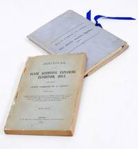
18932712376Adelaide: C.E. Bristow 1893. Wrappers torn at edges but well repaired as are the boards of the map section. Octavo complete with maps; original wrappers and boards preserved in a brown morocco bookform box. <p><p>First edition: one of 500 copies printed of the narrative of one of the last great Australian exploring expeditions written by the leader of the expedition and complete with its maps.</p> <p>Lindsay led this extensive expedition - it ran to eight men forty-four camels and five Afghan camel drivers - organised by the South Australian Branch of the Royal Geographical Society and equipped by Sir Thomas Elder to explore the unknown interior between South Australia and the west coast and to look for Leichhardt. Lindsay's exhaustive report includes the surveyor L.A. Wells's journal of the expedition. Also included is an extensive Aboriginal vocabulary collected by Wells from the Pidong tribe at the head of the Murchison River the Minninng tribe at Fraser Range from the Everard Ranges at Mount Illbillee and from the "Wallawe" tribe at Yarragabie Station Western Australia. He states "Appended is a list of native names which I have collected from four tribes met with during the expedition.".</p> <p>The separate large folding maps are original lithographs coloured to illustrate geological changes. Compiled and drawn by both Lindsay and Wells these maps show in great detail the earlier discoveries of Giles Gosse Forrest and Hunt as well as the route taken by the Elder explorers.</p> </p> . C.E. Bristow unknown
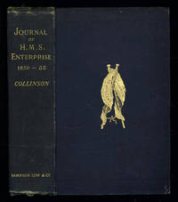
1889035576London: Sampson Low Marston Searle & Rivington. 1889. 1st Edition 1st Printing. Hardcover. Good/No Jacket. 8vo - over 7¾ - 9¾" tall. Good. Publishers cloth embossed with gilt lettering and emblem to upper cover. Front hinge cracked. Gift inscription in contemporaneous hand to free front endpaper. A touch of foxing. Two of the maps have a dog-eared fore-edge where they have not been folded quite flush with the page edges. Illustrated with tissue-guarded colour frontispiece of the ship tissue-guarded portrait of the author and 6 fold-out maps. xi i 531pp 32pp of publishers ads to rear. FIRST EDITION of the posthumously published journal by the captain who came closest to the site where Franklin's expedition ended. "In 1849 Collinson was appointed to command an expedition for the relief of Sir John Franklin by way of the Bering Strait; he himself had command of the Enterprise and with him was Commander Robert Le Mesurier McClure in the Investigator. The two ships sailed together from Plymouth on 20 January 1850 but unfortunately separated in the neighbourhood of Cape Horn and did not meet again. The Enterprise passed Point Barrow Alaska on 21 August but the ice forced Collinson to return south and winter in Hong Kong. In 1851 he was again hampered by ice and in 1852 was frozen in at Cambridge Bay for the winter. In 1853 the Enterprise was caught in the ice at Camden Bay and there passed a third winter. She reached Point Barrow on 8 August 1854 after being shut up in the Arctic entirely on her own resources for upwards of three years. Of the many who had searched for Franklin Collinson came closest to the place where the expedition had ended. Collinson's addition to geographical knowledge on this Arctic trip was very considerable and would have been tantamount to the discovery of the north-west passage had this not been already actually achieved by the men of the Investigator" DNB. Arctic Bibliography 3351; Hill 337; Ricks p 68; Tourville 986. <br/> <br/> Sampson Low, Marston, Searle, & Rivington. hardcover
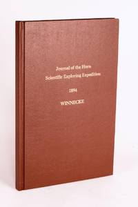
189658059Adelaide: C.E. Bristow Government Printer 1896. First Edition. Hardcover. Fine. Adelaide C.E. Bristow Government Printer 1896. Foolscap folio 32 pages including Appendix B: Report of the Physical Geography of Central Australia by Professor R. Tate and J.A. Watt plus 24 plates on 13 leaves printed rectos only and a folding meteorological chart 2 folding maps a topographical map of Mount Watt and a Survey of Hermannsburg Mission Station and a very large folding colour map 1210 × 1210 mm. Modern cloth lettered in gilt on the front cover; blank bottom margin of the main map slightly creased with one tiny tear expertly sealed; a fine copy. South Australian Parliamentary Paper 19 of 1896: only 650 copies printed. Winnecke was the leader of the expedition and in 'the natural order of things these journals and maps should have been published in connection with the scientific and other records of the Horn Expedition as both supplementary and complementary to them'. After a financial disagreement with W.A. Horn the organiser and backer of the venture this did not occur and this first edition was published under the auspices of the South Australian branch of the Royal Geographical Society of Australasia in conjunction with the Department of the Minister for the Northern Territory and the Survey Department. McLaren 16973; an octavo edition was published the following year see McLaren 16969 - not noting the very large map. C.E. Bristow, Government Printer hardcover