THOMAS (Lowell).Livre Rare Book
1 365 résultats
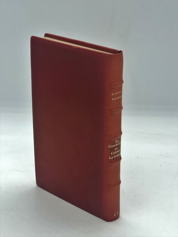
1933PHO-688Paris, Payot, 1933, in-8,plein chagrin rouge, dos à nerfs, insolé. 297pp, illustrations , bel exemplaire.
8vo., Fifth Impression, with frontispiece, 68 plates on 46, 3 maps in the text and large folding map in red and black in pocket at end, free endpapers lightly browned; ivory cloth, backstrip lettered in gilt and black, a very good, bright, clean copy in unclipped dustwrapper. The author's first and most celebrated book, chronicling his years of travel after WWII 'without European companions and living as an Arab'. EARLY PRINTINGS ARE SCARCE IN THIS CONDITION.
2026__8857248941Skira 2026. Hardcover. New. 384 pages. Arabic language. 9.65x0.21x11.42 inches. Skira hardcover
92102aafNew York/London, D. Appleon-Century Company, 1938, in-8vo, X (with map of „the Arab revolt against the Turks“) + 303 p. + 7 black/white photos on plates, orig. publisher’s illustrated red cloth. Spines sunned, else a fine set.
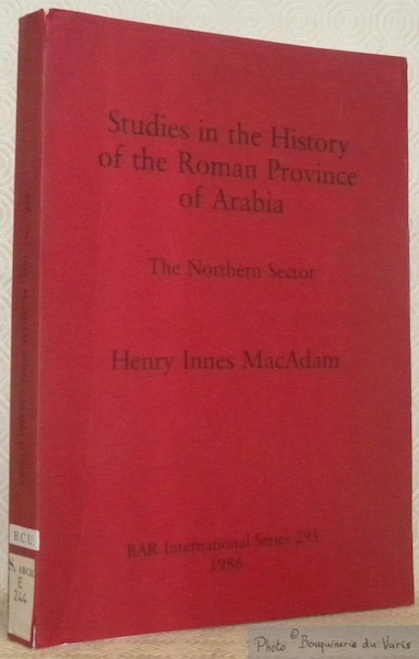
89522Oxford, BAR International Series 295 1986, 295x210mm, XV - 420pages, paperback. Library stamp. Rating label stick on the bottom of the spine, otherwise book in good condition, despite very small tears on top and bottom of the spine.
14478BERREBY J.J. Le golfe persique. Mer de légende - Réservoir de Pétrole: Iran Irak Arabie Saoudite Koweit Bahrein Qatar Côte des Pirates Mascate et Oman. Paris Payot 1959; First Edition. Bibliotheque Historique. 8 vo. 8 vo 228 pp; French text; Illustrated cover with paperback binding including 4 maps 11 b/w photographs Preface de Jacques Vernant. Some yellowing to the spine and covers with remnants of a price sticker on back cover. In good condition. unknown books
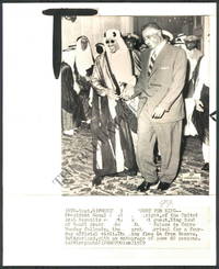
1960144471960. Wirephoto of Naser and King of Saudi Arabia from Arab Summit Conference Photograph from the 1960's . From the Historic Archives of the Baltimore Sun<br /> Arab Summit Conference Size: 8.3" x 9.1". This WIREPHOTO is straight from The Baltimore Sun's historical photo archive. Wire photos are different than traditional photographic prints! This print is the result of what used to be breakthrough technology now completely obsolete that allowed a photographic image to be scanned transmitted over "the wire" telegraph phone satellite networks and then printed at the receiving location. These are the originals that then were printed in newspapers across the country to illustrate the Newspaper story. unknown
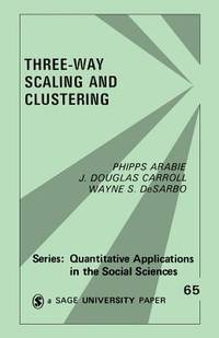
1987Q-0803930682SAGE Publications Inc 1987-07-01. Paperback. New. New. In shrink wrap. Looks like an interesting title! SAGE Publications, Inc paperback
2010114562Köln: Taschen Verlasg, 2010. 44 x 32,5 cm ; Pp.
0365784265.Ghardcover. Good. Access codes and supplements are not guaranteed with used items. May be an ex-library book. hardcover
8vo., First Edition, with frontispiece, 103 plates on 60 and 3 maps (one double-page) in the text; green cloth, gilt back, backstrip lightly age-soiled else a very good, bright, clean copy. Thesiger's second book. The Marsh Arabs occupy the region around the junction of the Tigris and Euphrates in southern Iraq. This classic account, recording eight years spent living among them, is a worthy sequel to his masterpiece 'Arabian Sands'.
20 pages, including 2 sketch maps. Plus photographic plates. Original condition with blue wrappers, titles to front, and containing all the ads. This is a complete issue, seldom found in such good and original condition. This is an exceptional report detailing a journey to the The Somali Coasts - Somalilands and Eritrea. The journey was made crossing Africa, through Timbuktu, Lake Chad, the Ubangi,Congo, Uganda, and Kenya, and many other places. The author discusses their main objective as the collection and photography of animals. Illustrations include: Camp at Rama on the River Dawa, Portuguese sixteenth-century lighthouse at Mogadishu, Camel corps at Gardo, Italian Somaliland, Street in Mogadishu, Native market in Mogadushu, Mosque and Sultan's house at Tio, General view of assab, Street in Assab.
33 pages, inluding sketch illustrations. Plus black and white photographic plates and a large fold-out colour map measuring approximately 16 x 9 inches (40 x 23cm). Original condition with blue wrappers, titles to front, and containing all the ads. This is a complete issue, seldom found in such good and original condition. This is a detailed first-hand expedition report of discoveries made by accomplished Libyan Desert explorer Ralph A. Bagnold. Although retired from the military since 1935, Bagnold remained a desert explorer. With the aid of the Egypt Exploration Society, in 1938 Bagnold organized his most ambitious scientific expedition to the Gilf Kebir and Uweinat. While on this venture, fellow explorers, Hans Winkler, recorded rock art at Karkur Talh, and Oliver Myers excavated two main neolithic sites in the Gilf Kebir, in Wadi Bakht and Ard al Akhdar. Bagnold and Shaw also discovered a new rock art site in Karkur Murr, and one also in Wadi Abd el Melik in the Gilf Kebir. With contributions by Bagnold's expedition members Myers, Peel and Winkler, this comprehensive dissertation is clearly outlined in sections dealing with the Sir Robert Mond expedition, archaeological work - specifically of Palaeolithic sites and later sites, on rock-drawings and paintings, Tibu (Guraan Remains), dramatic features and craters of the Gilf Kebir, rock pictures at Uweinat, Sand Movement and Dunes, and a section describing logistics such as transport, navigation and supplies. This is Bagnold's preliminary reveal of critical findings, which precedes the release of his book, 'The Physics of Blown Sand and Desert Dunes' which was not published until 1941. A marble plaque in memory of Bagnold's 1938 Egypt Exploration Society's Expedition was later placed along the Tropic of Cancer at Gilf Kebir by the Zarzora Expedition.
Narrative is 6 pages, accompanied by a large fold-out map measuring approximately 13 inches x 10 inches (32cm x 25cm). Original condition with blue wrappers, titles to front, and containing all the ads. This is a complete issue, seldom found in such good and original condition. The author endeavors to clear up the mystery surrounding the long lost ancient oasis 'Zerzura' in the Libyan Desert. He provides a succinct lucid account accompanied by a spectacular fold-out map including routes traveled in his quest for knowledge and discovery. In hope of finding the lost oasis of Zerzura, in 1929 Major Bagnold and his expedition team had explored extensive regions west and south-west of Ain Dalla. The Zerzura was not found. Several others followed in pursuit of answering the age old mystery. The mythical city or oasis, Zerzura, 'the oasis of fluttering birds' described in old manuscripts dating as far back as the 13th century, is rumoured to have existed in the desert west of the Nile River in Egypt or Libya. This disputed oasis situated in the regions of the Libyan desert has long been a topic of hot controversy and debate.
19 pages, including 3 in-text sketch illustrations, plus a fold-out color map measuring approximately 9 inches x 10 inches (23cm x 25,5cm). Original condition with blue wrappers, titles to front, and containing all the ads. This is a complete issue, seldom found in such good and original condition. Accompanying his narrative with a vivid map of the ancient district of Olba, placing several ruined villages, temples and fortresses, revered explorer and archaeological Theodore Bent examines the ancient region known as Cilicia Tracheia, meticulously inspecting even small sites. On the map he compares ancient routes to his own, and indicates 'Oura' in modern Anatolia, the temple of Hermes, and several ancient cities. Bent's first-hand account describes physical evidence from the Byzantine Empire, and the contemporary Yuruk or Yörük nomads with whom he interacted.
13 pages, including a full-page sketch map. Original condition with blue wrappers, titles to front, and containing all the ads. This is a complete issue, seldom found in such good and original condition. Captain Vaughan and the author left Tehran on April 7th, intending to march to Ispahan via the Sia Kuh, with the object of ascertaining the routes crossing these mountains towards the south, and more particularly inquiring into the nature and defining the limits of the extent of ground marked on most maps as a swamp, into which several rivers crossed on the road between Tehran and Kum were supposed to empty themselves.
6 pages of the account. Plus a fold-out colour map, measuring approximately 13 x 14 inches (33 x 36cm). Original condition with blue wrappers, titles to front, and containing all the ads. This is a complete issue, seldom found in such good and original condition. An interesting travel account of Campbell's visit to the remote district of Shoarawak Valley, previously unknown to the Europeans, situated in the southeastern part of Kandahar Province, Afghanistan. Inhabited by mixture of Barechi Pathans and Brahuis, who possessed large flocks of camels, goats and sheep, the valley is almost destitute of trees. On May 1879, Major Campbell and his party, also visited the Toba table for the purpose of surveying the plateau located at the north eastern extremity of the Khwaja Amran range of mountains. This table land is divided into two portions called Toba and Tabin, according to the Campbell, the western part of Toba and Tabin belonged to the Atchazai Pathans and the eastern portion of Toba was the property of the Kakar tribes. However, frequent quarrels between these tribes over the territory have always caused the death of several men each year. Also included is a beautiful fold-out color map of "The Country Between Sind and Candahar", by W. J. Turner, showing the constructed and proposed railway. Shorawak valley is a narrow strip of flat country lying between the desert on the west and north west and a range generally known as the Sarlat Hills to the east. Its total length is about 40 miles with a width of 10 miles at the northern end and it is 3,250 feet above the sea. The head of the valley to the north is closed in by the southern spurs of the Khwaja Amran range of mountains which nearly join tie north-western spurs of the Sarlat Hills, only leaving a gap of about a mile through which the Lora river runs into the valley. The desert which stretches away westward as far as the Persian frontier rolls up in the form of sand hills to the edge of the cultivated land of the valley. The Lora river which waters the valley runs nearly dry in summer and its water is always brackish. The name of the valley drives from the Persian words, Shor brackish and Abak, meaning the scarcity of water. Major Campbell suggested that Shorawak was once a lake which was gradually silted up by deposits from the Lora and this seems to account for most of the phenomena. The river after flowing through the valley is swallowed up in the sand of the desert.
Title: From Oqair to the Ruins of Salwa. Author: Captain R. E. Cheesman Publisher: London: Edward Stanford, Royal Geographical Society, 1923. Item is in Original Condition, with Blue Wrappers - As Issued, Complete with All the Ads! Notes & Condition: On a uniquely motivated expedition, for ornithological and archaeological research, in 1921 Cheesman ventured to the coastline near Bahrain, south of Oqair, which forms the Gulf of Salwa. In addition to the investigation of birds' migratory habits, Cheesman visited the area's extensive ruins and there made some important discoveries. An engaging account of the journey commence with those of the camel party itself, and vivid descriptions the city of Bahrain with its fresh water springs, ancient mounds and volcanic hills, an audience with the local important Sheik Isa and local date groves. Further commentary describes local fauna discovered on the difficult road to Salwa: Agama, sedge warblers, grasshopper warblers, a grey wagtail and mole rats (Nesokia). Aboard the "Baghala", the seascape was invaded, Cheesman reports, by thousands of small black Socotra Cormorant and once ashore, a pale example of the Desert lark was seen feeding, together with the Common Bee Eater, Pallid Harrier, Crested Lark, Blue-headed Wagtail as well as the Red-throated Pitpit, Yellow Wagtail, Crag Martins, Chiff Chaff and Sand Martins. Cheesman was a corresponding member of the Zoological Society of London, and this expedition into an unexplored tract of Arabia was first and foremost a pursuit of zoological knowledge in the area. Cheesman was the first European to travel across some of the desert areas (Murra, Jabrin) and his travels preceded those of Philby. He was also the first to map the Arabian coast from Uqair to the head of the Gulf of Salwa. Here he recounts the journey, lands untrodden by his European counterparts, and fascinating Arabian customs. [Subsequently, in 1923-24 he spent three months at Hufuf. Having fixed its position, he then mapped 150 miles of desert, he identified the site of the ancient Gerra, and corrected some serious mistakes relating to the wadi system. For this he was awarded the Gill Memorial Award by The Royal Geographical Society]. Having finally arrived at Salwa, however, Cheesman was directed to the ruins where some pieces of pottery, alabaster and similar relics were uncovered. On his two visits to the Salwa Bight, he made archaeological discoveries which showed that the site of the Gerra emporium was to be found in the immediate vicinity of the port of Oqair, and not at the head of Salwa Bay as was formerly supposed. Estimates suggested that the settlement may have originated from the Kindi epoch, around the 6th century AD. 8vo. 15 pages, plus a full page sketch map and photographic plates for illustration. Original condition with blue wrappers, titles to front, and containing all the ads. This is a complete issue, seldom found in such good and original condition. Major Robert Ernest Cheesman CBE (1878-1962) was a military officer, explorer and ornithologist. He was Private Secretary to Sir Percy Cox during his tenure as High Commissioner in Iraq. In 1923, during a journey into the Arabian Peninsula, Cheesman collected over 300 specimens from the Hasa oasis, several of them previously unknown to science. These specimens are currently in the British Museum. He is credited with discovering Cheesman's Gerbil (Gerbillus cheesmani). Cheesman was the first man to map the Arabian coast from the Gulf of Salwah to Uqair. In 1924 he fixed the position of Hofuf and identified the site of ancient Gerrha. He presented his findings to Ibn Sa'ud at his court in Hofuf. He was later given the Gill Memorial Award for this work by the Royal Geographical Society. In 1936 he was awarded the Patron's Gold Medal of the society for his explorations and surveys of the Blue Nile and Lake Tana.
30 pages. Plus photographic plates and a large fold-out color map, measuring approximately 18.5 x 20 inches (47 x 51cm). Original condition with blue wrappers, titles to front, and containing all the ads. This is a complete issue, seldom found in such good and original condition. An exciting first-hand record of Cheesman's travels across Arabia, illustrated with several plates and a spectacular colour map showing his routes in Eastern Nedj, between the 'Oqair and Jabrin oasis. Pre-dating his book, "In Unknown Arabia," published first in 1926. The author is revered for his travels and findings in northern parts of the Arabian desert, as he was the first European to travel across some parts, such as Murra and Jabrin; his travels preceded those of Philby. Inspired by the expedition undertaken by ornithologist Lieutenant Boyd Alexander, killed in a native dispute in Nyeri in 1909, Cheesman set off to bring back a collection of desert animals and birds from central Arabia. Features discussion of some bird encounters: the White-eared Bulbul (P leucotis mesiopotamiae) and a new species of Wren Warbler (Prinia gracilis hufufae), the Desert Eagle Owl (Bubo bubo desertorum), two species of Desert Larks (Ammomanes cinctura pallida and A deserti azizi) and more, as well as descriptions of ruins - those at Abu Zahmul, 'Oqair, meetings with various sheikhs, among them the well known Sheikh Abdullah ibn Jiluwi and the Amir of Jabrin as well as a catalogue of specimens obtained.
Two Reports on the Gilf Kebir in One Complete Issue of the Royal Geographical Society. 11 pages, including a full-page sketch map. Plus several photographic plates. Original condition with blue wrappers, titles to front, and containing all the ads. This is a complete issue, seldom found in such good and original condition. Featuring the Clayton-Almàsy Expedition of 1932 drawn from the late Robert Clayton's notes and diaries (he died of poiomyelitis within two months of leaving the Gilf Kebir) and written by one of Clayton's companions on the expedition, P A Clayton, of the Egyptian Survey Department. Much of the area's reconnaissance was conducted from Robert Clayton's Gypsy Moth but the near disaster that befell Clayton and Penderel occurred when the two became lost whilst returning by car to pick up provisions from Dune Camp. Excerpt from the text: "That wait was the worst time I have ever had. I thought of Tankards of beer, England, and all the wet things one does think about on these occasions, wondered why I had spent a lot of money to go and die in a desert, and trying to think what to do about last letters, will, etc. I remebered all the lovely descriptions of people dying of thirst that I have read about and realized that they were mild in comparison. Finally, I thought of all the drinks I have refused, all the wickednesses I might have committed, and again of water..." End excerpt. "The Western Side of the Gilf Kebir" is P A Clayton's 1931 survey of the area traversed in the Clayton-Almàsy Expedition, followed by an account in his own words of the expedition's intentions to reconnoitre the top of the Gilf Kebir plateau and to examine the district between Gebel Arkenu and the southern tip of the Gilf.
24 pages. Plus a photographic Portrait of David George Hogarth. Original condition with blue wrappers, titles to front, and containing all the ads. This is a complete issue, seldom found in such good and original condition. This is a comprehensive memoir of a distinguished British archaeologist and scholar, David George Hogarth, who explored and excavated (1887-1907) in Cyprus, Crete, Egypt, Syria, and Melos, accompanied by his portrait photograph and includes fascinating remarks on his published works including "Devia Cypria"; "Notes of an Archaeological Journey in Cyprus in 1888"; "Accidents of an Antiquary's life"; "A Wandering Scholar in the Levant"; "Philip and Alexander of Macedon"; "The Nearer East"; "The Penetration of Arabia"; "The Ancient East"; and "Arabia". Also contains numerous excerpts from his books as well as letters sent from Jidda, Palestine, Cairo and Paris.
19 pages, plus a fold-out colour map, measuring approximately 14.5 inches x 8.5 inches (37cm x 21,5cm). Original condition with blue wrappers, titles to front, and containing all the ads. This is a complete issue, seldom found in such good and original condition. A captivating expedition report detailing Lieutenant H. B. Vaughan's early travels in uncharted regions of eastern Persia, and a caravan journey through the Great Salt Desert, Dasht-i-Kavir, accompanied by a bright colour route map for illustration. Vaughan determined the true position of several places only roughly placed on previous maps, and discovered numerous additional towns, villages, or halting stations unknown to European geographers. Here he describes mining towns and desolate villages, conflict between Arabs and Persians, an encampment of 100 tents for an estimated 300 nomadic Persians, and other peculiarities of this foreign land, inlcuding customs of the Bhaloos and the Iliyats. Colonel Vaughan undertook two adventurous journeys of exploration and espionage in Persia for which he was awarded the MacGregor Medal in 1892, in those days very much the medal of the "Great Game" of rivalry between Britain and Russia in Central Asia.
Author: Sir Rupert Hay Publisher: London: Edward Stanford, Royal Geographical Society, 1954. Item is in Original Condition, with Blue Wrappers - As Issued, Complete with All the Ads! Notes & Condition: As former Political Resident in the Persian Gulf until 1953, Hay's purpose with this report was "to give a brief geographical description of the ten Shaikdoms and Muscat, bringing to light "the problems to which their boundaries give rise." Having had worked numerous years as a British political officer charged with establishing and maintaining British rule, Hay was very knowledgeable of the region and inhabitants, as well as its political history, especially in relation to Great Britain. He begins by describing Kuwait, "before the advent of oil... existing on pearling, fishing, shipbuilding...but now one of the richest..." A thorough description of Kuwait concludes with remarks of the section disputed by leaders of Qatar, Saudi Arabia and the Trucial Coast Shaikdom of Abu Dhabi. Trucial Oman and its "extraordinarily complicated borders" is the next subject of Hay's attention, Abu Dhabi being "the most westerly and by far the largest of the Shaikhdoms." He provides fascinating visual imagery of this region, "... Dibai...flourishes on its entrepôt trade and its suqs or markets on either side of its broad creek are the most picturesque... in the Middle East... takes one back to the time of the Arabian Nights... narrow lanes roofed with matting... Arabs, Persians and Baluchis display their multi-coloured wares. Wild-eyed tribesmen with their camel-canes and daggers haggle with the shopkeepers... wealthier Persian merchants with their long flowing robes and gold-brocaded headdresses pass to and fro... Graceful dhows glide into the creek... ...there is an air of bustle and prosperity... a peculiar charm." Boundaries, territorial disputes, claims of the Sultan of Muscat and Oman, the positive and problematic impact of the proliferate oil companies, are all examined before reiterating, in conclusion, the imperative need for clear delineation of boundaries in the highly coveted oil-rich Persian Gulf. 8vo. 13 pages including a full page sketch map. Original condition with blue wrappers, titles to front, and containing all the ads. This is a complete issue, seldom found in such good and original condition. [From 1763 until 1971, the British Empire maintained varying degrees of political control over some of the Persian Gulf states, including the United Arab Emirates (originally called the Trucial States) and at various times Bahrain, Kuwait, Oman, and Qatar through the British Residency of the Persian Gulf.] Sir William Rupert Hay KCMG KCIE CSI (1893-1962) was a British Indian Army officer and administrator in British India. He served as Chief Commissioner of Balochistan during the colonial era. During World War I he was in Mesopotamia with the Dorsetshire Regiment, transferring to the Indian Army, attached to the 24th Punjabis, being appointed Quarter-Master 30th October 1916, and promoted to Lieutenant in 1918. Hay was seconded to the Foreign and Political Department in May 1920 and was confirmed in his appointment in May 1924. He was Political Agent in South Waziristan from 1924 to 1928, Assistant Commissioner in Mardan 1928 to 1931, and Political Agent in Malakand 1931 to 1933. He was Resident in Waziristan 1940 to 1941, Resident in the Persian Gulf 1941 to 1942, Revenue and Judicial Commissioner in Balochistan 1942 to 1943, and Agent to the Governor-General, Resident and Chief Commissioner in Balochistan 1943 to 1946. He was again Political Resident in the Persian Gulf from 1946 to 1953, then retiring from the service and returning to England. [St. Anthony's College, Oxford holds a collection of Hay's papers and diaries.] The Trucial States of the Coast of Oman, also known as Trucial Oman and Trucial Sheikhdoms, were a group of sheikhdoms in the south-eastern Persian Gulf, previously known to the British as the 'Pirate Coast', which were signatories to treaties (hence 'trucial') with the British government. These treaties established an informal protectorate by Great Britain, and the sheikhdoms, or emirates, were a British protectorate from 1820 until 2 December 1971, when the seven principal trucial sheikhdoms became independent. Six (Dubai, Abu Dhabi, Sharjah, Ajman, Umm Al Qawain and Fujairah) were to form the United Arab Emirates on that day; the seventh "Ras Al Khaimah" joined the Federation on 10 February 1972. The last sheikhdom to be granted recognition was that of Fujairah, which became a trucial state in 1952 after the British government came under pressure from PCL (Petroleum Concessions Limited) to grant status in order that the company could have a free hand to explore for oil along the whole east coast. Also in 1952, the Trucial States Council was established to encourage co-operation between the seven Rulers.
21 pages. Plus photographic plates. Original condition with blue wrappers, titles to front, and containing all the ads. This is a complete issue, seldom found in such good and original condition. This is a fascinating expedition report on an extraordinary pioneer who supplied much needed confidential information to the British General Headquarters about Arabia and the Arabs during First World War. This is the first ever published narrative of her journey to Hayil, being as she was so physically worn out at the time of the World War, she died before she could publish this rare journey. This extraordinary narrative is written from her notes, and journals, and letters. Her intelligence and knowledge of the country and its people shines through every page and it is not difficult to understand just why she later became so influential in British circles in determining the future shape of the Middle East after World War I. In her adventurous life she travelled far, but it was in the Near East and Middle East, the adopted lands of {Sir Richard} Burton, {Charles M.} Doughty and {T.E.} Lawrence, that she chose to linger. Syria, Persia and Iraq laid firm hold on her affections and she came to understand them as few Westerners can. She was scholar, poet, historian, archaeologist, art critic, mountaineer, explorer, naturalist, distinguished servant of the State, and these many facets of a brilliant personality are mirrored in her works. Gertrude Bell, who with T.E. Lawrence and Sir Percy Cox created the kingdom of Iraq, was a remarkable woman. To wealth and position, she added wit, intelligence and good looks. Despite the conventions of the 1890s she excelled in mountain climbing, in modern history at Oxford, and in writing both prose and verse. A visit to the Middle East roused what became an unquenchable love of the East. She studied Persian and Arabic and set off to explore to visit desert tribes, learn their customs, made maps and delved into history and archaeology. Traveller, historian, linguist, archaeologist, geographer and prodigious writer. She became the most famous contemporary English figure in Arabia until history was swamped by the legend of T.E. Lawrence. Bell & Lawrence both became involved with Middle East affairs i.e. Military Intelligence during the war and politics afterwards.
With vivid descriptions and stunning photographic plates depicting ancient ruins, nomadic Bedouins, famine and relief work,the authors provide first-hand insight into social conditions in the Hadhramaut, including the Wahidi country, Hadhrami communities, Al 'Abr, Shiban and Al Ghuraf, where famine and tribal war prevailed and consumed lives at alraming rates, where relief was imperative and drought was yet another added burden. A fold out colour map illustrates villages and the author's routes in the environs of the "Incense Road".Harold Ingram was the first British Resident Adviser in the Hadhramaut in South Arabia. Doreen Ingrams travelled on donkey and camel to far distant parts of the country, helping him to bring about the peace among the warring tribes which became known throughout Arabia as 'Ingram's Peace'. A fantastic Arabia expedition report at a time when war and savage famine pervaded the hostile country - an exceptional Primary Resource!!! 37 pages; including illustrations. Plus a Large Fold-out Color Map. Original condition with blue wrappers, titles to front, and containing all the ads. This is a complete issue, seldom found in such good and original condition.