1 365 résultats
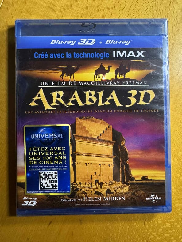
2012500264005Universal 2012 13 6x17x1 1cm. 2012. blu_ray.
In-8°, pp. (4), 490, (2), copertina editoriale. Con 16 tavole di illustrazioni in bianco e nero nel testo, alcune delle quali a doppia pagina. Pagine leggermente ingiallite ai margini, a causa del tipo di carta. N. 3 nella collana "Le vie della civiltà". Sommario: Capitolo I. Europa aperta, Europa chiusa: 1066-1350; Capitolo II. La dominazione della nobiltà in Europa; Capitolo III. La società contadina; Capitolo IV. Fede popolare e Chiesa antica; Capitolo V. Le città; Capitolo VI. L'aurora dello spirito e del cuore: movimenti spirituali del XII secolo; Capitolo VII. Il conflitto est-ovest del Medioevo e le crociate; Capitolo VIII. L'invenzione della cultura cortese e la nascita della fantasia europea; Capitolo IX. "Sinistra" e "destra" nei movimenti religiosi popolari; Capitolo X. L'intellettualismo europeo e le università; Capitolo XI. I migliori ingegni d'Europa lottano a Parigi; Capitolo XII. La nascita della storia: storiografia e visione della storia universale; Capitolo XIII. Magia, potenza, calcolo della natura e nascita delle scienze naturali; Capitolo XIV. L'ebreo e la donna nel Medioevo; Capitolo XV. Il nuovo Stato e la nuova Chiesa; Capitolo XVI. Odio e amore: il risveglio dei popoli nella lingua volgare; Capitolo XVII. Mondi artistici del Medioevo. Postilla; Tavole; Tavola cronologica; Bibliografia; Indice analitico.
grand in-4° 132 pages entierement illustrees en couleurs, index, biblio, cartonnage de l"editeur, jaquette illustree en couleurs. Très bel exemplaire. [HP-2]
197849545Stacey international, 1978. Format oblong 31x23 cm, reliure éditeur sous jaquette illustrée, 128 pages. Etat de neuf.
340 pages. Translated from the Hebrew. "Carries us into the strange and exciting world of the Yemenite Jews from Southern Arabia who have settled in contemporary Israel." - from dust jacket. Price-clipped dust jacket. Average wear. Unmarked. Binding intact. Sound copy. Book
20 pages, including two in-text sketch maps. Plus many photographic plates. Original condition with blue wrappers, titles to front, and containing all the ads. This is a complete issue, seldom found in such good and original condition. This is a fascinating account on the political state of India's 'Mashud country', a region to the west of Dera Ismail Khan on the North-West Frontier of India, at a time when there was bitter hostility and serious fighting between the Wazirs and Mahsuds over their boundaries, particularily in the vincinity of Razmak. Captain Hay was in charge of the South Waziristan Agency for 3-4 years, and describes the intricacies of relationships between the feuding tribes, as well as their custom and history. Hay visited many places not previously seen by Europeans and on this journey he and several hundred natives, climbed the region's highest peak in the Preghal range. Includes remarks on Hindu legend surrounding the mountain, miracles and superstition reported by tribesmen, a list of plants identified, and Pashtu geographical vocabulary. South Waziristan is a mountainous region of northwest Pakistan, comprising the area west and southwest of Peshawar between the Tochi River to the north and the Gomal river to the south. The region was an independent tribal territory from 1893, remaining outside of British-ruled empire and Afghanistan. Tribal raiding into British-ruled territory was a constant problem for the British, requiring frequent punitive expeditions between 1860 and 1945. The region became part of Pakistan in 1947.
4 pages, including two in-text sketch maps. Original condition with blue wrappers, titles to front, and containing all the ads. This is a complete issue, seldom found in such good and original condition. In November 1893 an agreement was signed between the British and Afghan governments defining on paper the boundary of the spheres of influence of the two governments wherever they touched each other. The British representative during the negotiations was sir Mortimer Durand, and the boundary in question was since then referred to as the Durand Line. Demarcation was successfully carried out along a considerable portion of the frontier. Owing however to conditions prevailing in tribal territory certain parts of the boundary line could not be visited, and much of it remained undemarcated. This narrative describes how in 1894, one of the gaps, a small but important one, had been filled in.
Author: Sir Rupert Hay Publisher: London: Edward Stanford, Royal Geographical Society, 1954. Item is in Original Condition, with Blue Wrappers - As Issued, Complete with All the Ads! Notes & Condition: As former Political Resident in the Persian Gulf until 1953, Hay's purpose with this report was "to give a brief geographical description of the ten Shaikdoms and Muscat, bringing to light "the problems to which their boundaries give rise." Having had worked numerous years as a British political officer charged with establishing and maintaining British rule, Hay was very knowledgeable of the region and inhabitants, as well as its political history, especially in relation to Great Britain. He begins by describing Kuwait, "before the advent of oil... existing on pearling, fishing, shipbuilding...but now one of the richest..." A thorough description of Kuwait concludes with remarks of the section disputed by leaders of Qatar, Saudi Arabia and the Trucial Coast Shaikdom of Abu Dhabi. Trucial Oman and its "extraordinarily complicated borders" is the next subject of Hay's attention, Abu Dhabi being "the most westerly and by far the largest of the Shaikhdoms." He provides fascinating visual imagery of this region, "... Dibai...flourishes on its entrepôt trade and its suqs or markets on either side of its broad creek are the most picturesque... in the Middle East... takes one back to the time of the Arabian Nights... narrow lanes roofed with matting... Arabs, Persians and Baluchis display their multi-coloured wares. Wild-eyed tribesmen with their camel-canes and daggers haggle with the shopkeepers... wealthier Persian merchants with their long flowing robes and gold-brocaded headdresses pass to and fro... Graceful dhows glide into the creek... ...there is an air of bustle and prosperity... a peculiar charm." Boundaries, territorial disputes, claims of the Sultan of Muscat and Oman, the positive and problematic impact of the proliferate oil companies, are all examined before reiterating, in conclusion, the imperative need for clear delineation of boundaries in the highly coveted oil-rich Persian Gulf. 8vo. 13 pages including a full page sketch map. Original condition with blue wrappers, titles to front, and containing all the ads. This is a complete issue, seldom found in such good and original condition. [From 1763 until 1971, the British Empire maintained varying degrees of political control over some of the Persian Gulf states, including the United Arab Emirates (originally called the Trucial States) and at various times Bahrain, Kuwait, Oman, and Qatar through the British Residency of the Persian Gulf.] Sir William Rupert Hay KCMG KCIE CSI (1893-1962) was a British Indian Army officer and administrator in British India. He served as Chief Commissioner of Balochistan during the colonial era. During World War I he was in Mesopotamia with the Dorsetshire Regiment, transferring to the Indian Army, attached to the 24th Punjabis, being appointed Quarter-Master 30th October 1916, and promoted to Lieutenant in 1918. Hay was seconded to the Foreign and Political Department in May 1920 and was confirmed in his appointment in May 1924. He was Political Agent in South Waziristan from 1924 to 1928, Assistant Commissioner in Mardan 1928 to 1931, and Political Agent in Malakand 1931 to 1933. He was Resident in Waziristan 1940 to 1941, Resident in the Persian Gulf 1941 to 1942, Revenue and Judicial Commissioner in Balochistan 1942 to 1943, and Agent to the Governor-General, Resident and Chief Commissioner in Balochistan 1943 to 1946. He was again Political Resident in the Persian Gulf from 1946 to 1953, then retiring from the service and returning to England. [St. Anthony's College, Oxford holds a collection of Hay's papers and diaries.] The Trucial States of the Coast of Oman, also known as Trucial Oman and Trucial Sheikhdoms, were a group of sheikhdoms in the south-eastern Persian Gulf, previously known to the British as the 'Pirate Coast', which were signatories to treaties (hence 'trucial') with the British government. These treaties established an informal protectorate by Great Britain, and the sheikhdoms, or emirates, were a British protectorate from 1820 until 2 December 1971, when the seven principal trucial sheikhdoms became independent. Six (Dubai, Abu Dhabi, Sharjah, Ajman, Umm Al Qawain and Fujairah) were to form the United Arab Emirates on that day; the seventh "Ras Al Khaimah" joined the Federation on 10 February 1972. The last sheikhdom to be granted recognition was that of Fujairah, which became a trucial state in 1952 after the British government came under pressure from PCL (Petroleum Concessions Limited) to grant status in order that the company could have a free hand to explore for oil along the whole east coast. Also in 1952, the Trucial States Council was established to encourage co-operation between the seven Rulers.
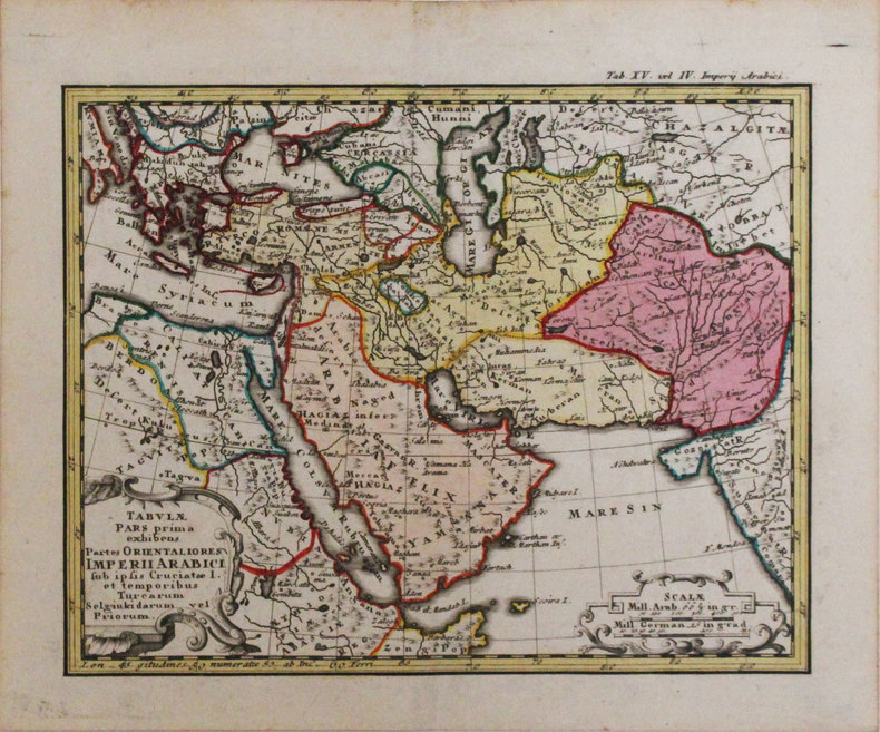
1746LBW-33181746. 168 x 212 mm.
1909ISLA0057Lpz., Haupt 1909. gr.-8°, X, 685 S., HLn. d. Zt., abgegriff., hint. Rückenkante oben etw. zerschlissen, flieg. Vors. m. Besitzerstemp., Innentit. m. Namenszug, marmor. Schnitt.
17 pages, including a full-page sketch map. Plus photographic plates. Original condition with blue wrappers, titles to front, and containing all the ads. RGS stamp to front cover, otherwise this is a complete issue, seldom found in such good and original condition. In this is a fascinating narrative, the author reports on his nine months spent on a geological survey in the remote mountainous district of Kuhgalu, which he describes as a "region of formerly unruly tribes" . Throughout this report are thirteen magnificent illustrations: Kuh-i-Dina, with dust rising during rock falls, The 1933 landslide, Kuh-i-Dina from near Kakan, Talaspid village around a tumulus, Basht from N.W., Simarun from above, Diz-i-Kurd, Dishmuk, Ford across the river Khirsin, Crossing Kuh-i-Barfi, Vista from Balaga southward, Cliffs N.of Kuh-i-Alvarz, and Tang-i-Tasar.
8vo. 17 pages including a sketch map map, plus photographic plates for illustration. Original condition with blue wrappers, titles to front, and containing all the ads. This is a complete issue, seldom found in such good and original condition. Delving beyond the geographical wonders of Makran's waterless rivers and mountain ranges, aside from the objective of geologically mapping a strip along the coast 50 miles wide, from Jask to the Baluchistan border, Harrison describes the native way of life. By examining the then sultan-governed region in a series of inland traverses, he encounters and interacts with the Baloch people as well as Muslims. Of the Balochs, Harrison provides a substantial account of customs including survival and sustenance in a harsh land, graves, costume, date harvesting, and much more. Illustrations show graves, a cliff dwelling, mat huts, the badlands near Bandini, and a mud volcano. One of Makran's outstanding features described is the water-courses seldom contained water and had subsequently become the natural roads for travel, where the means were limited to camels or donkeys. Other geological aspects were perplexing findings, and described in scientific terms. Of the scientific explorers of Persian Baluchistan, J.V. Harrison, D.Sc., occupied a leading role. By the time of this account, the author had been for twenty years a member of the Anglo-Iranian Oil Company and had made numerous expeditions to the area, the first being in 1917. In the present account he describes a journey made in 1932, part of a multi-year undertaking with plans made for as far ahead as 1937.
18 pages. Plus photographic plates and a fold-out colour map measuring approximately 12.5 x 14.5 inches (32 x 37cm) . Original condition with blue wrappers, titles to front, and containing all the ads. This is a complete issue, seldom found in such good and original condition. Undertaken at the behest of the Anglo-Persian Oil Company, this expedition's objective was to study the geology of Bakhtiari country, an area believed to possess oil located in south-western Persia, between the Diz or Sehzar River on the north-west and the Karun River on the south-east - home to the semi-nomadic Bakhtiari tribes. Of particular geological interest are Harrison's depictions of the region's narrow valleys or tangs, his discussion of imbrics and tectonics and the expedition's arduous trekking itself: via Zeloi; the whale-backed mountain range, Kuh-i-Pabda; Chulbar on the north-eastern base of Kuh-i-Pabda; the Gapi basin; following a branch of the river Ab-i-Balut; Silili; Baznui; the country around Qal'eh Kuh and Ushtarinan Kuh; Qal'eh Pachah; Niyakan and Kuh-i-Dalan and numerous other locations. Accompanied by interesting photographs of the area's mountains and a large folding map of the territory covered.
Fairly beat-up; appears to be children's text; upper spine has small tear, binding is loose but still impressively intact, back cover has felt pen emblem, about 10 pages heavily underlined, the rest clean, illustrated endpapers, occasional illus. throughout. Detailed contents pages 319 pages. Includes a few lined papers with a child's lessons.
1950032455Rohrer Verlag, Wiesbaden 1950. Hardcover Sehr gut
2765berger-levrault 1962 in 8 broché 271 pages - illustrations
8vo; 240 pages
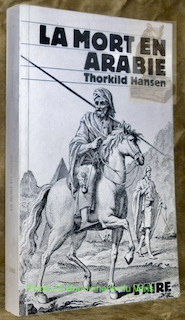
40410Lausanne, Lettres Universelles - Editions de l’Aire 1981, 225x145mm, 309pages, broché.
Slight wear, one small tear, and sticker residue to DJ; Author Hansen was shipwrecked off the coast of Yemen and buried his journals there upon resuce, thinking to pick them up in a few days. It was years before he took up the search and the shipwreck and the subsequent return journey is the subject of this book ; 8vo; 240 pages
Author Hansen was shipwrecked off the coast of Yemen and buried his journals there upon resuce, thinking to pick them up in a few days. It was years before he took up the search and the shipwreck and the subsequent return journey is the subject of this book ; 8vo; 240 pages
196499910114London Collins London Collins 1964, In-8 cartonnage de l'éditeur, 381 pages. Index, maps and line-drawings. Trés bon état.
London Collins 1964, In-8 cartonnage de l'éditeur, 381 pages. Index, maps and line-drawings. Trés bon état.
L'Aire, 1981. In-8 broché de 309 pages. Une carte. Très bon état
1988PROCHEORIENT31115Actes Sud, "Terres d'aventures", 1988, 11,5 x 21,5, 137 pages cousues sous couverture illustrée. Traduit du danois par Raymond Albeck.
1952032490Brockhaus, Wiesbaden 1952. Befriedigend Hardcover Sehr gut