1 365 résultats
13 pages, including a full-page sketch map. Original condition with blue wrappers, titles to front, and containing all the ads. This is a complete issue, seldom found in such good and original condition. Captain Vaughan and the author left Tehran on April 7th, intending to march to Ispahan via the Sia Kuh, with the object of ascertaining the routes crossing these mountains towards the south, and more particularly inquiring into the nature and defining the limits of the extent of ground marked on most maps as a swamp, into which several rivers crossed on the road between Tehran and Kum were supposed to empty themselves.
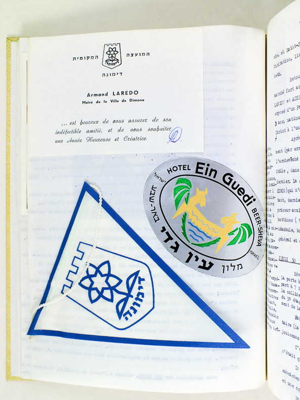
1 vol. in-4 dactylographié et enrichie de nombreux documents et photographies au verso de chaque feuillet, 31 ff. Intéressant journal de voyage d'une charentaise (angoumoise) en Pélerinage en Terre Sainte en 1965. Français
1965426721 vol. in-4 dactylographié et enrichie de nombreux documents et photographies au verso de chaque feuillet, 31 ff.
492pp.richly illustrated in colour & bl/w, 1st edition, cart.cover, dustwrapper, 28cm., [Exhibition catalogue, München, Staatlichen Museum für Völkerkunde, April-Dezember 1987]
1987G56403Innsbruck, Pinguin-Verlag 1987 492pp.richly illustrated in colour & bl/w, 1st edition, cart.cover, dustwrapper, 28cm., [Exhibition catalogue, München, Staatlichen Museum für Völkerkunde, April-Dezember 1987]
120pp.with map and few illustrations in text (with bibliography on pp.118-119), 22cm., in the series "Jazyki narodov Azii i Afriki", edition of only 1700 copies, orig. softcover, good condition, [text in Russian in Cyrillic script], OCLC 258597554, X75259
119pp.with map and illustrations (with bibliography on pp.118-119), 21cm., in the series "Jazyki narodov Azii i Afriki", edition of only 1700 copies, bound in cloth (original wrappers preserved), copy from the collection of Jacques Ryckmans with his signature, G, [text in Russian in Cyrillic script; on the language in the literature from South Arabia; bound together with a handwritten index, made by J. Ryckmans, of the cited inscriptions], OCLC 258597554, X72598
1966X72598Moskva [Moscow], Akad. Nauk SSSR Institut narodov Azii 1966 119pp.with map and illustrations (with bibliography on pp.118-119), 21cm., in the series "Jazyki narodov Azii i Afriki", edition of only 1700 copies, bound in cloth (original wrappers preserved), copy from the collection of Jacques Ryckmans with his signature, G, [text in Russian in Cyrillic script; on the language in the literature from South Arabia; bound together with a handwritten index, made by J. Ryckmans, of the cited inscriptions], OCLC 258597554, X72598
1966X75259Moskva [Moscow], Izdat. "Nauka" 1966 120pp.with map and few illustrations in text (with bibliography on pp.118-119), 22cm., in the series "Jazyki narodov Azii i Afriki", edition of only 1700 copies, orig. softcover, good condition, [text in Russian in Cyrillic script], OCLC 258597554, X75259
Title: Jauf and the North Arabian Desert. Author: H. St. J. B. Philby Publisher: London: Edward Stanford, Royal Geographical Society, 1923. Item is in Original Condition, with Blue Wrappers - As Issued, Complete with All the Ads! Notes & Condition: Philby recounts a journey made in 1922 together with railway engineer Major Holt, through Jordan to Jauf [Al Jawf Region, Al-Jouf] and into Iraq as far as Karbala, for the purpose of investigating the area's unstable political situation, and to examine possibilities of building a railway in the Wadi Sirhan valley. Beginning with a fascinating summary of a most unstable government indeed, Philby describes an ongoing power struggle between two dynasties, inter-tribal raids, a slave governor being murdered, betrayals and quarrels over land, so forth. The pair travelled to Medina, to the volcanic lava field of Harrat al-Shamah where they found some Safaitic inscriptions on stone, then to Sakaka where they stayed for nine days, and eventually arriving at the Al-Ukhaidir Fortress and the city of Karbala [Iraq], to be hosted by the Arab governor. Choosing a safe route was imperative as rebel holdings were prolific, particularly in the Al-Jawf Region. Once their mission was accomplished they made their way north for Ramadi, from where a flight would take them back to Amman. Interesting accounts describe inhospitable places and encounters, most notably the house of Sha'lan whose members were able to impede the expedition for some time. Philby's observations further include the important village of Kaf and its citizens, the Quraiyat salt -pans which are worked by the Badawin [Bedouins]; the plain of Ithra and its settlement of the black tents of the Ruwalla; the vast, dazzling, white salt marsh of Nuqrat al Hadhaudha, the prominent landmark of Kharana; Shaib Shanmari and in Jauf itself, the great medieval Arab fortress of Qasr Marid, the ruins of the hamlets of Suq and Suq al Hattab, the Safaitic inscriptions at Harrat; at the Sultan's invitation, a visit to Sakaka; the oasis of Qara; Suluba; the wells of Abal Dufuf; the magnificent ruins of Ukhaidir; Abu Dibis and Amadi. Photographic plates provide excellent visuals from the journey. Philby's account is accompanied by a large highly detailed fold-out colour map and a report by Major A. L. Holt titled, "The Future of the North Arabian Desert," which outlines his work in terms of developing communications through the desert, and a compelling argument promoting the desert as an important trade route. Holt accompanied Philby on his extraordinary Arabian adventure. At the time of this expedition, Philby was chief head of the Secret Service in Mandatory Palestine (since November 1921), working with T. E. Lawrence and meeting his American counterpart, Allen Dulles. 8vo. Two reports, 39 pages combined, plus a large fold-out colour map measuring approximately 59 x 34 cm, and photographic plates for illustration. Original condition with blue wrappers, titles to front, and containing all the ads. This is a complete issue, seldom found in such good and original condition. Excerpt from the text: "We left Amman on 10 March 1922... my personal preference... camels over mechanical transport in the real desert... in country where no organized route exists" "... The introduction of modern firearms has been a curse and veritable scourge to Arabia and its independent, individualistic denizens... the Arab social code of raid and rapine has not shown any signs as of yet of adjusting itself..." "... the northern desert of Arabia is at the present moment unsafe in the widest sense of the term - unsafe for the innocent traveller, the merchant, and the shepherd - there are already signs of a welcome change in the south, where Ibn Sa'ud has created a well-knit polity on a religious basis and has found himself strong enough to prohibit tribal raiding within his borders." "Our reception by the authorities of Kaf was cordial enough though guarded.... We were not allowed to visit the natural fortress ... called Qasr Sa'idi... a small guard of some twenty-five men with machine guns... Kaf is commanded by this eminence..." "... within a month of our sojourn at Jauf, we heard of the downfall of the house of Sha'lan at the hands of Ibn Sa'ud. As rulers they were detested by their own people, whom they treated with insolent harshness..." "Every human seen in the desert is an enemy, and the weaker party must make its best speed away if it would escape death." End Excerpt. Harry St John Bridger Philby, Order of the Indian Empire (CIE) (1885-1960), also known as Jack Philby or Sheikh Abdullah, was a British Arabist, explorer, writer, colonial office intelligence officer, and adviser to the first monarch of Saudi Arabia. Philby joined the British Foreign Service in 1917 and was the first European to visit the southern desert of Arabia. He was the first European to enter Abha, the capital of Najran, the frontier district between the Wahhabis and the Yemenites, and the second to visit Shabwa, although he was the first to explore the ruins where he discovered the great temple of Astarte. During Philby's explorations of Arabia, he came into contact with Ibn Saud, and was greatly influenced by the Wahabi ideology and culture, converting to Islam and renouncing his faith in Christianity.
1927108068P., Nouvelle Revue Critique, 1927, pt in-4°, 90 pp, broché, couv. blanche rempliée, titre en brun au 1er plat et au dos, bon état. Edition originale tirée à deux mille exemplaires, tous numérotés, celui-ci un des 1940 sur papier alfa spécial des papeteries Outhenin-Chalandre
Full Tilte: J.R. Wellsted's Reisen in Arabien. [J.R. Wellsted's Travels in Arabia.] Halle (Saale): Verlag der Buchhandlung des Waisenhauses, 1842. "...Deutsche Bearbeitung herausgegeben mit berichtigenden und erlaeuternden Anmerkungen und einem Excurs über himjaritische Inschriften von E. Rödiger." [German translation edited with corrections and explanatory notes and an excursus on Himyaritic inscriptions by E. Rödiger.] 2 vol. bound together. 8vo. xiv, 312; vi, 412 pages, respectively. First and only German edition. Text is in German. The complete work, with title pages, half-titles, 1 meteorological data chart, and 2 extra-large fold-out maps with multiple insets featuring inscriptions recorded by Wellsted. Brown cloth boards titled in gilt to front and spine, patterned endpapers. Minor age-toning, otherwise in very good condition, exceedingly scarce original maps printed the year of Wellsted's passing. Wellsted conducted the first European exploration of Oman and was the first to penetrate the interior. A successor Samuel Miles who travelled the country forty years later, said that even then, Wellsted's map of Oman was the most trustworthy delineation of the country. Wellsted's exceedingly scarce 1838 map of Oman and his illustrations of Himyaritic Inscriptions found on of the South Coast of Arabia, are here contained in a contemporary and also scarce work. The map of Oman charts Wellsted's route to the interior and along the coast in 1835-36, including dates of arrival and discovery, placing numerous villages Beouin encampments, and springs, also illustrating geographical features encountered by Wellsted and his travel companion Lieutenant Whitelock.
28 pages, including a full-page sketch illustration. Plus a large fold-out colour map, measuring approximately 12 x 28 inches (30 x 71cm). Original condition with blue wrappers, titles to front, and containing all the ads. This is a complete issue, seldom found in such good and original condition. This detailed expedition report includes a description of the geography, topography and new routes discovered in Ancient Persia - modern day Iran. Lieut.-Col. Lovett's survey is especially valuable for its elucidation of untrodden parts of these Elburz Mountains, and it also throws new light on the entire route, no part of which had hitherto been delineated with any approach to the same detail and perspicuous accuracy. The Course of Lovett's Journey from Tehran to Astarabad: Gulhek, the Garden of Vujiia, Ahar, Sarak, Husun Ikdir, Gutchisir and Waliabad, Towar, Asolat, Arsinkiru, Mekhsas, Oz, Baladeh, Chashmeh Shahi, Khan Lar Khan, Ask, Lesan, Arjumand, Firuskuh, Chashmeh Kabud, Salash, Chashmeh, Kurrand, Fulhad Mahala, Pishirt, Chaman-i-Manga, Chardeh, Ziarat-i-Khas-rud, Astarabad. From Astarabad, Lovett travels towards Shahrud; he provides valuable information of his surveys in this illuminating account.
In-8 p., brossura orig., sovraccoperta illustrata a colori (piccoli strappi al marg. super.), pp. 348,(2), con tavole in b.n. e cartine geografiche, più volte ripieg., f.t. Nell’opera: “La fede, el vivere et costumi de tutte le prefate provincie”. Volume 2° della collana “Viaggi e scoperte di navigatori ed esploratori italiani”. Firma di apparten. alla sovrac. e a p. 11., altrimenti esemplare ben conservato.
In 8. Dim. 21x16 cm. Pp. 354+(2). Edizione Alpes del 1929 di questo resoconto di viaggio del bolognese Ludovico De Vathema (1465-1517) fra i massimi esploratori italiani del Rinascimento a cura di Paolo Giudici. L'opera riporta i viaggi di Vathema in Arabia, Etiopia, Persia, India (Combeia, Cevul, Goga, Decan, Bathacala, Centacola, Canonor, Bisinagar, Tormapatani, calcutta, Cioromandel, Zailani, Borneo, Monoch ecc..) ecc... All'interno sono presenti numerose planches e mappe ripiegate. In buone condizioni e completo. Copertina editoriale in buone condizioni generali con lievi usure ai margini e dorso. Legatura in buone condizioni. All'interno le pagine si presentano in ottime condizioni con rare fioriture, pagine ancora unite fra loro. Alpes edition of 1929 of this resuming of travel by Ludovico De Vathema (1465-1517) from Bologna, one of the most important italian explorers of Rinascimento period cared by Paolo Giudici. Thw work describes the travels of Vathema in Arabia, Aethiopia, Persia, India (Combeia, Cevul, Goga, Decan, Bathacala, Centacola, Canonor, Bisinagar, Tormapatani, calcutta, Cioromandel, Zailani, Borneo, Monoch ecc..) etc... Inside there are different planches and folded maps. In good conditions and complete. Editorial cover in good general conditions slightly worn in the edges and spine. Binding in good conditions. Inside pages are in very good conditions with occasional foxings, pages still bound together.
Very Good English Paperback. Pbo. Roy. 8vo. (24 x 17 cm). In Turkish. [viii], 176, [1] p., 1 folding map. Pre-Islamic history of Arabs and Arabia and Age of Ignorance. Islâmdan önce Arap tarihi ve Cahiliye Çagi.
Book is in excellent condition. Binding is solid and square, covers have sharp corners, exterior shows no blemishes, text/interior is clean and free of marking of any kind. Heavily illustrated with color and b&w illustraitons, 240 pages.
In-8 (cm. 23), brossura illustrata, pp. 131, (5), con illustrazioni in bianco e nero fuori testo. In ottimo stato (nice copy).
A9781913645632Hardback. New. This catalogue invites readers to dive deeper into the captivating dialogue between materiality and imagination as envisioned by IRTH at the 18th International Architecture Exhibition - La Biennale di Venezia. hardcover
47523492like new. unknown
47523492-nnew. unknown
2024DADAX1913645630Paul Holberton Publishing 2024-09-19. 1. hardcover. New. 9.84x0.04x12.20. Buy with confidence. Excellent Customer Service & Return policy. Paul Holberton Publishing hardcover
2024SONG1913645630Paul Holberton Publishing 2024-09-19. 1. hardcover. Used: Good. 9.84x0.04x12.20. Buy with confidence. Excellent Customer Service & Return policy. Paul Holberton Publishing hardcover
2024__1913645630Paul Holberton Pub 2024. Hardcover. New. 336 pages. 12.20x9.84x12.24 inches. Paul Holberton Pub hardcover
193730997ABBerlin, Zürich., Atlantis-Verlag., 1937. XXIV, 130 Seiten, mit 170 Originalaufnahmen des Verfassers. + Wichtig: Für unsere Kunden in der EU erfolgt der Versand alle 14 Tage verzollt ab Deutschland / Postbank-Konto in Deutschland vorhanden +, A|B|C Mit eiem Geleitwort von Reichminister des Auswärti Orbis Terrarum. Die Länder der Erde im Bild.