[IRAQ -ENGLAND - PHOTOGRAPHY].Biblio.com
1 159 résultats
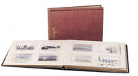
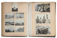
1912JBDEH1HAEOMM1912. 1/4 leather album. 4to. Approximately 120 mounted usually 2-4 to a page snap shots ranging in size from 60 x 40 mm to 120 x 100 mm. Brief captions in black ink under almost all the photos. The first half of the photos show middle class life in Edwardian England. The second and more interesting half of the photos are snap shots that appear to have been taken by a British officer and include military subjects scenes of Baghdad and the Euphrates and views of the Bosporus.An early 19th century photograpic impression of middle class life in England and the military in Iraq Some photos are faded or have minor spots or light streaks. Wretched-looking lacking backstrip with covers worn discolored and detached. hardcover
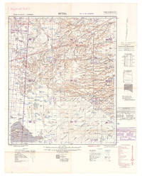
1940L7VDM2ALRS81UK Government: Geographical Section General Staff War Office 1940. 2 topographic maps colour-printed. Scale 1:500000. 820 x 640 mm and 770 x 648 mm. Previously folded. Marked "Iraq Desert Sheet 1" and "Sheet 2". Generally well preserved. Compiled from 1930s surveys and produced by the British 512 Army Field Survey Company Royal Engineers for use in the Persian war theatre. These consecutive maps cover the south-western area of Iraq including Rutba and Fallujah with parts of Saudi Arabia Jordan and Syria approximately the area between 31° and 33°30 N and 39° and 44° E.Previously folded. Marked "Iraq Desert Sheet 1" and "Sheet 2". Generally well preserved. Geographical Section, General Staff, War Office, unknown
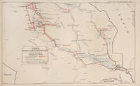
112648Government of Iraq 1929. . Revised and enlarged edition. Folio 34.5 x 21.5 cm. approx. iv 34pp. photographic frontispiece 8 folding maps coloured in outline scale 1 inch = 15.78 miles 1: 100000 original red cloth lettered in gilt on upper cover a very good copy.<br /> Maps include Baghdad and Environs The Environs of Basrah and several road maps to Southern and Northern Iraq.<br /> Government of Iraq, 1929. hardcover
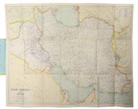
1930L6CC0NQYKB25London: George Philip & sons 1930. Colour printed map 54 x 68 cm with yellow covers 19.5 x 11 cm. Map of Iran Iraq and parts of the surrounding countries including modern Kuwait Bahrain Qatar and the UAE in the 1930s published in the series "Philips' authentic imperial maps for tourists & travellers". Published in the early years of the discovery of oil in the Middle East the map shows roads and railways but also caravan routes submarine cables and oil pipelines.Slightly soiled in very good condition. George Philip & sons, unknown
1942L7VCIV4N38L2UK Government: Survey Directorate HQ Tenth Army / Indian Field Survey Co. 1942. 42 chromolithographed topographic maps of parts of Iraq made from aerial photographs during World War II on a scale of 1:100000 and 1:253440 a quarter-inch to a mile. 68 x 50.5 cm & 60 x 47 cm. An impressive collection of Iraq maps compiled from the most current aerial photography and produced by the British Army for use in the Persian theatre of war during World War II. The cities and regions covered include Ain Sifni Aqra Tel Afar Salman Pak BaQuba Sumaika Penjwin Halabja Baghdad Kirkuk Dulaim Erbil and Mosul divisions.Previously folded. Generally well-preserved. Survey Directorate HQ Tenth Army / Indian Field Survey Co., unknown
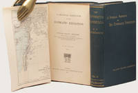
188833602London: Kegan Paul Trench & Co. 1888. 2 volumes. First Edition. With pleasing provenance. With a fine map showing the Tigris and Euphrates rivers and the surrounding geography of the Middle East. Thick 8vo publisher's original dark green cloth the upper covers and spines lettered in gilt original green endleaves. xv 447 32 publisher's catalogue; vii 492 pp. A very bright and pleasing set as fine as can be expected. FIRST EDITION OF THIS ELUSIVE AND SIGNIFICANT WORK. Ainsworth's excellent account of the Euphrates expedition to which he was appointed surgeon and geologist. The expedition was intended to "examine the feasibility of opening up the Mesopotamian rivers to steam navigation as a new route to India as well as asserting British political presence in the area promoting British commercial ties and gathering scientific and archaeological data" ODNB.<br> This is arguably the fullest contemporary account of the expedition as the fraught publication history of Chesney's account meant that his 'NARRATIVE.London 1868 was ultimately less detailed than intended.<br> This copy was owned by John Brinton who was elected member of parliament for Kidderminster in 1880 but accepted the Chiltern Hundreds next month because he was holding a government contract at the time. He was reelected without opposition and held the seat until 1886. In 1887 he presented Brinton Park to Borough of Kidderminster. He became High Sheriff of Worcestershire in 1889 and was an Alderman of the County Council from 1890. His attractive engraved plate is at each pastedown. Kegan Paul, Trench & Co. hardcover
200906811Paris, Fayard, 2004 ; in-8, 504 pp., broché, couverture illustr.
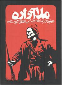
199083129Kurdistan: New Organization 1990's. Original silkscreened poster 63.5cm x 46cm printed in red and white on heavy black paper. Slight wear to edges almost neglible and some minor surface cracking to the very heavily applied paint are the only things that could be considered defects. A very good example. <br /> <br /> An exceptionally striking image printed in dramatic red and white onto black card depicting a heavily armed figure in traditional Kurdish dress beneath the legend in Kurdish:<br /> "The Displaced Mullah; The Shining Face of Revolutionary Kurdistan"<br /> <br /> The figure depicted is in all likelihood a stylized portrait of Mahmoud Barzanji a national Kurdish hero from the unrest of the early 20th century who became the first King of Kurdistan and was appointed Governor of the region by the British after the formation of the Kurdistan Protectorate after WW1. Barzanji not universally popular in Southern Kurdistan was a leader of considerable energy and ambition which far outstripped British plans for his 'control' of the region. The British and Barzanji came into direct conflict when he began arresting and imprisoning British officials who put up any opposition to his plans and embarking upon a localised uprising. The British predictably enough put a stop to his ambitions by ambushing him on the Sulamaniah road wounding him and then graciously commuting his death sentence to one of imprisonment in the British stronghold of Lahore in India where Barzanji was kept prisoner until 1922.<br /> The other possibility and with a stronger resemblance is that the poster depicts Simko Shakik early 20th century warlord and revolutionary who aside from massacring Armenians and Assyrians for the greater good of Kurdistan also led a rebellion against Iran. Although not conspicuously working from a Kurdish nationalist perspective modern critical thought suggests that Shikak should be placed "within the confines of Kurdish ethno-nationalism" Kamal Soleimani; "The Kurdish image in statist historiography: the case of Simko" 2017. Shikak himself was mainly interested in plunder and what he no doubt considered 'punitive justice against' basically anyone who sought to extert power over him or as a secondary consideration other Kurds; the results of his aggressive energy and willingness to fight anybody however are historically considered evidence of his benefit to Kurdish freedoms. No other examples of this poster can currently be traced in trade or institutional database. New Organization unknown
2003LFA-126739993N° 207 (Février 2003): 66 pages, format 220 x 295 mm, illustré, broché couverture couleurs, bon état
208099S.l., s.d. (1929) 2 vol. in-4, [52] et 35 ff. de papier fort, regroupant 194 tirages photographiques généralement de format 12,5 x 17 cm, et 61 reproductions de dessins, demi-percaline (cerise / verte) à coins, traces de rubans (reliure de l'époque). Manque le dos du volume I.
1917ABC_48426Iran and Iraq 1917. Contemporary cloth one album in in red and one in grey with 'Kodak' lettered in gold on the front board and a black classical meander border tooled near the foot. The albums are kept together by a black ribbon. Oblong 8vo ca. 15.5 x 20 cm. With 191 resp. 95 and 96 gelatin silver prints all ca. 4 x 6 cm. 2 volumes. Remarkable set of Kodak photo albums with nearly 200 photographs of military life and the oil industry in Iran and Iraq in the early 20th century. The photographs were most likely taken by the compiler of the albums and show scenes from his daily life. Most of them are captioned. Included are images of Persian oil fields Abu Zenema Sinai coast Port Sudan Bushehr Basra various locations along the Tigris Euphrate and Shatt al-Arab rivers Ashwaz and Shush. The photographs also show locals involved in various activities including races shark hunting and selling wares. The compiler of the album was likely a British soldier who was stationed in Basra and other locations in Iran and Iraq after the First World War.The edges and corners of both albums are slightly scuffed with a few light stains on the back board of the red album. The paper on which the photographs are mounted is slightly browned ten of the photos have either creased corners or a damaged surface some photographs a little loose within their windows missing a photo on the final page of the red album. Otherwise in good condition. hardcover
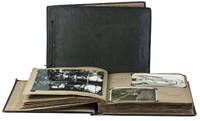
1928I3OEKR47KBBKIraq plus Malta and Egypt 1928. The photos mounted with paper corner-mounts in two contemporary cloth-covered albums the larger with padded boards covered in alligator-skin patterned dark green cloth with the photographs on both sides of 24 dark grey album leaves each leaf with a glassine paper guard-leaf embossed with a spider-web pattern bound in before it; the smaller covered in black cloth with a grey-white bird in a cloud painted on the front board and the word snaps with the photographs on both sides of leaves 2-35 & 51-52 of 54 light brown album leaves. Oblong albums 25 x 34.5 cm & 21.5 x 28.5 cm. Two albums containing about 275 silver halide photographic gelatin prints 6 x 8.5 cm to 16 x 21.5 cm assembled and mostly taken by a British Royal Air Force pilot while stationed in Iraq and then briefly Malta with a visit to Egypt. A collection of about 275 photographs made by an RAF pilot Sergeant William Reynish during his service in Iraq ca. 1928-1933 and Malta 1933 and during a brief visit to Egypt. Most have captions written on the album leaves clearly identifying the scenes. Some photos show scenes of daily life in Iraq Bagdad Hinaidi Mosul and other cities as well as the surrounding countryside with local people shops buildings landscapes ruins monuments etc. Others show the British troops and their activities vehicles airplanes including crashed ones etc. The portraits include an unidentified sheik with a falcon and an Arabic man smoking a hookha water pipe. The Kurdish Sheik Mahmud Barzanji of Sulaimaniyah rebelled against the Iraqi army around June 1930 but the RAF bombed his people's villages from September 1930 to April 1931 when he finally surrendered to Major W.C.F.A. Wilson administrative inspector at Mosul. Several photographs cover the sheik and his surrender.The surviving corner mounts show that three photographs have been removed from the album. A few photographs are slightly blurry or faded but most are very sharp and in very good condition. The inside front hinge of one album has broken but the albums are otherwise in good condition. A wealth of informative images from pre-War Iraq most clearly identified in the captions. hardcover
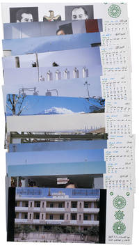
1977ABC_47947Baghdad: Ministry of Oil 1977. Original sturdy plastic case. Oblong 10 x 23 cm. With photographic illustrations all postcards are printed in colour. Remarkable complete set of 14 postcards published by the Iraqi Ministry of Oil to celebrate the flourishing petroleum industry and probably its nationalisation in 1972. The first 2 postcards show the building of the ministry and the official state portraits of then President of Iraq Ahmed Hassan al-Bakr 1914-1982 and Vice Chairman Saddam Hussein 1937-2003. The remaining 12 postcards are each printed for a different month of the year and show various aspects of the Iraqi petroleum industry including the Al-Bakr deep water terminal renamed in 2003 to Al-Basah oil terminal the Al-Khalida oil products tanker the degassing station at North Rumaila oil field the eternal fire near Kirkuk which was the first oil field found in Iraq and the Haditha-Rumaila pipeline which was newly built at the time.With a small crack in one of the sides of the sturdy plastic case. The first and last card in the set are slightly creased. Otherwise in very good condition. Ministry of Oil, unknown
1369152Paris: Musée de l'Homme, Museum National d'Histoire Naturelle, 1963 in-4, nombreuses illustrations. Broché, bon état, cachet. Sommaire: Joseph CHELHOD, Pélerinage à Kadzimain, lieu saint de l'Islam. - Françoise GIRARD, Plats en bois sculpté des îles Salomon. - Guy de BRAUCHENE, Une statuette ouest-africaine. - Jean-François VINCENT, Dot et monnaie de fer chez les Bakwélé et les Djem. - Elie VERNIER - Bambous gravés malgaches. - Louis BERTHE, Une mission en Indonésie. - Robert GESSAIN, Sénégal Oriental 1963. - Jacques MILLOT, Le congrès de Santo Tirso. Les musées ethnographiques du Portugal.
8481Saint-Etienne (4, rue Rembrandt). Direction : Dominique Bazet-Simoni, Christiane Chevigny, Michel Pasquier. In-8° broché. 25 numéros ont paru en 25 livraisons d'octobre 1985 à novembre 1997 (et un numéro hors série).
1373583Paris: Musée de l'Homme, Museum National d'Histoire Naturelle, 1969 in-4, nombreuses illustrations. Broché, très bon état. Sommaire: Robert GESSAIN et Paul-Emile VICTOR, Le kayak des Ammassalimiut. Evolution technique. - Dominique CHAMPAULT, L'izâr de Qaracoche Nord de l'Iraq. - Nicole BOULFOY, Poteries d'Imerina. Tavy-fanaova-mofo, moules à beignets. - Henri LEHMANN, A propos de l'exposition"Chefs d'oeuvre des arts indiens et esquimaux du Canada". - Ethnomusicologie.
Very Good Arabic Original chromo-lithograph map in brown tones. On a special paper with an ongoing blindstamped "Regestre Robur" during the borders. Folded. 70x100 cm. In Arabic. Scale: 1 /1.000.000. Chipped on margins, split on folded traces. Slight discoloration and one stain on lower margin. Otherwise a good copy. An attractive and detailed map of Syria shows the capital (as Aleppo n that map), other cities like Damascus, Raqqa, Homs, Latakia, Ayn al-Arab, Idlib, Hama, Deir Ez-Zor, Jarabulus, et alli. And it shows Turkey on the north (as Turkey containing Hatay and Alexandrette), The Mediterranean shores of the land as well as Lebanon and Palestine (and Jerusalem) on the west, Sharq al-Urdun (Jordan) and Iraq on the south and east. It's very detailed on showing the roads spread throughout the land like railways and ancient roads from the Roman period. Additionally this roads can be followed to the other Arabic countries and regions on the map. This map was calligraphed by Kamel Al-Baba, (1905-1991), who was a Lebanese contemporary / modern calligrapher. He is the son of famous calligrapher Mokhtar Al-Baba. Cannot be found in WorldCat.; Not in Library of Congress Map Collection. Very scarce.
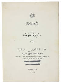
1961ABC_47301Baghdad: Wizarat al-Kharijiyah = Ministry of Foreign Affairs 1961. Original printed wrappers stapled. 8vo. Arabic text. First edition of the second of two rare pamphlets published by the Iraqi government opposing the independence of Kuwait. The first pamphlet published in English and Arabic outlined Kuwait's historical connection to Iraq and analysed its "imperialist relations" with Britain. This second one in Arabic throughout prints the minutes of the Political Affairs Committee of the Arab League which met in Cairo on 20 July 1961 to consider Kuwait's request to join the League.Kuwait emerged as an independent state in June 1961 after sixty-two years as a British protectorate. With a new constitution it held its first parliamentary elections in 1963 thereby becoming the first Arab state in the Gulf to establish a parliament. Such political developments married with growing wealth and modernisations in health culture and finance helped to make Kuwait the most prosperous state in the Arabian Peninsula.The Iraqi government argued that the move toward independence was a continuation of Kuwait's relationship with Britain albeit under a new guise. Furthermore they felt that the historical links between Iraq and Kuwait entitled the former to control over the latter and one suspects a share of its growing wealth. This position partly detailed in the pamphlet led to a point of crisis with Iraq threatening invasion. To the relief of Kuwait the Iraqis were eventually deterred by the Arab League's promise of military opposition.The wrappers are a little dusty two thick black lines on the front wrapper seemingly erasing a stamp another stamp partially visible on the back wrapper most likely a bookseller's name and address "Baghdad" is legible. Internally clean and bright. Overall in very good condition.l Jisc LibraryHub 1 copy BL; WorldCat 219629380 3 copies. Wizarat al-Kharijiyah [= Ministry of Foreign Affairs], unknown
2005LFA01803Revue mensuelle concernant la philatélie : environ 110 pages en couleurs, format 300 x 210 mm, illustrée, brochée couverture couleurs + fiches détachables
191938949London: Cassell & Co. Ltd. 1919. Two vols. 8vo. ix 1 294; vi 311 1 pp. Frntsp. photos both vols. 14 plates 19 maps & plans most folding. Blue linen blue illust. lozenge on frnt cvr blue lettrng & decrtn lght toning to endpapers mnr shlfwr still a VG- set. First edition 4th printing of this informative eyewitness account of the Mesopotamian war against the Ottoman Empire during World War I. It includes an extensive account of the disastrous Battle of Dujaila during the Samarrah Offensive which resulted in Aylmer being replaced as field commander. Cassell & Co., Ltd., unknown
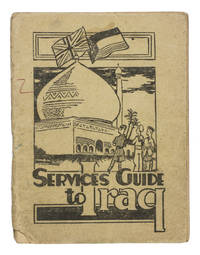
1942ABC_47444Baghdad: PAI force G. H. Q. Welfare Committee 1942. Original publisher's beige printed paper wrappers. 14.5 x 11 cm. With two full-page maps of Iraq and Baghdad on page 24 and 25 and a full-page map of the "Baghdad Amenities area" on the back wrapper. Further with 6 pages of advertisements serving as endleaves. A very rare guide intended for British armed forces stationed in Iraq during the Second World War. It was probably handed to the soldiers soon after arrival. Works like these were often discarded when they were no longer needed. As such there are usually few of them left. This particular military guide is likewise extremely rare. We have only been able to find 3 other copies 2 of which are located at the Imperial War Museum in London.The Services guide to Iraq was probably published by the welfare committee of the British PAI force which is short for "Persia and Iraq Force". The British were stationed here to prevent Nazi Germany from invading the region for oil among other reasons. The guide was meant to teach the soldiers the basics of finding their way in this new country. It explains where to go for sports music religion legal aid education the costs of sending letters home and how to recognize and prevent various tropical diseases. It also aims to instill some cultural awareness in the reader: included is an excerpt of a work about the history of Iraq by Seton Lloyd 1902-1996 archaeologist and then curator at the Baghdad museum.The paper wrappers are torn at the bottom of the spine with some loss of material barely affecting the integrity of the binding a small stain and two small pen marks in red and green on the front wrapper. Somewhat browned throughout. Otherwise in good condition.l Not in WorldCat. PAI force G. H. Q. Welfare Committee, unknown
Mm 170x240 Collana del T.C.I. " Le Vie del Mondo, Viaggi d'Autore ". Brossura originale con copertina illustrata a colori, 164 pagine con numerose illustrazioni in nero e a colori nel testo. Volume in ottime condizioni, spedizione in 24 ore dalla conferma dell'ordine.
Mm 170x240 Brossura editoriale, 605 pagine con numerose illustrazioni in bianco e nero nel testo. Libro in condizioni di nuovo. SPEDIZIONE IN 24 ORE DALLA CONFERMA DELL'ORDINE.
AA.VV Iraq. , Banco di Roma 1938, Iraq, vademecum economico, edito a cura del banco di Roma. Copertina editoriale lievemente sporca e piccolo taglio al piede del dor, interno ingiallito ai bordi ma in buonissimo stato. Buono (Good) . <br> <br> <br> 101<br>