358 résultats
New English Original bdg. HC. 4to. (31 x 23 cm). In English. 152 p., color ills. "This book focuses on the banknotes of Kazakhstan with respect to their cultural, historical and technical content. It also tells the little known history of how Kazakhstan became one of the best producers of banknotes in the world in less than 20 years time." "Kazakhstan has been an eager adopter of innovative anti-counterfeiting technologies, including many firsts in world banknotes. Collectors everywhere will appreciate adding this book to their numismatic libraries as the first specialized reference to the nation's beautiful and groundbreaking new notes." (Owen W. Linzmayer, Publisher of the Banknote Book). Contents: Introduction.; Acknowledgements.; H. E. Nursultan Nazarbayev the First President of the Republic of KAzakhstan, his bright vision on the news technologies and innoivation.; Mr. Grigoriy Marchenko, the governor...; Historical characters depicted on the banknotes of Kazakhstan.; Technical definitions of the Security Features used on the banknotes of Kazakhstan.; Regular issues: 1993 - Tenge, 1993 Tiyn, 1994, 1996, 1998, 1999, 2000, 2001, 2003, 2006, 2011-2012 issue: Commemorative banknotes of Kazakhstan...".
Fine English Paperback. Roy. 8vo (24 x 17 cm). In English. 206 p., facs. plates of Arabic documents and original text in Arabic. Yemenite authorities and Jewish messianism: Ahmad ibn Nâsir al-Zaydî's account of the Sabbathian movement in Seventeenth Century Yemen and its aftermath. Includes Zaydi?'s Arabic text, an English translation, and a facsimile reproduction of the Arabic text. "The text dealt with in this study is to be found in Codex Orientalis 8288f of the Leiden University Library". "This volume contains the Arabic text, plus facsimiles of the Cairo MS., of Ahmad bin Nasir's account of the Messianic disturbances in the Yemen in A.D. 1666-7 with a re-translation of the passage in Ibn al-Wazir's Tabaq al-Halwa based upon it. The Messianic movement in the Yemen derived its inspiration from the movement of Sabbati Sevi some years before...". (From the Book Review of Royal Asiatic Society).
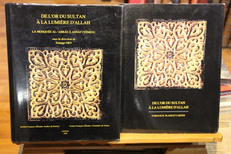
199994729Damas, Institut Français d’études Arabes de Damas, Centre Français d’études Yéménites de Sanaa 1999 In-4 30,5 x 24,5 cm. Reliure éditeur simili-cuir havane, jaqette noire illustrée en couleurs, 609 pp., abondamment illustré, bibliographie, index des auteurs, index historiqe, index géographique, index des monuments, tables des plans, des photographies et des figures, 10 tableaux, cartes et plans sous pochette. Bon exemplaire.
1994BN100253Mainz am Rhein : von Zabern 1994. 1994. Les fortifications d'Arabie méridionale du 7e au 1er siècle avant notre ère. par. Deutsches Archäologisches Institut Sana / Archäologische Berichte aus dem Yemen ; BD 8 1.80 <br/><br/>Les fortifications d'Arabie méridionale du 7e au 1er siècle avant notre ère. par. Deutsches Archäologisches Institut Sana / Archäologische Berichte aus dem Yemen ; BD 8 1.80 Mainz am Rhein : von Zabern unknown
New English Original bdg. Small 4to. 184, 564, 216 p. A heavy volume. Ills. In Arabic. This is a facsimile edition of the copy (Mushaf) of the Holy Quran which is attributed to the time of Ali b. Abi Talib and located in Sana'a, Yemen. It comes out as a third publication in IRCICA's series of editions of oldest copies of the Quran. Earlier IRCICA had published editions, accompanied by descriptive and comparative studies, of two Quran copies that are attributed to the time of Othman b. Affan namely the copies of Topkapi, Istanbul and al-Mashhad al-Husayni, Cairo. The other copies attributed to the same period are in the following cities: Istanbul (the Museum of Turkish and Islamic Arts, edition published by ISAM, Istanbul, 2008); London; Paris; St. Petersburg, and Tashkent. There are other editions of Quran copies that IRCICA published outside this series. One of them is the copy dated 582 H/1186 and known as the Fazil Pasha (Sherifovic) Mushaf, which is located in Gazi Husrevbegova Library, Sarajevo. Another edition, supervised by IRCICA, is the reprint of the Mushaf of Kazan dated 1803 which is known to be the first copy printed in the Muslim world; it was reprinted in cooperation with Kazan Municipality in the year 2005 corresponding to the millennium of Kazan city. By publishing these editions, with studies in the case of the former ones, IRCICA aims to contribute in preserving them and making them known and accessible to all. The Sana'a copy is located at the Grand Mosque of Sana'a. The elaborate Introduction to the edition is a study by Dr. Tayyar Altikulaç, specialist of the history of copies of the Quran and ex-Head of Religious Affairs in Turkey. The study is a concise history of the dissemination of the Holy Quran through its copies and of the developments relating to script, orthography, punctuation, locations, etc. of the copies. It examines, describes and analyses the characteristics of the Sana'a copy as to script, orthography, binding, etc. It also describes the other copies attributed to the period of Othman b. Affan as well as the copy printed by the King Fahd Complex for the Printing of the Holy Quran, Medina, which is known to be in conformity with the orthography of the time of Othman b. Affan. IRCICA planned to publish this edition during the 2010-2011 period which, at the suggestion of IRCICA, was designated by the 2010 meeting of the OIC's Council of Foreign Ministers as the "1400th Year of the Revelation of the Holy Quran". The Council had invited all OIC member countries and Muslims' associations and institutions world-wide to commemorate this anniversary of the beginning of the revelation with cultural and scholarly activities that would contribute in diffusing a correct and deeper understanding of the Holy Quran. IRCICA for its part is honoured to have been able to record this publication among its activities related to the said Year.
New Turkish Original aesthetics full leather bdg. in traditional Ottoman style. In publisher's special box. 4to. (30 x 20 cm). In Arabic. All edges gilt. Fully illuminated as traditional: Serlevha, hecde hizb, cüz roses, zahriye semses, müsenna besmele, with 'tevafuk' and color secavends, and med-kasirs. 605, 11, [4] p. The glorious Quran. Kur'an-i Kerim. was an Islamic calligrapher born during Ottoman times. His real name is Sheikh Musa Azmi, which is why his works may be found to be signed as Azmi. He is known by the pseudonym Hamid. He is also known as Hamid Al Amidi in international circles. Hamid learned the jali-thuluth (Turkish: celi-sülüs) style from Mehmed Nazif (1846-1913), the naskh and thuluth styles from Kamil Akdiç (1862-1941) and the ta'liq style from Mehmed Hulusi (1869-1940). His works are on display in many countries including Egypt and Iraq. His works are also on display in many newly built mosques of Istanbul. Some of his popular students include Hasan Çelebi and Fuat Basar. He was buried in the Karacaahmet Cemetery of Üsküdar district, Istanbul.
New New English Original bdg. Dust wrapper. 4to. (28 x 21 cm). In English and Turkish. [xii], 563 p., ills., 67 plts., 2 color maps. Mangir: Copper coins of Ottoman Empire.= Mangir: Osmanli Imparatorlugu bakir paralari.
Carta geografica raffigurante il territorio dello Yemen disegnata da Niebuhr nel 1763, incisa da l Desehrt nel 1772 ed edita nel 1780. Stampata su carta virata in azzurro. Pieghe editoriali
Very Good Turkish, Ottoman (1500-1928) Paperback. With a pictorial cover. Large roy. 8vo. (23 x 18 cm). In Ottoman script [and French on the cover]. 355-442 pp., ills. Bilingual cover is written 'Medeniyet Ordusu Yemen çöllerinde' and 'L!Armee dans le Desert de Yemen' bilingual in Turkish with Arabic script and in French. [i.e. The Ottoman civilized army in the desert of Yemen]. Extremely rare.
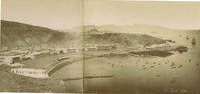
60392c. 1880s. . Panorama two albumen prints pasted on original card 20 x 50 cm title in negative. Good tonal range and in good condition.<br /> <br /> [c. 1880s]. unknown
New Turkish Original aesthetics full leather bdg. in traditional Ottoman style. With flap (miklep). In publisher's special luxury box. Large 4to. (30 x 25 cm). In Arabic. All edges gilt. Fully illuminated as traditional: Serlevha, hecde hizb, cüz roses, zahriye semses, müsenna besmele, with 'tevafuk' and color secavends, and med-kasirs. 605, 11, [4] p. The glorious Quran. Kur'an-i Kerim. was an Islamic calligrapher born during Ottoman times. His real name is Sheikh Musa Azmi, which is why his works may be found to be signed as Azmi. He is known by the pseudonym Hamid. He is also known as Hamid Al Amidi in international circles. Hamid learned the jali-thuluth (Turkish: celi-sülüs) style from Mehmed Nazif (1846-1913), the naskh and thuluth styles from Kamil Akdiç (1862-1941) and the ta'liq style from Mehmed Hulusi (1869-1940). His works are on display in many countries including Egypt and Iraq. His works are also on display in many newly built mosques of Istanbul. Some of his popular students include Hasan Çelebi and Fuat Basar. He was buried in the Karacaahmet Cemetery of Üsküdar district, Istanbul.
1740A131-2661Amsterdam / Venezia, Tirion / Giovanni Battista Albrizzi, c. 1740. Landkarte, Kupferstich, koloriert, 27 x 33 cm / Map, copperplate engraving, coloured, 27 x 33 cm
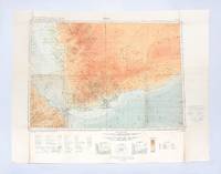
1930182334London: Geographical Section General Staff War Office 1930. Later impression overprinted with a Cassini grid in 1930 following the first edition of 1926. This map of the Aden Protectorate and its neighbours was produced for the International Map of the World a project that aimed to create a complete world map at a 1:1000000 scale. It covers South Yemen and the Hadhramaut as well as the tip of French Somaliland. The International Map of the World or the Millionth Map of the World was first proposed by German geographer Albrecht Penck in 1891. The project was adopted by ten countries in 1909 who agreed to follow consistent rules and standards for mapping their own territories. While countries like the US and UK made strides at first "production was slow in the earlier years since it was first necessary to complete basic surveys for the required data and during and after World War II there was little interest in pursuing the project" Ency. Brit. Colour lithograph map 648 x 856 mm linen-backed perhaps not as issued key printed on recto; text in English and French. A little foxed dust-soiling slight wear and a few small holes along fold lines: a very good copy. unknown
New Arabic Original bdg. 4to. In Arabic and Turkish. 2 volumes set: (77, 1563, 72 p.). Mushaf-i Serif (Topkapi Sarayi Müzesi nüshasi, Medine Nr. 1). 2 volumes set. Prep. by Tayyar Altikulaç. One of the main chapters of IRCICA s research program titled "Studies on the Holy Quran" consists of analytical and comparative studies on historical and physical features of early copies of the Holy Quran which are located at different places around the world. These studies, published by IRCICA, not only enrich the academic literature in the field but also highlight the clear evidence of the authenticity of the Holy Quran, thus refuting some Western +authors suggestions to the contrary. The following volumes have been published by IRCICA in this series, in the order of publication: the copies attributed to the time of the Third Caliph, Othman bin Affan RA and preserved, respectively, at Topkapi Palace Museum in Istanbul and the Central Library of Islamic Manuscripts (originally founded as Mashhad al-Husayn) in Cairo; the copy attributed to the time of the Fourth Caliph Ali bin Abi Talib KAW and located in the Manuscripts Library near Sana a Grand Mosque, that attributed to the period of the Third Caliph, Othman bin Affan RA and preserved at the Islamic Arts Museum in Cairo, the partial copy preserved at the National Library of France, Paris, the partial copy at Tubingen University Library, Germany, the partial copy at British Library, London, the copy located at State Library in Berlin, Germany, and now, a two-volume study on the copy which is located in the collection of Fahreddin Pasha ("Defender of Madina" during World War I) at Topkapi Palace Museum Library, Istanbul. This new book contains the scholarly study by Dr. Tayyar Altikulac, specialist of studies on the Holy Quran and ex-President of Religious Affairs in Turkey, on this copy. The latter was brought from Madina to Istanbul by Fahreddin Pasha. The study is composed of elaborate chapters written with utmost depth and meticulosity. Some of the subjects dealt with are: the history of the copy, its physical condition and contents, its descent, its relationship with the known pronunciations, its orthography, the period when it was copied, and the method applied in the study.
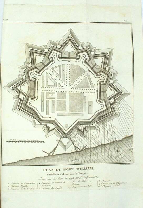
1801PHO-1972Paris, Dentu, an IX (1801); Atlas seul, in-4 (33x24,5cm),composé de 7 planches gravées dépliantes dont une grande vue de la citadelle de Calcutta et un plan du Fort William.. Bel exemplaire, relié basane époque, roulette aux plats et à l’intérieur, tranches dorées, manque au dos, coins usés, intérieur frais.
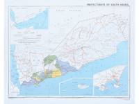
1964182178Surrey: Directorate of Overseas Surveys 1964. Later edition printed in the second year of the protectorate. In addition to showing the states of Kathiri Mahra and Qu'aiti it also highlights the members of the Federation of South Arabia in colour and features three inset maps which show the entire region the island of Socotra and the State of Aden. The Directorate of Overseas Surveys was established in 1946 with responsibility for surveying parts of the British Empire that did not have the resources to otherwise map themselves. "The Directorate was charged with two key tasks. It was to provide national geodetic frameworks throughout the British Empire that would contribute to understanding the size and shape of the earth and constitute the basis for accurate mapping. It would also produce mapping using modern methods based on aerial photography. This would in turn help to inform the development and administration of each country" Natural Collection of Aerial Photography. This copy is the fourth edition. Colour map 324 x 406 mm printed on recto only key on recto. Map bright a little bowed sometime folded with a vertical crease at centre slightly creased at edges: a very good copy. National Collection of Aerial Photography "Directorate of Overseas Surveys". unknown
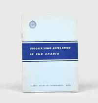
1962164052Rome: Centro arabo di informazioni 1962. First edition first printing scarce of this booklet published by the League of Arab States's communications body in Italy. The three maps show de facto and indefinite boundaries on the Arabian Peninsula in Aden and in Muscat and Oman. We have traced four institutional copies all of which are in Italy. The text surveys British activity in the region from the early 19th century through to the present day with sections on the Ottoman empire the First World War the 1934 peace treaty and the structure of the Aden Colony and Protectorates. Octavo. With 3 folding maps. Original card wrappers wire-stitched as issued front cover lettered in blue. Wrappers lightly toned and foxed contents clean with just couple of spots. A near-fine copy. unknown
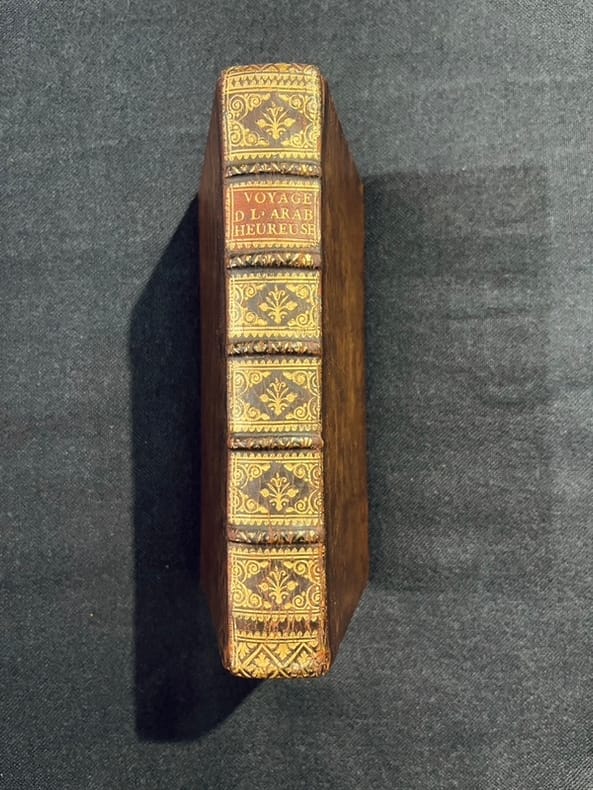
171621801A Amsterdam, chez Steenhouwer et Uytwerp, 1716. In-12 de [16]-343-[13] pages (dernier feuillet blanc) :*8;A-N12; P4;Q6. Pleine basane brune, dos à nerfs orné de filets et fleurons dorés, pièce de titre beige, tranches rouges.
1920X119387Leiden, E.J. Brill 1920-1923-1942 Complete work in 3 volumes, xi + 2976 + xxxiv pp. (continuous pagination), with a frontispiece in colour in volume I, uniform blind solid hardover bindings, text and interior are clean and bright, rare complete set, good condition, weight: 4.6 kg., [The 3rd volume was published by K.V. Zettersteen], X119387
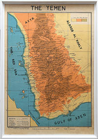
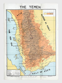
1976168409San a: Yemen Arab Republic Government 5 January 1976. Second edition labelled here as "The Yemen". It is drawn by the elusive cartographer usayn Abd All h Dham r here appearing as H. Althamary who also produced a map of San a . We have identified only six institutional copies on WorldCat at Exeter Leiden NLS Cornell LoC US Geological Survey. The first edition was published in Egypt in 1972 while an Arabic edition appeared in 1976. The map is in idiosyncratic English and marks the strategically important governorates of Taiz al-Bayda and Ma rib. Several words are misspelled including "drawen" "boundries" and "vally." The eastern border is left blank excluding the independent People's Democratic Republic of Yemen. A brief border war took place in October 1972 ending with the Cairo Agreement which proposed unification of the two Yemeni states. Each was backed by opposing Cold War powers: Saudi Arabia supported the Yemen Arab Republic while the Soviet Union backed the other. The two states ultimately united in 1990 as the Republic of Yemen. Colour lithographed map 655 x 450 mm scale 1:1000000; later laid down on board; white wooden frame overall 690 x 490 mm; text in English. Slightly toned some creasing one small hole: a very good copy. Warren P. Aston "The Origins of the Nihm Tribe of Yemen: A Window into Arabia's Past" in Journal of Arabian Studies: Arabia the Gulf and the Red Sea 4:1 2014 pp. 134-148. unknown
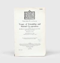
1934164042London: His Majesty's Stationery Office 1934. First English-Arabic edition first impression of the diplomatic agreement which acknowledged "the complete and absolute independence of His Majesty the King of the Yemen the Imam and his kingdom in all affairs of whatsoever kind" p. 2. In June 1934 shortly after this agreement was concluded Ibn Saud and Imam Yahya signed the Treaty of Taif which brought an end to armed hostilities between the two countries. In this development Britain had played a major part with its support for Yemen and comparatively lukewarm stance vis-à-vis Ibn Saud helping to both precipitate military conflict and ultimately bring it to an end. The English text of the treaty without the ratifications was first published earlier in the year as HMSO Yemen No. 1. Octavo 232 x 151 mm pp. 11. Royal coat of arms of the UK on first page. Sometime disbound with no subsequent stitching. Small faint Admiralty ink stamp dated 14 December 1934 on first page. Light creasing and skinning where previously bound a few nicks small chip at foot of first leaf text bright. A very good copy. unknown
178175Egypt: M. Louts 5 January 1972. With manuscript route annotations First edition here labelled "The Yemen". It is drawn by the elusive cartographer usayn Abd All h Dham r appearing as H. Althamary who also produced a map of San a . Only three institutional copies are recorded in WorldCat at Leiden the Library of Congress and Michigan. An Arabic edition and a second English edition were published in 1976. The map is in idiosyncratic English and marks the strategically important governorates of Taiz al-Bayda and Ma rib. Several words are misspelled including "drawen" "boundries" and "vally." The eastern border is left blank excluding the independent People's Democratic Republic of Yemen. A brief border war took place in October 1972 ending with the Cairo Agreement which proposed unification of the two Yemeni states. Each was backed by opposing Cold War powers: Saudi Arabia supported the Yemen Arab Republic while the Soviet Union backed the other. The two states ultimately united in 1990 as the Republic of Yemen. The route annotations in red pen stretch from Najran in the north to the Bab al-Mandab Strait in the south. Colour map 660 x 463 mm scale 1:1000000 text in English. Old fold marks a few small holes at folds small chip to head not affecting text a little offsetting at lower margin: a very good copy. Warren P. Aston "The Origins of the Nihm Tribe of Yemen: A Window into Arabia's Past" in Journal of Arabian Studies: Arabia the Gulf and the Red Sea 4:1 2014 pp. 134-148. unknown
71236c.1880. . Albumen print. Four-part panorama very good tonal range and in good condition.<br /> <br /> [c.1880]. unknown
1852X114460Göttingen, Dieterichschen Buchhandlung 1852 Complete in 2 parts in one physical volume, [4] + [82] + [106] pp. (containing resp. 24 and 27 genealogical tables), in oblong (23x32cm.), solid modern amateur hardcover (marbled boards, spine in cloth), pages are clean and bright, good condition, [N.B. The "Register" to this work, published in 1853, is not included], weight: 1kg., X114460
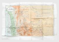
1962171426Sana'a: c.1962. Mining the border between north and south Yemen First and sole edition of this map of North Yemen with unique additions marked "top secret" in Arabic and annotated Kharitah tanbih mawaqi' al-algham "mashru' rif'at" "A map of briefing of the locations of mines of the Rifaat Plan". Although the map itself is undated and information about the "Rifaat Plan" is not publicly available it is possible that the strategy was connected to the Egyptian military officer Kamal Rifaat who visited the Yemen Arab Republic along with Anwar Sadat just after its establishment in 1962. Subsequently the Egyptians provided the YAR with a great deal of military support and advice as Abd Allah al-Sallal the country's first president fought the Federation of South Arabia later South Yemen. The long period of confrontation between North and South Yemen extended throughout the 1970s from the First Yemenite War of 1972 to the Second Yemenite War of 1979. Mines were also laid on the border before the two countries were unified in 1990 and have continued to be planted in subsequent conflicts until the present day. The map shows schematic clusters of minefields beginning due east of Sana'a around Meghdal extending in a line northwards to Wa'ir and then northwest to Jabal Mara' on the border with Saudi Arabia. The consequence of laying these minefields would have been to entrench the border between North and South Yemen the course of which they mirror almost exactly. It is annotated in pencil and colour pencil. Colour map 1000 x 690 mm. Text in Arabic. Creased where folded short closed tears and holes along fold lines and extremities a little soiled in places: a very good copy. unknown