239 résultats
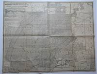
18851099Chicago: Geo. F. Cram 1885. Good plus. Large folding pamphlet approximately 20 x 41.5 inches. A few small chips and short closed tears at edges; several short separations and very minor losses along folds. Contemporary agent's ink stamp on cover panel. Tape repair across portion of horizontal fold; one panel with patches of light staining. A scarce colorful promotional for the Rock Island Route as well as its national and international connections with a fascinating stamp of an Australian sales agent. One side of the sheet prints an extensive promotional text and timetables for the various routes and services of the Chicago Rock Island & Pacific Railway. The main side of the sheet prints a map of the United States with state borders shaded in four colors highlighting the principal routes of the Rock Island from Chicago to Minnesota Iowa and Kansas and its connections to points on both the East and West Coasts. An inset map at lower right promotes the Rock Island as part of a transcontinental route between the United Kingdom Ireland and Australia. Most interestingly this copy is stamped on the cover panel with the information of a George. H. Hibbard "Australian Passenger Agent America's Cons'd Trans-continental Railways 6 Bridge Street Sydney N.S.W." Hibbard was evidently the agent in charge of distributing information about the trans-America route in Sydney one of its end points.<br /> <br /> Several issues of this map were published during the 1880s all scarce. We locate copies of the present 1885 issue at Stanford SMU and the Library of Congress. Geo. F. Cram unknown
18571004304to 11 ½ x8 ¾ original law calf morocco illustrated 4 134 85102 114 2 iv 64 pp. Some scuffing and wear to covers slight gouge to front joint chipping to edges. Two plates detached one with a chipped corner. Overall very good. Organized by the War department under the direction of Jefferson Davis who was Secretary of War at that time a collection of volumes was produced in the quest for the best route for a railroad to the West. Jefferson Davis wrote part of the introduction to this series and outlines the goals of the project. This report is on routes explored in Northern California and Oregon. Specifically the expedition was to look for a railroad route crossing the Sierra Nevada near the source of the Carson River and to see if it was feasible to connect the Sacramento valley with the Oregon Territory. Most of the color plates in this volume are located in the first three parts of the publication which is focused on topography geology and botanical subjects. This volume includes 23 color lithographs of scenery and botanical subjects 2 hand colored plates of birds and 24 steel engraved plates. Wagner-Camp 264a. Beverly Tucker, unknown
18561006214to leather spine and tips with marbled boards 36 Illustrations include 21 tinted/color lithographs one folding diagram two folding maps and a couple of black and white plates 36 14 136 127 175 pp. Binding with some wear at the spine and extremities hinges cracked some pages are a bit loose plates all present but probably not bound in correct order folding maps have a few tears some staining to front endpapers but not into the balance of the text plates and text show some aging foxing and browning but most plates resonably are clean. One of the great sources of information on the west the Pacific Railroad Reports also contains some great illustrations. This installment Vol. III is no exception. Included are some interesting and colorful pictures of the Mojave Indians and their territory. This report contains intelligence on an expedition near the 35th parallel which took the southern route due west to the Pacific Ocean from Fort Smith Kansas that was conducted by Lieutenant A.W. Whipple and assisted by Lieutenant J.C. Ives. Ives would make his own mark on western expansion a few years later in his travels on the Colorado River. The substantial amount of information on various Indain tribes makes this installment an important one. Since many of these volumes are broken for the plates they are getting somewhat scarce. Beverly Tucker, hardcover
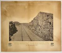
187510295Boston: Heliotype Printing 1875. Heliotype 38 cm x 48 cm on cream colored stock 55 cm x 66 cm with printed title and credit. Overall age toning. Heliotype promoting the Union Pacific line with a view of the tracks crossing Sherman Hill and the Continental Divide outside of the now ghost town of Sherman Wyoming. Sherman Hill is one of the landmarks on the transcontinental railroad and the highest point on the original U.P. line with a summit topping of 8247 feet above sea level. Sherman Hill is one of the easiest crossings of the Rockies and today it is one of the busiest lines. We are unable to locate another example of this poster. Rare. Heliotype Printing unknown
18709707Omaha: Omaha Herald Steam Printing Establishment 1870. First Edition. 44pp. Octavo 23 cm Black buckram with the title gilt stamped on the front board. Original printed salmon wrappers bound in. New endsheets and pastedowns. Manuscript label to head of original cover with paper of a similar color attached to the head of the verso. Small lib. ink stamp with accompanying 'Discard' stamp to title page. Complete with all three maps including the fold-out map 'Map of the Union Pacific Railroad Line in Nebraska' 19.5 cm x 56 cm / 7.5" x 22".<br /> <br /> Land promotional work from the Union Pacific encouraging the settlement of three million acres of U.P. lands that divides the available lands into three groups: agricultural lands the first 350 miles west of the Missouri River grazing lands from the forks of the Platte through the Laramie Plains in Wyoming and mineral lands between the Black Hills and the Wasatch Mountains. <br /> <br /> "No section of the United States furnishes facilities for grazing and stock raising superior to Nebraska and the lands on the line of the Union Pacific Railroad. The rich bottom lands of the valleys of the Platte Elkhorn Loup Fork Papillion Maple Shell Logan and Pebble Creeks Wood River Wahoo and Big Blue are included within these limits and present extensive tracts of the finest meadow land in America." Eberstadt 115: 856 later edition. Graff 4238 later edition. Herd 2351 later edition. Uncommon. Omaha Herald Steam Printing Establishment unknown
1850DEMO015143ILille France: L. Lefort 1850. Stated Second edition. Hardcover. Very Good. steel-engraved frontispiece. 8vo 258 pages 20th century half sprinkled calf marbled boards original wrappers bound in place. <br/><br/>Needs to be read with de Smet's LETTERS AND SKETCHES . AMONG THE INDIAN TRIBES OF THE ROCKY MOUNTAINS 1843 which contains several letters not included in this French text; but this French text "contains material not found in the English - Wagner-Camp-Becker 113a:5." Howes M288; Graff 3831; Monaghan 1332. Binding by "Reliure Francais". Issued in the Bibliotheque Historique et Morale this is actually the Third French Edition. Steel-engraved frontispiece. L. Lefort hardcover
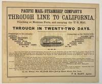
186740392New York 1867. Oblong broadsheet 9-1/2" x 11-1/2." Attractively printed within a ruled border with several type styles and sizes and engraved vignette of a steamship. The number '110' printed in lower margin beneath the border. Signed in type at the end "F. R. Baby Agent." Advertisement on verso for "Simons Brothers & Co. Manufacturers of the Metropolitan Shirt. . . Boston." Light foxing Very Good.<br /> <br /> "One of the above large and splendid Steamships will leave Pier No. 42 North River foot of Canal street at 12 o'clock noon on the 1st 11th and 21st of every month. . . for APSINWALL connecting via Panama Railway with one of the Company's Steamships from Panama for SAN FRANCISCO touching at ACAPULCO. Those of the 1st touch at MANZANILLO.<br /> "Families in Second Cabin and Steerage taken at reduced passage rates.<br /> "An allowance of one-quarter on through rates to clergymen and their families and school-teachers going to practice their vocations."<br /> According to Wikipedia "The Pacific Mail Steamship Company was founded April 18 1848 as a joint stock company under the laws of the State of New York by a group of New York City merchants. Incorporators included William H. Aspinwall Edwin Bartlett American consul at Lima Peru and also involved with the Panama Railroad Company Henry Chauncey Mr. Alsop G.G. Howland and S.S. Howland. The Pacific Mail Steamship Company was established to carry US mail on the Pacific leg of a transcontinental route via Panama."<br /> OCLC does not record this as of August 2024 nor does AAS; but the Huntington owns a copy "Date is determined by the vessels listed in the print". unknown
18561004314to original cloth rebacked with original spine strip laid on new endpapers. Illustrated with 20 of 21 color lithographs several steel engraved charts and shell engravings and three color lithographed folding maps. Table of contents list 20 color plates but some copies seem to have twenty-one. Two of the folding maps/charts have been placed in a rear endpaper pocket; one has a neat repair. A little rubbing to cloth and some minor darkening within. Could be missing one plate. Overall very good and nicely restored. One of the great sources of information on the west the Pacific Railroad Reports also contains some great illustrations. This installment Vol. III is no exception. Included are some interesting and colorful pictures of the Mojave Indians and their territory. This report contains intelligence on an expedition near the 35th parallel which took the southern route due west to the Pacific Ocean from Fort Smith Kansas that was conducted by Lieutenant A.W. Whipple and assisted by Lieutenant J.C. Ives. Ives would make his own mark on western expansion a few years later in his travels on the Colorado River. Wagner-Camp 263 Beverly Tucker hardcover
18653621262(Batavia, Koninkl. Natuurkundig Vereeniging in Ned. Indie, 1851-1865). Zusammen etwa 680 S. mit einigen Tabellen, 2 Tafeln, 21 mehrfach gefalteten, teils farbigen Tafeln mit zahlreichen Abbildungen und Karten, separat 1 mehrfach gefaltetee und auf Leinen gezogene farbige Karte in Tasche. Hlwd der Zeit mit Rückenvergoldung. Gr.-8vo. (etwas beschabt, Vorsätze und Tasche etwas fleckig, einige Bl. mit kleinen Randläsuren und Fehlstellen ohne Textverlust, einige Bl. bzw. Tafeln staubrandig und fingerfleckig).
1884GC10-643Leipzig, Verlag Fedrinand Hirt, 1884. original Leinenband, gr.-8?, 262 SeitenMit vielen Illustrationen nach Zeichnungen des Verfassers und einer Karte. und X (10) Seiten, Zustand: Einband etwas fleckig, innen sehr guter Zustand
187544494Washington D.C.: From the Press of The Henry E. Wilkens Printing Co. n. d. ca 1875. 1875. First edition. 3 3/8" x 6" pictorial wrappers 50 pp. including covers illustrated from photographs map. A train trip on the Washington Line of the Southern Pacific Company is described from Washington D. C. to California. Beginning in Washington D.C through North Carolina Alabama Louisiana Texas Arizona New Mexico southern California northern California and ending in Portland Oregon. Many interesting photographic views are shown including the Congressional Library the White House a cotton market in Alabama the French Market in New Orleans the Alamo New Mexican Indians protesting against their picture being taken views of Riverside California Los Angeles and much more. The centerfold is an interior diagram and vignettes of a tourist bedroom and sleeping car. Stamp of Alex S. Thweatt Eastern Passenger Agent Southern Railway 1185 Broadway New York on the inside front cover light wear to the spine else a near fine bright copy of one of the nicest booklets we have handled. From the Press of The Henry E. Wilkens Printing Co., n. d. (ca 1875). unknown
187166Boston; Nov. 1 1871. 1871 9 pp. folio. This indenture was made the first day of November 1871 between the Atlantic and Pacific Railroad Company and Oliver Ames and Charles F. Choate. The Atlantic and Pacific was to be built from Missouri and Arkansas to the Pacific Coast. From the very beginning the Atlantic and Pacific was plagued with problems even though they had the same rights as other transcontinental railroads regarding bonds land grants etc. Ames and Choate noted bankers of railroads and other various schemes were to loan to the railroad in gold coin. The amount is left blank in this document and the document is not signed by the parties. They were to be repaid in gold coin with an annual interest rate of 6%. In addition to the indenture listed above another indenture was made with George Bigeldow and James Dixwell. 2 pp. with manuscript corrections and additions. Including a provision to enable the Atlantic and Pacific to mortgage the road. This document was written earlier and does not have nearly as many provisions as in the Ames and Choate indenture. Four years later the Atlantic and Pacific would lapse into receivership. Oliver Ames then the largest stockholder purchased 96697 acres of the road's Missouri lands. After reorganization the A & P had some life until the panic of 1893 and the spoils were then divided between the Santa Fe and Frisco. These two documents are important in understanding the financial development of this railroad. Atlantic and Pacific material is quite scarce. Oliver Ames was the brother of Oakes. This railroad was to have been a very important development for Arkansas and Missouri. These documents are housed in a very attractive folding box 9 x 7 3/4 inches with green cloth-covered boards and a green morocco spine label with gilt lettering. 3214013 OG2080. 1st Edition. Hardcover. Very Good. Boston; Nov. 1, 1871. hardcover
1860DEMO010833IWashington: Thomas H. Ford 1860. First & Quarto edition. Hardcover. chromolithographs b&w pls. Quartos 358 40; 399 pages 21stC 3/4 calf marbled boards waterstains <br/><br/>House Exec. Doc. no. 56. Howes P3; Wheat TRANSMISSISSIPPI 822ff; Wagner - Camp - Becker 261ff; Rittenhouse 442. Vol.I has 70 chromolithographed scenes. With 3 folding maps. Vol.1 has the Report. Vol.2 has the Botany Zoology Ornithology Fish Mollusks & Crustaceans. "The plates in Book 1 are all really tinted. Book II has 8 fine colored plates of birds; 45 black & white plates of fish animals insects and plants -Whitman Bennett in his PRACTICAL GUIDE TO AMERICAN NINETEENTH CENTURY COLOR PLATE BOOKS p.101." Thomas H. Ford hardcover
1887009783Chicago: Rand McNally & Co./ Matthews Northrup & Company Engravers & Printers Buffalo NY 1887. Book. Very Good. Single Sheet Folded. 33 3/4" x 27 1/2". Corrected up to Apr. 1 1887 inset at upper left. Single Sheet Folded 33 3/4" x 27 1/2" entire verso contains - "Map showing land grant of the Northern Pacific Railroad Co. in eastern Washington and northern Idaho" with inset map showing "Northern Pacific Railroad System" . Sheet folded to 17 3/8" x 13 3/4" with additional folds making it 8 7/8" x 4 3/4" to fit in a pocket. Recto titled - "Sectional Map Showing the Lands of Northern Pacific Railroad Co. In Eastern Washington and Northern Idaho with Condensed Information Relating to the Northern Pacific Country" - contains printed information on the Pacific Northwest company advertising and a smaller map 10 3/4" x 8 1/2" of "Washington Oregon & Northern Idaho" by Rand McNally. Very Good small tears and a few small holes at creases. RARE OCLC locates three libraries with holdings of this 1887 map - U. of Calif Berkeley U. of Missouri St. Louis and Washington State Library. There was one earlier version corrected up to January 1 1886 one of which most recently seen at an auction in 2007. Rand McNally & Co./ Matthews, Northrup & Company Engravers & Printers , Buffalo, NY unknown
189564099Portland OR: Lewis & Dryden Printing Co. 1895. Folio. 10 x 14.75 in. xxiii 1 494 pp. Frontisp. 100s of illusts. photos decorated initials. Original publisher’s brown morocco over beveled boards gilt lettering & decoration on spine paneled in gilt ruling on covers marbled fore-edges & endpapers very slight rubbing slight shelfwear to corners and very slight sunning to spine still a near fine entirely unsophisticated copy. First edition of this invaluable maritime history in the Pacific Northwest with an excellent index and lavishly illustrated and perhaps one of the best copies this cataloguer has ever examined. Wright 1863-1930 as manager of the Portland Merchant’s Exchange had access to a vast store of original documents letters journals and accounts of marine shipping and development on the Columbia River and Pacific Northwest much of which has not survived. With the help of Harriman he later became director of the Port of Portland and later operated the shipyards in Astoria OR. Howes W963. Lewis & Dryden Printing Co., hardcover
189547595Portland OR: Lewis & Dryden Printing Co. 1895. Folio. xxiii 1 494 pp. Frntsp. 100s of illusts. photos decorated initials. Original publisher’s brown morocco over beveled boards gilt lettering & decoration on spine paneled in gilt ruling on covers gilt inner dentelles a.e.g. marbled endpapers minor bumping & wear to corners some rubbing edgewear rebacked with original spine laid back down still a VG copy from the library of Thea Foss 1857-1927 of Foss Launch & Tug Company later Foss Maritime -- who served as the inspiration for the story and Tugboat Annie movie based on her life. First edition of this invaluable maritime history in the Pacific Northwest with an excellent index and lavishly illustrated. Howes W963. Lewis & Dryden Printing Co., hardcover
1848DEMO015918IGand / Ghent: Chez Ve Vander Schelden 1848. First Belgian edition. Hardcover. Very Good. Small octavo 589 pages contemporary full green sheep extra gilt aeg scuffed. Inked presentation in 1912 from Rev. Francis J. Harbe: Harbe died in 1913 at age 37 in San Antonio Texas. He may have acquired this when a seminarian at Belgium in 1900. <br/><br/>Howes D286; Graff 3826; Field 1425; Sabin 82266; Smith 9549; Strathern 511:iii. "This edition seems to have been prepared by the author himself. It contains more material than the edition in English "Oregon Missions" the illustrations are different and the three maps are entirely new - Sabin 82265." It has several additional letters and an Appendix pp. 360 - 378. "Origine des Americains." Contains Fr. De Smet's description of his travels through and about the central Columbia River Plateau . he continued . to the Fort Vancouver by way of Fort Colville -- Wagner-Cam-Becker 141.2." Contains 16 plates including the pictorial title-age and 3 folding maps. Chez Ve Vander Schelden hardcover