Spontini, Comte Gasparo Luigi PacificoBiblio.com

239 résultats
1819249959N.p. Paris 1819. One page in French. 8vo. One page in French. 8vo. The Neapolitan-born Gaspare Luigi Pacifico Spontini 1774-1851 was a celebrated composer of operas in his day who made his career in Paris under the patronage of the Empress Josephine. His most famous opera LA VESTALE premiered in Paris in 1807 and according to Grove's Dictionary underwent over 200 performances in Paris by the year 1824. As late as 1954 in fact in celebration of the composer's 180th birthday it enjoyed a revival at La Scala with Maria Callas in the leading role.<br /> <br /> According to calendars only these two years during Spontini's time in Paris had a September 22 which fell on Wednesday. Spontini left Paris in 1819 to accept a position with the Dresden opera. unknown
189046165San Francisco: Crocker & Co. December 1890. 1890. 7" x 21" sheet on cream-colored stock folded to 12 panels each 7" x 3 1/2." 2 pictorial cover panels. Ticket rates from San Francisco to Monterey Pacific Grove or Santa Cruz along with excursion rates. 2 panels offering "Schedule of Stage Connections Showing Routes Distances Rates of Fare Etc." Black and white illustration showing bird's eye view of Hotel del Monte. Time schedules for the Monterey Line Pacific Grove Extension Santa Cruz Line Almaden Line Tres Pinos Line and Sta. Margarita Line. Light soiling to cover panels else near fine. Crocker & Co., December, 1890. unknown
1850DEMO014460IPhiladelphia: Printed by C. Sherman 1850. Popular Edition. Hardcover. Good. 64 excellent steel-plate engravings with 12 of 13 maps Samoa map apparently never inserted many vignettes and woodcuts. Octavos half brown calf blue marbled boards edges and endpapers; vol. 1 rebacked retaining original back and leather labels scuffing and wear to other spines corners worn. <br/><br/>Wilkes' expedition was the first American scientific exploring expedition by sea voyage. His six ships sailed south around South America along Antarctica causing Wilkes to decide that Antarctica was indeed a separate continent. Other stops were at the Pacific islands of Tahiti the Samoas Australia and New Zealand. Maps of Tahiti & Australia and New South Wales Along the way they charted the coasts of California Washington and Oregon. Howes W414; Palau 375505; Sabin 103994 note; see Cowan p.683; Taylor PACIFIC BIBLIOGRAPHY p.13. "Wilkes' spectacular Antarctic and South Sea explorations - Goetzmann ARMY EXPLORATION IN THE . WEST p.61" 64 excellent steel-plate engravings many vignettes and woodcuts. Unlike the 1844 edition the following Sherman editions did not have a 6th volume - the Atlas but have 3 Tables and 11 maps Printed by C. Sherman hardcover
189132829St. Louis: Woodward & Tiernan Printing Co. n.d. 1891. 1891. First edition. Third edition. 12mo. Original orange wrappers printed in black ink 82 2 pp. illustrated map. advertising. Issued by the general passenger department of the Missouri Pacific Railway. A general description of the state and its place in history is provided. Plus soil rainfall churches schools higher educational opportunities newspapers population and wealth corn wheat oats stock farming wild flowers orchards and vineyards salt lead and zinc stone brick and lime coal gas hunting and fishing cities irrigation etc. Views are offered of farms and ranches parade grounds city parks etc. of various cities. Herd 1204 says "Issued by the Missouri Pacific Railway Company this book appeared in many editions though all are now rare." Prior to this copy the earliest edition of a similar booklet was a 13th edition and that was 15 years ago. Fine clean copy with a fine folding map. An exceptional copy of a rare item. Woodward & Tiernan Printing Co., n.d. (1891)]. unknown
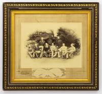
1888134827Sydney: Kerry & Jones 308 George Street 1888. Sydney Kerry & Jones 308 George Street 1888. A high-gloss gelatin silver photograph 222 × 296 mm laid down within a gilt border on the original cardboard mount with the photographic studio's details in gilt in the bottom margin. Also mounted there is a small gelatin silver photograph 47 × 165 mm of the signatures of the eight participants 'Government House Sydney Jan. 25 1888' is written below the original signatures. The item is in a contemporary frame wood with gilt-decorated plaster a little chipped now lacking the original glass visible image size 315 × 350 mm external dimensions 423 × 458 mm. The contemporary label of Cole's Book Arcade Melbourne is mounted on the verso. The main photograph has a couple of tiny surface chips to the top edge and a few tiny marks to the bottom right-hand corner; the mount is a little marked possibly lightly water-streaked but fortunately the photograph is untouched; these trifling blemishes have little impact on this fine portrait. This informal group portrait features the Governors of each of the Australian colonies along with the Governors of Fiji and New Zealand. It was taken on 25 January 1888 the day before the centenary of the arrival of the First Fleet at Port Jackson the main reason for their presence in Sydney. It features left to right Sir Robert George Crookshank Hamilton 1836-1895 KCB LLD Governor and Commander in Chief of Tasmania and its dependencies; Sir Anthony Musgrave 1828-1888 GCMG Governor of Queensland; Sir Charles Bullen Hugh Mitchell 1836-1899 Governor of Fiji; Henry Brougham Loch 1st Baron Loch 1827-1900 GCP GCMG PC Governor and Commander in Chief of Victoria; Charles Robert Wynn-Carrington 1st Marquess of Lincolnshire 1843-1928 KG GCMG PC JP DL Governor of New South Wales; Sir Frederick Napier Broome 1842-1896 KCMG Governor of Western Australia; Lieutenant General Sir William Francis Drummond Jervois 1821-1897 GCMG CB FRS Governor of New Zealand; and Sir William Cleaver Francis Robinson 1834-1897 GCMG FRGS Governor of South Australia. <p>Extensive research notes come with this item; they were compiled with the assistance of Dr John Fahey author of 'Australia's First Spies' Sydney 2018 and 'Traitors and Spies: Espionage and Corruption in High Places in Australia 1901-1950' Sydney 2018. Among much else the notes have identified a slightly variant photograph taken at the same time as this one held by the Blue Mountains City Library; the identity of the sitters comes from a letter and diagram sent to them from the Mitchell Library in 1929. 'From the various sources available most notably the title given by the State Library of New South Wales this photograph commemorates an unofficial side-meeting of these Governors to discuss Australia's interests in the South Pacific'. Dr Fahey puts it more succinctly when he says it likely offers 'evidence of one of our earliest "secret" off to the side policy conferences'. The notes provide a lot more background information for the purchaser. A few incidentals not mentioned there: Sir Anthony Musgrave was Governor of South Australia from 1873 to 1877 and he died on 9 October 1888; Sir William Jervois was Governor of South Australia from 1877 to 1883; Sir William Robinson was Governor of Western Australia three times between 1875 and 1895 1875-1877 1880-1883 and 1890-1895. Provenance: the Sloane Pastoral Family of the Riverina purchased at the estate clearing sale in April 2021. Kerry & Jones, 308 George Street unknown
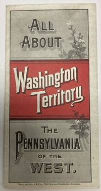
188853587Chicago: Rand McNally & Co. 1888. 1888. 20 3/4" x 13 1/2" sheet folded to 24 panels. Map. One cover panel; one panel showing N.P.R.R. route from Minneapolis to Washington Territory; and 10 panels of information to include information on the area's location and physical features climate agriculture stock raising manufacturing mining public schools cities and towns etc. Opposite 12 panels offer a map of Washington Territory printed in red and black. A rare promotional piece to encourage sales of Northern Pacific Railroad lands in Washington Territory. Light soling a few small splits to creases and with minor wear to the extremities. Very good. Rand, McNally & Co., 1888. unknown
18717912San Francisco: A. L. Bancroft & Company 1871. First Edition. Hardcover. Good . 12mo. 256 pp. original green cloth lettered in gilt index to advertisers advertisements i-lvii. -- Moderate wear to the extremities some fraying to the spine tips & corner edges corners bumped. Blank paste-down and first free end-paper paper a little separated but hinges still strong. Rear hinges strong. Rear paste-down has an advertisement pasted on and a small stamp at bottom near the gutter of "H. K. Van Siclen Bibliophile 133 Nassau St. Ny". --. "This tourist guide for visitors of San Francisco and the Yosemite Valley offers a look at travel and accommodations in the late 19th century".-googlebks. A. L. Bancroft & Company hardcover
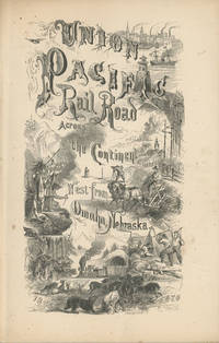
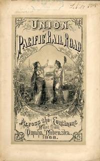
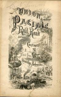
186849559New York: Published by the Union Pacific Railroad Company 1868. 1868. RAILROAD. First edition. 8vo. Original pictorial printed wrappers 32 pp. frontispiece Map of the Union Pacific Rail Road and its Connections introduction. Details the formation of the company and the progress of the work including the topography character of the country and distances along the line. Much information is provided regarding agricultural resources timber minerals etc. Branches and connecting roads along with the needed resources for construction are discussed as is information on actual earnings anticipated earnings and the issuance of the company's first mortgage bonds. A wonderful advertisement on the rear cover panel offers First Mortgage Bonds at par principal and interest Payable In Gold. A faint vertical crease and very lightly toned at the cover edges else a near fine bright copy. Published by the Union Pacific Railroad Company, 1868. unknown
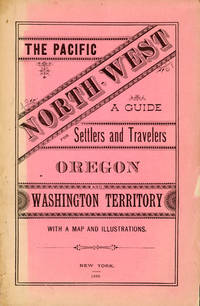
188250958New York: Land Dept. Northern Pacific Railroad Co. 1882. 1882. PACIFIC NORTHWEST. First edition. 8vo. Printed wrappers 81 pp. introductory illustrated large folding map at the rear. Scarce Western promotional travel guide to the Pacific North-West. Addressed to prospective settlers and travelers alike this guide consists of historical geographical and agricultural information and discusses at length matters such as commerce climate education taxes prices and the regions of the Pacific North-West. Each county is described and suggestions are provided to prospective emigrants such as "In mercantile pursuits the opening is good for men of enterprise and capital; but the chances for mere clerks are not good." Farm labor wages in these parts are recorded as being between $25 and $30 per month and lumber mills wages between $60 and $90 per month for first-class hands. It is also noted that "Chinamen work for the railroads and boards themselves at $1.00 a day and in winter take contracts for grubbing brush land." There are ten full-page illustrations which include a two-page "Bird's Eye View of Portland Oregon" "Saw Mill on Puget Sound W.T." "Astoria Oregon Entrance to Columbia River" "First Street Portland Oregon" and "Commercial Street Seattle W.T." with folding map of the region Unfolded 28 1/2 x 18 inches in the back. Spine and outer edges of wrappers sunned else very good copy. Land Dept., Northern Pacific Railroad Co., 1882. hardcover
18389126Ithaca NY: Published by the Author 1838. First edition. 8vo xii 13-371pp. Folding map of Oregon Territory at front and one plate here between pgs 208 and 209. Contemporary sheep with black spine label gilt lettering. Rebacked with original spine laid down. Front pastedown stained mild to moderate foxing throughout. Map with single small tear at fold neat tape repair at edge few spots of foxing. A very good example with attractive fragile map. <br /> <br /> First edition in contemporary binding of this popular book which went through at least four editions in the 1840s and contained one of the first widely circulated maps to contain reliable information about the Oregon Territory. Parker's journal details his fur trading expedition in the Rockies in 1835 for part of which he was accompanied by Marcus Whitman. The group arrived in Walla Walla in October 1835 and returned East 2 years later via ship around Cape Horn. A cornerstone Pacific Northwest title. <br /> <br /> Howes P89. Wagner-Camp 70. Washington 89 60. Published by the Author unknown
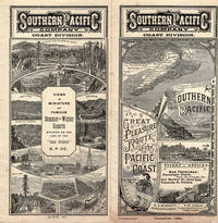
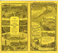
188741282N. P.: Crocker & Co. 1887. 1887. RAILROAD CALIFORNIA. First edition. 6 1/4" x 13 3/4" goldenrod colored paper folds to 6 1/4" x 3 3/8" two-sided eight panel timetable with exquisite scenes a map and train schedules for the Northern California lines of the railroad. The timetable has engraved vignettes and ornate lettering by E. Schultze. This is an attractive museum quality timetable and one of the rarest and finest early Southern Pacific railroad pieces that we have handled. It's in near fine condition and 130 years old. Crocker & Co., 1887. unknown
1859013021San Francisco: Towne & Bacon 1859. Small faded ink stamp on front wrapper and an old ink accession number. Contained in a cloth clamshell box with a printed paper label. First Edition. Original Printed Wrappers. Very Good. Towne & Bacon Paperback
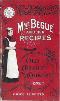
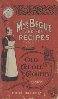
190010228San Francisco; Chicago: Southern Pacific Railroad; Printed by Poole Bros 1900. Duodecimo-size booklet 14.75 x 8.5 cm. 80 pages. Blue and brown ink on pink paper. Two photographic portraits Monsieur and Madame Bégué. Illustrations. List of railway agents. Title from cover. In logo at head of title: Southern Pacific Sunset Route. ~ Evident FIRST EDITION. A souvenir anthology of writings including sixty recipes from two landmark New Orleans restaurants offered for sale to customers traveling the Sunset Route San Francisco–New Orleans by the Southern Pacific Railroad Company. A sampling: Mutton Feet à la Créole Liver à la Bégué Jambalaya of Chicken Codish with White Beans Bisque of Crayfish Creamed Cauliflower Onion Salad Eggplant with Rice and Ham Mayonaise of Celery and Shrimps Pineapple with White Wine. ~ The title displayed on the wrappers is misleading: the atmospheric essays and testimonials – arranged by a literary journalist who contributed to Southern Pacific's promotional magazine Sunset Henry Monroe Mayo 1868-1950 – reveal little regarding the eponymous originator of the recipes or the history of the cuisine that brought her fame. Only pages 47-68 contain recipes by Elizabeth née Elisabetha Kettenring Dutreuil Bégué 1831-1906 the proprietary chef of the beloved restaurant in the Vieux Carré – the second oldest such establishment in New Orleans – located on the Rue de la Levée Decatur Street after 1870 downriver from Jackson Square and across from the French Market. An immigrant from southern Germany she had opened a coffee shop with her husband Louis Dutreuil in 1863. After his death in 1875 she married again and with her second husband Hippolyte Bégué 1842-1917 reopened in the same location with the aim of serving one meal per day – a “second breakfast†beginning at 11:00 a.m. – to accommodate laborers in the meat markets and on the docks who started work at dawn. A fuller history by David Shields is available in his The Culinarians Chicago: University or Chicago Press 2017 pages 270-273. By the mid-1880s trade fairs held in the city were bringing tourists as well and Bégué’s became a destination on its own. Madame Bégué died in 1906. The restaurant continued under management of her daughter but was sold in 1914 to relatives of the family Tujague competitors since 1856 on Decatur Street a few doors away. ~ A shorter tribute with recipes pages 69-74 is accorded another restaurateur presumably Victor Béro d. 1904 an immigrant from Belgium who had presided over Victor's Restaurant since 1873. Mayo appears to confuse the "Monsieur Victor" of his time with the founder and namesake of the establishment Victor Martin 1812-1865; cf. Shields page 136 445. ~ The Sunset Route of the Southern Pacific Company was the southernmost of the transport lines to the West Coast originally contemplated by the series of Pacific Railroad Acts between 1862 and 1866. Of the resulting publicly subsidized corporate consortia that would transform western North America – known collectively as the transcontinental railroads – Southern Pacific was already a mammoth system in 1900 including smaller subsidiaries such as the Texas and New Orleans Railroad and extending across territories that would later become New Mexico and Arizona as well as northwards through Nevada Utah and much of California. The in-house Sunset magazine appears to have been printed close to headquarters in San Francisco but like many publications issued by the transportation industry Mme. Bégué and Her Recipes was printed by Poole Brothers of Chicago who advertised as "railway printers" and also produced tickets brochures and mileage tables. ~ Internally clean and sound; in publisher's red wrappers decorated in black and white with an image of Madame Chef in kitchen apron. Wrappers with some rubbing and two small chips to the spine Near very good. Rare. OCLC locates thirteen copies; Uhler 28; New Orleans Culinary History Group page 13; not in Bitting Brown or Cagle. Southern Pacific Railroad]; [Printed by] Poole Bros unknown
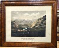
1900P5495Canada: Canadian Pacific Railway c.1900. Very Good . Notes: View of Banff Springs Hotel and Bow River Valley National Park-Rocky Mountains. It is framed in its original frame. <br>The Fairmont Banff Springs formerly and commonly known as the Banff Springs Hotel is a historic hotel in western Canada located in Banff Alberta. Image Size : 404x528 mm 15.91x20.79 Inches Platemark Size : Paper Size : 550x692 mm 21.65x27.24 Inches Coloring: Hand Colored Medium: Offset Lithograph Categories: Views Canada Alberta & British Columbia; Canadian Pacific Railway unknown
187044035Omaha: Land Department Union Pacific Railroad Company 1870. 1870. First edition. First edition. 8vo. 8 3/4" x 5 3/4" printed wrappers with map on back cover 44 pp. introduction illustrated maps. The rear cover features a map of portions of Idaho Utah Wyoming Colorado Dakota Nebraska Kansas Missouri and Iowa. States where land grant bonds are available from the Union Pacific Railroad Company. The frontispiece is a map of the United States that shows the Union Pacific Railroad and its connections. A third map shows counties in Nebraska in 1870 and the Union Pacific Railroad lands first 200 miles grants of 1862-64. A description of the Nebraska lands are provided county by county. The available lands are contained in alternate sections of one square mile each within a breadth of twenty miles on either side of the railroad and extend along the entire line. They extend through central Nebraska southern Wyoming and northern Colorado and Utah and include within their limits the splendid agricultural lands of the Platte Valley the great natural pastures of the Laramie Plains and the valleys of Lodge Pole Creek and Bear River and the rich iron and coal fields between the Black Hills and the Wahsatch Mountains. Description advantages water resources climate soil live stock raising farming markets timber minerals information about homesteads advantages of living in colonies etc. Both Adams' Herd and Graff list similar titles but different years and claim their listings to be "rare." A small bump to the top edges light wear to the spine ends else a near fine copy. Land Department Union Pacific Railroad Company, 1870. unknown
186854323New York: Published by the Company 1868. 1868. TRANSCONTINENTAL RAILROAD. First edition. Pamphlet edition. 8vo. Pictorial wrappers 40 pp. frontispiece Map of the Union Pacific Rail Road and its Connections introduction illustrated frontispiece map advertisement on rear cover for "First Mortgage Bonds at 102 principal and interest payable in gold with an annual income of "between eight and nine percent." This is an investment and advertising booklet for the first transcontinental railroad in the United States which was built by the Union Pacific Railroad and the Central Pacific Railroad in order to connect the Atlantic and Pacific coasts by rail for the first time. Begun in July of 1865 and built primarily by Civil War veterans the construction and completion of the Union Pacific line was one of the most significant technological and economic accomplishments of the 19th century creating the vital connection for commerce trade and travel and literally joining the eastern and western halves of the United States. Contents include the formation of the Union Pacific Railroad Company progress natural resources construction branch and connecting roads construction resources anticipated business & profits actual earnings and sale of first mortgage bonds. A list of officers of the company is provided. Top of front cover displays that this copy is mildly ex-library with stamp and number appearing at the upper right side a faint vertical fold to the center of the booklet tiny chips to bottom corner of front cover and a few preliminary pages. Overall a very good copy of an important railroad report. Published by the Company, 1868. unknown
186754322New York: Brown & Hewitt Printers 1867. 1867. TRANSCONTINENTAL RAILROAD. First edition. Pamphlet edition. 8vo. Pictorial wrappers 24 pp. frontispiece Map of the Union Pacific Rail Road and its Connections introduction illustrated frontispiece map advertisement on rear cover for "First Mortgage Bonds at six per cent. In gold at Ninety Cents on the Dollar. Light evidence of the entire booklet having been folded vertically penciled name to top of front cover covers lightly soiled and used small closed tear to the lower margin of the front cover Overall a very good copy of an important railroad report. Brown & Hewitt, Printers, 1867. unknown
1851PACIFICO015869Longman Brown Green and Longmans London. 1851. First edition. Octavo. Two volumes in one: pp xii 352; xii 371. Four chromolithograph plates. Original blue cloth decorated in blind lettered in gilt.On the front free endpaper are two 19th century inscriptions one of which has been crossed through. Some foxing here and there. Head and tail of spine a bit scuffed. Some wear to edges. Very good. Very scarce in the intact publishers' binding. Longman, Brown, Green, and Longmans, London. hardcover
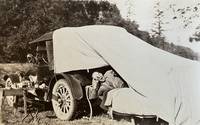
188059310Portland OR & Seattle WA: Walter Angus MacKay Julia Rose Eder MacKay Cross & Dimmitt ca. 1880-1958. Two vols. 1st - Thick oblong 4to. 11.5 x 8.75 x 2.25 in. 128 pp unpaginated. on thick black paper. With 461 photographs sized 1.75 x 2.75 in. up to 4.5 x 5.5 in. including 2 CDV’s 1 cyanotype several albumen and range of silver gelatin snapshots on matted and glossy paper stock many w/ annotations either on verso below images or w/in the margins at lower fore-edge or in pencil some w/ white ink alongside the images. Contemporary flexible polished calf post-binder punch-sewn at gutter margin in gold silk braid RPPC of Tillamook Bay OR by Gregg mounted on front cover chipping & wear to front cover wear to corners wear & rubbing to some fore-edges occasional chipping minor closed tears still VG exemplar; 2nd vol. -- Oblong 8vo. 8 x 5.75 in. 78 pp unpaginated. on thick tan paper stock. With 101 silver gelatin photographs mounted sized from 1.75 x 2.75 in. up to 4 x 6 in. some w/ sepia effect either mounted directly on the pages or many affixed with small strips of black paper or old paper corners affixing the images to the leaves a few w/ annotations on verso or below. Contemporary flexible diced calf “Housh†photo album chipping & wear to spine wear & bumping to corners some pages reworked by compilers at some point still a G exemplar both albums’ photos with bright strong contrast. These photo albums faithfully follow the sporting and leisure activities of two gearheads from Chicago -- Walter MacKay and his brother Carrol MacKay who together with their extended families and friends drive and auto-camp across the West. The large first album opens with many photos following a trip to Yosemite National Park as well as scenes along the route and upon the return of Walter & Julia. Their follow-up automobile trip in 1928 takes them to Yellowstone National Park via Spokane Idaho and Montana with photos included of Old Faithful a photo by Haynes of the Grand Geyser as well as auto camping at “Mammoth Hot Springs.†Subsequent photos trace their travels through the Columbia River Gorge the Snake River Mount Rainier National Park Ariel Dam near Ariel WA Hoods Canal WA and Newport OR. Their speed boat launch the Carmen is featured in some photos along with several views of pumps hoisting engines giant diesel and gas engines under repair. Other trips include those to Snoqualmie Falls Trout Lake WA near Mt. Adams working a hoist at logging camp partying with friends in Renton WA and even views of Walter MacKay advertising his Automobile Repair Shop with a cover on his rear tire. Other outings include auto camping and picnicking along the Mt. Hood Loop Grant’s Park on the Clackamas River Mt. Hood the Rogue River Table Mountain and views of Grants Pass. Walter and his gearhead friends were known for their stripped-down roadster racing cars and were also early participants in the Seattle Motorcycle Club and Motorcycle races. A couple photos within the two albums show early motorcycles and even gallivanting on some stripped down chassis without engines or tires. The second album includes a series of photos featuring Walter and his car beneath a towering Cedar Stump with arch cut into the base and him holding gun as well as standing on the fenders of the car. The second also includes automobile camping photos with tent and cots folded out of the rear of the automobile driving into Vancouver B.C. as well as driving to Mount Rainier and more along the Columbia River Highway and Mount Hood. Also featured are hunting shots in Eastern Oregon construction of a summer log cabin and much more. Mackay 1883-1959 was a mechanical engineer machinist gearhead racecar builder who came West working for the railroad as a machinist before working for Paragon Co. in Seattle as parts manager. He owned and operated the MacKay Automotive Repair at 165 E. 39th in Portland OR on the SW corner of 39th Cesar Chavez and Belmont for years before working at Albina Engine & Machine Works at the end of the Great Depression. One of the photos in the 2nd album shows MacKay with his camera shooting a photo and several show Julia MacKay’s 1880-1958 sisters and family. Should be noted we unknowingly catalogued an album on Seattle Auto Racing and Motorcycle Clubs from before World War I without having had access to these unknown albums. See: The Origins and Growth of the Club Scene in Western Washington 1910-1941 Jolly Rogers Motorcycle Club Feb. 7 2009; Seattle Motorcycle Races Pantages Theater Program Early Advertising in the West 1867-1918 Univ. of Washington Spec. Collections. Walter Angus MacKay, Julia Rose Eder MacKay, Cross & Dimmitt, unknown
1874M7548Montreal: Canadian Pacific Railway 1874. Very Good; laid down on acid-free tissue paper for long-term preservation. Notes: A very important and early working map of Alberta and British Columbia depicting existing and suggested railways.<br>There is a note written in period ink in the lower margin in reference to a contemporary marking of newly suggested routes in black ink:<br><br>"Note -- The Surveys made since the publication of the Report & Maps of 1874 shew the routes colored full black line and thus broken black line to be the best lines for railway construction that have been found to this date Oct 1875. Mr. Smith".<br><br>"Mr. Smith" is believed to be Donald A. Smith a major partner in the yet-to-be incorporated Canadian Pacific Railway Company in 1881. <br><br>The routes marked out in red as printed depict potential lines crossing the Rockies to the west of Edmonton at Yellowhead Pass. Almost none of the suggested routes depicted on this map were eventually used--CPR dismissed the use of Yellowhead Pass for a pass farther south in order to discourage competition from railway lines south of the border. They chose instead Kicking Horse Pass which is depicted on this map. Size : 608x779 mm 23.94x30.67 Inches Coloring: Hand Colored Category: Maps Railroad; Maps Canada West British Columbia;Maps Canada West Alberta; Canadian Pacific Railway unknown
19006878San Francisco; Chicago: Southern Pacific Railroad; Printed by Poole Bros 1900. Duodecimo-size booklet 14.75 x 8.5 cm. 80 pages. Blue and brown ink on pink paper. Two photographic portraits Monsieur and Madame Bégué. Illustrations. List of railway agents. Title from cover. In logo at head of title: Southern Pacific Sunset Route. ~ Evident FIRST EDITION. A souvenir anthology of writings including sixty recipes from two landmark New Orleans restaurants offered for sale to customers traveling the Sunset Route San Francisco–New Orleans by the Southern Pacific Railroad Company. A sampling: Mutton Feet à la Créole Liver à la Bégué Jambalaya of Chicken Codish with White Beans Bisque of Crayfish Creamed Cauliflower Onion Salad Eggplant with Rice and Ham Mayonaise of Celery and Shrimps Pineapple with White Wine. ~ The title displayed on the wrappers is misleading: the atmospheric essays and testimonials – arranged by a literary journalist who contributed to Southern Pacific's promotional magazine Sunset Henry Monroe Mayo 1868-1950 – reveal little regarding the eponymous originator of the recipes or the history of the cuisine that brought her fame. Only pages 47-68 contain recipes by Elizabeth née Elisabetha Kettenring Dutreuil Bégué 1831-1906 the proprietary chef of the beloved restaurant in the Vieux Carré – the second oldest such establishment in New Orleans – located on the Rue de la Levée Decatur Street after 1870 downriver from Jackson Square and across from the French Market. An immigrant from southern Germany she had opened a coffee shop with her husband Louis Dutreuil in 1863. After his death in 1875 she married again and with her second husband Hippolyte Bégué 1842-1917 reopened in the same location with the aim of serving one meal per day – a “second breakfast†beginning at 11:00 a.m. – to accommodate laborers in the meat markets and on the docks who started work at dawn. A fuller history by David Shields is available in his The Culinarians Chicago: University or Chicago Press 2017 pages 270-273. By the mid-1880s trade fairs held in the city were bringing tourists as well and Bégué’s became a destination on its own. Madame Bégué died in 1906. The restaurant continued under management of her daughter but was sold in 1914 to relatives of the family Tujague competitors since 1856 on Decatur Street a few doors away. ~ A shorter tribute with recipes pages 69-74 is accorded another restaurateur presumably Victor Béro d. 1904 an immigrant from Belgium who had presided over Victor's Restaurant since 1873. Mayo appears to confuse the "Monsieur Victor" of his time with the founder and namesake of the establishment Victor Martin 1812-1865; cf. Shields page 136 445. ~ The Sunset Route of the Southern Pacific Company was the southernmost of the transport lines to the West Coast originally contemplated by the series of Pacific Railroad Acts between 1862 and 1866. Of the resulting publicly subsidized corporate consortia that would transform western North America – known collectively as the transcontinental railroads – Southern Pacific was already a mammoth system in 1900 including smaller subsidiaries such as the Texas and New Orleans Railroad and extending across territories that would later become New Mexico and Arizona as well as northwards through Nevada Utah and much of California. The in-house Sunset magazine appears to have been printed close to headquarters in San Francisco but like many publications issued by the transportation industry Mme. Bégué and Her Recipes was printed by Poole Brothers of Chicago who advertised as "railway printers" and also produced tickets brochures and mileage tables. ~ A few pages dog-eared. Very good in publisher's red wrappers decorated in black and white with an image of Madame Chef in kitchen apron. Rare. OCLC locates thirteen copies; Uhler 28; New Orleans Culinary History Group page 13; not in Bitting Brown or Cagle. Southern Pacific Railroad]; [Printed by] Poole Bros unknown