440 résultats
1841LBW-1308Paris, [1841-1854]. 290 x 400 mm.
1827LBW-4444[1827]. 760 x 503 mm.
1827LBW-4418[1827]. 505 x 366 mm.
1827LBW-4421[1827]. 498 x 363 mm.
1827LBW-6869[1827] 471 x 755 mm.
1824PHO-2094Paris, Librairie de Gide Fils, 1824, In-8 (210x130mm),299 pp.- 1f., relié demi basane époque, dos lisse avec titre, tranches jaunes, illustré d’une carte repliée en couleurs (déchirure au pli), légers frottements, .
1826LBW-4990[Paris, 1826]. 502 x 764 mm.
1856120572Washington D. C. A. O. P. : Nicholson Printer 1854-1856 1856. First Edition. Hardback. Very good copy in the original gilt-blocked cloth. Professionally recased with the original spine laid back; very impressively finished. Remains particularly well-preserved overall; tight bright clean and strong. Scans and additional detail on request. ; 1 pages; Physical desc. : 1 vol. various pagings : ill ; 30 cm. Subjects; Natural history - West U. S. . Indians of North America - West U. S. . Geology - California. Washington, D. C. , A. O. P. : Nicholson, Printer [1854-1856] hardcover
1871761New York 1871. Good plus. Folding pamphlet 6 x 17 inches. Separated along one fold. A few later pencil annotations. Light wear and tanning. A scarce advertisement for bond investment in the Northern Pacific Railroad issued in 1871 during the first great construction push on the line. Although the company was founded in 1865 ground was only broken on construction in 1870 after considerable backing by Jay Cooke. This pamphlet outlines the plans for the railroad to be built from St. Paul to Portland and Seattle the prospects for passenger and freight business upon completion and the extent of the land grants afforded the railroad by the federal government. The text goes on to describe the financial instruments on offer their advantages over Treasury bonds chiefly a greater yield at 7-8% vs. 5-6% and their security against the commercial and financial assets of the railroad as well as its land grants. With a map of the proposed route on the rearmost panel. A scarce call for investment in the Northern Pacific from its early history. unknown
1871761New York 1871. Good plus. Folding pamphlet 6 x 17 inches. Separated along one fold. A few later pencil annotations. Light wear and tanning. A scarce advertisement for bond investment in the Northern Pacific Railroad issued in 1871 during the first great construction push on the line. Although the company was founded in 1865 ground was only broken on construction in 1870 after considerable backing by Jay Cooke. This pamphlet outlines the plans for the railroad to be built from St. Paul to Portland and Seattle the prospects for passenger and freight business upon completion and the extent of the land grants afforded the railroad by the federal government. The text goes on to describe the financial instruments on offer their advantages over Treasury bonds chiefly a greater yield at 7-8% vs. 5-6% and their security against the commercial and financial assets of the railroad as well as its land grants. With a map of the proposed route on the rearmost panel. A scarce call for investment in the Northern Pacific from its early history. unknown books
189143969San Francisco: H. S. Crocker Company 1891. Printed self-wrappers. General wear & age-toning. A few short tears along folds. Stain upper right corner. A Good copy. One long sheet oriented horizontally printed both sides in purple folded three times to form a 12-panel brochure. Illustrated with 4 wood engravings one 3-panel "Views of Pacific Grove and Vicinity"; one 2-panel and map single panel. Unfolded: 21-3/4" x 7". Folded: 7" x 3-1/2" <br/><br/>A promotional "announcement extraordinary" for a five-day program held by the YMCA at Pacific Grove from June 17 - 21 1891 featuring a program of bible study lectures e.g. "Aggressive Christian Work" "How to Teach the Bible to Young and Old" and related preaching and readings. A special train was provided for the association by the Southern Pacific Company Coast Division. Includes a large illustrated "View" and other promotional material for Pacific Grove and a map of the Southern Pacific routes to Monterey. Not found in Rocq. H. S. Crocker Company unknown books
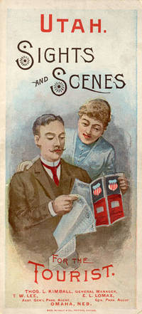
188852275Chicago: Rand McNally & Co. Printers 1888. 1888. UTAH RAILROAD. First Edition. 8vo. 21.5 x 10 cm. 8 1/2" x 4" color pictorial wrappers. 48 pp. illustrated from photographs fold-out map 'Tourist Map of Union Pacific and Connecting Lines' 20.5 x 59 cm. 8 1/4" x 23 1/2" present at the rear. The map is in nice condition and provides an excellent panorama of the Union Pacific Railway. Lines in red and run from Kansas City Atchison and Omaha to Denver and south to Gunnison or west through Cheyenne Granger and onto Portland with a spur up to Helena or west through Ogden and onto San Francisco with a spur down to Los Angeles. Blue shaded illustrations surround the lines which include a plowing scene Union Depot Salt Lake City Garfield Beach a mining scene Falls of the Yellowstone a ranching scene etc. Union Pacific produced guide for the would-be tourist of Salt Lake City including a description of the Mormons and their customs. Illustrated with nine full-page engravings from photographs by C.R. Savage. Also provided are List of Agents. Pullman Palace Car rates. Information on Salt Lake City tours Salt Lake City and the area surrounding "The Temple City" Beck's Hot Springs the Great Salt Lake Giant's Cave at Garfield Beach Echo Canon Weber Canon the Devil's Gate Ogden Ogden Canon etc. Detailed information on 9 different tours touting what the tourist might see and do. Covers lightly used light wear to fore-edges else a very good copy. Rand, McNally & Co., Printers, [1888]. unknown
188038887Chicago: Rand McNally & Co. n. d. ca 1880. 1880. First edition. 5 3/4" x 4" oblong color pictorial wrappers 16 pp. black & white engraved view of the "Hotel Colfax at Colfax Springs Iowa 333 miles west of Chicago and 24 miles east of Des Moines on the Chicago Rock Island & Pacific Railway." "Accommodations for three hundred and fifty guests. On the site of the famous Magnesium Chalybeate and Colfax Mineral Springs. A sanitarium for invalids and fashionable Summer Resort." Descriptive paragraphs about all the fishing grounds along the routes mostly in Illinois and Iowa with some mention of Missouri Dakota and Minnesota. Small agent's stamp at bottom of title page light evidence of a fold crease to the front cover else a near fine bright clean copy. Rand, McNally & Co., n. d. (ca 1880). unknown
1836508917Crocker and Brewster / Leavitt Lord & Co 1836. Fifth Edition. Hardcover. VERY GOOD. First Edition of what became the standard scholarly reference for New Testament Greek for the better part of the 19th century. 920pp. 4to half sheepskin leather over marbled boards marbled endpapers speckled edges. Some modest rubbing to the extremities spine a bit parched and cracking as usual with sheep tidemark to top edge of the first few pages typical age spotting otherwise a very clean sound copy. With multiple provenance inscriptions to the front matter notably for this Oregonian cataloger one 'F. W. Cathey' which is Rev. Frankly Warren Cathey b. Gresham 1863 d. Seattle 1941. Loosely tucked in between pp. 12 adn 13 is a notice of a meeting led by A. C. Scott. Both men were Methodist ministers in Oregon. Edward Robinson was one of the most prominent English-speaking Biblical Scholars in the 19th century holding professorships first at Andover-Newton and later Union Theological Seminary. 'His most important fruit . was the preparation of an independent Greek and English Lexicon of the New Testament which at once took the place of the his own translation of Wahl's Clavis. He made frequent use of his predecessors — Bruder Schleussner Wahl Bretschneider and all exegetic sources of importance; and. in the later editions particularly of the commentaries of De Wette and Meyer which he preferred on account of their great philological advantages and concise brevity without however allowing them to disturb his American orthodoxy in any important point. This extremely valuable and sterling work first appeared in 1836 and was at once welcomed as the best English lexicon of the New Test. and reprinted in three different editions in England. A new edition greatly improved and in part entirely altered appeared in 1850 and made it the first work of its kind to the present time. It is likewise an almost complete concordance and enables the student to nearly dispense with Bruder. This work is a monument of labor and industry. Its motto is 'Dies diem docet' and 'Nulla dies sine linea.'' McClintock & Strong 'Robinson was born near Southington Connecticut the-son of a Congregational minister. He was educated at Hamilton College in Clinton New York 1812-16. On a visit to Andover in 1822 Robinson fell under the spell of Moses Stuart who persuaded him to study in the seminary. In 1826 Robinson went to Europe where he studied four years primarily at Halle and Berlin. Returning to Andover he was named Professor of Biblical Literature in 1830. In 1837 Robinson was appointed to the faculty of Union Theological Seminary in New York which had been founded the year prior. William Baird History of New Testament Research II/28. Crocker and Brewster / Leavitt, Lord & Co hardcover
18851099Chicago: Geo. F. Cram 1885. Good plus. Large folding pamphlet approximately 20 x 41.5 inches. A few small chips and short closed tears at edges; several short separations and very minor losses along folds. Contemporary agent's ink stamp on cover panel. Tape repair across portion of horizontal fold; one panel with patches of light staining. A scarce colorful promotional for the Rock Island Route as well as its national and international connections with a fascinating stamp of an Australian sales agent. One side of the sheet prints an extensive promotional text and timetables for the various routes and services of the Chicago Rock Island & Pacific Railway. The main side of the sheet prints a map of the United States with state borders shaded in four colors highlighting the principal routes of the Rock Island from Chicago to Minnesota Iowa and Kansas and its connections to points on both the East and West Coasts. An inset map at lower right promotes the Rock Island as part of a transcontinental route between the United Kingdom Ireland and Australia. Most interestingly this copy is stamped on the cover panel with the information of a George. H. Hibbard "Australian Passenger Agent America's Cons'd Trans-continental Railways 6 Bridge Street Sydney N.S.W." Hibbard was evidently the agent in charge of distributing information about the trans-America route in Sydney one of its end points.<br /> <br /> Several issues of this map were published during the 1880s all scarce. We locate copies of the present 1885 issue at Stanford SMU and the Library of Congress. Geo. F. Cram unknown
18571004304to 11 ½ x8 ¾ original law calf morocco illustrated 4 134 85102 114 2 iv 64 pp. Some scuffing and wear to covers slight gouge to front joint chipping to edges. Two plates detached one with a chipped corner. Overall very good. Organized by the War department under the direction of Jefferson Davis who was Secretary of War at that time a collection of volumes was produced in the quest for the best route for a railroad to the West. Jefferson Davis wrote part of the introduction to this series and outlines the goals of the project. This report is on routes explored in Northern California and Oregon. Specifically the expedition was to look for a railroad route crossing the Sierra Nevada near the source of the Carson River and to see if it was feasible to connect the Sacramento valley with the Oregon Territory. Most of the color plates in this volume are located in the first three parts of the publication which is focused on topography geology and botanical subjects. This volume includes 23 color lithographs of scenery and botanical subjects 2 hand colored plates of birds and 24 steel engraved plates. Wagner-Camp 264a. Beverly Tucker, unknown
18561006214to leather spine and tips with marbled boards 36 Illustrations include 21 tinted/color lithographs one folding diagram two folding maps and a couple of black and white plates 36 14 136 127 175 pp. Binding with some wear at the spine and extremities hinges cracked some pages are a bit loose plates all present but probably not bound in correct order folding maps have a few tears some staining to front endpapers but not into the balance of the text plates and text show some aging foxing and browning but most plates resonably are clean. One of the great sources of information on the west the Pacific Railroad Reports also contains some great illustrations. This installment Vol. III is no exception. Included are some interesting and colorful pictures of the Mojave Indians and their territory. This report contains intelligence on an expedition near the 35th parallel which took the southern route due west to the Pacific Ocean from Fort Smith Kansas that was conducted by Lieutenant A.W. Whipple and assisted by Lieutenant J.C. Ives. Ives would make his own mark on western expansion a few years later in his travels on the Colorado River. The substantial amount of information on various Indain tribes makes this installment an important one. Since many of these volumes are broken for the plates they are getting somewhat scarce. Beverly Tucker, hardcover
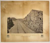
187510295Boston: Heliotype Printing 1875. Heliotype 38 cm x 48 cm on cream colored stock 55 cm x 66 cm with printed title and credit. Overall age toning. Heliotype promoting the Union Pacific line with a view of the tracks crossing Sherman Hill and the Continental Divide outside of the now ghost town of Sherman Wyoming. Sherman Hill is one of the landmarks on the transcontinental railroad and the highest point on the original U.P. line with a summit topping of 8247 feet above sea level. Sherman Hill is one of the easiest crossings of the Rockies and today it is one of the busiest lines. We are unable to locate another example of this poster. Rare. Heliotype Printing unknown
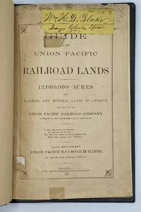
18709707Omaha: Omaha Herald Steam Printing Establishment 1870. First Edition. 44pp. Octavo 23 cm Black buckram with the title gilt stamped on the front board. Original printed salmon wrappers bound in. New endsheets and pastedowns. Manuscript label to head of original cover with paper of a similar color attached to the head of the verso. Small lib. ink stamp with accompanying 'Discard' stamp to title page. Complete with all three maps including the fold-out map 'Map of the Union Pacific Railroad Line in Nebraska' 19.5 cm x 56 cm / 7.5" x 22".<br /> <br /> Land promotional work from the Union Pacific encouraging the settlement of three million acres of U.P. lands that divides the available lands into three groups: agricultural lands the first 350 miles west of the Missouri River grazing lands from the forks of the Platte through the Laramie Plains in Wyoming and mineral lands between the Black Hills and the Wasatch Mountains. <br /> <br /> "No section of the United States furnishes facilities for grazing and stock raising superior to Nebraska and the lands on the line of the Union Pacific Railroad. The rich bottom lands of the valleys of the Platte Elkhorn Loup Fork Papillion Maple Shell Logan and Pebble Creeks Wood River Wahoo and Big Blue are included within these limits and present extensive tracts of the finest meadow land in America." Eberstadt 115: 856 later edition. Graff 4238 later edition. Herd 2351 later edition. Uncommon. Omaha Herald Steam Printing Establishment unknown
18851099Chicago: Geo. F. Cram 1885. Good plus. Large folding pamphlet approximately 20 x 41.5 inches. A few small chips and short closed tears at edges; several short separations and very minor losses along folds. Contemporary agent's ink stamp on cover panel. Tape repair across portion of horizontal fold; one panel with patches of light staining. A scarce colorful promotional for the Rock Island Route as well as its national and international connections with a fascinating stamp of an Australian sales agent. One side of the sheet prints an extensive promotional text and timetables for the various routes and services of the Chicago Rock Island & Pacific Railway. The main side of the sheet prints a map of the United States with state borders shaded in four colors highlighting the principal routes of the Rock Island from Chicago to Minnesota Iowa and Kansas and its connections to points on both the East and West Coasts. An inset map at lower right promotes the Rock Island as part of a transcontinental route between the United Kingdom Ireland and Australia. Most interestingly this copy is stamped on the cover panel with the information of a George. H. Hibbard "Australian Passenger Agent America's Cons'd Trans-continental Railways 6 Bridge Street Sydney N.S.W." Hibbard was evidently the agent in charge of distributing information about the trans-America route in Sydney one of its end points. Several issues of this map were published during the 1880s all scarce. We locate copies of the present 1885 issue at Stanford SMU and the Library of Congress. Geo. F. Cram unknown books
1850DEMO015143ILille France: L. Lefort 1850. Stated Second edition. Hardcover. Very Good. steel-engraved frontispiece. 8vo 258 pages 20th century half sprinkled calf marbled boards original wrappers bound in place. <br/><br/>Needs to be read with de Smet's LETTERS AND SKETCHES . AMONG THE INDIAN TRIBES OF THE ROCKY MOUNTAINS 1843 which contains several letters not included in this French text; but this French text "contains material not found in the English - Wagner-Camp-Becker 113a:5." Howes M288; Graff 3831; Monaghan 1332. Binding by "Reliure Francais". Issued in the Bibliotheque Historique et Morale this is actually the Third French Edition. Steel-engraved frontispiece. L. Lefort hardcover
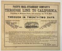
186740392New York 1867. Oblong broadsheet 9-1/2" x 11-1/2." Attractively printed within a ruled border with several type styles and sizes and engraved vignette of a steamship. The number '110' printed in lower margin beneath the border. Signed in type at the end "F. R. Baby Agent." Advertisement on verso for "Simons Brothers & Co. Manufacturers of the Metropolitan Shirt. . . Boston." Light foxing Very Good.<br /> <br /> "One of the above large and splendid Steamships will leave Pier No. 42 North River foot of Canal street at 12 o'clock noon on the 1st 11th and 21st of every month. . . for APSINWALL connecting via Panama Railway with one of the Company's Steamships from Panama for SAN FRANCISCO touching at ACAPULCO. Those of the 1st touch at MANZANILLO.<br /> "Families in Second Cabin and Steerage taken at reduced passage rates.<br /> "An allowance of one-quarter on through rates to clergymen and their families and school-teachers going to practice their vocations."<br /> According to Wikipedia "The Pacific Mail Steamship Company was founded April 18 1848 as a joint stock company under the laws of the State of New York by a group of New York City merchants. Incorporators included William H. Aspinwall Edwin Bartlett American consul at Lima Peru and also involved with the Panama Railroad Company Henry Chauncey Mr. Alsop G.G. Howland and S.S. Howland. The Pacific Mail Steamship Company was established to carry US mail on the Pacific leg of a transcontinental route via Panama."<br /> OCLC does not record this as of August 2024 nor does AAS; but the Huntington owns a copy "Date is determined by the vessels listed in the print". unknown
18561004314to original cloth rebacked with original spine strip laid on new endpapers. Illustrated with 20 of 21 color lithographs several steel engraved charts and shell engravings and three color lithographed folding maps. Table of contents list 20 color plates but some copies seem to have twenty-one. Two of the folding maps/charts have been placed in a rear endpaper pocket; one has a neat repair. A little rubbing to cloth and some minor darkening within. Could be missing one plate. Overall very good and nicely restored. One of the great sources of information on the west the Pacific Railroad Reports also contains some great illustrations. This installment Vol. III is no exception. Included are some interesting and colorful pictures of the Mojave Indians and their territory. This report contains intelligence on an expedition near the 35th parallel which took the southern route due west to the Pacific Ocean from Fort Smith Kansas that was conducted by Lieutenant A.W. Whipple and assisted by Lieutenant J.C. Ives. Ives would make his own mark on western expansion a few years later in his travels on the Colorado River. Wagner-Camp 263 Beverly Tucker hardcover
18571004304to 11 ½ x8 ¾ original law calf morocco illustrated 4 134 85102 114 2 iv 64 pp. Some scuffing and wear to covers slight gouge to front joint chipping to edges. Two plates detached one with a chipped corner. Overall very good. Organized by the War department under the direction of Jefferson Davis who was Secretary of War at that time a collection of volumes was produced in the quest for the best route for a railroad to the West. Jefferson Davis wrote part of the introduction to this series and outlines the goals of the project. This report is on routes explored in Northern California and Oregon. Specifically the expedition was to look for a railroad route crossing the Sierra Nevada near the source of the Carson River and to see if it was feasible to connect the Sacramento valley with the Oregon Territory. Most of the color plates in this volume are located in the first three parts of the publication which is focused on topography geology and botanical subjects. This volume includes 23 color lithographs of scenery and botanical subjects 2 hand colored plates of birds and 24 steel engraved plates. Wagner-Camp 264a. Beverly Tucker, unknown books
18561004314to original cloth rebacked with original spine strip laid on new endpapers. Illustrated with 20 of 21 color lithographs several steel engraved charts and shell engravings and three color lithographed folding maps. Table of contents list 20 color plates but some copies seem to have twenty-one. Two of the folding maps/charts have been placed in a rear endpaper pocket; one has a neat repair. A little rubbing to cloth and some minor darkening within. Could be missing one plate. Overall very good and nicely restored. One of the great sources of information on the west the Pacific Railroad Reports also contains some great illustrations. This installment Vol. III is no exception. Included are some interesting and colorful pictures of the Mojave Indians and their territory. This report contains intelligence on an expedition near the 35th parallel which took the southern route due west to the Pacific Ocean from Fort Smith Kansas that was conducted by Lieutenant A.W. Whipple and assisted by Lieutenant J.C. Ives. Ives would make his own mark on western expansion a few years later in his travels on the Colorado River. Wagner-Camp 263 Beverly Tucker hardcover books