UNION PACIFIC RAILROAD COMPANYBiblio.com
441 résultats
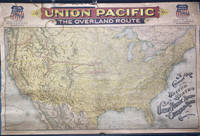
189649745Chicago: Rand McNally & Co. 1896. 1896. RAILROAD MAP. Oblong atlas folio. 37 x 56 in. One large color lithograph map mounted on linen showing the routes of the Union Pacific and subsidiary railroads in red with red yellow & black banner style lettering at upper fore-edge Union Pacific shields with mentions of subsidiary Railways mounted to upper & lower wooden rods as issued some minor lifting & creasing from being rolled over the years minor tide mark at left fore-edge upper fore-edge minor fraying and darkening still nice complete example of this map. First Rand McNally & Co. edition thus of this uncommon First Rand McNally & Co. edition thus of this uncommon Union Pacific Railroad route map intended to be used by travel agents and passenger agents in Union Pacific stations across the West. The map demarcates the Overland Route and connections with the Oregon Short Line RR Co. Oregon RR & Navigation Co. and the Southern Pacific in bold red stretching West from Kansas City Leavenworth St. Joseph Omaha Council Bluffs Sioux City & Fort Worth. A version of this map was initially released in 1892 by Reeves with the Knight Leonard & Co. and a little larger by a couple inches as it included insets for Sandwich Islands and Alaska whereas this version focuses only on the Continental United States. Rand McNally & Co., 1896. unknown
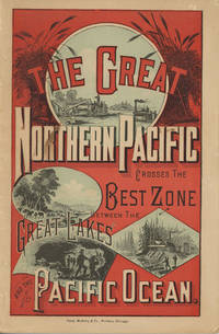
188249882Chicago: Rand McNally & Company 1882. 1882. First edition. 9" x 6" in color pictorial wrappers printed in red blue & black with vignettes of wheat threshing cattle mining and logging on front wrapper. 82pp. plus 2 pp. publisher's ads for Oregon Railway & Navigation Co. Contents. Illustrations. Maps. Uncommon Northern Pacific Railway land promotion detailing the sites and possibilities along the Northern Pacific route at the end of the 19th century. The work details the history of the NPRR divisions branch lines development opportunities for homesteaders and businesses in Western Washington the inner-mountain West Montana Yellowstone National Park the Dakotas Minnesota and specific land grants available from the NPRR in Minnesota and the Dakotas. Large color map attached to inside rear wrapper. Map fine. Light chipping to wrapper edges and with a few small closed tears to wrapper edges along with light soiling and rubbing to spine. Very good. Rand, McNally & Company, 1882. unknown
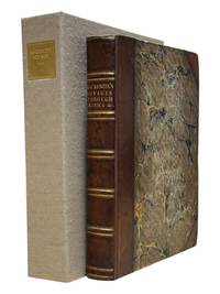
1860100432Large thick 4to contemporary calf spine and tips with marbled boards 70 very attractive color lithograph plates 358 41 pp. Extremeties worn minor aging one map has tear in lower corner plates bright and clean. The Pacific Railroad Surveys 1853-1855 explored possible routes for a transcontinental railroad. However the surveys went beyond looking for a place for a railroad they included and incredible amount of information on natural history and the peoples that inhabited the areas where the surveys explored. Representing the first part of the final volume of these surveys this installment focused on the northern route for a railroad. The 12 volumes included in these surveys is also known for rich illustrations many of which were in color. With 70 color plates one folding and three folding maps in Volume XII part 1 this edition is particularly rich in illustration and the plates are bright and clean. Thomas A. Ford hardcover
1860100432Large thick 4to contemporary calf spine and tips with marbled boards 70 very attractive color lithograph plates 358 41 pp. Extremeties worn minor aging one map has tear in lower corner plates bright and clean. The Pacific Railroad Surveys 1853-1855 explored possible routes for a transcontinental railroad. However the surveys went beyond looking for a place for a railroad they included and incredible amount of information on natural history and the peoples that inhabited the areas where the surveys explored. Representing the first part of the final volume of these surveys this installment focused on the northern route for a railroad. The 12 volumes included in these surveys is also known for rich illustrations many of which were in color. With 70 color plates one folding and three folding maps in Volume XII part 1 this edition is particularly rich in illustration and the plates are bright and clean. Thomas A. Ford hardcover books
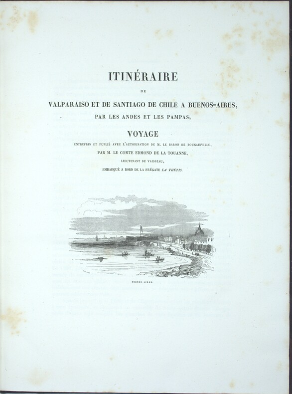
1837PHO-2280Paris, Arthus Bertrand, 1837, 2 volumes (3) grand in-4° (30x24,5cm), VIII pp., 742 pp., demi chagrin et coins époque, dos lisse avec auteur, titre et tomaison, frottements au dos, quelques rousseurs, défaut à la coiffe supérieure. Édition originale du texte du voyage du Bougainville autour du monde, manque l’atlas.
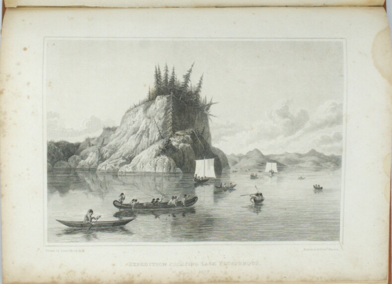
1823PHO-1666London, John Murray, 1823 et 1828, 2 volumes In-4, relié pleine toile orange, dos lisse avec pièce d’auteur et titre, date en pied, xvi-768pp. et xxvi-320pp.cvii-1f., tome 1, tâche sur les 5 premiers feuillets, petites rousseurs, mouillure angulaire sur les planches au tome 2, petits frottements à la reliure. Édition originale, illustrée de 30 planches dont 11 en couleurs pour le tome et de 31 planches au tome 2, les cartes manquent, Cachet Émile Petitot, Ex-libris manuscrit, Ex-libris Jean-Pierre Legrand-Deloron. Avec une mention signée : "membre de l'Expédition arctique T.A. 23 , 1972-1973" .
183914879Pourrat frères Paris 1839 2 vol. 2 vol. in-8 de 2 ff.n.ch. 510 pp. 1 f.n.ch. (table) et 2 ff.n.ch. 547 pp. 1 f.n.ch. (table), demi-veau romantique de l'époque, dos à faux nerfs orné.
1868WRCAM33573AWashington: Government Printing Office 1868. 39pp. plus large color folding map 23 1/4 x 44 3/4 inches. Original printed wrappers. Presentation inscription on front wrapper see below. Wrapper edges chipped minor soiling and tanning to wrappers spine partially chipped old vertical fold to pamphlet. Light foxing and tanning and occasional soiling throughout Map with a few small closed tears at cross-folds with no loss. About very good. This copy is inscribed on the front wrapper: "With Regards of James Tilton C.E." Tilton 1819-78 was then chief engineer of the Washington Division of the Northern Pacific Railroad. Thanks in part to his support for Franklin Pierce's presidential campaign Tilton was appointed the first Surveyor General of Washington Territory and served from 1853-61. Both the Tilton River and Fort Tilton near Fall City Washington are named for him. <br> <br> An important report to Congress by the Northern Pacific Railroad headed by Minnesota railroad magnate James J. Hill for federal aid to support the Railroad's expansion to the West Coast. The petition reviews the railroad's original charter printing with it a memorial from the NPRR's Board of Directors and supporting communications from military figures including Montgomery Meigs and Ulysses S. Grant. Since the early 1850s Edwin Johnson described by Wheat as a "visionary" engineer had been associated with the plan to build a railroad across the northern part of the United States from the Great Lakes to the Pacific Coast. In 1867 he was named chief engineer of the Northern Pacific and this memorial is a work of major importance for the history of the railroad. It includes Johnson's topographical survey of the route to the Pacific a discussion of potential problems that may be encountered and a detailed economic and military survey of the area in justification of construction. <br> <br> The exceptional large folding "Map of the Country from Lake Superior to the Pacific Ocean from the Latest Explorations and Surveys" was produced by the Colton firm in New York. One of the finest maps of the region to date it shows the area from Detroit to the Pacific well into Canada and south to about the 39th parallel. Johnson has drawn the route of the Northern Pacific from Lake Superior to Washington Territory where the line splits with one branch heading toward Fort Vancouver and the other to Puget Sound. Among the details shown on the map are the Pony Express route wagon routes and overland mail routes exploration routes and other proposed railroad routes the locations of Indian tribes mineral deposits military forts and much more. Wheat gives a long description of the map and remarks that "the detail of such a map defies cataloging." Construction on the Northern Pacific Railroad began in 1870 and was completed in 1883. Edwin Johnson did not see its completion dying in 1872. An edition of this report with the supporting documents and map was also privately published in Hartford. <br> <br> A significant early account of railroad expansion in the Northwest. We could find only ten copies listed in OCLC and this is the first copy we have seen in wrappers and with a presentation from an important engineer on the project. RAILWAY ECONOMICS pp.242-43. SABIN 55819 Hartford edition. WHEAT TRANSMISSISSIPPI WEST V item 1169 pp.205-09. PHILLIPS MAPS p.916. DECKER 37:266 Hartford ed. MIDLAND NOTES 68:164. OCLC 60578657. Government Printing Office unknown books
18871408San Francisco 1887. About very good. 668pp. including numerous in-text or full page illustrations and eight photolithographed plates plus large folding map. Folio. Original pictorial wrappers. Wraps with some soiling wear at edges; front wrap with a few signs of biopredation; two small chips to rear wrapper; spine perishing at extremities. Minor worming at upper corner of a few interior leaves. Light tanning. A rare and extravagant promotional for the Pacific Cable Railway Company which manufactured installed and operated the famous streetcar system of San Francisco and in several other American cities. The present work also serves as a declaration of patent with a list of patents and patent holders at the rear and the text comprises a detailed technical description of the wire cable system with many illustrations of its mechanisms and operation as well as general accounts of the systems running in San Francisco Los Angeles Chicago and Kansas City. In addition to the technical diagrams are several attractive line illustrations and eight photolithographed plates reproduced by artotype of the cable cars of San Francisco in action all by Britton & Rey. The folding map at the rear provides a detailed delineation of the lines running across the city. Very scarce OCLC locates only five copies.<br /><br />Cowan II p.512. books
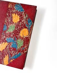
188553538Paris: Imprimé pour Isadore Liseux et ses amis 1885. First edition thus. Near fine. First vernacular translation of these suppressed Latin elegies that include the most explicit poetic expressions of homosexual desire of the Italian Renaissance. The HECATELEGIUM was first published in Florence in 1489 by a poet so notorious for his open homosexuality that Machiavelli named him in a 1501 letter as one of those poets who would have been burned at the stake had they not been protected by powerful cardinals "qui nisi haberent refugium in asylum nunc huius nunc illius Cardinalis combusti iam essent". Massimi's fame during his long life was nearly extinguished over the centuries of suppression and silence that followed which saw a heavily bowdlerized edition of the HECATELEGIUM published in Parma in 1691 and this privately printed edition in French and Latin only in 1885 the first uncensored edition since 1523. Though the Latin of this edition is complete certain obscene Latin words are printed in Greek rather than French in the facing translation still deemed too filthy to be read by anyone without a protective classical education. Undertaken by the shadowy publisher Antoine-Isidore Liseux 1835-1894 it was printed in Liseux's elegant typographical style in a "private" edition of 120 copies. Rare and important. 9.75'' x 6.5''. Later three-quarter cherry-red calf over marbled boards signed "Canape Belz" with matching marbled endpapers. Edition of 120 copies this copy no. 80. Text in French and Latin. xvi 354 2 pages. Minor rubbing to extremities. Old shelf label removed from head of spine. Else bright clean and sound. Imprimé pour Isadore Liseux et ses amis unknown
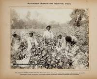
1900373823St. Louis 1900. 34 photographs mounted recto and verso on 17 cards with printed album title on each the images captioned in the negative on linen guards. Oblong small folio 10-1/8x12-1/2 inches. Contemporary half calf and cloth covered boards titled in gilt on the upper cover leather perished contents loose. The images generally dark printings in good condition. Provenance: Battery Park Hotel Asheville NC presentation in gilt on the upper cover from H. C. Townsend Gen'l Pass'r and Ticket Agent St. Louis. 34 photographs mounted recto and verso on 17 cards with printed album title on each the images captioned in the negative on linen guards. Oblong small folio 10-1/8x12-1/2 inches. The images by an unindentifed photographer comprise lovely compositions of buildings and scenes along the route in Missouri Kansas Nebraska and Arkansas. OCLC locates only a single example at University of Texas Austin. unknown
18019122London: Printed for T. Cadell Jun. & W. Davies; Cobbett & Morgan; and W. Creech by R. Noble 1801. First edition. 4to 4 viii 412 2 errata cxxii pp with "General History of the Fur Trade" following the Voyages section and errata leaf. Complete with half title often lacking frontis portrait three large folding engraved maps. Fine 1/2 polished calf tooled in blind and lettered in gilt on spine marbled boards endpapers and page edges. Few stains and foxing to prelims most notably at the inner margin of the frontis and title pages. Otherwise scattered light foxing mainly marginal and more pronounced on the final dozen leaves or so. Maps quite nice with typical offsetting from folds some foxing and toning. A very good copy in attractive binding housed in a custom oatmeal cloth Solander box lined with green felt gilt spine label. <br /> <br /> A cornerstone work on early Pacific Northwest exploration being the first account of crossing the continent from ocean to ocean by a white man some dozen years before Lewis and Clark. This text also represents the first published account of the fur trade which was attributed to Roderick Mackenzie. A nice copy in attractive binding. <br /> <br /> Howes M 133. Sabin 43414. Streeter 3653. <br /> <br /> <br /> . Printed for T. Cadell, Jun. & W. Davies; Cobbett & Morgan; and W. Creech, by R. Noble unknown
1872WRCAM29311Various places 1872. Twelve cards each 17 x 13 inches a.e.g. with manuscript captions in lower margins. Images are 9 x 6 1/2 inches except the two oval images of San Francisco. Some minor soiling on cards some images slightly faded. Very good. Archivally matted protected with a mylar sheet. An excellent collection of views quite early for Hawaii and New Zealand. The four views of Honolulu include one wide view of the town a view of a side street with a church steeple in the background the Pali mountain pass and the harbor with several large vessels at anchor. In New Zealand the Supreme Court building in Christchurch and the city of Littleton are displayed. The San Francisco images include the Palace Hotel and the famous Cliff House. Of particular interest are the three views of the Central Pacific Railway. The sections of the track include Capestown the Palisade and Summit Station each with fresh evidence of the line's recent completion. Also in the collection is one image of a railroad along the banks of Salt Lake and three wide views of Salt Lake City one with the Mormon tabernacle completed in 1871 prominently featured. An attractive collection of views each quite displayable. unknown books
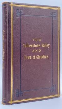
188210945St. Paul MN: The Pioneer Press Co 1882. First Edition First State. 100pp. Octavo 24 cm Presentation binding. Publisher's full grained brown leather with the title gilt stamped on the front board and backstrip. A.E.G. Satin moire endsheets. Near fine. Inscribed on the front free endsheet. 'Mr. Minnie with compliments of the author. Map of the Yellowstone Valley 42 cm x 70 cm and the Plat map of Glendive 40 cm x 56 cm present and both linen backed and in nice condition. Presentation copy. The trade edition of this work was bound in green printed wrappers with 10 pages of advertisements in the front and 3 to 10 pages of advertisements in the rear. Map of transcontinental was attached to the rear free endsheet. Our copy predates the various issues with advertisements and the map attached to the rear free endsheet. Eberstadt and Yale copies and others only list the plat and cattle trails maps. Early Montana promotional item from the Northern Pacific Railroad a year before they opened the Gardiner Gateway at the north end of Yellowstone Park. An important descriptive tract of the new country at the time of its settlement with a fine large map showing the towns and cattle trails. Eberstadt 132: 478. Howes Y8. Rampaging Herd 1535. This is the first time that we've handled or encountered this title. Rare. The Pioneer Press Co unknown
186895331868. <p>The Transcontinental Railroad made possible the winning settlement and development of the American West. It led to a revolution in interstate and international trade opening the markets of the west coast and Asia to the east and Europe while bringing products of eastern or European industry to the growing populace west of the Mississippi and beyond. The railroad caused a great production boom and was in a sense America’s first technology corridor. As it encouraged the growth of American trade and business so too did the railroad impact the nation's public discourse and intellectual life by making it possible to come and go across the length of the continent in just over a week. Now for the first time the beauties and riches of the central part of the continent could be accessed any anyone in days. Nothing was the same afterwards. Many people consider the Transcontinental Railroad the greatest technological feat of the 19th century and one of the most consequential major construction projects ever undertaken.</p><p>Before the advent of the Transcontinental Railroad a journey across the continent to the west coast meant months of careful preparation and acquisition of a conveyance and supplies then a dangerous six month trek over rivers deserts and mountains all the way risking the loss of necessities and encounters with blizzards and Indians. Alternatively a traveler could hazard a three to six month sea voyage around ferociously stormy Cape Horn which proved a graveyard to many ships or sail to Central America and cross the Isthmus of Panama through the jungle in part by pack animal and in part by rail which took five or six weeks risking exposure to any number of deadly diseases in the crossing. So it is no surprise that interest in building a railroad uniting the east and west coasts of the continent began soon after the advent of the locomotive.</p><p><strong>Early Trains in the US and the Idea to Build a Train Connecting East and West Coasts</strong></p><p>The first trains began to run in the U.S. in the 1830s along the East Coast and by the 1840s the nation's railway networks extended throughout the East South and Midwest. The annexation of the western territories including California following the Mexican War the almost immediately subsequent discovery of gold in the region in 1848 the resultant Gold Rush starting in 1849 and statehood for California in 1850 brought momentum to the idea of building a railroad across the nation to the Pacific. Meanwhile thousands of immigrants and miners sought their fortune in the West. During the 1850s Congress sponsored numerous survey parties to investigate possible routes for a transcontinental railroad. No particular route emerged as a clear favorite as the project became yet one more point of contention between the North and South before the Civil War with each wanting the railroad to go through their section.</p><p>Theodore Judah was a civil engineer who helped build the first railroad in California and he became obsessed with the idea of a transcontinental railroad running through Nebraska Wyoming Utah Nevada and California. In 1859 he drew up letters of incorporation for the Central Pacific Railroad Company. Judah surveyed the route creating maps that he used to bolster a presentation of the scheme he made to Congress in October 1861. Many Congressmen were leery of beginning such an expensive venture especially with the Civil War underway but President Abraham Lincoln a long-time supporter of railroads saw in the proposal an important additional opportunity: to help knit California and the West to the Union. He agreed with Judah and on July 1 1862 Lincoln signed the Pacific Railway Act authorizing land grants and government support which amounted to $32000 per mile of track laid to two companies the Central Pacific Railroad and the Union Pacific Railroad. The Central would start at California’s eastern rail point in Sacramento cross the Sierras go through Nevada and into northern Utah where it would meet up with the Union Pacific. The Central Pacific Railroad spiked the first rail on October 26 1863 and its construction crews began building the line east from Sacramento.</p><p>At the eastern end of the project Gen. Grenville Dodge and his assistant Peter Dey surveyed the potential route the Union Pacific would take. They recommended a line that would follow Nebraska’s Platt River along the North Fork would then cross the Continental Divide at South Pass in Wyoming and continue along to Green River then head into Utah. President Lincoln favored this route and made the decision that the eastern terminus of the Transcontinental Railroad would be Council Bluffs Iowa across the Missouri River from Omaha Nebraska.</p><p><strong>The Union Pacific</strong></p><p>Thomas Durant a medical doctor turned businessman gained control of the Union Pacific Railroad Company in July 1863. Though Durant took the office of vice president he was the actual leader of the railroad. In 1864 Congress passed the second Pacific Railway Act which doubled the size of the land grants and allowed the railroads to sell their own bonds. The Union Pacific began to lay tracks at Omaha Nebraska in July 1865. But Durant's management of the actual building of the rail line was sub par and lacked both organization and people with sufficient knowledge and skills to accomplish its ambitious task.</p><p>So as 1866 dawned Durant hired Grenville Dodge as chief engineer of the railroad Dodge began advising Durant immediately although he would not leave the service until May and Dodge insisted up front that Jack Casement and his brother be hired to lay the track and actually construct the Union Pacific line. John S. Jack Casement had worked as a railroad contractor on the Ohio Railroad prior to the Civil War. During the war he rose to the rank of General and Brigade commander and was admired for his bravery management skills and railroad experience. Jack and his brother Daniel had formed the firm of J.S. & D.T. Casement; “General Jack†was construction leader while Daniel handled financial matters.</p><p><strong>Jack and Dan Casement Build the Railroad</strong></p><p>The Casements came to an understanding with Durant and they agreed upon a proposal letter dated February 6 1866. That letter provided that the Casement firm would ""lay and fill the track on the Union Pacific Rail Road for seven hundred fifty dollars per mile on the following terms and conditions. The Rail Road Company to furnish motive power cars wood and water and tracks for boarding cars and pay for delays of over three consecutive days caused by want of material motive power or other default or neglect of Company. The track to be laid in a good and workmanlike manner and filled and surfaced with material taken from the side of the road the whole to be subject to the approval and acceptance of the Engineer of the Company in charge of the work and the track to be accepted on the completion of every twenty miles and approximate estimates to be made by the Engineer in charge and paid monthly. We will lay the track as fast as required not to exceed one mile per day and will at the option of the Company on ten days notice reduce our gang to a force sufficient to lay one half mile per day. We will furnish engineer men and all other help for the trains used in distribution of material and take the materials for track at any point on the Rail Road within one hundred feet of the track and we will furnish oil waste etc for trains in our employ. All trains used in construction or for any purpose by us are to be run subject to the regulations & schedule time of the Company & under the general control of the Superintendent of the Company. We will make no extra charge in cutting and filling in leveling ties unless it exceeds six inches. No extra charge for putting in frogs and switches for all necessary sidings. And we will place the labor of all our men at the disposal of the Company whenever the delays exceed three days and charge for their time as per our payroll. We will commence as soon as the Company requires & will lay track during the whole of the present season and longer if the Company requires.†This proposal was signed “J.S. & D.T. Casement.†Durant responded to the Casements two days later on February 8 1866. His letter stated: “J.S. & D. T. Casement Painesville Ohio. Gentlemen: Your proposition to the Union Pacific Railroad Company under date of Feb. 6 1866 in relation to track-laying is received and has been considered. The Company decides to regard your proposition and this acceptance as the agreement upon the subject. The Company reserves the right to terminate this arrangement in case you do not perform the agreement on your part. Yours truly Thomas C. Durant V. P.""</p><p>Jack Casement was responsible for all matters relating to building the Union Pacific. He hired the workers many of whom were former military personal gathered the materials and supplies and went into the field. As during the war his post was at the front in the construction camps which he ran like an army at the end of the line where the work was being done or in his car at the tail of the work train. Scrappy and hard-working he oversaw not just the laying but the grading of the track as well. As one of the necessities of his job to get to and from the work sites the Union Pacific presented him with annual passes to use their cars.</p><p><strong>Jack Casement’s engraved Union Pacific pass for 1868</strong> used by him to manage and supervise work on the Transcontinental Railroad signed by Company President John D. Perry. This pass was retained by Casement’s descendants until recently when we obtained it directly from them.</p><p>Under Casement’s leadership the Union Pacific laid 1087 miles of track from Fremont Nebraska west to Utah where the Central Pacific and Union Pacific Railroads met to form the transcontinental railroad. His was a magnificent achievement that compares well with the Central Pacific Railroad which laid 690 miles.</p><p>On April 9 1869 with construction work nearing a conclusion and both the Union Pacific and Central Pacific needing a meeting point Congress established it as Promontory Summit north of the Great Salt Lake in Utah. Less than one month later on the morning of May 10 1869 locomotives from the two railroads met nose-to-nose to signal the joining of the two lines. At 12:57 p.m. local time at a ceremony planned to connect the railroads Leland Stanford Governor of California and president of the Central Pacific and Durant as vice-president of the Union Pacific were to pound in the golden spike with silver hammers. Both men proved unable to hit the spike so Jack Casement stepped up to do the job accompanied by much cheering from the workers surrounding him. Telegraphers announced the completion of the Pacific Railway. Canons boomed in San Francisco and Washington. Bells rang and fire whistles shrieked as people celebrated across the country. The nation was indeed united.</p> unknown
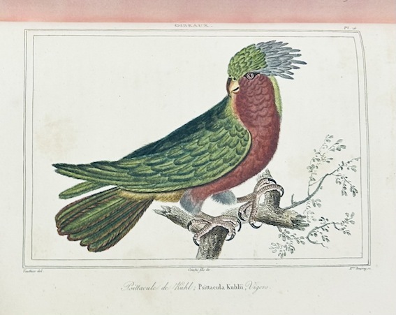
1860WRCAM41089BWashington 1860. Twelve volumes bound in thirteen. Profusely illustrated with maps lithographic plates colored lithographic plates profiles etc. Large thick quarto. Original blindstamped cloth spines gilt. Minor edge wear. Each volume rebacked retaining original backstrip but with new endpapers. All but one volume from the Senate issue Vol. XII Part 1 is the House issue with a Senate backstrip. Lacking the general map of the routes surveyed from Vol. XI. Several maps with holes and separations along fold lines many with large tears including Warren's map of the western United States. Occasional tideline affecting text or an illustration scattered foxing and toning. Overall quite clean internally. Good plus. This large quarto set is the most important and massive compilation of exploration reports and data ever published about the trans-Mississippi West. Under the direction of Secretary of War Jefferson Davis the Pacific Railroad survey in two years increased the contemporary knowledge of the geography topography geology and natural history of the West by a quantum leap. Included herein are the reports of Humphreys Stevens Beckwith Whipple Warren Williamson Lander et al supplemented with reports on scientific observations and numerous significant achievements in cartography including Warren's "Map of the Territory of the United States from the Mississippi to the Pacific Ocean." here present in the eleventh volume which has been hailed as "the best cartographical work on the West up to its time." Howes. The illustrative material engraved and lithographed views specimens of birds fishes and other animals is of the highest quality often in colored state and encompasses thousands of illustrations either in the text or as separate plates. Wheat devotes twenty-four pages of detailed discussion to the maps in this series of reports singling out the Warren map as "among the great maps of the United States that preceded the Civil War." <br> <br> All things considered this edition of the Pacific Railroad Surveys stands as a testament to one of the greatest government sponsored projects in our history and is a foundation work for any collection devoted to Western Americana or cartography. HOWES P3 etc. WHEAT TRANSMISSISSIPPI 822 through 824 843 through 846 852 853 864 through 867 874 875 877 through 882 898 936 23 in all. TWENEY 89 59. WAGNER-CAMP 262 through 267. RITTENHOUSE 442. REESE STAMPED WITH A NATIONAL CHARACTER 75. ZAMORANO SELECT 108. REESE BEST OF THE WEST 138. hardcover books