Garnier NicolasLivre Rare Book

6 261 résultats
2000R300312628Hazan. 2000. In-8. Relié. Etat d'usage, Couv. convenable, Dos satisfaisant, Intérieur frais. 157 pages - nombreuses illustrations en noir et blanc et en couleurs dans et hors texte. Jaquette frottée en coins et coiffes.. Avec Jaquette. . . Classification Dewey : 996-Autres régions du pacifique
16366USIS, New York,1945, 1st edition, very good condition, pictorial wraps, published by 174 pages. An overall account of the United States Navy Task Force 58, and the Aircraft Carrier Pacific Sea Battles. Profusely illustrated with photographs.
8vo., First Edition, with photographs and maps in the text; buff boards, white cloth back lettered in gilt, ivory endpapers, a fine copy in unclipped dustwrapper.
Edizione italiana della celebre carta dell’isola di Tahiti di James Cook. La presente carta è stata stampata come parte del resoconto ufficiale del primo viaggio di Cook, che fu curato dal critico letterario John Hawkesworth e sottoscritto dall'Ammiragliato britannico. An Account of the Voyages undertaken by the order of His Present Majesty for making Discoveries in the Southern Hemisphere... (Londra: W. Strahan and T. Cadell, 1773) raccontava i viaggi non solo di Cook, ma anche di Byron, Wallis e Carteret che si erano avventurati nel Pacifico per la Royal Navy in precedenza negli anni 1760. James Cook, fu nominato luogotenente al comando dell'Endeavour, un vascello di 370 tonnellate, salpò da Plymouth il 25 agosto 1768, conducendo seco J. Banks, il botanico Solander, e i pittori Buchan e Sydney Parkinson, l'ultimo dei quali acquistò fama per i suoi quadri d'interesse naturalistico. Dopo aver toccato Madera e Rio de Janeiro, doppiò il Capo di Buona Speranza e giunse nell'aprile del 1769 a Tahiti; riconobbe e rilevò l'arcipelago delle Isole della Società e, portata a termine la missione affidatagli, navigò verso SO., compiendo quasi per intero il periplo della Nuova Zelanda, dove scoprì lo stretto che da lui prese nome. Colpito dal fatto che, nonostante Tahiti fosse comunque uno scalo di estrema importanza per le navi che solcavano il Pacifico, la posizione segnata sulle carte risultava terribilmente approssimativa, Cook approfitta della sosta per calcolare anche latitudine e longitudine esatte dell’Isola, destinate ad arricchire e migliorare le attuali mappe nautiche che risultano sempre incomplete e notevolmente indeterminate. È il 13 luglio 1769 quando Cook dà ordine di salpare l’ancora, navigando sulla rotta prestabilita che dovrebbe portarlo verso Sud scopre altre isole facenti parti dell’Arcipelago di Tahiti alle quali conferisce il nome di Isole della Società, in onore appunto alla Royal Society. Acquaforte, finemente colorata a mano, in ottimo stato di conservazione. Italian edition of the map of Tahiti by James Cook. Captain James Cook (1728-1779) is considered to be the greatest explorer of the eighteenth century and was the finest maritime cartographer of the Age of Enlightenment. Having first worked on coal colliers and then distinguished himself as a surveyor in Eastern Canada, in 1768 he became the British Admiralty's choice to lead an unprecedented voyage of discovery. The central impetus for the expedition was to observe the Transit of Venus from Tahiti and then to proceed to explore Terra Australis Incognita, the supposedly rich southern continent. Whereas the first part of the voyage was to be conducted under the auspices of international scientific cooperation, the second part was entirely clandestine and was only communicated to Cook via "Secret Instructions" to be opened once at sea. Cook's party left Plymouth in August 1768 aboard the converted coal collier HMS Endeavor and proceeded to Tahiti by way of Cape Horn. They arrived in time to observe the Transit of Venus, which occurred June 3, 1769. Cook then proceeded towards New Zealand, to the coordinates recorded by Tasman. The present chart was printed as part of the official account of Cook's first voyage, which was edited by the literary critic John Hawkesworth and underwritten by the British Admiralty. An Account of the Voyages undertaken by the order of His Present Majesty for making Discoveries in the Southern Hemisphere… (London: W. Strahan and T. Cadell, 1773) recounted the voyages not only of Cook, but of Byron, Wallis, and Carteret who had also ventured to the Pacific for the Royal Navy earlier in the 1760s. Etching with fine later hand colour, good condition.
(Codice VI/0225) Bella carta finemente incisa in rame e acquerellata, proviene da una copia scompleta dell'ATLANTE GEOGRAFICO UNIVERSALE. Dimensione dell'incisione: cm 18,5x25 ca. più margini bianchi. Viene spedita con una riproduzione del frontespizio dell'atlante stesso. Bella e decorativa, ottima conservazione, adatta ad essere inquadrata. ~~~ SPEDIZIONE IN ITALIA SEMPRE TRACCIATA
Carta della Nuova Zelanda del Capitano Cook, tratta dal "Compendio della storia generale dei viaggi" tradotta dal lavoro di Prevost "Historie generale des voyages". L'opera in sette volumi è dedicata ai viaggi di Cook e altri viaggiatori nell'emisfero australe ed è stampata a Venezia da Vincenzo Formaleoni.Acquaforte, solite pieghe di carta, in ottimo stato di conservazione. Map of New Zealand by Captain Cook, taken from the "Compendio della storia generale dei viaggi" Italian translation of the Prevost's work "Historie generale des voyages". The seven-volume work is dedicated to Cook and other travelers in the southern hemisphere and is printed in Venice by Vincenzo Formaleoni.Very good condition with usual traces of original binding folds.
Carta geografica tratta dall'atlante della relazione di James Hawkesworth "Cartes et figures des voyages entrepris par ordre de sa Majesté Britannique pou fair des découvertes dans l'hémisphère méridional; exécutes par Byron, Carteret, Wallis & Cook dans les vaisseaux le Dauphin, Le Swallow & l'Endeavour" pubblicata in più edizioni di lingua francese, inglese, olandese ed italiano. Incisione in rame, in ottimo stato di conservazione. Map of the atlas is the report by James Hawkesworth "Cartes et figures des voyages entreprise par ordre de sa Majesté Britannique pou fair des découvertes dans l'Hémisphère southern exécutes par Byron, Carteret, Wallis and Cook dans les vaisseaux le Dauphin, Le Swallow & Endeavour "published in multiple editions of the English, French, Dutch and Italian.A map of Tahiti and the surrounding islands discovered by Wallis, Carteret and Cook in the years 1765, 1767 and 1769.The map shows Maurua, Tubai, Bolabola (Bora Bora), Otaha, Ulietéa and Huaheine. This group of islands was identified by Cook in 1769 when he wrote in his journal, "So call'd by the Natives and it was not thought advisable to give them any other names but these three together with Huaheine, Tubai, and Maurua as they lay contiguous to one another I have named Society Isles."
Carta geografica tratta dall’ Atlante geografico. Corredato di notizie relative alla geografia fisica politica, ed in generale alla statistica delle varie regioni del Globo. Compilato ed eseguito in litografia per cura e sotto la direzione di Benedetto Marzolla edito a Napoli nel 1858. Marzolla, autore di importanti atlanti sulle provincie del Regno di Napoli, è anche autore di diverse carte sulle Circoscrizioni Ecclesiastiche nel Regno delle Due Sicilie, pubblicate postume, nello stesso anno della morte (1858) a Napoli nello Stabilimento Geografico diretto da Luigi Manzella. Benedetto Marzolla fu disegnatore topografo e litografo; geografo e cartografo; membro della Commissione di statistica presso il Ministero dell'Interno. Personaggio di grandissimo rilievo nella cartografia napoletana ed italiana del XIX secolo, Marzolla ottenne in vita pubblici riconoscimenti ed attestati per la produzione cartografica di altissima qualità. La sua notorietà si è lentamente dissolta dopo la morte; va tuttavia osservato che solo la mancanza di uno spiccato coinvolgimento politico in senso risorgimentale e di una valenza letteraria nella sua opera non lo hanno reso famoso come i contemporanei Francesco Costantino Marmocchi (1805-1858) e Attilio Zuccagni-Orlandini (1783-1872), con i quali può certamente confrontarsi. I progetti culturali didattici e editoriali di Marzolla furono e rimangono di straordinaria modernità; egli inventò, è il caso di dire, un nuovo modo di intendere e di disegnare la carta geografica, fornendo una visione assolutamente originale della comunicazione dei dati geografici attraverso la combinazione di testo e immagine. Con tale operazione, egli riuscì a fondere in un'unica opera, storia, geografia, economia, statistica e cartografia, raggiungendo un equilibrio grafico di rara efficacia (cfr. V. Valerio, Benedetto Marzolla Brindisino, Geografo e Cartografo dell'800 Europeo, Brindisi 2008). Bell’esemplare con coloritura coeva dei contorni, in ottimo stato di conservazione. Bibliografia V. Valerio, Benedetto Marzolla Brindisino, Geografo e Cartografo dell’800 Europeo (2008), n. 60. Map taken from the Atlante geografico. Corredato di notizie relative alla geografia fisica politica, ed in generale alla statistica delle varie regioni del Globo. Compilato ed eseguito in litografia per cura e sotto la direzione di Benedetto Marzolla published in Naples in 1858. Marzolla, author of important atlases on the provinces of the Kingdom of Naples, is also the author of several maps on the Ecclesiastical Circumscriptions in the Kingdom of the Two Sicilies, published posthumously in the same year of his death (1858) in Naples in the Stabilimento Geografico directed by Luigi Manzella. Benedetto Marzolla was draftsman topographer and lithographer, geographer and cartographer. Character of great importance in the Neapolitan and Italian cartography of the nineteenth century, Marzolla obtained during his life public recognition and certificates for the production of high quality cartography. His notoriety slowly faded after his death; it should be noted, however, that only the lack of a strong political involvement in the sense of the Risorgimento and of a literary value in his work did not make him as famous as his contemporaries Francesco Costantino Marmocchi (1805-1858) and Attilio Zuccagni-Orlandini (1783-1872), with whom he can certainly compare himself. Marzolla's cultural, didactic and editorial projects were, and remain, extraordinarily modern; he invented a new way of understanding and drawing maps, providing an absolutely original vision of the communication of geographical data through the combination of text and image. With this operation, he was able to merge in a single work, history, geography, economics, statistics and cartography, achieving a graphic balance of rare effectiveness. Benedetto Marzolla is famous for being among the most important cartographers of the XIX century, for being the one to print geographic maps using high quality lithographies. His Atlante Geografico, made of 58 maps, presents finely sketched works. Six maps depict North America, among them famous map of gold diggers in California, deriving from Hippolite Ferry. Extremely relevant are also the maps of Antarctic, South Africa with the plan of Cape Town and those about Australia. Though the maps are dated between 1843 and 1856, this 1858 edition, printed in Naples at the Stabilimento Geografico Strada San Carlo (founded by Marzolla himself), represents the final version of his atlas, the last one before his death. A posthumous edition will be published in 1865. The atlas is pretty rare, is not actually listed in Phillips, British Library e OCLC. Beautiful specimen with contemporary coloring of the contours, in excellent condition. Bibliografia V. Valerio, Benedetto Marzolla Brindisino, Geografo e Cartografo dell’800 Europeo (2008), n. 60.
Carta geografica tratta dall'atlante della relazione di James Hawkesworth "Cartes et figures des voyages entrepris par ordre de sa Majesté Britannique pou fair des découvertes dans l'hémisphère méridional; exécutes par Byron, Carteret, Wallis & Cook dans les vaisseaux le Dauphin, Le Swallow & l'Endeavour" pubblicata in più edizioni di lingua francese, inglese, olandese ed italiano. Incisione in rame, in ottimo stato di conservazione. Map of the atlas is the report by James Hawkesworth "Cartes et figures des voyages entreprise par ordre de sa Majesté Britannique pou fair des découvertes dans l'Hémisphère southern exécutes par Byron, Carteret, Wallis and Cook dans les vaisseaux le Dauphin, Le Swallow & Endeavour "published in multiple editions of the English, French, Dutch and Italian.Interesting and highly detailed charting of a portion of the Coastline of New South Wales, from Cape Tribulation to Endeavour Straits and Cape York.
10962Tableau géographique et statistique de l’Ile Bourbon. Baudoin frères éditeurs. Imprimerie de D’Urtubie et Worms, sans date (1831) 590x460mm avec le texte et la marge. 220 x240mm, carte en couleur seule. Très bon état
Carta geografica tratta dal “Atlas encyclopédique, contenant la géographie ancienne et quelques cartes sur la géographie du Moyen Âge, la géographie moderne, et les cartes relatives à la géographie physique” di Rigobert Bonne e Nicolas Desmarest, edito a Parigi nel 1787-88, "Par M. Bonne, Ingénieur-Hydrographe de la Marine, et par M. Desmarest, de L'Académie Royale des Sciences".Il Bonne è stato uno tra i cartografi francesi più influenti del settecento, tanto da venir scelto quale successore di Jacques Nicolas Bellin al Depot de la Marine come idrografo di Sua Altezza Reale Luigi XVI.L'Atlas Encyclopédique, opera che il Bonne portò a termine con l'ausilio di Nicholas Desmarest, costituisce il suo lavoro di maggior fama.Incisione in rame, in buono stato di conservazione. Map taken from the “Atlas encyclopédique, contenant la géographie ancienne et quelques cartes sur la géographie du Moyen Âge, la géographie moderne, et les cartes relatives à la géographie physique” by R. Bonnè and Nicolas Desmarest, printed in Paris "Par M. Bonne, Ingénieur-Hydrographe de la Marine, et par M. Desmarest, de L'Académie Royale des Sciences", 1787-88.Bonne was one of the most influential French cartographers of the eighteenth century, so much so that he was chosen as the successor of Jacques Nicolas Bellin to the Depot de la Marine as a hydrograph of His Royal Highness Louis XVI.The Atlas Encyclopédique, that Bonne completed with the help of Nicholas Desmarest, constitutes his most famous work.Copperplate, in good conditions.
1825LBW-31631821 [1825]. 408 x 544 mm.
1749LBW-8991749 280 x 543 mm.
Edizione francese della mappa della Nuova Zelanda del capitano J. Cook, che riporta le rotte seguite intorno alle due grandi isole (Isola del Nord e Isola del Sud) dal 6 ottobre 1769 al primo aprile 1770.James Cook fu il primo a operare il rilevamento integrale delle coste.Esemplare tratto dalla prima edizione dell'opera "Relation des voyages entrepris par ordre de Sa Majesté Britannique . . ." di John Hawkersworth, pubblicata a Parigi nel 1774.Incisione su rame, carta irregolare il solo margine sinistro, per il resto in perfetto stato di conservazione. French edition of Cook’s foundation map of New Zealand, showing the track of the Endeavour around both islands, from October 6, 1769, to April 1, 1770.From John Hawkesworth’s "Relation des voyages entrepris par ordre de Sa Majesté Britannique . . ." (Paris, 1774). Copperplate, in very good condition.Endeavour came within sight of land on April 19, well north of the area charted by Tasman 125 years earlier. The New Holland (Australia) coast was exasperating, however, and Cook could not find a safe place to land until the afternoon of Saturday, April 28, when they entered Botany Bay (part of today’s Sydney Harbor), which Cook later named for the wide variety of plant life found there. The Aborigines that they saw there were unintelligible to Tupaia and kept away, avoiding contact. Through May and into June, Endeavour sailed north, arcing northwest, following the Great Barrier Reef coastline. On the evening of June 10, when most of the men were sleeping, the ship struck coral, stuck fast, and began leaking. Quick thinking and decisive action by Cook and his men—pumping furiously and jettisoning fifty tons of decayed stores, stone ballast, and cannons—kept the ship afloat and allowed a temporary underwater repair. A few days later, the damaged ship was safely beached on a barren shore (near today’s Cooktown, by the EndeavourRiver), and a fury of activity began more permanent work: the expedition had avoided a real disaster. (Henceforth, the British Admiralty would send Cook out with two ships for safety.) During this time, the men enjoyed more favorable interactions with the natives, but not without miscommunications and incidents of distrust. By August 13, the ship was ready to resume its journey.The labyrinth of treacherous islands and reefs was threaded slowly and carefully, with vigilance and some luck, as the expedition sailed northward through the Great Barrier Reef, westward around the northernmost point of New Holland, and into what Cook called Endeavour Strait. He stopped briefly at Possession Island (his name) where, now knowing he was in territory explored by the Dutch, he claimed the whole coastline he had just charted for King George III. It was a proud moment, essentially marking the end of Cook’s first Pacific voyage’s geographical discoveries.
Dettagliata carta nautica dell'arcipelago compreso tra l'Australia settentrionale e l'Asia sudorientale, che comprende Giava e l'arcipelago delle cosidette Piccole Isole della Sonda: le isole di Bali, Lombok, Sumbawa, Flores, l'arcipelago di Solor, di Alor e le isole Aru (o Aroe). Comprende, inoltre, il mar di Banda, il mare degli Arafura e il Golfo di Carpentaria.Disegnata da Pierre Daussy e incisa da Chassant. Prima edizione pubblicata nel 1840.Incisione su rame, in ottimo stato di conservazione. Detailed sea chart of Timor Sea west from the Gulf of Carpentaria and including Banda Sea. Relief shown by hachures and bathymetric soundings.First edition, published "par ordre du roi" in 1840. Drawed by Pierre Daussy and engraved by Chassant.Copperplate, in excellent condition.
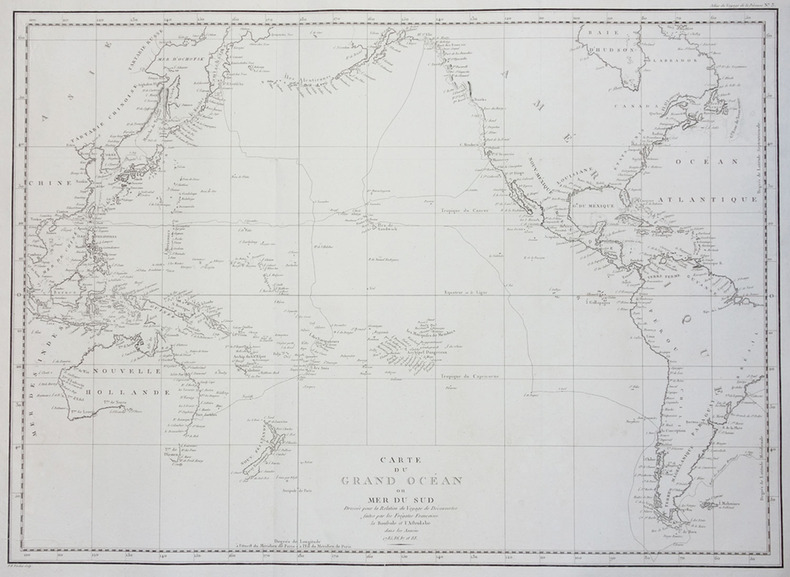
1790143934Paris: F. Dufart 1790. Very Good. Paris F. Dufart circa 1790. A hand-coloured engraved map printed surface 378× 415 mm sheet size approximately 420 × 540 mm. 'Gravée par Tardieu l'Ainé . Dessiné par Poirson . Ecrit par Beaublé'. Original folds as issued; some minor uneven tanning; in very good condition. An uncommon chart of the Pacific Ocean and Australia showing magnetic variation and dip drawing on observations made in the course of Pacific voyages after 1775 most notably Cook's third voyage. It is most likely from a duodecimo edition of Buffon's 'Histoire naturelle générale et particulière' around the end of the eighteenth century 'PL. III. Tome XVI' and 'Page 58' are printed in the top margin. It is based on a larger chart in four sheets attributed to Jean-Charles de Borda. The engraver Tardieu is one of half a dozen members of the family working as engravers at the period one of whom P.A.F. Tardieu would engrave the charts published in the official account of the Baudin voyage. F. Dufart unknown
177521548Paris 1775. Very good condition. Large detailed copper engraved map of Captain Cook's voyage in the Resolution of New Caledonia and the New Hebrides islands in the south Pacific with the tracks and the dates indicated. From Prevost's "L'Histoire Generale des Voyages".<br /> <br /> Bellin 1703 - 1772 one of the most noted French mapmakers of the 18th century was named the hydrographer chief cartographer to the French Navy and later the Official Hydrographer to the French King.<br /> <br /> Folding 19 x 15 1/4". Strong impression very clean. unknown
Dettagliata carta nautica della Polinesia francese, con Tahiti e le isole del Vento, le isole Australi, con le isole Tubuai e le isole di Bass, le isole Cook, le isole Gambier, le isole Marchesi. L'autore della carta, edita dal Depot de la Marine, è Clement-Adrian Vincenton - Doumolin (1811 - 1858)Incisione su rame, in ottimo stato di conservazione. Detailed nautical map of French Polynesia, with the Austral, Gambier, Marquesas, Society and Tuamotu archipelagos, issued by Depot de la Marine.The author is Clement Adrien Vincendon-Dumoulin (1811-1858).Copperplate, in very good condition.
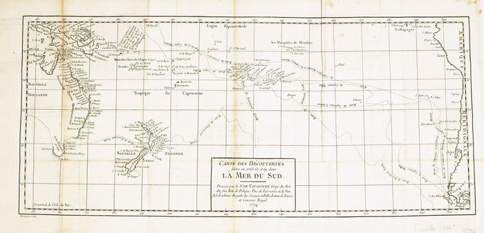
1774LBW-6111774 235 x 535 mm.
Carta geografica tratta dall'atlante della relazione di James Hawkesworth "Cartes et figures des voyages entrepris par ordre de sa Majesté Britannique pou fair des découvertes dans l'hémisphère méridional; exécutes par Byron, Carteret, Wallis & Cook dans les vaisseaux le Dauphin, Le Swallow & l'Endeavour" pubblicata in più edizioni di lingua francese, inglese, olandese ed italiano. Incisione in rame, in ottimo stato di conservazione. Map taken from the atlas by James Hawkesworth "Cartes et figures des voyages entrepris par ordre de sa Majesté Britannique pou fair des découvertes dans l'hémisphère méridional; exécutes par Byron, Carteret, Wallis & Cook dans les vaisseaux le Dauphin, Le Swallow & l'Endeavour" published in more edition in french, english, duth and italian. Fine map shows the explorations of Captain Cook, Captain Byron, Captain Wallis and Captain Carteret in the vicinity of Tahiti and the Society Islands from 1765 to 1769. Extends from Is. Scilly [i.e. the Scilly Islands] in the west and to I. Whitsunday de la Pentecote [i.e. the Whitsunday Island] in the east, from Is. du Disappointment [i.e. Disappointment Island] in the north to Ohetiroa in the south. Features the routes taken by these important explorers as the zig-zagged in and around the Society Islands. Depicts the island of Tahiti (Otaheite) as well as Bora Bora (Bolabola), Otaha, Marma, Ulietea, and others. Title in decorative script in the upper right quadrant. Copper engraving, in excellent condition.
Carta geografica tratta dal “Atlas encyclopédique, contenant la géographie ancienne et quelques cartes sur la géographie du Moyen Âge, la géographie moderne, et les cartes relatives à la géographie physique” di Rigobert Bonne e Nicolas Desmarest, edito a Parigi nel 1787-88, "Par M. Bonne, Ingénieur-Hydrographe de la Marine, et par M. Desmarest, de L'Académie Royale des Sciences".Il Bonne è stato uno tra i cartografi francesi più influenti del settecento, tanto da venir scelto quale successore di Jacques Nicolas Bellin al Depot de la Marine come idrografo di Sua Altezza Reale Luigi XVI.L'Atlas Encyclopédique, opera che il Bonne portò a termine con l'ausilio di Nicholas Desmarest, costituisce il suo lavoro di maggior fama.Incisione in rame, in buono stato di conservazione. Map taken from the “Atlas encyclopédique, contenant la géographie ancienne et quelques cartes sur la géographie du Moyen Âge, la géographie moderne, et les cartes relatives à la géographie physique” by R. Bonnè and Nicolas Desmarest, printed in Paris "Par M. Bonne, Ingénieur-Hydrographe de la Marine, et par M. Desmarest, de L'Académie Royale des Sciences", 1787-88.Bonne was one of the most influential French cartographers of the eighteenth century, so much so that he was chosen as the successor of Jacques Nicolas Bellin to the Depot de la Marine as a hydrograph of His Royal Highness Louis XVI.The Atlas Encyclopédique, that Bonne completed with the help of Nicholas Desmarest, constitutes his most famous work.Copperplate, in good conditions.
Carta geografica tratta dal “Atlas encyclopédique, contenant la géographie ancienne et quelques cartes sur la géographie du Moyen Âge, la géographie moderne, et les cartes relatives à la géographie physique” di Rigobert Bonne e Nicolas Desmarest, edito a Parigi nel 1787-88, "Par M. Bonne, Ingénieur-Hydrographe de la Marine, et par M. Desmarest, de L'Académie Royale des Sciences".Il Bonne è stato uno tra i cartografi francesi più influenti del settecento, tanto da venir scelto quale successore di Jacques Nicolas Bellin al Depot de la Marine come idrografo di Sua Altezza Reale Luigi XVI.L'Atlas Encyclopédique, opera che il Bonne portò a termine con l'ausilio di Nicholas Desmarest, costituisce il suo lavoro di maggior fama.Incisione in rame, in buono stato di conservazione. Map taken from the “Atlas encyclopédique, contenant la géographie ancienne et quelques cartes sur la géographie du Moyen Âge, la géographie moderne, et les cartes relatives à la géographie physique” by R. Bonnè and Nicolas Desmarest, printed in Paris "Par M. Bonne, Ingénieur-Hydrographe de la Marine, et par M. Desmarest, de L'Académie Royale des Sciences", 1787-88.Bonne was one of the most influential French cartographers of the eighteenth century, so much so that he was chosen as the successor of Jacques Nicolas Bellin to the Depot de la Marine as a hydrograph of His Royal Highness Louis XVI.The Atlas Encyclopédique, that Bonne completed with the help of Nicholas Desmarest, constitutes his most famous work.Copperplate, in good conditions.
1797LBW-2785[Paris, 1797]. 510 x 699 mm.
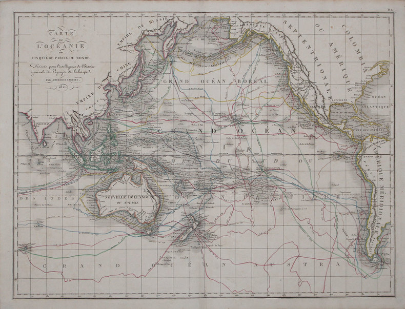
Una mappa dettagliata centrata sull'Oceania. Basata sui dati della spedizione di Dumont d'Urville.Litografia, in buono stato di conservazione. A detailed map centred on Oceania. From the expedition of Dumont d'Urville.Good and dark impression.
177521546Paris 1775. Very good condition. Detailed copper engraved map of Juan Fernandes islands in the South Pacific off the coast of Chile. The islands were the home of Alexander Selkirk a sailor marooned there in the early 1700s an event which may have served as the inspiration for 'Robinson Crusoe'. Selkirk was put off his vessel by a British captain and partner with Capt. William Dampier on a buccaneering expedition in search of Spanish vessels carrying gold. With an inset view of the northeast coast of the island at the top of the map. With compass rose rhumb lines and ornate cartouche.<br /> <br /> Bellin 1703 - 1772 one of the most noted French mapmakers of the 18th century was named the hydrographer chief cartographer to the French Navy and later the Official Hydrographer to the French King.<br /> <br /> One vertical fold 11 1/2 x 8 1/4". Strong impression very clean small chip to lower right edge only not affecting printed area. unknown