6 260 résultats
1885R47020Saint-Brieuc, Prud'homme 1885 xii + 384pp.+ frontispice (portrait) & 1 carte, br.orig. (dos restauré), 19cm.
xii + 384pp.+ frontispice (portrait) & 1 carte, br.orig. (dos restauré), 19cm.
1890H30249Bruges, Desclée, de Brouwer 1890 viii + 216pp. avec qqs. illustrations, dos peu reparé, bon état, H30249
1890H103033Bruges, Desclée, de Brouwer 1890 viii + 216pp. avec qqs. illustrations, reliure cart., dos en cuir noir avec titre doré, feuilles de garde marbrées, texte frais, bon état, H103033
viii + 216pp. avec qqs. illustrations, dos peu reparé, bon état, H30249
viii + 216pp. avec qqs. illustrations, reliure cart., dos en cuir noir avec titre doré, feuilles de garde marbrées, texte frais, bon état, H103033
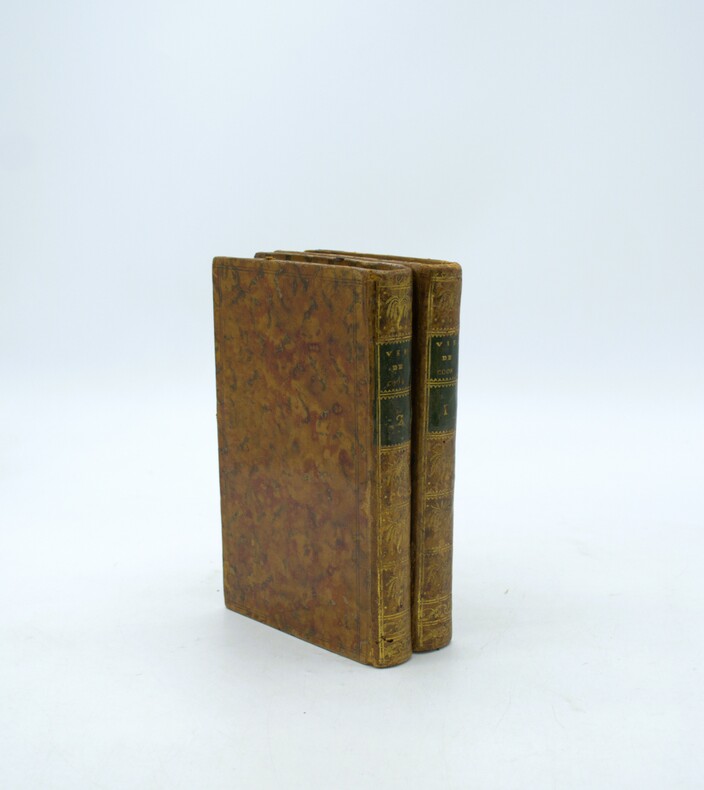
1789PHO-2082Paris, Hôtel de Thou et Lyon, Bernuset & Comp., 1789. 2 vol. in-8° de xl, 387, [1] pp. ; 419, [1] pp. Basane fauve jaspée, dos long orné de fers à la corne d'abondance & aux épis de blé, p. de t. et de tom. en maroquin vert, double filet à froid sur les plats, filet doré sur les coupes, tranches marbrées (Reliure de l'époque). Quelques épidermures et 4 trous de vers à la reliure. Bon exemplaire. Mention ms. d'achat : « 18 février 1789, 6 [livres] les 2 vol. brochés ».
1935R47019Lyon-Paris, Vitte 1935 356pp.avec ills., br.orig., 23cm., 5e éd., bon état
356pp.avec ills., br.orig., 23cm., 5e éd., bon état
1160268711.Gpaperback. Good. Access codes and supplements are not guaranteed with used items. May be an ex-library book. paperback
1167715667.Gpaperback. Good. Access codes and supplements are not guaranteed with used items. May be an ex-library book. paperback
A9781167715662New. unknown
B9781167715662New. unknown
1889R47018Lyon, Vitte & Perrussel s.d. [+:- 1889] 194pp.avec frontispice (portrait) & 1 carte, br.orig., 5e éd., 17cm., bon état
194pp.avec frontispice (portrait) & 1 carte, br.orig., 5e éd., 17cm., bon état
43029Washington.1989.In-8 carré,cartonnage éditeur illustré.409 p.Photos.En langue anglaise. TBE.
Circa 1940. 22 pages Victory Guide contains advice for: Emergencies; Alarms; Blackouts; Air Raids; Bombs; Fires; Gas Attacks; First Aid; Nine Vital Points; Morale; Insignia of Civilian Defenders; Safety First; Car Conservation. Book clean and unmarked with light wear. Laid in is an 8.5"x11" sheet announcing "Proclamation of Rules and Regulations for TEST BLACKOUT NIGHT March 7, 1941 at 10:40 P.M in Seattle, WA. Sheet contains detailed instructions which conclude with the name (not signature) of Mayor John E. Carroll. Second sheet is 8.5" x 14" and bears the title "City of Seattle - Department of Lighting: Time Table relative to enforcement of public proclamation #12 - effective from sunrise to sunset", dated 10-27-42. Balance of sheet contains sunrise and sunset times for every day of the year. Book
1390343766.Gpaperback. Good. Access codes and supplements are not guaranteed with used items. May be an ex-library book. paperback
0364797681.Ghardcover. Good. Access codes and supplements are not guaranteed with used items. May be an ex-library book. hardcover
8vo., First Edition, with large folding map coloured in outline as frontispiece and 2 maps (one folding; one full-page); original green cloth, sides elaborately framed and patterned in blind, backstrip blocked in blind and lettered in gilt, uncut AND LARGELY UNOPENED, primrose endpapers, upper hinge cracked (but binding entirely sound), a remarkably well-preserved, bright, clean, fresh copy IN WHOLLY UNRESTORED PUBLISHER'S BINDING. A PRESENTATION COPY FROM THE AUTHOR TO JOHN O'SHANNASSY WITH THE FORMER'S HOLOGRAPH INSCRIPTION ON FRONT FREE ENDPAPER. With a bookplate on front paste-down and 16pp publisher's catalogue (dated July 1857) bound in at end. This copy was formerly in the holdings of Melbourne Public Library and bears its stamp dated 18 Dec 1888 on frontispiece verso, title and occasionally in text. Westgarth's Notes on the Overland Route comprise pp.376-451. A detailed statistical Appendix occupies pp.453-466. LOVELY COPY OF AN EARLY ISSUE OF A SCARCE AND IMPORTANT ACCOUNT OF THE COLONY. Ferguson 18418.
Carta geografica raffigurante le legazioni ecclesiastiche della regione, tratta dall’Orbe Cattolico di Girolamo Petri. L'Orbe Cattolico ossia Atlante Geografico Storico Ecclesiastico fu pubblicato a Roma in 3 volumi nel 1858-1859. Le mappe di grande formato sono finemente incise e ben colorate. È senza dubbio una delle opere più finemente incise ed eleganti della metà del XIX secolo. Ogni mappa mostra le varie diocesi, ognuna delle quali è contraddistinta da colori vivaci che ne segnano la sede, e altre città importanti. Sebbene le caratteristiche geografiche siano chiaramente espresse, le mappe sono volutamente piuttosto scarne di dettagli, in modo da non sminuire visivamente il loro scopo, che è quello di mostrare le divisioni ecclesiastiche. Nel creare l'atlante, Petri ha sottolineato di aver attinto solo alle "fonti più attendibili", comprese le mappe degli archivi vaticani e delle diocesi d'oltremare L'atlante fu pubblicato in un numero molto limitato di esemplari ad uso esclusivo dei cardinali e degli amministratori di alto rango, il che ne spiega la grande rarità odierna. Girolamo Petri (1806 - 1871) fu una figura importante nell'amministrazione della Chiesa cattolica romana durante il regno di Pio IX. Nacque a Onano (Viterbo, Lazio), figlio di un funzionario vaticano che in seguito divenne governatore di Frascati. Il lavoro di Petri fu svolto in un periodo in cui la Chiesa era sotto assedio in Europa, ma, al contrario, aveva grandi ambizioni di espansione all'estero, in particolare in Asia e in Africa. La metà del XIX secolo fu un periodo di grandi cambiamenti a Roma. L'atlante faceva senza dubbio parte degli ultimi sforzi del Vaticano per comprendere e controllare la sua vasta influenza in tutto il mondo, resuscitando il concetto popolare di province ecclesiastiche diffuso nelle opere di Nicolas Sanson e altri cartografi del XVII secolo. La Calcografia Nazionale (Istituto per la Grafica) conserva ancora 135 rami di questo rarissimo atlante. Incisione in rame, coloritura coeva, in ottimo stato di conservazione. Bibliografia Walter Goffart, Historical Atlases: The First Three Hundred Years, 1570-1870 (Chicago, 2003), p. 427-8; J.A.B. Jongeneel, Philosophy, Science, and Theology of Mission in the 19th and 20th Centuries: A Missiological Encyclopedia (1995), p. 264. A very rare map showing the dioceses of Catholic organization, taken from L'Orbe Cattolico by Girolamo Petri. L’Orbe Cattolico ossia Atlante Geografico Storico Ecclesiastico’ was published in Rome in 3 volumes in 1858-1859. The large-format maps are finely engraved and beautifully colored. The atlas is a testament to the artistry of the engravers and the relative indifference of the publisher to the commercial success of the work. It is without question one of the most finely engraved and elegant works of the mid-19th Century. Each map shows the various dioceses, which are each distinguished by their own bright colors, marking their seats, as well as other major towns. While key geographical features are expressed throughout, the maps are otherwise intentionally rather sparing of detail, so as not to visually detract from their purpose, which is the show the ecclesiastical divisions. In creating the atlas, Petri noted that he drew only upon the “most trusted sources”, including maps from the Vatican archives and overseas dioceses. The atlas was by far and away the finest ecclesiastical atlas created during the 19th Century, featuring exceptionally beautiful examples of thematic cartography. The uncommonly beautiful atlas was published in only a very small number of examples for the exclusive use of Cardinals and high-ranking administrators, accounting for the great rarity today. Petri who was commissioned by Pope Pius XI thus created during a time when the Church was under siege within Europe, but, conversely, while it had major ambitions for expansion overseas, particularly in Asia and Africa. The mid-19th Century was a period of dramatic change in Rome. The atlas was no doubt part of the Vatican's last-ditch efforts to understand and control its vast influence around the world, resurrecting the popular concept of ecclesiastical provinces popularized in works by Nicholas Sanson and others during the 17th Century. The Calcografia Nazionale still preserves 135 copperplates of this extremely rare atlas. Bibliografia Walter Goffart, Historical Atlases: The First Three Hundred Years, 1570-1870 (Chicago, 2003), p. 427-8; J.A.B. Jongeneel, Philosophy, Science, and Theology of Mission in the 19th and 20th Centuries: A Missiological Encyclopedia (1995), p. 264.
1958RO30354367Imp. J. Rosso. 1958. In-16. Broché. Etat passable, Coins frottés, Agrafes rouillées, Papier jauni. 19 pages. Quelques tâches en premier plat.. . . . Classification Dewey : 200-RELIGION
A FINE SIGNED LARGE-PAPER COPY of the first and only edition of this first-hand account of a voyage to the South Pacific, including the New Hebrides (now Vanuatu), Fiji, Tonga, and numerous other places. 115 pp plus folding map. ONE OF 100 NUMBERED LARGE-PAPER COPIES PRINTED ON FINE LAFUMA WOVE PAPER, SIGNED BY THE AUTHOR IN PURPLE INK. 8vo. Original wraps. ENTIRELY UNCUT AND UNOPENED. A bit of very light foxing, else FINE AND BRIGHT
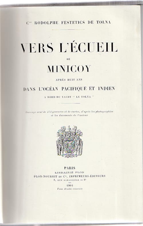
60187Paris, Librairie Plon, 1904, ouvrage orné de 174 gravures et de cartes, d'après les photographies et les documents de l'auteur, 355 pp. + planches et cartes, relié, très légères traces d'usage, bon état général.
64590Coll. "Etonnants Voyageurs", Paris, Seghers, 1983, Première Edition, in-8, br., couv. photo en noir éd., 256 pp., nb. photos en noir, Bibliographie, Table des matières, Les principaux voyages qu'a effectué Victor Segalen : le Pacifique et la Chine. Très bonne biographie sur la partie la plus importante et la plus marquante de sa vie et de l'élaboration de son œuvre. Très bon état