6 260 résultats
Uniform and handsome in beige cloth. Volume 5 printed in 1955, Volume 4 in 1959, Volume 3 in 1961, Volume 2 in 1964 and Volume 1 in 1969. Umarked with light wear and sound bindings. An excellent first edition example of this magnificent work. Please note: Very heavy. Special shipping considerations may apply.. Book
16 pages. Plus a large fold-out color map, measuring approximately 8 x 12 inches (20 x 30cm). Original condition with blue wrappers, titles to front, and containing all the ads. This is a complete issue, seldom found in such good and original condition An exceptional report on a man who carved himself niche in history, shaping the future of generations to come and forever changing the geography of the known world with his discovery of the Pacific Ocean, and the Islands of the Philippines.
Madrid, Imprenta del Cuerpo de Artillería, 1896. 4to.; 22 pp. Cubiertas originales.
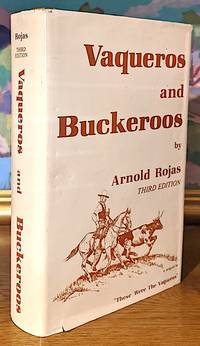
19849989Self Published 1984. Third Edition Revised and Enlarged. Near fine/very good . Expanded from 312pp. to 564pp. with new material. -- 8vo. 564 pp. textured boards historical photographs illustrations. -- A few small areas of wear to the outer extremities of the dust jacket. Overall Condition. "Arnold R. Rojas 1896 - 1988 has the distinction of being the most celebrated chronicler of the life and lore of California's Vaqueros. He did this in a series that he didn't start publishing until he was into his mid-50s his first "The California Vaqueros" in 1953. Ultimately he would publish seven books over the years the final one being "Vaqueros and Buckaroos" in 1979. He wrote about what he knew and loved - the life and ways of the old California vaqueros - men he rode and worked with for over fifty years. he wrote down the memories of all those years for as he said "These are stories as seen through the eyes of old vaqueros they are something of the splendor of those days for there will never be another cattle ranching era in California that produced such men."-eclectic-horseman.com. Self Published unknown
198024139Institut of Pacific Studies, University of the South Pacific, 1980. 291 SS., zahlreiche s.w. Abbildungen. 8°, original Pappband, Rückentitel silbergeprägt. Im illustr. original Schutzumschlag.
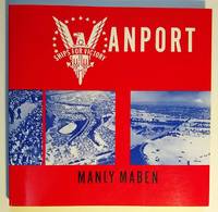
1987016356Portland OR: Oregon Historical Society Press 1987. First Edition. Softcover. Fine. 9" x 9" Softcover; 151pp; Covers clean & bright text unmarked binding is tight as new Fine condition. Signed by Author. History of the city of Vanport Oregon situated on a flood plain between Vancouver Washington and Portland Oregon and which was conceived in 1942 as a temporary housing project for families of war-time shipyard workers. The temporary city was destroyed by flood on Memorial Day 1948. Illustrated with photos. Oregon Historical Society Press paperback
Vanikoro Islands Surveyed by Capt. Durmont D'Urville, French Royal Navy 1828 - Tevai and Manevai Bays From the Survey by Capt Durmont D'Urville, French Royal Navy 1828. In the right side of the chart insert of Basilisk Harbour By Lieut. Hayter & Nav. Lieut. T.L. Mourilyan, 1872. Sub.Lieut. C.F.M. Malan, 1874, & Lieut. W. Munro Kerr, 1900. London Published at the Admiralty 1st Sept. 1873, under the Superintendence of Rear Admiral G.H. Richards, Hydrographer. Small corrections: 1930. Folded editorially. Autore: Admiralty Charts. Luogo: Vanikoro Islands - Pacific Ocean. Anno: '900. Tecnica: incisione. Dimensioni: 993x662 mm
Book is in excellent condition. Binding is solid and square, covers have sharp corners, exterior shows no blemishes, text/interior is clean and free of marking of any kind. Dust jacket shows the slightest signs of shelf wear only, price sticker residue, no tears. 192 pages. Follows the history of fairs and exhibitions in Vancouver from 1907 to 1982. Short section of photographs.
192 pages including notes, bibliography and index. Focuses on the political and administrative history of a highly visible, controversial provincial institution. Deals with two main themes: the fair's evolution from a small urban exhibit to one of the largest of its type in North America, and the often stormy relationship between the fair directors, residents of the Lower Mainland, city councillors, and members of the provincial government. Black and white photographic plates. Lightest wear to clean and unmarked book and dust jacket. Excellent copy. Book
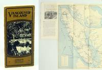
1925652j0955Canada: Canadian Pacific Railway C.P.R. Good. 1925. First Edition Thus. Pamphlet. Substantial text is graciously illustrated with black and white photos on alternating pages. Contents include: Victoria; Motoring & Golfing; East Coast; Hunting & Fishing; West Coast; Resources/Industries; Travel Routes. Two-colour 16.5" x 12" fold-out map of Vancouver Island affixed to back cover lists hotels and boarding houses on verso. 16 glossy pages folded vertically in half. Contents securely stapled. Black and white photo-illustrated covers loose but present with opening to upper portion of fold. Inside the covers are lists of Canadian Pacific Hotels and Canadian Pacific Agencies throughout the world. A remarkable and informative memento of Vancouver Island's early tourism industry.; Sm 4to . Canadian Pacific Railway (C.P.R.) unknown
304 pages. Index. Superbly illustrated in black and white. Map illustrated endpapers. "An Illustrated account of the construction and first years of operation of the Canadian Pacific transcontinental railway." - subtitle. Price-clipped dust jacket now preserved in archival-grade Brodart cover. Small bookseller's sticker upon first blank leaf. Unmarked. Average overall wear. A sound copy. Ex-Library
1396470816.Ghardcover. Good. Access codes and supplements are not guaranteed with used items. May be an ex-library book. hardcover
139109476X.Gpaperback. Good. Access codes and supplements are not guaranteed with used items. May be an ex-library book. paperback
0331602059.Ghardcover. Good. Access codes and supplements are not guaranteed with used items. May be an ex-library book. hardcover
0331602032.Gpaperback. Good. Access codes and supplements are not guaranteed with used items. May be an ex-library book. paperback
191228787Vancouver Development Company EDITEUR ( Impr. Draeger Fr. Paris) 1912 une plaquette, brochée à cordonnet de soie beige in-douze à l'italienne éditeur (22,3 x 17,6 cm) (paperback in-12 oblong editor), dos muet, couverture marron gauffrée vert avec titre imprimé en noir, page de titre ainsi que toutes les pages sont imprimées en noir dans un encadrement en marron, orné d'une carte hors-texte en marron et noir indiquant "les Lignes Maritimes partant du port de Vancouver à travers le Monde" + une photographie hors-texte en noir du Port de Vancouver + une photographie hors-texte en noir de la Gare terminus du Canadian Pacific Railway + une photographie double page hors-texte en noir : "Vue panoramique de Vancouver et de son port" + une photographie hors-texte en noir des Nouveaux Quartiers (de Vancouver) + une photographie hors-texte en noir : " Vue du Parc (de Vancouver)" + une photographie hors-texte en noir; "Le Quartier des Affaires (de Vancouver)" + une photographie hors-texte "PLANCHE DEPLIANTE" en noir (de 75 cm de large une fois dépliée) : "Vue panoramique de Vancouver en 1912", fines rousseurs sur les gardes, sinon bel exemplaire, 16 pages, 1912 Vancouver Development Company EDITEUR ( Impr. Draeger Fr. Paris).
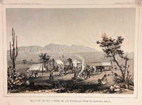
185714427Washington DC: Bevery Tucker Printer 1857. First Edition. Very Good. A.H Campbell. 8.25x11in One litho tinted illustrated plate Part I plate V; Light age-toning along edges with several light spots in margin. Samuels p. 81 Taft p. 265. This plate is from from Volume VII of the quarto edition of twelve volumes were published from 1855 to 1861 as exploration and survey reports became available. These volumes contained not only the survey maps and elevations but a monumental collection of scientific reports on geography geology zoology botany and ethnology of the Native American tribes. The surveys also included 11 artists to record the landscape and indigenous peoples of the west. <br /> <br /> <br /> <br /> Albert Henry Campbell 1826-1899 was a Railway survey artist-explorer civil engineer and surveyor. He was one of the more important artist of the surveys and participated in several survey expeditions across the west from 1853 to 1854. In the fall of 1854 he joined the Parke survey expedition for a coastal railroad route from San Francisco to San Diego and the survey along the 32nd parallel to Arizona. All eight of the full-page illustrations are credited to Campbell in the report three of California and five of Arizona scenes After the surveys he was assigned to Washington as Superintendent of Pacific wagon roads to 1860. During the Civil war he was a map maker for the Confederate Army and chief engineer of railroads based in West Virginia. from Samuels <br /> <br /> The twelve volumes were disorganized in publication with no overall all arrangement or indexing. Some of the plates and maps referred to in volumes were published in other volumes various reports were also published out of sequence relating to the four routes. Preliminary reports published were updated in latter volumes. From Wagner-Becker-Camp In 1853 Senator Gwin of California lead the inclusion of Congressional funding for 1853-54 of a series of surveys to determine the best and most economical railroad routes from the Mississippi River to the Pacific coast. The act directed the Secretary of War Jefferson Davis to plan and direct Army topographical engineers to conduct surveys of four routes. The first was between the 47th and 49th parallels generally along the Lewis and Clark route to the Pacific. The Second route between the 37th and 39th parallels was promoted by Senator Thomas Hart Benton of Missouri. The Third route was along the 35th parallel. The Fourth route was promoted by Secretary Davis along the 32nd parallel that followed Emory's 1846-47 reconnaissance. Bevery Tucker, Printer unknown
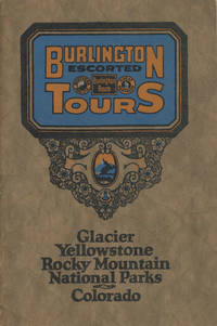
192548702N.P.: Privately printed n.d. ca 1925. ca 1925. 9" x 6" color pictorial wrappers. 47 pages tinted illustrations maps tour plans. Numerous tour itineraries and schedules with numerous beautifully colored photographs of various areas buildings and parks. Tours discussed include Glacier and Yellowstone; Colorado and Yellowstone; Inter-Mountain Route From Colorado to Yellowstone and Glacier; Colorado and Glacier. General information for the tourist including cost of tours discussion of climate apparel booklets of possible interest a list of ticket routing for various tours calendar schedules for various tours etc. Separate map depicting each tour. Very good plus. Privately printed, n.d. [ca 1925]. unknown
0656030127.Ghardcover. Good. Access codes and supplements are not guaranteed with used items. May be an ex-library book. hardcover
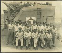
194624943South Pacific 1946. Photography. Overall very good condition. 100 real photographs of the USS Bennion in the South Pacific and Japan. Some which are annotated in the image with locations and dates appear to be taken by the ship's photographer; others are candid shots by a crew member. Some are described on the verso naming crew members. A group snap shot which identifies the personnel on the verso includes: Lt. Scott Kollert Mach. Flaherty Ens Hulkill Lt. McCool Loomis Morrison Dabbs Matlack Cobb & Murray. A note on the verso explains the scorecard poster displayed behind the men: "Score card shows 16 Jap planes 8 shore bombardments & 1 Jap battleship sunk by torpedoes in Battle of Surigao Strait. 13 planes since I've been aboard" the reference to the sunk battleship refers to October 1944 when Bennion helped sink the Japanese battleship Yamashiro. Many shots of life on board the ship. Some snap shots indicate the crew was segregated by role with gunners mates and fire control men all white while the steward mates are all African American. Numerous group photographs include: CPOs cooks radar men radio men 2nd Division and the Bridge force. Additional snap shots include the ship at Club Saipan showing Admiral Whiting and a "nurse . was the last one to leave Corregidor and got a lot of publicity" Kuluk Bay Adak Aleutians in August 1945; Vanikoro Feb 1943 snap shots of Officers Club Solomon Islands. Interior and exterior views; numerous images of Ominato including Japanese service men and villagers Ominato was a major navy base for the Imperial Japanese Navy in northern Honshu; and USO performers. The USS Bennion won a Presidential Unit Citation for her actions off Okinawa during the Battle of Iwo Jima. The citation to the ship was presented "For extraordinary heroism in action as a Fighter Direction ship on Radar Picket duty during the Okinawa Campaign April 1 to June 1 1945". USS Bennion DD-662 was a US Navy Fletcher-class destroyer launched in 1943. It served in the Pacific as a fighter director and radar picket ship and supported operations at Leyte and Luzon in the liberation of the Philippines and at Iwo Jima February - March 1945. In July and August 1945 USS Bennion took part in Third Fleet Operations Against Japan. Bennion received her citation for actions off Okinawa 1 April-1 June 1945 as well as eight battle stars. Photographs which identify personnel include the presentation of medals: the Bronze Star to the Bennion's Commander R. H. Holmes on May 17 1945; presentation of Silver Star to T. C. Beale; and James Holloway III "who assisted sinking with torpedoes of Japanese battleship Yamashiro"; Vice Admiral H. W. Hill addressing the crew; Commodore Moosbrugger; Lt. Comd. Brokenshire. A total of 100 real photographs mostly in postcard size format 4 3/4 x 3 3/4" some 5 x 4". Very good condition. unknown
Folio, First Edition, with illustrated title-spread, numerous photographs throughout and endpaper maps; blue cloth, gilt back, a fine copy in unclipped dustwrapper.
2008232824San Francisco: GAPA 2008. 32p includes covers 5.5x8.5 inches photos ads event schedule cards laid-in very good event program in stapled white pictorial wraps. Twentieth annual awards ceremony. GAPA unknown books
20121355283PN. New. 2012. Soft Cover. Date is original print. This is a reprint edition. . PN paperback
pp. 345-393, 45 figs., refs. Offprint, new plain wrs.
1953PB261641953-1954 2 parts (complete). 14, 58 p., 36 pls, 2 folded maps, wrappers/paperbound (printed covers). Published in: Univ. Queensland Pap. Dept. Geol. On Brachiopods only.We added: Maxwell, 1960. Tournaisian Brachiopods from Baywulla, Queensland (11 p., 1 fig., 1 plate) & Maxwell, 1964. The Geology of the Yarrol Region. Part I. Biostratigraphy (79 p., 14 pls - mainly molluscs & brachiopods).