Aa Road Maps EuropeBiblio.com
1 660 résultats
GOR001576744Paperback. Very Good. paperback
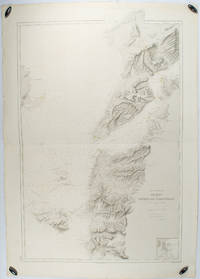
1883178272Paris.: Service hydrographique et océanographique de la marine. 1883 but1894. Engraved hydrographical chart on watermarked double sheet 99 x 63 cm soundings in metres lighthouses picked out in yellow and red inset map of the port and town of Tenedos central fold a few very slight edge tears to the generous margins light spotting and surface soiling but in very good condition. Fine and impressive large naval chart of this strategically important strait then still under the control of the Ottoman Empire. <br> <br>From a private collection; "Lord John Fitzroy Royal Yacht Squadron" in manuscript on the verso. . Service hydrographique et océanographique de la marine unknown
190375062London: McCorquodale 1903. First edition of this atlas map folio 16 1/4 x 27 1/2 inches. 5 sheets of British Commission maps and index map; 13 sheets of United States Commission maps Alaska boundary atlas and index map. Total of 20 maps 19 folding and 5 in color Maps are 53 x 32 inches. All but the British index map folded and backed in linen. Quarter red morocco over red cloth. Gilt Royal Seal to front board and spine. Maps mounted on linen and sectioned as issued. Portfolio case with moderate rubbing chipping to leather. Does not include the 10 cards to accompany the U.S. Commission maps seems to be common that these smaller ones are missing. Old staining to cloth. Toning and edge wear to British Index map. Slight toning and offsetting to maps. Overall a very good copy; quite scarce. [McCorquodale] hardcover
1939144331939. Archive of six large original World War II-era maps used by a United States Army soldier in the European Theater of Operations during the Allied liberation of Europe. Lithographed maps various issuers 1938-1939 wartime use 1944-1945.<br /> <br /> Beyond their immediate tactical utility these maps occupy a pivotal geopolitical moment. The Czech sheets document territories liberated by American forces in May 1945 particularly around Plzeň which marked the effective western limit of U.S. advance before demarcation lines were fixed with Soviet forces. Within months these same regions fell firmly within the Soviet sphere of influence formalized through postwar agreements and culminating in the 1948 Communist coup in Czechoslovakia. Cartographically borders administrative divisions and place names shifted to reflect the new socialist state while subsequent Eastern Bloc map production emphasized different political geographies aligned with Moscow. Thus these pre-Communist and German-printed sheets capture a fleeting interstice: cities momentarily under American military administration before incorporation into the Soviet Eastern Bloc. The 1938 promotional map of Czechoslovakia preserves the nation's pre-Munich territorial identity prior to its partition under Nazi pressure while the 1939 Hamburg map reflects the industrial heartland of the Third Reich before Allied devastation and Germany's eventual division into East and West. In this sense the archive charts not only wartime movement but the rapid redrawing of Europe's political landscape-where American operational cartography was almost immediately superseded by Cold War boundary-making. Sizes range from 19" x 24" to 34" x 22". The archive comprises detailed city and regional maps of western Czechoslovakia-Město Teplá 19" x 24" Plzeň Sheet 4151 24" x 19" black and white with green overlay Horšovský Týn Sheet 4150 24" x 19" and Kralovice Sheet 4051-together with a large 1938 promotional map of Czechoslovakia 34" x 22" and a 1939 German-printed map of Hamburg 28" x 24". All are original period printings retained by the soldier following his service. Good overall with expected wartime folds creasing and moderate wrinkling from field use and storage; no significant losses observed. A rare and materially resonant survival of Allied operational maps that document both the liberation of Central Europe and the swift geopolitical transformation that consigned much of that terrain to the Soviet Eastern Bloc rendering these sheets artifacts of a brief and transitional military presence. unknown
72546E-210. Hardcover. 8vo. Published by Robert Clarke & Co Cincinnati OH. 1875 xiv 454 pp; v 478 pp; iv 22 fold-out maps. 3 volumes including 2 volumes of text plus the Atlas. Bound in red cloth boards with titles present to the spine and front board. Spines have been replaced and rebacked. Atlas is missing the spine. Boards have light shelf-wear present to the extremities. No ownership marks present. Text is clean and free of marks. Spine is missing from the atlas volume with the front board barely attached to the spine. The army originally fought under the name Army of the Ohio until Maj. Gen. William S. Rosecrans assumed command of it along with the Department of the Cumberland; he thus changed the name of the newly combined entity to the Army of the Cumberland. Under Major General George H. Thomas who took command in October of 1863 the Unit played a major role in Sherman's March to Atlanta. In all; the Army of the Cumberland played important roles in the battles of Stones River Chickamauga Chattanooga-Ringgold Peachtree Creek Kennesaw Mountain and Nashville. The Atlas volume depicts the army's movements during these battle and campaigns. ; 8vo 8" - 9" tall . hardcover
194121072Window Rock AZ: United States Department of the Interior Office of Indian Affairs Navajo Service 1941. First Edition. Small quarto 26.25cm; mimeographed sheets printed recto and verso and side-stapled into illustrated wrappers; vi 180pp 20; illus. Former owner's name in ink to front wrapper with chipping thin splits and short tears to same; thin vertical paint streak to rear wrapper; text remains fresh and clean; Very Good.<br /> <br /> Guide book and gazeteer of the Navajo country and adjacent regions compiled by Richard Fowler Van Valkenburgh a former Bureau of Indian Affairs worker and long-time archeological assistant with the L.A. County Museum of History Art and Science. Contains a 4pp key to the Navajo alphabet palatalization and labialization an extensive list of Navajo place names providing detailed information regarding their origins history and significance. Illustrated throughout with maps drawn by Charles Keetsie Shirley. Scarce in commerce. United States Department of the Interior, Office of Indian Affairs, Navajo Service unknown
0976373343-11-1Toucan Maps Inc. 4th. Very Good. It's a well-cared-for item that has seen limited use. The item may show minor signs of wear. All the text is legible with all pages included. It may have slight markings and/or highlighting. Toucan Maps Inc. unknown
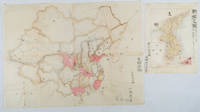
1902220266Japan. No date. Circa1902. Two very attractive colour folded manuscript maps one showing China and the other Korea. <br> <br>Map of China: Watercolour map 48 x 63.5cm. Closed tear now professionally repaired. <br> <br>Map of Korea: Finely detailed watercolour map a few tiny holes very neatly repaired on the verso with archival washi. 33 x 24.5cm Two delicate hand-painted maps one of China and one of Korea produced by a Japanese student cartographer named Koike Tokushige 小池徳重. <br> <br>The undated map of China appears to have been produced in the first five years of the twentieth century: a time when Japan had recently colonized Taiwan and when Japanese economic and political interest in the region was rapidly expanding. The inscription on the map suggests that it was a third year college project. But the high level of detail suggests that the artist had considerable experience of map making. The map of China shows the main provinces rivers major transport routes the Great Wall and the location of key cities although the names of the cities are not included. It also shows outlines of the Korean Peninsula Taiwan and the Japanese island of Kyushu but not the rest of Japan. <br> <br>The map of Korea is more detailed. It provides an accurate outline of the Korean Peninsula with careful hatching indicating changes in elevation. Rivers and major road routes are shown on the map and the locations of major towns are marked though only Busan and Incheon are named. Dotted lines show coastal sea routes and routes between Kyushu and Busan and between Incheon and China. The map shows the Gyeongin railway line between Seoul and Incheon which was completed in 1899 and route of the Gyeongbu railway line between Busan and Seoul whose construction started from both ends in 1901. But the map depicts only small sections of this line close to Seoul and Busan as being completed with the rest more lightly outlined to show the projected route implying that the map was drawn around 1901-1902 and certainly before the Gyongbu line was opened in 1904. <br> <br>Inserted text gives the land area and population of Korea. Rather strangely though the figure given for the Korean population is vastly underestimated. Ikeda gives this as 5.7 million when in fact at that time is was around 18 million. . unknown
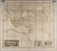
1853176118Paris.: Ministère d'Etampes et de Géographies. 1853. Engraved map with outline hand colour 67.2 x 75.1 cm sectioned and linen-backed two large vignettes: a view of Constantinople; and costumed Turks and European soldiers facing off across a stream the linen browned with some loss but not affecting the map with the fine nineteenth century label of Charles Delarue & Hivert on the verso. Fine map with beautiful vignettes by Adrien Toussaint Lallemand 1793 - c.1856 geographer and engraver at the Depôt de la Guerre. Lallemand was appointed at a precociously young age and later set up in business on his own the quality of his work assuring him of the continued business of the Depôt. <br> <br>Highly attractive map of the Ottoman Empire published at the outset time of the Crimean War 1853-1856. <br> <br>This item is held off-site. Please note there may be a few days delay while it is brought into our shop for viewing or mailing to you. Thank you for your understanding. . Ministère d'Etampes et de Géographies unknown
Z1-Q-017-02661Collins. Used - Good. Ships from UK in 48 hours or less usually same day. Your purchase helps support Sri Lankan Children's Charity 'The Rainbow Centre'. Ex-library so some stamps and wear but in good overall condition. 100% money back guarantee. We are a world class secondhand bookstore based in Hertfordshire United Kingdom and specialize in high quality textbooks across an enormous variety of subjects. We aim to provide a vast range of textbooks rare and collectible books at a great price. Our donations to The Rainbow Centre have helped provide an education and a safe haven to hundreds of children who live in appalling conditions. We provide a 100% money back guarantee and are dedicated to providing our customers with the highest standards of service in the bookselling industry. Collins unknown
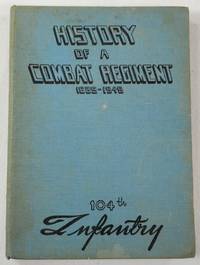
1945043919N.P.: 104th Infantry United States Army 1945. First edition undated late 1945 signed by Commanding Officer Ralph W. Palladino on the introductory page. History of this venerable US Army Regiment from its roots as a militia unit in the American Revolution up through the end of World War II the period on which this book focuses. Includes maps other black and white illustrations from photographs list those killed or missing in action battle statistics etc. Light blue cloth printed in black Route of Advance map on endpapers book about 7.5 inches tall 153 pages no dustjacket likely issued without. Some soil to covers good hinges sound text block age-browning to the war-era paper used for the pages no other names or markings. Signed by the Commanding Officer. First Edition. Hard Cover. Good. 16mo - over 5¾" - 6¾" tall. 104th Infantry, United States Army Hardcover
195837615Berlin: Verlag des Ministeriums für Nationale Verteidigung 1958. First edition. Paperback. g to vg. 18 2pp text 48 loose plates 2 loose folded maps as issued. Original photo-illustrated wrap around. Published by the East German Ministry of National Defense on the occasion of the 40th anniversary of the Red Army this work features 48 b/w photographic plates depicting the Soviet Army in action during the Russian Civil War 1917-1922 the Second World War 1941-1945 to the annual Moscow Military Parade held on the 40th anniversary of the Bolshevik Revolution November 7 1957. Includes two color folded maps The fronts of the civil war and the armed intervention 1918-1920; and The Great Patriotic War 1941-1945. Moderate rubbing along edges of wrappers. Text and captions in German. Wraps in overall good interior in good to very good condition. Verlag des Ministeriums für Nationale Verteidigung paperback
175961994W. Owen. London. 1759. First edition. Pages 461-964 8pp index. Contains the following fold-out maps: Poland Prussia and Lithuania opp. page 521 torn map of the area of London opp. page 561 Part of Persia opp. page 581 Chart of the English Channel opp. page 621 Commercial map of area around Leipzig opp. page 733 and Accurate map of the West Indies opp. page 937. A fold-out plate torn in two opp. page 833 18 engraved plates which incl. map of West Africa a view of Fort St. Louis in Senegal a path of the comet with the stars and the pictured constellations incl. Leo and Cancer in the bakground a sailing ship details of the Cherburg cannon and many natural history plates incl. enlarged louse. Half brown calf very worn and rubbed pages browned contents and binding sound. Please contact us for more information. unknown
1766016077London: Printed for S. Crowder 1766. Book. Very Good. Hardcover. The Second Edition. Folio 21 x 32cm. The second edition with additions and improvements; pp. iv 45 iii publisher's adverts; engraved frontispiece map of the world five further engraved plates of maps and one engraved plate of globes ten engraved figures and diagrams within the text. Contemporary half textured calf binding with marbled paper boards expertly restored with a new spine in matching style re-corned. contents clean and tight a few small marks/reading wear; frontispiece plate with a couple of short edge-tears expertly and inconspicuously repaired a few corners re-tipped. A very good well-presented copy. Scarce. Printed for S. Crowder Hardcover
2022DADAX1849075530Philip's 2022-04-07. spiral_bound. New. 11.42x0.39x15.43. Buy with confidence. Excellent Customer Service & Return policy. Philip's unknown
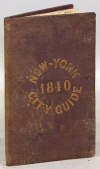
1840000014171New York: Tanner & Disturnell 1840. Later edition. Hardcover. Very Good. 64mo. 13 cm x 8 cm. 3 4-15 1 pp. Brown cloth with gold lettering on the front board. Yellow coated rear endpaper and rear pastedown. Illustrated with a frontispiece and with a folding map in the rear of the volume. The folding map in the rear of the volume is hand-colored. Its title is "New Map of the City of New-York with part of Brooklyn & Williamsburg". By J. Calvin Smith. Engraved on steel by Stiles Sherman & Smith. The folding map is dated 1840. Phillips 532. Guide books similar to this one were published as early as 1836. OCLC locates a few examples of this exact edition. With a list of wards streets and information on how to get around the city. A fascinating look at early nineteenth-century New York City. Light soiling to the cloth. Lacks the yellow free front endpaper and front pastedown. The folding map with one piece neatly detached but laid in the whole map is present. Tanner & Disturnell hardcover
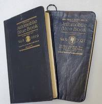
191974907Chicago: Automobile Blue Book Publishing 1919 & 1921. Vol. 8; Tall octavo. 776 pp. including numerous inserts maps photographic illustrations. Complete. Publisher's flexible blue cloth with gilt cover lettering. Expertly rebacked retaining the original spine. Ver good.Vol. 9; Tall octavo. 848 pp. including numerous inserts maps photographic illustrations. Complete but for the folding map at the rear often missing as they were used. The map is reproduced in smaller segments on pp. 2-21. Publisher's flexible blue cloth with gilt spine and cover lettering. Some creases and general rubbing but a good complete copy.Between these two books the entire West Coast is covered. Between them they detail 1783 driving routes across the arid west. These are exhaustive and comprehensive guides to early car touring in California and the West. With such instructions as 'turn left after the wooden bridge" we can infer that car travel in 1920 was a difficult proposition at best. There is an illustrated chapter on Yosemite with a full page map and five pages of texts with illustrations. While "Official Automobile Blue Books" are not rare one usually finds the guides for New York or the Midwest with Vol. 8 California and Vol. 9 Oregon and Washington rarely appearing on the market. Chances are that these particular volumes were just generally used to oblivion as California has always been the most car-friendly state in the Union and the Pacific Northwest was by and large empty of people. Automobile Blue Book Publishing hardcover
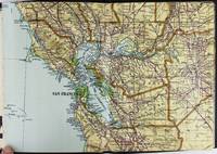
19282443San Francisco and Los Angeles: The Heald-Menerey Company 1928. Very good. Large color map measuring 44 x 64 inches cut into eight sections and folded into book form. Original black limp textured cloth yapp edges titled in pale yellow on front cover. Moderate edge wear titles on front cover almost completely worn away. Internally clean. A rare portable version of the large and impressive Heald-Menerey's Geographical Commercial and Recreational Map of California produced in the late-1920s. According to the sheet of instructions bound before the map: "The first of its kind ever devised for desk home or automobile use. It consists of the California Survey 44 x 64 inches in size cut into eight strips and folded to make a book of 64 pages. Page No. 1 is the extreme northwest corner of our Survey and page No. 64 is the extreme southwest corner." The instructions proceed to inform the user on how to locate points on the map given its form as a book. The verso of the instructions page is a county index keyed to the pages of the map. The cover title begins "California Survey" but the remainder is rubbed beyond readability.<br /> <br /> The map was produced by the Schmidt Lithograph Company of San Francisco. The legend of the map contains symbols representing roads trails railroads streams springs swamps aqueducts lighthouses county and state boundary lines national forests mountain peaks township and range lines base and meridian lines and more. There are also two inset maps - one showing San Francisco and vicinity and the other Los Angeles and its immediate surroundings. OCLC records just a handful of copies of this book-form map published between 1928 and 1933. The Heald-Menerey Company unknown
250702DHarperCollins UK 2015-05-01. paperback. Good. 4x0x7. HarperCollins UK paperback
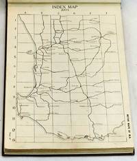
1923101984Perth: Hale's Motor Maps Ltd. 1923. Octavo cloth boards with block printed title laid on upper boards b&w plates b&w illus pp 244. Rebound with new endpapers in custom-made slipcase. First page creased otherwise contents clean. Very good condition. Road maps of Western Australia from Moora Kondut and Becubbin in the north to Albany in the south and stretching iinward through the wheatbelt. Scale: 4 miles to the inch. With many illustrated advertisements for WA companies decriptions of Perth and Western Australia with photographs lists of garages and hotels and information for travellers. Boards in slip-case. Hale's Motor Maps Ltd. hardcover
1849075433-8-1Philip's. Very Good. It's a well-cared-for item that has seen limited use. The item may show minor signs of wear. All the text is legible with all pages included. It may have slight markings and/or highlighting. Philip's unknown
1759848041759. T. Kinnersley. London. 1759. In Two Volumes II and III and contains the whole set for the year 1759. Bound in 18th century quarter brown calf gilt very worn and rubbed and lacking portions of leather from heads and tails of spine. Joints tender but holding. Vol. II; ii 372 pages plus 4pages of index. Vignette to general title-page and engraved head-piece for each month. 6 engraved plates of unusual and more ordinary fauna including the dodo the rhinoceros sea hedge-hog the horned didapper flying fish and cassowary. 1 portrait plate of Magliabechi 14 full page engraved maps and plans. Vol. III; ii. 404 pages plus 4 page index. Engr. vignette to general title-page and engraved head-pieces or decorations to each month 4 engraved plates of fauna one portrait plate of Major General Wolfe 1 incredible engraved plate displaying the Torments Inflicted by the Dutch on the English in Amboyna plus the engraved frontis. to Pope's Essay on Man. Three engraved plates - 1 map and 2 plans. A wonderful insight into what interested people in the mid-18th century. Pages browned and occasionally foxed but otherwise a very useful set. hardcover
2007DADAX0935039392StreetWise 2007-12-27. map. New. 4.00x0.25x8.75. Buy with confidence. Excellent Customer Service & Return policy. StreetWise unknown
58305Hamburg Deutsche Verlags-Gesellschaft D.V.G. 1912. . Außentitel "Pharus Atlas deutscher Städte". - Aachen Berlin Bremen Breslau Coblenz Cöln a. Rh. Darmstadt Dresden Duisburg Düsseldorf Frankfurt a.M. Hamburg Hannover Kiel Leipzig Lübeck Magdeburg München Stettin Stuttgart sowie Brüssel London Paris Wien. Mit illustrierten Bäder- und Kurort-Anzeigen und Führer von Heidelberg Hildesheim Osnabrück und Rendsburg von diesen Städten keine Pläne vorgesehen sowie internationalem Hotel-Register und einem Mitgliederverzeichnis des Internationalen Möbel-Transport-Verbandes. Mit einem Sonderanhang "Schweiz". Besonders interessant durch die zahlreichen schön gestalteten Anzeigen der Zeit viele davon ganzseitig. - Berieben wenig bestoßen innen nur vereinzelt etwas fleckig wenige Blätter eingerissen 1 Blatt m. großem Einriß. Hamburg, Deutsche Verlags-Gesellschaft D.V.G. 1912]. unknown
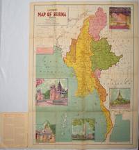
1951214601Delhi.: S.B. Makhija & Brothers. circa1951. Printed colour map 98.6 x 69 cms folding into pictorial wrappers 25.3 x 19.5 cms five pictorial colour inserts of pagodas and the Shwethalyaung reclining Buddha wrappers a little chipped marginal wear and three small fold splits in the map but overall in very good condition. Attractive large map of Burma with the provinces coloured steamship routes shown in red and printed in the booklet a range of information printed based on the 1951 census including climate agriculture and form of government "Burma became an independent nation completely outside the British Empire on January 4 1948 and is now a sovereign independent republic known as the Union of Burma". . S.B. Makhija & Brothers. unknown