[ZHANG YONGRU]. (EDITED BY).Biblio.com

1 660 résultats
1952215851大陸輿地社. 1952. Charming pocket size atlas with double page coloured map showing China as a whole and the provinces with inset maps of special geographical features and a description of key information about each province vertical text. Text in traditional Chinese characters names on map read from right to left or vertically. Light wear little light browning but maps very clean and bright very good condition 14.5 x 9.8cm. . 大陸輿地社. unknown
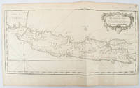
1750136782circa1750. Black and white copperplate engraving map of Java a little light even browning neat colour pencil highlighting of rivers and two settlements. Folded as issued. Good copy. 26 x 44cm. Issued in Prevost's Histoire Générale des Voyages ou nouvelle collection de toutes les relations de voyages par mer et par terre. . unknown
SONG0008318735Collins 2019-10-01. map. Used: Good. 5.51x0.24x9.65. Buy with confidence. Excellent Customer Service & Return policy. Collins unknown
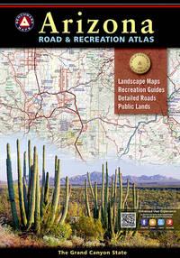
20189780929591186-2025Natl Geographic Society Maps 2018. Paperback. New. <p><strong>Author:</strong> Benchmark Maps</p><p><strong>Publisher:</strong> Natl Geographic Society Maps</p><p><strong>Binding:</strong> Paperback</p><p><strong>ISBN:</strong> 9780929591186</p><p><strong>Release Date:</strong> 2018</p><p><strong>Number Of Pages:</strong> 105</p><p><strong>Details:</strong> The Grand Canyon State abounds in natural beauty and outdoor possibilities. Completely reworked with larger scale Landscape Maps and a comprehensive Recreation Guide Benchmark's Arizona Road and Recreation Atlas is an invaluable resource for adventure planning and exploration.</p> Natl Geographic Society Maps paperback
GOR002061338Paperback. Very Good. paperback
192729334HBDJ VG/VG- 1927 on Title pg 1ST edition Hardcover. Condition: Fine-. Dust Jacket Condition: Very Good. SMALL Dark burgundy cloth with Gold gilt Spine Cvr. Hinges & Binding strong. . 12mo 188 pg INDEX o/w VG Copy in dusty but o/w VG DJ with Spine DJ endchips. Hard Cover. FINE-/Very Good. 12mo Ghostly Castles Seat of its 1st Kings St. cloud St. Germaine MalmaisonVersailles Fountainebleau ETC<br /><br /> Robert McBride NY hardcover
197230289<p>HBDJ 1972 Revised VG-/VG AS-IS Blue cloth lettered in White Interior Nice tight light Wear SOME INK NOTES AND UNDERLINING but has FoX Stains 108 pgs DJ light wear & SCUFFING Extremities DJ 8vo - over 51â„4" - 83â„4" with 2 FOLD OUT Maps</p><p>According to Churchward Lemurians developed homes with transparent roofs lived to be hundreds of years old and were capable of telepathy astral travel and teleportation. ATLANTIS they became greedy petty and "morally bankrupt" and the gods "became angry because the people had lost their way and turned to immoral pursuits" Orser says. As punishment he says the gods sent "one terrible night of fire and earthquakes" that caused Atlantis to sink into the sea.</p> LONDON, Illinois: Theosophical Publishing House, hardcover
1931257418.Gmap. Good. Access codes and supplements are not guaranteed with used items. May be an ex-library book. unknown
1990045014Essex Ca: Tales Of The Mojave Road Publishing Company 1990. 1st Edition 1st Printing. Hardcover. Near Fine. 303 Pp. First Printing. Gold Cloth Stamped In Brown. First Printing. Very Near Fine. <br/> <br/> Tales Of The Mojave Road Publishing Company hardcover
1997Q-0002555093HarperCollins 1997-01-01. Hardcover. New. In shrink wrap. Looks like an interesting title! HarperCollins hardcover
20209780008363802-2025Nicholson 2020. Paperback. New. <p><strong>Author:</strong> Collins Maps</p><p><strong>Publisher:</strong> Nicholson</p><p><strong>Binding:</strong> Paperback</p><p><strong>ISBN:</strong> 9780008363802</p><p><strong>Release Date:</strong> 2020</p><p><strong>Number Of Pages:</strong> 1</p><p><strong>Details:</strong> The map companion to the Collins/Nicholson Waterways Guides covering the entire network of canal and river navigations in England Scotland and Wales including newly restored/opened canals and rivers.The map identifies:• narrow and broad canals;• navigable rivers;• tidal river navigations;• waterways under construction.Also:• contact telephone numbers and dimensions for each waterway;• internet links.Clear insets of the Birmingham Canal Navigations Scottish inland waterways the Norfolk Broads and the London area.</p> Nicholson paperback
20191-1566958164Natl Geographic Maps 2019. Paperback. New. map ill edition. 484 pages. 9.25x4.50x1.25 inches. Natl Geographic Maps paperback
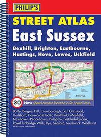
0540092886.Gspiral_bound. Good. Access codes and supplements are not guaranteed with used items. May be an ex-library book. unknown
1845878736.Gmap. Good. Access codes and supplements are not guaranteed with used items. May be an ex-library book. unknown
2011DADAX1886705801StreetWise 2011-12-01. map. Used: Good. StreetWise unknown
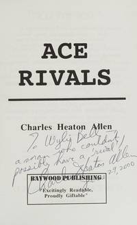
1995Q-0964540401Baywood Publishing 1995-01-01. paperback. New. In shrink wrap. Looks like an interesting title! Baywood Publishing paperback
0930657160.Gpaperback. Good. Access codes and supplements are not guaranteed with used items. May be an ex-library book. paperback
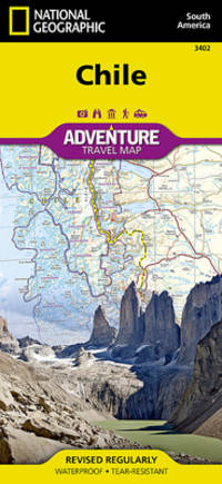
20199781566955461-2025Natl Geographic Society Maps 2019. Paperback. New. <p><strong>Author:</strong> National Geographic Maps - Adventure</p><p><strong>Publisher:</strong> Natl Geographic Society Maps</p><p><strong>Binding:</strong> Paperback</p><p><strong>ISBN:</strong> 9781566955461</p><p><strong>Release Date:</strong> 2019</p><p><strong>Number Of Pages:</strong> 2</p><p><strong>Details:</strong> • Waterproof • Tear-Resistant • Travel MapNational Geographic's Chile Adventure Map is the perfect travel companion for adventure travelers exploring this long and narrow coastal country occupying much of South America's Pacific coastline. Expertly researched the map combines unparalleled detail with a user-friendly design including a handy index of towns cities and National Parks and Reserves to help locate them quickly as well as a clearly marked road network of highways major and minor roads and unpaved roads labeled with distances. In addition hundreds of well-known and off the beaten path cultural historical and recreational points of interest are highlighted including UNESCO World Heritage Sites archeological sites beaches lighthouses monuments churches spas and areas for skiing fishing and surfing. Outdoor adventurers will find mapped hiking trails along with such topographic features as contour lines elevations and labeled peaks.The map conveniently covers the country in four sections: from its northern borders with Peru and Bolivia to the city of Copiapo; the next section continues south through the capital of Santiago to Concepcion; then into Patagonia and the city of Coihaique the Chonos Archipelago and Moraleda Channel; finally to the southernmost part of the country with its National Parks and Preserves including Alberto de Agostini National Park. The long border with Argentia is shown with border crossings. Inset maps cover Easter Island and the Juan Fernandez Islands. This unique map with its abundance of specialized content. compliments any guidebook.Every Adventure Map is printed on durable synthetic paper making them waterproof tear-resistant and tough — capable of withstanding the rigors of international travel.Map Scale = 1:1750000Sheet Size = 37.75" x 25.5"Folded Size = 4.25" x 9.25"</p> Natl Geographic Society Maps paperback
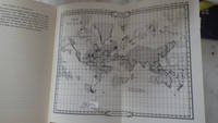
178425892London: Harrison & Co 1784. 1 vols. 10 x 7 3/4 inches. Extracted from a volume. Some light marginal discoloration folds else in very good condition. 1 vols. 10 x 7 3/4 inches. The first "A General Stereographic Map on the Plane of the Meridian" and the other showing a "Stereographic Projection on the Plane of the Horizon" and "Orthographic Projection on the pLane of the Meridian" Maps of the Hemispheres. <br/><br/> Harrison & Co unknown
196078704Atladena California: Altadena Federal Savings and Loan Association 1960. Printed on both sides on an 18 1/2" x 23 1/2" sheet of white paper that folds to 4" x 9 1/4" 24 panels. There is printing in red and a color rendering of the Altadena Federal Savings building on one side. Handwritten name on the front panel; else near fine. Scarce OCLC locates no holdings.<br /> <br /> Fully indexed street map of the unincorporated Los Angeles County California community that was devastated by the Eaton Fire in January 2025. Situated next to and within the foothills of the San Gabriel Mountains Altadena has long resisted annexation to Pasadena though that city has taken 46 "bites" of it over the years seeking tax revenues. That independent spirit is reflected in the mosaic of ethnic diversity that made Altadena one of the most integrated communities in Southern California. Altadena Federal Savings and Loan Association unknown
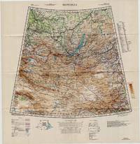
19425330Washington D.C.: U.S. Army Army Map Service 1942. Loose sheet. Near Fine. Sheet 22 1/M North K-O 46-50. Full color map measures 28 x 29 inches. With a list of authorities i.e. other maps consulted in the creation of this map. Glossary. Index to boundaries. Folds as issued. An especially bright copy. First published 1931 by the War Office this edition is labeled "For Use by War and Navy Department Agencies Only. Not for Sale or Distribution." Revised to aid the US WWII effort in the Far East special emphasis is applied to railways international boundaries and "nomadic encampments." From the collection of Asian books and maps formed by Albert Ravenholt. U.S. Army, Army Map Service unknown
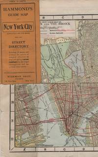
191341637New York: Wehman Brothers Publishers 1913. Very good. An impressive color map of the island of Manhattan and the Bronx. Scale is 1" equals 1/2 mile and includes railroads subways elevated railroads surface railroads and proposed railroads. An uncommon early 20th Century New York City street map. Folding color map. Measuring approximately 18" x 36" when unfolded. In original printed card wrapper. Verso a thorough printed street index. Mild handling wear toning. A few tiny holes near fold corners. Overall well preserved; very good. Wehman Brothers Publishers unknown
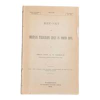
19006902Washington D.C.: Government Printing Office 1900. First edition. 8vo 100pp. Color folding map 42x108cm attached at rear. Stitched lacking wrappers or disbound from a larger publication paper toned with light chipping. Map clean. A good copy. <br /> <br /> Senate Document No. 429 56th congress. This report was given by Adolphus Washington Greely 1844-1935 then Brigadier General and Chief Signal Officer of the U.S. Army. Greely was in charge of maintaining communications networks during the Spanish-American War and oversaw construction and maintenance of telegraph lines in Puerto Rico Cuba and the Philippines. <br /> <br /> The map in this report is "Map of the Island of Porto Rico Showing the lines of signal communication telegraph telephone and heliograph operated by the Signal Corps U.S. Army with Military Posts." It was prepared by major William A. Glassford under the direction of Greely. <br /> <br /> <br /> OCLC cites 11 holdings. . Government Printing Office unknown
194463900Washington D.C. & New York NY: Navy distribution by Educational Services Section; Prepared and distributed by Army Information Branch Army Service Forces 1944. Oblong double atlas folio. 47 x 34.5 in. One large double-sided colour lithograph map and panoramic cutaway view minor dustsoiling light age toning very minor creasing at folds still a NF copy. First edition of this splendid educational panorama with cutaway view of a World War II Balao-class submarine conning tower lines have been altered to prevent enemy identification when surfacing which improved upon the Gato class with higher yield-strength steel pressure hull skins and increased depth to 400 feet. The four inset maps on verso track the campaigns in the Philippine Islands with maps for Manila Bay and Cebu Leyte & Samar separately as well as maps tracking the Western Front progress in 1944 just 4 months after D-Day. Navy distribution by Educational Services Section; Prepared and distributed by Army Information Branch, Army Service Forces, unknown
1953309567NY: BALLANTINE BOOKS. Near Fine in Very Good dust jacket. 1953. First Edition. Hardcover. Near fine in a Vg. dj. Barely discernable 2"-inch tear at upper seam of rear panel of dj. A few short edge tears & small chips as well as traces of shelfsoiling to dj. Novel of the Virginia Calvary in the Shenandoah Valley during the Civil War. LR . BALLANTINE BOOKS. hardcover