1 660 résultats
193929724HBDJ 1939 on title & Copyright Pg 1st edition VG/VG- PRICECLIPPED But $3 on back of DJ Contains two folding maps Clean lightly-worn copy in Green Cloth with Gold Illustration & Titles DJ has rub Wear Spine & Tiny TEARS & Extremities Chips Lightly worn hardcover in the original dust cover. Book shows very light wear Dust cover is price-clipped and shows wear/chipping to spine ends. A very clean copy that I will call Very Good. Measures 6 1/8 X 8 3/4 284 pages. Contains two folding maps.<br /> Dodd, Mead and Co. hardcover
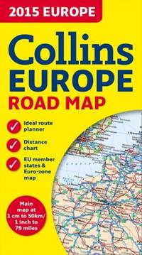
4085463Collins. New edition. Map. Used; Very Good. Simply Brit welcome to our online used book store where affordability meets great quality. Dive into a world of captivating reads without breaking the bank. We take pride in offering a wide selection of used books from classics to hidden gems ensuring theres something for every literary palate. All orders are shipped within 24 hours and our lightning fast-delivery within 48 hours coupled with our prompt customer service ensures a smooth journey from ordering to delivery. Discover the joy of reading with us your trusted source for affordable books that do not compromise on quality. 10/09/2014 Collins unknown
1931257337.Gmap. Good. Access codes and supplements are not guaranteed with used items. May be an ex-library book. unknown
8170530660.Gpaperback. Good. Access codes and supplements are not guaranteed with used items. May be an ex-library book. paperback
T87-ODE-3EPHardcover. Very good. Imperial War Museum in association with The Battery Press 1992 V1. 380 pages V2. 517 pages red cloth hard covers with gold spine stamping no owner's mark or underlining tight and square very light wear. hardcover
1994Q-1878067575Seal Press 1994-08-01. Paperback. New. In shrink wrap. Looks like an interesting title! Seal Press paperback
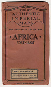
190029227London: George Philip & Son Ltd. ca.1900. Early printing of this map by the cartographic publishing company. Finely rendered in colours. Large multi-folding map approximately 22" x 27" publisher's original protective wrappers printed in black. A very fine copy pristine and very near to mint. George Philip was born in Huntly Aberdeenshire to a staunchly Calvinist family but in 1819 George traveled to Liverpool where his brother Robert who was a nonconformist minister lived. In 1819 he became assistant to the Liverpool bookseller William Grapel and in 1834 set up his own business as a bookseller and stationer in Paradise Street Liverpool. He rapidly expanded the business by producing books particularly educational works and maps. Within his first year of trading to keep up with demand he had to move his business into larger premises at the Atlas Buildings in South Castle Street. <br> Philip used cartographers such as John Bartholomew the elder August Petermann and William Hughes to produce maps on copper plates. Philip then had these printed and hand-coloured by his women tinters. By the time he produced his county maps of 1862 he was using machine coloured maps produced on power-driven lithographic presses. 'His maps ranged from the expensive Imperial Library Atlas 1864 to an atlas costing as little as 3d. and although the bulk of his production was for the commercial and particularly the educational market he also produced important scientific maps notably of North America especially the Arctic and Pacific Northwest Africa and of the West Indies.<br> This is a very fine copy of a scarce map showing the extent of European possessions in North-East Africa before the end of the colonial period. George Philip & Son, Ltd. unknown
2007SONG092959195XNational Geographic 2007-01-17. 2nd. paperback. Used: Good. 10.50x0.25x15.00. Buy with confidence. Excellent Customer Service & Return policy. National Geographic paperback
1566958164.Gmap. Good. Access codes and supplements are not guaranteed with used items. May be an ex-library book. unknown
0881307823.Gpaperback. Good. Access codes and supplements are not guaranteed with used items. May be an ex-library book. paperback
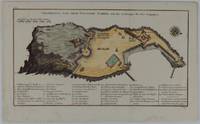
1748175859Leipzig.: Schwabe Johann Joachim. 1748. Engraved map on laid paper 20.5 x 36 cm plate -mark inc. captions 24 x 39 cm sheet size original fold later hand-colouring slight marginal spotting but in very good condition. Fine 18th century ground plan of Gorée Island off the coast of Senegal infamous for its association with slavery. The map shows encampments and forts with a detailed key. Originally published in Abbe Prevost's "Histoire générale des voyages." 1746 -1789 with maps and plans by the great cartographer Jacques-Nicolas Bellin this was prepared for volume two of the the German edition "Allgemeine Historie der Reisen." published in 1748. . (Schwabe, Johann Joachim) unknown
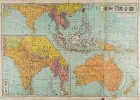
1572159290東京.Tokyo.: 金鈴社. Kinrei-sha. 昭和十八 October 101943. Two maps printed in colour on a single side of a folded sheet. The map titled "Complete Map of India and Australia" shows the region covering Australia southern India western mainland south-east Asia Indonesia the Philippines and New Guinea. The other map titled "India and Burma" shows the region covering India Afghanistan the western section of China Burma and Thailand on the lower left side. New Zealand is in an inset map in the lower right corner. As the note on the cover says "Including the detailed descriptions of the Solomons New Guinea and southern islands" this map shows the theatres of the Pacific War and the surrounding areas. The map indicates agricultural and mineral resources as well as cities roads railways sea routes national borders etc. Cover and publication details printed on two panels on the reverse. Some marking and browning. . 金鈴社. [Kinrei-sha]. unknown
1816175252Philadelphia.: Carey Mathew and Warner Benjamin. 1816. Engraved map 19 x 22.3 cm original folds some offsetting to the map marginal browning and staining small archival repairs to the outer margin but in good condition. Fine map Plate 19 prepared for Carey and Benjamin's "General Atlas.". . (Carey, Mathew and Warner, Benjamin). unknown
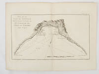
1774174257Paris.: Chez Saillant et Nyon rue Saint-Jean-de-Beauvais Chez Panckoucke Hotel de Thou rue des Poitevins. 1774. Engraved map on laid paper 18.5 x 31cm 25.6 x 34.4cm sheet size central fold slight marginal toning but a very good dark impression. Map of Bonthain Bay situated southeast of Macassar on the island of Celebes finely re-engraved for the French edition of Captain James Cook's First Voyage 1768-1771 "Relation des voyages.pour faire des decouvertes dans l'hemisphere meridional et successivement executes par le commodore Byron le capitaine Carteret le capitaine Wallis & le capitaine Cook.". . Chez Saillant et Nyon, rue Saint-Jean-de-Beauvais, [Chez] Panckoucke, Hotel de Thou, rue des Poitevins. unknown
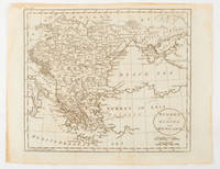
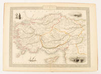
1851174952London & New York.: Tallis J & F. 1851. Lithographed map 24.5 x 32.3 cm borders picked out in original hand colour four inset vignette illustrations decorative Greek key border edge worn and discoloured paper toned but the attractive map in good condition. Attractive decorative map prepared for "Tallis's illustrated atlas and modern history of the world." one of the last great illustrated series of world maps. The fine vignettes are of Mt. Olympus Rhodes a ketch in the Mediterranean Sea and two costumed Ottomans. . Tallis, J & F. unknown
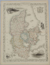
1850175779London & New York.: John Tallis & Company. Circa1850s. Lithographed map with original outline hand colour 34.5 x 24.7 cm including border and captionsfive fine vignette illustrations decorative border central fold edges with light toning in very good condition. Attractive decorative map with fine vignettes of Copenhagen Sleswig and Elsinore figures in costume the coat of arms of Denmark and an amiable equine pair by the great mapmaker and publisher John Tallis. . John Tallis & Company. unknown
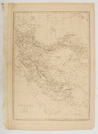
1863177017London.: Cassell Petter and Galpin. circa1863. Engraved map 43.1 x 30.3 cm 50.7 x 34.5 cm sheet central fold small edge tears one neatly repaired lower corner chipped slight age toning but in very good condition. Impressive large map of Persia Iran by noted map maker Edward Weller in original uncoloured state re-issued by the publisher for inclusion as map 26 in Cassell's Atlas. . Cassell, Petter and Galpin. unknown
0540092045.Gpaperback. Good. Access codes and supplements are not guaranteed with used items. May be an ex-library book. paperback
1581741243.Gspiral_bound. Good. Access codes and supplements are not guaranteed with used items. May be an ex-library book. unknown
0935039996.Gmap. Good. Access codes and supplements are not guaranteed with used items. May be an ex-library book. unknown
1839782121839. Longman Rees and Co. 1839. Early Edition. Hardback. No DW. Brown textured cloth. 9cm x 12.5cm. Linen-backed fold-out map in colour 35cm x 42cm . Ownership signature to inside cover. A lovely copy. hardcover
20189780008225087-2025Collins 2018. Paperback. New. <p><strong>Author:</strong> Collins Maps</p><p><strong>Publisher:</strong> Collins</p><p><strong>Binding:</strong> Paperback</p><p><strong>ISBN:</strong> 9780008225087</p><p><strong>Release Date:</strong> 2018</p><p><strong>Number Of Pages:</strong> 1</p><p><strong>Details:</strong> This unique pictorial map shows the ancient territories of the principal Scottish clans in the 17th century and features Don Pottinger’s Islay Herald of Arms distinctive and original artwork of Scottish arms and crest badges. The map includes over 170 arms the official insignia of clan chiefs and crest badges. It also includes a territories map of principal clans at the beginning of the 17th century; arms of the ancient Scottish principalities; and locations of the ancient territories held by the clans around the time of King James VI. The map is ideal for those those with an interest in Scottish heraldry clans and family history. The map is based on the map originally conceived and illustrated by the late Sir Iain Moncreiffe of that Ilk Bart. C.V.O. Q.C. Ph.D. Albany Herald of Arms and the late Don Pottinger C.V.O. M.A. D.A. Islay Herald of Arms.</p> Collins paperback
2005mon0000707576Hema Maps Pty.Ltd 01/06/2005 00:00:01. spiral_bound. Like New. . Tanning to edge of pages Hema Maps Pty.Ltd unknown
19822091502135401251Not Available 1982. Soft Cover. Fine. Number of books: 1 Not Available paperback
19302083002116201908Oriental Maps Masatoshi Yoshii 1930. Soft Cover. Fine. Number of books: 2 Oriental Maps Masatoshi Yoshii paperback