1 660 résultats
192076159Boston: Scarborough Motor Guide Company 1920. Narrow octavo. 676 pp. crammed with numerous textual maps and advertisements. Original folding map present and in very good condition. Publisher's stiff green wrappers lettered in black. Small 1/2 inch slit to upper front joint but a remarkably clean and nice copy with the map. Scarborough Motor Guide Company unknown
193960959San Francisco CA: San Francisco Bay Exposition 1939. 8vo. 116 pp. With oblong folio. 19.25 x 16 in. colour pictorial map frontisp. detailed sections of island and exhibits in blue on verso fold creases numerous photo illustrations text maps diagrams stepped thumb tabs at outer fore-edge. Blue-cloth backed softcovers featuring the striking Art Deco cover art by Simon “Si†Vanderlaan 1904-1986 famed pin-up artist and illustrator who worked for Walt Disney studios during World War II minor scuffing very minor age toning shelfwear still VG bright copy from the library of Prof. Marvin Nathan. Revised 1939 edition of this excellent guide to the first year in 1939 of the Golden Gate International Exposition including “Cartograph†revealing all of the Art Deco architectural wonders and surrounding areas of Treasure Island. The pictorial maps were issued separately as well as with the “Official Guide Books.†Ruth Taylor White’s 1902-1985 delightful pictographic maps or cartographs included depictions of the Territory of Hawaii in which she had driven or traveled to every corner of the Islands and the Grand Canyon for her for her brother’s book “Grand Canyon Country.†Later Little Brown requested an entire atlas which was published as the very scarce Our U.S.A. “A gay geography.†Her cartographs influenced the style of American cartographic illustration for decades afterwards. See: Griffin Mapping Wonderlands: Illustrated Cartography pp. 192-193; Field MapCarte 29/364: Our U.S.A. A Gay Geography 2014. San Francisco Bay Exposition, paperback
1800D7401unknown: unknown likely early 1800s. Ephemera. Very Good. A collection of 8 engraved maps 420 x 280 mm including wide margins numbered in Arabic or Roman numerals see below otherwise seemingly uniform. From an unknown source. It includes: 1 Bombardement de Lille par l'Armee Autrichienne en 1792 with the stamp of Depot de la Guerre Bibliotheque in the top margin; 2 Siege de la Citadelle d'Anvers par l'Armee Francaise en 1792; III Siege de Valenciennes par l'Armee Coalisee Anglaise Hannovrienne et Autrichienne en 1793; VIII Siege d'Ypres par l'Armee Francaise en 1794; IX Siege de Charleroy par les Francais en 1794; X Siege de Landrecies par les Francais en 1794; XI Siege du Quesnoy par les Francaise in 1794; and XIII Siege de Nieuport par l'Armee Francaise en 1794. A bit foxed; flattened crease down the middle from folding these were perhaps pulled from a book where they were mounted on stubs along the crease. <br/><br/> [unknown] unknown
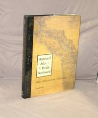
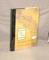
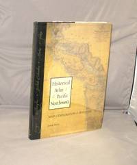
199928781Seattle:: Sasquatch Books 1999. First Printing of the First US Edition. A Fine copy in a Fine bright unclipped dust jacket. This volume provides a visual journey through four centuries of exploration and discovery beginning with the 16th Century Spanish and English explorers. Included are accounts and the cartographic contributions of Sir Francis Drake Vitus Bering James Cook Alexander Mackenzie George Vancouver Lewis & Clark and dozens of other important travelers. Includes 325 map reproductions. Sasquatch Books, unknown
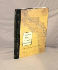
199929225Seattle::: Sasquatch Books 1999. Third Printing of the First Edition. A Fine copy in a Fine bright unclipped dust jacket. This volume provides a visual journey through four centuries of exploration and discovery beginning with the 16th Century Spanish and English explorers. Included are accounts and the cartographic contributions of Sir Francis Drake Vitus Bering James Cook Alexander Mackenzie George Vancouver Lewis & Clark and dozens of other important travelers. Includes 325 map reproductions. Sasquatch Books,, unknown
199929316<p>Seattle::: Sasquatch Books 1999. First Printing of the First US Edition. A Fine copy in a Fine bright unclipped dust jacket. This copy is signed by the author. This volume provides a visual journey through four centuries of exploration and discovery beginning with the 16th Century Spanish and English explorers. Included are accounts and the cartographic contributions of Sir Francis Drake Vitus Bering James Cook Alexander Mackenzie George Vancouver Lewis & Clark and dozens of other important travelers. Includes 325 map reproductions.</p> Sasquatch Books,, hardcover
199929402Seattle::: Sasquatch Books 1999. Third Printing of the First Edition. A Fine copy in a Fine bright unclipped dust jacket. This volume provides a visual journey through four centuries of exploration and discovery beginning with the 16th Century Spanish and English explorers. Included are accounts and the cartographic contributions of Sir Francis Drake Vitus Bering James Cook Alexander Mackenzie George Vancouver Lewis & Clark and dozens of other important travelers. Includes 325 map reproductions. Sasquatch Books,, unknown
201128184Berkeley:: University of California Press 2011. First Printing of the First US Edition. A Fine copy in a Fine bright unclipped dust jacket. This gorgeous atlas illustrated throughout with more than 500 colorful images and maps provides a visually rich and textually engaging history of the states of Oregon and Washington. Derek Hayes brings his enthusiasm and expertise to a full range of topics beginning with the first inhabitants and tracing the westward expansion conflict between settlers and Native Americans and the establishment of the Oregon Trail. We see in vivid images old maps and lively text the coming of the railroads and the rapid establishment of the coastal ports northwest cities and roads the fur and lumber industries and the large farms. University of California Press, unknown
19529160DuBois PA: Samuel A. King 1952. Revised 1952. Folding map 25x19" printed in red and black. Sportsman's club label to upper margin with some offsetting to lower. Small split at fold intersections title and a few stains to blank verso otherwise a clean near fine example. <br /> <br /> Very popular map which was originally designed and published by Samuel A. King in 1951 and revised in 1952 and 54. According to OCLC there were also 1960s and 70s printings under slightly different titles. This map shows the Allegheny National Forest and surrounding counties with animal silhouettes tracks and a portrait of John O'Bail the Cornplanter last of the great Seneca chiefs. Made for motorists hunters and anglers it shows paved and clay roads trails pipe and power lines fire and lookout towers state parks game lands airports and towns with post offices. <br /> <br /> The early copies of this map are somewhat scarce and there are many modern reprints available. OCLC cites 8 holdings for the '51-54 editions with just 1 being the '52. A lovely example. . Samuel A. King unknown
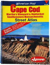
200681813aaspArrow Map 2006. 4th. spiral_bound. Good. 10x0x13. Fourth Edition 2006 with a yellow red and blue cover. Wire coil binding. Pages unmarked; mild usage wear. Arrow Map unknown
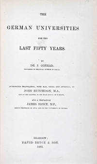
188530824Glasgow: David Bryce & Son 1885. First English language edition. Hardcover. g. Quarto. XXX 333 1 3pp. Original red cloth with gold lettering on spine. The present work is a captivating survey of the German Universities for the last 50 years between 1835 and 1885. It forms the second part of the third volume of a series of statistical inquiries in various departments of the national economy of Germany conducted by Dr. Conrad Professor of Political Science at Halle. Minor age wear on binding with spine slightly age toned. Previous owner's signature in ink on half-title page and dated 1885. Very minor age toning along paper margin. Binding and interior in overall good condition. David Bryce & Son hardcover
19-8996Madrid: National Institute of Spanish Books ca. 1970. Large format color print poster 25†x 12â€. Very Good. Minor creasing on top and bottom edges. Scarce. Text in Spanish.From the collection of the late Frederick Ruffner Jr. founder of Gale Research Detroit. Madrid: National Institute of Spanish Books, [ca. 1970] unknown
73-3802Ithaca: Historical Maps 1968. 60x84 cm. Color poster. Very Good. In plastic.Item in plastic sleeve new photos of item can be sent to customer upon request. Ithaca: Historical Maps, 1968 unknown
1976160565NY THOMAS Y. CROWELL 1968 1976 1976. DUST JACKET UNCLIPPED FIRST AMERICAN EDITION VERY GOOD. 1st Edition. Hardcover. NY, THOMAS Y. CROWELL [1968, 1976] hardcover
19012221875<p>Map of San Francisco: Showing points of special interest to attendants the Fifth International Convention of the Epworth League July 18-21 1901 folding map of 21" x 28" printed in black & red.With numbered locations of places of Methodist interest and historical. Verso of map with 23 panels detailing trips excursions to Yosemite Valley Southern California including Pasadena Redlands Riverside Palo Alto Santa Cruz Lick Observatory. Very good minor wear; short tears at folds.</p><p>San Francisco before the 1906 devastating earthquake.</p> unknown
0540088714.Gpaperback. Good. Access codes and supplements are not guaranteed with used items. May be an ex-library book. paperback
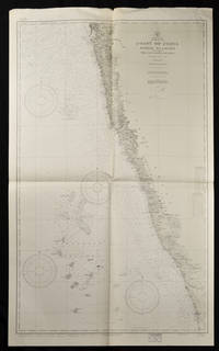
193765133Washington. D.C.: U.S. Navy Hydrographic Office. 10th edition. 1937. Two charts black and white folded as issued. #1589: sheet measures approx. 89 x 118cm #1590: 127 x 76cm little creased at upper edge. Very good. A great length of the coast is here charted with much detail marked along the coast including rivers towns and the topography. The charts mark soundings in fathoms or feet and various natural and man-made features of the coastal area. Both are stamped "Corrected Through Notice to Mariners Feb. 17 1951". . U.S. Navy Hydrographic Office. unknown
2008Q-1566954622National Geographic Maps 2008-01-01. Map. New. In shrink wrap. Looks like an interesting title! National Geographic Maps unknown
Q-1566955009National Geographic Maps 2019-01-01. Map. New. In shrink wrap. Looks like an interesting title! National Geographic Maps unknown
1581740522.Gpaperback. Good. Access codes and supplements are not guaranteed with used items. May be an ex-library book. paperback
1593530064.Gmap. Good. Access codes and supplements are not guaranteed with used items. May be an ex-library book. unknown
20049780792289890-2025National Geographic Maps 2004. Spiral-bound. New. <p><strong>Author:</strong> National Geographic Maps</p><p><strong>Publisher:</strong> National Geographic Maps</p><p><strong>Binding:</strong> Spiral-bound</p><p><strong>ISBN:</strong> 9780792289890</p><p><strong>Release Date:</strong> 2004</p><p><strong>Number Of Pages:</strong> 144</p><p><strong>Details:</strong> National Geographic's Road Atlas: Adventure Edition is the ideal companion for the next time you hit the road. Includes up-to-date road maps for all 50 U.S. States plus Canada Mexico and Puerto Rico. Major cities and metropolitan areas are shown in detail with inset maps that include popular attractions infrastructure and points-of-interest.Setting this atlas apart from all other road atlases are the inclusion of detailed maps and guidebook-like recommendations on the top 100 destinations for adventure plus the top 24 most visited National Parks. An additional resources section provides contact information for local tourism offices plus a place name index to help easily locate a specific city.The Road Atlas: Adventure Edition features a heavy duty spiral binding and Travel Tough a tear-resistant cover for durability and lay-flat reading.Folded Size = 11" x 15"</p> National Geographic Maps unknown
18622109160014D Appleton and Company 1862. Hardcover. Good. 1962 printing. Bound in publisher's cloth. Hardcover. Shelf wear. Spine ends chipped with loss. Some folded maps torn. D Appleton and Company hardcover
1845878981.Gmap. Good. Access codes and supplements are not guaranteed with used items. May be an ex-library book. unknown
GOR006084980Paperback. Good. paperback