Sheridan, John DBiblio.com
1 660 résultats
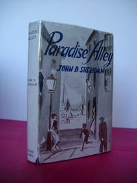
1945023064Dublin: The Talbot Press 1945. Book. Fine. Hardback. First Edition. 8vo. 273 pages. Original dust jacket bright without browning; a little rubbing and general wear lightly scuffed to head/tail of the spine and corners small chip to centre of front spine fold and several marginal tears repaired to the reverse with archival materials now protected in a clear removable archival sleeve. Hard-back binding very good. Contents clean and tight no inscriptions no foxing. A fine first edition copy in a very good jacket. Scarce first edition. The Talbot Press Hardcover
1953biblio664Overall size is about 31 1/2" X 21". Map has some creasing and the top left corner has some crinkling. Includes a full size Map of Havana A Map of Marianao Interesting Places in Marianao Map of the Gulf of Mexico City of Havana Streets. Ships First Class with Delivery Confirmation. Ucar Garcia, S. A. paperback
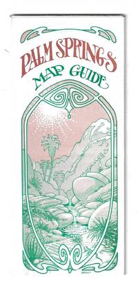
197678705Orange and Palm Springs California: Ken and Ruth Du Maurier The Palm Springs Map Guide 1976. Tourist map to the desort resort city in Riverside County California. In addition to a large street map of Palm Springs there are smaller maps of the city bus route Cathedral City and the Coachella Valley respectively. Also provides a list with addresses of movie star and celebrity homes a brief history of the region a description of the picturesque canyon areas and descriptive lists of local shops restaurants hotels golf courses activities service stations etc. Features photographic illustrations and numerous advertisements. Printed in green and desert rose on a 30" x 25 1/2" sheet of white paper that folds to 3 3/4" x 8 1/2" 48 panels. A fresh and clean example. Scarce OCLC locates only one holding at the Library of Congress. Ken and Ruth Du Maurier, The Palm Springs Map Guide unknown
197054789circa1970. Collection of 20 black and white photographic plates with their accompanying negatives of maps showing patterns of land use and land forms throughout Pakistan. These photographs are of two sets of maps prepared by the Canadian government covering the whole of Pakistan. A very useful set. From the collection of Professor Basil Johnson Emeritius Professor of Geography at the Australian National University Canberra. From the collection of geographer Professor Basil Johnson who was the author of a number of works on South Asia including "India Resources and Development" and "Geographical Dictionary of India". . unknown
1851375015.Gmap. Good. Access codes and supplements are not guaranteed with used items. May be an ex-library book. unknown
1973Q-038504335XDoubleday & Co. Inc. Garden City 1973-01-01. Hardcover. New. New. In shrink wrap. Looks like an interesting title! Doubleday & Co., Inc., Garden City hardcover
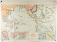
1930205997Sydney: H.E.C. Robinson. Circa1930s. Printed colour maps in all 65.5 x 99cm the main map roughly 50 x 65 cms on a single sheet 76 x 101.3 cms; a little carelessly folded decorative blue title cover a little dusty and a few fold splits and edgewear but in good condition. The exceptional feature of this map are the twenty six large scale inset maps of Pacific islands including: Malay States Singapore Hong Kong these at lower left Japan Philippine Islands Hawaiian Islands Fiji Solomon Islands Western and Eastern Samoa Tahiti Saipan New Caledonia and Dependencies and many others. <br> <br>The main map of the Pacific Ocean stretches from Southeast Asia including all of Australia and New Zealand the west coast of the Americas the Kamchatka Peninsula Manchukuo Manchuria and most of China. Korea and Taiwan are marked as Japanese Territory. Possessions of Britain France the Netherlands and the United States are highlighted. <br> <br>An incredibly rich source of information on the Pacific theatre during the years leading up to World War II. From the Sydney publisher H.E.C. Robinson the firm founded in 1895 by Herbert Robinson 1857-1933 a founder of the Royal Geographical Society of Australasia. . H.E.C. Robinson. unknown
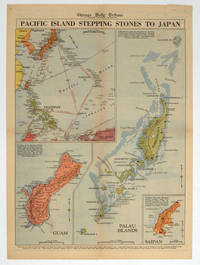
1944208880Chicago.: Chicago Daily Tribune. 28 September1944. Colour pictorial map on a single newspaper leaf archivally laid down on linen 50 x 39.2 cms; 59.3 x 43.3 cms sheet including captions faint toning to fold lines very good condition. Vivid colour maps of the Palau Islands Guam and Saipan in the Marianas and an inset location map published in the "Chicago Daily Tribune" in September 1944 months after the landing of US and Allied Forces in the offensive against the Japanese during the Pacific War. . Chicago Daily Tribune. unknown
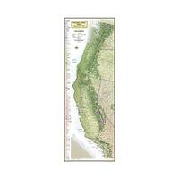
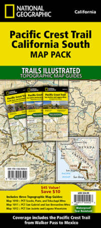
20141-1597755834Natl Geographic Maps 2014. Map. New. lam map edition. 1 pages. 18.50x2.00x2.00 inches. Natl Geographic Maps unknown
1566958504New. Brand new and still unused unknown
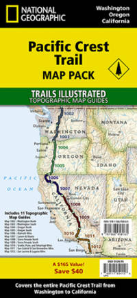
1566958164New. Brand new and still unused unknown
ING9781566958165National Geographic Maps. New. Special order direct from the distributor National Geographic Maps unknown
1566958504.Gmap. Good. Access codes and supplements are not guaranteed with used items. May be an ex-library book. unknown
1566958164.Gmap. Good. Access codes and supplements are not guaranteed with used items. May be an ex-library book. unknown
2023SONG1566958164National Geographic 2023-01-01. 2023. map. Used: Good. 4.50x1.25x9.25. Buy with confidence. Excellent Customer Service & Return policy. National Geographic unknown
2023DADAX1566958164National Geographic 2023-01-01. 2023. map. New. 4.50x1.25x9.25. Buy with confidence. Excellent Customer Service & Return policy. National Geographic unknown
20201-1566958504Natl Geographic Society Maps 2020. Paperback. New. fol map edition. 132 pages. 9.25x4.25x0.50 inches. Natl Geographic Society Maps paperback
38009901Korea late 18th-early 19th century 1780-1810. Eight color gouache pastel tinted maps ca. 57.5 x 90.1 cm.contemporary re-backing very solid clean examples complete set of all provinces hand-painted gouache manuscripts. RARE & OBSCURE . . . . A RARE & COMPLETE SET OF ANTIQUARIAN MANUSCRIPT KOREAN . . . YI PERIOD PROVINCIAL MAPS . . "P'ALTO CHIDO" OR "EIGHT PROVINCES MAPS" . . . DELUXE ELEPHANT FOLIO SIZE SHEETS . . . HAND-COLORED GOUACHE PASTELS . This is a very RARE & COMPLETE set of eight Korean provincial manuscript maps. Drawn circa 1780-1810 by an unsigned Korean cartographer. These maps are of historical importance giving place names isolating the time frame. . Painted on very thin finely hand-made mulberry-fiber tissue paper contemporary re-backed with a stiff hand-made paper. Beautifully hand-painted & colored in gouache pastels. . The record shows several reliable verities of manuscript maps showing the eight ancient Korean provinces. . Commonly these maps had no title cartographer's name date or other critical bibliographic colophon data. This is a common theme with Korean manuscript maps. . Political divisions of Korea are by and large mostly stable making name comparisons easier. . PROBABLE MAP TITLES INCLUDE: . a. The "SINJUNG-TONGGUK-YOJI-SUNGNAM:" "EIGHT SEPARATE MAPS EACH SHOWING ONE COMPLETE PROVINCE OF THE EIGHT KOREAN PROVINCES similar in intention to the "P'ALTO CHIDO." . The eight provinces were established during the Chosen dynasty 1392-1910 alternately and commonly called the Yi dynasty. . The eight provinces are from the north to south: . 1. Hamgyong 2. P'yong'an 3. P'yongyang 4. Kangwon 5. Hwanghae 6. Kanghwa 7. Kyongsang 8. Cholla'ungch'ong . During the Sejo reign 1455-68 Yang Songji made the first "P'Alt-do "P'ALTO CHIDO" type maps of the eight provinces this type and style became the "standard" for future examples. There after his style and format were copied by others for centuries. . b. A second version and style of the above eight provinces maps is called "TONGGUK CHIDO: MAP OF THE EASTERN COUNTRY i.e. KOREA" showing a compressed northern frontier along Manchuria the characteristic "CHONG CH'OK" style. . c. A third similar map: "P'ALDO-CHONGDO: A SINGLE MAP SHOWING THE EIGHT PROVINCES OF KOREA." . These maps are pictorially beautiful and artistically drawn in detail. Graphics expressing a primitive naive folk charm depicts prominent geological landscape features. Mountain ranges hills forests in green streams/rivers blues political district seats distinctively painted cartouches box-like in various differing colors for each province. Roads paddy coastal shore line & islands in blue tints with other features nicely colored. . There are a large number of name throughout each map all written in Hanzi traditional Chinese characters called "Hanja" in Korean as was the common practice at that time for Koreans. There are no Hangul characters at all. The Hanja identify navigational directions names of surrounding ocean harbors beaches geographical names city towns villages mountains rivers roads and the like. . Each of the eight maps illustrates a complete single province. Within each of the various political divisions and boundaries outlined and named. . RARITY OF KOREAN ANTIQUITIES: Antiquarian Korean examples are sparse when compared to items of the same period in China and Japan. Korean works are less than 10% of those created elsewhere. . Fewer Korean items were made survived and preserved. The attrition rate: bad weather unstable ancient mud building structures fires natural disasters earthquakes war and other factors diminished the remaining examples. . Those the numbers that come to marked are steadily reduced while the value continues to appreciate. Many never return to market when acquired by institutions or private collectors who eventually donate to museums. . DATING THESE MAPS: These were mostly undated. . There are three possible methods of dating. . a. BY PLACE NAME: there are details in the reference books about county seat names being colored or put in various kinds of 'boxes' on the map depending on that according to the resources approximate dates can be derived. . b. PAPER TECHNOLOGY & FIBERS: Koreans have been using hand-made mulberry bark and fiber paper from the Zhenguan period AD 627-649 printing Buddhist sutras by woodblocks on similar kinds of paper. . These two technologies papermaking and woodblock printing was transmitted to Japan around 700 AD. . Since that time both Koreans & Japanese have utilized mulberry paper Washi in Japanese to woodblock print and paint a large variety of items including maps books and single page works. . By comparing the paper of these maps with known dated printed Japanese books a very close approximate date can be derived. . These Korean map papers are nearly identical to dated woodblock-printed Japanese examples we have. It is therefore highly possible these maps were painted on hand-made mulberry paper from circa 1780-1810 period. . In ancient times sheet size was limited to a small size then joined to other sheets to create a large size single sheet. These maps are of that format. See McCune below where he states the kind of paper used which matches our examples. . CONDITION: Per McCune we summarize: as usual these maps were folded several times from their creation time so they could be safely stored and carried in small 'book' format in covers with a tied string. See McCune below. . Being painted on very fine & thin hand-made mulberry paper most all examples were eventually re-backed. Ours as typical have period re-backing using the same character hand-made mulberry fiber paper of a thicker quality. . They are well preserved however nevertheless as usual there remains some old original wear at the folds the expected light water stains dustiness with other typical very minor flaws for an item of this grand size being 200 years old. These do not detract from the overall excellent impression and stunning appeal. . RARITY: . The complete set is RARE! The work is nicely executed in a firm hand with artistic value illustrating artistically hills mountains and other features of the map pictorially. It is not only a map but a work of art. Tastefully colored in subtle pastels nice representation of water rives and sea. . Such early and beautifully artistic examples seldom come to market. . A RARE AND FRESH EXAMPLE NEVER BEEN ON THE MARKET IN THE LAST 120 YEARS ! . PROVENANCE: These items were acquired from a former missionary's estate who was stationed in Korea from circa 1900-1930's. They have been in this private collection since and have never been on the market. . Color scans are posted to our website. . REFERENCES: . TOOLEY Ronald V. et al.: Article: Shannon McCune: SOME KOREAN MAPS pp.70-102 with illustrations. McCUNE Shannon.: KOREAN MAPS OF THE YI DYNASTY KOREAN CULTURE Korean Consulate General L.A. Ca. Sept. 1983 pp.21-31 34 back cover color plate color & b.w. illustrated. . He discusses "P'ALTO CHIDO""EIGHT PROVINCES MAP" origins maps without scale and were copies of a Korean scholar named Won his title was: Haksaeng works based on Chong Ch'ok's 1390-1475 TONGGUK CHIDO MAP OF THE EASTERN COUNTRY then modified by Won to be the more typical "P'ALTO CHIDO" "EIGHT PROVINCES MAP" but in his new style. This new style clearly resembles our maps in layout format color of county seats and similar boxes around them and other critical details. KOREAN CONSUL GENERAL KOREAN CULTURE September 1983 pp.21-31 34 color map on back cover color and b.w. illustrated. . It was from these maps that the later versions similar to ours eventually emerged mostly by Imperial Order by the ".Yi Dynasty court specifically decreed that both magistrates and governors should prepare up-to-date maps of their territories udder their supervision." p.25. HARLEY J.B. ed. et al.: CARTOGRAPHY IN THE TRADITIONAL EAST AND SOUTHEAST ASIAN SOCIETIES. Ahead of Title: THE HISTORY OF CARTOGRAPHY Vol. 2 Book 2 an excellent article by Gari Ledyard: CARTOGRAPHY IN KOREA pp. 235-345239 figures 10.23 10.24 et al. NAKAMURA Hiroshi.: EAST ASIA IN OLD MAPS. . --. NIHON KO CHIZU TAISEI: GREAT COLLECTION OF OLD JAPANESE MAPS MONUMENTA CARTOGRAPHICA JAPONICA . --. OLD CHINESE WORLD MAPS PRESERVED BY THE KOREANS. Article in IMAGO MUNDI IV 1958. LEE Chan. CH'AN Yi.: OLD MAPS OF KOREA. Han'guk ko chido. By: Ch'an Yi Hong-gyu Che Han'guk Tosogwanhak Yon'guhoe. He discusses and illustrates a good number of similar examples. On pp.226-27 he outlines an early Yi Dynasty example of: THE MAP OF EIGHT provinces found in TONGGUK YOJI SUNGNAM Chong Sang-gi's Tongguk Chido. These manuscripts were on large paper one province per sheet. Many other fine related examples are illustrated & discussed. . --. OLD MAPS OF KOREA: HISTORICAL SKETCH. He traces the early origins of Early Yi dynasty1392-1910 Eight Provinces Map origins and progressions excellent lucid article with illustrations and references to Yi HOE's MAP OF EIGHT PROVINCES. Excellent essay on provincial maps. SHIN Michael D. ed.: KOREAN HISTORY IN MAPS: From Prehistory to the Twenty-First Century. British Museum similar examples cited: commons-wikimedia-org/wiki/Category:Room_67_British_Museum# /media/File:Map_of_the_Jeolla_Province_British_Library_c.27. f.14_fol.12_n02.jpg Library of Congress: Young Il Kim: dong-kookyu-do: A RECENTLY DISCOVERED MANUSCRIPT OF A MAP OF KOREA. Imago Mundi vol.21 1967 pp.31-49 illustrated. . . unknown
0540089451.Gpaperback. Good. Access codes and supplements are not guaranteed with used items. May be an ex-library book. paperback
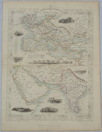
1850177525London.: The London Printing and Publishing Company. circa1850s. Lithographed map with original outline hand colour 33 x 24.5 cm including border and captions seven vignette illustrations two reference keys decorative border central fold light toning mainly at the central fold and to the verso of the sheet in very good condition preserved in a window mount. Attractive decorative map with fine vignettes of the London Post Office Suez Bombay Madras. Aden Malta Gibraltar and a wonderful camel train led by a carriage and horses crossing North Africa originally by the great mapmaker and publisher John Tallis. The two reference keys note steam packet routes railways electric telegraph and the Suez Canal. . The London Printing and Publishing Company. unknown
19532083002116202803School Maps KK Educational Maps Study Group Edited by Kiyoshi Nobutoki Gakuhiko Miyanaga/Sashie Nishihara Hiroshi 1953. Soft Cover. Fine. The book is in fine condition. School Maps KK Educational Maps Study Group Edited by Kiyoshi Nobutoki Gakuhiko Miyanaga/Sashie Nishihara Hiroshi paperback
194227092A.A. Knopf New York 1942 HARDBACK NODustjacket 1942 Stated 1st EDITION First Printing NF/NF NOJACKET Dates Match on title & Copyright pg bound in GREEN buckram cloth with Gilt design & title 304 pages of clean bright highly illustrated text with no dust jacket Title and a decoration device are embossed into the front cover in bright gilt. Title Author's name as well as two decorative devices are embossed into the spine in bright gilt. Interior nice tight clean Light Wear Fox Index. Signed by Authors. 1st Edition. Hardcover. Near Fine/No Jacket. A.A. Knopf, New York, hardcover
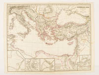
174950Gotha.: Justus Perthes. Map with original colour and outline hand-colour 32.2 x 40 cm text in German five inset maps central fold slight marginal toning and spotting on the verso but in very good condition. A most handsome and highly detailed map detailing the Eastern provinces of the Byzantine/Roman Empire in the time of the Roman Emperor Justinian 527-565. The inset maps depict Carthage Rome Constantinople Naples and a Western continuation of the main map originally issued for the "Hand-Atlas für die Geschichte des Mittelatters und die Neueren Zeit" . Justus Perthes. unknown
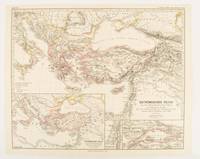
1874174914Gotha: Justus Perthes. 1874. Map with original colour and outline hand-colour 32.2 x 40 cm three inset maps text in German central fold slight marginal toning in very good condition. A most handsome map detailing the Eastern Roman Empire from the immigration of Hungarians in Ponnonia around 895 to the subjugation of the Bulgarian Empire by Emperor Basilius in 1019. The inset maps depict Divisions of the Empire Palestine and the Themata around Propontis present day Sea of Marmara issued for the "Hand-Atlas für die Geschichte des Mittelatters und die Neueren Zeit". . Justus Perthes unknown
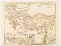
1876174911Gotha: Justus Perthes. 1876. Map with original colour and outline hand-colour 32.2 x 40 cm text in German four inset maps central fold slight marginal toning and spotting on the verso but in very good condition. A most handsome and highly detailed map detailing the Eastern provinces of the Byzantine/Roman Empire before the Fourth Crusade. The inset maps depict Constantinople Divisions of the Empire and Antioch issued for the "Hand-Atlas für die Geschichte des Mittelatters und die Neueren Zeit" . Justus Perthes unknown