HOMANN, JOHANN BAPTISTBiblio.com
1 660 résultats
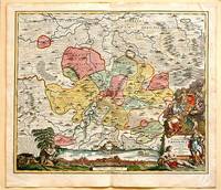
171761880Nuremberg.: Johann Baptist Homann. 1717. A beautifully engraved hand coloured map of North East Germany showing the area around Erfurt in detail. In the centre of the map is a small plan of Erfurt which is also shown as a panoramic view at the foot of the map and titled 'St. Petersburg'. An elaborate decorative title cartouche in the lower right corner depicts allegorical figures surrounded by the produce of the land including sheaves of wheat; a beehive; and a cornucopia of fruits. Cherubs holding a coat of arms float up from the scene on the right while on the lower left a centaur sits meditatively beneath a pine tree amongst slaughtered cattle. Physical features of the area are illustrated and farming areas shown by fields which criss-cross across the map. A clear dark impression the work of an outstanding German cartographer who in 1715 was appointed as imperial geographer by Emperor Charles VI. This map also includes "Schwan See" Swan Lake under a town of the same name which has since disappeared. Hand coloured two very minor splits at upper and lower edges on centre fold and not affecting engraved area a handsome map 54 x 61.5 cm. . [Johann Baptist Homann.] unknown
0282689079.Gpaperback. Good. Access codes and supplements are not guaranteed with used items. May be an ex-library book. paperback
0282579060.Gpaperback. Good. Access codes and supplements are not guaranteed with used items. May be an ex-library book. paperback
192355333Paris: Cartes Taride 1923. Paperback. Very good. Paperback. 139 x 108 cm 55 x 42.5 inches unfolded. Toning to folds with some minor spots of loss else a nice example. Folder worn and lightly chipped but very good. <br/><br/> Cartes Taride paperback
0483222895.Gpaperback. Good. Access codes and supplements are not guaranteed with used items. May be an ex-library book. paperback
18191405618Paris: Menard et Desenne 1819. Dernière édition. Hardcover. Octavo 684 pages. In Fair minus condition. Spine is tan with gold print on red banner. Boards half bound with green leather to spine and corners and green cloth to boards; corner leather not present spine leather is toned with some rubbing and wear to hinges board cloth has worn edges rubbing shelf wear. Text block has deckle edges; cracked front hinge foxing and toning throughout. Illustrated: “Enrichie de sept Cartes géographiques conformes aux nouvelles divisions et ornée des Pavillons des vingt principales Puissances maritimesâ€â€” title page; however illustrations may not be present. Text in French. <br /> <br /> NOTE: Shelved in Netdesk Column W. 1405618. FP New Rockville Stock. Menard et Desenne hardcover
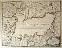
172354819Rainer Ottens. 1723. A most attractive map with early outline hand colour vertical fold barely visible diagonal crease upper half of map few very pale small brown spots otherwise a clean and bright image. Numbering in red pencil few annotations in pencil and light number stamp on reverse however not at all visible from front of map or affecting image. Sheet measures 46.6 x 60.2cm. . Rainer Ottens. unknown
0008202036.Gspiral_bound. Good. Access codes and supplements are not guaranteed with used items. May be an ex-library book. unknown
001174FINE map. Reproduction from Speed's "THEATRE OF THE EMPIRE .". Softcover. FINE map. Overall 17.5"x23.5" image 15.25"x20". This is not a photographic reproduction. Attractive & colorful. . FLAWLESS image. Not even the faintest aging foxing etc. VERSO FLAWS: light but extensive surface damage from some sort of adhesive with some loss of lettering. Verso only effected not into recto. . paperback
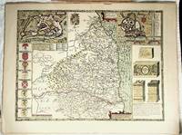
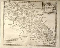
64139London.: Gibson. Early 18th Century. Engraved map on watermarked paper central fold 38 x 46.5 cm decorative title cartouche towns roads rivers and landforms shown; from Gibson's edition of Camden's Britannia upper edge trimmed by the original binder causing minor loss to the border at the inner edge but in very good condition. . [Gibson.] unknown
2019G0008309396I3N00Nicholson 2019. Spiral-bound. Good. Pages can have notes/highlighting. Spine may show signs of wear. ~ ThriftBooks: Read More Spend Less.Dust jacket quality is not guaranteed. Nicholson unknown
0008309396.Gspiral_bound. Good. Access codes and supplements are not guaranteed with used items. May be an ex-library book. unknown
1935B3841New York: Harcourt Brace and Company 1935. Dust jacket missing Very Good condition. Edition: Third Printing. Binding: Original full cloth with blue lettering flat spine. Size: Small 4to Illustration: With profuse black and white illustrations. Category: Book Arctic & Antarctic Harcourt, Brace and Company hardcover
19351395167New York: Harcourt Brace and Company 1935. First Edition Fourth Printing. Hardcover. Octavo 255 pages. In Very Good minus condition and lacking issued dust jacket. Bound in dark blue cloth with silver gilt lettering on spine. First edition fourth printing as stated on copyright page. Foxing to boards with light fraying to cloth along edges. Top edge of textblock dyed dark blue though faded. Toning to interior pages and tanning to pastedowns. Inscribed by Anne Morrrow Lindbergh on second endpaper in Spanish. Shelved in Case 9. 1395167. Shelved Dupont Bookstore. Harcourt, Brace and Company hardcover
054009191X.Gspiral_bound. Good. Access codes and supplements are not guaranteed with used items. May be an ex-library book. unknown
000854705X.Ghardcover. Good. Access codes and supplements are not guaranteed with used items. May be an ex-library book. hardcover
197320-28357Reliance Printers 1973-01-01. Paperback. Good. Good condition with some wear to cover. Reliance Printers paperback
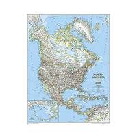
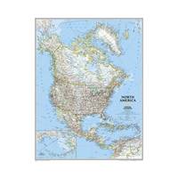
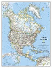
20111-0792281020NATIONAL GEOGRAPHIC MAPS DIVISION 2011. Map. New. rol map en edition. 1 pages. 46.25x35.75x2.30 inches. NATIONAL GEOGRAPHIC MAPS DIVISION unknown
20131-0792250176Natl Geographic Society Maps 2013. Map. New. lam map edition. 1 pages. 22.00x1.60x1.20 inches. Natl Geographic Society Maps unknown
A9780792281023Sheet map rolled. New. unknown
A9780792250180Sheet map. New. unknown
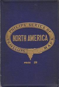
006893London UK: George Philip & Son Ltd. Good. 0. Hardcover. Dark blue cloth boards with gilt title. Map folds out to 22 x 28 inches. No date circa 1900s. Boards worn on edges corners bumped spine starting to split.; Book; 12mo - over 6¾ - 7¾" tall . George Philip & Son, Ltd. hardcover
0007539002.Gspiral_bound. Good. Access codes and supplements are not guaranteed with used items. May be an ex-library book. unknown
0008258007.Gspiral_bound. Good. Access codes and supplements are not guaranteed with used items. May be an ex-library book. unknown
195256432Portland OR: Published by Byington Printing Co. March 1952. 1 large folding map sized 21 x 23 printed in red & black inset map on verso of map as well as street and city guide index street traction system transportation information and zones. Map folds down into small printed portfolio w/ fold-over flap printed in red & black illust. of mill on front light toning still VG. First edition thus of this updated city map with postal zones and all of the motorcoach lines and electric trolley lines delineated. The map is of particular interest as showing Portland OR neighborhoods before the clearing and construction of Interstate-5 and the outlines of the destroyed city of Vanport. Destroyed in the 1948 flood Oregon’s second largest city had been originally constructed by Henry Kaiser outside of the Portland city limits in order to house a large influx of African-American workers largely barred by Oregon discriminatory laws. Byington 1862-1956 was a California printer who moved to Oregon following World War I would own and operate Byington Printing Co. until his death. No copies located in Worldcat. Published by Byington Printing Co., unknown