Outdoor Books & MapsBiblio.com

1 660 résultats
0930657160.Gpaperback. Good. Access codes and supplements are not guaranteed with used items. May be an ex-library book. paperback
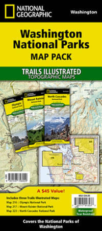
159775224X.Gmap. Good. Access codes and supplements are not guaranteed with used items. May be an ex-library book. unknown
2001DADAX159775224XNational Geographic 2020-01-01. 2020. map. New. 4.25x0.20x9.25. Buy with confidence. Excellent Customer Service & Return policy. National Geographic unknown
0008368317.Gmap. Good. Access codes and supplements are not guaranteed with used items. May be an ex-library book. unknown
19802090502113716153Not Available 1980. Soft Cover. Fine. The book is in fine condition. Not Available paperback
20022083002116200896Industrial Maps Supervised by Hiroyasu Funakubo and others 2002. Soft Cover. Fine. The book is in fine condition. Industrial Maps Supervised by Hiroyasu Funakubo and others paperback
1597751022.GGood. Access codes and supplements are not guaranteed with used items. May be an ex-library book. unknown
0976373343-11-1Toucan Maps Inc. 4th. Very Good. It's a well-cared-for item that has seen limited use. The item may show minor signs of wear. All the text is legible with all pages included. It may have slight markings and/or highlighting. Toucan Maps Inc. unknown
193849584Chicago: Rand McNally Co. ca. 1938. Large colour map 26.5 x 19.5 in. which folds into 12 sections w/ several inset colour maps on verso colour-illustrated Art Deco cover art of couple driving from the front & back advertising Triton Oil minor shelfwear some dustsoiling still VG map. First edition thus including large Highway map on one side of Washington & Oregon along with smaller inset maps for Portland Everett Salem Seattle Spokane and Tacoma before World War II. Rand McNally Co., unknown
Q-0929591984National Geographic Maps 2015-10-01. Paperback. New. In shrink wrap. Looks like an interesting title! National Geographic Maps paperback
20121-1597752509Natl Geographic Society Maps 2012. Map. New. map edition. 1 pages. 30.50x1.60x1.60 inches. Natl Geographic Society Maps unknown
A9781597752503Sheet map. New. unknown
1597756024New. Brand new and still unused unknown
1597756024.Gmap. Good. Access codes and supplements are not guaranteed with used items. May be an ex-library book. unknown
20151-1597756024Natl Geographic Maps 2015. Paperback. New. fol map edition. 6 pages. 9.50x4.50x0.75 inches. Natl Geographic Maps paperback
19372306200115Government Printing Office 1937. hardcover. Very Good. 0x0x0. Bound in publisher's cloth. Hardcover. No dust jacket. Good binding and cover. Spine faded. Clean unmarked pages. Includes map in rear pocket. xxvi. 1140 pages. <br> The American Guide Series was a group of books and pamphlets published under the auspices of the Federal Writers' Project FWP a Depression-era works program in the United States. The American Guide Series books were compiled by the FWP but printed by individual states and contained detailed histories of each state with descriptions of every city and town. The format was uniform comprising essays on the state's history and culture descriptions of its major cities automobile tours of important attractions and a portfolio of photographs. Government Printing Office hardcover
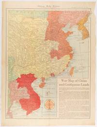
1519180794Chicago.: Chicago Daily Tribune. January 151942. Printed colour map on a single newspaper leaf 53 x 40.7 cm; 59.8 x 45 cm sheet inset text box marginal browning and at the folds but remarkably bright in very good condition. WWII map of China showing most of China Indo-China Thailand and Korea with territory captured and controlled by Japan shaded in orange and red published by the Chicago Daily Tribune barely six weeks after the bombing of Pearl Harbour. The text on the map reads "Since 1937 China has been at war with Japan. Lacking many essentials of war the Chinese nevertheless have managed to maintain a front against the aggressors. China's principal life line is the Burma road shown on the map which starts at Lashio Burma and extends to Kunming Yunnan province where it links with connections to Chunking the present Chinese capital". <br> <br>Based on a Rand McNally map the Tribune briskly got to work issuing maps for readers showing the beginnings of the war with Japan. Later maps were also published for sale separately but remarkably few have survived. <br>"… the historic Chicago Tribune was an innovator in color inks and printing but also a pioneer in bringing colorful art in the form of illustrations photographs cartoons and advertisements to the average person in an everyday medium." see The Janet A. Ginsburg Chicago Tribune Collection Michigan State University Libraries. . Chicago Daily Tribune. unknown
1843424215.Gpaperback. Good. Access codes and supplements are not guaranteed with used items. May be an ex-library book. paperback
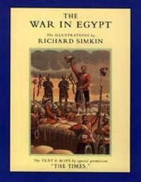
2003x-1843424215Naval & Military Press Ltd 2003. Paperback. New. revised ed. edition. 66 pages. 9.53x7.24x0.24 inches. Naval & Military Press Ltd paperback
184463111London: J.&C. Walker 9 Castle Street Published by Longman & Co. ca. 1844. 16mo. 3.5 x 5 in. folding out to 13.25 x 16.5 in. dissected 15-panel hand-coloured steel-engraved map linen-backed w/ 3 leaf folding population and mileage distance chart from Dublin by County mounted on front pastedown. Dark gray-green publisher’s cloth portfolio pocket binding decorative borders in blind gilt lettering stamped on front cover a NF copy. First edition thus of this very scarce dissected pocket map of Ireland published against the backdrop of the full impact of the Great Potato Famine which from 1841-1851 resulted in the diaspora and death of nearly 30% of the Irish population and as reflected in the mileage table mounted with the map the population in 1845 had already dropped from 8.2 million in 1841 to 7.7 million by 1844 and it would plummet further to below 6.5 million by 1851. The bulk of these emigrated to the United States Canada and the United Kingdom resulting in the fact that Ireland’s current population still resides below the high of 1841 and nearly 38 million Irish-Americans claim descent from the successive waves of migration much of which channeled through New York’s Lower East Side and the Bowery in the 19th-Century. John Walker 1787-1873 was a British mapmaker engraver lithographer hydrographer draughtsman and publisher publishing nautical charts and geographical maps with his brothers Charles and Alexander in their firm J.&C. Walker located at 9 Castle Street Holborn from 1841-1847 and moving to 37 Castle St. in 1848 where they remained to 1875. Much of their work was published under the auspices of the Society for the Diffusion of Useful Knowledge or S.D.U.K. Worldcat locates 1 copy Yale. J.&C. Walker, 9 Castle Street, Published by Longman & Co., hardcover
1839782121839. Longman Rees and Co. 1839. Early Edition. Hardback. No DW. Brown textured cloth. 9cm x 12.5cm. Linen-backed fold-out map in colour 35cm x 42cm . Ownership signature to inside cover. A lovely copy. hardcover
0008328072.Gmap. Good. Access codes and supplements are not guaranteed with used items. May be an ex-library book. unknown
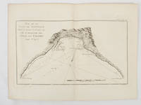
1774174257Paris.: Chez Saillant et Nyon rue Saint-Jean-de-Beauvais Chez Panckoucke Hotel de Thou rue des Poitevins. 1774. Engraved map on laid paper 18.5 x 31cm 25.6 x 34.4cm sheet size central fold slight marginal toning but a very good dark impression. Map of Bonthain Bay situated southeast of Macassar on the island of Celebes finely re-engraved for the French edition of Captain James Cook's First Voyage 1768-1771 "Relation des voyages.pour faire des decouvertes dans l'hemisphere meridional et successivement executes par le commodore Byron le capitaine Carteret le capitaine Wallis & le capitaine Cook.". . Chez Saillant et Nyon, rue Saint-Jean-de-Beauvais, [Chez] Panckoucke, Hotel de Thou, rue des Poitevins. unknown
0365890855.Gpaperback. Good. Access codes and supplements are not guaranteed with used items. May be an ex-library book. paperback
2001Q-1860469264Harvill Press 2001-01-01. Hardcover. New. In shrink wrap. Looks like an interesting title! Harvill Press hardcover