National Geograhic MapsBiblio.com
1 660 résultats
20131-0792239156Natl Geographic Society Maps 2013. Map. New. lam map edition. 1 pages. 30.10x1.60x1.40 inches. Natl Geographic Society Maps unknown
A9780792229872Sheet map. New. unknown
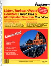
2000Q-0880976403Hagstrom Map Co 2000-01-28. paperback. New. In shrink wrap. Looks like an interesting title! Hagstrom Map Co paperback
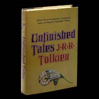
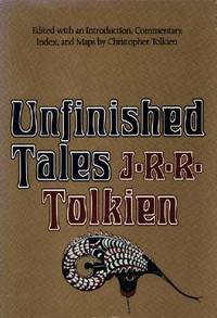
19807042Boston: Houghton Mifflin Company 1980. Book Club Edition. Hardcover. pp. xxiv 483. 8vo. Quarter-brown spine over mustard-yellow boards with red lettering and ornamentation to the spine; map endpaper. Black-and-white maps charts etc. Lightest edgewear contents without blemish with bright clean and unmarked pages and firm sound binding; very good and housed in lightly rubbed unclipped dustjacket showing light wear along the edges of the panels. Overall very good. <br/><br/> Houghton Mifflin Company hardcover
1980047136Boston: Houghton Mifflin Harcourt 1980. Book. Fine. Hardcover. First Edition/First Printing. A square solid tight clean unread copy. The 15.00 unlaminated jacket as issued has some lightish rubbing wear some edge wear some edge chipping two short closed tears. Light green cloth boards with silver/green inlay. First US Edition. A very nice overall copy in a worn jacket. Map by Christopher Tolkien tipped to rear endpaper as issued has neber been removrf from this copy. THIS COPY IS IN MY POSSESSION AND WILL NORMALLY SHIP NEXT DAY. Houghton Mifflin Harcourt Hardcover
19522083002116200967Meiji Maps Ministry of Education 1952. Soft Cover. Fine. The book is in fine condition. Meiji Maps Ministry of Education paperback
1566958733.Gmap. Good. Access codes and supplements are not guaranteed with used items. May be an ex-library book. unknown
1933911387.Gmap. Good. Access codes and supplements are not guaranteed with used items. May be an ex-library book. unknown
0540089338.Gspiral_bound. Good. Access codes and supplements are not guaranteed with used items. May be an ex-library book. unknown
054008753X.Gpaperback. Good. Access codes and supplements are not guaranteed with used items. May be an ex-library book. paperback
178425892London: Harrison & Co 1784. 1 vols. 10 x 7 3/4 inches. Extracted from a volume. Some light marginal discoloration folds else in very good condition. 1 vols. 10 x 7 3/4 inches. The first "A General Stereographic Map on the Plane of the Meridian" and the other showing a "Stereographic Projection on the Plane of the Horizon" and "Orthographic Projection on the pLane of the Meridian" Maps of the Hemispheres. <br/><br/> Harrison & Co unknown
1885508921.Gmap. Good. Access codes and supplements are not guaranteed with used items. May be an ex-library book. unknown
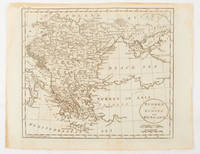
1816175252Philadelphia.: Carey Mathew and Warner Benjamin. 1816. Engraved map 19 x 22.3 cm original folds some offsetting to the map marginal browning and staining small archival repairs to the outer margin but in good condition. Fine map Plate 19 prepared for Carey and Benjamin's "General Atlas.". . (Carey, Mathew and Warner, Benjamin). unknown
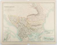
1893177055Edinburgh & London.: W. & A. K. Johnston. 1893. Engraved map with original outline hand-colour 44 x 57.4 cm map two inset maps of the Bosphorus and Crete; central fold corners chipped with loss lower edge with several small marginal tears neatly repaired head and foot clipped at the fold with loss to the margin but the map in very good condition. Detailed and finely engraved map also showing submarine telegraph lines and relief by hachures. Re-issue of the map first published in 1863 for "Keith Johnston's Royal Atlas of Modern Geography". . W. & A. K. Johnston unknown
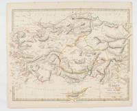
1830175250London.: Society for the Diffusion of Useful Knowledge. Baldwin & Cradock. 1830. Engraved map wth outline hand colour 29.7 x 42 cm relief shown in hachures key to abbreviations including "Ancient Ruins" the west and east extremities attactively engraved to burst through the border original folds map with occasional spotting more pronounced at the lower corner edges a little ragged small chip to the inner margin no loss to the map manuscript pagination in the lower corner but in good condition. . Society for the Diffusion of Useful Knowledge. Baldwin & Cradock. unknown
1887749330.Gspiral_bound. Good. Access codes and supplements are not guaranteed with used items. May be an ex-library book. unknown
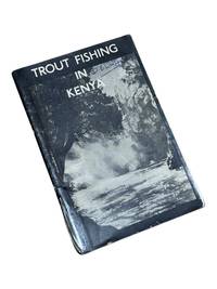
19508975Nairobi Kenya: Printed in E. Africa by W. Boyd & Co 1950. First edition. 18x13cm 64pp. Illustrated ads photos fold out map attached at rear. Staple bound in illustrated wrappers. Old tape reinforcement to spine edges rubbed owner's name to front cover. Upper corners stained else clean internally and very good. <br /> <br /> Very scarce mid-century publication a guide for English and American sportsmen seeking angling opportunities in Kenya Colony. Brown and Rainbow Trout eggs were introduced into the rivers by colonists around 1905. The sport was a popular pastime for the colonists and tourist fishing in the region continues to thrive today. The three color map at rear shows the Kenya Highlands with principle trout rivers roads and railways.<br /> <br /> OCLC cites a single holding at the University of California. Printed in E. Africa by W. Boyd & Co unknown
1888J4KDIGIVEPWUFrance 1888. Brown and black ink watercolour chalk and gold paint on paper mounted on several laminated sheets of paper 69.5 x 52.5 cm. Charming trompe-l'oeil of maps of European countries on a decorated background somewhat reminiscent of a church ceiling. It contains a French inscription "to my beloved parents" which together with some inconsistencies in the use of perspective suggest a young French artist. The maps show some interesting departures from reality: in the Netherlands parts of the province of Gelderland are shifted 50 kilometres to the north replacing Zwolle with Arnhem and Sweden lacks Stockholm but includes Copenhagen in place of Malmö. However the most humorous is in the map of Germany which lacks its western neighbours - the Netherlands Belgium Luxemburg and France - giving it an extensive North Sea coast. The gothic lettering is inconsistent in style with the artist apparently improvising an alphabet for each inscription in the process forgetting Denmark.Somewhat soiled and browned at the edges with several white spots due to overpainting; the sheets are coming loose from one another. unknown
182342750London: T. Cadell and W. Davies 1823. First edition. Hardcover. g to vg. Large quarto 11 1/4 x 9". 2 xxviii xxiii 1 812pp; xix 13 715pp 1pp Errata 2pp Publisher's advertisement; 2 xv 12 20 822pp; 2 xx 14 735pp 1pp Errata; xii 14 763pp 1pp Errata; 2 iv 14 555 1pp. Modern half black morocco over dark grey cloth with gold lettering and ruling to spines. Raised bands. First volume with a striking tissue-guarded frontispiece portrait of the author engraved by Richard Golding after a painting by John Opie. Tissue-guarded engraved frontispiece in each volume.<br /> <br /> First edition of Edward Daniel Clarke's magnum opus "Travels in Various Countries of Europe Asia and Africa" the author's personal account of a fascinating journey throughout three continents. <br /> <br /> Following a tour of Scandinavia in 1799 Edward Daniel Clarke 1769-1822 travelled through Russia and the Crimea before proceeding to Constantinople Rhodes and afterwards Egypt and Palestine. Greece was the country next visited. While touring this country Clarke as a mineralogist and antiquary collected marbles coins and vases and purchased a large ancient statue at Eleusis. From Athens he proceeded by land to Constantinople and after a short stay in that city directed his course homewards through Rumelia Austria Germany and France.<br /> <br /> Each of the six volumes is lavishly illustrated throughout with numerous in-text vignettes and woodcuts as well as full-page copper plates many folded depicting views monuments natives in traditional costume ceremonies and processions antiquities etc. Includes several folded maps and charts. All the 185 copper plates and 157 vignettes and cuts are accounted for.<br /> <br /> Plates engraved by Joseph Skelton R. Pollard Laetitia and Elizabeth Byrne F. R. Hay J. Fittler and R. Cooper after illustrations by E. D. Clarke Angelica Clarke Guarenghi Martin Dreier W. Havell Camporesi J. B. Lusieri Morritt W. Harraden Grelot Fauvel G. Wilkins Henry Wrighte and Preaux. Most of the delightful vignettes were engraved by Elizabeth and Laetitia Byrne. The maps and plans were engraved by S. I. Neele and H. Mutlow.<br /> <br /> Some offsetting to text pages facing plates. Moderate to heavy foxing to plates throughout. Minor foxing to text pages. Sporadic clear water-staining along edges of plates in second volume Part 2 section 1. Ex-library copy with perforating library stamp to each title page and small reference stamp at inner gutter of the first text leaf of each volume not affecting lettering. Bindings in overall very good interior in good to very good condition. T. Cadell and W. Davies hardcover
0259197726.Gpaperback. Good. Access codes and supplements are not guaranteed with used items. May be an ex-library book. paperback
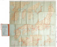
1927215711Tokyo.: Japanese Government Railways. Circa1927. Large folding colour map 78.5 x 80 cm of Japan and Korea 6 inset maps one of which shows Taiwan scale 1:1640000 for Hondo Shikoku and Kyushu 1:2340000 for Chosen; tipped into the original orange cloth covered case with orange ties text in 31 panels on the verso one a little age-toned a few very small fold splits without loss a very good copy. Attractive tourist map for the English-speaking traveller issued by the Japanese Government Railways with extensive notes for tours and points of interest on the verso short descriptions of cities and sites to visit principal theatres with suggestions for cafes restaurants and department stores. . Japanese Government Railways. hardcover
193860338Marshfield OR: Oregon Coast Highway Association 1938. 4to. 16 pp unpaginated. numerous text illustrations double-page centerfold map by T.J. Greene small closed tear minor creasing self-printed photo-illustrated colour-softcovers center crease and printed in double-columns for folding slight soiling front cover still VG- copy w/ small rubber stamp of Breakers Motor Apts. Crescent City California on front cover. First edition thus of this automobile and bus travel tour guide to the newly completed US Highway 101 which finally had completed paved highway and bridges including the iconic Yaquina Bay bridge designed by Conde B. McCullough. Throughout the 1930’s with substantial support from the WPA and PWA projects as well as the U.S. Bureau of Public Works the highway became a scenic continuous drive. Oregon Coast Highway Association, paperback
19792090502113710013Not Available 1979. Soft Cover. Fine. The book is in fine condition. Not Available paperback
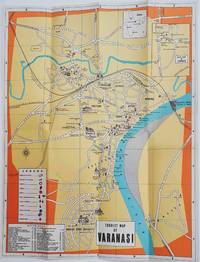
1960178269Circa1960. Folding colour tourist map of Varanasi in Uttar Pradesh province two inset maps of India and a gude map of Sarnath legend and key select Ghats shown railways "western style" and "Indian style" hotels marked in very good condition. 42.9 x 33.1 cm. . unknown
191176478New York: Automobile Club of America 1911. First edition Tall octavo. 876 pp. plus 48 leaves of maps one folding. Original flexible calf with two-brad binding gilt cover lettering yellow endpapers. Leather with some professional restoration. Text complete and clean. OCLC only records 3 copies all east of the Mississippi.The very first coast-to-coast automobile guidebook was published in 1901 The Official Automobile Blue Book. One usually finds these early automobile road guides devoted to specific parts of the country New England West Coast etc. but this one covers the entire nation. In this guidebook the routes given for the West comprise the smallest section of the book. 1911 was before the official opening of all of the major early automobiles routes: The Lincoln Highway planned in 1912 officially opened in 1913; The National Old Trails Road 1912; The Yellowstone Trail 1912; Pacific Coast Highway began in 1913. Automobile Club of America hardcover