333 résultats
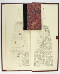
1987ST20505-11Madison Wisconsin: The Juniper Press 1987. No. 116 OF 150 COPIES. 632 x 250 mm. 25 x 9 3/4". 2p.l. 19 1 pp. <br/> Black quarter buckram over maroon marbled paper boards spine lettered in gilt. In a custom maroon buckram clamshell box. WITH 24 FACSIMILE GLOBE GORES. Signed by Woodward on the limitation page. Just a hint of use to the box booklet corners just a touch rubbed otherwise as new.<br/> <br/> This sizable attractive publication reproduces one of the largest complete sets of 16th century globe gores. Dating from around 1574 the original gores which when assembled would make a globe measuring just under 70 centimeters in diameter have been attributed to brothers Livio and Giulio Sanuto Venetian cartographers and engravers. Little is known about the gores' origin; the accompanying essay suggests they may have never made it to the final stages of publication and production possibly stopped by an outbreak of plague. This facsimile was created from the only extant set in the collection of Arthur Holzheimer 1932-2025 and was produced by his research foundation along with the Newberry Library. The gores are accompanied by a booklet by noted cartography scholar David Woodward 1942-2004 which provides background and the evidence supporting the attribution of the gores to the Sanuto brothers. The Juniper Press unknown
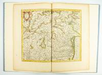
1985ST20505-12Fullerton California: Stone & Lorson 1985. ONE OF 89 COPIES in quarter vellum of a total edition of 115. 490 x 325 mm. 19 1/4 x 13". viii 23 1 pp. 1 leaf. <br/> Publisher's quarter vellum over gray paper boards covers with device in gilt smooth spine lettered in gilt. In just slightly chafed black buckram slipcase. WITH A MAP FROM THE ORIGINAL 1619 ATLAS bound in with period hand coloring. Map 293 "Tarvisina Marchia Et Tirolis Comitatus". De Hamel & Silver "Disbound and Dispersed" 186. One corner a bit bumped otherwise the main volume flawless; the map edges a bit browned and just slightly frayed a few light spots but still excellent with good color and strong general appeal.<br/> <br/> This attractive oversized production includes an original map of an important region of northeastern Italy taken from the 1619 edition of the Mercator-Hondius atlas. A pioneer in commercial cartography and a founder of the Netherlandish school of cartography and geography Mercator 1512-94 produced maps used around the world that were informed by his brilliant "Mercator Projection" which allowed the round Earth to be accurately depicted on a flat map. Near the end of his life he began work on an ambitious cosmography that would contain an account of the creation of the world a description of the universe descriptions of the countries and oceans of the world genealogies and political histories of the several countries and a chronology of the cosmos. Only the account of creation the chronology and maps of the known regions of the world came to fruition. Mercator having died before the work came to press it was completed by his heirs and published in 1595 with 107 maps. Leading Amsterdam map publisher Jodocus Hondius 1563-1612 acquired the plates in 1604 and issued the first Mercator-Hondius "Atlas" in 1606 with 37 maps he had engraved added to the original 107. Teacher and Hondius' brother-in-law Pieter van den Berg wrote the introduction and the descriptive text that appears on the versos of the maps. A 1611 edition increased the number of maps to 150 and another six were added in 1619. The hand-colored map included in our copy depicts the South Tyrol and Veneto regions including Lake Garda Verona Padua and Venice. It is accompanied with an essay by Norman J. W. Thrower 1919-2020 UCLA geography professor and cartographer describing the historical background of the atlas. Joel Silver in "Disbound and Dispersed" tells us that "the physical production of this leaf book is superb from the design by Vance Gerry to the presswork of Patrick Reagh.". Stone & Lorson unknown
185275869Oregon City: Surveyor General's Office 1852. First edition. 15 3/4 x 26 inches. Printed in various shades of green blue red and black. Some light toning long fold-lines else a very good map of a vastly underpopulated Territory.The map above shows the surveyed portion of the Oregon Territory as of October 21 1852. It was prepared by John B. Preston first surveyor general of Oregon."With the establishment of the Oregon Territory on August 14 1848 all grants of claims of land in the territory were nullified. It was not until the passage of the Donation Land Act on September 27 1850 that new provisions were made for acquiring unclaimed land to be based upon government surveys. John B. Preston was appointed first surveyor general of Oregon where he arrived on April 20 1851. On June 7 1851 Preston drove the “starting stake†for the base surveys of the territory at what is today known as the Willamette Stone. The east-west Willamette Base Line and the north-south Willamette Meridian still define surveying and legal land descriptions in Oregon and Washington state.Preston and his crew were able to carry out their surveying and mapping to the extent depicted on this map in just over one year. Each square of the grid termed a section is one mile on each side and includes 640 acres of land—the maximum acreage allowed for a married couple making a claim under the Donation Land Act; a single man could claim up to 320 acres. Thirty-six sections make up a township.The surveyors took careful note of waterways hills prairies and roads. Some recognizable places are already viable communities such as Salem and Lafayette; other communities of the period—Champoeg Fairfield Cincinnati for example—have vanished as meaningful places. All three of those were river landings that were affected by floods channel changes and the eventual disappearance of river transportation. Notably absent from the map is Mission Bottom or Mission Landing the by-then-abandoned site of the Methodist mission of the 1830s and St. Paul on French Prairie. The roads that are mapped include ancient routes such as the California-Oregon Trail which had sections that paralleled both sides of the valley as well as newer roads established in recent years. The roads converging on Salem from the outlying farming districts for instance reflect its recent importance as a mill town powered by the waters of Mill Creek Surveyor General's Office unknown
197240342Chicago: Rand McNally & Company 1972. Collection of 14 company Christmas cards one each for the years 1972 through 1985 plus year three undated. Near fine overall. Printed in modest quantities and intended for distribution only to top vendors suppliers and distributors this delightful collection ranges in size from narrow 4to to wide 8vo some bigger and some smaller. All are handsomely and colorfully printed on fine heavy stock. Most are at least three panels and many are more and all open up to reveal superb reproductions of famed antiquarian maps from around the world. Some open up to small poster size and two contain separate folded maps that open to full poster size. Several have been signed by various company executives. Most unusual and attractive -- a collection that would be near-impossible to duplicate. Rand McNally & Company unknown
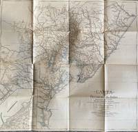
1928List1922Bahia 1928. Folded map. Fine condition. Fine. Teodoro Sampaio was an Afro-Brazilian cartographer engineer politician and historian who was very active in Brazil particularly in Bahia during the late nineteenth and early twentieth century. Offered here is Sampaio’s map of Bahia from 1928 which updates a map he produced in 1899 of the same region with updates of the settlement of the region including a detailed inset of the city of BBahio de Todos os Santos on the lower right corner. At the time of the map’s production Sampaio was an authority on Brazilian geography being a member of the Instituto Geográfico e Histórico da Bahia serving as president in 1922 and a member of the Instituto Histórico e Geográfico Brasileiro and the Instituto Geográfico e Histórico da Bahia and publishing several books on Brazilian geography. The period between 1899 when the first edition of this map was published and 1928 saw the development of rubber plantations in Bahia and the map provides detail on the region’s roads and population centers. We find no publicly held examples of this edition and one copy of the 1899 edition at Princeton though we do find a reference to this edition at the Brazilian National Archives. unknown
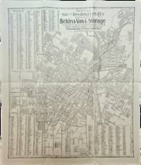
1910List3117Los Angeles California: Bekins Van & Storage 1910. Map measuring 15 ¼ x 13 ¼ inches. Folded with some wrinkling; Near Fine. A map of Los Angeles between Aldama Street South Indiana Street Slauson Ave and Arlington Street published by Bekins Van & Storage. The map is undated but based on the city’s population listed on the map—a mere 125000—it was created some time between 1900 when the population was about 103000 and 1910 when it had ballooned to over 319000. Bekins Van & Storage unknown
190827846Various places.: Various publishers 1908 to 1923. 10 volumes bound together in one volume. First Editions and all but one are inscribed by the author. Illustrated with cartographic cover art re-impressions of important works cartographic decorations and a number of maps including a number that are folding. 8vo the original printed wraps to each pamphlet are present and all are bound into the one cloth covered volume brown morocco label gilt. Each pamphlet can be considered fine and in exemplary condition some evidence of use and a bit of age to the cloth covers. A fine collection. A FINE COLLECTION OF INSCRIBED FIRST EDITIONS. Ranging from the cartography of the provinces of France 1594 to British and Irish Itineraries and Road-Books English Counties Welsh a pamphlet on the Evolution of the Maps of the Bristish Isles on the great engraver and mapmaker John Cary and two on France cartography and routes from the mid-1500's until the middle of the 19th century. ALL BOOKS ARE INSCRIBED BY THE AUTHOR. Various publishers paperback
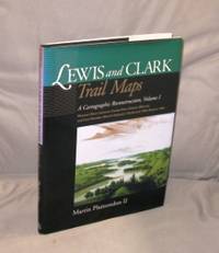
200027054<p>Pullman:: Washington State University Press 2000. First Printing of the First US Edition. A Fine tight copy in a Fine dust jacket. A Vancouver Washington cartographer based his unique maps on Clark's untapped survey notes excerpted on the maps. Taking into account nearly 200 years of changes to key geographic features of the 7000 miles that the Corps of Discovery covered Plamondon's 153 full-page maps precisely depicting the 1804-6 roundtrip permit comparison of the geography past and present from the Missouri River from Illinois to Fort Mandan in North Dakota. The book includes an introductory essay with notes on expedition mapping methods. Indexed by outbound and return camps dates locations and events and place names.</p> Washington State University Press, hardcover
48555National Library of Australa. Canberra. 2014 Reprint. Large 4to 256pp. Printed card covers with flaps; excellent condition. Covers the journey of Australia's exploration with over 100 maps atlases globes and scientific instruments written to accompany an exhibition in 2013-2014. National Library of Australa. Canberra. 2014 (Reprint) unknown
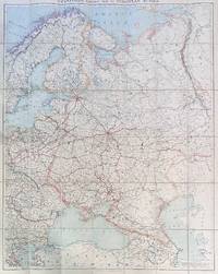
192284192London: Edward Stanford Ltd 1922. Large folding map. Lithograph in colors on uncoated paper dissected and laid down on linen as issued; overall dimensions 123cm x 97cm ca 48" x 38" folding to 20cm x 14cm 8" x 5-1/2"; card covers with publisher's slipcase of maroon cloth with printed paper title label. A bright clean well-preserved example Very Good to Near Fine. In the original slipcase cloth lightly rubbed at corners and a bit of soil to title label still easily Very Good.<br /> <br /> An impressive Revolutionary-era map of Russia in 42 sections scaled 1 inch to 50 miles. This revision dated March 1922 would appear to be the fourth and final edition of the map - it was preceded by editions in 1915 1917 and 1919. By December 1922 the Soviet Union would be formally established with Azerbaijan Georgia Belarus and Armenia which all appear here as independent states being absorbed into the Union of Soviet Socialist Republics. Edward Stanford, Ltd unknown
198283789Baltimore: Johns Hopkins University Press 1982. First Edition. First printing. Oblong quarto 11" x 14-1/2"; cloth-backed boards hardcover in pictorial dustjacket; 128pp; illus. Mild soil to board edges else tight and clean; internally free of markings or soil; Very Good or better in the original dustwrapper. Johns Hopkins University Press unknown
195282192Minneapolis:: Printed for the Author by the Voyageur Press 1952. First edition; one of Sixty Copies Printed. Two looseleaf albums . Generally fine. 8vo. A comprehensive album for collecting postage stamps featuring maps from around the world with spaces to affix specimens and information about each stamp. In this example there are approximately 150 affixed stamps and 133 blank spaces for stamps. Printed for the Author by the Voyageur Press, unknown
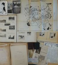
1950List2425Europe and California 1950. Includes two small diaries from 1901 and 1917 with sporadic entries a large photo album measuring 14 x 11 with appx. 400 small photographs from 1906-1909 attached to album pages most measuring 3 x 2 as well as a few larger format images laid in. With 100 plus pages of typed pages including retained correspondence story ideas and various other manuscripts. With eleven maps produced for his “Of Men and Maps†series including five copies of a large map entitled “Whither Russia†in varied states and in large sizes up to 30 by 36 inches and a handful of small ephemeral pieces. Generally near fine condition with the exception of the album which is missing its rear board and has some pages loose and torn. Very Good. J.M. de Beaufort a war correspondent for the London Daily Telegraph and New York American during World War I recounted his wartime adventures in the 1917 book "Behind the German Veil: A Record of a Journalistic War Pilgrimage." Originally arriving in Chicago in 1909 he married a steel magnate's daughter and pursued a career in show business. However by 1912 he had gone through a divorce and transitioned to newspaper work earning the moniker of the "Dude Reporter." Originally born in the Netherlands as Jacques Albert Uilenbroek he was thought to be a deserter. He spent the latter part of his life in the United States apparently jailed in San Francisco for a stint in the 1920s and eventually settled in Los Angeles. <br /> Offered here is an interesting smattering of material from the life of the mysterious De Beaufort which bookends his most unusual career and life with a large visual photographic record of his life in Europe as a young man and over a hundred pages of manuscript material from late in his life with a highlight being several maps in draft form for an apparently unpublished project called “Of Men and Maps.†As a group the material shows the work of an ex-con artist and war correspondent trying to regain his form while living in Los Angeles. He was still writing as a “Special Correspondent†at this point though the title seems to have been fully honorary. Also included are two small pocket journals with sporadic notations from his life in Europe in 1900 and in 1917. In its entirety the group gives an interesting visual and manuscript record of a literary fraudulent and imaginative transatlantic life and intellect. <br /> The cartographic highlight of the group is several iterations of a large map called “Whither Russia†in varied forms which show an interesting interpretation of the sphere of influence of the USSR and its growth from 1939 to 1946. Also included are two drafts of a map of Operation Market-Garden in the Netherlands in 1944 an unidentifed tactical map of a military battlefield a map called “Middle East Jackpot†showing the division of territory between the Allied and Axis powers a map called “Dawn’s Early Light some reproduced small format maps from the De Beaufort’s and a small map called “Gifts from Yalta.†De Beaufort was working on these maps for a column called “Of Men Maps and Memories†that was published in the East Los Angeles Tribune. He also sent the columns out in newsletter form from his address at 1635 N. Ogden Drive in Los Angeles. <br /> The collection of manuscripts drafts and retained correspondence tackle a range of subjects perhaps most interestingly those detailing De Beaufort’s creative process - drafts of stories lists of ideas for stories and letters. His over the top style is on display in a lot of the writings some of which are of unknown origin and purpose. The documents contain correspondence between De Beaufort and Edwin Pauley the oil man and presidential advisor. In one untitled essay he asks himself the question “What has been your most thrilling experience†and his reply is “ Silly questions. Who or at least what newspaperman of some 25 turbulent years standing - and falling - could answer such a question. A reporter’s life has a thousand thrills. There was that rainy day in Marcy 1915 in the fortress of Loetzen when I stood face to face with Hindenburg. Hm yes that was quite a thrill…†De Beaufort was entrenched in the Los Angeles journalistic scene at this point and the documents show the degree to which he relied on his former glories to attempt various career revitalizations endeavors. <br /> The album of photographs from 1906-1909 over 400 in total give a visual record of the young Uilenbroek’s life in Europe. The star of the collection is his bulldog Bob who travels throughout Europe with him and eventually comes to America by 1907. Mary who we presume to be his future wife is featured heavily in the images. It is unclear whether he was working at this point the images show affluent young people and their dog in varied cities and are purely of a personal nature. Other photographs laid in are relics from his war correspondent period. The loose photographs and ephemera are a mix of portraits from different periods from his life including two pictures of Sydney Turing Barlow Lawson one signed by his widow. The journals are sporadically filled and hard to decipher though one legible passage says “drinking all day.â€<br /> Overall the group gives evidence of this intriguing life and is the only extant group of material relating to Beaufort to our knowledge with the exception of a single journal from his time in Belgium during WWI that was sold at Bonhams and is still available in the trade as of this writing. unknown
9818English; circa 1790. 8vo 6 pp. Two bifoliums sewn together. On laid paper with Britannia watermark. Text clear and complete. Neatly written out at approximately 38 lines to the page. On aged paper with slight damage to the first bifolium the leaves of which are detaching at the spine. Some of the items have been lightly scored through in pencil but are still legible. The inclusion of such items as '149 Blank Silk Paper for copying Maps' would appear to indicate that the document is an inventory for probate of a cartographer's stock. Last two entries read '165 Blank Sheets of Paper for copying Maps. A Bond relating to the Honble. Thomas Howe. Prints to copy from. Several Plans of the River and Sound of Dawfoskee in South Carolina survey'd by Captn. Gascoigne. 166 Draught of Falklands Islands. Map of the Province of New York. La Cours de la Meuse. The Circle of the Inferior Rhine. Plans of Port Royal in South Carolina. Les Duchés de Lorraine & De Bar. Plans of the River & Sound of Dawfoskee in South Carolina.' The first two entries list items by John Hamilton Moore a Scottish cartographer who according to his obituary in the Gentleman's Magazine was 'late teacher of Navigation on Tower-Hill author of Moore's Navigation Seaman's Daily Assistant the Monitor &c.' English; circa 1790. unknown
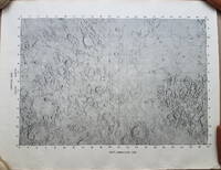
19693792<p>A very uncommon map of the Sea of Tranquility area that would be the site of the first moon landing in 1969. According to a description of a related larger-scale map in a 2020 Bonham's auction "NASA mission planners created this internal Manned Spacecraft Center chart a few months before the flight in 1969."</p><p>The map encompasses the area from 14 degrees South to 14 degrees North Latitude and from 0 degrees to 42 degrees East Longitude. The coordinates of the Eagle's landing site were 0.675 degrees Latitude North and 23.47 degrees Longitude East – very near the center of the mapped area.</p><p>The map is numbered "MSC – 6238 – 69" in the lower right margin. As it was meant for internal use only the map appears to be significantly less common than the LAC Lunar Chart series and the USGS geologic chart series. We were unable to locate an online reference to the map on the Lunar and Planetary Institute website.</p><p><strong>Condition: </strong>Rolled never folded. Some crinkling in the lower margin. Tear at extreme lower right corner with map number has been closed with archival tape on the reverse. Good.</p><p>ICN 7706.1.</p> NASA Manned Spacecraft Center
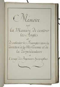
1750ABC_46337France 1750. Folio. Sewn in quires and stored loose in a portfolio covered with grey paper grey cloth ties paper label on the front board. Manuscript in French on thick paper written in a neat 18th-century cursive hand. With 5 manuscript plates showing 14 geometrical figures. 2 blank 1 1 blank 61 3 blank pp. Cartographic manuscript intended to teach engineer-geographers how to in the authors words centrer les angles bisect angles and to triangulate to calculate locations on a map as precisely as possible. The author remains unidentified but probably taught cartography. He the field was hardly open to women gives many examples to explain his methods all richly illustrated in the manuscripts geometric figures and with tables. He quotes the methods of the important French mathematician physician and hydrographer Pierre Bouguer 1698-1758 who was also geometer at the Académie des Sciences in Paris for the means to centrer les angles though we have not found Bouguer using that phrase and those of the French astronomer and cartographer César-François Cassini de Thury 1714-1784 also member of the Académie for triangulation. Altogether the work is a practical guideline for engineer-geographers in which the author not only describes methods for bisecting angles and for triangulation but for example also how to use his own tables on pp. 29-44. A highly interesting cartographic manuscript with a strong geometrical focus quoting two of the foremost French cartographers of the 18th century.With the library stamp of the Danish national library Det Kongelige Bibliothek in Copenhagen. Portfolio a little worn dust-soiled and somewhat stained but the leaves are still in good condition.l Katalog der Bibliothek und Kartensammlung der Königlichen Allgemeinen Kriegsschule 1851 56. hardcover
193560001New York: John Day Reynal & Hitchcock 1935. 4to. xiv 351 1 pp. With 56 maps most full-page numerous text illustrations. Blue publisher’s cloth silver lettering front cover & spine minor shelfwear light rubbing at head & foot of spine corners w/ d.j. striking Art Deco cover art of ships voyaging minor creasing edgewear couple closed tears on back cover wear to corners still NF/VG- copy inscribed by author on half-title. First edition inscribed of this unashamedly Eurocentric voyages and exploration history detailing “all the great adventurers by land and sea from Hannu 2750 B.C. to Piccard 1935.†The specially prepared maps specifically show the ground and oceans covered by each explorer with the contemporary “Known World†starkly defined. The maps and histories sequentially “unroll†from the very small area around the Mediterranean to the World. Outhwaite 1892-1979 was an anthropologist who worked on American race relations at the Laura Spelman Rockefeller Memorial from 1923-1028 worked for the Rockefeller Foundation through the 1930’s and organized “Outhwaite Exhibits†for museums World’s Fairs and window displays. He also was an adventurer who sailed 14000 miles on the Atlantic Ocean from 1929-1930 onboard the yacht “Kinkajou†visiting Mt. Pelee Martinique. John Day, Reynal & Hitchcock, hardcover
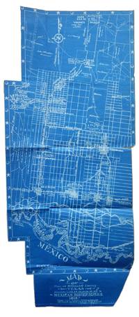
1917List2530VP 1917. Scrapbook measuring 15 ½ x 10 ½ inches. With forty leaves most with newspaper clippings and varied ephemera attached. Boards detached contents generally fine. Laid in is a blueprint map entitled Map of Part of Hidalgo County Texas Showing Line of March in my Mexican Border Service 1916. Made from Survey Notes taken on the march by Corp. C.A. Rice 74 Inf. N.G.U.S. Buffalo N.Y. Armory. Map measuring 33 ½ x 14 ¾ inches irregularly shaped and apparently complete. Very Good. A scrapbook documenting the military service of 1st Sergeant Samuel Gaffney of the 74th National Guard New York in the Mexican Border Service. Gaffney documents the campaign in great detail through printed matter - with each of the forty leaves containing material affixed including panoramic photographs advertisements from local businesses along the routes programs from entertainment offered to the troops military orders and official correspondence and many affixed newspaper articles and photographs. <br /> <br /> The scrapbook is most notable for the inclusion of an unrecorded map by Charles A. Rice the Buffalo native who would eventually map the campaign in larger fashion in a map entitled Map Showing Lines and March and Border Patrols in my Mexican Border Service 1916-1917. The map here just showing the route through Hidalgo County is unrecorded. The larger map - which was produced as souvenirs for the other members of the 74th - is quite scarce as well with five copies known to exist per OCLC with two different numbers. This blueprint map which appears to be complete cartographically and missing only the ornamental border on one portion shows the route taken early in the campaign in 1916. The Buffalo native Rice 1885-1931 who would eventually settle in Texas after the conflict also wrote a history of the 74th during the campaign. Rice published the maps and memoir himself. The map shows the route in great detail showing the location of wells farms roads and identifying landowners. Water quality and abundance is understandably a common theme in Rice’s notes. Some notes show the location of bandits smugglers and the like. We find no other examples of blueprint maps by Rice. <br /> <br /> Other highlights from the scrapbook include seven panoramic photographs of the 74th encamped at Pharr; a broadside advertisement for the shop of Agustin Acevedo in Pharr listing prices of goods; a handbill advertising the 74th’s Minstrels and Great Entertainment show on September 16 1916; an advertisement for a production entitled Glorious Liberty at the National Theatre in Pharr; two circulars instructing troop movement issued by Headquarters Brownsville District; several postcards with songs about the campaign; several snapshots; a mounted albumen photograph of troops at rest with the notation “Corp Frederick Paid†verso; a typed poem entitled “Home Again†and a notebook page describing his activities from January 1917 onward; and a thanksgiving menu for 1916 for the holiday spent at Pharr. The remainder of the scrapbook is composed of affixed newspaper clippings which provide extensive information on the 74th collected in a single volume. <br /> <br /> Overall a significant scrapbook with much information to glean for students of the 74th’s activities with the map providing a unique cartographic reference of the early days of the campaign. unknown
1842Map 806Edinburgh: A&C Black 1842. No Binding. Fine/uncoloured. World map with Australia at the middle 140 degrees. Beautiful steel engraving from Encyclopaedia Britanica Seventh edition dated 1842. Plate CCLXIII. Fine example with no wear. Australia is named 'Australia and New Holland'. 410x260mm. Relief is shown by hachures. Engraved by S. Hall Bury Strt. Bloomsbury. Published by A. & C. Black. Engd. by G. Aikman Edinr. <br/> <br/> A&C Black unknown
1974012035New York: Macmillan 1974. 8.75" wide by 11" tall. Previous owner's blindstamp. Otherwise a bright clean square tight unmarked copy. Not a book club edition. Not price clipped 15.00. No remainder mark. Illustrated with photos drawings and 65 maps. From the Dust Jacket: "Here is the most extensive historical atlas of religion ever published." Essays photos and maps illuminate the origins and distribution of religions; their movement; locations of sacred cities sites and temples; growth; the relation of one religion with another; places associated with leading rabbis theologians and writers; Jewish emigration; Muslim rule; religious use of narcotics; Chinese religions; 18th century Christianity; Islamic schools of law sects and reform movements; spread of Orthodox law schools; etc. Appendix 38 pages long gives detailed chronologies of the religions of the past. Subject Index. Name Index. First Printing of the First Edition. Oversize Hardcover. Near Fine condition/VG DJ tiny closed tears. xviii 346pp . Macmillan Hardcover
1780Map724Bassano Del Grappa: Giovanni Remondini 1780. 1st ediiton . No Binding. Fine. Folio. ND c1780. 36 x 50cms. Original hand-colour. Dusty condition. Very rare town view of Marseille engraved by the Venitian Francesco Ambrosi 1713-173. A numbered key in French to the lower margin of places of interest in the city 1-19. A dark impression printed on heavy paper with a strong plate mark and clear chain lines but no watermarks. <br/> <br/> Giovanni Remondini unknown
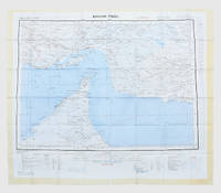
1963153757London: Geographical Section General Staff 1963. Scarce charts of Bahrain and the Straits of Hormuz A rare and historically interesting pair of adjacent maps of the Arabian Gulf covering six degrees of longitude each the geographical area encompassing the whole of Qatar Bahrain and part of what was to become the United Arab Emirates Al-Hofuf being the major city in the Al-Ahsa Oasis Eastern Province Saudi Arabia; sixth and fifth editions respectively. Maps of the period issued by the GSGS Geographical Section General Staff use a 7-colour tint scale to distinguish altitude and a glossary that highlights towns of significance and other standout features which provided steady references for army personnel to aid navigation in the challenging conditions of the region. The Bander Abbas map was compiled by the US Army Map Service Corps of Engineers from a number of sources including USAF Aeronautical Approach Charts of 1951-55 and the US Geological Survey of the Arabian Peninsula 1958. The Hofuf chart is based inter alia on 512 Field Survey Royal Engineers charts 1942-4. WorldCat lists just three individual copies for Hofuf NG39 SUNY at Buffalo University of Notre Dame and Eastern Illinois University alongside four copies of Bandar Abbas NG40 University of Exeter University of Notre Dame Eastern Illinois University and University of South Florida. It should be noted that major national institutions - BL for example - will have holdings of these maps within the complete GSGS series. Most copies would be discarded on supersession making these an important record of cartographic progress in the region. Two two-colour printed maps 1:1000000 scale 690 x 610 & 750 x 610 mm respectively. Ex- libris stamp of Arizona State Library both stamped "superseded" in blank margin and "withdrawn" on verso some pencilled marginalia; both in excellent condition. unknown
1957182684London: War Office; Printed for D. Survey WO and AM by Balding and Mansell Ltd 1957. A bright example of this detailed Gulf map Classified "restricted" and issued for military use at the time of the Jebel Akhdar War this double-sided sheet shows much of the modern-day UAE extending northwards from the latitude of Abu Dhabi and the Buraimi Oasis as well as the eastern Arabian Peninsula from the Trucial Coast to Jubail. As with other contemporary GSGS maps the sheet covers six degrees of longitude and highlights towns of significance and other standout features for example oil pipelines and wells water systems and roads and railways. Rayon sheet 630 x 710 mm printed both sides in colour folded as issued. A fine example. unknown
1956153759London: Geographical Section General Staff 1956 & 1957. Scarce maps of Oman and south-east Arabia dating to the Jebel Akhdar War A pair of decidedly uncommon and impressively sized regional maps both second editions Muscat-Musira following the first of 1945 S. E. Arabia first published in 1956. The Muscat-Masira map drawn up by D Survey of the Ministry of Defence reaches as far north as Khaburah Oman on the coast south beyond Masirah Island and westward reaching beyond Lahus and Hadhi. It is based on several mappings including Bertram Thomas's map of Rub' al Khali the "Empty Quarter" 1931 the sand desert covering most of the southern third of the Arabian Peninsula Samuel Barrett Miles 1910 map of Oman and Captain F. F. Hunter's map of Arabia 1935 revision. The aeronautical chart goes into greater detail reaching beyond Sur in the North South to Masirah Island and Manadhif and West to Uruq ash Shaybah UAE; this was drawn up by No. 1 SPC.RE i.e. Survey Production Centre Royal Engineers and is based largely on the USAF Aeronautical Approach Charts 1956 and World Aeronautical Chart 563 1951. During the mid to late-1950s Britain was involved in a number of disputes in Oman perhaps the most serious involving the Imam Ghalib al-Hinai and his brother Talib bin Ali who led the Imamate's revolt against Sultan Said bin Taimur which resulted in the Jebel Akhdar or Oman War 1954-1959. In this the RAF played a leading role not least because aircraft could at the same time expedite oil exploration operations in the interior of Oman. Pembrokes light transport aircraft and heavier Avro Ansons from 1417 Communication Flight RAF carried out reconnaissance "and other tasks during this operation against the Imamate and were the first aircraft ever to land at Nizwa marked "Nazwa" on the chart on a roughly cleared strip which proved extremely hazardous for the pilots but which was later transformed into a passable airfield" Lee p. 22. The present chart has two pencilled lines radiating from Masira airfield one of which passes through Nizwa near which is marked the "approx. position" of an airstrip. The chart bear the proviso that they should "not be taken as an authority on names" and that "the alignment of all tracks is approximate". Users were also directed to update information and highlight errors which were to be directly sent to the Director of the Military Survey in the War Office. There are noticeable graphical variations between the chart and map as fitting their usage. Before the Second World War pilots flew using landmarks - such as train tracks or roads - as pointers which meant that they relied on perfect weather conditions. However technological advances in aviation alongside the use of radio for more accurate navigation meant that to a degree pilots could work in more challenging conditions. This meant that maps with their focus on terrain and details relevant from the perspective of ground troops would become irrelevant when observed from a plane's altitude. Therefore a number of countries started to produce charts highlighting key information by reducing the contour structure and focusing on key landmarks necessary for aviators. The Muscat-Masira map uses a five-colour tint scale to distinguish altitude includes a glossary and key the latter identifying towns given four categories of importance significant ruins geographical features such as mountains hills marshes saddles and passes rivers water holes and man-made features such as railways roads tracks telegraph lines pipelines and pumping stations mosques and temples; tribal and regional names are also given. However reflecting the simplification required by pilots the S. E. Arabia chart only uses fives tones to highlight land mountains paths and the sea. These maps intended for use in the field would have had a high rate of attrition; WorldCat locates just a handful of copies of the Muscat-Masira map whilst S.E. Arabia 4802 is well represented institutionally but decidedly uncommon on the market. Two colour printed maps the first 1: 1000000 scale 860 x 640 mm the second 1:500000 scale 1100 x 825 mm. Both with creases from old folds and some minor marginal splits and spots the second with pencil lines marking a flight route from Masira Island and a notation in the margin; both remain very good. Sir David Lee The RAF in the Mediterranean and Middle East 1945-71 1978. unknown
1839W043Eton: E. Williams 1839. New and improved edition . Hardback. Fair. large 8vo. xviii 847 i adpp. Folding frontis. plate of the Solar system.; astronomical folding plate; folding plate of Athens. Lacks Rome and Syracuse plates. Title-page and frontis. loose and binding worn. READING/ REFERENCE COPY ONLY. <br/> <br/> E. Williams hardcover