333 résultats
2005b1150<p>University of California Press 2005. XIV150 pages. New Hardcover. NearFine DJ. Oblong. 12.0"x9.25"x1.0". be6</p> University of California Press hardcover
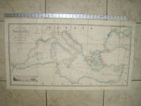
1853020822London: James Wyld Geographer to Her Majesty Charing Cross East 1853. Very Good condition only a little light soil SEE PHOTOS. This huge detailed map of the Mediterranean measures 99.5cm by 54cm when unfolded. The image itself is 93.5cm by 47.5cm. There is a finely engraved view of the entrance of Gibraltar Bay in the lower left corner. The map is a linen-backed copper engraving with original hand coloring. The map has handsome marbled paper endsheets and when folded-up measures 18cm by 12.5cm. SEE PHOTOS. Published by James Wyld Geographer to Her Majesty Charing Cross East London. A New General Atlas of Modern Geography Consisting of a Complete Collection of Maps of the Four Quarters of the Globe; Delineating their Physical Features and Coloured to Show the Limits of Their Respective States 1853. First Edition. Linen-backed hand-colored map. Very Good condition. 99.5cm by 54cm when unfolded. Great Packaging Fast Shipping. James Wyld, Geographer to Her Majesty, Charing Cross East Paperback
1999017926Mansfield Centre Connecticut: Martino Publishing 1999. Brand New HARDCOVER in perfect condition. STILL SEALED in the publisher's clear plastic SHRINKWRAP. NO rubbing. NO fading. Bright clean square and tight. Sharp corners. NO owner's name or bookplate. NOT a remainder. Fresh and crisp -- obviously never read. 1999 reprint of the 1944 original. A standard work. Illustrated with 22 FOLD-OUT maps. "An excellent study of those maps from Ptolemy to 1798 important in the development of the cartography of the Pacific area with facsimiles of 22 of the 104 maps described." -- Ristow 393 in GUIDE TO THE HISTORY OF CARTOGRAPHY. Hodgkiss/Tatham 137 in KEYGUIDE TO INFORMATION SOURCES IN CARTOGRAPHY. Bound in the original gilt-stamped brown cloth. Because this edition is bound in sturdy cloth it is much better suited to repeated use than the paper binding of the original edition. 1999 reprint of the 1944 original. Hardcover. New/in publisher's shrinkwrap. 8vo. vi pp. 87-268 22 folding plates. Great Packaging Fast Shipping. Martino Publishing Hardcover
1880S218London: Hakluyt Society 1880. 1st Edition . No Binding. Vg. Folio. A single sheet folding map based on the map in Richard Hakluyt's ' Principall Navigations Voyages and Discoveries of the English Nation' associated with Edward Wright map-maker. The Wright Molyneux map. Called by Shakespeare in Twelth Night ' the new map with augmentation of the Indies'. To illustrate the Voyages of John Davies'. Map only lacks the 16pp booklet. 29 x 21 inches. One small repair. A trifle foxed. PLEASE EMAIL FOR PHOTO. Produced by THE TYPOGRAPHICAL PRINTING COMPANY. <br/> <br/> Hakluyt Society unknown
1985024925Toms River New Jersey: Ocean County Historical Society 1985. Near Fine condition. NO cover wear or fraying. Hinges inner and outer are PERFECT. Brief gift note on endpaper. 1985. Reprint of the 1878 Woolman & Rose Philadelphia original. Limited to 700 numbered copies this being #121. The hand inked number "121" has bled through to adjoining pages as usual. All other pages are clean and unmarked. Profusely illustrated with more than 70 maps and prints of New Jersey Shore towns and architectural landmarks in Cape May Atlantic Ocean and Monmouth Counties. Many fold out maps. Tipped-in after the title page is a HUGE folding map THE STATE OF NEW JERSEY 1877 from US Coast Guard Survey Records. It measures a whopping 18" wide by 31.5" tall when unfolded and is imprinted with the populations of major cities in each NJ county from the 1875 Census. Bound in the original maroon cloth stamped in bright gold. Oversize Hardcover. 12" wide by 14.25" tall. This very large extremely heavy book will require extra postage for Priority and International shipments but only the standard charge for media mail. Reprint Limited to 700 numbered. Oversize Hardcover. Near Fine condition/No dust jacket as issued. Illus. by Rose T. F. . 374pp. Great Packaging Fast Shipping. Ocean County Historical Society Hardcover
1953003010New York: American Society of Civil Engineers 1953. Fine condition. Bright clean square and tight. Sharp corners. Gilt on cover is still bright and shiny. No owner's name or bookplate. Pages are fresh and crisp. No underlining. No highlighting. No margin notes. Illustrations throughout. Author Index. Subject Index. Includes: A HUNDRED YEARS OF AMERICAN CIVIL ENGINEERING 1852-1952 by J. K. Finch pp. 28-96; AN ENGINEERING CENTURY IN CALIFORNIA by Walter L. Huber pp. 97-111; SURVEYING AND MAPPING IN CANADA 1852-1952 by F. H. Peters pp. 857- 871; WATERWAY GROWTH IN THE UNITED STATES by William L. Hartley pp. 976-1041; HISTORY AND FUTURE OF FLOOD CONTROL by George R. Schneider pp. 1042- 1099; etc. There are also papers on Civil Engineering - History and Practice; Engineering Education; City Planning; Construction; Irrigation; Power Sanitary Engineering; Soil Mechanics; Structural; Surveying; Transportation; Waterways; Allied Interests Metals in the Economy; Synergism between Engineering and Petroleum; Iron and Steel Production 1851-1951. Bound in the original black cloth. . First Edition. Hardcover. Fine condition/No dust jacket. 8vo. xii 1330pp. American Society of Civil Engineers Hardcover
1823Map926London: Robt. Wilkinson 1823. 1st Edition . Hardback. Vg. Folio. 52 coloured plates - 45 maps 7 chrono-geological charts 7 maps double-page. Orignal boards and spine. Fine contents with hand-coloured maps thoughout. Rubbed and worn boards but a sound binding needing new paper covering pasted to the boards.The fine map plates are dated between 1800 and 1823 <br/> <br/> Robt. Wilkinson hardcover
1969018432New Haven Connecticut & London: Yale University Press 1969. SIGNED by co-author Christian Brun on the title page his signature only NOT personalized to anyone. Very Good condition. Mild crease to one corner of a few early leaves. NOT a library discard. NO owner's name or bookplate. NO underlining. NO highlighting. NO margin notes. 1969. First Edition. Expertly described here are all separately published maps and charts in America until 1800 as well as those in books pamphlets almanacs magazines atlases and gazetteers. Illustrated with 18 map reproductions frontispiece in color; 1 folding. Bibliography. Index. Bound in the original gilt-stamped blue cloth. 7.75" wide by 10.25" tall. Signed by Christian F. Brun. First Edition. Hardcover. Very Good condition/No jacket. xxii 215pp. 18 plates . Great Packaging Fast Shipping. Yale University Press Hardcover
MASTER361054IParsippany NJ.: Maurizio Martino. VG In Green Cloth With Gilt Lettering. 5 Books In 6 Volumes Complete. Oversize. All Pages Clean Bindings Tight. Pub. 1995 Reprint Of 1957 I.H.C. Edition. Pages: 1378. Undated. Reprint. Hardcover. Maurizio Martino hardcover
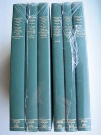
1995018762Storrs-Mansfield CT / Parsippany New Jersey: Martino Fine Books / About Books 1995. 6 separate volumes complete 5 volumes bound in 6 books WITH LARGE FOLD-OUT MAPS -- just like the first edition. SEE PHOTOS. Each of the 6 books in this 1995 large format edition measures 9.25" wide by 12.25" tall. This is NOT the later smaller format 3-volume reprint in which the maps are reduced in size. Unlike later reduced-size editions the maps in this 1995 six-volume edition measure as large as 21" by 33" when unfolded. SEE PHOTOS. As original co-publisher we are pleased to offer the few remaining sets of the 1995 large-format 6-volume edition recently rediscovered in our warehouse. They are BRAND NEW in perfect condition. STILL SEALED in the publisher's clear plastic SHRINKWRAP and the PUBLISHER'S CARDBOARD SHIPPING BOX. NO rubbing. NO fading. Bright clean square and tight. NO owner's name or bookplate. NOT a remainder. Fresh and crisp -- obviously never read. No date but 1995 First Martino/About Books printing "strictly limited to 350". Reprint of the original 1957-1963 six separate volumes: xiv 264; xiii 281; xiii 349; xiii 260; xix 222; iv 223-487pp. MAPPING THE TRANSMISSISSIPPI WEST is a monumental and exceptionally thorough work that is unlikely to be surpassed. The set is illustrated with a total of 376 maps including several that fold out. In this standard carto-bibliography are full descriptions of some 1300 maps from the year 1540 to about 1880. Wheat discusses each map showing the origins of its date and weighing its significance and accuracy. He also identifies the atlases and books in which the maps can be found. Norman Thrower: "Scholars and others who are interested in the American west have found Wheat's work indispensable." Ristow 382: "A comprehensive cartobibliography with many fine reproductions." The 6 volumes are uniformly bound in the original gilt-stamped green cloth. SEE PHOTOS. Oversize Hardcover. All 6 volumes measure 9.25" wide by 12.25" tall. This heavy set will require extra postage for Priority and International shipments. But for media mail you pay only our standard charge for 1 volume and we ship the other 5 volumes at no extra cost. First Martino/About Books printing. Oversize Hardcover. New/in publisher's shrinkwrap. Illus. by We ship all 6 volumes for cost of 1. 6 volumes: 9.25" wide by 12.25" tall. Great Packaging Fast Shipping. Martino Fine Books / About Books Hardcover
1995018771Storrs-Mansfield CT / Parsippany New Jersey: Martino Fine Books / About Books 1995. Vol. 5 Part I only of 6 separate books. As original co-publisher we are pleased to offer the few remaining individual volumes from our 1995 large-format 6-volume edition that were recently rediscovered in our warehouse. Oversize Hardcover. 9.25" wide by 12.25" tall. This volume is NOT from the later smaller format 3-volume reprint in which the maps are reduced in size. Offered here is Vol. 5 Part I only Vol. 5 was issued in 2 separate books. It is BRAND NEW in perfect condition. NO rubbing. NO fading. Bright clean square and tight. NO owner's name or bookplate. NOT a remainder. Fresh and crisp -- obviously never read. No date but 1995 First Martino/About Books printing "strictly limited to 350". Vol. 5 Part I only. Reprint of the 1963 Institute of Historical Cartography original. MAPPING THE TRANSMISSISSIPPI WEST is a monumental and exceptionally thorough work that is unlikely to be surpassed. In this standard carto-bibliography are full descriptions for hundreds of important maps 1861-1867. Many are illustrated on full page plates 9.25" wide by 12.25" tall. Wheat discusses each map showing the origins of its date and weighing its significance and accuracy. He also identifies the atlases and books in which the maps can be found. Norman Thrower: "Scholars and others who are interested in the American west have found Wheat's work indispensable." Ristow 382: "A comprehensive cartobibliography with many fine reproductions." Bound in the original gilt-stamped green cloth. This large heavy book will require extra postage for Priority and International shipments but only the standard charge for media mail. First Martino/About Books printing. Oversize Hardcover. New/No jacket as issued. xix 222pp. Great Packaging Fast Shipping. Martino Fine Books / About Books Hardcover
1995018772Storrs-Mansfield CT / Parsippany New Jersey: Martino Fine Books / About Books 1995. Vol. 5 Part 2 only of 6 separate books. As original co-publisher we are pleased to offer the few remaining individual volumes from our 1995 large-format 6-volume edition that were recently rediscovered in our warehouse. Oversize Hardcover. 9.25" wide by 12.25" tall. This volume is NOT from the later smaller format 3-volume reprint in which the maps are reduced in size. Offered here is Vol. 5 Part 2 only Vol. 5 was issued in 2 separate books. It is BRAND NEW in perfect condition. NO rubbing. NO fading. Bright clean square and tight. NO owner's name or bookplate. NOT a remainder. Fresh and crisp -- obviously never read. No date but 1995 First Martino/About Books printing "strictly limited to 350". Vol. 5 Part 2 only. Reprint of the 1963 Institute of Historical Cartography original. MAPPING THE TRANSMISSISSIPPI WEST is a monumental and exceptionally thorough work that is unlikely to be surpassed. In this standard carto-bibliography are full descriptions for hundreds of important maps from 1868 to the 1870s. Many are illustrated on full page plates 9.25" wide by 12.25" tall. Wheat discusses each map showing the origins of its date and weighing its significance and accuracy. He also identifies the atlases and books in which the maps can be found. As this is the final volume it contains a comprehensive index for all 6 books in the set. Norman Thrower: "Scholars and others who are interested in the American west have found Wheat's work indispensable." Ristow 382: "A comprehensive cartobibliography with many fine reproductions." Bound in the original gilt-stamped green cloth. This large heavy book will require extra postage for Priority and International shipments but only the standard charge for media mail. . First Martino/About Books printing. Oversize Hardcover. New/No jacket as issued. iv pp. 223-487. Great Packaging Fast Shipping. Martino Fine Books / About Books Hardcover
1995018317Storrs-Mansfield Connecticut: Maurizio Martino Publisher 1995. 1995 Enlarged edition. BRAND NEW in perfect condition. NO rubbing. NO fading. Bright clean square and tight. Sharp corners. NO owner's name or bookplate. NOT a remainder. Fresh and crisp -- obviously never read. No date but 1995 First Martino printing "strictly limited to 350". This 1995 edition has all the content of the 1942 original plus is updated and enlarged. There is a new introduction by Gary Kurutz that places Wheat's work in historical context and offers information on the book's production and initial reception. Also new are descriptions by Warren Heckrotte of 27 Gold Rush maps or variants that Wheat missed. Another plus is the frontispiece Map of the Southern Mines 1852 which did not appear in the 1942 trade edition but only in 22 deluxe presentation copies. Including the frontispiece there are a total of 27 full-page and double-page map facsimiles. This is an attractively produced book handsomely bound in the original tan cloth stamped in bright red and black over a cream color spine label. Oversize Hardcover. 9.25" wide by 12.25" tall. This large heavy book will require SUBSTANTIAL extra postage for international shipments but only the standard charge for priority or media mail. Updated and Expanded Edition. Oversize Hardcover. New/No jacket as issued. xlii 153pp. plates 262 total pages. Great Packaging Fast Shipping. Maurizio Martino Publisher Hardcover
1880GT058Edinburgh: John Bartholomew & Co. 1880. 1st Edition . Hardback. Fine. Folio. ND 1880 The Royal Horticultural Society Gardens in Kensington are still mapped but closed in 1882 being the Royal Albert Hall and Royal College of Music so this scarce map is published prior to that date. 23.5 x 33 x 23.5 inches 80x60 cms Folded and enclosed with a green cloth booklet 31pp with index of the streets etc. A nice copy with a few pin-holes where the folds intersect. A single un-dissected sheet pasted on linen with 36 panels when folded. From Hampstead to south of Battersea and Shepherd's Bush to Greenwich with printed and hand-colouring. The map has grid-lines each covering half mile suares with grid letters and numbers in the margins. Tower Bridge is not present. <br/> <br/> John Bartholomew & Co. hardcover
1840Map871London: Longman Hurst Row Orme & Co. 1840. 1st issue . Cloth. Vg. WALKERS COUNTY MAP SERIES. nd C1840. Folding map of Hampshire and The Isle of Wight laid on linen and dissected into 15 sections. Out-line hand-colour coloured woods and railway lines. Enclosed in a card case with a decorative paper label. Stain to the lower margin and affecting some folds otherwise an attractive travellers map in a v.g. condition. 41 x 34cms. <br/> <br/> Longman, Hurst, Row, Orme & Co. hardcover
1843Map872London: Longman Hurst Row Orme & Co. 1843. 1st issue . Cloth. Vg. WALKERS COUNTY MAP SERIES. nd c1843. Folding map of KENTlaid on linen and dissected into 15 sections. Out-line hand-colour coloured woods and railway lines. Enclosed in a card case with a decorative paper label. Covers worn otherwise an attractive travellers map in a very clean condition. 34 x41 cms.13 x 16 inches <br/> <br/> Longman, Hurst, Row, Orme & Co. hardcover
1840GT692London: Longman Rees Orme. 1840. 1st issue . Cloth. Vg. Folding map. WALKERS COUNTY MAP SERIES. nd C1840. Origina green boards with the original label with an attractive border. Folding map of Wiltshire laid on linen and folded into 15 sections. Out-line hand-colour coloured woods and railway lines. An attractive travellers map in a v.g. condition. 41 x 34cms.Parliamentary divisions updated in 1830. Please email for photos. <br/> <br/> Longman Rees Orme. hardcover
1999018413Mansfield Centre Connecticut: Martino Publishing 1999. 2 volumes bound as 1 complete. BRAND NEW HARDCOVER in perfect condition. STILL SEALED in the publisher's clear plastic SHRINKWRAP. NO rubbing. NO fading. Bright clean square and tight. Sharp corners. NOT a library discard. NO owner's name or bookplate. NOT a remainder. Fresh and crisp -- obviously never read. No date but 1999 First Martino printing "Limited Edition Facsimile". Reprint of the 1937 two volume set. 2 vols. in 1: xii pp. 1-270; iv pp. 271-543 13 maps not included in the pagination. Well illustrated with 41 map reproductions including 13 that fold-out. Bound in the original pale yellow cloth stamped in bright gold over a handsome dark green spine panel. "Although emphasis is on the Northwest Coast of America this is a useful reference work for the student of the cartographic history of America. It contains an extensive index bibliography and list of place names as well as a list of maps. An exhaustive and scholarly publication which includes a note on practically every important map. 1507-1794." -- Ristow GUIDE TO THE HISTORY OF CARTOGRAPHY #377. Howes USIANA W7. Oversize Hardcover. 8.75" wide by 11" tall. This large heavy book will require extra postage for international shipments but only the standard charge for priority or media mail. First Martino printing. Oversize Hardcover. New/in publisher's shrinkwrap. 2 vols. in 1: xii pp. 1-270; iv pp. 271-543. Great Packaging Fast Shipping. Martino Publishing Hardcover
1830Le601London: G.G. and J. Robinson 1830. 3rd Edition . Hardback. Vg. 8vo. :Containing a Comprehensive System of Modern Geography After a New and Curious Methodlxiii 567 viii pp appendix. Original full plain calf gilt ruled compartments. 5 engraved plates in the Introduction A double hemisphere world map worn but complete as a frontis. and 6 folding maps Europe creased in the main section. "Corrected and considerably enlarged". New descriptions of America and Cook's Voyages I. A General View of the Terraqueous Globe: Being a Description of the Figure Motion and Magnitude of the Earth; The Theory of the Air Winds and Tides; the Doctrine of the Sphere; the Use of the Globes etc etc. II. A particular View of the Terraqueous Globe: Being an accurate Description of all the Empires Kingdoms States Provinces and Colonies in the known World; shewing the Extent of their Situation Extent Climate Air Soil Animal Vegetable and Mineral Productions . To which is added An Appendix: Containing a Geographical Table with the Names and Situations of the Chief Cities Towns &c. etc etc.The first edition of this educational book was <br/> <br/> G.G. and J. Robinson hardcover
1984018064Utrecht: H&S / Hes Uitgevers 1984. This is the original 1984 FIRST EDITION in PERFECT condition. Brand New in a Brand New dust jacket. STILL SEALED in the publisher's clear plastic SHRINKWRAP thanks to a lucky warehouse find. NO chips. NO tears. NO creases. NO rubbing. NO fading. Bright clean square and tight. Sharp corners. NO owner's name or bookplate. NO remainder mark. Fresh and crisp -- obviously never read. A history of early globe production and their makers. Extensive descriptions of 340 globes made in London Paris Brussels Nuremberg Venice Amsterdam etc. Illustrated with 83 photos 9 in color. Translated into English from the Dutch manuscript by Willie ten Haken. Bound in the original gilt-stamped green cloth. Complete with a pristine dust jacket. 7" wide by 9.75" tall 18cm x 24.5 cm. . First Edition. Hardcover. New/in publisher's shrinkwrap. 290pp. Great Packing Fast Shipping. H&S / Hes Uitgevers Hardcover
1627Map864London: George Humble 1627. 1st Edition . No Binding. Fine. An original uncoloured issue of Van Der Keere's map of Anglesey and Carnarvon. Lovely dark impression of this 'miniature Speede map'. 5 x 3.5 inches <br/> <br/> George Humble unknown
1627Map054London: George Humble 1627. 1st Edition . No Binding. Fine. An original uncoloured issue of Van Der Keere's map of Berkshire. Lovely dark impression of this 'miniature Speede map'. 5 x 3.5 inches <br/> <br/> George Humble unknown
1627Map082London: George Humble 1627. 1st Edition . No Binding. Fine/No Jacket. An original uncoloured issue of Van Der Keere's map of Cambridgeshire. Lovely dark impression of this 'miniature Speede map'. 5 x 3.5 inches <br/> <br/> George Humble unknown
1627Map132London: George Humble 1627. 1st Edition . No Binding. Fine. An original uncoloured issue of Van Der Keere's map of Denbeigh and Flintshire. Lovely dark impression of this 'miniature Speede map'. 5 x 3.5 inches <br/> <br/> George Humble unknown
1627Map859London: George Humble 1627. 1st Edition . No Binding. Fine. An original uncoloured issue of Van Der Keere's map of Dorset. Lovely dark impression of this 'miniature Speede map'. 5 x 3.5 inches <br/> <br/> George Humble unknown