Adriano BalbiMareMagnum

5 782 résultats
78x58 cm; 18 spicchi applicati su tela coeva con cornice realizzata con carta marmorizzata coeva verde. Qualche macchiolina del tutto ininfluente, una leggerissima macchia di unto nella zona “africana” dell'ultimo spicchio in basso a sinistra), due piccolissimi forellini di puntina ai due angoli alti della carta, fuori dalgli spicchi, sul margine in carta marmorizzata, ininfluenti e nel complesso esemplare in buone-ottime condizioni di conservazione. Prima edizione in questo formato, una seconda uscirà nel 1843, di questa nota carta stradale e postale dell'Italia, in fini coloritura coeva, realizzata dal noto geografo e statista veneziano, Adriano Balbi. Figlio di un governatore dell'isola di Veglia, Adriano Balbi esordì a Venezia con il testo "Prospetto politico-geografico dello stato attuale del mondo". La pubblicazione di questo lavoro nel 1808 gli valse subito la cattedra di Geografia presso il Collegio di S. Michele a Murano e, dal 1811 al 1813, l'insegnamento della fisica al Liceo di Fermo. Tornato a Venezia, lavorò come funzionario della Dogana. Nel 1820 visitò il Portogallo, dove raccolse diverso materiale per un "Saggio di statistica sul Regno del Portogallo e dell'Algarve" e per il testo "Varietà politiche e statistiche della monarchia portoghese" (pubblicato a Parigi nel 1822), che contiene alcune interessanti osservazioni sulla regione lusitana ai tempi della dominazione Romana. Nel 1821 si trasferì a Parigi, dove si trattenne sino al 1832 e dove pubblicò, in francese, i lavori che da tempo andava preparando. Fra di essi spicca l' "Atlante etnografico del mondo" , in folio, opera di grande erudizione, dove le popolazioni vengono classificate a seconda della lingua. Ma il libro che gli diede fama internazionale fu il "Compendio di Geografia". Quest'opera si fece notare per la novità dell'impostazione, nonché per l'abbondanza e l'esattezza delle informazioni, e divenne ben presto un classico, tanto che fu tradotta, in una forma ampliata, nelle principali lingue d'Europa e, in seguito, riedita da Henry Chatard nel 1872. In essa Balbi fonda lo studio della Geografia sui bacini idrografici. La diffusione e l'importanza di quest'opera fecero sì che egli fosse chiamato a Vienna dal Governo austriaco con il titolo di Consigliere per la Geografia e la Statistica. Dopo l'esperienza austriaca tornò in Italia, prima a Milano, poi a Venezia, dove morì nel 1848. Non comune e ancor meno comune in quest'edizione del 1841.
Rarissima carta dei Campi Flegrei. Nel cartiglio, in alto a sinistra, Explicatio aliquot locorum quae Puteolis spectantur. Segue una legenda di 20 luoghi notabili rappresentati nella mappa, e alla fine la firma ·N·V·A. formis Romae. Carta orientata da una rosa dei venti nel mare, priva di margine graduato e scala miliare. Replica romana della carta del Cartaro, realizzata dalla tipografia dell’editore di origini fiamminghe, Nicolas van Aelst. La carta è priva di data, ma è comunque riconducibile all’ultimo decennio del XVI secolo. Opera molto rara, che non ebbe ristampe, nota in quattro soli esemplari conservati alla British Library, alla Newberry Library, alla National Library of Malta e nella collezione Moreschi.Acquaforte e bulino, mm 377x497, impressa su carta vergata coeva con filigrana “giglio con monti nel doppio cerchio”, con margini, tracce di piega di carta perfettamente restaurate, margine inferiore sinistro aggiunto, nel complesso in ottimo stato di conservazione.Bibliografia: S. Bifolco - F. Ronca, tav. 132; A. Ganado, Description of a splendid collection of 950 maps and views of the sixteenth and seventeenth centuries at the National Library of Malta, p. 179, 202. Newberry Library Cartographic Catalog, 4F 345; R. Shirley, Maps in Atlases of the British Library. A descriptive Catalogue, pp. 381-384, 53; R.V. Tooley, Maps in Italian Atlases of the Sixteenth Century, 1939, pp. 12-47, n. 459. A very rare map of Campi Flegrei.At the top right, in a cartouche, Explicatio aliquot locorum quae Puteolis spectantur, a key of 20 places, and the signature N·V·A. formis Romae.Orientation through a compass rose in the sea. The map is a Roman replica of the Cartaro map, edited by the Flemish publisher Nicolas van Aelst. The map is undated, but it is to date back to the last decade of the sixteenth century. The work is very rare, just only editions is known and just four examples are preserved: in the British Library, the Newberry Library, the National Library of Malta and in the Moreschi collection.Etching and engraving, 377x497 mm, printed on contemporary laid paper with watermark "lily with mountains in a double circle", with margins, perfectly restored folds of paper, lower left margin added, overall in excellent condition.References: S. Bifolco - F. Ronca, tav. 132; A. Ganado, Description of a splendid collection of 950 maps and views of the sixteenth and seventeenth centuries at the National Library of Malta, p. 179, 202. Newberry Library Cartographic Catalog, 4F 345; R. Shirley, Maps in Atlases of the British Library. A descriptive Catalogue, pp. 381-384, 53; R.V. Tooley, Maps in Italian Atlases of the Sixteenth Century, 1939, pp. 12-47, n. 459.
Torino, Paravia, 1935. Bella Carta a Colori mis. mm. (660 x 700) più volte ripiegata in 8°gr. bross.edit.
Bross., cm 24x17, pp 252, ill. in b/n.. - ISBN: 9788866455479
Very Good Turkish, Ottoman (1500-1928) Original b/w map from Kitab-i Cihannuma which is one of the most important Turkish incunabula. Oblong large 4to. (31 x 37 cm). In Ottoman script. It shows Venice and Venetian Bay and Algerian shores at North Africa (Maghrib). Toponyms are in Turkish with Arabic letters. Written directions (Simal, Cenûb, Sark and Garb) on corners of the map, and decorative compass on Mediterranean Sea. Scale can be seen at left upper side (El-mikyas: Mil-i Islâmiyân Mil-i Frençe, and Mil-i Italiya]. It's one of the thirteen maps and plates from the book of Cihannuma. The story of Cihannuma can be considered as an effort to keep up with the speed that knowledge spread around the world at a time when literacy was highly limited. Kâtip Çelebi began to rewrite Cihannuma in 1654. During the next six years, he added to his books the knowledge he gained from the books he read. Kâtip Çelebi was vastly influenced by nonreligious positive knowledge, especially by the Atlas and later the Atlas Minor of Gerardus Mercator. He had the book translated from Latin to Turkish by a French recruit andenriched his own book with the new information. He brought together in Cihannuma the knowledge of geography and astronomy existing in Western sources (1654). Cihannüma has 13 charts and 27 maps. Mercator's maps are distinguished by their distinct properties. However, there are such maps which depict Istanbul, Anatolia, the Caucasus and the Orient that have to have been borrowed from other sources and there are those with relatively less detail that might have been prepared by Muslim geographers. Sources cite Ahmed El Kirimî (Ahmed the Crimean) and Galatali Migirdich as mapmakers for Cihannüma. Their names are placed on the maps. Another name that is mentioned is Tophaneli Ibrahim. Researchers agree on the fact that he is Ibrahim Müteferrika. Perhaps he wished to hasten the printing of the book. Perhaps he enjoyed making this contribution to a book he half owned. There is one map in Cihannüma which definitely does not belong to Mercator. Nor is there any information that it was originally charted by Müteferrika's team. Historians state that the 'invertedness' can be found in other maps made by Muslim cartographers. Since it is amap of Turkey, the difference can easily be perceived. The Mediterranean coasts of Turkey are at the top of the map while the Black Sea coasts are at the bottom. The compass on the map correctly indicates the North. The map seems to be inverted but it is not considered scientifically wrong to draw maps in this fashion...". (Source: Boyut; Kitab-i Cihannuma). Extremely rare.
1842Map 806Edinburgh: A&C Black 1842. No Binding. Fine/uncoloured. World map with Australia at the middle 140 degrees. Beautiful steel engraving from Encyclopaedia Britanica Seventh edition dated 1842. Plate CCLXIII. Fine example with no wear. Australia is named 'Australia and New Holland'. 410x260mm. Relief is shown by hachures. Engraved by S. Hall Bury Strt. Bloomsbury. Published by A. & C. Black. Engd. by G. Aikman Edinr. <br/> <br/> A&C Black unknown
195079232- Broché. 28 pages. 11 x 25 cm.
Chicago, The Newberry Library, 1993, 4to brossura con copertina illustrata a colori, pp. 48 completamente illustrato.
pp. 372, cm 24x16, rileg. edit. in t.t. con sopracoperta.
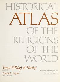
1974012035New York: Macmillan 1974. 8.75" wide by 11" tall. Previous owner's blindstamp. Otherwise a bright clean square tight unmarked copy. Not a book club edition. Not price clipped 15.00. No remainder mark. Illustrated with photos drawings and 65 maps. From the Dust Jacket: "Here is the most extensive historical atlas of religion ever published." Essays photos and maps illuminate the origins and distribution of religions; their movement; locations of sacred cities sites and temples; growth; the relation of one religion with another; places associated with leading rabbis theologians and writers; Jewish emigration; Muslim rule; religious use of narcotics; Chinese religions; 18th century Christianity; Islamic schools of law sects and reform movements; spread of Orthodox law schools; etc. Appendix 38 pages long gives detailed chronologies of the religions of the past. Subject Index. Name Index. First Printing of the First Edition. Oversize Hardcover. Near Fine condition/VG DJ tiny closed tears. xviii 346pp . Macmillan Hardcover
1796644DGWien, ca. 1796. Kolorierte Kupferstichkarte. Plattengrösse: 24 x 31 cm.
1929356171929 Le Caire - Société Royale de Géographie d'Egypte - 1929 - 1952 - Complet en 7 volumes in-folio - 463 planches dont 38 en couleurs - Les trois premiers en reliure moderne, les 4 autres en cartonnage éditeur - Monumental ouvrage très rare complet car paru sur plus de 20 ans -
GF297671 page in4 - En tête de la Société de Géographie -
Bologna, Università, 1956, 8vo punto metallico, pp. 24 con 4 cartine nel testo ed una carta a colori più volte ripiegata allegata in fine.
Grande carta geografica incisa in rame, applicata su tela e più voltre ripiegate di cm. 100 x 160 ca. Entro custodia originale in cartoncino marmorizzato con titoli a stampa. Qualche arrossatura, ma complessivamente buono stato di conservazione. Celebre e dettagliata carta dell'isola di Sardegna dedicata dal La Marmora alla Maestà del Re Carlo Alberto Primo. Non comune.
Mm 215x310 Nuova raccolta colombiana. Volume cartonato rigido di pagine 511, astuccio editoriale illustrato in cartone. Pari al nuovo. Spedizione in 24 ore dalla conferma dell'ordine.
1796644DGWien, ca. 1796. Kolorierte Kupferstichkarte. Plattengrösse: 24 x 31 cm. + Wichtig: Für unsere Kunden in der EU erfolgt der Versand alle 14 Tage verzollt ab Deutschland / Postbank-Konto in Deutschland vorhanden +, Bild
1967163295Berlin, Akademie-Verlag, 1967. 4°. M. 34 Taf. u. 65 S. Text. OLwd. Einbd. angeschmutzt u. etwas stockfl. Buchbl. bei Tit. lose. (Veröff. d. Geodät. Inst. in Potsdam 30)
1903220213Berlin, Reimer, 1903-16. 4°. 24 Taf. u. 9 Abb. Bd. 1-3 in 1 Hlwdbd., Bd. 4 u. 5 brosch. Bd. 1-3 St. a. Tit. Bd. 5 Sign. a. OU. (Veröff. d. Zentralbureau d. internat. Erdmessung N.F. 8, 13, 18, 22, 30).
In-8° (cm. 23,5x16), pp. 51 + 1 grande CARTA-SCHIZZO a 3 colori, scala 1:150.000 e 3 profili altim. delle cerchie moreniche. Bross. edit. con mende alla cop., che però è munita di INVIO AUTOGRAFO FIRMATO dell'Autore.
Acquaforte e bulino, priva di data ma fine dle XVII secolo, firmata in basso a destra con l'imprint editoriale "Si vende à S. Giuliaen al Nome di Dio in Venetia", indirizzo che identifica la tipografia di Girolamo Albrizzi.L'opera, con il Leone Marciano che stringe tra gli artigli la mezzaluna turca, è una rarissima carta d'occasione, nata per celebrare un avvenimento. Si riferisce alla riconquista veneziana della regione, il Golfo di Prevesa, da parte dell'armata guidata da Francesco Morosini.Il 29 settembre 1684 Morosini, nella sua prima campagna della Morea, attirò verso la riva la guarnigione di Prevesa, corsa per impedire uno sbarco di truppe dalle galee e galeazze presentatesi davanti alla piazza; e intanto fece effettivamente sbarcare il grosso delle forze in prossimità della cittadella, che dopo pochi giorni fu costretta ad arrendersi.Con la pace di Carlowitz (15 aprile 1701) Prevesa ritornò alla Turchia.Opera rarissima, della quale non abbiamo trovato tracce nella bibliografia. Rifilita alla parte inferiore, con parziale perdita di inciso, per il resto in ottimo stato di conservazione. Etching and engraving, without date but end of the seventeenth century, signed lower right with the editorial imprint "Si vende à S. Giuliaen al Nome di Dio in Venetia", an address that identifies the typography of Girolamo Albrizzi.The work, with the lion of Venice clutching the Turkish, is a very rare broadsheet created to celebrate an event. It refers to the Venetian reconquest of the region, the Gulf of Prevesa, by the army led by Francesco Morosini.On September 29, 1684 Morosini, in his first campaign of the Morea, drew the Prevesa garrison towards the shore, a race to prevent troops landing from the galleys and galleys presented in front of the square; and in the meantime he actually had the bulk of the forces near the citadel, which after a few days was forced to surrender.With the Peace of Carlowitz (April 15, 1701) Prevesa returned to Turkey.Very rare work, of which we have not found traces in the bibliography. Trimmed to the lower part, with partial loss of incision, otherwise excellent condition.
70339, H. Dessain, 1905 Hardcover, 140 pages, 23,0 x 32,0 cm, FR. En bon tat.
1249Amsterdam, Uitgeverij John Benjamins, 1994 Geillustreerde cover, frontispice, 17x24 cm., 280 pp. en XLIX kleurenillustraties. ISBN 9027220891.
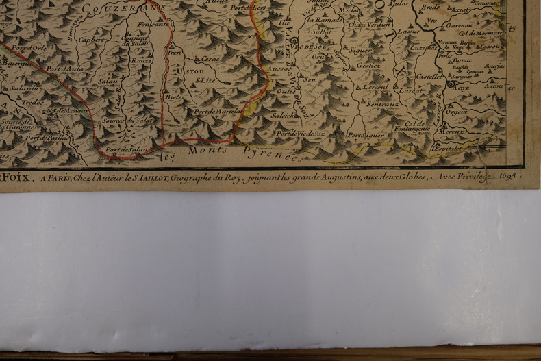
CARTE2T101695, à Paris chez l'Auteur. 65x47cm (marges à ras). Carte réalisée par Jaillot. Épreuve originale de 1695 tirée de l'Atas François. Colorisation des limites datant de l'époque. Deux restaurations au coin gauche de la marge supérieure. Pliure verticale au milieu de la feuille. Brunissure normale. Charmant exemplaire