5 843 résultats
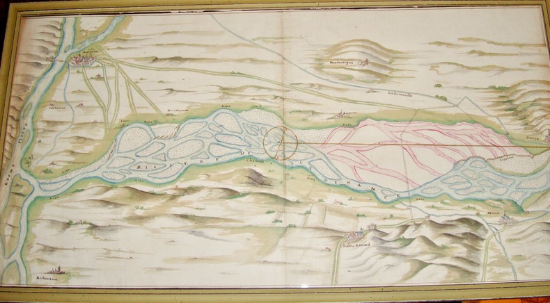
6450Intéressant plan qui nous montre des aménagements des rives de la Durance à son approche d’Avignon; on peut y localiser Avignon, Barbantane, Noves, Châteaurenard ainsi que la Courtine, Mondevergues etc XVIIIè siècle 40 x 74,5 cm avec le cadre.
CARPETTA CON MATERIALE DIVULGATIVO INERENTE ALLE CELEBRAZIONI "GIACOMO CANTELLI" GEOGRAFO DEL SERENISSIMO E SEGNALIBRO.
Grande carta applicata su carta blu, dimensioni cm 68x188. pubblicata a Londra presso Charles Wilson nel 1882. Bella carta in cui sono descritte le varie località della costa che si affaccia sul Mare Adriatico e riquadri con dettagli su alcuni porti e baie ( Durazzo , Zante, Argostoli, Vostitza, Navarino, Venezia, Brindisi…….... lievi tracce del tempo nel complesso buono stato di conservazione
19711247911Amsterdam, Theatrum Orbis Terrarum, 1971. 13, 1659 S. u. 1 Bl., 137, 1030; 163, 639 S. OLwdbd (Kanten u. Gelenke teils stärker bestoßen, erste u. letzte Blätter etwas knickfaltig).
bella carta a colori stampata su carta pesante incisa da P. Allodi e Figlio, più volte ripiegata, misure cm. 95 x 65, sono comprese le varie isole incluse le Canarie. Con le possessioni e stabilimenti degli stati europei segnati a colori. Graziosa copertina figur.
(Codice OS/0257) Le 2 tavole (29,5x21,5 cm) impresse su carta forte, con 13 incisioni in rame, sono ORIGINALI, provengono da un volume sciolto. Ottimo stato. A garanzia dell'autenticità, alleghiamo fotocopie di: frontespizio, prefazione (10 pp.) e indice delle tavole con elenco delle incisioni. ~~~ SPEDIZIONE IN ITALIA SEMPRE TRACCIATA
1976134422Stuttgart, Klett, (1976). 4. M. zahlr. farb. Ktn. 194 S. OPp. Unt. Rücken gering bestoßen u. m. kl. Kleberest. Bind. a. Tit. fachmänn. stabilisiert.
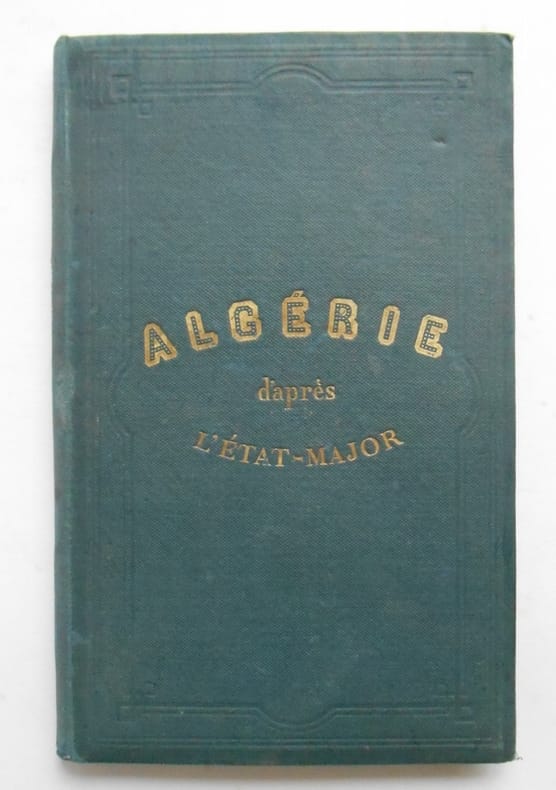
18731663781873 ALGERIE . D ' après les cartes et les documents du ministère de la Guerre .Andriveau - Goujon ,1873Carte de 96 x 67 cm ,coloriée , entoilée et repliée sur une couverture toilée de 16 x 23.Dans le bas inférieur droit l'éditeur a imprimé une autre carte : Carte d ' ensemble des rapports entre la France , L'Algérie, la Sénégambie , et le Nord de l ' Afrique .( 22x 23 cm ) Carte coloriée.Très bon état
19311321227Berlin, Wertheim - Das Biblographikon, 1931. 71, (1) S. m. 13 Abb. im Text, 1 Tafel. Lwdbd m. eingebund. OBroschur (Rücken oben m. winz. Feuchtigkeitsspur, innen etwas gebräunt).
1992121523(München), Prestel, (1992). 4°. M. zahlr. (teils farb./teils blattgr.) Abb. 192 S. OLwd.
1889248731Roma, 1889. M. 1 gef. Taf. u. 1 gef. farb. Kte. IX, 138 S. OBr. Unaufgeschn. Ex. Umschlag angeschmutzt, m. Randläsuren bzw. kl. Fehlst. M. mehr. St. Vord. Umschlag u. Vorsatz wasserrandig.
Cartina più volte ripiegata a fisarmonica; 22 x 136 cm. Ottima
1964247800Leipzig, 1964. M. zahlr. Tab. u. Abb. 150 S. St. a. Tit.
16°, 18 cm, pp. 221, brossura editoriale illustrata, titolo al piatto e dorso, esemplare ottimo
1879162993Berlin, 1879. 4°. 192 S. OBr. Rücken agnerissen. Umschl. angeschmutzt u. eingerissen. Hint. Umschl. fehlt. Letztes Bl. etwa stockfl. (Publ.. d. Königl. Preusz. Geodät. Inst.)
1912159736Potsdam, 1912. 4°. IV, 78 S. OBr. Umschl. angeschmutzt u. eingerissen. (Veröffentlichung d. Königl. Preuszischen Geodätischen Institutes. N.F. 53)
1938159766Potsdam, 1938. 4°. 82 S. OBr. Umschl. beschmutzt. (Veröffentl. d. Königl. Preus. Geodät. Inst. N.F. 109)
31 cm, rilegatura editoriale illustrata, titolo al piatto e dorso; pp. 31, più 50 carte geografiche ripiegate
Legatura mezza pelle coeva, dorso muto e piatti in carta decorata, buonissime condizioni, carte bianche con ampi margini. Due carte di testo, frontespizio e indice tavv) e 30 carte geografiche incise. Nota di possesso manoscritta (datata 1857) al risguardo anteriore. Sc. C.
Roma, La Libreria dello Stato, 1933, in-8, br. edit. Con 8 cartine a col. Affrancato con valore da 10 cent. "per i tubercolosi poveri".
1970404072Leipzig, Edition, 1970. Royal-Folio. M. 1 farb. Wappentaf. u. 53 (35 doppelblattgr.) Ktn. Ganzlederausgabe m. Goldschnitt, aufgeschlag. Superexlibris u. Beschlägen a. Vorder- u. Rückendeckel sowie 3 Schließen, auf 18 echte Bünde gearbeitet. Kommentarbd. Hldr. in Schuber. Am unteren Rücken leicht beschäd. Ohne d. Schutzkarton.
188645011886 Paris, Jouvet et Cie, 1886 In-folio, demi-basane. Cartes en couleurs. Avec 2 cartes supplémentaires tirées de lAtlas des colonies françaises par Paul Pelet et montées sur onglets : Points dappui de la flotte (1901) et Sahara algérien et tunisien (1898). Reliure usagée.
1964134446Warszawa, Panst. Przeds. Wydawn. Kartogr. (1964). 4°. M. zahlr. farb. Ktn. (dar. 1 beilieg.). 120, 29 S. OLwd. Einbd. teils verblichen. St. a. Tit.