Vorarlberg. – Hueber, Blasius:Livre Rare Book
145 résultats
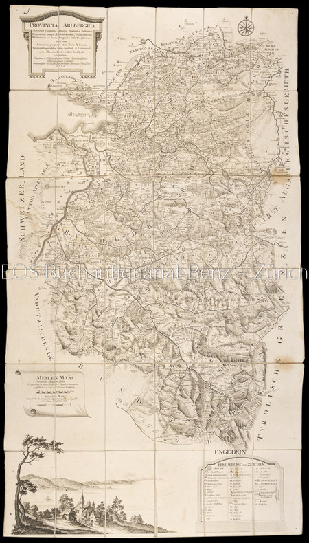
17831804AGWien, Johann Ernst Mansfeld, 1783. Kupferstichkarte, gestochen von Johann Anton Pfaundler. 115 x 66 cm.
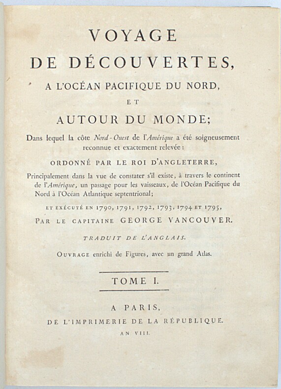
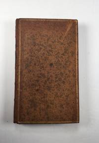
1800PHO-2418Paris, Imprimerie de la République, an VIII (1800). 3 vol. in-4 (28,5 × 21 cm), XII-491pp., 2ff.-516pp., 3ff.-562pp., demi-veau fauve à petits coins de vélin, dos lisses teintés vert et ornés de bateaux (reliure de l’époque). Charnières fendillées, accrocs à deux coiffes. Infimes rousseurs, petites déchirures sans gravité. Tome I, quelques cahiers brunis, 1 feuillet fragile.
1758T370Dublin: John Exshaw Dame Street 1758. No Binding. Fine. 8vo. 427-480pp. A disbound copy of the Dublin version of the Gentleman's Magazine for the month of August 1758. Fine fresh paper with no foxing wear or marks. The title-page lists 24 articles on the title-page and includes a fine copy of the rare 'A PLAN of the Harbour and TOWN of LOUISBOURG in the Island of CAPE BRETON Drawn on the Spot. Folding page 28 x 20 cms with a plate impression 24 x 18 cms.4 page description of the plan and town. Other articles include an estimate of the Naval Debt; Part of the trial of William Barnard; Journal of the Seige of Louisbourg; General Abercromby's Account of the Exped. to Crown Point. Single page map of 'The Country between CROWN POINT and ALBANY being the Great Pass from the English to the French Settlements in North America'.11.5 x 19.1 cms. Please email for photos. <br/> <br/> John Exshaw, Dame Street unknown
1758T372Dublin: John Exshaw Dame Street 1758. 1st Edition . No Binding. Fine. 8vo. 313-368pp. A disbound copy of the Dublin version of the Gentleman's Magazine for the month of June 1758. Fine fresh paper with no foxing wear or marks. The title-page lists 24 articles on the title-page and includes a fine copy of the rare folding map 'A NEW MAP OF THE ENGLISH CHANNEL' engraved by Ridge 25 x 17 cms. Map engraved by Ridge. Title contents calls for a Sheet map of Germany and not the English Channel. Please email for photos. <br/> <br/> John Exshaw, Dame Street unknown
1758T373Dublin: John Exshaw Dame Street 1758. 1st Edition . No Binding. Fine. 8vo. 3-64pp. A disbound copy of the Dublin version of the Gentleman's Magazine for the month of January 1758. Fine fresh paper with no foxing wear or marks. The title-page lists 21 articles on the title-page and includes a fine copy of the rare folding map 'Island Rathlin showing the Ballycastle Colleries 21x18 cms. Also A PLAN OF THE CITY OF BRESLAU Capital of Silesia 18x12 CMS.Please email for photos. <br/> <br/> John Exshaw, Dame Street unknown
1758T374Dublin: John Exshaw Dame Street 1758. 1st Edition . No Binding. Fine. 8vo. 369-425pp. A disbound copy of the Dublin version of the Gentleman's Magazine for the month of July 1758. Fine fresh paper with no foxing wear or marks. The title-page lists 19 articles on the title-page and includes a fine copy of the rare folding sheet map 'A New and Accurate Map of Germany Drawn from the latest surveys Discribing the Port Roads & Distances from Town to Town according to the original Map of the Prussion Routs Published at berlin By Richd Bennet Engineer'. Engraved by S. Wheatley.33x26 cms. Trifle margin crop lower corner. Title-page call for a map of the Channel Islands but Germany map present. Please email for photos. <br/> <br/> John Exshaw, Dame Street unknown
1758T371Dublin: John Exshaw Dame Street 1758. 1st Edition . No Binding. Fine. 8vo. 481-536pp. A disbound copy of the Dublin version of the Gentleman's Magazine for the month of Sept 1758. Fine fresh paper with no foxing wear or marks. The title-page lists 25 articles on the title-page and includes a fine copy of the rare 'Plan of the Country from the LANDING PLACE with the Encampments and Marches of the Troops under Major General ABERCROMBIE to the Attack of TICONDEROGA . 19 x11 cms. Together with an account from the action. Also a fine plan of St Malo with map of part of French Coast inset 19 x 11cms together with an account of shipping lost in recent action. Also a PLAN of Cherburg with Channel map inset 19 x 11cms with an account. All 3 plans engraved by Ridge. Please email for photos. <br/> <br/> John Exshaw, Dame Street unknown
1758W196Dublin: John Exshaw Dame Street 1758. 1st Edition . Audio Book DVD. Fine. 8vo. 595-648pp. A disbound copy of the Dublin version of the Gentleman's Magazine for the month of November 1758. Fine fresh paper with no foxing wear or marks. The title-page lists 25 articles on the title-page and includes a fine copy of the rare map 'A Plan of Milford Haven' by Ridge; 19 x 12 cms. Articles include the capture of Fort Frontemac. Major Grant debacle at Fort Quesne. Please email for photos. <br/> <br/> John Exshaw, Dame Street unknown
1758W204Dublin: John Exshaw Dame Street 1758. 1st Edition . No Binding. Fine. 8vo. 131-192pp. A disbound copy of the Dublin version of the Gentleman's Magazine for the month of April 1758. Fine fresh paper with no foxing wear or marks. The title-page lists 24 articles on the title-page. Articles include History of the last campaign in North America 214-221; The Idler A New Paper; Account of the pilgrimages to Mecca; Temoray foot bridge over the Thames is consumed by fire; etc Please email for photos. <br/> <br/> John Exshaw, Dame Street unknown
1758W201Dublin: John Exshaw Dame Street 1758. 1st Edition . No Binding. Fine. 8vo. 259-312pp. A disbound copy of the Dublin version of the Gentleman's Magazine for the month of May 1758. Fine fresh paper with no foxing wear or marks. The title-page lists 22 articles on the title-page. Articles include The Effects of Camphire on a 'lunatic'.; York rioters ordered for execution; Shipping lists; The conduct of Admiral Knowles. Please email for photos. <br/> <br/> John Exshaw, Dame Street unknown
1794025454Hartford Connecticut: Elisha Babcock 1794. Good - Very Good condition. SEE PHOTOS. Hinges are sound with only a single half inch hairline crack. NOT a library discard. NO owner's name or bookplate. Foxing mostly light to moderate to several pages. Slight age toning. Bound in full leather sprinkled calf with 5 raised spine bands. Brown leather spine label mostly chipped away. Gilt spine decorations and gilt double ruled borders on the front and rear covers. Handsome gilt inside dentelles i.e. borders decorated with gilt lacy pattern at inner edges. SEE PHOTOS. Frontispiece portrait of the author engraved by Amos Doolittle. This copy includes plates 1 2 4 5 6 8 also engraved Amos Doolittle. Of these 6 plates 5 are folding some copies have only 3 plates that are folding. Plate 1 is a map of New Haven and Its Environs Wheat 281. Plate 4 shows 3 maps one of which shows Hadley Mass Wheat 276 278 280. Plate 5 is a map of the City of New Haven Wheat 275. Plate 8 is another map of Hadley Massachusetts Wheat 279. Lacks pages 145-156 plates 3 and 9 which apparently were not bound in. Plate 7 does not exist in any copy per Howes and Sabin: "there is no plate 7 in any of the copies seen and it is probable none was made." This is a history of three members of the tribunal which had Charles I beheaded in 1649. The author Ezra Stiles was president of Yale College from 1778 until his death in 1795. No errata slip is present in this copy so presumably it is Howes' second issue. Includes the "Advertisement" at the end on an unnumbered page that offers subscribers the option to cancel if dissatisfied with the change in the dimensions of this book from what was described in the prospectus not present. Full title: "A history of three of the judges of King Charles I. Major-General Whalley Major-General Goffe and Colonel Dixwell: Who at the Restoration 1660 fled to America; and were secreted and concealed in Massachusetts and Connecticut for near thirty years. With an account of Mr. Theophilus Whale of Narragansett supposed to have been also one of the judges." Howes S-999. Evans 27743. Sabin 91742. Trumbull Connecticut 1425. ESTC W20469. Church 1264. Wheat and Brun 275-283. First Edition Second Issue. Hardcover. Good - Very Good condition. Illus. by NOT a library discard. 12mo. 358pp. "Advertisement". Great Packaging Fast Shipping. Elisha Babcock Hardcover
1713Map868London: Henry Overton 1713. Original printed issues 1st Editions . No Binding. Fine. Folio. 1603-1713 The rare re-issue with amendments by Henry Overton of Smiths original plate of 1603. Based on the map by Saxton in 1573. Un-coloured example in fine condition of the copperplate engraving. Paper size 55 x 46 cms. Plate size 48 x 33 cms. No splits or holes. Plain verso and part of the original hinge still present. Table with a list of the hundreds. One of the original 'anonymous' maps that were identified as being by Smith in recent times.PLEASE EAMIL FOR PHOTOS. <br/> <br/> Henry Overton unknown
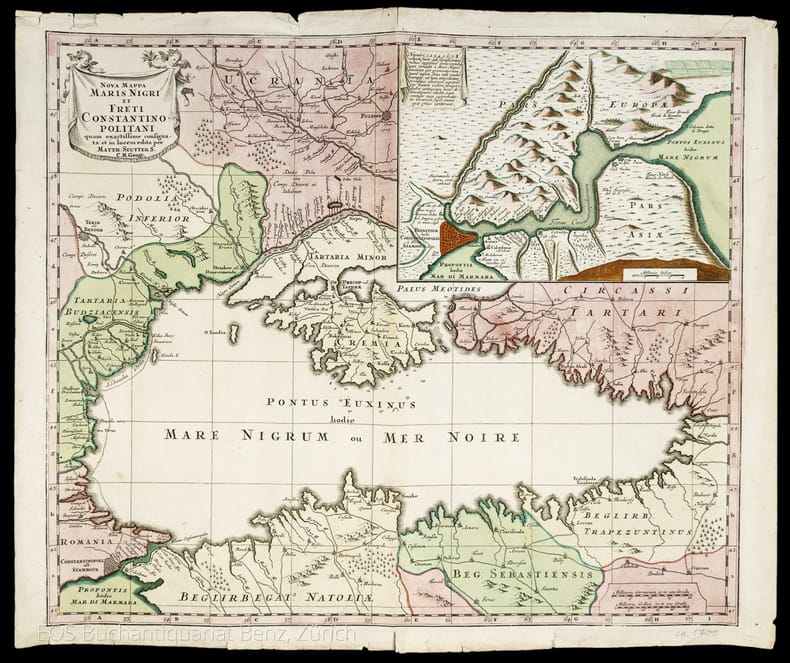
1741986DGAugsburg, 1741. Altkolorierter Kupferstich. Blattgrösse: 49.4 x 57.8 cm + Wichtig: Für unsere Kunden in der EU erfolgt der Versand alle 14 Tage verzollt ab Deutschland / Postbank-Konto in Deutschland vorhanden +, 986DG
1741986DGAugsburg, 1741. Altkolorierter Kupferstich. Blattgrösse: 49.4 x 57.8 cm
1730988DGAmasterdam, Jean Convens et Corneille Mortier., 1730. Grenzkolorierte Kupferstich. Blattformat: 56 x 64 cm. Gesamtgrösse der vier Teile: 112 x 128 cm. + Wichtig: Für unsere Kunden in der EU erfolgt der Versand alle 14 Tage verzollt ab Deutschland / Postbank-Konto in Deutschland vorhanden +, 988DG|988DG_2|988DG_3|988DG_4 [4 Warenabbildungen]
17656486CBZürich, Johannes Hofmeister, 1765. Schmal 12°. 132 S. Pappbd. d. Zt. + Wichtig: Für unsere Kunden in der EU erfolgt der Versand alle 14 Tage verzollt ab Deutschland / Postbank-Konto in Deutschland vorhanden +, bild
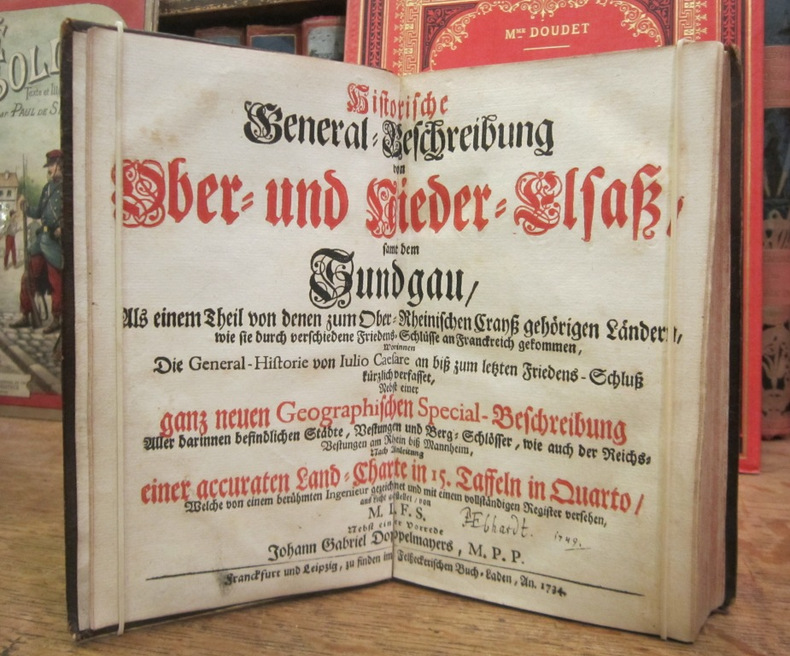
1734002762Franckfurt und Leipzig, Felsseckerischen Buch-Laden, 1734
1730988DGAmasterdam, Jean Convens et Corneille Mortier. 1730. Grenzkolorierte Kupferstiche. Blattformat: 56 x 64 cm. Gesamtgrösse der vier Karten: 112 x 128 cm.
1749620CG(Nürnberg), Homanns Erben, 1749. Kolorierte Kupferstichkarte. Plattengrösse: 51 x 59 cm. Blattgrösse: 52,5 x 61 cm.
1769MAP1038London: Russell and Price 1769. Original Map . No Binding. Vg. 4to. Single page map of BUCKINGHAMSHIRE G. Rollos. Published in ENGLAND DISLAYED Being a New Complete and Accurate Survey and Description of the Kingdom of England and Principality of Wales. Plate 16x20 cm sheet 160 x 243mm. VG original map printed on laid paper. SOME MOTTLING. Uncoloured. 2ND EDITION pub. 1769. OTHER COUNTIES ARE AVAILABLE FROM THIS ISSUE. <br/> <br/> Russell and Price unknown
1769MAP1039London: Russell and Price 1769. Original Map . No Binding. Vg. 4to. Single page map of BERKSHIRE G. Rollos. Published in ENGLAND DISLAYED Being a New Complete and Accurate Survey and Description of the Kingdom of England and Principality of Wales. Plate 16x20 cm sheet 243 x 160mm. VG original map printed on laid paper. Uncoloured. 2ND EDITION pub. 1769. OTHER COUNTIES ARE AVAILABLE FROM THIS ISSUE. <br/> <br/> Russell and Price unknown
1769MAP1037London: Russell and Price 1769. Original Map . No Binding. Vg. 4to. Single page map of ANGELSEY G. Rollos. Published in ENGLAND DISLAYED Being a New Complete and Accurate Survey and Description of the Kingdom of England and Principality of Wales. Plate 16x20 cm sheet 160 x 243mm. VG original map printed on laid paper. SOME MOTTLING. Uncoloured. 2ND EDITION pub. 1769. OTHER COUNTIES ARE AVAILABLE FROM THIS ISSUE. <br/> <br/> Russell and Price unknown
1769MAP1026London: Russell and Price 1769. Original Map . No Binding. Fine. 4to. Single page map of the County of DURHAM John Roque. Published in ENGLAND DISLAYED Being a New Complete and Accurate Survey and Description of the Kingdom of England and Principality of Wales. Plate 16 x20cm sheet 160 x 243mm. Fine original map printed on laid paper. Uncoloured. 2ND EDITION pub. 1769. <br/> <br/> Russell and Price unknown
1769MAP1020London: Russell and Price 1769. Original Map . No Binding. Fine. 4to. Single page map of the County of GLOUCESTER SHIRE John Roque. Published in ENGLAND DISLAYED Being a New Complete and Accurate Survey and Description of the Kingdom of England and Principality of Wales. Plate 16 x20cm sheet 160 x 243mm. Fine original map printed on laid paper. Uncoloured. 2ND EDITION pub. 1769. OTHER COUNTIES ARE AVAILABLE FROM THIS ISSUE. <br/> <br/> Russell and Price unknown
1769MAP1006London: Russell and Price 1769. Original Map . No Binding. Fine. 4to. Single page map of the County of HAMPSHIRE John Roque.Published in ENGLAND DISLAYED Being a New Complete and Accurate Survey and Description of the Kingdom of England and Principality of Wales. Plate 16 x20cm sheet 160 x 243mm. Fine original map printed on laid paper. Uncoloured. 2ND EDITION pub. 1769. OTHER COUNTIES ARE AVAILABLE FROM THIS ISSUE. <br/> <br/> Russell and Price unknown