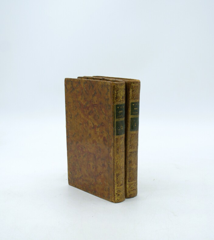
145 résultats
1769MAP1016London: Russell and Price 1769. Original Map . No Binding. Fine. 4to. Single page map of the County of NOTTINGHAM SHIRE John Roque. Published in ENGLAND DISLAYED Being a New Complete and Accurate Survey and Description of the Kingdom of England and Principality of Wales. Plate 16 x20cm sheet 160 x 243mm. Fine original map printed on laid paper. Uncoloured. 2ND EDITION pub. 1769. OTHER COUNTIES ARE AVAILABLE FROM THIS ISSUE. <br/> <br/> Russell and Price unknown
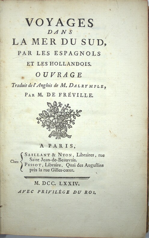
1774PHO-2287Paris, Chez Saillant & Nyon, Pissot, 1774. In-8 (20,5x13cm) de 2ff.-XIV-1f. 502pp.- 1f., veau marbré époque, dos à nerfs orné avec pièce de titre grenat, tranches rouges, illustré de 3 cartes dépliantes in fine. Frottements, coins et coupes usés, coiffes arasées, débuts de fentes, quelques rousseurs
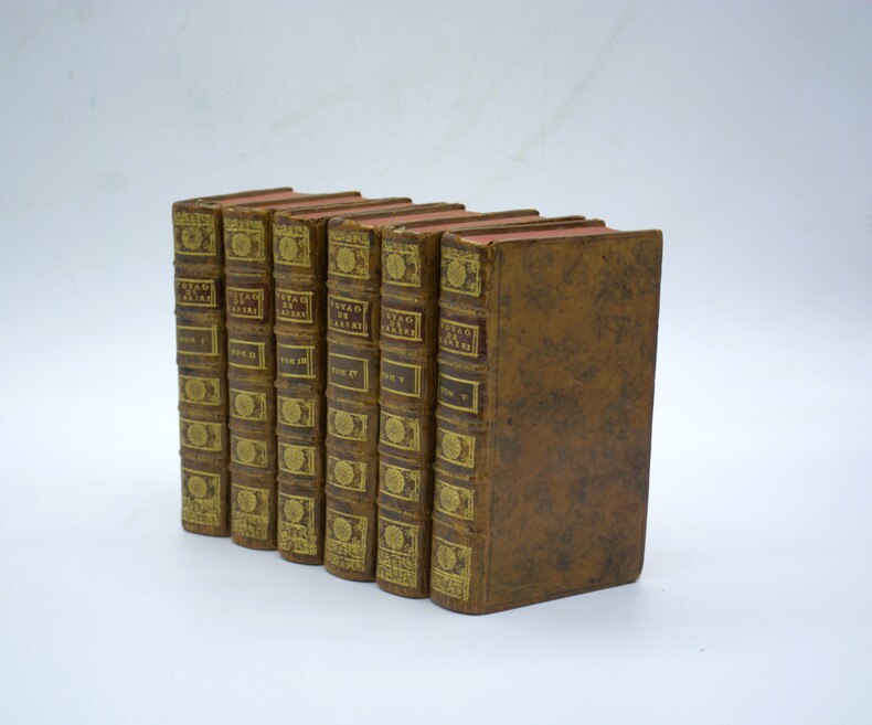
1727PHO-2344Paris, chez E. Ganeau, 1727. 6 vol. in-12 (17x9,5cm), 3ff.-xvii-592pp.-3ff. (table), 4ff.-512pp., 4ff.-426pp.-3ff., 4ff.-537pp.- 4ff., 4ff.-444pp.-3ff., veau havane tacheté, dos à nerfs orné avec tomaison et pièce de titre grenat, tranches rouges, quelques coiffes accrochées, quelques coins usés, déchirure à 1 planche au pli. Nouvelle édition de cette première traduction en français qui parut initialement en 1719. L'illustration entièrement gravée sur cuivre h.-t. se compose d'un frontispice, un portrait, et 62 planches (63 ?), dont 9 dépliantes. Sabin signale 60 planches sans mentionner le frontispice et le portrait. I ; De la Turquie : Frontispice, portrait, 4 pl. dont 1 dépliante ; II. De la Perse : 5 pl. dont 2 dépliantes ; III. L'Indostan, 25 pl. dont 1 dépliante ; IV. De la Chine 8 pl. dont 2 dépliantes ; V. Des Isles Philippines 2 pl. ; VI. De la Nouvelle Espagne, 18 pl. dont 3 dépliantes.
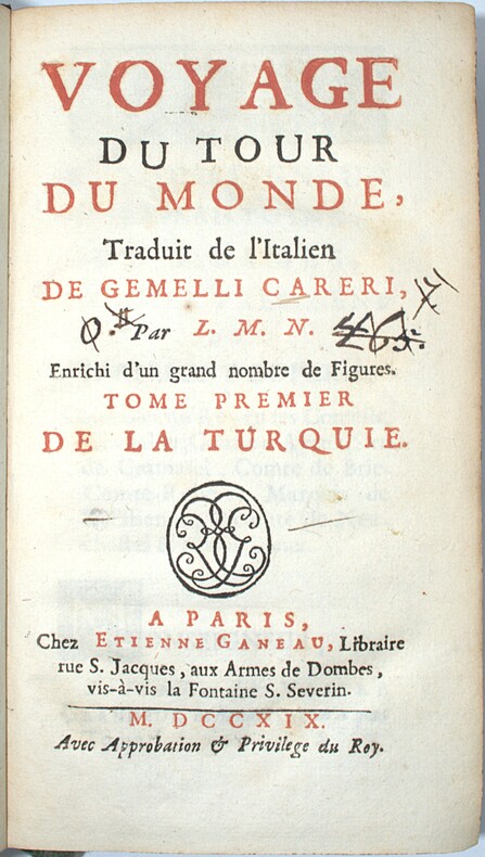
1719PHO-2391Paris, chez Étienne Ganeau, 1719. 6 vol. in-12 (17x9,5cm), 4ff.-xxvii-2ff.-454pp.-5ff. (table), 4ff.-354pp.-3ff., 4ff.-402pp., 4ff.-532pp., 4ff.-374pp., 4ff.-512pp., veau moucheté, dos à nerfs orné avec tomaison et pièce de titre, tranches jaspées, exlibris verso 1er plat, écritures aux titre, dos et charnières frottés, coins usés, petit manque plat tome 1 Édition originale L'illustration entièrement gravée sur cuivre h.-t. se compose d'un frontispice, un portrait, et 60 planches, dont dépliantes. Sabin signale 60 planches sans mentionner le frontispice et le portrait. I ; De la Turquie : Frontispice, portrait, mappemonde, 4 pl. dont 1 dépliante ; II. De la Perse : 3 pl. ; III. L'Indostan, 24 pl. ; IV. De la Chine 8 pl. dont 2 dépliantes ; V. Des Isles Philippines 2 pl. ; VI. De la Nouvelle Espagne, 18 pl. dont 3 dépliantes.
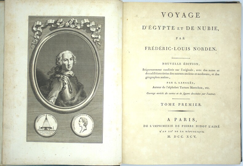
1795PHO-2281Paris, de l'imprimerie de Pierre Didot l'aîné, 1795-98. 3 vol. in-4°, demi chagrin et coins, dos lisse avec titre et tomaison, tranches jaspées bleues. Frottements, épidermures aux dos, coins usés, quelques rousseurs en début et fin, papier légèrement bruni. Tome I ; portrait-LV-176 pp.- 59 planches et cartes (n°1 à 59), Tome II ; frontispice- 256 pp. ; 56 planches et cartes (n°60 à 113 avec 96bis & ter), Tome III ; frontispice-149 pp.-3ff. - 392 pp., 36 (53) planches et cartes (n°131 à 160) et 9 non numérotées. Un total de 149 (166) planches et cartes, certaines dépliantes et 9 planches d'éléments décoratifs non numérotées, manque les planches n° 114 à 130 qui n’ont pas été reliés ici.
17956386Paris, de l'imprimerie de Pierre Didot l'aîné, l'an IIIe de la République, 1795 - l'an VIe de la République, 1798. 1795 3 vol. in-4° (300 x 225 mm) de : I. 1 frontispice ; 1 portrait ; LV (dont faux titre, titre, préface) ; 176 pp. (dont table) ; 59 planches et cartes (n°1 à 59) ; II. 256 pp. (dont faux titre, titre) ; 54 planches et cartes (n°60 à 113) ; 149 pp. ; [3] ff. ; pp. 392 pp (reprise à 153) ; 53 planches et cartes (n°114 à 159, 140 et 141 ainsi que 142 et 143 réunies en deux planches + 9 non numérotées) ; petit dessin collé en regard de la planche n°8 avec notes manuscrites. Un total de 166 planches et cartes dont 2 composées de 2 numéros, certaines dépliantes et 9 planches d'éléments décoratifs non numérotées. (Petites manques aux premiers feuillets du second volume). Pleine basane marbrée, dos à nerfs orné, pièce de titre de maroquin et tomaison, filets dorés sur les plats, dos à nerfs très ornés, tranches rouges, gardes de couleurs. (reliure frottée).
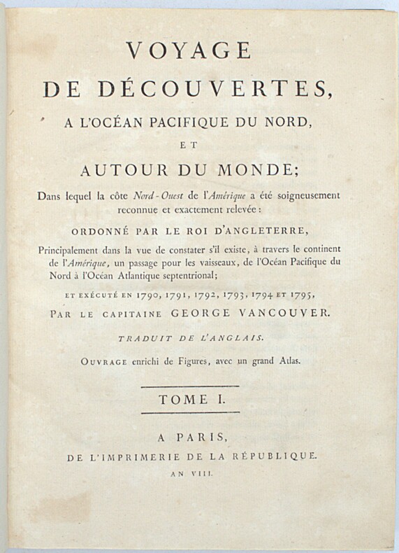
1800PHO-2418Paris, Imprimerie de la République, an VIII (1800). 3 vol. in-4 (28,5 × 21 cm), XII-491pp., 2ff.-516pp., 3ff.-562pp., demi-veau fauve à petits coins de vélin, dos lisses teintés vert et ornés de bateaux (reliure de l’époque). Charnières fendillées, accrocs à deux coiffes. Infimes rousseurs, petites déchirures sans gravité. Tome I, quelques cahiers brunis, 1 feuillet fragile.
1789PHO-2082Paris, Hôtel de Thou et Lyon, Bernuset & Comp., 1789. 2 vol. in-8° de xl, 387, [1] pp. ; 419, [1] pp. Basane fauve jaspée, dos long orné de fers à la corne d'abondance & aux épis de blé, p. de t. et de tom. en maroquin vert, double filet à froid sur les plats, filet doré sur les coupes, tranches marbrées (Reliure de l'époque). Quelques épidermures et 4 trous de vers à la reliure. Bon exemplaire. Mention ms. d'achat : « 18 février 1789, 6 [livres] les 2 vol. brochés ».
1769Map1005London: Russell and Price 1769. Original Map . No Binding. Fine. 4to. Single page map of the County of ISLE OF WIGHT John Roque.Published in ENGLAND DISLAYED Being a New Complete and Accurate Survey and Description of the Kingdom of England and Principality of Wales. Plate 16 x20cm sheet 160 x 243mm. Fine original map printed on laid paper. Uncoloured. 2ND EDITION pub. 1769. OTHER COUNTIES ARE AVAILABLE FROM THIS ISSUE <br/> <br/> Russell and Price unknown
1758T370Dublin: John Exshaw Dame Street 1758. No Binding. Fine. 8vo. 427-480pp. A disbound copy of the Dublin version of the Gentleman's Magazine for the month of August 1758. Fine fresh paper with no foxing wear or marks. The title-page lists 24 articles on the title-page and includes a fine copy of the rare 'A PLAN of the Harbour and TOWN of LOUISBOURG in the Island of CAPE BRETON Drawn on the Spot. Folding page 28 x 20 cms with a plate impression 24 x 18 cms.4 page description of the plan and town. Other articles include an estimate of the Naval Debt; Part of the trial of William Barnard; Journal of the Seige of Louisbourg; General Abercromby's Account of the Exped. to Crown Point. Single page map of 'The Country between CROWN POINT and ALBANY being the Great Pass from the English to the French Settlements in North America'.11.5 x 19.1 cms. Please email for photos. <br/> <br/> John Exshaw, Dame Street unknown
1758T372Dublin: John Exshaw Dame Street 1758. 1st Edition . No Binding. Fine. 8vo. 313-368pp. A disbound copy of the Dublin version of the Gentleman's Magazine for the month of June 1758. Fine fresh paper with no foxing wear or marks. The title-page lists 24 articles on the title-page and includes a fine copy of the rare folding map 'A NEW MAP OF THE ENGLISH CHANNEL' engraved by Ridge 25 x 17 cms. Map engraved by Ridge. Title contents calls for a Sheet map of Germany and not the English Channel. Please email for photos. <br/> <br/> John Exshaw, Dame Street unknown
1758T373Dublin: John Exshaw Dame Street 1758. 1st Edition . No Binding. Fine. 8vo. 3-64pp. A disbound copy of the Dublin version of the Gentleman's Magazine for the month of January 1758. Fine fresh paper with no foxing wear or marks. The title-page lists 21 articles on the title-page and includes a fine copy of the rare folding map 'Island Rathlin showing the Ballycastle Colleries 21x18 cms. Also A PLAN OF THE CITY OF BRESLAU Capital of Silesia 18x12 CMS.Please email for photos. <br/> <br/> John Exshaw, Dame Street unknown
1758T374Dublin: John Exshaw Dame Street 1758. 1st Edition . No Binding. Fine. 8vo. 369-425pp. A disbound copy of the Dublin version of the Gentleman's Magazine for the month of July 1758. Fine fresh paper with no foxing wear or marks. The title-page lists 19 articles on the title-page and includes a fine copy of the rare folding sheet map 'A New and Accurate Map of Germany Drawn from the latest surveys Discribing the Port Roads & Distances from Town to Town according to the original Map of the Prussion Routs Published at berlin By Richd Bennet Engineer'. Engraved by S. Wheatley.33x26 cms. Trifle margin crop lower corner. Title-page call for a map of the Channel Islands but Germany map present. Please email for photos. <br/> <br/> John Exshaw, Dame Street unknown
1758T371Dublin: John Exshaw Dame Street 1758. 1st Edition . No Binding. Fine. 8vo. 481-536pp. A disbound copy of the Dublin version of the Gentleman's Magazine for the month of Sept 1758. Fine fresh paper with no foxing wear or marks. The title-page lists 25 articles on the title-page and includes a fine copy of the rare 'Plan of the Country from the LANDING PLACE with the Encampments and Marches of the Troops under Major General ABERCROMBIE to the Attack of TICONDEROGA . 19 x11 cms. Together with an account from the action. Also a fine plan of St Malo with map of part of French Coast inset 19 x 11cms together with an account of shipping lost in recent action. Also a PLAN of Cherburg with Channel map inset 19 x 11cms with an account. All 3 plans engraved by Ridge. Please email for photos. <br/> <br/> John Exshaw, Dame Street unknown
1758W196Dublin: John Exshaw Dame Street 1758. 1st Edition . Audio Book DVD. Fine. 8vo. 595-648pp. A disbound copy of the Dublin version of the Gentleman's Magazine for the month of November 1758. Fine fresh paper with no foxing wear or marks. The title-page lists 25 articles on the title-page and includes a fine copy of the rare map 'A Plan of Milford Haven' by Ridge; 19 x 12 cms. Articles include the capture of Fort Frontemac. Major Grant debacle at Fort Quesne. Please email for photos. <br/> <br/> John Exshaw, Dame Street unknown
1758W204Dublin: John Exshaw Dame Street 1758. 1st Edition . No Binding. Fine. 8vo. 131-192pp. A disbound copy of the Dublin version of the Gentleman's Magazine for the month of April 1758. Fine fresh paper with no foxing wear or marks. The title-page lists 24 articles on the title-page. Articles include History of the last campaign in North America 214-221; The Idler A New Paper; Account of the pilgrimages to Mecca; Temoray foot bridge over the Thames is consumed by fire; etc Please email for photos. <br/> <br/> John Exshaw, Dame Street unknown
1758W201Dublin: John Exshaw Dame Street 1758. 1st Edition . No Binding. Fine. 8vo. 259-312pp. A disbound copy of the Dublin version of the Gentleman's Magazine for the month of May 1758. Fine fresh paper with no foxing wear or marks. The title-page lists 22 articles on the title-page. Articles include The Effects of Camphire on a 'lunatic'.; York rioters ordered for execution; Shipping lists; The conduct of Admiral Knowles. Please email for photos. <br/> <br/> John Exshaw, Dame Street unknown
1704TH254London: printed for John Nicholson and Samuel Ballard 1704. The Seventh Edition . Hardback. Fine. 12mo. Being a geographical index. Of all the considerable cities patriachships. in Europe. The seventh edition corrected and very much enlarged with the addition of a table of births marriages &c. of.Unpaginated.256pp. Both parts present. The second part being The Births marriages etc of all the Kings Princes and Potentates of Europe. Original full calf binding with panelled polished calf boards and attractive decoration to the corners of the outer panel. Robbed to the extremities but a nice copy. PLEASE EMAIL FOR PHOTOS. <br/> <br/> printed for John Nicholson, and Samuel Ballard hardcover
1716Pa888London: John Nicholson and Samuel Ballad 1716. eleventh edition . Hardback. Vg. 12mo. ii pubs. ad. including maps and atlases by Herman Moll. i pp ad Preface incl. The Clavis i pp vi Gazetteer a5-Ll5; iii pub. book lists.; bound with the Second Part THE GAZETTEER'S OR NEWMAN'S INTERPRETER Being a Geographical Index .in Asia Africa and America pub. by George Sawbridgeand Maurice Atkins London the third edition Corrected and Enlarged 1710 Preface iv Or Divers Measures iii The Clavis i pp The Gazeteer A6- M5 pub. ads iii pp. Original full calf with raised bands. Single gilt ruled borders to the boards. <br/> <br/> John Nicholson and Samuel Ballad hardcover
1740TH228London: Printed for Thomas Wright Mathematical Instrument-Maker. And E. Cushee Globe-Make 1740. fifth Edition . Hardback. Vg. 8vo. THE DESCRIPTION AND USE OF THE GLOBES AND THE ORRERY To which is prefixed by way of introduction a brief Account of the Solar System.viii 190pp. 6 folding plates. Pub. advert to the reverse of the title-page. Index of the astronomical terms. Original full calf polished calf binding with gilt dbl. ruled border to the boards. Five raised band and neat owners to the top edge of the title-page. A tight clean and fresh copy with a plain but period binding Near fine Nicholson Calvert 1816 an English Whig politicain who fought at the Battle of Waterloo. <br/> <br/> Printed for Thomas Wright, Mathematical Instrument-Maker. And E. Cushee, Globe-Make hardcover
1745TH352London: Printed for Thomas Wright Mathematical Instrument-Maker. And E. Cushee Globe-Make 1745. sixth edition . Hardback. Vg. 8vo. To which is prefixed by way of introduction a brief Account of the Solar System.viii 190pp. 6 folding plates. Pub. advert to the reverse of the title-page. Index of the astronomical terms. Original full calf calf binding. Five raised bands. A tight clean and fresh copy with a plain but period bindng/ Original binding intact but worn to the extremities and joints cracked but the boards attached. A tight and clean text with beautiful crisp plates. <br/> <br/> Printed for Thomas Wright, Mathematical Instrument-Maker. And E. Cushee, Globe-Make hardcover
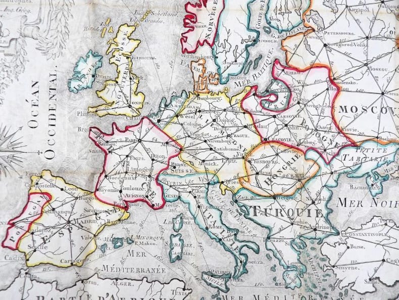
17942640Sans lieu, gravée p. B. Pris. 1794. Dimensions dépliée : 32 x 47 cm ; pliée : 7,5 x 11 cm. Carte pliée dans un cartonnage en papier rose. Rare carte géographique ancienne de l'Europe, dressée par Charles Oudiette, aux frontières réhaussées à l'aquarelle. Elle indique les principales distances entre les capitales, grandes villes et frontières du continent européen.
1769Map1007London: Russell and Price 1769. Original Map . No Binding. Fine. 4to. Single page map of the County of SUSSEX John Roque. Published in ENGLAND DISLAYED Being a New Complete and Accurate Survey and Description of the Kingdom of England and Principality of Wales. Plate 16 x20cm sheet 160 x 243mm. Fine original map printed on laid paper. Uncoloured. 2ND EDITION pub. 1769. OTHER COUNTIES ARE AVAILABLE FROM THIS ISSUE. <br/> <br/> Russell and Price unknown
1769MAP1010London: Russell and Price 1769. Original Map . No Binding. Fine. 4to. Single page map of the County of SURREY John Roque. Published in ENGLAND DISLAYED Being a New Complete and Accurate Survey and Description of the Kingdom of England and Principality of Wales. Plate 16 x20cm sheet 160 x 243mm. Fine original map printed on laid paper. Uncoloured. 2ND EDITION pub. 1769. OTHER COUNTIES ARE AVAILABLE FROM THIS ISSUE. <br/> <br/> Russell and Price unknown
1749620CG(Nürnberg), Homanns Erben, 1749. Kolorierte Kupferstichkarte. Plattengrösse: 51 x 59 cm. Blattgrösse: 52,5 x 61 cm. + Wichtig: Für unsere Kunden in der EU erfolgt der Versand alle 14 Tage verzollt ab Deutschland / Postbank-Konto in Deutschland vorhanden +, 620C