Livre Rare Book
145 résultats
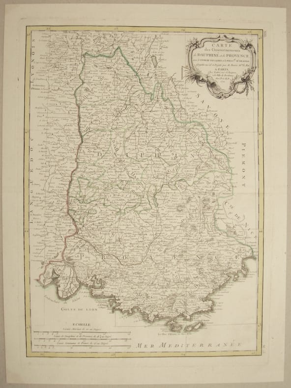
177111299Avec le Comtat Venaissin et la Principauté d'Orange. Carte en parfait état, avec un beau cartouche. En feuille Très bon Paris Lattré 1771
17508142Belle vue panoramique de la ville de Nice, extraite de "Storia moderna di tutti i popoli del mondo" de Thomas Salmon. (Albrizzi). Pliures et petite réparation sans conséquence. en feuille Bon 1750 16,2 x 37,2 cm.
1772186401dat. 1772. Jeweils 57 x 52 cm, zusammengesetzt 57 x 104 cm. Gut erhalten.
1750187172Nürnberg, Homanns Erben, (um 1750). Von mehreren Platten gedruckt. Mit großer allegorischer Titelkartusche mit mehr. Wappen oben links sowie Kartusche mit Erklärungen unten rechts. Grenzkolorit. In 6 Segmenten auf Leinen aufgezogen u. mehrf. gefaltet (ca. 140 x 130 cm). Jeweils m. Titelschildchen versehen u. in Schuber d. Zt. Dieser beschabt u. bestoßen. Vereinzelt gering fleckig.
179446191794 London, Laurie & Whittle, 1794 Carte gravée sur cuivre (50,5 x 57 cm hors marges, 54 x 73 cm toutes marges comprises). Tirage de l'époque. Quelques traces d'une autre carte en surimpression. Map on copperplate (50,5 x 57 cm without the margins, 54 x 73 cm with the margins). Contemporary printing. Several light printed marks of another map.
171216203Paris, chez l'Auteur, 1712 ; grande carte (cuvette du cuivre : 67,5 x 49 cm), coloris d'époque.
179011074Paris, Dezauche, 1790. 4 cartes géographiques horizontales, réhaussées en couleurs, de 157 x 60 cm., entoilées sur un beau tissu saumon, au format plié de 13 x 22 cm., chacune avec l'étiquette de Goujon (marchand de géographie ancienne et moderne) contrecollée, languette de vélin portant le nom des cartes. Emboîtage en bois imitant la forme de 2 livres in-4, demi-veau blond, dos lisses ornés de décors dorés, étiquettes de titre ("Hollande") et tomaison vertes avec décors dorés, plats saumon encadrés de roulettes dorées avec "Bibliothèque V. Perdonet" en lettres dorées au premier plat. Quelques frottements à l'emboîtage, les cartes étant quant à elles en parfaite condition.
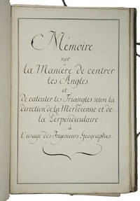
1750ABC_46337France 1750. Folio. Sewn in quires and stored loose in a portfolio covered with grey paper grey cloth ties paper label on the front board. Manuscript in French on thick paper written in a neat 18th-century cursive hand. With 5 manuscript plates showing 14 geometrical figures. 2 blank 1 1 blank 61 3 blank pp. Cartographic manuscript intended to teach engineer-geographers how to in the authors words centrer les angles bisect angles and to triangulate to calculate locations on a map as precisely as possible. The author remains unidentified but probably taught cartography. He the field was hardly open to women gives many examples to explain his methods all richly illustrated in the manuscripts geometric figures and with tables. He quotes the methods of the important French mathematician physician and hydrographer Pierre Bouguer 1698-1758 who was also geometer at the Académie des Sciences in Paris for the means to centrer les angles though we have not found Bouguer using that phrase and those of the French astronomer and cartographer César-François Cassini de Thury 1714-1784 also member of the Académie for triangulation. Altogether the work is a practical guideline for engineer-geographers in which the author not only describes methods for bisecting angles and for triangulation but for example also how to use his own tables on pp. 29-44. A highly interesting cartographic manuscript with a strong geometrical focus quoting two of the foremost French cartographers of the 18th century.With the library stamp of the Danish national library Det Kongelige Bibliothek in Copenhagen. Portfolio a little worn dust-soiled and somewhat stained but the leaves are still in good condition.l Katalog der Bibliothek und Kartensammlung der Königlichen Allgemeinen Kriegsschule 1851 56. hardcover
175046405149Paris, Jombert, 1750 ; in-12, veau fauve marbré, dos à nerfs et ornements dorés, tranches rouges. (Reliure de l’époque) 6 ff., 144 pp., 4 ff. n. ch. (approbation par Belidor, privilège et annonces) - 16 planches gravées dépliantesLa première édition de ce traité est de 1693. Cette nouvelle édition comporte des changements, corrections et additions par Charles-Antoine Jombert. Barbier III, 292 - Polak. Bibl. maritime 7231. Au sujet du mathématicien J. Ozanam voir la notice dans D. S. B. tome X, pp. 263-265. Bel exemplaire frais et bien relié.
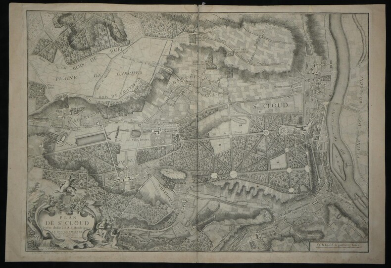
1744boz_006230Rare Plan Original de Saint-Cloud - 1744 - Abbé DELAGRIVE - Carte Ancienne XVIIIe Grand format, limites de Paris, Bois de Boulogne, Garches, Vaucresson. Gravure sur cuivre. Véritable document historique, cette carte finement gravée détaille avec une grande précision le domaine de Saint-Cloud, son château, le dessin de ses jardins et parcs, ainsi que les territoires environnants (Boulogne, Sèvres, Garches, Vaucresson) au milieu du XVIIIe siècle. Elle se distingue par un superbe et imposant cartouche allégorique. Cartographe : Abbé Jean Delagrive (1689-1757), Géographe de la Ville de Paris. Titre exact : « Plan de St. Cloud levé et dedié à S.A.S. Monseigneur LE DUC DE CHARTRE » Date d'édition : 1744 Graveurs : M. Maroye (sculp.) et M. Fourneau (scripsit, pour la lettre). Éditeur / Imprimeur : Imprimerie de Charbonnier, rue St Jacques au Chariot d'Or (Paris). Technique : Gravure originale sur cuivre (eau-forte et burin) tirée sur papier vergé. Dimensions : de la feuille : 92,4 x 63,5 cm ; à la cuve : 86 x 62 cm État : Bon état général, quelques rousseurs et brunissures marginales éparses, de petites déchirures en marge (visibles sur les clichés de détail), sans manque majeur. Ancienne restauration en papier en haut de la pliure centrale au dos. On note également une mention manuscrite ancienne au crayon « St Cloud ». Voir photos et description pour plus de détails.
1796644DGWien, ca. 1796. Kolorierte Kupferstichkarte. Plattengrösse: 24 x 31 cm. + Wichtig: Für unsere Kunden in der EU erfolgt der Versand alle 14 Tage verzollt ab Deutschland / Postbank-Konto in Deutschland vorhanden +, Bild
1796644DGWien, ca. 1796. Kolorierte Kupferstichkarte. Plattengrösse: 24 x 31 cm.
1780Map724Bassano Del Grappa: Giovanni Remondini 1780. 1st ediiton . No Binding. Fine. Folio. ND c1780. 36 x 50cms. Original hand-colour. Dusty condition. Very rare town view of Marseille engraved by the Venitian Francesco Ambrosi 1713-173. A numbered key in French to the lower margin of places of interest in the city 1-19. A dark impression printed on heavy paper with a strong plate mark and clear chain lines but no watermarks. <br/> <br/> Giovanni Remondini unknown
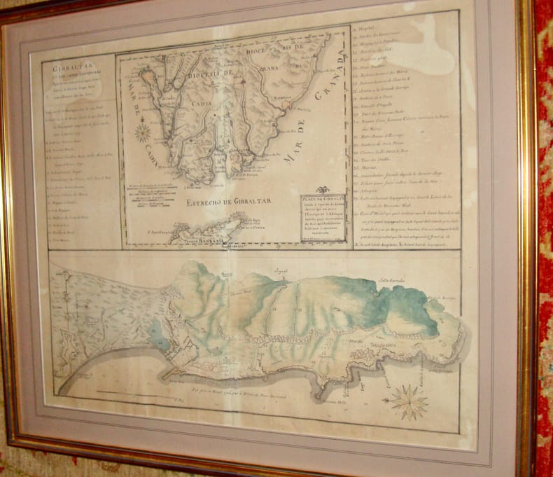
179613938Très beau plan levé par le chevalier d'Antin (Bertrand d'Antin ?) en 1796. En feuille Très bon Gibraltar 1796 53 x 66 cm
1787190168Wien, Schraembl, 1786-1787. 2 Kupferstichkarten nach Jean-Baptiste Bourguignon d'Anville. Jeweils mit allegorischer Titelkartusche u. zartem Grenzkolorit. 73,5 x 79,5 bzw. 52 x 108 cm. In Segmenten auf Leinen aufgezogen u. mehrfach gefaltet.
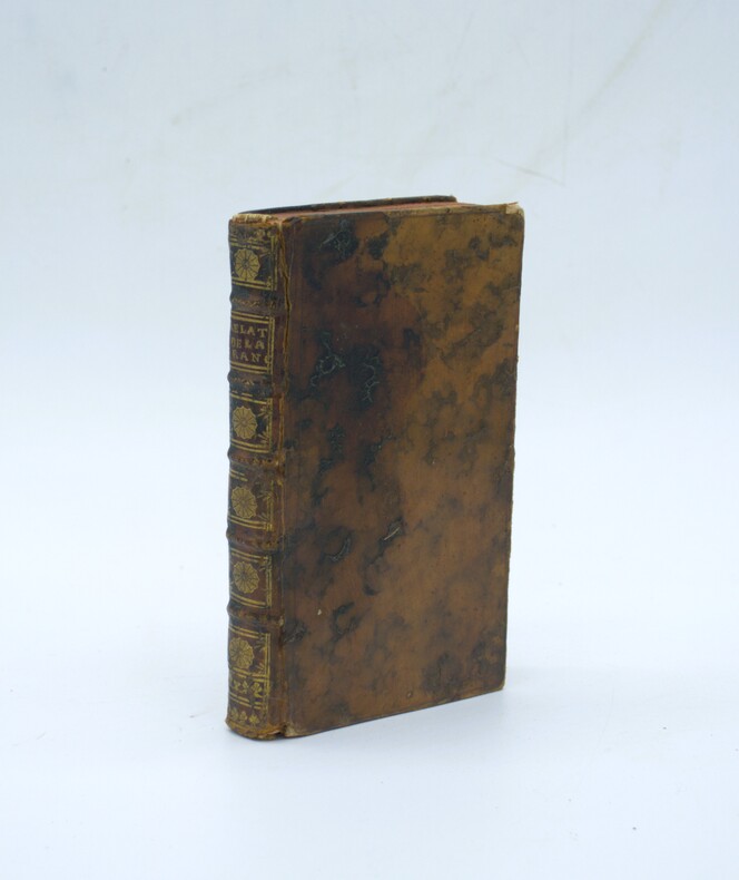
1743PHO-2340A Paris, Chez Piget, Damonneville & Durand, 1743. In-12, (2) ff., IV-250 pp., (1) f. (approb.). Veau havane moucheté de l’époque, dos à nerfs, pièce de titre maroquin grenat, caissons ornés, roulette dorée aux coupes, tranches rouges (coiffe de tête arasée, accrocs en queue, plat en partie noircis ; mouillure claire dans les marges de tête, brunissures).
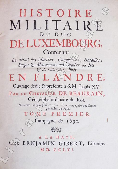
17565629La Haye, Benjamin Gibert, 1756 ; tomes premier et second : Campagne de 1690 et campagne de 1691 ; deux tomes reliés en un volume, in-4 ; demi-basane à coins havane, faux-nerfs dorés, pièce de titre vert clair, tranches mouchetées de bleu (reliure ancienne) ; XVI, 90 ; 146 pp., 5 grandes cartes dépliantes (Nouvelle carte du Comté de Flandre, dressée sur des mémoires fidèles ; Carte du Comté de Flandres par Guillaume de l'Isle ; Carte des camps de Saint-Amand et de Leuse, les 2 et 17 mai 1690, par le chevalier de Beaurain ; Carte des camps de Leuse et d'Hauterive les 17 et 20 mai 1690, par le chevalier de Beaurain ; Carte des camps d'Hauterive et d'Harlebeck les 20 et 21 mai 1690, par de Beaurain).
17710044961771 Paris, Imprimerie Didot, 1771. In-quarto (204 X 255 mm) veau blond, plats ornés d'un encadrement de triple filet doré, dos cinq nerfs filetés, caissons dorés ornés aux petits fers avec fleuron central, roulettes en queue, pièce de titre maroquin marron, coupes et coiffes filetées, bordure intérieure, tranches rouges (reliure de l'époque) ; (1) f. blanc, XII-235 pages, 49 planches hors-texte, (1) f. blanc.
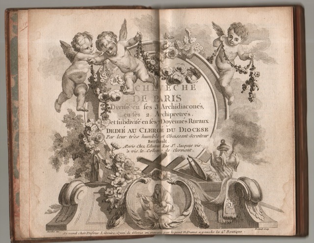
17605889Joli petit atlas des environs de Paris.Beau frontispice et 15 planches colorées (sur 16) sur double page et montées sur onglets. Plein veau raciné, dos long orné, pièce de titre rouge, tranches rouges. Très bon Paris Berthault s.d. (circa 1760) 1 volume in-12.
178149841781 Paris Lattré 1781-1791 5 cartes anciennes. Env. 30 x 41,5 cm hors marges, 36,5 x 51 cm toutes marges comprises. Frontières rehaussées. Bonnes conditions. Quelques menues déchirures marginales à certaines cartes. Pliure partiellement fendue à la carte du Dauphiné et de la Provence.
1742208961742 Au Havre de Grace chez la Veuve de Guillaume Gruchet, Imprimeur & marchand libraire 1742; Avec privilege du Roy, IN8 reliure moderne demi chagrin tabac a coins,dos a nerfs,exemplaire rogné ,court de marge,(4) ff., 415 pp., + table non chiffrée,19 pp., nombreuses figures de contours et 68 cartes gravées sur bois dans le texte.Complet,mouillures claires en bas de quelques dizaines de feuillets,quelques ratures anciennes dans l’epitre,sinon frais,.rare edition.
1744Map918London: Eman. Bowen 1744. 1st Edition . Hardcover. Fine. Double hemisphere map of the world with four seated allogorical women in each corner of the plate. Uncoloured state with a trimmed right hand side but no loss to the map. Plate impress 31.5 x 53.5 cms with sheet size 36.5 x 54 cms. Centre fold. Pre-Cook outlines of Australia and New Zealand. PLEASE EMAIL FOR PHOTOS. <br/> <br/> Eman. Bowen hardcover
1747Map882London: E. Bowen 1747. 1st Edition . printed Map. Fine. . Drawn from the Most approv'd Foreigners Mpas and Charts and Regulated By Astron'l Observations. An original printed map with outline hand-colour to the coast-line and cartouche in the lower right corner. A lovely plate impressed map with sharp clear engraving and title cartouche to the lower right-hand corner. Emanuel Bowen 1694- 1767. Plate 31.7x22.0 paper 38.5 x 26.5 cms. Nice margins. From the 1747 'A Complete System of Geography'. <br/> <br/> E. Bowen unknown
1790Map924London: Thomas Bowen 1790. 1st Edition . printed Map. Fine. Folio. ND 1790. Engraved by Thomas Bowen for Barlow's General Hostory of Europe. A fine copy printed on thick paper with two folds. Nice strong impression with strong plate mark and good margins. No wear or splits. A lovely example. One small fox mark. 36x47cms. Interesting map in that Portugal is not mapped in this cartographic original merely the ' Portugal' where the country should be.ESCT 97895 Barlows History c1790. <br/> <br/> Thomas Bowen unknown
1760Map1001London: T. Bowen 1760. Original First Edition . No Binding. Fine. c1760 A fine example of Bowens map of Portugall. Title within an oval frame. An uncoloured example and printed of thick paper. 2 vertical folds to the page but nice clean margins and a dark impression. Some minor foxing reflecting its age but a nice example. 'Prepared for Barlow's General History of Europe'. Blank reverse. 33x34cms Barlows volume is often very damp stained and foxed. This map is however a fine example. Thomas Bowen 1714-1767 <br/> <br/> T. Bowen unknown