ANSON, GEORGE.MareMagnum

5 843 résultats
Tratta dal “A Voyage round the word. In the Years MDCCXL, I, II, III, IV. By George Anson, Esq; Now Lord Anson...” (London, printed for the Author, 1749). Incisione in rame all'acquaforte (incisa da R. W. Seale), b/n, cm 52 x 50 circa (alla lastra), cartiglio in basso a destra, margine graduato su tutti i lati. Sono segnalate tutte le località che dal Brasile scendono fino alla Patagonia e alla Terra del Fuoco con Cape Horn e le Isole Falkland. Anson George (1697 – 1762). Usuali pieghe editoriali, strettissimi margini, molto buono lo stato di conservazione. .
Tratta dal “A Voyage round the word. In the Years MDCCXL, I, II, III, IV. By George Anson, Esq; Now Lord Anson...” (London, printed for the Author, 1749). Incisione in rame all'acquaforte (incisa dal Lattre), b/n, cm 29,5 x 55,8 circa (alla lastra), piccolo cartiglio in alto a destra, margine graduato sul laterale sinistro e sull'inferiore. Oltre a tutte le isole e agli scandagli di mare sono raffigurate le coste della California (“Partie de Californie”) e le Coste del Messico (“Partie du Mexique”). Anson George (1697 – 1762). Usuali pieghe editoriali, strettissimi margini, molto buono lo stato di conservazione. .
n dieci saggi viene composto il ritratto di un personaggio straordinario e poco noto, Agostino Codazzi (1793-1859), uno dei massimi geografi dell’Ottocento. Avventuriero, viaggiatore, esploratore, ingegnere, visse in un periodo in sospeso fra rivoluzione e restaurazione, patriottismo ed espatrio, illusione e delusione: il libro approfondisce i momenti più significativi della sua parabola umana e s <br/> TITOLO: L'orizzonte in fuga. Viaggi e vicende di Agostino Codazzi da Lugo. <br/> AUTORE: Antei, Giorgio.<br/> EDITORE: Olschki Ed.<br/> DATA ED.: 2012,<br/> EAN: 9788822262196
Amsterdam, Tj. van Holkema,, 1885, ingelijst in frame. 12 losse gekleurde lithografische platen in fraaie lijst ingekaderd, In 14 kleuren op Hollandsch papier gedrukt door Tresling & Co. te Amsterdam. Boek in linnen is erbij. afmeting lijst; 1460x1160mm
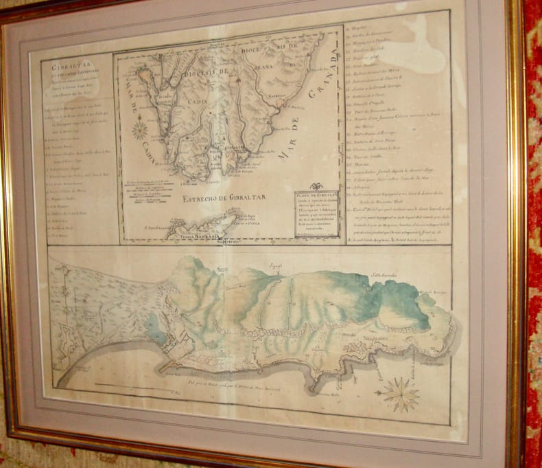
179613938Très beau plan levé par le chevalier d'Antin (Bertrand d'Antin ?) en 1796. En feuille Très bon Gibraltar 1796 53 x 66 cm
Antonio e Luigi Bolifoni Carte de' Regni di Napoli e Sicilia loro Provincie ed Isole adiacenti. , Casa del Libro 1982, Esemplare numerato 1194 di 1500. Copertina in piena tela con titolo in oro al piatto e al dorso, integra con piccole macchie sul fronte e sul retro. Interno in ottime condizioni, cerniera lenta in prima pagina, una mappa con angolo piegato Molto buono (Very Good) . <br> <br> Copertina rigida <br> 8 pp., 19 mappe piegate<br>
Le Guide di ALP alpinismo, collana a cura di Flavio Bessone - Progetto grafico e copertina, Eliana Barbera - Cartografia Eros Deel'Ozio - Introduzione - Esempi difficolt? - Simbologia - Note tecniche 1 20x12,5 cm., in brossura, risvolti con carta all'interno, pp. 159 (1), illustrazioni, figure, schizzi, prima edizione, in italiano, buone condizioni. Copia saggio. Timbro ex libris ...105 vie di arrampicata, dalle classiche alle pi? recenti, con tutti i livelli di difficolt? presenti nello splendido massiccio calcareo...un invito alla scoperta del gioiello dell'Appennino, facilitata dagli schizzi tracciati direttamente sulle fotografie delle pareti e da dettagliate note tecniche relative a esposizione solare, sviluppo, impegno, qualit? della roccia...
18655Paris, chez l'auteur, 1749, 103,5 x 104 cm (taches, déchirures de la toile).
18656S.l., s.n. 1765. 74 x 47 cm. (un coin détaché, déchirures, rousseurs).
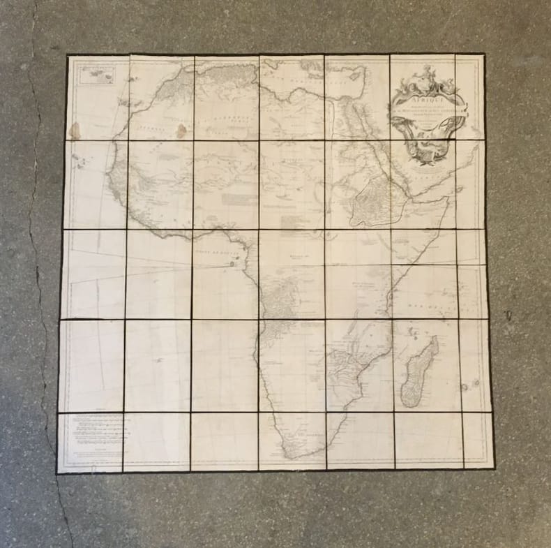
1787190168Wien, Schraembl, 1786-1787. 2 Kupferstichkarten nach Jean-Baptiste Bourguignon d'Anville. Jeweils mit allegorischer Titelkartusche u. zartem Grenzkolorit. 73,5 x 79,5 bzw. 52 x 108 cm. In Segmenten auf Leinen aufgezogen u. mehrfach gefaltet.
cm. 17 x 24, 36 pp. con 3 tavv. f.t. Atlante Toponomastico della Venezia Tridentina 79 gr. 36 p.
Mm 170x240 Volume nella sua brossura originale, dorso muto, 226 pagine con numerose illustrazioni in nero fuori testo. Opera in condizioni molto buone. Spedizione in 24 ore dalla conferma dell'ordine.
1 carta ripiegata e tavole in bianco e nero fuori testo
1963153757London: Geographical Section General Staff 1963. Scarce charts of Bahrain and the Straits of Hormuz A rare and historically interesting pair of adjacent maps of the Arabian Gulf covering six degrees of longitude each the geographical area encompassing the whole of Qatar Bahrain and part of what was to become the United Arab Emirates Al-Hofuf being the major city in the Al-Ahsa Oasis Eastern Province Saudi Arabia; sixth and fifth editions respectively. Maps of the period issued by the GSGS Geographical Section General Staff use a 7-colour tint scale to distinguish altitude and a glossary that highlights towns of significance and other standout features which provided steady references for army personnel to aid navigation in the challenging conditions of the region. The Bander Abbas map was compiled by the US Army Map Service Corps of Engineers from a number of sources including USAF Aeronautical Approach Charts of 1951-55 and the US Geological Survey of the Arabian Peninsula 1958. The Hofuf chart is based inter alia on 512 Field Survey Royal Engineers charts 1942-4. WorldCat lists just three individual copies for Hofuf NG39 SUNY at Buffalo University of Notre Dame and Eastern Illinois University alongside four copies of Bandar Abbas NG40 University of Exeter University of Notre Dame Eastern Illinois University and University of South Florida. It should be noted that major national institutions - BL for example - will have holdings of these maps within the complete GSGS series. Most copies would be discarded on supersession making these an important record of cartographic progress in the region. Two two-colour printed maps 1:1000000 scale 690 x 610 & 750 x 610 mm respectively. Ex- libris stamp of Arizona State Library both stamped "superseded" in blank margin and "withdrawn" on verso some pencilled marginalia; both in excellent condition. unknown
1957182684London: War Office; Printed for D. Survey WO and AM by Balding and Mansell Ltd 1957. A bright example of this detailed Gulf map Classified "restricted" and issued for military use at the time of the Jebel Akhdar War this double-sided sheet shows much of the modern-day UAE extending northwards from the latitude of Abu Dhabi and the Buraimi Oasis as well as the eastern Arabian Peninsula from the Trucial Coast to Jubail. As with other contemporary GSGS maps the sheet covers six degrees of longitude and highlights towns of significance and other standout features for example oil pipelines and wells water systems and roads and railways. Rayon sheet 630 x 710 mm printed both sides in colour folded as issued. A fine example. unknown
1956153759London: Geographical Section General Staff 1956 & 1957. Scarce maps of Oman and south-east Arabia dating to the Jebel Akhdar War A pair of decidedly uncommon and impressively sized regional maps both second editions Muscat-Musira following the first of 1945 S. E. Arabia first published in 1956. The Muscat-Masira map drawn up by D Survey of the Ministry of Defence reaches as far north as Khaburah Oman on the coast south beyond Masirah Island and westward reaching beyond Lahus and Hadhi. It is based on several mappings including Bertram Thomas's map of Rub' al Khali the "Empty Quarter" 1931 the sand desert covering most of the southern third of the Arabian Peninsula Samuel Barrett Miles 1910 map of Oman and Captain F. F. Hunter's map of Arabia 1935 revision. The aeronautical chart goes into greater detail reaching beyond Sur in the North South to Masirah Island and Manadhif and West to Uruq ash Shaybah UAE; this was drawn up by No. 1 SPC.RE i.e. Survey Production Centre Royal Engineers and is based largely on the USAF Aeronautical Approach Charts 1956 and World Aeronautical Chart 563 1951. During the mid to late-1950s Britain was involved in a number of disputes in Oman perhaps the most serious involving the Imam Ghalib al-Hinai and his brother Talib bin Ali who led the Imamate's revolt against Sultan Said bin Taimur which resulted in the Jebel Akhdar or Oman War 1954-1959. In this the RAF played a leading role not least because aircraft could at the same time expedite oil exploration operations in the interior of Oman. Pembrokes light transport aircraft and heavier Avro Ansons from 1417 Communication Flight RAF carried out reconnaissance "and other tasks during this operation against the Imamate and were the first aircraft ever to land at Nizwa marked "Nazwa" on the chart on a roughly cleared strip which proved extremely hazardous for the pilots but which was later transformed into a passable airfield" Lee p. 22. The present chart has two pencilled lines radiating from Masira airfield one of which passes through Nizwa near which is marked the "approx. position" of an airstrip. The chart bear the proviso that they should "not be taken as an authority on names" and that "the alignment of all tracks is approximate". Users were also directed to update information and highlight errors which were to be directly sent to the Director of the Military Survey in the War Office. There are noticeable graphical variations between the chart and map as fitting their usage. Before the Second World War pilots flew using landmarks - such as train tracks or roads - as pointers which meant that they relied on perfect weather conditions. However technological advances in aviation alongside the use of radio for more accurate navigation meant that to a degree pilots could work in more challenging conditions. This meant that maps with their focus on terrain and details relevant from the perspective of ground troops would become irrelevant when observed from a plane's altitude. Therefore a number of countries started to produce charts highlighting key information by reducing the contour structure and focusing on key landmarks necessary for aviators. The Muscat-Masira map uses a five-colour tint scale to distinguish altitude includes a glossary and key the latter identifying towns given four categories of importance significant ruins geographical features such as mountains hills marshes saddles and passes rivers water holes and man-made features such as railways roads tracks telegraph lines pipelines and pumping stations mosques and temples; tribal and regional names are also given. However reflecting the simplification required by pilots the S. E. Arabia chart only uses fives tones to highlight land mountains paths and the sea. These maps intended for use in the field would have had a high rate of attrition; WorldCat locates just a handful of copies of the Muscat-Masira map whilst S.E. Arabia 4802 is well represented institutionally but decidedly uncommon on the market. Two colour printed maps the first 1: 1000000 scale 860 x 640 mm the second 1:500000 scale 1100 x 825 mm. Both with creases from old folds and some minor marginal splits and spots the second with pencil lines marking a flight route from Masira Island and a notation in the margin; both remain very good. Sir David Lee The RAF in the Mediterranean and Middle East 1945-71 1978. unknown
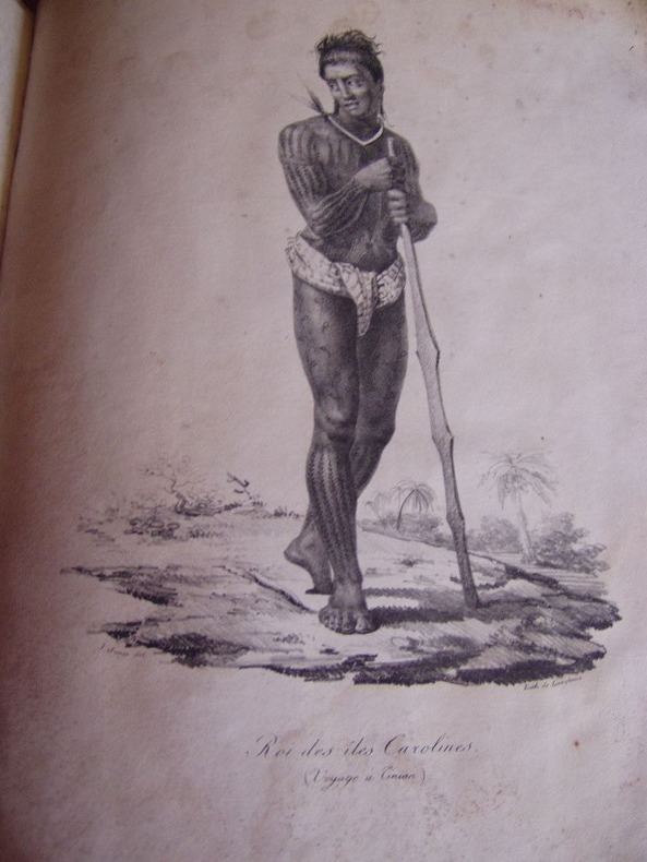
1822176291822 Paris, Béthune & Plon for Leblanc, (1822). atlas vol. in folio. Sans page de titre ni reliure,broche,mouillures en marge,carte abimée,25 lithographies en noir,dans l’etat
580504Paris, Masson , 1967. 2 vol. in-4, chemise à double rabats, contenant les planches à gauche et le texte à droite: fasc. I. 7 planches, 12 cartes géologiques en couleurs sur double page avec les notices, 79pp, 27 fig. in-texte - fasc. 2: 6 cartes, 15 cartes géologiques en couleurs sur double page avec les notices,165pp , 44 fig. in-texte. Table des matières et des cartes.
Carta di cm 36 x 50 alla battuta, più i margini, su tav. piegata a metà. Ampio testo incorniciato a destra e a sinistra, a descrivere ciascuna isola dell'arcipelago. Tratta da 'Atlante storico, geografico, genealogico, cronologico e letterario di M. A. Le Sage in ogni sua parte corretto, ampliato e proseguito sino all'anno corrente. Prima Veneta Edizione'. Strappetto senza mancanze al margine bianco, in alto a destra.
Taranto, 1992, 8vo stralcio con copertina posticcia muta, pp. 441/452 con un'illustrazione, 3 carte e 2 tabelle. - !! ATTENZIONE !!: Con il termine estratto (o stralcio) intendiamo riferirci ad un fascicolo contenente un articolo, completo in se, sia che esso sia stato stampato a parte utilizzando la stessa composizione sia che provenga direttamente da una rivista. Le pagine sono indicate come "da/a", ad esempio: 229/231 significa che il testo è composto da tre pagine. Quando la rivista di provenienza non viene indicata é perché ci è sconosciuta. - !! ATTENTION !!: : NOT A BOOK : “extract” or “excerpt” means simply a few pages, original nonetheless, printed in a magazine. Pages are indicated as in "from” “to", for example: 229/231 means the text comprises three pages (229, 230 and 231). If the magazine that contained the pages is not mentioned, it is because it is unknown to us.
Taranto, 1992, 8vo stralcio con copertina posticcia muta, pp. 539/542 con una cartina. - !! ATTENZIONE !!: Con il termine estratto (o stralcio) intendiamo riferirci ad un fascicolo contenente un articolo, completo in se, sia che esso sia stato stampato a parte utilizzando la stessa composizione sia che provenga direttamente da una rivista. Le pagine sono indicate come "da/a", ad esempio: 229/231 significa che il testo è composto da tre pagine. Quando la rivista di provenienza non viene indicata é perché ci è sconosciuta. - !! ATTENTION !!: : NOT A BOOK : “extract” or “excerpt” means simply a few pages, original nonetheless, printed in a magazine. Pages are indicated as in "from” “to", for example: 229/231 means the text comprises three pages (229, 230 and 231). If the magazine that contained the pages is not mentioned, it is because it is unknown to us.
2 voll. <br/> TITOLO: L'Europa Occidentale. <br/> AUTORE: Arena,Gabriella. Palagiano,Cosimo.<br/> EDITORE: UTET<br/> DATA ED.: 1990,<br/> COLLANA: Coll.Il Mondo Attuale.<br/>
<br/> TITOLO: In giro per il Mar Egeo con Vincenzo Coronelli. Note di topologia, toponomastica e storia medievali. Dinasti e famiglie italiane in Levante. <br/> AUTORE: Armao, Ermanno.<br/> EDITORE: Olschki Ed.<br/> DATA ED.: 1951,<br/> EAN: 9788822214584
<br/> STATO: NUOVO.<br/> TITOLO: In giro per il Mar Egeo con Vincenzo Coronelli. Note di topologia, toponomastica e storia medievali. Dinasti e famiglie italiane in Levante.<br/> AUTORE: Armao, Ermanno.<br/> EDITORE: Olschki Ed.<br/> DATA ED.: 1951,<br/> EAN: 9788822214577