ATLAS - CLOUET, l'ABBE (JBL). J B LBiblio.com
990 résultats
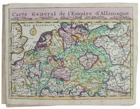
179329054Paris Mondhare et jean 1793. Small folio. 36x31 cm. Cont. hcalf. Back somewhat rubbed and with some cracking along first hinges but tight and not loose. Engraved titlepage and engraved Table of maps bound at end - bottom a little shawed. With 64 double-page engraved maps the first 7 are hemispheres world-systems etc all handcoloured in outline. All maps have engraved text in borders. On good paper with only minor scattred brownspots in margins. Plates numb. 1-64. <br/><br/><em>Scarce last edition of Clouet's fine general atlas first issued 1767. Phillips records 2 other editions form 1787 Phillips No. 661 and 1791 Phillips No. 673 but not this. - Not in Shirley: Maps and Atlases in The British Library. </em> unknown
180755735Weimar Geographischen Instituts 1807-13. Folio-oblong. 38 x 48 cm. Contemp hcalf. Spine a little rubbed. A paperlabel pasted on upper part of spine. Corners bumped. Stamp on "Netz-Karte"/ "Tableau". With 3 other "Netz-Karte" on verso of Sect. 311 a. 14. The engraved title-page in French present as Sect. 10. With all 204 engraved plates 203 maps. The maps clean and fine throughout. unknown
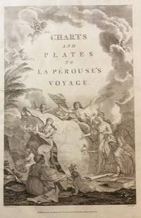
179843609London: Published as the Act directs Nov 1st 1798. by G.G.& J. Robinson 1798. Folio. 43x 27cm. 17" x 14.5". Atlas Volume First English Edition foliated engraved frontis portrait and engraved title-page 68 fine engraved plates maps charts and views many double page and include several plate illustrations on botanical and ornithological subjects. The plates are numbered 2 - 69 without the world map as usual plates are all very good to fine in contemporary half crimson morocco and marbled boards binding heavily dust worn similar wear on the edges upper hinge loose internally very good to fine condition. The map of the world is sometimes described as wanting however it would usually be in the two volume and is not call for in the list of plates <br /> <br /> ~ ~ ~ Hill #'s 972-979. "La Perouse expedition was one of the most important scientific explorations ever undertaken to the Pacific and North West Coast of North America. Hill. "Sabin 38960; Cox I-67. Fine copy of this Important 'Surveying Atlas' to the Pacific and west coast of North America. 1798. The plates are spectacular. - Atlas to the English edition of the report of the famous voyage around the world. Cook Bougainville and La Pérouse contributed decisively to the exploration of the Pacific. <br /> On the unexpected publication of this famous voyage at Paris in the previous year 1797 there was considerable competition among English publishers to bring out the English translation. Three different translations were made and published during 1798-99 and different engravers were employed for making the plates. Stockdale's appeared first in June 1798. Robinson's edition of 1799 is the most esteemed edition in English later editions being usually based on it." The atlas bears the date 1798 in the imprint but was published together with two text volumes in 1799. Published, as the Act directs, Nov, 1st, 1798. by G.G.& J. Robinson unknown
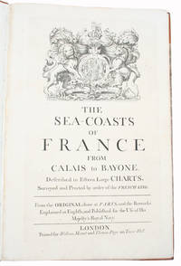
171534417London Printed for William Mount and Thomas Page on Tower Hall no date c. 1715. Folio. 53X35 cm. Cont. hcalf with marbled boards. Rebacked and recornered in old style with raised bands. Engraved typographical titlepage with a large engraved vignette showing the English King's Coat of Arms. With all 15 double-page engraved sea-charts numbered 1-15 in lower right corners. Neat repairs to inner margins of free endpapers and titlepage. Some browning to charts. Chart 5 45x755 cm having the right margin shaved reaching the printed frame. <br/><br/><em>Second edition of this scarce "Atlas Maritime". According to Shirley it was first published by Richard Mount and Thomas Page in 1701 and re-issued with undated title as this in ab. 1715 but with the charts unchanged and a new engraved titlepage. A third issue came out in 1737 with a dated title. The fine charts are copied from Pieter Mortier's famous "Neptune Francois" 1693-1702 and reduzed in size."The charts in this early Mount & Page atlas "The Sea-Coasts of France" are re-engravings reduzed in size from the charts in the French Neptune of 1693. The charts may also be found in the 1702 edition of Mount and Page's Atlas Maritimus Novus." Rodney Shirley. - Not in Phillips. - Shirley Vol. II: M.M&P - 12 b. </em> hardcover
174420097Augsburg Augustæ Vind 1744. 4to-oblong. Cont. hcalf. Back and covers somewhat worn. Platesizes ca. 205 x 27 cm. 32 pp. and 60 full-page engraved maps of 64 listed. Lacking the engraved title and 5 other maps Africa America septentrionalis Regum Portugalliæ Regnum Hispaniæ Italia totur and Palæstina but having 2 more not listed and some in the German section does not corresponds with the maps listed in the index. All maps in original handcolouring occasionally a little brownspotted and traces of use in lower right corners. One map have a little loss of image in lower middle Austria Saliburgensis. <br/><br/><em>Phillips No 3494. 2 maps relating to America Globus Terrestris World Map and America Meridionalis. Having maps of Europe Asia Russia Turkey Scandinavia etc. The World Map engraved by Andr. Silbereisen and most of the other maps engraved by A.C. Seutter and Tobias C. Lotter married to Seutters daughter and his successor. </em> unknown
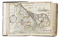
16525476Antwerp 1652. 4to 18 x 14.5 cm. Jan Huyssens Later 17th-century mottled calf sewn on 4 double cords gold-tooled spine and board edges. With a double-page letterpress title-page with a frame built up from typographic ornaments and 39 unnumbered double-page engraved maps of the northern and southern Low Countries by Jacob Aertsz. Colom each map coloured in outline. Interleaved with 38 blank leaves and with a manuscript table of contents 3 3 blank pp. at the end. Double-page title-page and 39 double-page maps. Second known copy of a pocket-atlas published at Antwerp but containing a selection of the maps of the Low Countries originally published by Jacob Aertsz. Colom at Amsterdam in 1635 with the title De Vyerighe Colom the title Colom had first used for his famous pilot guide in 1632 and the name he had given to his Amsterdam printing office where he worked from 1622 to his death in 1673 as a bookseller printer and mapmaker. The only other copy known is at the Royal Library in Brussels. The Vyerighe Colom with 47 maps and 3 plates and with extensive text in Dutch and French went through several editions in the 17th century but it was once thought that all editions before his death in 1673 had been published at Amsterdam by Colom himself. The Royal Library copy like the present one contains 39 maps but each contains one map not in the other so there are forty in total: the present copy includes Drentiae not in the Royal Library copy which includes Le terres entre la Meuse Vahal et Rhin not present here. The maps are also bound in a different order.The present edition is of great interest and gives cause to review Colom's activities. It is printed from Coloms plates so Colom may have licenced the Antwerp publisher to produce a variant edition of his Vyerighe Colom to broaden his market possibly reacting to the signing of the Peace of Münster in 1648 which finally ended the Eighty Years War and opened trade and communication between the northern and southern Low Countries. Jan Huyssens made an entirely new and practical atlas out of Colom's Vyerighe Colom. He omitted all text and the three plates that do not show maps and selected only maps of general interest leaving out the map of the ancient Low Countries and such typical Dutch maps as the separate maps of the polders De Zype Beemster Wormer Purmer Byllemermeer and Waterland also - at least in the present copy - completely rearranging the maps more in order of their geographical sequence. The title suggests that Huyssens originally planned to include a text so the present extremely rare edition may be the only surviving result of an abandoned project.l Koeman & Van der Krogt 365.23 IIIB pp. 644-645 2 copies: the present & Royal Library Brussels; UniCat 99095764 Royal Library Brussels only; cf. Koeman II Col 1 1635 Amsterdam ed.; not in KVK; STCV; WorldCat. unknown
173017253Haarlem 1730. Small 8vo 16 x 10 cm. Bernardus Cleynhens Half textured red cloth ca. 1860 sewn on 2 tapes chemical-marbled sides in brown and blue. With 25 double-page engraved maps 2 overview maps the second serving as a key to the 23 numbered detail maps and an engraved plate with 8 scales all hand-coloured partly in outline. The 2 overview maps slightly wider than the others have a flap folded in at each side. Further with 1 rococo woodcut tailpiece 1 woodcut decorated initial and a fleuron on the title-page. 40 23 1 blank pp. plus maps and plate of scales. A surprisingly rare pocket atlas illustrating the theatre of the "tegenwoordigen" present war probably meaning the War of the Austrian Succession 1740-1748 but possibly the Seven Years' War 1756-1763. The title-page notes that it is suited for officers travellers and lovers of geography to carry in a pocket. The text in Dutch gives a geographic description only of "Duytsland" Germany including Austria Bohemia and a few other areas whereas the maps also cover the Low Countries the English Channel northwest France and to the east as far as Warsaw Krakow and Belgrade. The 23 detail maps were designed so that they could be assembled with the key map to make a single wall map whose cartographic image would measure 53 x 90 cm.With a contemporary owner's bookplate embossed stamp and library labels. With the text leaves somewhat browned not affecting the maps or the plate with scales and the first 2 leaves slightly worn but generally in good condition. A rare pocket atlas from the War of the Spanish Succession.l Koeman I Cle 1; STCN 2 copies; WorldCat 2 copies. hardcover
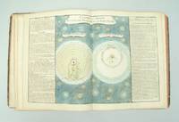
176130654Paris l'Auteur & Desnos vol. I Chec l'Auteur vols. 2-3 1761-62. Folio. 34x285 cm. 3 cont. hcalf. Backs worn tears to spine ends hinges weakening corners bumped. Vol.I: 57 double-folio leaves all engraved including engraved ornamental title in rococo-style leaves numb. 1-57. - Vol. II: 70 double-folio leaves all engraved including double-page engraved title different from the title in vol. 1 Table des Matieres. - Vol. III: 60 double-folio leaves all engraved including double-page engraved title the same as in vol. II Table des Matieres numb. 71-130. With in all 119 handcoloured engraved maps and astronomical plates. Further 68 other plates with tables text etc. All maps and illustrations having engraved text on both sides. On good thick paper. A few brownspots some dampstains mainly marginal 2 plates with small tears no loss. <br/><br/><em>First edition of this atlas which could be called an Atlas-series as the different parts were sold separately. The first volume having its own title deals with the historical development of cosmography geology astronomy oceanography winds streams etc. and illustrates this in a series of impressive pictures with globes spheres continents world-systems etc. having many maps of the continents globe-projections etc. - Volumes 2-3 deal mainly with historical geography and mapping having 84 handcoloured maps. Another volume which is not present here deals with contemporary geography. A fifth volume was announced but is unknown to the bibliographies. Phillips No. 628. - Shirley: T-buy 1a-2a. </em> unknown
184458482Paris Chez l'Auteur - Saint-Petersburg Issakoff 1844-48. Small folio. 35 x 27 cm. In a worn contemp. hcalf. Spine cracked and broken. Boards detached. All parts stitched a few loose. All parts uncut and unopened. All parts clean and fine. Each part separately paginated and with own title-page. Text to each part from 8-12 pp. Each part having a large folded engraved general map and from 11 to 27 engraved folio-maps. In all 292 textpages and 441 engraved maps. <br/><br/><em>The parts volumes comprises: 1. Turquie. 2. Afrique. 3. Grèce et Iles Ioniennes. 4. Portugal. 5. Mer des Indes 1ere Division. 6. Autriche Mer Adriatique. 7. Espagne Cotes N. Mer de Biscaye. 8. Espagne Mer Méditerranée. 9. Sardaigne. 10. Brésil. 11. Amérique Équatoriale Colonies européennes 1re Section. 12. Amérique Équatoriale et Continentale. 13. Prusse. 14. Russie Mer Blanche. 15. Russie Mer Baltique. 16. Russie Mer Noire. 17. Norvège. 18. Suéde. 19. Deux Siciles 1re Section. 20. Deux Siciles 2e Section. 21. Danemarck. 22. Hanovre. 23. Pays-Bas. </em> hardcover
6372614John Wiley & Sons pp. 14288 . Hardback. New. John Wiley & Sons hardcover
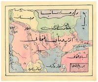
1910ABC_47241Ottoman Empire 1910. Gold-stamped cloth with the tughra of Mehmed V ruled 1908-18 on the front board when reading right to left and "Album" on the back board the front when reading left to right with an inscription below the tughra and the European numerals 16 and 2 flanking an ornament below the inscription the whole framed by 4 large floral cornerpieces. Oblong 4to 26.5 x 19.5 cm. 14 leaves with 10 pen-and-ink maps hand coloured with watercolours. Tissue guards. An album of hand-drawn maps forming an atlas of the western mostly European parts of the Ottoman Empire with legends in Ottoman Turkish written in the Arabic script. The overview map shows Albania Kosovo Macedonia and the Ottoman controlled northern parts of Greece coloured together with Thrace and the northwest parts of Anatolia shown treating them as a single unit while Serbia and Bulgaria like the small parts of territories outside Ottoman control are coloured separately. Most of the other maps give more detailed views of some of these regions including the Bosporus the Dardanelles Halkidiki Chalcidice Albania etc. but there is also a map of Crete not in the overview map.In fine condition. hardcover
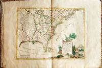
1778019206Venice: Antonio Zatta 1778. First Edition. Softcover. Some minor worming to inner marginal folds of maps occasional spotting. Complete with vibrant coloring. Close to Fine. Oblong folio 16 1/4" x 12" bound in contemporary limp decorated paper covers. Containing 15 double-page engraved maps including the double-page title each beautifully hand-colored depicting Bermuda; the east coast of North America from Nova Scotia to Florida west to the Great Lakes and south to "Luigiana" and "Messico"; Lake Superior and its coast with an inset of eastern Florida including the Keys and Bahamas; Canada between the Ottawa River and Hudson Bay; Labrador; Lake Michigan including parts of Michigan Illinois Indiana Wisconsin Minnesota and Iowa; Lake Huron Ontario Erie Ohio Pennsylvania New York the Hudson River Long Island and western New England; the Canadian and New England coast from Acadia and the Bay of Fundy down the coast to the Long Island Sound; Virginia the Mississippi and Missouri Rivers Louisiana and the Carolinas; Maryland New Jersey Virginia and the Carolinas; Jamaica; the Gulf of Mexico including the coast between Florida and New Orleans north into Indian territory; the east coast of northern Florida Georgia up to Cape Fear; Newfoundland and Cape Breton; and Hudson Bay. <br/><br/> Antonio Zatta paperback
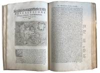
157643595Venice: Calignani & Porro 1576. Foliated 29.7 x 20.9cm a large complete untrimmed copy The enlarged Second Edition small folio 29.8 x 20.2cm 24201.1 colophon foliated with 47 copper plate maps decorated initial letters head and tail pieces in later full vellum red leather label gilt titles title page is lightly sprinkled with tiny spots a very good to fine large complete untrimmed copy of this enlarged edition containing 17 additional maps not in the first edition of 1752. fine. ~ ~ ~ ~ <br /> Header:. Porcacch. The Most Famous Islands Of The World. 1576. <br /> <br /> ~ ~ ~ Shirley. The Mapping of the World 127; The World Encompassed 87; Phillips. Atlases I67; European Americana 576/35; Sabin 64149; JCB I 263-264; Adams P-1905. This is one of the most beautiful works of its kind produced in the 16th century and is the ï¬rst to have maps engraved on copper rather than on woodblocks. "The popularity of Bordone's Isolario brought forth a successor which from both the cartographical and topographical point of view was far more distinguished. Porcacchi's description of the "most famous islands of the world" included the areas represented in the other atlas and devoted the third book to islands of the New World of the Pacific and the Indian Ocean. " "The ï¬rst world map is a ï¬nely-executed reduction of Camocio's large world map of 1567 one of the last in the long line of derivatives from Gastaldis prototype of 1546. The illustrated tract on islands presented here is said to be Porcacchi's most important work. - <br /> <br /> ~ ~ ~ Most of the maps included are: Iceland Hebridean islands and Orkney Gotland Hibernia Ireland England Scotland Sealand Maiorica Menorica Spain Malta Venice Italian archipelago corfu Curzolari Ionia Kefalonia island in the Ionian Sea Zante Morea Cerigo Candi of Indonesia Scarpanto Rhodi Santorini Milo Nixsia Cyrus Metellino Constantinople Stalimene Aegean Negroponte Greece Ciprus Temistitan Mondo Nuouo Spagnola Cuba San Lorenzo Peru S.Giovanni deL isole Molucche Indonesia and Del Mappamondo. The word Atlas was first used in the first collection of maps by Gerardys Mercator's "Atlas sive cosmographicae. 1585-1595 Calignani & Porro unknown
157418848Venetia Venice Giordano Ziletti 1574-73. 4to. Hcalf from ab 1820. Gilt back. Slight rubbing to spine. 78350 pp. and 65 double-page engraved maps with text on verso of plates 130 pp5665 pp. 6 textlvs. at end with brownspots in right margin sometimes a little browning to pages few brownspots and a few textlvs. with minor wormtracts. Complete with all 65 maps called for each measuring ab. 19 x 26 cm. A great part of the maps have some background shadowing from the printers ink mainly due to the fact that this is the third Ruscelli-edition where the plates have been used before. 3 printer's wood-cut devices and 20 smaller and larger woodcuts in the text. 2 woodcuts with Ptolemy shown observing. <br/><br/><em>Third edition of Ruscelli's translation from Venice 1561. The maps are printed from the same plates with the exception of Ptolemy's map of the world for which Malomba had returned to the original conical projection of Ptolemy. Moreover one map is added: the map of "Territorio di Roma". In general the maps are enlarged copies of Gastaldi's maps from the edition of 1548 which came out in 8vo. The Ruscelli translation contains an important innovation namely the division of the world map into two parts one for the Old World and one for the New as seen on the plate "Tavola Universal" depicting the 2 hemispheres. The atlas contains 27 ptolemaic maps and 38 new. 1 World 1 Hemisphere 10 Europe 4 Africa 12 Asia and 38 others. 10 of the maps relate to America.Philipps I:380. Sabin 66505. Nordenskiöld Nr. 34 p.27. </em> unknown
17945887<p>THE FIRST ENGLISH SEA ATLAS OF AMERICA</p><p>Folio 47.7 x 31 cm 66 pp. with pagination errors with 26 engraved maps 21 of which are double-page or folding the first chart with letterpress text attached as called for numerous woodcuts in the text. Bound in contemporary sheep rebacked blind-tooled borders to upper and lower covers. Minor rubbing to covers. Some spotting to the fourth map Verner no. 62 and adjacent letterpress pages small tear to fold of map 10 Verner no. 60 two small circular mends to title page not affecting text otherwise remarkably well preserved.</p><p>A spectacular copy of the final edition of the <em>English Pilot</em> <em>The Fourth Book</em> the first wholly English sea atlas of American waters. The work was sufficiently in demand to justify 37 legitimate editions from 1689 to 1794 and three pirated editions. All editions are rare. During the history of this title its charts underwent numerous changes. The first edition contained only 18 maps whereas this 1794 final edition contained 26.</p><p>"<em>The English Pilot</em> was the first major sea-atlas produced in England. In its final form it consisted of five separate books and <em>The Fourth Book</em> was the first wholly English sea-atlas of American waters. Although the idea originated with John Seller he was involved in producing only the first two books. William Fisher and John Thornton produced <em>The Fourth Book</em> in 1689 and their successors Mount and Page continued to print it for over 100 years Seller's proposal for a 'Sea Waggoner' resulted in the production of <em>The English Pilot</em> which consisted of five separate volumes with a common generic title. Book One included the southern navigation and Book Two the northern. Book Three was concerned with the Orient Book Four with America and Book Five contained Africa. Each book or volume has its own independent publishing history and appeared in numerous editions. The five separate books constitute a set only by virtue of the general title and under that title <em>The English Pilot</em> is the first great sea-atlas produced in England. Of the five books the fourth has the longest publication history and is the best known" Verner p. v.</p><p>Throughout its history <em>The Fourth Book</em> showed very few changes in textual matter and the content of the volume was established between the editions of 1706 and 1721.</p><p>The present example of the 1794 edition is complete and contains the following maps see Verner pp. xv-xx for full list of editions and charts from 1689 to 1794:</p><p>1. A New and Correct Chart of the Western and Southern Oceans Showing the Variations of the Compass with letterpress text attached</p><p>2. A New and Correct Chart of the North Part of America from New Found Land to Hudson's Bay</p><p>3. A New Generall Chart for the West Indies of E. Wright's Projection</p><p>4. A New and Accurate Chart of the Vast Atlantic or Western Ocean by Eman. Bowen</p><p>5. Harbour of Casco Bay Capt. Cyprian Southicke 1720 Em. Bowen</p><p>6. A New and Correct Chart of the Coast Line of Newfoundland from Cape Raze to Cape Bionavista</p><p>7. Island of St. Peters </p><p>8. Chart of the South East Coast of Newfoundland</p><p>9. New and Correct Chart of the Sea Coast of New-England from Cape Cod to Casco Bay Henry Barnsley</p><p>10. A Map of the Coast of New England from Staten Island to the Island of Breton Capt. Cyprian Southack</p><p>11. A Chart of New York Harbour with the Banks </p><p>12. Virginia Maryland Pennsylvania East & West New Jersey </p><p>13. A Draught of Virginia by Mark Tiddeman</p><p>14. Barbados copperplate in text</p><p>15. A New Mapp of the Island of St. Christophers Survey taken by Mr. Andrew Norwood</p><p>16. A Large Draft of the Island of Antegua copperplate in the text</p><p>17. A Draught of South Carolina and Georgia from Sewee to St. Estaca by Andrew Hughes</p><p>18. A Correct Chart of the Caribee Islands</p><p>19. A Correct Chart of Hispaniola with the Windward Passage by C. Price</p><p>20. A Draught of the West End of the Island of Porto Rico </p><p>21. A New & Correct Chart of Cuba Streights of Bahama Windward Passage </p><p>22. A New and Correct Draught of the Bay of Matanzas by Rob.t Pearson</p><p>23. Bermudas copperplate in text</p><p>24. A New and Correct Chart of the Island of Jamaica</p><p>25. A Chart of the Coast of Guayana By R. Waddington</p><p>26. A New and Correct Chart of the Trading Part of the West Indies</p><p> <em>The English Pilot: The Fourth Book</em> Amsterdam 1967 with an introduction by Coolie Verner.</p> Printed for Mount and Davidson hardcover