Historical Atlas Publishing CoBiblio.com

990 résultats
1906112114Toronto: Historical Atlas Publishing Co 1906. Hardcover. Good . 70 p. interspersed with plates CXXI. 49 cm. 22 p. of b&w portraits and 121 p. of colour maps. Half leather black cloth. Writing on front chipped off. Respined and corners rebuilt. Stain on rear cover. New free endpapers and hinge repairs. Paper repairs to title page and other pages up to p. 9. Some dampstains thumbing and small tears. <br/><br/>Contains historical sketch and biographies as well as maps. Atlas section has maps of communities such as Guelph Elora Fergus Aberfoyle Erin Palmerston Mount Forest Harriston Arthur etc. as well as townships. Bonus section includes maps of the world continents countries and various provinces. Historical Atlas Publishing Co hardcover
183553619New York: Published by Huntington and Savage 216 Pearl St. 1835. Imperial 4to. 16 x 14 in. 10 leaves 8 engraved plates 2 double-page 7 hand-coloured minor foxing edgewear faint tidemark to lower margin of first few leaves. Original printed yellow softcovers mounted on thicker paper stock cover art woodcut of astronomer gazing at the stars w/ telescope testimonials printed on back cover soiling edgewear rubbing tide-mark to lower margin bumping to corners pencil drawings by child on verso of some plates trying to reproduce some of the figures still G copy. First edition thus stated “New Edition†which in actuality was an updated and revised edition with new engraved plates executed by W.G. Evans of New York fl. 1830-1845 who also engraved the famed Map of Lewis & Clark’s Track Across the Western Portion of North America in 1842 revised by Archibald M’Vickar. Burritt 1794-1838 an American astronomer and mathematician created his textbook and the later atlas as a low-cost alternative to celestial globes which were often too expensive for many schools in Jacksonian America. The atlas could be purchased for $ 1.25 at the time and the Geography of the Heavens textbooks and Atlases would prove immensely popular in classrooms up until 1876. Adapting most of his constellation figures from Alexander Jamieson’s A Celestial Atlas 1822 Burritt included a plan of the Solar System Celestial maps of the skies in January-March October-December April-June July-September South Pole North Pole and Planisphere of the Whole Heavens on Mercator’s Projection. This was the last decorative celestial reference in the 19th century and even served as inspiration of H.P. Lovecraft who notes it as prized possession in letter to Maurice Moe in 1915. See: Kidwell Elijah Burritt and the Geography of the Heavens Sky & Telescope Vol. 69 January 1985 pp. 26-28; Boston University Art Gallery Celestial Images: Antiquarian Astronomical Charts and Maps from the Mendillo Collection 2005 75. Published by Huntington and Savage, 216 Pearl St., paperback
1849azgsWilliam Blackwood and Sons Edinburgh and London 1849. 5th or later Edition. Hardcover. Very Good/No Jacket. 14 volumes plus atlas complete. All fully bound in leather with gilt decoration - to fascias spines and edges - and titling. All have marbled papertrims and frontis and end papers. This is a FABULOUS set of this popular loquacious history of Europe with the first major account of the French Revolution. It is smart handsome gentlemanly and very clubbable. Some of the books have wear from shelving and are scuffed but this only adds a genial dignity and character. All have binder labels T. Sowler Manchester - the very model of a Victorian businessman on the front pastedowns. Spines have five ridges and six panels. The Atlas 108 pages - published 1850 contains maps of countries and towns and plans of 'battles and sieges &c.' The covers are worn and scuffed. Within there are some small storage marks about. The pages are clean startlingly bright and clear finely detailed and the colours for various regiments fresh. Volume 1 633 pgs; 1849: wear to edges and spine but dignified and secure. The contents are tight and clean. Covers 1774-1789. Vol 2 693 pgs; 1849. In very good handsome condition. Light wear bright gilt. Inside the contents are clean and fresh. There is a silk bookmark. 1789 - 1793. Vol 3 635 pgs; 1749. The stamped decoration as with all other volumes is neat and unworn. The spine has some wear but is benign and kindly. The pages are clean and comfortable. Covers 1795. Vol. 4 654 pages; 1849. A lovely atmospheric copy. At last the story moves on beyond France. The pages are fresh. 1795-1799. Vol V 658 pgs. Neat contented bright. 1799 -1801. Vol 6 670 pgs. Nelson Pitt Napoleon! The odd storage stain. Otherwise very clean. 1801-05. Vol 7 690 pgs. Some age related marks. Tidy and handsome. Fox Prussia Clive of India! 1805-07. Vol 8 696 pgs. Tight confident clean. Some cover wear. Wellesley Napoleon Peninsula Wars. 1807-09. Vol 9. A happy book. Some wear. Spain George III! Pages exceptional. Vol. 10 630 pgs. Some scuffing and wear. Wellington the Emperor South America Turks Russians! Pages very clean. 1810-12. Vol 11 637 pgs. Some wear to the covers. Contents are smart. Moscow Germany Generals! 1812-13. Vol 12 640 pgs. Confident benign copy with some spine wear. Pages very secure and certain. Wellington in France Blucher Napoleon on the run. 1813-14. Vol 13 664 pgs. Edge and spine wear. Pages vigorous and healthy. Come-uppances America Vienna decides! 1814-1815 1814 is the date when Alison had the idea of this history. Vol 14 644 pgs. Some aged wear to the covers. The pages are startlingly healthy. Waterloo St Helena The First Reform Bill contemporary judgements. 1815 and index. Oh happy person who owns this THRILLING story as told in these wonderful and REMARKABLE volumes. fk. Our orders are shipped using tracked courier delivery services. William Blackwood and Sons, Edinburgh and London hardcover
194937964Toronto & Montreal: Underwriter's Survey Bureau Limited. 1949 1949. Hardcover. Very Good Rare. Atlas Folio. 55x31.5cm 18 linen backed double page scale maps a bit wrinkled green cloth covered boards Underwriter's Survey Bureau Limited. 1949 hardcover
1896867391896. ATLAS. ATLAS OF THE CITY OF BOSTON VOLUME 6 WEST ROXBURY. Philadelphia: G. W. Bromley and Co. 1896. Second edition. Folio 22.5". Contains street index outline and index map and 30 double-page maps measuring 22.5" by 32". Maps have only minor soiling to margins and occasional pencil annotations plates 1 and 27. FFEP and title page have large chips. Bound in half leather now mostly chipping or absent. In need of rebacking front board detatched. unknown
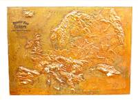
1907M11147Chicago: Atlas School Supply Co. 1907. Very Good. Notes: An interesting Relief Map of Europe. Size : 695x957 mm 27.36x37.68 Inches Coloring: Printed in Color Category: Maps Europe Continent; Atlas School Supply Co. unknown
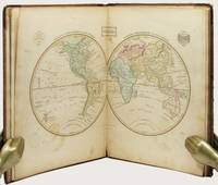
183533158Edinburgh: Oliver & Boyd ca. 1835. Early printing undated. Fully illustrated with 27 maps the map of the world double-page all hand-coloured. Two additional maps are affixed to the endpapers and are extra to those included in the book. These were sometime added by an owner of the volume. 4to publisher's original brown calf over brown cloth covered boards the spine lettered in gilt the upper cover with hand-printed titling label. vi 27 maps on 28 pages A very well preserved copy. The binding with some wear from time and use still strong and showing minor separation at the free-flies and pastedowns the maps all in good order clean and well coloured. EARLY PRINTING OF EWING'S GENERAL ATLAS. Now scarce as a complete book many copies have been broken up with the maps sold separately. The maps have been handcoloured and are preserved very well. A double-page world map is presented first and then the maps of the countries of European countries and Russia Asia Africa North America and South America. The U.S. map is quite interesting in that it includes only the states and territories recognized at the time of publication. The country is show bordering the Atlantic on the East but extending only into the Missouri Territory and Arkansas in the west. Oliver & Boyd hardcover
8992647Short description: In Russian. Atlas Zakhary Veniaminovich. Money and Credit under Capitalism and in the USSR. Moscow; Leningrad: State Publishing House 1930 Moscow: type. The Red Proletarian . The image is provided for reference only. It may reflect condition of one of the available copies or only help in identifying the edition. Please feel free to contact us for a detailed description of the copies available. SKU8992647 unknown
1770D18502Paris circa 1770. Paperback. Very Good. Chez Lattre Graveur Ordinaire de Monseigneur le Dauphin de Monseigneur le Duc d'Orleans et de la Ville. Engraved title-page dedication and 7 full-page engraved maps with original hand-color. 8vo format 10x6¾ inches original blue paste-paper wrappers light wear; minor worm track confined to the margins. A charming eighteenth-century traveler's guide from Paris to Compiegne. OCLC locates one copy listed under a different publisher. <br/><br/> paperback
CBS-9781469873206Lww Exclusive Np 45. New. Lww Exclusive Np (45) unknown
CBS-9781469873206Lww Exclusive Np 45. New. Lww Exclusive Np (45) unknown
181832926Uden Sted ca. 1818-30. Lille 4to. 195x17 cm. Beskedent hshirtbd. Indre false itu men blokken som består af kortbladene intakt. Indeholder 44 af Holms kortblade skårne i træ og herefter grænsekolorerede i hånden. Her og der med lidt brunpletter og brugsspor. Et kort med rift repareret uden tab. Et kort med lidt tab i øverste venstre hjørne. <br/><br/><em>Det lidt naive men charmerende atlas er selvom det er produceret til skolebrug det første danske atlas. Det udkom med et varierende antal kort og sammensætning men ialt er der registreret 50 udgivne blade. Omfatter Danmark Slesvig og Holsten herefter kort over "Norge og Sverrig" "Rusland" "Tydskland" "Preussen" "Österrige Ungern og Gallicien" "Tÿrkiet" "Italien" "Spanien og Portugal" "Frankrige" "Nederlandene" "Storbrittanien" "Asien" "Afrika" "America" og "Australien". - Bibliotheca Danica II:391. </em> unknown
180855974Paris Didot L'Ainé 1808 1805-06. Folio. 54 x 39 cm. Contemp. hcalf. Wear to spine. Spine-ends repaired. Corners bumped.Titlelabel with gilt lettering on upper cover. 2 pp. recto: Atlas historique.- verso: Index listing 32 Engraved frontispiece: Les Fastes Napoléens de 1796 a 1808 with a small handcoloured map dated 1808. With 34 double-page uncut sheets ca. 53 x 72 cm. of which 16 are in letterpress text handcoloured 18 sheets are maps surrounded by text all handcoloured. Internally clean and fine in original colouring. Map-sheets dated 1805-06. The frontispiece having a dampstain. <br/><br/><em>Comprising maps from America Africa Asia Russia etc.etc. - See Phillips124-29 various editions. </em> unknown
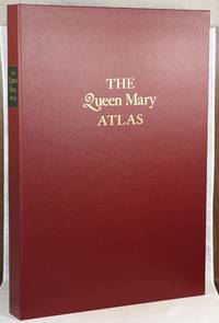
000014624London: The Folio Society 2005. First Folio Society edition. Hardcover. Fine. 2 vol. Elephant Folio; Large 8vo. The elephant folio is unpaginated the large 8vo has a pagination of 4 v-vii 4 4-87 1 pp. Both volumes housed in a maroon cloth clamshell lettered in gilt on the front with a black label lettered in gilt on the spine with three pieces of tissue laid in the interior. The clamshell measures 24" by 17". Full red calf with black and gilt decorations on the front board a coat of arms gilt decorations on the spine of the elephant folio; publisher's maroon cloth with a paper label printed in black on the front board gold lettering on the spine. Maroon and red-orange endpapers in the elephant folio; purple endpapers and pastedowns in the smaller volume. The elephant folio illustrated with twelve double-page maps all in color; the 8vo illustrated with four double-sided plates of color photographs. Number 506 out of 1000 numbered copies for sale. Nash 1245.5. This is a facsimile reproduction of the Queen Mary Atlas which was first produced and issued in the mid-sixteenth century. Commissioned by Queen Mary I as a gift for her husband and cousin King Philip II Queen Mary died before the atlas could be given to her husband. Queen Elizabeth I Mary's rival and successor was the actual recipient of the atlas. The atlas remains in the British Library whose cooperation was essential in reproducing both the rectos and versos of the maps in the original atlas. The maps in the elephant folio are bright and colorful and show different views of all five continents. Please note this item is quite large and will require extra postage. The Folio Society hardcover
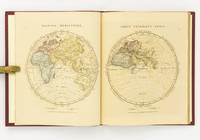
1828142642London: The Author 1828. First Edition. Hardcover. Very Good. London The Author 1828. Large quarto 358 × 295 mm vi pages engraved title dedication and index printed rectos only plus 53 extensively hand-coloured maps all printed recto or verso only with all but the last one - the Western Hemisphere - presented as facing pairs modern followed by ancient. Later quarter red morocco and cloth spine lettered in gilt; top corners slightly bumped; all edges speckled red; a few small inkspots to the top edge with minimal bleeding into a few top margins; all maps offset; blotted ink marks to the top corner of the map of 'Terra Sancta' map 20; trifling signs of age and use; overall in excellent condition. The extensive hand-colouring would appear to be the exception rather than the rule hand-coloured in outline only. The Author hardcover
184927973Kjöbenhavn Chr. Steen & Søn 1849-61. Titelbladet uden år. Stor folio. Samt. hldrbd. Forperm med orig. bogtrykt omslag påsat. Udvendig noget slidt og med brugsspor. Litograferet titelblad med trykt indholdsfortegnelse over atlassets 20 dobbeltsidede foliokort alle litograferede og håndkoloreret hvert målende ca 52x64 cm. Her og der med lidt brunpletter særligt marginer men indvendigt iøvrigt i god stand. Kortene er litograferede hos Emil Bærentzen & Co. Lith. Institut og alle daterede mellem 1849 og 1861 opsat på false. <br/><br/><em>Prægtigt stort atlas af dansk oprindelse. Ikke anført i Dansk Bogfortegnelse - ikke hos Phillips. Indeholder: 1. Den östlige og vestlige Halvkugle. 2. Europa. 3. Asien. 4. Afrika. 5. Nordamerika. 6. Sydamerika. 7. Australien. 8. Danmark. 9. Norge og Sverrig. 10. Storbrittanien og Irland. 11. Frankrig. 12. Spanien og Portugal. 13. Schweitz. 14. Tyskland. 15. Preussen. 16. Nederlandene og belgien. 17. Italien. 18. österrig. 19. Rusland. 20. Tyrkiet og Grækenland. </em> unknown
181956069København 1819. Folio. 44 x 27 cm. Original blue wrappers with some dampstains and rear somewhat soiled. With the engraved oval title on upper wrapper. In a later hcloth portfolio. With 19 all engraved maps charts plans coastal profiles of which 7 are double-page. Maps numbered in letters A-K profiles numbered I-IX.The maps depicting the main harbours with townplans and anchorages. Maps with a few small marginal closed tears. <br/><br/><em>Extremely scarce Danish edition a compilation from Vicente Tofino's "Atlas Maritimo" where the sheets have Danish text. This maritime-atlas was probably intended to accompagny Løvenørn's "Beskrivelse til det voxende Kaart over Kysterne af Spanien og Portugal." 1818.Bibl. Danica II 362 a. 367. - Luisa Martín-Merás: Catálogo analítico de los Atlas del Museo Naval de Madrid 2007". No 232. </em> hardcover
1718D14120Amsterdam: Aux dépens de la Compagnie 1718. Hardcover. Good. Contemporary speckled calf handsomely rebacked but one board detached; gilt-stamped lettering in tan leather spine label second compartment gilt-stamped ornament on 5 raised bands and direct in spine compartments; 3 volumes 12mo 163x95mm; pp. 10 336 35; 16 333 51; 14 468 32; with hand-colored engraved half-title in Volume I 18 hand-colored plates many folding hand-colored decorative head- and tail-pieces. Front rear board on volume one detached. Boards a bit scuffed along the edges; corners bumped; spines dry. Internally bright and clean; previous owner's tasteful bookplate. Plates are lovely. <br/><br/> Aux dépens de la Compagnie hardcover
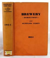
19341904190136New York : Atlas Pub. Co 1934. First Edition. Hardcover. Very Good. Bound in publisher's orange cloth. Hardcover. No dust jacket. Good binding and cover. Clean unmarked pages. Numerous ads. Includes listings for Schlitz etc. "breweries; brewery officials; brewmasters; purchasing agents; manufacturers of equipment and supplies used in breweries; beer jobbers and distributors; beer brands; bottling plants; beer and liquor legislation; associations and their officers; statistics etc." Interesting early post-prohibition book detailing the rebounding liquor industry 1933 repeal. Quite scarce. New York : Atlas Pub. Co hardcover
194764270Portland OR: Oregon Blue Print Co. 1947-1959. Oblong atlas folio. 21 x 17.5 in. 52 leaves not contiguously numbered. all dyazo-print whjteprint maps w/ first consisting of a large folding “Oswego Oregon Street Map†many leaves w/ creasing corners worn some with closed tears secured at gutter margin w/ 4 brass split-pins over thick brown paper stock still a VG- exemplar. First edition thus of this exceedingly rare realty atlas for Oswego Oregon chronicling its’ explosive growth following World War II prior to the consolidation with surrounding suburbs and renaming as the City of Lake Oswego in 1960. These real estate atlases were sold in installments to Lake Oswego & Portland area real estate agents land use boards and public institutions with installments appearing from 1947-1959 but the Oswego atlas sheets are far scarcer than even the very rare Portland issues. Oswego and surrounding suburbs such as Alto Park Acres Forest Hills Lake Grove Rainbow Terrace Uplands Crest and Woodmont were all developed initially by the Ladd Estate Company which first platted the area with Paul C. Murphy overseeing the design with the aid of of Frederick & John Olmsted to create a park like setting around the Lake. This atlas with key map opening details the evolution from 1947-1959 the street-by-street and plat-by-plat of the surrounding area providing essential information on the emergence of these suburbs from the original donation land claims as the city grew from about 1500 to over 10000 by 1959. The more than 100 new residential plats created from the original donation land claims throughout the Lake Oswego area including the plats on the south side of South Shore Drive which created the Palisades Neighborhood and just prior to the July 2 1959 annexation which brought all of Oswego Lake parts of Lake Grove Palisades and others in the Lake Grove Sanitary District all evolve through these maps. Researchers can trace the evolution of the Portland-Salem Expressway later called the Baldock Freeway and further developed into the I-5 corridor alongside Lake Oswego along with the rapid growth of the area. Original Donation Land Claims are clearly demarcated including those of Charles Brown Bryant Waters Carman Albert Durham and many others. Oregon Blue Print Co. was established on SE Hawthorne in Portland OR by the early 1940’s and were the printers for the Pittmon maps which were extensively used and continually updated in the Portland area. Under Walter & Min Underwood the company focused on blueprinting and engineering plans as well as land promotion brochures and street maps. Company still remains family owned. It appears that later versions of the Oswego Oregon Street Map were used as land promotion brochures and some early versions do survive in holdings of Lake Oswego City Government and 1 in OHS but no other examples are located in Worldcat. No similar versions of this atlas have survived in institutional holdings that this cataloguer could identify accurately. See: Mid-Century Lake Oswego: A Look at Lake Oswego’s Modern Developments 1935-1965 August 2010. Oregon Blue Print Co., hardcover
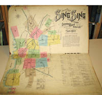
189715960New York: Sanborn-Perris Map Co. 1897. Third edition with additions. Hardcover. Good overall. Folio published in November 1897 with 18 hand colored maps including a title page on the key map. This is the third edition of the atlas according to the Library of Congress Census the first edition being published in 1886 but with only 13 sheets. The second edition was published in 1891 with an extra 2 sheet making a total of 16 sheets. Small private library stamp on the verso of the key map. There are very small pencil annotations on the maps obviously by F.J. Washburn the local insurance agent. <br /> Originating in London in the mid 18th century insurance maps had become invaluable in the US in the 1860's when Sanborn started work. The company started to standardize the maps and publish them in atlases under the town or city. Each map/sheet measures 21 x 25" and is drawn to a scale of 50 feet to an inch with color applied by hand at the time of publication. Every atlas records all town buildings shown to scale its construction material and use noted as well as fire-proofing thickness of walls elevators chimneys fire alarm boxes hydrants sprinkler systems and a wealth of other detail. Ultimately Sanborn produced maps and atlases for 12000 locations. Being so specific the demand was very slight. The Library of Congress estimates that there were usually fewer than twenty orders for a single sheet so production was small and usually produced for a specific Insurance company or agent. Because of this a very small number of copies of any atlas are offered on the market today. The maxim "if it turns up buy it because you won't find another copy" springs to mind. Folio maroon leather spine with printed hard boards rubbed but edges. Sanborn-Perris Map Co. hardcover
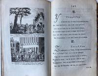
BB110059Half linnen binding 8º 205 x 125 cm. With 12 engraved pages each with 2 history prints in the period 1785-1789 the time of the Batavian Republic Bataafse republiek. BB110059Patriotten - patriots - ABC book - Schoolbook ABC- en geschiedenisboekje in enen waarin elke bladzijde getuigt van diepe liefde voor het Oranjehuis en zo mogelijk nog diepere afschuw van het landbedervend rot der patriotten. Elk van de 24 illustraties de letters J en X ontbreken gaat vergezeld van een zesregelig rijm en een beschrijving van de afgebeelde gebeurtenis. Op het alfabet volgen een dagboek op rijm waarin de gebeurtenisssen van de laatste vier vijf jaren op een rijtje zijn gezet en een vaderlandse geschiedenis in de toen zeer gebruikelijke vraag- en antwoordvorm beide eindigend met de gezegende omwenteling de restauratie van het stadhouderlijk gezag in 1787. Zeldzaam werk dat als een tegenhanger kan worden beschouwd van het ""Vaderlandsch A B boek voor de Nederlandsche jeugd""; dat de patriotsgezinde J.H. Swildens in 1781 had laten verschijnen. Lit.: Buijnsters BNK 1189 unknown
1837891931837. JAPANESE ATLAS Ichikawa Tokei. KOKUGUN ZENZU 2 volumes. Nagoya Edo Osaka Kyoto. Eirakuya Toshiro et al. Preface dated 1837. String-bound Japanese-style fukuro-toji printed paper title labels. Original yellow covers. Covers are a bit soiled with ownership labels. Internal occasional marginal worming. Printed in color woodblock throughout an interesting atlas of the traditional governing divisions of Edo-era Japan. unknown
0486427331New. Brand new and still unused unknown
181254863Paris Francois Buisson 1812. Large 4to. 34 x 25 cm. Contemp. hcalf. Gilt spine. Titlelabel with gilt lettering. Wear to spine and some leather at upper part of spine gone. Taped at foot of spine. 4111-errata pp. and 75 3 extra engraved maps all handcoloured in outline. The three extra inserted are: France Pologne Confederation Germanique. Scattered faint brownspots to textleaves. Maps clean with faint scattered marginal brownspots. <br/><br/><em>First edition. - Sabin 44159. </em> hardcover