990 résultats
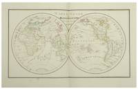
184117957Paris J. Andriveau-Goujon 1841. Folio. Bound in full leather with a closing flap just like a briefcase. Slightly scratched and a few tears to binding. Titlepage with a tear no loss. Complete with 30 double-page ca 41x53 cm full handcoloured engraved maps. A few tears in centerfoldings very ligh brownspottings otherwise good. <br/><br/><em>Philipps No 324 listing an edition from 1838 but not this second edition . This fine engraved atlas comprises 10 historical maps and 20 recent 1841 among these Mappemonde North-and South America Asia Africa Europe etc. </em> hardcover
182054816Weimar 1820. Folio. Image of maps: ca. 35 x 44 cm. Paper size: ca. 46 x 56 cm. Engraved title with outline of the maps title-page in French numbered as Section I. Comprising the Sections I-XXXVI XXIX and XXXII with a and b all but the General map in 2 parts not present. Some maps with markings in red and blue. One with dampstain in lower margin a few with minor traces of use but all intact. In all 38 engraved sheets. unknown
9a395Wohl 4. Auflage. Glogau Flemming ca. 1856. 1 Blatt Inhaltsverzeichnis 109 statt 110 grenzkolorierte Karten original Halbleder Querformat-Folio Rücken mit Fehlstelle/berieben und bst./Bezugspapier teils fehlend/teils stark stock- und wasserfleckig/einige Randlasuren/die letzten 3 Tafeln mit Knickspuren letzte Tafel mit Kantenausbrüchen/Karten mit alter Handschrift numeriert/Tafel 110 Neu-Süd-Wales fehlt. - Vgl. Espenhorst S. 224. Enthält diverse Karten von Deutschland und Europa Amerika 1 Texas Asien Afrika Australien 2 - unknown
DADAX1469873206LWW 2016-09-28. Fifth. hardcover. New. 8.75x2.75x11.00. Buy with confidence. Excellent Customer Service & Return policy. LWW hardcover
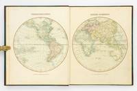
177851680Edinburgh and London 1778. Large 4to. 32 x 245 cm. Contemp. hcalf. Raised bands. Title-label with gilt lettering. Top of spine lacks ca. 1 cm. of leather bottom of spine ca. 1/2 cm. Spine rubbed wear along hinges. Old owner inscription on top of title-page. Ex Libris Scholae Regis Edinensis. Engraved title-page and 23 double-page numb. 1-23 and all with original handcolouring. The map of the world 2 hemispheres: printed size 25 x 46 cm. sheet: 31 x 485 cm. Printed on heavy paper verso blank all clean and fine. <br/><br/><em>First edition. Not in Shirley. The copy described by Shirley I T.YOU - 1 a having another imprint dated 1782. All the maps in our copy is signed "Published as the Act directs 1st July 1778". Shirley mentions that the Atlas was doubtless intended for educational use. </em> hardcover
182812553Paris Julie Bouesche 1828. In-folio 323 x 226 cm 2 ff 8 double maps 10 plates each with a page of explanations 1 f table of geographical & spherical figures contained in this Atlas. The maps show the world map Europe the Kingdom of France 2x Asia Africa North America and South America. The plates show the terrestrial globe celestial globe Ptolomean system Copernican sphere right sphere parallel sphere Copernican system Ticho-Brahé system eclipses and phases of the moon. The atlas is entirely manuscript in brown ink and hand-coloured. Contemporary binding red chagrin spine green cardboard boards gilt framing with the crowned figure of Miss Julie Bouresche on the first board gilt edges. Paris, Julie Bouesche hardcover
187354200Chicago IL: Warner & Beers 62 & 64 Lake Street 1873. Atlas folio. 16 x 18.7 in. 3 3 5-91 1 pp. Woodcut-engraved title page 42 hand-coloured steel-engraved maps all w/ nicely executed engraved borders couple double-page additional steel-engraved “Family Records†page filled-out in manuscript inserted. Original front panel stamped in decorative gilt lettering mounted on recent black cloth binding occasional edgewear minor soiling to fore-edges of textblock couple very minor closed tears still VG copy from the library of John Inkster 1828-1908 Scottish-American farmer who immigrated in 1860 to Pilot Township Kankakee IL to farm with his brother James and then continued West to farm in Coast Fork Lane Co. Oregon and finally the Washington Territory in 1881 where he homesteaded near Davenport WT assisted in building Fort Spokane and served as County Commissioner from 1886-1892. First edition of this exceedingly scarce Illinois Atlas published just after the great Chicago Fire of 1871 featuring an unrecorded platt map of Pilot Township in Kankakee County Illinois showing all the properties and property owners in 1872. This atlas also features the Railway map of Illinois City Map of Chicago maps of all the Illinois Counties and large map of the United States. Of special interest are the excellent early western maps of Texas; Minnesota Nebraska and the Dakota Territory; Wyoming Montana and Idaho Territories; Nevada and California along with map of Oregon and Washington and Alaska Territories. The Beers and Warners were successful map publishers in Chicago IL from about 1850 to 1886 and often publishing as Warner & Beers the cartographers produced a series of early state and county atlases and regional maps which were considered the most detailed maps produced at the time of the respective regions. As their Township and County maps often detailed individual homes and landowners they provide invaluable reference tools to researchers historians and genealogists. No copies located of this specific Warner & Beers Atlas in Worldcat; No individual copies located of the Pilot Township Map; See: Portrait & Biographical Record of Kankakee County Illinois 1893 pp. 390-391; An Illustrated History of the Big Bend Country embracing Lincoln Douglas Adams & Franklin Counties 1904 pp. 421-425. Warner & Beers, 62 & 64 Lake Street, hardcover
189056329Yamada Village Japan: n.p. ca. 1890. 4to. 7.5 x 11 in. 354 pp index maps & sections separately paginated. entirely in original manuscript with over 250 plat and section maps many double-page some folding many w/ additions tipped-in or laid-in as supplemental overlays and many w/ additional manuscript annotations most hand-coloured throughout. Original beige limp boards punch-sewn at gutter margin title in manuscript on front cover some scuffing wear occasional internal worming mildly affecting some maps still a VG- exemplar. An extraordinary Meiji-era manuscript real estate plat map atlas for the Yamada Village and environs of the Keta District in present-day northern Hyogo Prefecture. Traditionally ruled over by descendants of the Miwabe-no-Atai clan this real estate atlas volume encompasses hundreds of plat maps tied to outline maps with the plats all numbered and many colour-coded with colour coding to the opening index. The creator of this map atlas appears to have been commissioned by local land agents following the economic expansion after the opening of the Hyogo Harbor in 1867 for foreign trade while quickly became one of the largest trading ports in Japan. The Tajima province is perhaps best known as the birthplace of Kobe Beef or Tajima Wagyu traditionally compact working cattle with a calm nature but which quickly came into high demand as Kobe Beef in the late 1880s as the large foreign trading and tourist community desired beef and the Tajima cattle were especially desired. This also contributed to a rising demand for land in which to raise the Tajima Wagyu cattle and land prices. At the same time the nearby coast also began slowly developing a small tourist trade and coastal resorts. The map sections include No. 5 -- Kitakami no machi; No. 11 -- Sampo no matsu; No. 12 - Shita takimiya; No. 13 - Okawahara; No. 14 - Takimiya; No. 30 - Kita shitaya as well as No. 36 - Kawahara. In April 1896 the Keta District was dissolved and merged into the Kinosaki District along with the Mikumi District and became the Hyogo Prefecture anchored by the city of Kobe. The additional supplemental pieces tipped-in others laid-in and the many add-ons to the folding map with many bearing annotations indicate that this was a meticulously maintained working document for Meiji land agents. We have been unable to locate any similar manuscript or printed real estate atlases for this era and geographical location. See: Mochizuki Kotaro Japan To-Day: A Souvenir of the Anglo-Japanese Exhibition Held in London 1910 Special Number of the “Japan Financial and Economic Monthly;†Mike Buchanan Hyogo Prefecture Tajima Wagyu History Australian Wagyu Forum 2018; Masanobu Suzuki Development and Dispersal Process of Ancient Japanese Clans 2003. [n.p.], hardcover
1809127861London: Printed for C. Smith Mapseller Extraordinary to his Royal Highness the Prince of Wales 1809. First Edition. Hardcover. Very Good. London Printed for C. Smith Mapseller Extraordinary to his Royal Highness the Prince of Wales 1809. Folio 404 × 330 mm engraved title leaf letterpress contents leaf and 43 hand-coloured copper-engraved maps numbered as 45 the map of Germany comprises two double-page sheets numbered 19-20 and 21-22. All leaves are printed one side only; all maps are dated 1808. Modern half calf and cloth with a gilt-lettered contrasting leather title-label on the spine; short scratch to the leather on the rear cover; title page a little tanned and discoloured around the margins by the leather corners of an earlier binding; scattered light foxing; insignificant short tears to some margins now sealed; trifling signs of age and use; overall in excellent condition. An attractive Georgian atlas 'on a Scale sufficiently large for the Purposes of general Reading and yet not too inconvenient for the Study or the Table' advertisement at the foot of the contents page. The three maps showing Australia 'Eastern Hemisphere' 'The World on Mercator's Projection' and 'Asia' all show the southern coast of the continent as uncharted. The expeditions of Flinders and Baudin had both charted this coast in 1802 but their maps were not published until 1814 and 1811 respectively. Printed for C. Smith, Mapseller Extraordinary to his Royal Highness the Prince of Wales hardcover
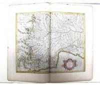
085473N: N 1985. Pp. viii242colophon blank pictorial title page printed in red & black 5 decorative initials printed in red black & white pictorial or decorative tailpieces pictorial endpapers notes bibliography; med. folio; qr. vein-patterned vellum spine lettered in gilt grey papered boards decorated in gilt; fore and bottom edges uncut; within black cloth slipcase which is a trifle marked; Stone & Lorson Fullerton California 1985. Edition limited to 115 copies; this one of 89 thus bound. Hamel 186. The hand coloured double page map tipped-in at the centre shows Pede Montana regio cum Genvensium territorio part of modern Italy. The French text on the reverse includes a large decorative initial and is lightly foxed. The leaf is from the 1619 French edition of Mercator's World Atlas which was the fourteenth edition of the celebrated cartographer's magnus opus. Parts of the atlas had been printed during Mercator's lifetime but the entire work was not published until a couple of years after his death in 1594. N unknown
199236211Norton Critical Editions. New. 1992. Hardcover. 0393034135 . FREE UPGRADE to Courier/Priority Shipping Upon Request IN STOCK AND IMMEDIATELY AVAILABLE FOR SHIPMENT - FLAWLESS COPY BRAND NEW PRISTINE NEVER OPENED - 157 pages. From Library Journal: "Since the 1987 publication of Allan Bloom's The Closing of the American Mind the question of whether that body of works referred to as either the Classics or Great Books should be required reading for college students has divided academia. Journalist and biographer Atlas Delmore Schwartz who covered the debates as waged between traditionalists and multiculturalists for the New York Times here revises an overview of curriculum controversies at major universities that he wrote for Whittle Communications' Larger Agenda series in 1990per BIP .He traveled to Duke Harvard and Chicago to interview professors and examine course catalogues in search of 'our educational mandate.' He contributes a refreshing voice to a discussion dominated by academics evincing a 'spirit of curiosity' where dry polemics are the rule. But he offers little in the way of original thought nor is his argument in favor of the 'canon of Great Books' unified. Denser more closely reasoned new books on the subject include David Bromwich's Politics by Other Means: Higher Education and Group Thinking Forecasts Aug. 10 and Beyond the Culture Wars by Gerald Graff Forecasts Sept. 7." First Norton edition so stated. -- with a bonus offer-- . Norton Critical Editions hardcover
199032897Knoxville TN U.S.A: Whittle Communications. As New. 1990. Hardcover. 0962474533 . FREE UPGRADE to Courier/Priority Shipping Upon Request - IN STOCK AND IMMEDIATELY AVAILABLE FOR SHIPMENT - TEXT PRISTINE & UNMARKED CRISP TIGHT TO THE SPINE - Discusses leading figures such as the late Allan Bloom. Educational values and standards vs. Test scores. 91pp. -- with a bonus offer-- . Whittle Communications hardcover
34025As New. Hardcover. FREE UPGRADE to Courier/Priority Shipping Upon Request - IN STOCK AND IMMEDIATELY AVAILABLE FOR SHIPMENT - AS NEW THE TEXT BLOCK IS PRISTINE CLEAN UNMARKED AND IN EXCELLENT CONDITION - - Color Illustrated Maps & Flags. 192 pp Index. This book contains general reference maps physical maps economic maps with new maps of each state in the union on a large scale and in full detail. Nelson's Complete Encyclopedia Atlas Section Index of Continents Countries States Provinces and Dependencies. -- with a bonus offer-- . hardcover
2015110857Prestel USA. New. 2015. Hardcover. 3791381008 . FREE UPGRADE to Courier/Priority Shipping Upon Request - IN STOCK AND IMMEDIATELY AVAILABLE FOR SHIPMENT - Flawless copy brand new pristine never opened - -- with a bonus offer-- . Prestel USA hardcover
198517247A. C. Black / W. W. Norton. As New. 1985. Paperback. 0713627174 . FREE UPGRADE to Courier/Priority Shipping Upon Request - IN STOCK AND IMMEDIATELY AVAILABLE FOR SHIPMENT - AS NEW THE TEXT BLOCK IS PRISTINE CLEAN UNMARKED AND IN EXCELLENT CONDITION - -- with a bonus offer-- . A. C. Black / W. W. Norton paperback
198754176Cambridge MA: Schenkman Books. New. 1987. Hardcover. 0870470299 . FREE UPGRADE to Courier/Priority Shipping Upon Request IN STOCK AND IMMEDIATELY AVAILABLE FOR SHIPMENT - Flawless copy brand new pristine never opened -- 413 pages. -- with a bonus offer-- . Schenkman Books hardcover
180756070Weimar Geographischen Institute 1807-13. Folio-oblong. Loose sheets in a box. Containg 128 engraved maps each measuring ca. 30 x 45 cm. Mostly clean and fine but some with annotations some with browning and some with traces of use. <br/><br/><em>Present are the following maps Sections: 3-12 17-24 29-36 42-48 53-60 64-66 71-74 80-81 86-90 97-98 103-108 114-126 135-142 151-159 167-173 180-186 193-197 204-208 216-219 227-231 239-243 and 248-254. </em> unknown
170448770Amsterdam Franciscus Halma 1704. Folio. 455 x 29 cm. Contemp. full blindtooled Dutch vellum. Raised bands. Spine ends with tears some cracking along fronthinge but not loose. Vellum at frontcover a bit soiled. Egraved titlepage Coxis del. ianen fecit. Printed titlepage in red/black with an engraved vignette. 15119511 pp. 1 engraved plate with portrait and coat of arms. 4 large folded engraved maps. Light yellowing to margins of textleaves but maps and text fine and clean. 3 of the maps engraved by F. Halma. <br/><br/><em>The maps are the Francois Halma reissues of Sanson's maps from 1683. </em> hardcover
1851D6GE1B01U79OMontpellier 1851. Contemporary bindings: vol. 1 red half goatskin with binder's/stationer's ticket of "Papeterie Sijas Montpellier" red textured paper sides "E.M." in gold on front board marbled endpapers Wolfe 159; vol. 2 black half goatskin black embossed paper sides "C. du M." in gold on front board marbled endpapers Wolfe 112; vol. 3 black sheepskin "C. du M." in gold on front board white watered-silk endleaves. Folio vol. 1 and large 4to 32 x 25.5. cm. vols. 2-3. Neatly written manuscripts on paper with 23 graphically vibrant maps coloured in outline with subtly shaded washes in grey for the coasts and numerous bright colours for political boundaries and with calligraphic headings. 3 volumes. A 3-volume historical manuscript atlas with beautiful manuscript maps the volumes titled: Atlas historique Souvenirs historiques and Tableaux et cartes. The Atlas historique contains finely calligraphed chronological tables displaying events in ecclesiastical history the history of the Roman Empire and France from the first century to 1850 followed by coloured double-page maps of France the Ottoman Empire Europe and the Roman Empire. The Souvenir historiques has the same structure but is solely devoted to the history of England Spain Germany and Italy covering the period from the fifth century to 1850 with coloured double-page maps of the British Isles the Iberian Peninsula the German states and Italy. The Cartes et tableaux is the most ambitious volume containing no fewer than 14 coloured double-page maps including two world maps maps of Africa Asia America Oceania Europe etc. and numerous chronological tables.The ink has sometimes left a browned shadow on the back of the leaves or facing leaves and occasionally eaten a small hole in the paper but the atlas is otherwise in very good condition. Bindings slightly chafed. A graphically vibrant French historical manuscript atlas. unknown
184810230AB1848. Parte primera. Barcelona Imprenta Hispana 1848. 355 : 30 cm. 2 hojas 46 tablas de doble página 2 hojas 32 mapas grabadas de doble página coloreado en los limites. Encuadernación de media piel. Primera edición. - Raro atlas con mapas detalladas de las provincias de España. Cada mapa con un cuadro con explicaciónes e estatisticas de la correspondiente provincia. Buen ejemplar con grandes margenes. - Fue publicado un segundo volumen en 1850 que solo tenia 14 mapas. - Palau III 107. unknown
1991ATLASPRE013370Atlas Press London. 1991-1996. First editions. Octavo. Wrappers. Almost complete set: 338 of 39 fascicles in three slipcased volumes. The last title is missing from the third volume. In the first volume each fascicle is one of 250 numbered copies; in the second one of 300; in the third one of 300. There are a couple of anomalies in the numbering of the fascicles. Authors include Alastair Brotchie who runs Atlas Press Grayson Perry his first book Benjamin P�ret Harry Mathews Remy de Goncourt Robert Desnos Alfred Jarry Pol Bury et al.All fine in very near fine slipcases. Atlas Press, London. unknown
179655711Paris J.B. Delaval 1796/97. Folio-oblong. 40 x 55 cm. Contemp. modest hcalf. A paperlabel pasted on upper part of spine. Marbled paper on covers. A stamp on title-page. Engraved title-page and engraved Tableau dated AN V. With 67 engraved maps incl. Tableau numb. 1-65 53 bis and 58 bis. On title-page the name P.G. Chanlaire is erased. Engraved title-page slightly soiled Tableau the first and last map a bit brownspotted and last map with a closed marginal tear otherwise clean. <br/><br/><em>The atlas is based on the survey carried out by Count Joseph Ferraris in the late 1760s. On the "Tableau d'Assemblage" the last map concerning Belgium is no. 65 Luxembourg and also the last map here not in accordance with the mentioning of 69 on the title-page.According to Shirley "Maps in the Atlases of the British Library" T.CAP-1a the atlas should include 4 sheets covering Belgium on a smaller scale numb. 66-69 they are not present here but having all the regional maps. </em> unknown
1871894281871. ATLAS Bridgeman E.C. translated by Mitsukuri Genpo. RENPO SHIRYAKU 2 vols. Tokyo Zodiacal date of Meiji 4 1871. String-bound Japanese-style fukuro-toji. An interesting work by Bridgeman the Chinese missionary originally published in Chinese but here marked for reading as Japanese kanbun. Thus not a translation as we might understand the term but a long standing aid for literate Japanese to understand the original classical Chinese. With a number of bw and some color maps of the USA along with a text describing US history culture economics etc. A bit of cover soiling outside and the scattered signs of insect damage internally but overall a very good copy. Upon comparison to the original Japanese edition of 1861 there is not much to choose between them. unknown
189255835Chicago & New York: Rand McNally & Co. 1892. Thick elephant folio. 16.5 x 23 x 3 in. 597 1 pp. plus 4 pp. Classified List of Subscribers in Portland Oregon. With over 150 wax engraved colour maps colour diagrams and charts many double-page numerous black & white text maps for cities streets and townships. Full embossed brown morocco over beveled boards gilt lettering & embossed borders on front cover gilt decoration & lettering on spine gilt inner dentelles marbled endpapers spine rebacked w/ original laid back down minor repairs to leather on back cover some scuffing edgewear wear to corners still a VG copy with superb clean interior. First edition thus of the subscriber’s edition of Rand McNally & Co.’s famed Indexed Atlas which encompasses both Western and Eastern Hemispheres offering an essential cartographic and historic reference for the world at the height of the Victorian era on the eve of the 1893 Columbian Exposition in Chicago Illinois. The detailed maps for the United States drew upon the 1890 census results and presented the population of every city town village and settlement in America at the time including Alaska the Indian Territory and Oklahoma all with maps present as well as many large maps of major cities such as Chicago including the site of the forthcoming Columbian Exposition a Chicago Railway Terminal map as well as such cities as Baltimore Cincinnati Louisville San Francisco and many others. Rand McNally & Co. were famed for their relief plate engraving process was engraving which produced fine detailed maps with exceptional detail and colour in competition with such companies as Colton Asher & Adams of New York Matthews-Northrup Co. and George Cram. The atlas also encompasses large detailed maps of Africa India China Asia Europe the Russian Empire and more along with detailed economic and statistical charts across the World. This Indexed Atlas was also released in other variations such as two volumes for Eastern and Western Hemispheres as well as a more compact version with less maps and descriptive text and without the subscriber’s list although all were issued with the same title page. The subscriber’s list for Portland reads as a Who’s Who of the most important firms in the business at the time including the Weinhard Brewery Stranahan & Du Puy architects the Portland Bottline Works owned by Cordes & Johannsen Max Smith’s Vienna Cafe Edison General Electric the Portland Cracker Company and many more. Worldcat locates 7 copies California State Notre Dame & Toronto Complete w/ varying paginations; Univ. of Illinois & Rutgers Vol. I only Rutgers substantially incomplete; Case Western Reserve copy not listed as present in their catalogue LOC; See: Phillips & Le Gear A List of Geographical Atlases in the Library of Congress Vol. I 975. Rand, McNally & Co., hardcover
184458335Paris Au Dépôt Gén.al de la Guerre 1844. Large folio. The 14 engraved maps are engraved by Pelet and each measuring ca. 75 x 100 cm. Engraved folded title-page Table des Cartes et Plans. de 18051806 et 7 1809. Listing 17 maps. One of the extra inserted is a large engraved map of Northern Germany Allemagne Septentrionale with part of Denmark Holland etc. measuring 67 x 130 cm. The measures are paper sizes. Comprising Nos. 3. Théâtre des opérations de l'Empereur Napoléon sur le haut Danube en Octobre. - 4. Bataille d'Ulm ou du Michelsberg 14 et 15 Octobre 1805. - 6. Bataille d'Austerlitz 2 Décembre 1805. - 7. Bataille d'Iéna 14 Octobre 1806. - 8. Places de la Vistule et de la Narew en 1807. - 9. Théatre des opérations de l'Empereur Napoléon entre la Passarge et la Prégel 1807. - 10. Bataille de Preuss-Eylau 8 Février 1807. - 11. Bataille de Friedland 14 Juin 1807. - 12. Théàtre des opérations de l'Empereur Napoléon sur les bords de la Laaber Avril 1809. - 13. Bataille d'Eckmühl 22 Avril 1809. - 14. Combat d'Ebersberg 3 Mai 1809. - 15. Bataille d'Essling et travaux de l'Ille de Lobau Mai Juin et Juillet 1809. - 16. Bataille de Wagram 5 et 6 Juillet 1809. - 17. Bataille de Znaïm 11 Jullet 1809. Faint scattered brownspots. <br/><br/><em>First edition. "Jean-Jacques Germain Pelet-Clozeau 15 July 1777 - 20 December 1858 became a French general in the Napoleonic Wars and later was a politician and historian. He joined the French army in 1800 and became a topographic engineer. He joined the staff of Marshal André Masséna and was wounded at Caldiero in 1805. He served in southern Italy in 1806 and Poland in 1807. He was wounded at Ebelsberg and fought at Aspern-Essling and Wagram in 1809." Wikipedia. </em> unknown