12 880 résultats
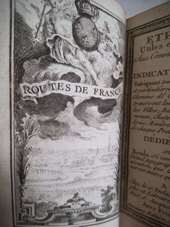
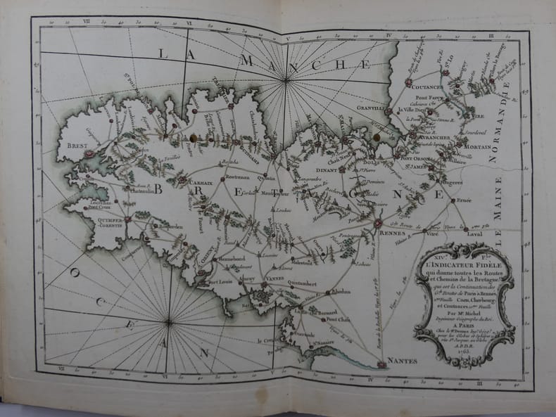
176581119Paris, Rue Saint-Jacques à L'Enseigne du Globe, 1765, in-4 (21x27,5cm), reliure tardive (19e s.) en demi-chagrin bleu nuit à dos long, titre et filets à l'or, plats papier marbré oeil de chat, Contient 19 cartes montées sur onglets, certaines dépliantes : une Carte Générale de France, IIe Feuille: Route de Paris à Rennes. IIIe F. Route de Paris à Bordeaux et Toulouse. IVe F. Route de la Diligence de Lion. Ve F. Le Carosse de Strasbourg. VIe F. Routes de Champagne, Lorraine, Franche-Comté, partie de la Bourgogne et de l'Alsace. VIIe F. Troisième Route de Paris à Strasbourg. VIIIe F. 3e Route de Paris à Strasbourg. IXe F. Grande Route des Prov. de Picardie, de Thiérache, d'Artois, de Hainaut, de la Flandre et des Pays-Bas. Xe F. Route des Provinces de Normandie, Boulonois, partie de la Flandres et Picardie, et Route de Paris à Londres. XIe F. Détail de la première Route d'Amsterdam à Marseille. XIIe F. suite Route Amst. à Mars. XIIIe F. Grande Route de Strasbourg à Wienne. XIVe F. Carte de Bretagne. XVe F. Routes et Chemins des Communications, compris entre les 4 grandes routes de Paris à Nantes et Rennes. XVIe F. Carte de Gacogne. XVIIe F. Qui donne les Routes et Chemins, tant Royaux que Particuliers, compris entre les deux grandes Routes de Paris à Toulouse. XVIIIe F. Qui donne les continuations des Routes Orientales et Méridionales des Grandes Routes de Paris à Marseille. Suit : un Prospectus du Guide des Voyageurs (1ff), un Catalogue Alphabétique des Routes Royales et Particulières (3ff), un Catalogue alphabétique du Supplément des 1380 Villes et Routes de France (4ff). MANQUE la Première Feuille, représentant Paris et les villages de la Banlieue.
1850166701850 un volume, reliure demi-chagrin rouge in-plano à coins (binding half shagreen in-plano with corners) (47,56 x 65 cm)), reliure d'Epoque, dos à nerfs (spine with raised bands) décoré or (gilt decoration) filets or (gilt line) et à froid (blind-stamping decoration) - entre-nerfs à fers spéciaux (between the raised bands specials blocking stamps) - titre frappé or (gilt title) dans un encadrement de filet or, filets or en place des nerfs (gilt lines on the place of raised bands), filets or en tête et en pied (top and at the foot of spine gilt lines), plats décorés or (gilt decoration), mors et coins à double filets or (joints and corners with double gilt line), coiffes supérieure et inférieure légèrement accidentées (head and tail of the spine lightly damaged), percale rose pale (insolée) aux plats (cover with marbled paper), titre doré au centre du 1er plat, plats avec de légères épidermures (front cover with light scratches), tête lisse (top edge smooth), contenant 38 plans sur 41 (Manquent les flles : I, II, III) double pages en noir et en couleurs montés sur onglets (dont un plan dépliant entoilé N°VI, format déplié 120 x 95 cm) + un Grand Plan (dépliant) Géométral de la Ville de Nantes entoilé, format déplié : 120 x 95 cm avec à part la table Alphabétique des Noms de Rues, Boulevards, Places, Passages, Ponts, Promenades, Quais, Impasses, Ruelles, Chemins, Monuments et Etablissements Publics de la Ville de Nantes, 1850/1858 Nantes Imprimerie de Chéneveau Editeur,
12565Etrennes utiles et nécessaires aux commerçants et voyageurs ou indicateur enseignant toutes les routes Royales et particulières de la France, et les chemins de communication qui traversent les grandes routes : les villes, bourgs, villages, hameaux, châteaux, abbayes, hôtelleries, rivières, bois et les limites de chaque province distinguée. Dédiées au Roi. Ouvrage rendu si complet, tant pour le détail topographique, que pour l’exécution que les amateurs y trouveront tout ce qu’ils peuvent désirer. A Paris chez S. DEDNOS ingénieur géographe et libraire de S.A Danoise Rüe st Jacques, au globe 1774.Dernière édition, corrigée, at augmentée. Frontispice gravé, titre avec encadrement, gravés, carte générale des routes de France (sur double page) Carte des environs de Paris sur doble pages) 150 cartes rehaussées en couleurs table des routes contenus dans ce recueil. (9 pages) 1 pages de remarques, 6 cartes en couleurs, 9 pages additions de la table. 2 pages avis, 24 pages blanches (pour annotation). En volume in 16 plein chagrin rouge pièce de titre chagrin vert, fers, roulette, filets dorés ; Roulette dorée encadrant les plats, filet doré sur coupes, dentelle dorée intérieure, tranches dorées. Très bon état d’ensemble, superbe état des cartes, coloris frais.
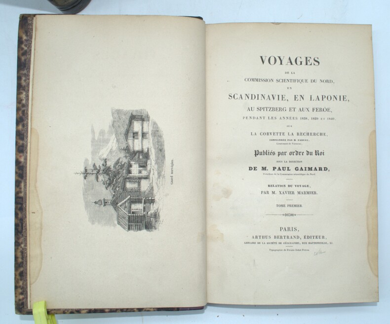
1843PHO-1524Paris, Arthus Bertrand, s.d. (1842-1845). 11 volumes grand in-8 (18, 13 volumes de texte et 5 atlas), relié demi veau aubergine, dos lisse avec titre et tomaison, étiquette au dos, supra libri effacés aux plats, coins usés, dos avec manque (géologie, minéralogie), dos manquant (histoire de la Scandinavie), - Relation du voyage par X. Marmier, 2 vol. (374 pp., 1 pl. ; 458 pp.) - Magnétisme terrestre par V. Lottin, A. Bravais : 3 vol. (563 pp. plus errata ; 448 pp. ; 297 pp. plus table générale détaillée des planches.) - Aurores boréales par V. Lottin, A. Bravais 1 vol. (566 pp., avec 42 figures in texte.) - Géologie, par E. Robert, 2 vol. en 1, (4), 210 pp. ; (4), 308 pp.) - Géologie, Minéralogie par J. Durocher, 1 vol. (482 pp.) - Astronomie et Hydrographie, par V. Lottin, A. Bravais… 1 vol. (531 pp.) - Littérature scandinave, par X. Marmier : 1 vol. (557 pp.) - Histoire de la Scandinavie, par X. Marmier, 1 volume (515 pp.)
213661Paris, Anselin, 1831 in-folio, [2] pp. (titre et table des cartes), 18 cartes, cartonnage papier brun (rel. de l'éditeur). Exemplaire défraîchi (dos absent, qqs rousseurs).
17364173A Paris, Didot, Quillau, Nully, 1736. 1736 1 vol. in-12° (172 x 109 mm) de : [1] f. (titre avec vignette aux armes du Roi) ; 268 pp. 112 plans et médaillons héraldiques gravés sur cuivre, chacun d'entre eux est imprimé sur une pièce de papier circulaire rapportée dans un cadre gravé sur bois. Plein veau glacé d'époque aux grandes armes de France, dos à cinq nerfs orné avec fleurs de lys répétées, pièces de titre de maroquin rouge, double filet doré d'encadrement des plats, armoiries au centre et fleurs de lys estampées dorées aux angles, roulette dorée sur les coupes, tranches jaspées rouges. (Coiffes discrètement restaurées). Provenance: Firmin Lazare (à l'encre sur le titre) et discret petit cachet.
1850199491-1Gotha, Perthes 1850. Quer Gr.4°. 48 S. (vorgebundener Bericht über den Atlas). Mit 83 doppelblattgroßen, gestochenen und grenzkolorierten Karten. Original-Halblederband mit Deckelvergoldung und goldgepr. Rückentitel.
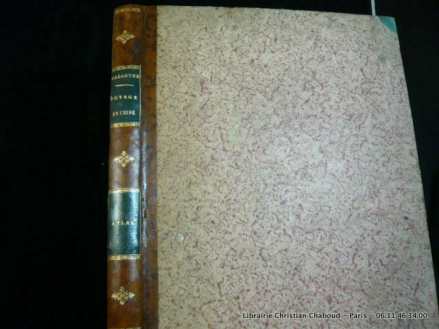
1 vol. in-folio cartonnage pleine percaline éditeur, Marcelin Lacoste, Libraire éditeur, Bordeaux, gravé par J. Geisendörfer, imp. Lermercier et Cie, Paris, 1876-1878, en 9 feuilles Rare exemplaire de cet atlas de la Gironde, dans sa reliure d'origine. Etat très satisfaisant (ex-dono, cartonnage frotté avec diverses traces d'usure, qq. rouss. mais bel état intérieur par ailleurs) Français
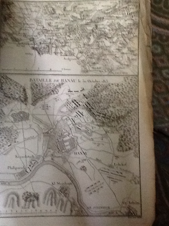
1819CCC-474mb. VAUDONCOURT (Frédéric Guillaume de). Tome 2 uniquement Histoire de la Guerre soutenue par les Français en Allemagne en 1813; avec un atlas militaire. Tome second contenant l'atlas militaire. Paris Barrois l'ainé 1819. in-4 en brochure d'attente (étiquette de titre sur le premier plat). Bien complet des 12 cartes dépl.annoncées. (taches jaunies).
19070A Paris, chez le Cen Lamarche, l'an III de la République française 1795. - In-4 plats cartonnés,dos abscent, 10 pages dont le titre gravé et 53 cartes aux limites coloriées, gravées à double page et montées sur onglet. (Quelques salissures, et mouillures claires en marges des premieres cartes.) titre gravé un peu taché,cartes numerotées a la main,en grande marge non rognée;
Very Good Turkish, Ottoman (1500-1928) Contemporary red cloth. Roy. 8vo. (24 x 16 cm). In Ottoman script (Old Turkish with Arabic letters). [1], 229, [1] p., many b/w and color ills., 30 chromo-lithographed maps. Wear and fading on spine, some ex-library stamps on the colophon and several blank pages, ownership ink inscription and signature on the first page-overall a good copy. First edition of this rare Ottoman atlas for the primary schools in the late Ottoman Empire, including beautiful 30 chromo-lithographed maps of the Ottoman land according to administrative regions (provinces) and richly illustrated with b/w plates of the cities and provinces in the Middle East. Map list: 1. World map 2. Complete Imperial Ottoman 3. Arabian Peninsula 4. Anatolia 5. Asia Minor 6. Marmara and Black Sea 7. Aegean (The Archipelago) 8. Demography of Anatolia and Syria, Libya, etc 9. Administrative map of Anatolia 10. Map of mines of Anatolia 11. Agricultural map of the Imperial Ottoman 12. Arabian Peninsula 13. Map of the Edirne Vilayat [Adrianople Province of the Ottoman Empire] 14. Map of the Bosphorus 15. Map of the Hüdavendigâr Vilayat [Brusa Province] 16. Maps of Izmit and Biga Sanjaks 17. Map of Aydin Vilayat and Mentese Sanjak 18. Map of the Konya Vilayat 19. Maps of the Adana Vilayat and the Mediterranean Sea 20. Maps of the Erzurum and Ankara Vilayats 21. MAps of Kastamonu Vilayat and Bolu Sanjak 22. Map of the Trebizond Vilayat 23. Maps of the Van and Bitlis Vilayats 24. Maps of the Sivas and Harput Vilayats 25. Maps of the Bagdad and Basrah Vilayats 26. Map of the Mosul Vilayat and Day al-Zor Sanjak 27. Map of the Aleppo Vilayat and Urfa Sanjak 28. Map of the Syria and Beirut Vilayats 29. Map of the Arabia 30. Maps of the Yemen vilayat and Asir Sanjak. This atlas was printed four times for the different classes of the early Turkish / Ottoman schools, during World War 1 (two times in 1916) and the National Struggle (two times in 1921). Geylangil was born in Istanbul in 1887 and studied in Aleppo and Baghdad. Geylangil, who also studied economic geography, taught geography at many schools, including Galatasaray High School. Until his death, he wrote 14 books on geography, most of which were geographical atlases. In 1941, he was among the founding members of the Turkish Geographical Society. Özege 23216.; TBTK 11481.; We couldn't find any copy of this edition worldwide.
Very Good Turkish, Ottoman (1500-1928) Contemporary quarter leather bdg. Rebacked boards. Foolscap 8vo. (18 x 12 cm). In Ottoman script (Old Turkish with Arabic letters). 220 p. Very rare early book of the concise biographies of 137 people who served as admirals in the Ottoman Empire between 1352 and 1853, written by Mehmed Izzet Pasha (d. 1853), son of Turkish admiral Abdullah Râmiz Pasha (d. 1813). Ceridehâne Printing House was founded for publishing Ceride-i Havâdîs [i.e. The Journal of News], which was the first semi-official newspaper in the Ottoman Empire. This journal was published from 1840 to 1877 and was founded by William Nosworthy Churchill (1796-1846), a British-born journalist who moved to Turkey aged 19. He was the cause of a diplomatic incident that resulted in the temporary severance of diplomatic relations between Britain and the Ottoman Empire. Babinger p. 323/2.; Özege 6951.; Library of Congress. Karl Süssheim Collection, no. 1336., OCLC: 11810438, 880485954.
1855KART0172Glogau, Flemming 1855. quer-folio (37 x 46 cm). 2 Bll. Mit 113 (von 114) lithographierten, meist grenzkolorierten Kartenblättern. Neuerer, restaur. Halblederband mit den originalen Leinern-Deckelbezügen, darauf goldgepr. Titel, Lederecken. Einige Karten stockfleckig bzw. gebräunt. - Die Karte 29 (Westfalen) fehlt. Espenhorst 5.3c.
18627-10-451Dresden, Fr. von Boetticher, 1860-1862. 2°, 1 Bl., 10 Karten, 1 Bl., 8 Karten, 1 Bl., 6 Karten, OLn. mit umlaufendem Goldschitt
18256181Paris, P. Dupont, 1825. In-folio broché de [4]p. et 15 cartes dépliantes, couverture grise d'éditeur. Non rogné.
141572aafBern, J.J. Burgdorfer, 1816 / 1817, in-8vo, XII + 404 S. + 1 Bl. (Verbesserungen) / 1 Bl. + VII + 1 S. Verbesserungen, S. 405-914 + 2 Bl. Anzeigen. mit 2 gest. Titelbl. mit je einer Vignette von Lory und 4 ganzseitig gestochenen Ansichten von Hegi nach Lory / Atlasband mit 84 S., 3 (2 mehrfach gefalteten) Panoramen, 5 Karten, 1 Tabelle und 1 gestochenen Tafel (Stellungen Oberländischer Schwinger), Exlibris-Stempel Dr. Hermann Fietz-Frey / Exlibris von Peter E. Obergfell. Band 1 und 2 sind neu und sauber in dezentem grünem Leinen gebunden wovon die ursprünglichen broschierter Einband Vorder- und Rückseite konserviert und auf den Leinen-Bänden montiert wurde. Der Hand Atlas ist in modernen grünen Halb-Leinen gebunden.
London, Gold and Co., 1818, 52 x 40 cm., holandesa piel (lomo moderno), portada + 2 págs. + 21 cuadros plegados y 18 mapas dobles con texto en los márgenes, todos ellos coloreados a mano.
1802PHO-1460Paris, Henri Agasse, 1802 , TEXTE et ATLAS , texte : 2 vol. in-8 de LVI-359-[1]-383pp. ,relié demi cuir , dos lisse avec titre et tomaison, plats frottés , coins et coupes usés , manque la page de titre ,XXXI,XXXV à XLVIII , 334 à 337 au tome 1 et les page 245 à 252 au tome 2 et Un ATLAS in-4°, viii-[4]-67 pp.; 43 planches (44), relié demi veau , dos lisse , quelques défauts à la reliure , petites rousseurs à l’atlas et papier légèrement bruni.
185443493Wien, Carl Gerold & Sohn, 1854. Qu.-Gr.-4°. Mit einer lithogr. Karte, einem lithogr. Längenprofil u. 5 Ansichten sowie einem mehrf. gefalt. Leporello-Panorama in Tonlithographie. 2 Bll., 22 S., 2 Bll., Mod. HLdr.
110814Edité par Militar, Kunst, Verlag "Mars" (éditeurs d'art militaire "Mars") - Sans date - In Folio, feuillets libres dans emboîtage rouge décoré - 32 planches, complet selon la Table des matières et numéros des tables (voir photos) + documents hors-texte
180469614Paris, Chez F. Buisson, AN XII (1804), in-4 (22X30cm) , demi-basane d'époque à dos long, pièces de titre (légers frottements), Très bel exemplaire. Planches et cartes de toute fraîcheur, sans déchirure.
BB110059Half linnen binding 8º 205 x 125 cm. With 12 engraved pages each with 2 history prints in the period 1785-1789 the time of the Batavian Republic Bataafse republiek. BB110059Patriotten - patriots - ABC book - Schoolbook ABC- en geschiedenisboekje in enen waarin elke bladzijde getuigt van diepe liefde voor het Oranjehuis en zo mogelijk nog diepere afschuw van het landbedervend rot der patriotten. Elk van de 24 illustraties de letters J en X ontbreken gaat vergezeld van een zesregelig rijm en een beschrijving van de afgebeelde gebeurtenis. Op het alfabet volgen een dagboek op rijm waarin de gebeurtenisssen van de laatste vier vijf jaren op een rijtje zijn gezet en een vaderlandse geschiedenis in de toen zeer gebruikelijke vraag- en antwoordvorm beide eindigend met de gezegende omwenteling de restauratie van het stadhouderlijk gezag in 1787. Zeldzaam werk dat als een tegenhanger kan worden beschouwd van het ""Vaderlandsch A B boek voor de Nederlandsche jeugd""; dat de patriotsgezinde J.H. Swildens in 1781 had laten verschijnen. Lit.: Buijnsters BNK 1189 unknown
194764270Portland OR: Oregon Blue Print Co. 1947-1959. Oblong atlas folio. 21 x 17.5 in. 52 leaves not contiguously numbered. all dyazo-print whjteprint maps w/ first consisting of a large folding “Oswego Oregon Street Map†many leaves w/ creasing corners worn some with closed tears secured at gutter margin w/ 4 brass split-pins over thick brown paper stock still a VG- exemplar. First edition thus of this exceedingly rare realty atlas for Oswego Oregon chronicling its’ explosive growth following World War II prior to the consolidation with surrounding suburbs and renaming as the City of Lake Oswego in 1960. These real estate atlases were sold in installments to Lake Oswego & Portland area real estate agents land use boards and public institutions with installments appearing from 1947-1959 but the Oswego atlas sheets are far scarcer than even the very rare Portland issues. Oswego and surrounding suburbs such as Alto Park Acres Forest Hills Lake Grove Rainbow Terrace Uplands Crest and Woodmont were all developed initially by the Ladd Estate Company which first platted the area with Paul C. Murphy overseeing the design with the aid of of Frederick & John Olmsted to create a park like setting around the Lake. This atlas with key map opening details the evolution from 1947-1959 the street-by-street and plat-by-plat of the surrounding area providing essential information on the emergence of these suburbs from the original donation land claims as the city grew from about 1500 to over 10000 by 1959. The more than 100 new residential plats created from the original donation land claims throughout the Lake Oswego area including the plats on the south side of South Shore Drive which created the Palisades Neighborhood and just prior to the July 2 1959 annexation which brought all of Oswego Lake parts of Lake Grove Palisades and others in the Lake Grove Sanitary District all evolve through these maps. Researchers can trace the evolution of the Portland-Salem Expressway later called the Baldock Freeway and further developed into the I-5 corridor alongside Lake Oswego along with the rapid growth of the area. Original Donation Land Claims are clearly demarcated including those of Charles Brown Bryant Waters Carman Albert Durham and many others. Oregon Blue Print Co. was established on SE Hawthorne in Portland OR by the early 1940’s and were the printers for the Pittmon maps which were extensively used and continually updated in the Portland area. Under Walter & Min Underwood the company focused on blueprinting and engineering plans as well as land promotion brochures and street maps. Company still remains family owned. It appears that later versions of the Oswego Oregon Street Map were used as land promotion brochures and some early versions do survive in holdings of Lake Oswego City Government and 1 in OHS but no other examples are located in Worldcat. No similar versions of this atlas have survived in institutional holdings that this cataloguer could identify accurately. See: Mid-Century Lake Oswego: A Look at Lake Oswego’s Modern Developments 1935-1965 August 2010. Oregon Blue Print Co., hardcover
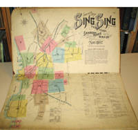
189715960New York: Sanborn-Perris Map Co. 1897. Third edition with additions. Hardcover. Good overall. Folio published in November 1897 with 18 hand colored maps including a title page on the key map. This is the third edition of the atlas according to the Library of Congress Census the first edition being published in 1886 but with only 13 sheets. The second edition was published in 1891 with an extra 2 sheet making a total of 16 sheets. Small private library stamp on the verso of the key map. There are very small pencil annotations on the maps obviously by F.J. Washburn the local insurance agent. <br /> Originating in London in the mid 18th century insurance maps had become invaluable in the US in the 1860's when Sanborn started work. The company started to standardize the maps and publish them in atlases under the town or city. Each map/sheet measures 21 x 25" and is drawn to a scale of 50 feet to an inch with color applied by hand at the time of publication. Every atlas records all town buildings shown to scale its construction material and use noted as well as fire-proofing thickness of walls elevators chimneys fire alarm boxes hydrants sprinkler systems and a wealth of other detail. Ultimately Sanborn produced maps and atlases for 12000 locations. Being so specific the demand was very slight. The Library of Congress estimates that there were usually fewer than twenty orders for a single sheet so production was small and usually produced for a specific Insurance company or agent. Because of this a very small number of copies of any atlas are offered on the market today. The maxim "if it turns up buy it because you won't find another copy" springs to mind. Folio maroon leather spine with printed hard boards rubbed but edges. Sanborn-Perris Map Co. hardcover
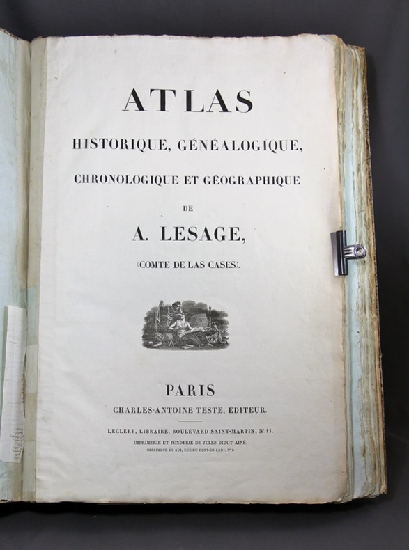
18236185Paris, Charles Antoine Teste, 1823. In-folio en demi-basane verte, dos lisse muet, coins et étiquette de titre au centre du premier plat en vélin teinté en vert. 1ff. de titre, 1ff. d'exposé préliminaire, 1 frontispice, et 38 planches doubles.