12 878 résultats
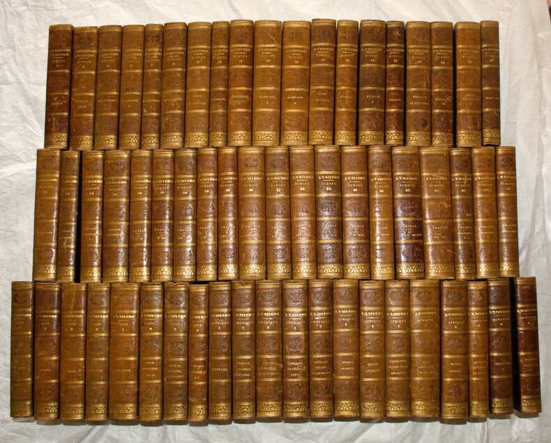
18765669718 vol. in-4 reliure éditeur demi-chagrin rouge, dos à 5 nerfs, toutes tranches peignées, Librairie Hachette et Cie, 1876. Rappel du titre complet : Nouvelle Géographie Universelle (18 Tomes sur 19 - Manque le tome XVII) Tome I : L'Europe Méridionale ; II : La France ; III : L'Europe Centrale ; IV : L'Europe du Nord-Ouest ; V : L'Europe Scandinave et Russe ; VI : L'Asie Russe ; VII : L'Asie Orientale ; VIII : L'Inde et l'Indo-Chine ; IX : L'Asie Antérieure ; X : L'Afrique Septentrionale. Première partie : Bassin du Nil ; XI : L'Afrique Septentrionale. Deuxième partie : Tripolitaine, Tunisie, Algérie, Maroc, Sahara ; XII : L'Afrique Occidentale ; XIII : L'Afrique Méridionale ; XIV : Océan et Terres Océaniques ; XV : Amérique Boréale ; XVI : Les Etats-Unis ; XVIII : Amérique du Sud. Les Régions Andines ; XIX : Amérique du Sud. L'Amazonie et La Plata
Large sized topographical map in striking colours and Ottoman Turkish text of one of the core provinces of the Ottoman Empire around 1900. – Content: Present detailed administrational and topographical map incorporates ground relief (landforms and terrain), drainage (the Aegian Sea, lakes and rivers), forest cover, administrative areas, populated areas (towns and villages in great detail), transportation routes, roads and railways. The Ottoman Ayd?n Province, named after the district and provincial capital Ayd?n, was established by the Ottoman authorities with the »Te?kil-i Vilayet Nizamnamesi« (Provinces Regulations Act) dated 1864 and consisted of ?zmir Central Sanjak (district), Ayd?n Sanjak, Saruhan Sanjak (added in 1877) and Mente?e Sanjak (until 1908). The ?zmir Sanjak is of particular historical importance, as it incorporated not only the historically, economically and culturally important city of Smyrna (?zmir), the second biggest urban agglomeration of the Aegian region after Athens, but also numerous unique ancient sites, foremost the Greek and Roman city of Ephesus. – Condition: Sheets in parts with minor staining, margins skilfully restored tears, otherwise in good condition.
186557001865 Paris Asselin, successeur de Béchet jeune et Laré libraire de la faculté de médecine et de la société centrale de médecine vétérinaire place de l'école-de-médecine 1865/1871 - 3 volumes petit in4 (29cmX20cm) 879 pages de textes et 126 planches non numérotées dont une dépliante.
18737-0-654Weimar, Geographisches Institut, 1873. gr.Folio(57x36cm), 71 Bll.(Karte 32 fehlt) in Kupferstich mit Farbendruck und Clororit, Halbleineneinband
184138194Hildburghausen: Bibliographisches Institut bzw. Schweinfurt: Geographische Gravir-Anstalt von Kleinknecht, ca. 1841. 1 Bl. (Titel), 115 (entgegen der auf dem gestoch.Titel angegebenen 116 Karten listet das Verzeichnis 115 auf) meist grenzkolorierten Stahlstichkarten u. Stadtpläne, 1 Bl. Verzeichnis der Karten. OPappband mit Rückenschildchen in Schuber. 13x19 cm quer.
199243475Mansfield, Martino, o. J. (um 1990; Nachdruck der Ausgabe Washington 1909-1992). Gr.-8°. Zus. ca. 6000 S., OLwd.-Bde.
1799G43465Paris, Didot jeune An 7 [1799] 8 volumes: viii,367 + viii,517 + viii,496 + viii,507 + viii,495 + 454 + viii,552 pp. & "Receuil" (Paris, Garnery, 1819): 19pp.texte + 32 planches (cartes et gravures, dont la plupart dépliantes), 4e éd., reliures plein-cuir avec titres et fleurons dorés aux dos (sauf tome 8: reliure cart.avec dos en toile), tranches et feuilles de garde marbrés, qqs.petites cachets aux pages de titre, bel état, G43465
1827xf399Paris, chez Mlle Carié de la Charie Relié 1827 In-4 (24 x 31 cm), reliure demi-basane, dos lisse orné de dorures, magnifique atlas bien complet des 214 planches annoncées (en fait 215 car il y a une planche 77 bis), 2e édition, plus complète que la première ; dos insolé, frottements aux coiffes, mors, coupes et quelques-uns aux plats, intérieur sans rousseurs à l'exception de la page de titre, très belle impression, exemplaire en bon état général. Livraison a domicile (La Poste) ou en Mondial Relay sur simple demande.
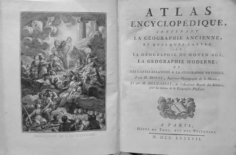
10245Paris, Hotel de Thou, 1787 (Orleans , Imprimerie de Couret de Villeneuve); 1 volume in-4°, demi-basane fauve de l'époque, dos lisse, filets dorés, 2 étiquettes de titre et tomaison citron et verte; (2)ff. (Fronstispice gravé par Boily d'après Cochin, titre), 65pp. et 73 cartes à double page en noir.Reliure frottée avec manque aux mors en pied,manque de papier dans la partie inférieure du 2ème plat (sur toute la largeur sur 5 cm de haut), bon état intérieur. Il manque 4 cartes, sur 77 , les cartes 32, 38, 41 (de France), 59 (d'Europe), complet des 6 mappemondes représentées sous différentes coupes selon les hémisphères et de la carte générale de la surface de la Terre.
184424311844 Ed. FORTIN MASSON ET Cie, 1844/1850/1866, 4 Volumes in-4, toilés marron, tome 1: 82 planches avec explication; tome 2 : 62 planches avec expl. ; tome 3: 40 planches avec expl. ; tome 4: 54 planches avec expl. , manque à la planche dépliante des muscles du dos.
1835PHO-2115Paris, Firmin-Didot Frères, 1835-1863, 60 volumes (70) in-8 (21x13cm), demi cuir époque, dos lisse avec titre et tomaison, frottements aux coiffes et aux charnières, 3 coiffes abimées, rousseurs éparses.
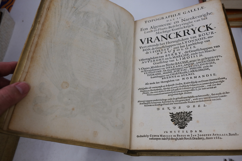
GEO501M1661-1663, Joost Broersz and Caspar Merian, Amsterdam. Incomplet. 3 volumes in-4, plein vélin, médaillon orné de rinceaux et filets estampés à froid sur les plats, dos à nerfs, titre manuscrit dans caisson supérieur. Superbe frontispice, différent sur chaque volume. Toutes les planches sont manquantes. T.II : (3)-184-(7)pp. T.III : (3)-420-(6)pp. T.IV : (3)-473-(6)pp. Vignette ex-libris sur contreplats. Inscriptions à l'encre sur les gardes blanches indiquant le nombre d'estampes à l'origine. Reliure d'époque en bel état malgré quelques éraflures normales et un léger enfoncement des coins. Intérieur très agréable. Épidermure occasionnelle et sans incidence sur la qualité de l'ensemble. Déchirure de 1cm de diamètre dans la garde du volume. Ensemble en bel état de conservation de l'un des atlas de France les plus complets et les plus riches du XVIIe siècle et ici imprimé sur un beau vergé filigrané. Un beau témoignage, amputé des vues et du premier volume.
19886977CBSüssen, Deuschle, 1988. 1 Atlas (30 Bl.) mehrfarbige Karten Kommentarband (102 S.). Orig.-Leinenkassette und Leinenband. + Wichtig: Für unsere Kunden in der EU erfolgt der Versand alle 14 Tage verzollt ab Deutschland / Postbank-Konto in Deutschland vorhanden +, A|B (Faksimileausgabe).
176758508Kopenhagen-Hamburg, Rothen Wittwe, Profft u. Michael Christian Bock, 1766-1767. Gr.-8°. Mit 4 gefalt. Kupferkarten, einem gefalt. Kupferplan und 21 (20 gefalt.) Kupfertafeln. XXXII, 464, XVIII, 276 S., Ppbd. d. Zt. m. reicher Rückenverg., goldgepr. Rückenschild u. dreiseitigem Rotschnitt.
1850SB-17775Stuttgart, Wilhelm Nitzschke, o. J. (ca. 1850). Braune verschließbare Original-Ganzleinenmappe im Format 32 x 26 cm mit goldgeprägtem Deckeltitel sowie ornamentalen Blindprägungen. Außerdem zugehöriges Textheft (2. Aufl., 84 S., 1 Bl.). Sehr seltenes Atlaswerk des Augsburger Mathematikers und Kosmographen Ludwig Preyssinger, enthaltend 12 ganzseitige, überwiegend kolorierte lithographische Tafeln auf Karton, welche folgende Himmelskonstellationen abbilden: Taf. I: Die Central-Sonne und die Ansicht von der Fixsternenwelt. Taf. II: Himmels Karte mit den Sternen welche während des ganzen Jahres sichtbar sind. Taf. III: Darstellung des Sonnensystems, die Planeten mit ihren Bahnen, wie sie bis heute bekannt sind. Taf. IV: Vergleichende Darstellung der Grösse der Planeten. Taf. V: Die Sonne und verschiedene Erscheinungen derselben. Taf. VI: Der Mond durch das Fernrohr gesehen. Taf. VII: Transparente Darstellung der Mondphasen. Taf. VIII: Finsternisse (Mondfinsterniss - Sonnenfinsterniss; niedrige Fluth - Springfluth) Taf. IX: Ansicht von den Jahreszeiten nebst den Zeichen des Thierkreises. Taf X: Die Erde und ihre Atmosphäre. Taf. XI: Kometen und Aerolithen. Taf. XII: Mathemat. Geographische Begriffsversinnlichungen. Das Besondere an den kunstvoll gestalteten Tafeln sind unter anderem zahlreiche kleine oder größere, mit transparentem Buntpapier hinterlegte Ausstanzungen, so daß die betreffenden Areale, sobald die Tafeln ins Licht gehalten werden, aufleuchten und zum Beispiel die Himmels-Karte als leuchtender Sternenhimmel erscheint. Alle Tafeln mit erklärenden Texten. Mit enthalten ist ferner das zugehörige Textheft (Ergänzungs-Text zum Astronomischen Bilder-Atlas) mit den jeweiligen Tafeln zugeordneten astronomischen und kosmographischen Erläuterungen. Ludwig Preyssinger lehrte als Professor für Mathematik, Chemie, Physik, Kosmographie und Naturgeschichte am Königlichen Lyceum Augsburg und fungierte zugleich als Leiter des Augsburger Observatoriums.
18006511800 Paris, Buisson, Bosange, Masson et Besson, Treuttel et Würtz (Imp. de Poignée), an VIII (1800). 4 volumes dont un d'atlas. Volumes de texte : 20,5 x 14 cm (R), in-8, XXXVIII - 299 (2) pp., 410 pp., 362 pp., reliure de l'époque en demi-basane fauve, dos lisses richement ornés, pièces de titre et de tomaison, toutes tranches jaunes. Volume d'Atlas : 29 x 23 cm (R), in-4, 39 pp. - 11 cartes, la plupart dépliantes et certaines finement rehaussées de couleurs, reliure de l'époque en demi veau glacé, dos lisse orne de filets et fleurons dorés, pièce de titre, tranches marbrées.
1804P1-5CP1-4DParis, Buisson, 1804. 3 volumes de texte in-8, reliés pleine basane époque, dos lisse ornés, pièce de titre maroquin rouge et de tomaison verte, tranches marbrées, filets or sur les plats, reliure frottée, coins émoussés. 396,375 et 318pp.(reliure T3 diff.) Un ATLAS in-folio (37x28 cm), relié demi-basane à coins, dos plat orné, manque de cuir au dos, reliure usagée, intérieur en bon état, pas de rousseurs. 2ff- 2 cartes dépliantes 28 planches. Illustré de deux cartes dépliantes et 28 planches de costumes, vues et histoire naturelle, gravées en taille-douce par Tardieu, Delignon, Niquet et Delvaux. Atlas of the French translation an account of an embassy to the kingdom of Ava , 2 folding maps and 28 plates half contemporary bounding, binding worn, the plates are very clean, no foxing or water stain. Size folio (37x28 cm). 3 volumes of text (binding vol.3 diff.)
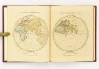
1828142642London: The Author 1828. First Edition. Hardcover. Very Good. London The Author 1828. Large quarto 358 × 295 mm vi pages engraved title dedication and index printed rectos only plus 53 extensively hand-coloured maps all printed recto or verso only with all but the last one - the Western Hemisphere - presented as facing pairs modern followed by ancient. Later quarter red morocco and cloth spine lettered in gilt; top corners slightly bumped; all edges speckled red; a few small inkspots to the top edge with minimal bleeding into a few top margins; all maps offset; blotted ink marks to the top corner of the map of 'Terra Sancta' map 20; trifling signs of age and use; overall in excellent condition. The extensive hand-colouring would appear to be the exception rather than the rule hand-coloured in outline only. The Author hardcover
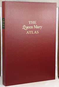
000014624London: The Folio Society 2005. First Folio Society edition. Hardcover. Fine. 2 vol. Elephant Folio; Large 8vo. The elephant folio is unpaginated the large 8vo has a pagination of 4 v-vii 4 4-87 1 pp. Both volumes housed in a maroon cloth clamshell lettered in gilt on the front with a black label lettered in gilt on the spine with three pieces of tissue laid in the interior. The clamshell measures 24" by 17". Full red calf with black and gilt decorations on the front board a coat of arms gilt decorations on the spine of the elephant folio; publisher's maroon cloth with a paper label printed in black on the front board gold lettering on the spine. Maroon and red-orange endpapers in the elephant folio; purple endpapers and pastedowns in the smaller volume. The elephant folio illustrated with twelve double-page maps all in color; the 8vo illustrated with four double-sided plates of color photographs. Number 506 out of 1000 numbered copies for sale. Nash 1245.5. This is a facsimile reproduction of the Queen Mary Atlas which was first produced and issued in the mid-sixteenth century. Commissioned by Queen Mary I as a gift for her husband and cousin King Philip II Queen Mary died before the atlas could be given to her husband. Queen Elizabeth I Mary's rival and successor was the actual recipient of the atlas. The atlas remains in the British Library whose cooperation was essential in reproducing both the rectos and versos of the maps in the original atlas. The maps in the elephant folio are bright and colorful and show different views of all five continents. Please note this item is quite large and will require extra postage. The Folio Society hardcover
Very Good Turkish, Ottoman (1500-1928) Original bdg. Large roy. 8vo. (24 x 20 cm). In Ottoman script. (Old Turkish with Arabic letters). 16 p., 15 chromo-lithographed maps. Some markings on the two maps. Otherwise a very good copy. First edition of this scarce atlas for Turkish primary schools drawn and published by Turkish geographical educators and cartographers in the early Republican period of Turkey. This fine atlas was printed in London, in a period after the proclamation of the Republic, before the Letter Revolution in 1928. Duran studied in Istanbul and Paris. He worked as a geography teacher in various high schools then he became a lecturer and a manager at Ankara Gazi Education Institute for a while. He was known for his writings on various topics and especially for his works on geography. Born in the imperial period, Duran signed the first cartographic studies of the Republic of Turkey with the transition to the Republican administration. Özege 8764.
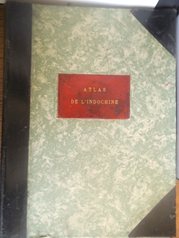
14163Second grand atlas publié en 1920 après celui par CHABERT-L GALLOIS publié en 1909 46 cartes en couleurs, doubles, montées sur onglets Reliure demi cuir vert muet à coins, plaque chagrin rouge avec le titre doré, sur le premier plat. 225x405mm, Sans lieu ni date. Publié par le service géographique de l’Indochine (Hanoï) aspects administratif, météorologique, archéologique, historique, Atlas à l’échelle 1/1 000 000e
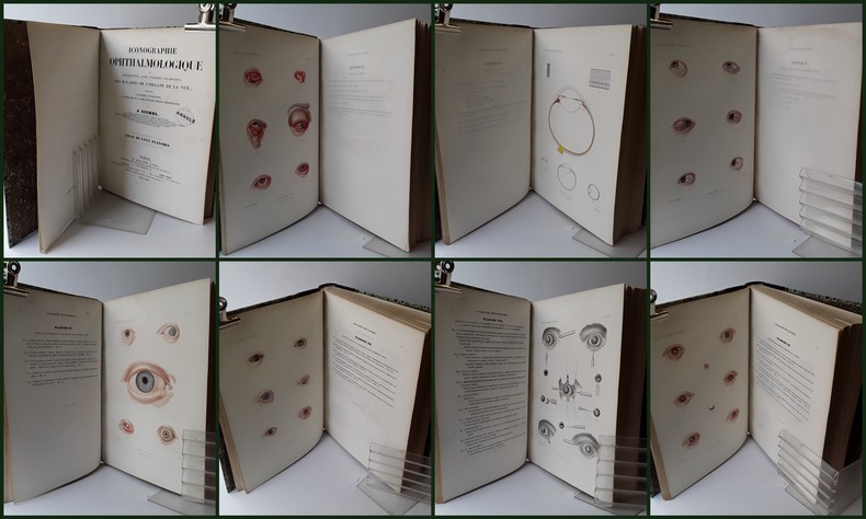
1859SHL-19Paris, J.-B. Baillière et Fils, 1852-1859, un vol. in-4° (310 x 230 mm), atlas seul, reliure postérieure demi-box vert sapin, dos d'origine conservé, lisse à faux-nerfs avec titre doré ; 2 ff. n.c. (faux-titre, titre) - 80 pp. d’« Explication des planches » placées en regard des 80 planches H-T. gravées sur cuivre par Clergé, Oudet, Martin et Visto, d'après les dessins d'Émile Beau, pour la plupart imprimées en couleurs mais rehaussées au pinceau dans un souci de réalisme et de perfection. Cachet de bibliothèque sur la page de titre « Annulé », quelques rousseurs dans le texte, petites brunissures sans importance, les serpentes ont été en partie ôtées.Cet ouvrage, avec celui d’Ammon, est l’ouvrage de référence sur les connaissances pré-ophtalmoscopique des maladies des yeux et l’un des plus beaux atlas dans cette spécialité « This work and that of Ammmon remain the greatest preophthalmoscopic atlases of ophthalmology », in Source Book OF OPHTHLMOLOGY ; Daniel M. Albert , M.D. / Edward W.D. Norton, M.D., Reva Hurtes, 2135, 5868. Après avoir étudié l’ophtalmologie à Vienne auprès de Jaeger, Jules Sichel créa, en 1832, la première clinique ophtalmologique de Paris qui devint l’un des centres de recherche et d’enseignement le plus actif et réputé de l’époque. Il donna également des conférences à l’Hopital Saint Antoine, publia de nombreuses monographies, la plus importante étant l’Iconographie Ophthalmogique, et permit à cette spécialité d’être reconnue par la médecine générale.
181832926Uden Sted, ca. 1818-30. Lille 4to. (19,5x17 cm). Beskedent hshirtbd. Indre false itu, men blokken som består af kortbladene intakt. Indeholder 44 af Holms kortblade, skårne i træ og herefter grænsekolorerede i hånden. Her og der med lidt brunpletter og brugsspor. Et kort med rift, repareret uden tab. Et kort med lidt tab i øverste venstre hjørne.
180855974(Paris, Didot L'Ainé), 1808 (1805-06). Folio. (54 x 39 cm.). Contemp. hcalf. Wear to spine. Spine-ends repaired. Corners bumped.Titlelabel with gilt lettering on upper cover. (2) pp. , (recto: Atlas historique.- verso: Index, listing 32), Engraved frontispiece: Les Fastes Napoléens de 1796, a 1808, with a small handcoloured map, dated 1808. With 34 double-page uncut sheets (ca. 53 x 72 cm.) of which 16 are in letterpress text, handcoloured, 18 sheets are maps surrounded by text, all handcoloured. Internally clean and fine in original colouring. Map-sheets dated 1805-06. The frontispiece having a dampstain.
181832926Uden Sted ca. 1818-30. Lille 4to. 195x17 cm. Beskedent hshirtbd. Indre false itu men blokken som består af kortbladene intakt. Indeholder 44 af Holms kortblade skårne i træ og herefter grænsekolorerede i hånden. Her og der med lidt brunpletter og brugsspor. Et kort med rift repareret uden tab. Et kort med lidt tab i øverste venstre hjørne. <br/><br/><em>Det lidt naive men charmerende atlas er selvom det er produceret til skolebrug det første danske atlas. Det udkom med et varierende antal kort og sammensætning men ialt er der registreret 50 udgivne blade. Omfatter Danmark Slesvig og Holsten herefter kort over "Norge og Sverrig" "Rusland" "Tydskland" "Preussen" "Österrige Ungern og Gallicien" "Tÿrkiet" "Italien" "Spanien og Portugal" "Frankrige" "Nederlandene" "Storbrittanien" "Asien" "Afrika" "America" og "Australien". - Bibliotheca Danica II:391. </em> unknown