12 878 résultats
Very Good Turkish, Ottoman (1500-1928) Original color map on cloth. A little foxing on cloth. Very good. Folded. Oblong atlas folio. (66 x 72 cm). In Ottoman script. Scale: 1/210.000. Ottoman sanjaks in Greece, mostly in Thessaly and Macedonian Greece. A rare Ottoman map of Balkans with Turkish place names for the period of pre-Balkan Wars, (1912-1913). Very important for onomastics and historical geography. Written 'Paris -French meridian- was accepted as the 0 meridian'. The Paris meridian is a meridian line running through the Paris Observatory in Paris, France-now longitude 2°20'14.03" east. It was a long-standing rival to the Greenwich meridian as the prime meridian of the world. Personal stamp of Muhiddin Pasha on cloth, under the printed descriptive texts. It's from the collection of him. Hasan Muhiddin Pasha [Çanga], (1866-1944), who was a lieutenant in Hedjaz Army of the Ottoman Empire in 1887. After he suppressed the rebellion in Yemen, 1891, his rank was promoted to the 'major'. After the Imam Yahya rebellion in Yemen, 1904, he prepared a report for the Ottoman government. He also took part in Ethiopia, Sudan, Yemen, Arabian Peninsula for various military duties. After promotion to division command, he was provincial president of CHP (Republican People's Party). He was a very important politic and diplomatic figure for the last period of Ottoman and early Republican Turkey. Not in Tooley. Extremely rare.
Very Good Turkish, Ottoman (1500-1928) Original color map on cloth. A little foxing on cloth. Very good. Folded. Oblong atlas folio. (66 x 72 cm). In Ottoman script. Scale: 1/210.000. Ottoman sanjaks in Balkans. A rare Ottoman map of Balkans with Turkish place names for the period of pre-Balkan Wars, (1912-1913). Very important for onomastics and historical geography. Written 'Paris -French meridian- was accepted as the 0 meridian'. The Paris meridian is a meridian line running through the Paris Observatory in Paris, France-now longitude 2°20'14.03" east. It was a long-standing rival to the Greenwich meridian as the prime meridian of the world. Personal stamp of Muhiddin Pasha on cloth, under the printed descriptive texts. It's from the collection of him. Hasan Muhiddin Pasha [Çanga], (1866-1944), who was a lieutenant in Hedjaz Army of the Ottoman Empire in 1887. After he suppressed the rebellion in Yemen, 1891, his rank was promoted to the 'major'. After the Imam Yahya rebellion in Yemen, 1904, he prepared a report for the Ottoman government. He also took part in Ethiopia, Sudan, Yemen, Arabian Peninsula for various military duties. After promotion to division command, he was provincial president of CHP (Republican People's Party). He was a very important politic and diplomatic figure for the last period of Ottoman and early Republican Turkey. Not in Tooley. Extremely rare.
Very Good Turkish, Ottoman (1500-1928) Original color map on cloth. A little foxing on cloth. Very good. Folded. Oblong atlas folio. (66 x 72 cm). In Ottoman script. Scale: 1/210.000. Ottoman sanjaks in Albania, Macedonia, Greece and Serbia. A rare Ottoman map of Balkans with Turkish place names for the period of pre-Balkan Wars, (1912-1913). Very important for onomastics and historical geography. Written 'Paris -French meridian- was accepted as the 0 meridian'. The Paris meridian is a meridian line running through the Paris Observatory in Paris, France-now longitude 2°20'14.03" east. It was a long-standing rival to the Greenwich meridian as the prime meridian of the world. Personal stamp of Muhiddin Pasha on cloth, under the printed descriptive texts. It's from the collection of him. Hasan Muhiddin Pasha [Çanga], (1866-1944), who was a lieutenant in Hedjaz Army of the Ottoman Empire in 1887. After he suppressed the rebellion in Yemen, 1891, his rank was promoted to the 'major'. After the Imam Yahya rebellion in Yemen, 1904, he prepared a report for the Ottoman government. He also took part in Ethiopia, Sudan, Yemen, Arabian Peninsula for various military duties. After promotion to division command, he was provincial president of CHP (Republican People's Party). He was a very important politic and diplomatic figure for the last period of Ottoman and early Republican Turkey. Not in Tooley. Extremely rare.
Very Good Turkish, Ottoman (1500-1928) Original color map on cloth. A little foxing on cloth. Very good. Folded. Oblong atlas folio. (66 x 72 cm). In Ottoman script. Scale: 1/210.000. A rare Ottoman map of Balkans with Turkish place names for the period of pre-Balkan Wars, (1912-1913). Very important for onomastics and historical geography. Ottoman Greece. Written 'Paris -French meridian- was accepted as the 0 meridian'. The Paris meridian is a meridian line running through the Paris Observatory in Paris, France-now longitude 2°20'14.03" east. It was a long-standing rival to the Greenwich meridian as the prime meridian of the world. Personal stamp of Muhiddin Pasha on cloth, under the printed descriptive texts. It's from the collection of him. Hasan Muhiddin Pasha [Çanga], (1866-1944), who was a lieutenant in Hedjaz Army of the Ottoman Empire in 1887. After he suppressed the rebellion in Yemen, 1891, his rank was promoted to the 'major'. After the Imam Yahya rebellion in Yemen, 1904, he prepared a report for the Ottoman government. He also took part in Ethiopia, Sudan, Yemen, Arabian Peninsula for various military duties. After promotion to division command, he was provincial president of CHP (Republican People's Party). He was a very important politic and diplomatic figure for the last period of Ottoman and early Republican Turkey. Not in Tooley. Extremely rare.
1974041050Budapest., 1974. Teil I - VI. ; Teil I: A Központi Körzet Atlasza. 61(3)S. mit zahlreichen meist farbigen Karten. Teil II: Eszak-Magyarorszag Atlasza. 82(5)S. mit zahlreichen meist farbigen Karten. Teil III : Az Eszak-Alföld Atlasza. 82(5)S. mit zahlreichen meist farbigen Karten. Teil IV : A Del-Alföld Atlasza. 83(5)S. mit zahlreichen meist farbigen Karten. Teil V : Az Eszak-Dunantul Atlasza. 86(5)S. mit zahlreichen meist farbigen Karten. Teil VI : A Del-Dunantul Atlasza. 81(5)S. mit zahlreichen meist farbigen Karten. In jedem Band zwei Karten auf Transparentblättern in hinterer Buchtasche. Ziustand: Aus einer Institusbibliothek ausgeschieden, Einbandkaten teilweise berieben, , Band I und VI hinterer Einbanddeckel lichtrandig, Titelblatt, Einleitungsseite (oder Vorsatz) und letzte Seite gestempelt. ; Es handelt sich um die vollständige Ausgabe des wirtschaftlichen Planungsatlas für die sechs Bezirke: Herausgebr / Publisher: Ministerium für Ernährung, Landwirtschaft und das Nationale Kataster- (Amt?). Herausgeber: László Bassa , St. Belgrad , Bujtor Bela, Chabada Julius , Demeter Susanna . Querfolio (40 x 56cm). OHalbleinen.
1881160091881 6 volumes, reliure demi-chagrin chocolat in-quarto (binding half shagreen color chocolate in-quarto), dos à nerfs (spine with raised bands), décoration or (gilt decoration) et filets à froid (blind-stamping decoration), entre-nerfs à fleuron au fer plein (between the raised bands floweret with full blocking stamp), titre et tomaison frappés or (gilt title and volume numbering), papier imitation percale marron-clair aux plats, plats légèrement frottés, toutes tranches lisses, texte mis en page sur deux colonnes, orné de trés nombreuses gravures in et hors-texte en noir (in-text and full page engraving) : Volume 1 : un portrait + 24 gravures, volume 2 : 25 gravures, Volume 3 : 25 gravures, Volume 4 : 25 gravures, Volume 5 : 19 gravures, Volume 6 : ATLAS de 119 cartes en double pages en couleur (Volume I. Portrait and 24 engravings. Vol. II. 25 engravings. Vol. III 25 engravings. Vol. IV. 25 engravings. Vol. V. 19 engravings. Vol. VI. 119 double-page colors maps), 1881 Paris Rouff Editeur,
11554The China Inland Mission, London,Philadelphia, Toronto, Melbourne, Shanghai, 1917 (second edition). 1 volume folio, v-22 pp. (maps) - 16 pp. (index), with 22 large double-page colour maps, rebound in modern full leather, a very good copy .
183745186Natorff, Bln. 1837. Mit gestochenem Titel, 78 grenzkolorierte Kupfersticharten u. 4 gestochenen Übersichten. Quer-4°. Hldr.d.Zt. Berieben u. bestossen. Durchgehend wenig bis stärker stockfleckig. Die "Spanien und Portugal" Karten sind numerisch falsch eingebunden.
BN91194MVS Medizinverlage Stuttgart. Atlas der Gebärhaltungen <br/><br/>Atlas der Gebärhaltungen Atlas der Gebärhaltungen MVS Medizinverlage Stuttgart unknown
1850137729Leipzig and Glogau: C. Flemming 1850. The 1850 supplement to the Sohr-Berghaus Hand-Atlas comprising in total 40 maps including Texas and a world map. The atlas and its supplements were published in various editions from 1847 to 1906. Sohr is a pseudonym probably of Friedrich Handtke the editor and main cartopgrapher; from 1848 onwards the inclusion of three maps contributed by the geographer Heinrich Berghaus led to the atlas being published as the Sohr-Berghaus atlas. The atlas and supplement was issued in series and are often found with maps in variant orders; this volume does not include the map of Morocco. Folio 370 x 233 mm. 38 double-page lithographic maps with hand colouring 2 large folding maps bound at rear from different atlas series. Contemporary quarter sheep spine lettered in gilt brown cloth sides. Binding somewhat soiled and worn at extremities contents foxed the two folding maps substantially torn but others all intact contemporary manuscript title to most maps on recto. A good copy. hardcover
1837118991P., Aimé André/Ve Le Normant, 1837, in-folio, 16-(83) pp, texte sur deux colonnes, 69 cartes réhaussées en couleurs dont 13 sur double page (sur 72 annoncées), reliure demi-chagrin havane à coins, dos à 5 nerfs filetés et caissons à froid, pièces d'auteur et de titre chagrin vert et carmin, tranches mouchetées (rel. de l'époque), plats et dos très lég. frottés, qqs épidermures, le cahier des pp 5 à 8 a été relié après la page 16, bon état
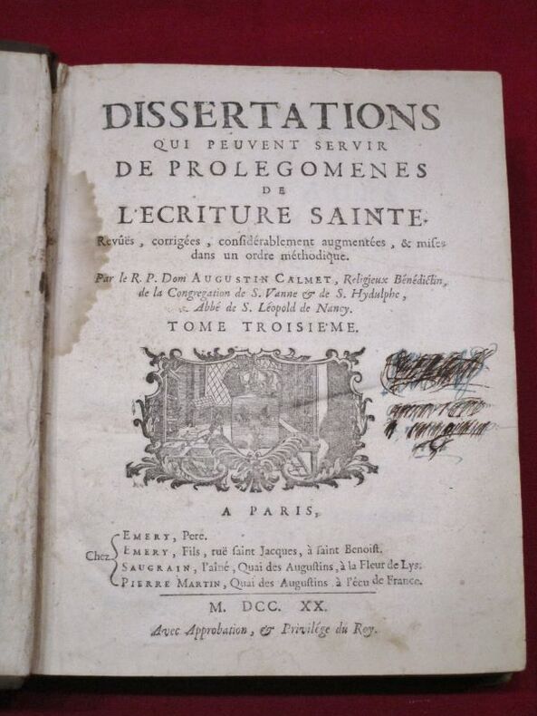
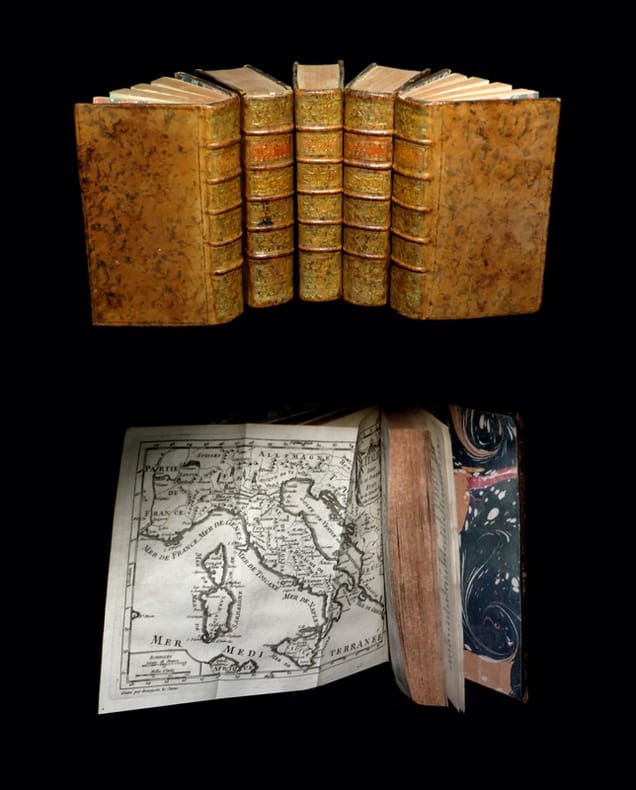
112406A Paris, Chez Emery, père, Emery, fils, Saugrain l'aîné, Pierre Martin, 1720, 3 volumes in-4 de 190x 250 mm environ, vj, 822 pages; 428-476 pages et (2) ff. (titre, table), 898 pages, (1) f. (Catalogue). Complet des 8 planches (cartes dépliantes, plans et gravures diverses). Pleines basanes granitées, dos à 5 nerfs portant titres dorés sur pièce de cuir bordeaux, tomaisons dorées, roulette sur les coupes, tranches mouchetées de rouge, gardes blanches. Reliures solides avec des usures du temps (deux coiffes accidentées, coins émoussés, plats avec quelques épidermures), ex libris manuscrit à l'encre raturé sur les pages de titre, mouillures présentes dans les 3 tomes et plus importantes dans le troisième, quelques feuillets déchirés sans manque dont 1 restauré, bon état général, bel ensemble.
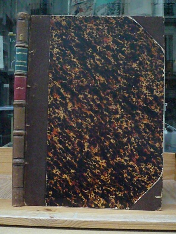
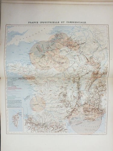
1883311151 vol. in-folio (format 45,5 x 33 cm) reliure de l'époque demi-chagrin à coins maroquiné vert, dos à 5 nerfs orné, fleurons, Librairie Furne, Jouvet et Cie, Paris, 1883, 2 ff. (table des cartes et titre), et 42 cartes en couleurs (toutes en double-page sauf la 34 : Grèce et la 35 ; Caucase et Crimée)
184417453Wien, H. F. Müller, o. J. (1844). 4°. Mit 2 mehrf. gefalt. lithogr. Tafeln u. 2 lithogr. Stadtplänen auf den Innendeckeln. Zus. mit Textheft (24 S. mit 2 [1 gefalt.] Tabellen u. einer mehrf. gefalt. lithogr. Tafel) in bedrucktem OPp.-Umschlag.
1798014463Paris Chez Hyacinthe Langlois, libraire 1798 Demi-reliure à coins
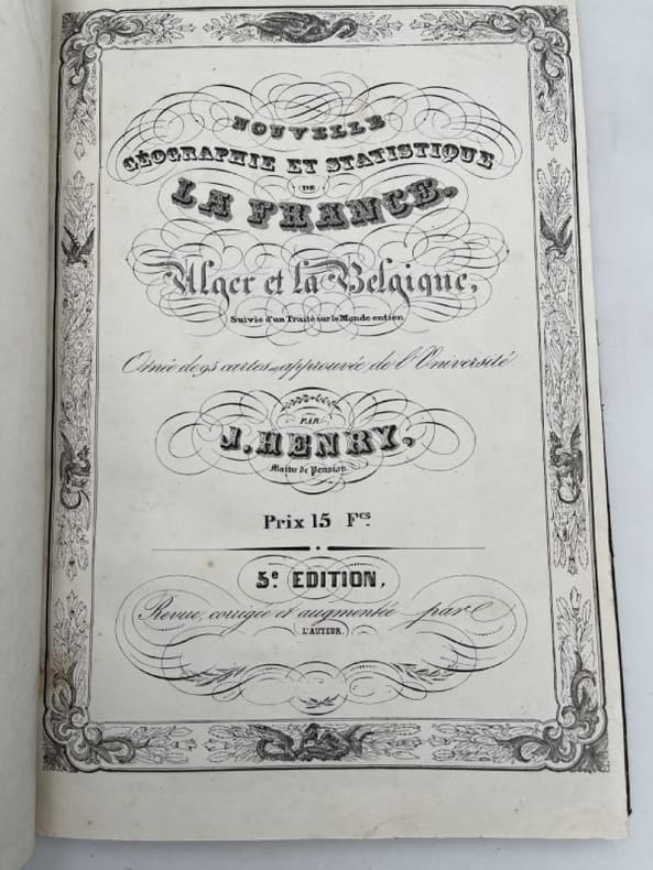
ORD-19366Châtellerault. Imprimerie Lithographique de J. Henry. 1835. In-f° (275 x 405 mm) cartonnage de l'éditeur, illustré d'une vignette, entièrement lithographié, superbe 1ère page de titre, texte dans un encadrement orné d'animaux fabuleux, 2e page de titre différente: Nouvelle Géographie et Statistique de la France, Alger et la Belgique ornée d'une carte de France entourée d'une couronne de laurier et illustrée d'emblèmes militaires, atlas bien complet de tous les départements y compris Alger, tous avec encadrement historié, carte de la Belgique, planisphère bordé de vues de paysages et belle planche sur double page: Les Cinq parties du Monde avec les cartes de chaque continent entourées de très nombreuses gravures d'animaux exotiques. Couverture très abîmée et un peu salie, très bon état inérieur nonobstant quelques rares feuilles uniformément jaunies.
1842191756Chez l'Auteur Chez l'Auteur, 1842. In-folio relié demi chagrin noir, dos lisse à filets dorés. 95 cartes. Relié en suivant du même auteur "Les cinq parties du Monde", 1836, une grande carte dépliante dessinée et lithographiée par A. Thez suivi d'une grande planche dépliante planisphère "Monde entier" dessiné par A. Clément. Puis une page recto verso sur Alger et l'Algérie avec une carte en cartouche et, en suivant, Notice sur le Monde entier sur deux pages. relié à la suite du même auteur "Histoire de France depuis Pharamond jusqu'à Louis Philippe 1er (420-1842)". Nous y trouvons un tableau synoptique des Rois de France et tous les rois de France lithographiés et légendés. L'ouvrage est célèbre pour être entièrement lithographié. Contrairement aux livres classiques imprimés avec des caractères mobiles, le texte et les cartes de cet atlas ont été calligraphiés à la main sur la pierre lithographique par A. Clément, ce qui lui donne un aspect visuel unique, très "écrit à la main". Notre exemplaire porte la signature de Jacques Henry, probablement comme il était fréquent pour éviter les contrefaçons. L'auteur se disait "Maître de pension", c'est à dire Directeur d'institution à Abilly en Indre et Loire. La reliure est modeste et en bon état, le corps de l'ouvrage est en très bon état, très rares petites rousseurs sans aucune gravité. Belle qualité des lithographies. Très bon exemplaire.
8 vol. in-folio reliure demi-chagrin maroquiné à coins noir, dos à 5 nerfs, Librairie Hachette et Cie, Paris, 1890-1905 Exemplaire bien complet des 7 tomes et du volume supplémentaire d'introduction publié en 1905. Etat satisfaisant (dos frottés, dos du volume d'introduction fort. frotté, accroc avec manque au tome, bon état intérieur) Français
224 pages. "Here are 1,266 answers to your color problems: systematically arranged gallery of color swatches to guide you in comparing, matching or identifying color samples - as illustrated on the cover.... Of pocket size but encyclopaedic in scope. The introductory text outlines the organization and the use of the color atlas; the color dictionary and key to the plates in the back of the book provide a simple system of cross-reference and identification." - from dust jacket. Please note: Color finder tool not included. Card pocket inside front board. Ink stamps to front endpaper. No other markings. Binding sound. Average wear to book. Above-average wear to dust jacket which is missing from front panel both a 3"x1" chunk from top edge and a 1/2"x3/4" piece from the upper left corner. Half-inch tear to top edge of back panel. Overall, a sound working copy. Book
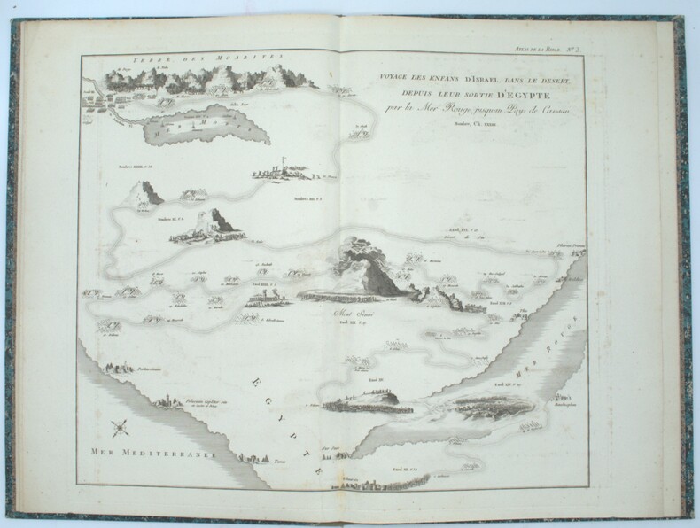
Un volume in gran folio (37x57 cm) di 37 doppie pagine di tavole colorate a mano, 18 delle quali di solo testo; le altre con carte geografiche e testo. La tavola doppia con il Mappamondo, all'inizio, non è numerata; la tavola 2 è seguita da una tavola 2 asterisco. La presenza di queste due tavole extra, indicate anche a pag 4 nell'Ordre numerique des cartes, leurs titres, etc., è necessaria alla completezza dell'opera. Su carta pesante. Qualche brunitura, fioriture o traccia di sporco ad alcune pagine soprattutto all'inizio e alla fine del volume; una macchia d'inchiostro alla carta n. 4; una gora stretta alla piega interna di alcune carte, in un caso con minima galleria di tarlo. Il testo dell'atlante è in francese. Legatura in mezza pelle moderna (una macchia al basso del dorso), piatti con carta marmorizzata. Seconda edizione di questo Atlas, famoso, opera del La Cases, grande seguace di Napoleone e autore poi del memoriale di Sant'Elena. (Extra postage cost is required for international shipping. Please email us for the new shipping cost.).
174124079A Paris, chez Rollin Fils / Debure l'Aîné, 1741 et 1742. 5 forts vol. au format in-12 (172 x 98 mm) de 1 f. bl., xvi - 664 pp. et 1 f. bl. ; 1 f. bl., xxiv - 732 pp. et 1 f. bl. ; 1 f. bl., xii - 676 pp. et 1 f. bl. ; 1 f. bl., xxiv - 701 pp. et 1 f. bl. ; 1 f. bl., xv - 653 pp., 1 f. n.fol. et 1 f. bl. Reliures uniformes de l'époque de plein veau glacé et marbré blond, filet à froid encadrant les plats, dos à nerfs ornés de filets gras à froid, jeu de petits filets verticaux dorés sur les nerfs, doubles caissons d'encadrement dorés, larges fleurons dorés, semis de pointillés dorés, pièces de titre et de tomaison de maroquin fauve, titre doré, tomaison dorée, palette dorée en tête et queue, filet doré sur les coupes, tranches jaunes et mouchetées.
ORD-20127Paris. Moithey. 1792. In-4 (225 x 2285 mm), dos à 4 nerfs, reliure très usagée, étiquette de titre collée sur le 1er plat, très abimée. Contient 79 cartes de départements sur 83, mises en couleurs, en très bon état. Feuilles manuscrites intercalées et inscriptions dans les marges concernant les cartes, sans toucher au cur de celles-ci. Atlas peu courant. Photos sur demande.
1809PHO-1531Paris, Chez Desray, 1809, in-folio, faux-titre, titre et 6 cartes à double page et montées sur onglets, relié demi toile, ex-libris en page de garde, frottements.
1895135101895 percaline rouge éditeur titre sur les plats. 4 vol. in-folio, 20, 32pp. (index), P. Lyon Simon 1895
188214512Gotha, Verlag Justus Perthes 1882. 2° (ca. 39 x 26 cm), Halbleder im Stil der Zeit mit Lederecken und aufgezogenem Originalrücken (etwas schmaler als der jetzige Rücken) und Originaldeckeln; mit 89 doppelblattgroßen grenzkolorierten Stahlstichkarten und gestochenem doppelblattgroßem Titel (dieser in der Kartenzählung mitpaginiert als Nr. 1). Die Karten datiert mit 1880-1881. Geschmackvoll und ansehnlich restauriertes Exemplar, jede Karte neu eingehängt; die Karten meist sehr sauber, nur ganz vereinzelt geringe Gebrauchsspuren.