VUILLEMINLivre Rare Book
12 878 résultats
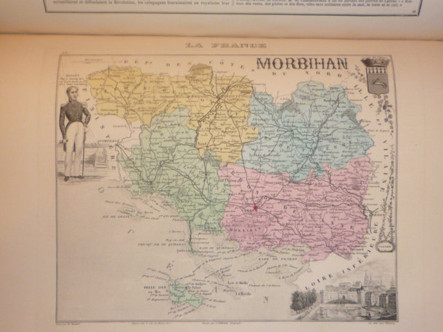
381815J. Migeon Paris 1880 Atlas grand in-4 ( 360 X 275 mm ), demi-chagrin anthracite, dos à nerfs orné de caissons dorés, plats de percaline chagrinée de la même teinte ornés de décors d'encadrement dorés. Atlas illustré de 105 cartes gravées en couleurs dressées d'aprés les cartes du dépôt de la guerre, des Ponts et Chaussées et de la Marine par M. VUILLEMIN. Toutes les planches des cartes sont aquarellées, ornées de vues, blasons, et portraits de personnages historiques. 5 cartes dépliantes en double page montées sur onglet, et complet des 3 grandes cartes dépliantes in-fine ( France physique administrative et routière, Chemins de fer et télégraphes de France, Chemins de fer européens et voies de communication par mer ). Coins émoussés, bel exemplaire de cet atlas aux cartes très fraîches dans une bonne reliure de l'éditeur.
BN66317Atlas der Weichteiloperationen bei Hund und Katze Gourley Ira M; Gregory Clare R; Poulsen Nautrup Barabara and Rosenhagen Carsten <br/><br/> unknown
BN66313Atlas und Lehrbuch der Kleintierneurologie: Mit Filmsequenzen auf CD-ROM Jaggy André <br/><br/> unknown
R320130005Société d'édition géographiques maritimes et coloniales. non daté. In-4. Broché. Etat passable, Livré sans Couverture, Dos satisfaisant, Intérieur frais. Environ 200 pages - nombreuses figures en noir et blanc dans le texte - nombreuses cartes en couleurs hors texte - livré sans couverture.. . . . Classification Dewey : 912-Atlas, cartes et plans
BN106128Editions ATLAS. Softcover. Le crochet: 55 modèles à réaliser <br/><br/>Le crochet: 55 modèles à réaliser Editions ATLAS paperback
Hardcover in-folio (25,5 x 39 cm) , 90 cartes gravées sur cuivre (frontières en couleurs) double pages, reliure demi-basane d'époque, dos à nerfs en partie manquant. Plats et coins frottés, manques importants au dos, intérieur en très bon état. [P-53]
New Turkish Original illustrated bdg. HC. 4to. (32 x 23 cm). In Turkish. 3 volumes set: (440 p., 1 folded color panorama of Istanbul; 442-875, [5] pp., 1 folded color panorama of Istanbul, 877-1289, [8] pp., 1 folded color panorama of Istanbul, b/w and color plates and photos. 20. Yüzyil'dan 21. Yüzyil'a Necip Bey Haritalari'ndan günümüze öncesi ve sonrasi Istanbul. 3 volumes set. [In special box]. First and Only Edition. Best and only reference on Nedjib [Necip] Bey maps.
Extraction de 56 planches (dont 1 double) du "Serrurier" de l' "Encyclopédie ou Dictionnaire raisonné des Sciences, des Arts et des Métiers", avec les 12p. de descriptif: ouvriers au travail, fers, gros fers, dessus de portes, balcons, appuis et rampes, grilles, vases et porte-enseignes, ornements, brasures, clefs, serrures, cadenats [sic], becs de cannes, targettes, loquets, roulettes, pivots, charnières, espagnolettes, heurtoirs, boutons, gaches, anneaux, sonnettes, moulures, corniches, croisées, persiennes, stors [sic], ferrures de voitures, ressorts, outils, etc... Planche XVI manquante, remplacée par une photocopie (planche double: grands ouvrages grilles battantes).
195037963Toronto & Monteal: Underwriter's Survey Bureau Limited. 1950 1950. Hardcover. Very Good to Fine. Atlas Folio. 54.5 x 32cm with 17 double page scale maps in colour linen backed linen is a bit frayed doesn't effect maps black boards over green cloth spine Underwriter's Survey Bureau Limited. 1950 hardcover
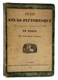
41356Paris. E. Garnot. 1834. 1835. 4to. 29x 20cm title-page vignette18p. preliminary place name index with 49 double-page colour maps preliminary lists prominent features in red each map with lithographic vignettes buildings parks boulevards etc. foliated paper is printed on one side only in the original paper over green boards with title with vignette reproduced on the upper cover with half title and publisher's vignette on the title page spine chipped at the top with 7cm piece missing covers worn hinges loose library plate removed removed on the front paste-down endpaper internally text and plates are fine. cgc. Note: the date on the title page is 1834 but 1835 on the cover title page. ~ A series of maps the first displaying the twelve arrondissements and the 42 districts of Paris as of 1834. The following maps are of the individual districts very detailed with prominent features in red and vignettes of important buildings parks and boulevards. The population of Paris was over 900000 at this time and was still a walled-city until 1860. The maps show the results of improvements made under Napoleon to be followed by changes made after the Restoration of 1815 and the reign of Louis XVIII. Paris. E. Garnot. 1834. (1835) unknown
Very Good English Original folded color map. Oblong atlas folio. (60x91 cm). Bilingual in English and Arabic. Arabic map and texts with b/w photographs of some views from Saudi Arabia and English map and texts with b/w photos of Jeddah, Riyadh and Dhahran airports with legends and "distances in kilometers". It shows a very detailed landscape of entire Arabian Peninsula including Saudi Arabia, Aden, Oman, Muscat Qatar, Trucial Coast, Nafud, Dahna, Rub' Al-Khali, Najran, Asir, Yemen, Ramlat As Sab'atayn, Dhofar, Al Mahrah, Hadhramaut, Kuwait, Neutral Zone, and others.
50230aafStuttgart, (Carl Hoffmann für) J. Scheible’s Buchhandlung, 1835, in-4to oblong, hinterlegter blaufarb. Umschlag-Titelblatt + 18 Blätter Karten + 15 (von 16 Blätter Text (Textbl. für Nordamerika fehlt), etwas stockfleckig, Wasserfleck in beiden ausseren Ecken, schön und gross handgeschr. altdt. Besitzeintrag auf Vorsatz von ‘... Eugen Bertschinger ... 1836’, Halblederband mit Ecken, Buntpapier auf den Deckeln, leicht berieben.
99278aafParusm Librairie Abel Pilon A. Levasseur, Gendre et Succ., s.d. (vers 1875), in-folio oblong (36.5x 44 cm), 2 ff. (feuille de titre abimée) + XXIV + 210 p. de texte intercalées + 93 cartes gravées en couleurs, dont la grande carte départementale dépl., reliure en d.-cuir originale. Dos à 6 nerfs orné or. Plat richement orné or, traces d’usage aux coins et qqs bords rapés sinon bon état.
120578Hildburghausen - Amsterdam - New-York, Stahlstich Druck & Verlag Bibliographischen Instituts 1849 - 1852, 280x320mm, Basil-Halbledereinband. Titel und Verzierungen auf dem Buchrücken vergoldet, Einband aus der Entstehungszeit. Guter Zustand.
89457aafParis, Imprimerie de H. Selves, Lithographe de l’Université, 1829, in-folio, avec 14 cartes en couleurs sur double page, papier généralement frais, cartonnage original.
92487aafAu frais de Mr. J.R. Meyer à Aarau, 1796, imperial in-folio, Levée et dessinée par J. H. Weiss et gravée par MG. Eichler, feuille pliée, bon état.
19811255131981 Lausanne, Editions Piantanida - 1981 - 5 volumes grand in-4, reliures plein Skivertex noisette, dos à 4 nerfs avec filets, auteur et titre en doré - 600 planches couleurs dans les 3 premiers tomes + 299 et 362 pages de textes
186633700Gotha, Justus Perthes, 1866. Folio. (38x24,5 cm.). Orig. full cloth, blindstamped and with title on front board in gilt lettering. Spine ends worn and a tear to upper part of first hinge. The printed title pasted on inside of front cover from the publisher. (2) pp. and 31 steel-engraved double-page coloured maps. The first, Planeten-System lightly brownspotted, otherwise fine with a few marginal brownspots to margins.
186633700Gotha Justus Perthes 1866. Folio. 38x245 cm. Orig. full cloth blindstamped and with title on front board in gilt lettering. Spine ends worn and a tear to upper part of first hinge. The printed title pasted on inside of front cover from the publisher. 2 pp. and 31 steel-engraved double-page coloured maps. The first Planeten-System lightly brownspotted otherwise fine with a few marginal brownspots to margins. <br/><br/><em>With maps of all the Continents Europe The Hemispheres etc. </em> hardcover
1784172751Lyons: Jean-Marie Bruyset 1784. A new and expanded edition of this popular teaching aid. Presented in a catechism-style question-and-answer format the text is accompanied by maps labelled with numbers and letters instead of place-names; the reader can test their ability to identify regions before checking their answers on the following page. It was published in Amsterdam in 1760. Duodecimo 156 x 93 mm pp. xi 1 331 1. Frontispiece of an infant figure of Atlas supporting the world 2 folding hand-coloured plates 22 similar maps all engraved after Guillaume Delisle head- and tailpieces. Contemporary mottled sheep spine with raised bands compartments decorated with elaborate floral design in gilt red morocco label floral patterned endpapers blue speckled edges red bookmarker. Later bookplate to front pastedown inscription noting purchase in 1793 to verso of first blank contemporary gift inscription to second blank later stamp to title page. Gilt a little rubbed rear board sprung corners bumped one worn small patches of stripping to front free endpaper from bookplate adhesive front hinge cracked but firm tidemark to fore edge margin occasional small ink marks. A very good copy. hardcover
188422483Philadelphia, Bradley & Bro., 1884. 2 Bll. (Titel und Inhalt), 78 Bll. (farb. lithograph. teils ganzseit., teils doppelblattgr. Karten und Pläne), 18 Bll. (Text und Tabellen). 4°. OHLdr. (beschädigt). [5 Warenabbildungen]
1997DADAX0805306552Brand: Benjamin Cummings 1997-12-21. 4. hardcover. New. 7.66x1.24x9.28. Buy with confidence. Excellent Customer Service & Return policy. Brand: Benjamin Cummings hardcover
1890867351890. ATLAS. ATLAS OF THE CITY OF BOSTON Vol. 7 BRIGHTON MASS. Philadelphia: G. W. Bromley & Co. 1890. Folio. 22" Contains 30 double page maps - outline and index map and 29 plates - measuring 32" x 22" with only slight marginal staining near spine at head. Maps are drawn at scale of either 600 100 or 150 ft/inch. Bound in 1/2 leather missing much of leather covering and has detached and chipped FFEP. Front hinge very weak. unknown
1906867321906. ATLAS. ATLAS OF THE TOWNS OF REVERE AND WINTHROP SUFFOLK COUNTY MASS. Boston: Whitman & Howard 1906. Folio. 22". Double page maps measure 32" by 22". All plans are drawn to a scale of 150 feet to one inch except index map. Includes street index outline and index map and 25 double-page maps. Interiors are in good condition with some light staining throughout at head and spine pencil or ink annotations to title page and plates 3 4 5 8. Exteriors are fair with heavily worn half-leather with black cloth boards and gilt-stamped edges. A good copy. unknown
1896867401896. ATLAS. ATLAS OF THE CITY OF CHELSEA AND THE TOWNS OF REVERE & WINTHROP MASS. Philadelphia: G. W. Bromley and Co. 1896. Folio 22.5". Contains street index outline and index map and 22 double-page maps measuring 22.5" by 32". Maps have only minor soiling to margins and occasional pencil annotations plates 12 17 18 21 and 22. Bound in half leather now mostly chipping or absent. In need of rebacking front board detached. As is. unknown