55 résultats
17992111902160200187Washimi Tamotsu 1799. Soft Cover. Fine. Number of books: 1 book Washimi Tamotsu paperback
1788024356London: Printed for J. Walker 1788. Book. Very Good. Hardcover. First Edition. 12mo. A very good four volume set in contemporary full tree calf binding with double lettering pieces in red and green. Complete pp. iii-vii 1 222; 2 206; 2 238 & 2 198. No half-titles which may or may not be wanting but the pagination for the prelims to vol. I might suggest that one is required Very good bindings with a little rubbing a couple of volumes slightly chipped to the head/tail of the spines corners lightly bruised. Contents clean and tight manuscript Greek initials to title pages dated 1788 otherwise unmarked no foxing paper crisp. A very good set. A Rare Eighteenth Century Novel. We have managed to located just one other copy at auction in the last thirty years and that at Sotheby's sale of July 21 1993 where it made £1000 on the hammer though seemingly not such a nice copy. Referenced by: ESTC T068744. Printed for J. Walker Hardcover
174019595(Augsburg), Matthäus Seutter, um 1740. Ca. 50 cm x 58 cm (Platte).
177051365Paris: Chez Le Rouge 1770. First edition . Oblong 4to. Engraved title leaf and seven engraved maps one folding the other six with a number of strip maps separated by thin rules detailing the route from Strasburg to Versailles. Delineates topographical features cities and villages churches forests etc. Not recorded on OCLC. Later patterned wrappers worn long tear in rear wrapper; interior soiled some old tidelines mostly marginal but affecting the image in the last two maps; several manuscript additions but a very good example of a scarce 18th-century French route map. <br/><br/> Chez Le Rouge unknown books
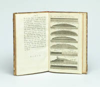
173729354London Gilliver and Clarke 1737. 8vo. Near contemporary half calf with gilt title label. 16622 pp. and 8 engraved plates 1 folding. 4cm tear to bottom of title page - proffesionally repaired with no loss. A fine clean copy. <br/><br/><em>First edition. Phillips recognized that a layer of gravel if resting on a well-drained dry sole would be beaten by the traffic into a firm road surface. He was thus the pioneer in the development of the Macadam method. The present work is described in Gregory: The Story of the Road p.207-211. Very uncommon. </em> unknown
173729354London, Gilliver and Clarke, 1737. 8vo. Near contemporary half calf with gilt title label. (16),62,(2) pp. and 8 engraved plates (1 folding). 4cm tear to bottom of title page - proffesionally repaired with no loss. A fine clean copy.
176837052Nueva impresión corregida 2ª Ed.- En Madrid: En la Imprenta de Andrés Ramírez con licencia Año MDCCLXVIII 1768.- 2 Vols. 16 h. 499 p.; 2 h. 708 p. i.e. 608 ya que por error se saltaron una centena; 4º menor 215 cm; Tela moderna hacia 1930 en color marfil con tejuelo rojo en lomo.- Este ejemplar es la 1ª reimpresión de esta obra en realidad la 2ª Edición y es tan apreciada como la primera ed. que constaba de 3 tomos y se publico en 1748.- MUY RARO. Palau Nº 84422. La página 195 del tomo 1º con un trozo del margen superior restaurado sin afectar texto y pequeñas marcas de humedad en el margen superior de 13 hojas sin que lleguen a tocar la impresión. Da la sensación de que faltan las portadillas aunque los ejemplares que hemos podido cotejar tienen esa misma particularidad ver Google Books o el ejemplar de la Biblioteca Nacional de España. SIGLO XVIII ESPAÑOL Libro en español En la Imprenta de Andrés Ramírez hardcover
179917589A Paris, chez Jean ; gravé sur une feuille pliante (55,5x86cm), colorié, qui doit dater de juste avant l'avénement de l'Empire car il y a encore le «quay Bonaparte». On relève aussi les rues d'Arcole, du Contrat Social, du Caire, et, plus curieux, l'existence encore signalée du Palais du Conseil des 500 pourtant dissous le 9 novembre 1799.
177322841Londres Robert Sayer 1773 une carte géographique dépliante entoilée saumon, CARTE D'EPOQUE, format plié : 16 x 22 cm, format déplié : 84 x 90 cm, Publié à Londres par Robert Sayer en 1773 et gravé par J. Gibson, il s'agit d'un bon exemplaire de la "Carte des routes de l'Europe de John Rocque". Rocque fut l'un des cartographes les plus importants de son époque. tissu et disséqué en vingt-quatre sections et conserve son étui d'origine la carte mesure 84 x 90 cm. avec une coloration à la main originale, la carte est en bon état, L'etui d'Epoque (16 x 22 cm) recouvert de papier marbré peigné orange est orné en son centre (partie haute) d'une pièce de titre sur fond vert avec roulette "or" en encadrment, titre doré "ROUTES D'EUROPE", plats et dos de l'étui dans un encadrement d'une roulette "or", l'or à terni légèrement mais l'étui est superbe, Bel exemplaire finement aquarellé à l'époque. 1773 Londres Robert Sayer Editeur,
176320307Lyon, Benoit Duplain, 1763 (marque gravée au titre) ; in-8 (200 mm), veau marbré, dos à nerfs décoré et doré, pièce de titre grenat, tranches rouges (reliure de l’époque) ; XXIV, 496 pp.
1766016077London: Printed for S. Crowder 1766. Book. Very Good. Hardcover. The Second Edition. Folio 21 x 32cm. The second edition with additions and improvements; pp. iv 45 iii publisher's adverts; engraved frontispiece map of the world five further engraved plates of maps and one engraved plate of globes ten engraved figures and diagrams within the text. Contemporary half textured calf binding with marbled paper boards expertly restored with a new spine in matching style re-corned. contents clean and tight a few small marks/reading wear; frontispiece plate with a couple of short edge-tears expertly and inconspicuously repaired a few corners re-tipped. A very good well-presented copy. Scarce. Printed for S. Crowder Hardcover
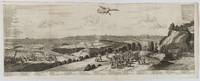
1720180201A Leide. Leiden.: Chez Pierre van der Aa. circa1720. Engraved panorama on watermarked laid paper 28.5 x 77.5 including captions; 31 x 79.5 cm sheet title cartouche engraved key in French and Dutch the upper margin trimmed to the platemark original folds edgewear and toning neat sealed tear to the outer edge barely visible 5mm intrusion to the image a very good dark impression. Finely composed and engraved panorama of Tokyo prepared for the monumental work "Galerie Agreable du Monde" by the master Dutch publisher Pieter Van de Aa 1659-1733. The detailed key in Dutch and French notes myriad buildings and temples on the horizon and in the foreground two processions converge: of nobles and their attendants dancers a trio of dogs and a priest or religious attending a suppliant. <br> <br>Pieter van der Aa 1659-1733 was born in Leiden Holland and started his own book publishing business when he was only twenty-three. His prolific output of highly decorated maps and atlases culminated in his magnum opus “Galerie Agreable du Monde” which illustrated the world known to Europeans in the early eighteenth century. Comprising 66 volumes it was the of plates published at that time it has been estimated that only 100 copies were published. . Chez Pierre van der Aa unknown
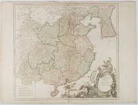
1751177606Paris. 1751. Engraved map 48 x 52.2 cm; 51 x 67.6 cm sheet provinces highlighted with outline hand-colour elaborate title cartouche central fold small tear at the foot affecting the border old paper repair on the verso affecting the margin only pin-holes to the four marginal corners margins a little browned and dusty a handsome map in good condition. Fine large format map showing China Korea Taiwan and parts of Central Asia prepared for De Vaugondy's "Atlas Universel". The beautifully foliated cartouche features a duo of joyful Chinese musicians one dancing and a diminutive figure holding a parasol. <br> <br>From the Estate of the late collector and scholar Arthur Hacker. . unknown
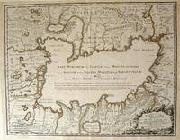
172354819Rainer Ottens. 1723. A most attractive map with early outline hand colour vertical fold barely visible diagonal crease upper half of map few very pale small brown spots otherwise a clean and bright image. Numbering in red pencil few annotations in pencil and light number stamp on reverse however not at all visible from front of map or affecting image. Sheet measures 46.6 x 60.2cm. . Rainer Ottens. unknown
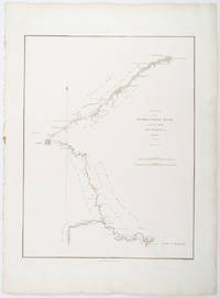
1796209283London.: George Nicol. 1796. Engraved copperplate map on Whatman paper 43.8 x 33.6 cm; 57 x 42 cm sheet including plate markscale in nautical and English miles; light undulation to sheet marginal toning and edgewear but in very good condition. Finely engraved and detailed map of two routes to Pekin Beijing along the White River Baihe from the Gulf of Petcheli and along the Imperial Highway from Jehol and includes commentary locating palaces and gardens type of cultivation "many barges" and "the road shaded by willow trees". The map elegantly drawn by Henry William Parish was published in George Staunton's account of Earl Macartney's embassy to China 1792-1794. . George Nicol. unknown
179725649chambery 1797 1 document original sur papier velin crème ligné : FEUILLE DE ROUTE POUR JULIEN LAURENT [NATIF DE NANTES], BRIGADIER AU 7EME RÉGIMENT DE HUSSARDS COMPAGNIE N°7 PARTANT DE CHAMBÉRY POUR SE RENDRE A NANTES DÉLIVRÉE PAR CLAPIER : COMMISSAIRE DES GUERRES DE CHAMBERY DU 26 FRUCTIDOR AN V, format : 38,5 x 28 cm, préimprimé en noir et manuscrit à l'encre brune de deux pages, avec notés la liste des arrets dans les villes traversées avec signatures , cachet noir de la présidence de l'autorité municipale de Nantes gravé en noir, + 1 document original sur papier velin bleu ligné : CERTIFICAT DE VISITE ET CONGÉ ABSOLU POUR CAUSE DE BLESSURES [CERTIFICAT DE RÉFORME] DÉLIVRÉ PAR L'ARMÉE DES ALPES - HÔPITAL MILITAIRE D'AIX DU 17 FRUCTIDOR AN V (3 SEPTEMBRE 1797) SIGNÉ CLAPIER, format : 25 x 38 cm, certificat détaillé et signé côté Nantais par l'Autorité Municipale de Nantes (avec cachet illustré en noir et signature de CHEVY Ainé, Administrateur Municipal de la Commune de Nantes),
17918128in-folio, 1 p. imprimée et complétée à la main, signature autographe de Sombreuil, en date du 28 août 1791 ; elle accompagnait le Brevet nominatif du bénéficiaire, invalide resté anonyme ; "ayant demandé à se retirer à Pont-à-Mousson et partant aujourd'hui de l'Hôtel...", l'intéressé a reçu quatre livres pour son trajet, à raison de huit sous par lieue pour dix lieues ; mention en dessous et au verso de divers versements qu'il a reçus à Meaux, Châlons, Château-Thierry, Saint-Dizier et Toul.
179521641Lorient 1795 1 feuillet avec en-tête préimprimé en noir : Liberté Egalité Fraternité et orné d'une vignette en noir (avec symboles révolutionnaires : faisceaux d'Armes et bonnet Phrygien ), manuscrit à l'encre brune sur papier vergé bleuté ligné filigrané, format 17,7 centimètres de large par 23,5 centimètres de haut, Lettre écrite à LORIENT, le 15 Messidor An 3 (3 juillet 1795) de la République Française, signature manuscrite de DAVID, Chef des Bureaux civils de la Marine, chargé des Armemens et des Classes, au port de LORIENT,
179621090Brest 1796 1 feuillet avec en-tête préimprimé en noir : Liberté Egalité Fraternité et orné d'une vignette en noir (avec symboles révolutionnaires : faisceaux d'Armes et bonnet Phrygien et marianne avec imprimé en bas "république Française"), manuscrit à l'encre brune sur papier vergé ligné filigrané, format 22,6 centimètres de large par 33,8 centimètres de haut, Lettre écrite à LORIENT, le 1er Messidor, An 4 (1796), de la République Française, une et indivisible, signature manuscrite de l'Adjudant Général MOLINI et de Mr BIVAUX secrétaire du Bureau de l'Etat Major Général de la Marine de Lorient,
1781814581781 A Salomopolis, chez Androphile, à la Colonne inébranlable. 1781. Seconde édition retouchée par le Fr. Circonspect. 1 vol in-8 ( 20x12 cm), broché ( brochage d'époque), étiquette de titre collée au dos. 546 pages. PHOTOS SUR DEMANDE
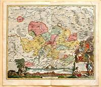
171761880Nuremberg.: Johann Baptist Homann. 1717. A beautifully engraved hand coloured map of North East Germany showing the area around Erfurt in detail. In the centre of the map is a small plan of Erfurt which is also shown as a panoramic view at the foot of the map and titled 'St. Petersburg'. An elaborate decorative title cartouche in the lower right corner depicts allegorical figures surrounded by the produce of the land including sheaves of wheat; a beehive; and a cornucopia of fruits. Cherubs holding a coat of arms float up from the scene on the right while on the lower left a centaur sits meditatively beneath a pine tree amongst slaughtered cattle. Physical features of the area are illustrated and farming areas shown by fields which criss-cross across the map. A clear dark impression the work of an outstanding German cartographer who in 1715 was appointed as imperial geographer by Emperor Charles VI. This map also includes "Schwan See" Swan Lake under a town of the same name which has since disappeared. Hand coloured two very minor splits at upper and lower edges on centre fold and not affecting engraved area a handsome map 54 x 61.5 cm. . [Johann Baptist Homann.] unknown
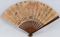
1718220781Japan.: 大海扇子商會. Taikai Sensu Shōkai. Meiji 17 1884. Black and white printed map with handcoloured pink highlights 23.5 x 39cm date stamped on reverse. A little minor wear at folds but overall very good. This fascinating fan was produced as a commemorative item marking a climb to the summit of Mount Fuji. A stamp on the reverse is dated 27 July Year 17 and appears to have been applied at the summit. This date likely refers to Meiji 17 or 1884. Commemorative fans of this type were popular at the time and the paper printing and general style appear consistent with that period. The red printed patterns and characters on the reverse also back up our belief that the fan was obtained at the summit. The pictorial map of the mountain shows four different routes to the summit marked in red with distance charts printed above. <br> <br>Mount Fuji is Japan’s highest peak. Long perceived as a sacred mountain it has a Shinto shrine at the summit and the climb has traditionally been regarded as a form of pilgrimage. . 大海扇子商會. [Taikai Sensu Shōkai]. unknown
1795210851795 1 feuillet avec en-tête préimprimé : MARINE LIBERTE, EGALITE, FRATERNITE et orné d'une vignette en noir, manuscrit à l'encre brune sur papier vergé ligné filigrané, format 20 centimètres de large par 30,8 centimètres de haut, Lettre écrite à bord de la Frégate "LA NEREÏDE", le 13 Floréal An 3, signature manuscrite de Jean-Pierre PILLET
179521642Lorient 1795 1 feuillet avec en-tête préimprimé en noir : Liberté Egalité Fraternité et orné en tête d'une grande vignette en noir (avec symboles révolutionnaires : l'Oeil, la balance, les lauriers, les cornes d'abondances et le bonnet Phrygien avec imprimé en haut "département du Morbihan"), manuscrit à l'encre brune sur papier vergé bleuté ligné filigrané, format 20 centimètres de large par 31,5 centimètres de haut, Lettre écrite à LORIENT, e 17 nivose An 3 (6 janvier 1795) de la République Française, une et indivisible, signature manuscrite de PHILIPPE-ALEXIS-LAURENT HENRY, Chef de Division, Commandant des Armes au port de LORIENT,
179521640Lorient 1795 1 feuillet avec en-tête préimprimé en noir : Liberté Egalité Fraternité et orné d'une vignette en noir (avec symboles révolutionnaires : faisceaux d'Armes et bonnet Phrygien et marianne avec imprimé en bas "république Française"), manuscrit à l'encre brune sur papier vergé bleuté ligné filigrané, format 20 centimètres de large par 31 centimètres de haut, Lettre écrite à LORIENT, le 27 Messidor An 3 (15 juillet 1795) de la République Française, signature manuscrite de PHILIPPE-ALEXIS-LAURENT HENRY, Chef de Division, Commandant des Armes au port de LORIENT et de Mr BIVAUX secrétaire du Bureau de l'Etat Major Général de la Marine de Lorient