Estrada, Marinio, Consul de CubaBiblio.com
2 245 résultats
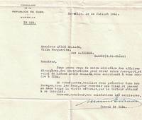
16-4373Marseille France: 24 juillet 1941. . TLS with franked envelope approving a visa for André and Lucie Bollack of Cassis.Provenance Estate of Paul Lombard. Né en 1889 Paul Lombard a été rédacteur en chef de la revue L’Homme libre journal de Clémenceau et critique littéraire sous le pseudonyme de Louis Méritan. Paul Lombard est de ces critiques qui comme l’a montré Thierry Laget Proust Prix Goncourt Gallimard 2019 reprochaient à l’Académie Goncourt d’avoir décerné leur prix à un écrivain trop vieux trop riche : "Au lieu de cela cette année le prix Goncourt … échoit à M. Proust qui n’est pas jeune : il a conquis en peu de jours une notoriété dont j’ignore le secret ; le prix Goncourt même s’il l’a mérité ne lui sera d’aucune utilité" déplore-t-il dans L’Homme libre du 11 décembre 1919 p. 2. Probablement aurait-il préféré que Les Croix de bois de Dorgelès remportât de prix d’autant que l'écrivain avait été un collaborateur régulier de L’Homme libre.Expertise by Ségolène Beauchamp 86bis rue de Bellébat 45000 Orléans and Pierre Prévost 75 rue Michel Ange 75016 Paris. Marseille, France: 24 juillet 1941. unknown
1837228771837. 4.75" x 7.5" folded. 1 3 blank pp gilt edges. Old wax seal remnants with small blank edge tear caused by opening the seal. 'Hazzard Esq. New Port' in script on back. Very Good. A rare ephemeron of this railroad and early American railroad travel. The printed invitation is on the first page. The ticket is loosely affixed to blank page 3. It is printed 'Excursion Over the New York Providence and Boston Rail Road. November 10th 1837. 'Mr. Hazzard' is written in script on its verso. unknown
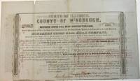
185438904Quincy IL: Patriot Office. Gibson & Warren Printers 1854. Folio broadsheet bond oblong 16-1/4" x 9-1/2." Old folds with a couple of short marginal fold splits no text affected. Printed in a variety of type fonts and styles. Very Good. Signed in ink by Thompson Chandler County Judge of McDonough County; Isaac Grantham County Clerk; N. Bushnell President of the Rail Road; and C.E. Lippincott State Auditor.<br /> <br /> The County is in West Central Illinois. The Rail Road one of the earliest Illinois Roads was operated by the State of Illinois until the late 1840s. It later merged with the Wabash Railroad. Patriot Office. Gibson & Warren, Printers unknown
185275654Buffalo:: Jewett Thomas & Co. 1852. First edition. original gilt-lettered cloth. Tear to the folding map neatly repaired on verso with Japanese tissue; slight use and fading to the cloth; very attractive. 12mo. Illustrated with maps and numerous engravings from original sketches including a folding map of the "Northern Route U. S. Mail Line.Steamers.New York and Rochester.and Routes from Albany to Niagara Falls Buffalo and Montreal" with inset view of Niagara Falls. Jewett, Thomas & Co., hardcover
3058Chicago: The Company: Passenger Department; Knight Leonard Co. Printers 1893. . 4to pictorial printed wrappers; text partially detached from wrappers; damp-staining on first two leaves First published in 1892. The illustrations are by Alfred Lambourne Chicago: [The Company: Passenger Department]; Knight, Leonard Co. Printers, 1893. unknown
191213113Monmouth Illinois:: Western Road Tool Company 1912. loose sheets as issued. Fine. Approx. 10-1/2 x 14 inches. Illustrated from photographs heightened in red and line drawings. Offering the "Perfection Gang" Road Drag horse gang drags scrapers plows grader blades and other road machines with order form. Western Road Tool Company, unknown
BN67306Das grosse Mercedes-G-Buch: Ein Off Road Sachbuch. Baureihen 460 461 463 Füngeling Michael <br/><br/> unknown
2015x-0198726457Oxford Univ Pr 2015. Hardcover. New. 1st edition. 288 pages. 10.25x8.00x0.75 inches. Oxford Univ Pr hardcover
2000CBS-9780817640859Sp Springer 2000. New. Sp Springer unknown
2000CBS-9780817640859Sp Springer 2000. New. Sp Springer unknown
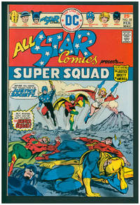
197638001New York: DC Comics 1976. First Edition. Stapled wraps. First appearance of Power Girl. Very Fine 8.5. ; 17 x 26 cm. DC Comics unknown
DADAX1489995137Springer 2014-10-22. 2006. paperback. New. 6.10x1.40x9.25. Buy with confidence. Excellent Customer Service & Return policy. Springer paperback
19955965014John Wiley and Sons 1995. This is an ex-library book and may have the usual library/used-book markings inside.This book has hardback covers. In good all round condition. Please note the Image in this listing is a stock photo and may not match the covers of the actual item800grams ISBN:9780471960126 John Wiley and Sons hardcover
2002ZB1209427Ministerio de Defensa 2002. 434 pp. very well illustrated paperback text clean and binding tight very good. - If you are reading this this item is actually physically in our stock and ready for shipment once ordered. We are not bookjackers. Buyer is responsible for any additional duties taxes or fees required by recipient's country. Photos available upon request. Ministerio de Defensa paperback
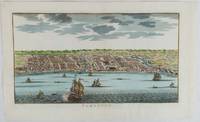
1750177186circa1750. Hand-coloured engraving 19.5 x 35.6 cm 25.5 x 41.6 cm sheet original folds two old paper repairs not affecting the image a trifle toned but in very good condition Attractive bird's-eye view town plan of Makassar in Sulawesi prepared for Abbé Prevost's monumental 'Histoire Générale des Voyages.' . unknown
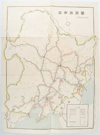
1519172590奉天. Mukuden.: 満鉄鉄道総局. Mantetsu Tetsudo Sokyoku. 昭和 15 1940. Colour folded map seven small very holes not affecting the printed image otherwise good. 53 x 38.5cm Map showing the comprehensive railway network in Manchuria with names of all the stations. It includes the lines run by the South Manchurian Railway Company their temporary industrial lines light rail as well as the lines run by other Russian and Chinese companies. By 1940 the network had expanded so much that it included almost the whole of Manchuria. . 満鉄鉄道総局. [Mantetsu Tetsudo Sokyoku]. unknown
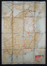
1938159295Tokyo: 大日本雄辯會講談社 Dainihon Yūbenkai Kōdansha. Shōwa 13. 1938. Two large detailed maps of China and on the reverse of the Soviet Union in Asia Manchuria and Mongolia printed double sided on a single large sheet. Issued as a supplement to Volume 14 Number 1 of the magazine Kingu on New Year's Day in 1938. <br> <br>Holes at a number of holes causing a small amount of loss some occasional browning some chipping on margins. The map has clearly been used but is still largely complete. The colourful map of China on a scale of 1:2600000 includes part of Manchukuo and Inner and Outer Mongolia on the north and part of French Indochina to the south-west. It shows East Hebei Autonomous Anti- Communist Council Jidong Fanggong Zizhi Zhengfu 冀東防共自治政府 south of Manchukuo which existed from late 1935 until February the 1st1938. The legend includes national and provincial borders cities roads railways sea and air routes and undersea cables. There is an inset map of East Asia titled "Present Situation of Far East" on the lower right corner which shows the areas under influence of Communism and those under influence of/controlled or colonised by the United Kingdom France Japan and China. <br> <br>The map on the reverse printed in blue and black shows the Asian section of the Soviet Union Manchuria and Mongolia on a scale of 1:3000000. There is an inset map of Asia titled "Asian Continent" at the upper left corner the area enclosed by a rectangle which indicates the area covered in this map. The legend includes cities railways roads national borders district borders province borders and air routes. . 大日本雄辯會講談社 [Dainihon Yūbenkai Kōdansha]. unknown
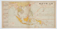
1572160545No place of publication.: 朝日新聞社. The Asahi Shimbun. 昭和十五1940. Published by 朝日新聞社 The Asahi Shimbun Japanese folding coloured WWII map with a calendar from January to June Shōwa 15 at the left scale 1:300000. Map includes French Indochina Dutch East Indies and parts of the territory of Papua China and British India. Some light browning and foxing otherwise very good. Text in Japanese. 25.3 x 51cm. Legend at lower left lists the boundaries between continents countries and provincials or regions railways airline routes capitals and Japanese embassies and consulates. <br> <br>The natural resources are indicated across the map. The map also shows parts of the territory of Papua under Australia's administration " 濠洲委任統治領 Gōshū inin tōchiryō". . 朝日新聞社. [The Asahi Shimbun]. unknown
20202081502111906437science publisher 2020. Soft Cover. Fine. The book is in fine condition. science publisher paperback
20222081502111904898science publisher 2022. Soft Cover. Fine. The book is in fine condition. science publisher paperback
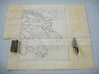
1749136781Paris. circa1749. Black and white engraved map on laid paper showing entrance to Pearl/Canton river Macao and the area which would become Hong Kong Sinn-gan-hien folded designed by the prominent French cartographer Jacques-Nicolas Bellin. This map is No. 16 Vol. 5 from the impressive 15-volume "Histoire Generale des Voyages" compiled by French novelist Antoine François Prévost. The walled city of Canton upper section is divided into areas of Tartar and Chinese. <br> <br>Some light even browning on paper added at margins good copy. Map measures 25.7 x 20.5. . unknown
2009Q-1401890326Cengage Learning 2009-01-27. Paperback. New. In shrink wrap. Looks like an interesting title! Cengage Learning paperback
2019x-1447340434Policy Press 2019. Hardcover. New. 162 pages. 9.50x6.25x0.75 inches. Policy Press hardcover
6545007like new. unknown