Estrada, Rodolfo Galvan, IIIBiblio.com
2 245 résultats
46849574-nnew. unknown
17592Methodist Book Room City Road London. 3 January 1820. 2pp. 4to. Bifolium. In fair condition on aged and worn paper with slight loss to text from breaking open of seal and some repair with archival tape and a square of paper neatly cut away from second leaf. Addressed with postmark on reverse of second leaf to 'Revd G Johnstone Methodist Chapel Kingstone Jamaica'. Letter on one page and 'Mr G Johnstone Dr in account with T Blanshard'. Writing to his 'Dear Brother' he hopes that Johnstone will be able to settle the annexed account 'at your ensuing District Meeting'. He hopes that he has 'done something' to clear the remainder of 'the Stock so <> accumulated and then abandond sic by Mr Wiggins'. He hopes 'the good Work continues still to flourish in the different Stations in your Island' and states that he has been 'visited with the grievous afflction of Widowhood'. The letter ends with a reference to 'your old Friend Bror Strangeways'.The account covers dates between 1814 and 1820 regarding debits one 'Preacher's fund' and nine 'To Books' amounting to £356 19s 8d with a balance of £73 7s 10d owing after payments 'By Cash' and By J Wood'. At the foot of the page another hand presumably Johnstone's has made financial calculations involving various shipments with the names given of two ships and their captains. For more on Johnstone see the letters of Dr Thomas Coke 2013 edited by J. A. Vickers in which a footnote states that Johnstone 'was ordained by Coke at Hull to go to Antigua in support of John Baxter. He died in Jamaica in 1821 having succumbed to a fever after overworking himself.' [ Methodist Book Room, City Road ] London. 3 January 1820. unknown
1998C139268Watermark Publications 1998. Hardcover Hardcover. Very Good. 13 vols. Oblong octavos. Green cloth. A near fine set. No slip cases. Watermark Publications, hardcover
17648Windsor Terrace City Road. 13 November 1861. Four pages 4to creased but good condition. Thanks for a letter. He differs with his correspondent on the "postponing the projected Memoir of Dr Clarke published 1843-9. I think it should have appeared 2 or 3 years ago and taken precedence of Daniel Isaacs. With Dawson's life you are prompt published 1842 and the publishers will find the advantage in an extensive sale. Every one who has seen him in the Pulpit or heard him from the Platform are desirous to refresh their memory with an outline of his extraordinary character" but postponement of publication would mean loss of public interest. "Not so in Dr Clarke he must live from generation to generation but a 'conversational life' should be for his cotemporaries who are now rapidly passing away. I think Thomas Jackson has murdered his own Work by cutting it into slips for the Magazine and reduced it into shilling parts. Surely a connexion like ours would have taken off the whole 1500 copies of Charles Wesley's Life .promoting a review in the Magazine". He then quotes a "MS. Letter Dated Wakefield 27 Sep. 1791" written by William Thompson at length about his life of Whitehead and the effects of publishing it in the Magazine. He goes on to discuss the unsatisfactory "state of our Funds" and mentions the resignation of a "Mr Farmer" Treasurer. He cuts short his letter because of a visit found among his "books and papers" but adds a closely written full page of notes on Everett's work on Dr Clarke. Note: Marriott bequeathed £10000 to the Wesleyan Missionary Society obit. in Wesleyan Methodist Magazine vol.75 p.103 1852. Windsor Terrace [City Road]. 13 November 1861. unknown
2019__3110655640De Gruyter 2019. Hardcover. New. 1st edition. 380 pages. 9.05x6.10x0.94 inches. De Gruyter hardcover
DADAX3110655640De Gruyter 2019-11-18. 1. hardcover. New. 6.14x0.94x9.21. Buy with confidence. Excellent Customer Service & Return policy. De Gruyter hardcover
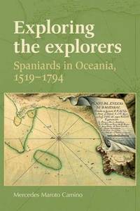
6851759Manchester University Press pp. xi 243 Maps . Hardback. New. Manchester University Press hardcover
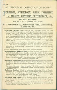
63-8321London UK: F. L. Gardner 1912. 8vo. Good in Wraps with re-taped spine 8 pp. each. Scarce. London, UK: F. L. Gardner, [1912]. paperback
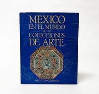
1994029030Secretaria de Relaciones Exteriores UNAM CONACULTA 1994. Book. Near Fine. Cloth. 1st Edition. 381 pages. Hardcover. Texts in Spanish. Minimal shelfwear to the edges of the boards with equally light wear and rubbing to the dustjacket with two remaining pieces of adhesive tape on the inside flaps of the jacket following the removal of a protective plastic cover. Else the binding is tight the interior clean and free of markings. Bound in black cloth covered boards and wrapped in a bright illustrated paper dustjacket. . Secretaria de Relaciones Exteriores, UNAM, CONACULTA Hardcover
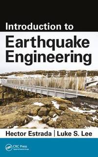
2017__1498758266CRC Pr I Llc 2017. Hardcover. New. 251 pages. 11.00x8.00x0.50 inches. CRC Pr I Llc hardcover
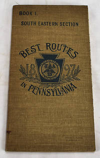
18972605120102Philadelphia: Armstrong & Fears 1897. 10. Maps. Very Good. Double sided foldout colored map 43 x 39 cm labelled "L.A.W. Local cycling Map" and colored corresponding to the road type. 79 p. Includes: an official list of consuls hotels and repair services in the area that acts as a very early example of a travel coupon. Pages include routes from Adamsville to Zionsville with route maps and information about the views road conditions and recommendations from riders. <br>Published to capitalize on the bike boom of the period where recent innovations in safety components and reduction of manufacturing costs made bicycles more commercially available and bike clubs sprung up across the country. Philadelphia was one of the centers of this Bike Boom due to it's relatively flat cityscape and was home to some of the most prominent cycling clubs. The League of American Wheelman was one of the most prominent with 103000 members in 1898 the year after this map was published. The league of American Wheelman still exists to this day. <br> Catalogued by Anastasia Rittenhousesmith. Armstrong & Fears unknown
1749136827Paris. Circa1749. Engraved map on watermarked laid paper 20 x 27.3 cm of Fuzhou and coastline of Fujian Province original folds designed by the great French cartographer Jacques-Nicolas Bellin. This map is from the impressive 15-volume "Histoire Génèrale des Voyages" compiled by Antoine François Prévost map no. 2 Vol. 6. This map shows the estuary of Yangtze River Rivière de Chang. Very light browning on sheet edges but in very good condition. . unknown
1749136826Paris. circa1749. Black and white engraved map on watermarked laid paper 20.9 x 32.7cm showing coastal area of Zhejiang Province Province de Che-kiang including Zhoushan Archipelago Isle de Chusan Zhoushan Bay Bay de Chusan and Xiangshan County Siang-chan-luen a walled city outside of upper border Ningbo Ning-po prefecture under Qing administration title cartouche lower left original folds. This map is No. 3 Vol. 6 from the impressive 15-volume "Histoire Generale des Voyages" compiled by Antoine François Prévost. Even browning mainly to the sheet edges in very good condition. . unknown
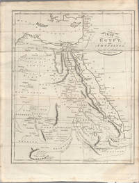
1803174955London. circa1803. Engraved map 23 x 18.5 cm original folds small split to one fold affecting the margin only paper age- toned lower corner darkened and on the verso inked circles to the lower half in an early hand but in good condition. Finely engraved early 19th Century map also showing to the north Syria Palestine and Cyprus and Darfur and Mountains of the Moon Sources of the Nile to the South. . unknown
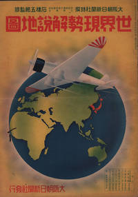
1937208633大阪朝日新聞社. Osaka Asahi Shinbunsha. Showa 12 1937. 10 colour maps not including insets or sketch maps in text on 12 pages. Handsome world map features as the centre fold colour pictorial paper wrappers. A little light soiling and horizontal crease wrappers. An attractive atlas. 38 x 26.7cm. A large format atlas with six pages of coloured maps showing the nations of the world and five pages of Japanese text. The publication seems to have been produced to celebrate the 1937 world record flight from Tokyo to London by Iinuma Masaaki and Tsugayoshi Kenji in their plane 'Kamikaze' which was sponsored by the Asahi Newspaper. The front cover depicts the plane soaring over a map of the world while the back cover also had a colour image of the 'Kamikaze' with an advertisement for the Oji Paper Company which we are told donated a hundred million yen to support the flight. The name 'Kamikaze" had at that stage not yet taken on the connotations which it acquired during the Pacific War. <br> <br>The maps inside the volume show political boundaries major cities and transport routes. The opening pages show the Japanese Empire including Japan proper Korea Karufuto and Manchukuo with small insets covering Taiwan the Chishima Archipelago and Japan's South Sea mandate. The accompanying text focuses on Japan's newly acquired client state of Manchukuo detailing its area population principle products etc while the map includes graphs illustrating Japan's trade with the world and with Manchukuo. China receives an entry of its own with a map of the Chinese Republic and information on the political situation population trade and infrastructure. The central pages of the volume are taken up with a double-spread map of the world including depictions of the flags of a selection of the world's nations. Other sections of the work cover Asia Europe America Africa and Oceania grouped together. The discussion of Oceania includes a section on Hawaii and some small and improbable depictions of Maori and Indigenous Australians. . 大阪朝日新聞社. [Osaka Asahi Shinbunsha]. unknown
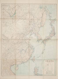
1419160524Tokyo.: 大日本帝國陸地測量部. 昭和14 1939. Large colour folding Japanese WWII map. Scale 1:5000000 featuring Japan Korea Taiwan Karafuto Eastern China parts of French Indochina and the Northern Philippines US colony in detail. Legend includes territorial boundaries national and regional and shows some borders as unclear i.e. Taiwan and bordering region along Northeast China the Soviet Union and Mongolia air routes submarine communication cables linking major costal cities i.e. Hong Kong Xiamen Shanghai Nagasaki etc. airports radio stations mining fields and more. A small chart shows the names of mountains rivers and lakes also included adjacent to legend. Some small holes at folds creases and some minor loss edges generally very good. Text in Japanese. 109 x 77.8cm. . 大日本帝國陸地測量部. unknown
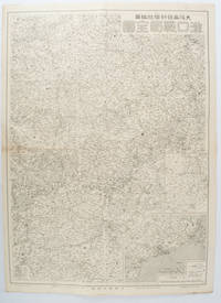
1572172829大阪. Osaka.: 大阪毎日新聞社. Osaka Mainichi Shinbunsha. 昭和 13 1938. Black and white map folded showing Hankow one of the three cities which merged to become Wuhan 54.5 x 49cm scale 1:2000000. Some light browning tiny closed tear upper margin neatly repaired with conservation standard tape. Good copy. This Hankow/Hankou War Situation Map is a supplement map of Osaka Mainichi Newspaper on 25 August 1938. The two inset maps show the region around Nanjing and Hong Kong. It gives detailed place names of Hankow area. . 大阪毎日新聞社. [Osaka Mainichi Shinbunsha]. unknown
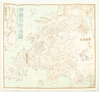
1572171093Qingdao: Taiheiyoko. 太平洋行. 昭和 13 1938. Coloured folding plan of Qingdao in 1938. some browning on reverse with a small lighter section on map Japanese place names no scale 36 x 39cm 3 inset maps. This 1938 Qingdao city map shows street names in Chinese characters and location of Chinese and Japanese public buildings such as the hospital shrines Japanese primary schools and high schools. The 3 inset maps show railway and transport routes as well as outskirts of the city. . [Taiheiyoko]. 太平洋行. unknown
1819162103Tokyo.: Tōseisha. Showa 18 1943. Folding colour map of Australia 54.2 x 76.4cm. Some foxing particularly along folds and upper right margins a few repaired tears and small holes at folds.With original sleeve. The 15th map in the Standard Maps of Greater East Asia series of 20 maps. Shows the natural resources such as sheep gold pearl diary regions opals etc. Tasmania appears as an inset in the bottom right corner. Text in Japanese. . Tōseisha. unknown
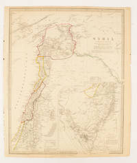
1843174934London.: Chapman & Hall. 1843. Engraved map with outline hand colour 39.4 x 31.4 cm inset map "Continuation from the Dead Sea to Mount Sinai" with finely engraved notes and a key to the Divisions under control of the Turkish Government manuscript pagination in an early hand to the top right edge tear nicks and browning but in very good condition. A most attractive map with detailed notes published when Syria was still under control of the Ottoman Empire. . Chapman & Hall. unknown
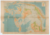
1572160533Tokyo.: 日本名所圖繪社.Nihon Meisho Zuesha. 昭和 17 1942. Folding Japanese coloured map of the Malay Archipelago and Thailand during World War II scale 1:8500000. Legend in lower corner indicates altitudes. Ink annotation in Japanese left edge. Pin holes at three corners upper right corner torn with loss evenly browned otherwise very good. Text in Japanese and English. 52.8 x 75.6cm. This map shows most of Thailand former Indochina Hainan Province and South China Sea Sumatra and Java Sea Borneo the Philippine Islands Celebes Timor New Guinea and parts of Micronesia. Natural resources such as tobacco spices wood sugar metal mines tin iron and etc. rice and other resources are indicated on the map. . 日本名所圖繪社.[Nihon Meisho Zuesha]. unknown
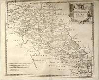
64216London.: Gibson. Early 18th Century. Black and white map from Camden's Britannia showing towns roads rivers and landforms 38 x 46.5 cm. . [Gibson.] unknown
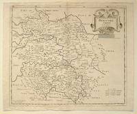
64139London.: Gibson. Early 18th Century. Engraved map on watermarked paper central fold 38 x 46.5 cm decorative title cartouche towns roads rivers and landforms shown; from Gibson's edition of Camden's Britannia upper edge trimmed by the original binder causing minor loss to the border at the inner edge but in very good condition. . [Gibson.] unknown
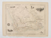
1851174666London.: Tallis John. 1851. Lithographed map 24.2 x 32 cm districts picked out in original hand colour inset vignette illustrations decorative border lower margin ragged but the attractive map in very good condition. Attractive decorative map from "Tallis's illustrated atlas and modern history of the world." one of the last great illustrated series of world maps. The fine vignettes are of Cape Town Graham Town and entrance to the Knysha Heads. . (Tallis, John). unknown