MacLaughlin, David C; Estrada, HectorBiblio.com

2 245 résultats
2009SKU0050444Cengage Learning 2009-01-27. Paperback. Good. Textbook May Have Highlights Notes and/or Underlining BOOK ONLY-NO ACCESS CODE NO CD Ships with Emailed Tracking Cengage Learning paperback
191862523Peoria IL: Avery Company Manufacturers 1918. 4to. 24 pp unpaginated. printed in red gray & black throughout. Photo text illustrations throughout decorative borders illustrations. Self-printed colour-illustrated softcovers cover art of Avery road tractors and scrapers front & back minor edgewear creasing minor wear & dustsoiling w/ tiny closed tears at spine still VG- copy. First edition of this uncommon catalogue of equipment which played a crucial role in road building driven by the Good Roads Movement during the opening decades of the 20th century. At the end of the 19th century less than 50% of roads within American cities were paved and the very few highways and turnpikes connecting cities and towns were little more than crushed rock macadam dirt roads or even paths. Sidewalks were nearly unknown and unlike Europe road construction was not primarily managed by national or local governments. Although founded in the 1880s by bicycling enthusiasts the Good Roads Movement at the beginning of the 20th century began to be driven largely by advocates of the automobile. This catalogue illustrates Avery road tractors graders scarifiers blades drag scrapers and more building roads in Texas Oklahoma Idaho Nebraska Kansas Indiana and more. The Avery company was founded initially in Galesburg IL following the Civil War by Robert and John Avery with Robert as the ever-intrepid inventor and machinist one of whose earliest inventions was the riding cultivator. By 1883 and teamed up with his brother Cyrus the company proved successful and after 1892 became well-known for their internal combustion engine equipment. By 1920 the company led by Bartholomew employed 4000 people and pioneered motor cultivators and road-building equipment but was hit by the post-World War I depression about the time this catalogue was issued and although the company attempted to reorganize and laid off 90% of its workforce it failed by 1923 and was renamed the Avery Power Machinery Co. The company limped through the Great Depression and closed finally in World War II. No copies in Worldcat; See: Mowitz The Once-Great Tractor Innovator Lost to Time Successful Farming Nov. 20 2024. Avery Company Manufacturers, paperback
1975008587New York: ATLAS SEABOARD 1975. Magazine. Illus. by REECE RALPH : SPARLING JACK : MARCOS PABLO. New. Magazine. 1st Edition. Magazine - 1st. Print - CGC Graded 9.2 NM- Off White to White Pages - Includes Satans Domain The Lost Tomb of Nefertiri Lay of the Sea Midnight Muse Merchants of Evil plus an adaptation of Shakespeares The Tempest. Also an article about the vampires of cinema. Part of the short-lived Atlas line from former Marvel publisher Martin Goodman. Cover by Alberto Pujolar was later reused for Vampirells No. 111. . ATLAS SEABOARD Paperback
BN317808Caja de Navarra. Softcover. LORENZO AGUIRRE. <br/><br/>LORENZO AGUIRRE. Camino Paredes Caja de Navarra paperback
BN278386Experiencing Ethics with Sterne and Musil <br/><br/>Experiencing Ethics with Sterne and Musil Jorge Estrada unknown
BN324939Promopress. Softcover. Bagues: Tour du monde en 500 créations artistiques <br/><br/>Bagues: Tour du monde en 500 créations artistiques Nicolas Estrada Promopress paperback
2016BN247033Packt Publishing 2016. 2016. Softcover. Fast Data Processing Systems with SMACK Stack <br/><br/>Fast Data Processing Systems with SMACK Stack Raúl Estrada Packt Publishing paperback
1955ZB579886London: 1955. first edition; 31 pp churches should become gathering points for advocates of road safety and emphasize the moral issues involved also a short prayer might be composed to calm down elderly pedestrians before their journey from one curb to the other; paper wrappers lightly soiled else very good. - If you are reading this this item is actually physically in our stock and ready for shipment once ordered. We are not bookjackers. Buyer is responsible for any additional duties taxes or fees required by recipient's country. Photos available upon request. London: unknown
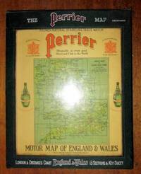
1922198554United Kingdom: George Philip & Son for Perrier 1922. Book. Very Good. Hardcover. a very good set of sectional coloured maps on an 8 miles to the inch scale in original case undated but around 1920-1923 as the Road lettering and numbering system A1 A40 etc are not here used and earlier than 1920 copies were backed onto linen fourteen maps distance card Index sheet all printed on card and with linen index taps to top edge lacking tab for Card Six Index card with Perrier advertising and reference to Royal Warrant of George V housed in a very good original wooden sided case lettered silver and red on green cloth plastic front to case revealing maps behind two press fasteners to rear flap a very well preserved set. George Philip & Son for Perrier Hardcover
2009x-0719077796Manchester Univ Pr 2009. Hardcover. New. 1st edition. 256 pages. 9.50x6.25x0.75 inches. Manchester Univ Pr hardcover
DADAX0198726457OXFORD UNIVERSITY PRESS 2015-05-19. 1. hardcover. New. 9.85x0.74x7.64. Buy with confidence. Excellent Customer Service & Return policy. OXFORD UNIVERSITY PRESS hardcover
SONG0198726457OXFORD UNIVERSITY PRESS 2015-05-19. 1. hardcover. Used: Good. 9.85x0.74x7.64. Buy with confidence. Excellent Customer Service & Return policy. OXFORD UNIVERSITY PRESS hardcover
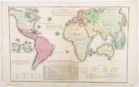
1835203763Philadelphia.: W. Marshall. Circa1835. Handcoloured engraved map 26.5 x 41.3 cms; 29.6 x 48.3 cms sheet central fold insets of "Oceanica" and "New Holland" central table some light staining in the image and margins in good condition. Eurocentrism laid bare. This 19th Century map includes a "State of Society" for each part of the world declared with a symbol to represent "Barbarous Half Civilized Civilized and Enlightened Societies" as well as noting religion and ethnicity. It includes a table of distances between chief towns or capitals and between these towns and Washington DC. Australia "New Holland" is styled principally as pagan barbarous unexplored and African a thin sliver of what is now New South Wales and Victoria is labelled civilized European and Protestant. Scarce. . (W. Marshall). unknown
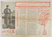
1967169746Beijing.: 地图戰報.Di tu zhan bao. September1967. Maps printed in red and black single sheet printed on both sides folded scale not given photographic image of Mao Zedong. Some light browning at edges with tears and losses on left edge still good. Text in Chinese. Sheet measures 26.5 x 38.4cm. Includes a map of Autumn Harvest Uprising and also shows the routes of the military advancing towards Jinggangshan between September and October 1927. On reverse left section a map shows the route along which Chairman Mao led the Fourth Army of the Chinese Red Army marching towards south of Anhui and Jiangxi Provinces in 1929. On reverse right section a map titled "The Long March of The Chinese Workers' and Peasants' Red Army October 1934-October 1935". Quotations of Chairman Mao about the Long March insert on corners of the map. <br> <br>Issue no. 6 of a series of maps with text issued by the Red Guards organisations in the form of Cultural Revolution tabloid-sized newspaper. This issue is designed to celebrate the 40th anniversary of the Autumn Harvest Uprising which was one of the earliest armed uprisings organised by the Chinese Communist Party. . 地图戰報.[Di tu zhan bao]. unknown
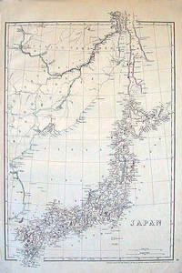
1852185246London.: Cassell Petter & Galpin. circa1852. Map with outline handcolour 42.5 x 30.1 cms; 49.2 x 34.3 cms sheet margins a little toned small corner crase but in very good condition. Very detailed map of the Japanese islands with Sakhalin above and the coast of Manchuria and Korea. . Cassell, Petter & Galpin. unknown
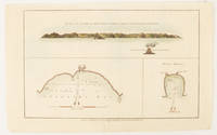
1784174896London.: Alexander Hogg at the King's Arms. circa1784. Engraved map in triptych on laid paper 20.1 x 32.7 cm three insets: cross section of the north side of Queen Charlotte's Islands Solomon Islands with detail of a volcano "6 leagues North"; Swallow's Bay Harbour; and Byron's Harbour early hand colour trimmed to the plate mark at the top edge neat sealed tear affecting the publisher's caption slight edge wear and paper toning but a most attractive map in very good condition. Attractive engraving of the Queen Charlotte's Islands Solomon Islands. The Islands were named for the consort of King George III by Philip Carteret the British naval officer and explorer who participated in two of the Royal Navy's circumnavigation expeditions in 1764–66 and 1766–69. His ship the Swallow gave her name to the Bay and Carteret's commanding officer on the first of his voyages John Byron to the Harbour depicted in this most attractive early chart. . Alexander Hogg at the King's Arms. unknown
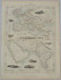
1850177525London.: The London Printing and Publishing Company. circa1850s. Lithographed map with original outline hand colour 33 x 24.5 cm including border and captions seven vignette illustrations two reference keys decorative border central fold light toning mainly at the central fold and to the verso of the sheet in very good condition preserved in a window mount. Attractive decorative map with fine vignettes of the London Post Office Suez Bombay Madras. Aden Malta Gibraltar and a wonderful camel train led by a carriage and horses crossing North Africa originally by the great mapmaker and publisher John Tallis. The two reference keys note steam packet routes railways electric telegraph and the Suez Canal. . The London Printing and Publishing Company. unknown
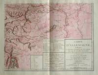
1805570721805. Copper engraving with handcolouring map shows the border of the Austrian Empire and Hungary Vienne sic and the Danube can be seen at the top of the map Two keys and scale inset. Few closed tears and some browning edges otherwise a clean and bright image. Map measures approximately 34 x 44cm. Map of Germany <br>indicating the present division of this empire as well as the new possessions of the princes who make up the Germanic body and including Batavia and Helvetia Switzerland with their divisions. by E. Mentelle a member of the institute and P. G. Chanlaire one of the authors of the National Atlas. An xiii 1805. Paris. There is a key to the explanation of the signs and an explanation of the colours used for the district of the various states contained in this map. . unknown
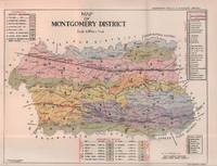
1935215892Lahore.: Government Printing. Revised Edition. 1935. Four folding colour maps xi 311 pages 26.5 x 18 cms; original papered boards spotted and a trifle scuffed linen backstrip with paper title label worn; foredges and endpapers spotted a few leaves toned but on the whole in very good condition the maps particularly bright and clean. A remarkable association copy: the author Frederick Blyth Wace's copy with his inked initials to the front free endpaper and his humorous unpublished foreword tipped in opposite the preface together with a dedication leaf both in Wace's hand and his business card loose within. As a further dedication makes clear this copy was given by Wace's son a couple of his loose notes on scrap paper are included the eminent botanist Nigel Morritt Wace 1929-2005 late head of the Australian National University's department of Biogeography and Geomorphology in 2003 to his fellow academic and marsupial biologist Dr. Hugh Tyndale-Biscoe. Both Wace and Biscoe were born in India and began their schooling in Kashmir at the school founded by Tyndale-Biscoe's father a Christian missionary and for whom the school is named. <br> <br>From the collection of Hugh Tyndale-Biscoe. . Government Printing. hardcover
2026x-1666969567Bloomsbury USA Academic 2026. Hardcover. New. 208 pages. 9.01x6.00x1.01 inches. Bloomsbury USA Academic hardcover
22035640-nnew. unknown
CBS 9781634855617USA Edition . New. Brand New! Fast Delivery US Edition and ship within 24-48 hours. Deliver by FedEx and Dhl & Aramex UPS & USPS and we do accept APO and PO BOX Addresses. Order can be delivered worldwide within 6-10 days and we do have flat rate for up to 2LB. Extra shipping charges will be requested if the Book weight is more than 5 LB. This Item May be shipped from India United states & United Kingdom. Depending on your location and availability. unknown
22035640like new. unknown
2023x-3031203046Palgrave Macmillan 2023. Hardcover. New. 257 pages. 8.25x5.75x0.75 inches. Palgrave Macmillan hardcover
2024x-3031203070Palgrave Macmillan 2024. Paperback. New. 264 pages. 8.27x5.83x0.61 inches. Palgrave Macmillan paperback