Speed, JohnBiblio.com
1 204 résultats
164623401London: William Humble 1646. Other. In excellent condition. 385 by 510mm 15¼ by 20 inches. 385 by 510mm 15¼ by 20 inches. Copper engraving uncolored as published. William Humble unknown
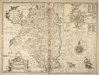
49671London: Tho. Bassett and Richard Chiswell. 1676. Original engraved map 38 x 51 cm. Uncoloured. Inset of Dubline. Good impression very light tanning to centre-fold minor crease at margin of lower right corner. London: Tho. Bassett and Richard Chiswell. [1676] unknown
1992109244Pavilion Books 1992-01-01. Hardcover. New. 11x9x0. Brand new gift quality hardcover in jacket oversized and overweight. B75 Please email for photos. Pavilion Books hardcover
1989Q-0500251045Thames & Hudson 1989. hardcover. New. In shrink wrap. Looks like an interesting title! Thames & Hudson hardcover
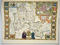
16651780London: to be sold by Roger Rea the Elder and younger at the Golden Crosse in Cornhill against the Exchange 1665. 410 by 550mm. 16.25 by 21.75 inches. Double-page engraved map upper left and right margins skilfully repaired margins reinforced with japan paper. The map bears the imprint of Roger Rea the Elder and Younger. The Reas had purchased the rights to Speed's work from William Garrett in 1659 who had previously purchased them from the widow of William Humble in the same year. Skelton suggests that the father and son intended a new edition of the atlas for the Restoration of 1660. However the atlas would appear not to have been published until 1665. This is borne out by an advertisement in the Term Catalogue by the subsequent owners of the plates Thomas Bassett and Richard Chiswell in 1675: "Mr John Speed's. Geography of the Kingdoms of England Scotland and Ireland. together with his Prospect. all in one entire Volume hath been for seven Years past out of Print the greatest part of an Impression then newly Printed being destroyed by the late dreadful Fire 1666". This is borne out by the rarity of the Rea edition of the atlas. There is evidence that they planned an edition of 1666 as there are impressions of Sussex Buckingham and Derby with Rea's imprint which bear that date. Rea would later sell the plates to Bassett and Chiswell who would publish a new edition in 1676. to be sold by Roger Rea the Elder and younger at the Golden Crosse in Cornhill against the Exchange, unknown
16651788London: to be sold by Roger Rea the Elder ad younger at the Golden Crosse in Cornhill against the Exchange. 1665. 410 by 550mm. 16.25 by 21.75 inches. Double-page engraved map fine contemporary outline hand colour upper left and right margins skilfully repaired margins reinforced with japan paper. The map bears the imprint of Roger Rea the Elder and Younger. The Reas had purchased the rights to Speed's work form William Garrett in 1659 who had previously purchased them from the widow of William Humble in the same year. Skelton suggests that the father and son intended a new edition of the atlas for the Restoration of 1660. However the atlas would appear not to have been published until 1665. This is borne out by an advertisement in the Term Catalogue by the subsequent owners of the plates Thomas Bassett and Richard Chiswell in 1675: "Mr John Speed's. Geography of the Kingdoms of England Scotland and Ireland. together with his Prospect. all in one entire Volume hath been for seven Years past out of Print the greatest part of an Impression then newly Printed being destroyed by the late dreadful Fire 1666". This is borne out by the rarity of the Rea edition of the atlas. There is evidence that they planned an edition of 1666 as there are impressions of Sussex Buckingham and Derby with Rea's imprint which bear that date. Rea would later sell the plates to Bassett and Chiswell who would publish a new edition in 1676. to be sold by Roger Rea the Elder ad younger at the Golden Crosse in Cornhill against the Exchange. unknown
161221264London: Sudbury & Humble 1612. Insets of the Plan of Radnor Wales with a coat of arms compass rose/scale of miles and title in decorative cartouche. From the atlas "The Theatre of the Empire of Great Britaine". Skelton R. A. County 7. Restoration in margins otherwise very good. Copper engraving with original color re-touched. 20 x 15" plus ample margins. Sudbury & Humble unknown
1989132425England: Thames And Hudson 1989. Hardcover. Fine/Fine. First American edition. Fine in fine dustwrapper. A beautiful copy clean like new many detailed maps. Thames And Hudson hardcover
DADAX0500251045Thames & Hudson 0000-00-00. hardcover. New. 0.00x0.00x0.00. Buy with confidence. Excellent Customer Service & Return policy. Thames & Hudson hardcover
16765494London Thomas Bassett &: Richard Chiswell 1676. Copper engraving 38.5 x 51.2 cms recent hand colour English text to verso. John Speed 1552-1629 is unquestionably the most significant English map-maker of the seventeenth-century. A brief note from Granger's Bibliographical History of England 1779 contains most of the information we have about Speed's life: "John Speed who was bred a Tailor was by the generosity of Sir Fulk Grevil his patron set free from a manual employment and enabled to pursue his studies to which he was strongly inclined by the bent of his genius. The fruits of them were his Theatre of Great Britain containing an entire set of maps of the counties drawn by himself his History of Great Britain richly adorned with seals coins & medals from the Cotton collection; and his Genealogies of Scripture first bound up with the Bible in 1611 which was the first edition of the present English translation. His maps were very justly esteemed & his History of Great Britain was in its kind incomparably more complete than all the histories of his predecessors put together ." The first edition of Speed's "Theatre" was published in 1612. It was the first atlas of the British Isles and the first attempt made by an Englishman to match the achievements of the great continental publishing houses - although much of the engraving of the copper plates was performed in Amsterdam by Jodocus Hondius. Speed was an antiquary and intended that his atlas should be read in conjunction with his history of Britain. He managed to include a great deal of historical detail on his 'modern' county maps and the inset town plans some surveyed by himself together comprise the first collection of town plans of the British Isles all in all making the Theatre a highly decorative as well as a useful volume. It was a great success and there were editions printed throughout the seventeenth-century. Map Richard Chiswell unknown
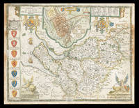
167621981<p>London: And are to be sold by Thomas Bassett in Fleet Street and Richard Chiswell in St. Pauls Churchyard 1676. 385 by 510mm. 15.25 by 20 inches. Speed's Map of Cheshire Double-page engraved map with hand-colour some discolouration to margins and to left and right of image. A map of Cheshire from the 1676 edition of the first large-scale atlas of the British Isles Speed's 'Theatre'. In the top-centre of the map is an inset town-plan of Chester with four coin medallions possibly showing: Julius Caesar the emperor Vespasian the emperor Domitian and the 20th Legion which was among those to invade Britain with Claudius in 43CE. Along the left-hand side of the map are depicted the arms of the Earls of Chester since the Norman Conquest among them 'Ranulph Blundeuill' and 'Ranulph Gernones'. John Speed 1552-1629 was the outstanding cartographer of his age. By trade a merchant tailor but by proclivity a historian it was the patronage of Sir Fulke Greville poet and statesman that allowed him to pursue this interest in earnest. His 'Theatre of Great Britain' from which the present work is drawn was first published in 1611 or 1612 and is 'the earliest English attempt at atlas-production on a grand scale' Skelton. Drawing heavily on the work of Saxton and Norden little of Speed's cartography is original he acknowledges 'I have put my sickle into other mens corne' instead it is his blend of cartography and history incorporating town-plans vignettes and genealogy that makes Speed an innovator. This map is from the 1676 edition of the 'Theatre' published by Thomas Bassett and Richard Chiswell. Interestingly this map lacks the text in English that is usually printed on the verso. Chubb CIV; Shirley Atlases T.Spe-1j; Skelton 92.</p> And are to be sold by Thomas Bassett in Fleet Street, and Richard Chiswell in St. Pauls Churchyard,
1258331071.Ghardcover. Good. Access codes and supplements are not guaranteed with used items. May be an ex-library book. hardcover
197528530Hull: N.T. Leslie 1975. First edition thus. Hardcover. Very good condition. Beautiful color reproductions of the English county maps from the London edition of 1611. <br /> <br /> Elephant Folio 59 cm unpaginated 43pp 1/4 black and blue cloth boards title label on front with gilt title no title on spine. Spine rubbed top front corner bumped otherwise good. OCLC: 57296131<br /> <br /> Speed John 1552–1629 historian and cartographer was born in 1552 in Farndon Cheshire. His father was also called John and was a member of the Merchant Taylors’ Company; his mother was Elizabeth Cheynye. He was brought up in his father's trade and in 1580 was himself admitted into the Merchant Taylors’ Company. At this time he also speculated in property and acquired a number of sites through the patronage of the Taylors’ Company and through Sir Fulke Greville first Lord Brooke.<br /> <br /> However although Speed is regarded as the first English historian as opposed to chronicler or annalist it is through his hobby that he is best known; he made maps of English counties in his spare time. In 1598 he presented a number to Queen Elizabeth and in 1600 others to the Merchant Taylors’ Company. Speed became a recognised and skilled cartographer – his insertion of town plans into his maps in particular was a distinctive feature. In 1607 he copied John Norden's map of Surrey for William Camden's Britannia and in 1608–10 published a series of fifty-four maps of England and Wales. These were issued in 1611 as his famous Theatre of the empire of Great Britain. In 1608 the publisher George Humble was granted the twenty-nine-year privilege to print this book ‘compiled by John Speed’ CSPD 1603–10 425. It was reprinted in 1614 and 1627 and brought out in a Latin version in 1616 and 1646. Dictionary of Irish Biography. N.T. Leslie hardcover
191219949Chicago: The Reilly and Britton Co. Near Fine with no dust jacket. 1912. First Edition; First Printing. Hardcover. Just perhaps the faintest hint of fading to the spine and 3 small light spots at the bottom of the front cover. Owner's name in pencil on the fep. Not chipped bumped or rubbed. It doesn't get much better. ; Small 8vo 7½" - 8" tall; 313ads pages . The Reilly and Britton Co. hardcover
191211881Chicago: The Reilly and Britton Co. Good with no dust jacket. 1912. First Edition; First Printing. Hardcover. The spine is darkened and the covers are somewhat soiled. The paint on the cover is unaffected. The front endpapers are soiled. The hinges are tight. ; Small 8vo 7½" - 8" tall; 313ads pages . The Reilly and Britton Co. hardcover
1981Q-0674632109Belknap Press: An Imprint of Harvard University Press 1981-01-01. Hardcover. New. In shrink wrap. Looks like an interesting title! Belknap Press: An Imprint of Harvard University Press hardcover
1977386150Cambridge MA: Harvard University Press 1977. 1st. Hardcover. Very Good/None. Hardcover blue cloth with gilt lettering and design to spine and front cover. 552 pages. Clean bright copy. Record # 386150 Harvard University Press hardcover
0666030987.Ghardcover. Good. Access codes and supplements are not guaranteed with used items. May be an ex-library book. hardcover
1103068067.Gpaperback. Good. Access codes and supplements are not guaranteed with used items. May be an ex-library book. paperback
1104391015.Gpaperback. Good. Access codes and supplements are not guaranteed with used items. May be an ex-library book. paperback
1015768407.Ghardcover. Good. Access codes and supplements are not guaranteed with used items. May be an ex-library book. hardcover
1165672669.Gpaperback. Good. Access codes and supplements are not guaranteed with used items. May be an ex-library book. paperback
2 vols., oblong 4to., First Edition thus, with numerous coloured and monochrome photographs throughout; original green cloth, upper boards blocked with Goodwood crest in silver and black, backstrips lettered in silver, green endpapers, a near fine set in publisher's green card slip-case.
Please note: colour plate not included. Chapter CCLXXXIX - The Secret of Jutland - with photos and illustrations. Super centerfold action photos of British ships at full speed and firing their 13.5" and 12" guns. Many photos of the British warships that won glory in the Battle of Jutland. Battle diagrams. Somewhat above-average wear and soiling. Staples disintegrated. A worthy reference copy. Book
1331463963.Gpaperback. Good. Access codes and supplements are not guaranteed with used items. May be an ex-library book. paperback