BARRUCAND VictorLivre Rare Book
11 021 résultats
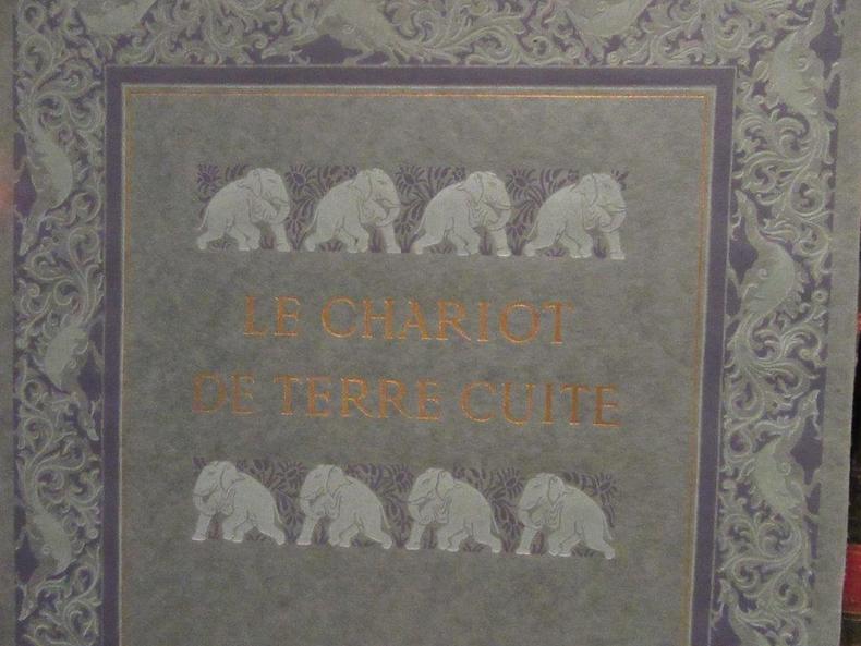
42665Piazza.1921.In-4 br.avec étui.Ills.de Léon Carré.114 p.+ Table des Illustrations.Ex.n°242 sur vélin. Bel exemplaire.Couverture à rabats illustrée d'éléphants dans des tons verts,bleus et dorés.Très léger manque de papier au dos.
1749Geo-Buyde1-1in-12. Édition originale. Reliure plein veau marbré de l'époque, dos lisse orné de fleurs, tranches jaspées. 522 pages. 14 planches en hors texte. Manques au dos et au mors du plat de devant, coin émoussé trois petits trous. Ex-libris sur la page de titre. Intérieur très frais. Bel état. Llivre d'occasion, vendu en l'état, hors frais d'envoi.
186442260(London, Taylor and Francis, 1864). 4to. No wrappers as extracted from ""Philosophical Transactions"", Vol. 154 - Part II, pp. 413-435 a. pp. 437-444 and 2 lithographed plates.(1 plate showing the spectroscope which could be attached to his eight-innch telescope invented by Huggin's and Miller, the start of stellar spectroscopi, the other plate showing the obtained spectra of the nebulæ Aldebaran and Orionis).
174051275(Paris, L'Imprimerie Royale, 1740). 4to. Without wrappers. Extracted from ""Mémoires de l'Academie des Sciences. Année 1737"". Pp. 389-469, 1 engraved map (from Torneå to Kittis) and 5 folded engraved plates.
188342216(London, Harrison and Sons, 1883). 4to. No wrappers as extracted from ""Philosophical Transactions"" Year 1882, Volume 173 - 1883. - Pp. 863-883 and 1 plate. Margin of plate with small tears.Otherwise clean and fine.
189549284London, arrison and Sons, 1895. - (Paris, Gauthier-Villars), 1895. 8vo. and 4to. Later full cloth, gilt lettering to spine (Ramsay) and without wrappers (Cleve). In ""Proceedings of the Royal Society"" (Ramsay), Vol. 58. (Entire vol. offered). And in ""Comptes Rendus Hebdomadaires des Séances de L'Academie des Sciences"" (Cleve), Tome 120, No 15. Pp. (797-) 850. (Entire issue offered). Ramsay's papers: pp. 65-67 and pp. 81-89. - Cleve's paper: p. 834. Stamps tp edges and a few corners a bit bumped on vol. 58, otherwise clean and fine.
186442260London Taylor and Francis 1864. 4to. No wrappers as extracted from "Philosophical Transactions" Vol. 154 - Part II pp. 413-435 a. pp. 437-444 and 2 lithographed plates.1 plate showing the spectroscope which could be attached to his eight-innch telescope invented by Huggin's and Miller the start of stellar spectroscopi the other plate showing the obtained spectra of the nebulæ Aldebaran and Orionis. <br/><br/><em>First printing of a historical paper in spectroscopy and cosmology in which the authors shows by analysing the spectrae of nebulae of stars of planets of comets and of the sun that they are all built of the same elements as the earth. Thus was "laid to rest the twenty-one-century notion of Aristotle's that the heavens were composed of a unique substance not found on the earth."Asimov. They also shows that there is a considerable diversity of chemical composition among the stars.In this paper Huggins also describes his discovery by spectroscopy that a number of nebulae are luminous gas clouds."William Huggins 1824-1910 English astronomer a pioneer in spectroscopy and photography. He examined spectroscopically the chemical constitution of stars and comets and the gaseous nature of planetary and diffuse nebulae; he applied the Doppler Principle to the measurement of the radial velocities of stars and published an atlas of representative stellar spectra" Ripley: Source Book in Astronomy. </em> unknown
174051275Paris L'Imprimerie Royale 1740. 4to. Without wrappers. Extracted from "Mémoires de l'Academie des Sciences. Année 1737". Pp. 389-469 1 engraved map from Torneå to Kittis and 5 folded engraved plates. <br/><br/><em>First printing of the official report from the French Academy of the geodetic expedition to Lapland in order to settle the conflict between Earth-elangators and Earth-flatteners between the French and the British. "Newton had calculated from the Earth's rotational force at the Equator that its equatoeial diameter should exceed its polar diameter by 0.44 per cent or 27 km 17 miles; similar in Jupiter rotating more than twice as fast the disparity of the diameters was shown to be even greater. In France however tha Cassinis from geodetic measurements stretching along the meridian at Paris from the Channel to the Pyrennees came to exactly the opposite conclusion - that the polar diameter of the Earth was the greater. After Maupertuis had examined this imcompatibility in 1733 the Academy of Sciences decided that it should be settled by measure of a degree of latitude taken in two widely separated parts of the globe. Maupertuis with Clairaut took a party to the Golf ofBothnia. La Condamine with Bouguer took another to Peru. maupertuis departed in May 1736 and was absent for a year only in December 1737 was he able to announce the result that in accordance with Newton's dynamical theory the degreee in the far north was loner than that in Paris. More years elepsed before the degreee in Peru was found to be shorter. As Voltaire put in a wrily witty but un-Baconian couplet addresseed to Maupertuis:"In tedious deserts you were forced to roam. To find the truth that Newton knew at home." Rupert Hall "Revolution in Science 1500-1750 pp.351-52.Parkinson "Breakthroughs" 1736-37 E. </em> unknown
188342216London Harrison and Sons 1883. 4to. No wrappers as extracted from "Philosophical Transactions" Year 1882 Volume 173 - 1883. - Pp. 863-883 and 1 plate. Margin of plate with small tears.Otherwise clean and fine. <br/><br/><em>First appearance of the first paper describing the invention of the seismograph to record earthquakes."Milne studied at the Royal School of Mines and became mining engineer. He joined an Expedition to Arabia as a geologist. His real chance came in 1875 however when he accepted an appointment as a professor of geology and mining in the Imperial College of Engineering at Tokyo. He remained in Japan for twenty years and there had a marvelous opportunity to study earthquakes for no land is more riven with them than Japan. In 1880 he invented the seismograph.and established a chain of seismographs in Japan and elsewhere marking the beginning of modern seismology."Asimow.The paper describes 8 sets of experiments set up at different stations in Japan.On Milne's initiative the Seismological Society of Japan was founded and the emperor of Japan conferred upon him the Order of the Rising Sun. </em> unknown
189549284London arrison and Sons 1895. - Paris Gauthier-Villars 1895. 8vo. and 4to. Later full cloth gilt lettering to spine Ramsay and without wrappers Cleve. In "Proceedings of the Royal Society" Ramsay Vol. 58. Entire vol. offered. And in "Comptes Rendus Hebdomadaires des Séances de L'Academie des Sciences" Cleve Tome 120 No 15. Pp. 797- 850. Entire issue offered. Ramsay's papers: pp. 65-67 and pp. 81-89. - Cleve's paper: p. 834. Stamps tp edges and a few corners a bit bumped on vol. 58 otherwise clean and fine. <br/><br/><em>First printing of both papers in which Ramsay and Cleve - independently - announced their discovery of Helium on the Earth. Although Ramsay announced the discovery of Helium before Cleve had completed his research the Swedish chemist was independent discoverer of the element.Helium was discovered in the sun already in 1868 by Jules Janssen and independently by Lockyer the same year. Janssen discovered helium in the sun when he observed a total eclipse in India by studying the spectra of the suns chromosphere and Lockyer also by spectroscopy found that the new line in the spectrum did not belong to any element then known and he named it Helium for the sun.In the same volume as Ramsays paper there are 5 papers by NORMAN LOCKYER dealing with the discovery of Helium on the earth examining Ramsay's and Cleve's findings.Parkinson "Breakthroughs" 1895. </em> hardcover
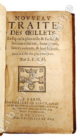
167619500Paris, Charles de Sercy, 1676 ; in 12, veau marbré, dos à nerfs décoré et doré, roulette sur les coupes (reliure de l’époque) ; [1, 1 bl., 2], 162, [2] pp.
24796LA PLAINE-SUR-MER 1698 à 1862 une chemise gris souris à fermeture à ruban, format : 32 x 24,5 cm, contenant 36 actes notariés manuscrits à l'encre brune avec différents timbres fiscaux sur papier velin ligné et filigrané crème ou bleu, datés de 1698 à 1836,
30161Etudes sur l'instinct et les moeurs des insectes. Edition définitive illustrée. P. Delagrave, 1822-1824. 11 vol. in-8. Demi basane havane de l'éditeur, dos à nerfs richement ornés, coins, têtes dorées.
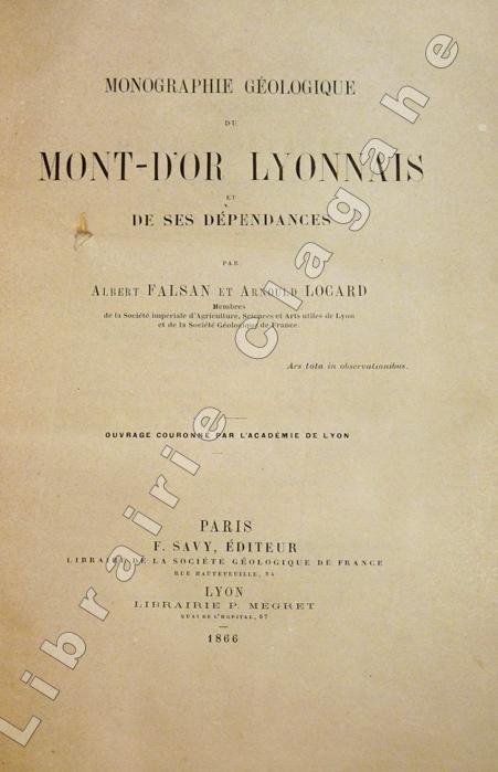
18665649Paris, Savy et Lyon, P. Mégret (Lyon, Imprimerie Pitrat Aîné), 1866 ; in-8 ; demi-veau glacé bronze, dos à nerfs, titre doré, exemplaire juste ébarbé (reliure de l'époque) ; 499, (1) pp., 6 tableaux dépliants dont 1 très grand sur les étages géologiques, 4 planches hors-texte lithographiées dont 2 dépliantes et 1 grande carte géologique dépliante lithographiée en couleurs qui indique aussi les carrières, sablières, mines et emplacements de fossiles.
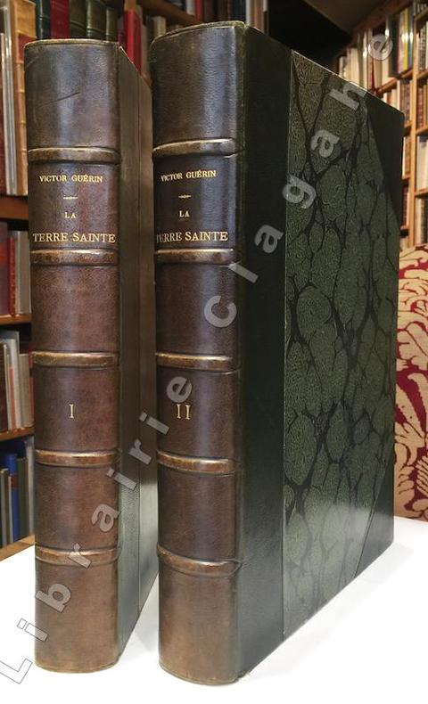
188416153Paris, Plon, Nourrit et Cie, 1884 ; 2 tomes in-folio ; demi-chagrin à coins vert foncé, dos à nerf, titre doré ; (4), 468 ; (4), 512 pp. et en tout 44 planches hors-texte gravées sur acier dont 2 frontispices et 3 cartes en couleurs (dont 2 à doubles pages) et le plan de Jérusalem et plusieurs centaines d'illustrations gravées sur bois.
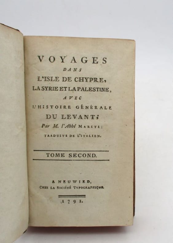
21532Neuwied, chez la Société typographique, 1791. 2 vol. in-12, 342 pp. + 423 pp., basane marbrée havane, dos long orné de filets et fleurons dorés, tranches rouges (manques et épidermures, quelques taches).
186926237Paris Arnaud de Vresse 1869 -in-4- demi-chagrin un volume, reliure demi-chagrin bordeaux in-quarto Editeur (binding half shagreen in-quarto) (31,3 x 24,5 cm), RELIURE D'ÉPOQUE, dos 5 nerfs (spine with raised bands), décoration "or" et à froid (gilt and blind stamping decoration), titre frappé "or", entre nerfs à gros fleuron "or", filet fins et filet large à froid de part et d'autre des nerfs, filet fin à froid en tête et en pied, plats de percale vieux rose décorés à froid (plaque spéciale Editeur), toutres tranches lisses dorées, gardes blanches moirées (endpapers with paper watered), orné de 37 planches hors-texte lithographiées en couleurs et gommées avec serpentes + une vignette au titre en noir + front de chapitres, lettrines et culs-de-lampes historiés gravés en noir par Augustin François LEMAITRE, légères rousseurs (redness marks) habituelles pour les livres de cette époque n'atteignant pas les lithographies en couleurs, 141 pages, 1869 à Paris Arnaud de Vresse Editeur,
187614715Wien, Alfred Holder, 1876 ; fort in-8 ; cartonnage de l'éditeur bleu-noir-or décoré d'images "polaires" : navire, ours blanc, chien de traineaux, explorateurs en fourrure, toutes tranches dorées (reliure signée H. Scheibe) ; CVI, 696 pp., 3 cartes dépliantes lithographiées en couleurs et 146 dessins gravés sur bois.
2005LFA-1267249526 volumes en 5 tomes de 442, 406, 1332, 835 et 411 pages, format 165 x 240 mm, reliés cartonnage, publiés en 2005, Librairie Honoré Champion, bon état, rare
174623229Paris Didot 1746 In-12 ( 4 Volumes ) 1 portrait LXXXIV - 362 pp ( 2 gravures dép et 2 cartes ) + 450 ( 1 gravures, 1 plan et 4 cartes dépliantes ) + 466 pp ( 1 gravure et 2 cartes dépliantes ) + 360 ( 1 carte dépliante , 4 planches dépliantes ) Tête de Collection en plein maroquin vert , triples filets dorés encandrant les plats, tranches dorées
Affascinante carta del Polo Nord che rispecchia le conoscenze cartografiche del periodo, lasciando aperta la possibilità di una passaggio a Nordest che a Nordovest. La mappa è decorata da mostri marini, e vignette di cacciatori ed orsi. Pubblicata nell'opera di Heinrich Scherer Atlas Novus exhibens orbem terraguem per naturae opera, historiae navae acveterus monumenta, artistique geographicae leges et praecepta edita in 8 parti, stampate tra il 1702 e il 1710 a Monaco di Baviera. Heinrich Scherer, professore di matematica a Monaco di Baviera, era un gesuita devoto la cui opera sottolineava la gerarchia cattolica e la diffusione delle missioni gesuite in tutto il mondo. Il suo Atlas Novus contiene mappe di tutte le altre parti che mostravano la diffusione del cattolicesimo e delle missioni gesuite. Le 180 mappe incluse in questo lavoro sono state preparate tra il 1699 e il 1700 e sono state incise da Leonard Hecknaeur, Joseph Montelegre e Matthus Wolfgang; ogni volume è introdotto da splendidi frontespizi allegorici dagli stessi incisori. Incisione su rame, in ottimo stato di conservazione. Fascinating map of the North Pole by Heinrich Scherer (1628-1704) for his Atlas Novus exhibens orbem terraguem per naturae opera, historiae navae acveterus monumenta, artistique geographicae leges et praecepta...published in eight volumes from 1702-1710 in Munich. Scherer, a devout Jesuit, produced this geographical compendium to depict the Catholic hierarchy and the spread of Jesuit missions throughout the world.The map itself presents typical cartography for the period, leaving open the possibility of both a Northeast and Northwest Passage to the Far East. The map is literally filled with images of sea monsters, whaling, hunting and exploration. The title cartouche is engraved onto the hide of a polar bear with two hunters, and at right is a vignette of the people of Lapland.Copper etching, some light stains, otherwise in good condition.
109895A Paris, chez Briasson, Libraire, ruë Saint-Jacques, à la Science, 1735, Avec Privilege du Roy, 1f.blanc, un frontispice dépliant (Idée du Sisteme de M. Wodward sur la structure presente de l'intérieur de la Terre), xiv (titre à la marque de l'imprimeur " A la Science", Préface, Table)-390 pages, 1f. (Privilege), 2ff.blancs, plein veau granité brun, dos à nerfs portant titres dorés, orné de caissons à fleurons et riches motifs dorés, coupes dorées, gardes marbrées, tranches rouges. Rares petites rousseurs, des erreurs de pagination : les cahiers R et S, Aa et Bb, et les cahiers Dd et Ee sont inversés, sans manque de page (confirmé par les signatures et réclames), manque de cuir sur 3 coins et une coiffe, début de fente sur un mors, frottements d'usage sur le cuir, sinon bon état.
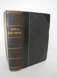
1900016807San Francisco and Sacramento: California State Mining Bureau 1900. 3 volumes bound as one. All three are First Editions published 1902/1901/1902 respectively -- not cheaply-made modern reprints. Bound together in black cloth with black leather spine and corners stamped in shiny gold on the spine. The leather joints have a hairline crack. SEE PHOTOS. The original colored wraps for all three books are bound-in. The binding is in Near Very Good condition. Internal condition is Very Good. The ink stamp of Harry M. Roche is on the front endpaper. All three books are profusely illustrated with photos and maps. Many of the maps are fold-out and printed in color. COPPER RESOURCES has 69 illustrations mostly photos and 8 maps of which 3 are folding. The largest: Map of California Copper Deposits unfolds to 29.5" wide by 36" tall. Another fold-out is: Geological Map of the Western Portion of the Shasta County Copper Belt. OIL AND GAS YIELDING FORMATIONS has 35 photos and 13 fold-out maps including Geological Map of Territory between Los Angeles and Santa Ana River; Los Angeles Oil Fields 1898-1900; Geological Sketch Map of the Peninsula of San Pedro; Geological Sketch Map of SE Portion of Orange Co.; Devils Gate Oil District; Sketch Map of Summerland Oil Wells; Coalinga Oil District Fresno Co. 1900; etc. SALINE DEPOSITS has 98 photos and 5 maps. Three of the maps are folding. Two of them are quite large and in color: Map of California Saline Deposits 1902 unfolds to 29" wide by 36" tall; Saline Deposits of the Southern Portion of California unfolds to 30.5" wide by 30.5" tall. First Editions. Hardcover. Near Very Good condition. 8vo. 282pp. 236pp. 215pp. Great Packaging Fast Shipping. California State Mining Bureau Hardcover
1886016429Washington: Department of the Interior Census Office / Government Printing Office GPO 1886. This is a solid reading/reference copy that was formerly in the Library of Congress/Smithsonian Institution. Good condition. See photos. New endpapers. Inner hinges are perfect. There is a small red ink stamp on the title page that reads: "Library of Congress February 25 1887 Smithsonian Deposit." Stamped over it in blue ink is: "Transferred Jan 7 1911." Otherwise all pages are unmarked. NO underlining. NO highlighting. NO margin notes. Bound in the original brown cloth moderately rubbed at the spine ends/edges. See photos. 76 tables. Profusely illustrated with 242 figures in the text and 102 full-page inserted maps and diagrams -- many folding and/or PRINTED IN BEAUTIFUL FULL COLOR. See photos. The List of Plates lists a total of 102 maps sections and diagrams. Of these 96 are bound-in as called for and all 96 are present. Of the remaining 6 plates that are supposed to be in a pocket at the rear only one plate LI is present. The 5 plates missing from the pocket are numbers XXIV Map of a group of iron mines in the town of Moriah Essex county New York and L LII-LIV Geological maps of the Cretaceous bituminous coal region of central Montana. Full title: "Report on the Mining Industries of the United States exclusive of the precious metals with Special Investigations into the Iron Resources of the Republic and into the Cretaceous Coals of the Northwest." Spine title: "Tenth Census of the United States 1880 Vol. XV Mining Industries." Oversize Hardcover. 9.5" wide by 12" tall by 3" thick. This large heavy book will require extra postage for Priority and International shipments but only the standard charge for media mail. First Edition. Oversize Hardcover. Good condition. xxxviii 1025pp. Department of the Interior, Census Office / Government Printing Office (GPO) Hardcover
1741biblio1Original bind in parchmin. Traduit de "Istoria dell" incendio del Vesuvio accaduto nel mese di maggio dell" anno 1737" de Francesco Serao. Rare and important book on Vulcanology. Please contact me ramrozzi@yahoo.fr