11 020 résultats
In 4, pp. VIII + 432 con 43 tavole fotografiche fuori testo in nero e a colori e 6 grandi panorami fotografici piu' volte ripiegati + 1 grande carta geografica della Terra del fuoco in apposita taschina editoriale separata. Tutta tela editoriale con la rarissima sovraccoperta fotografica, estremamente difficile da reperirsi, probabilmente per la frase a firma Mussolini che campoeggia al piatto anteriore e che potrebbe aver indotto molti possessori a eliminarla. Curiosa la figura di Alberto MAria De Agostini, sacerdote salesiano e missionario in Terra del Fuoco, uni' alla sua attivita' pastorale anche quella di esploratore, alpinista e naturalista. Sali' infatti il Monte S. lorenzo nel 1943 e organizzo' varie spedizioni con Carlo Mauri e Monzino. Importanti furono anche le sue ricerche cartografiche e naturalistiche.
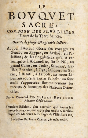
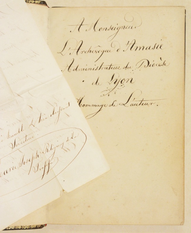
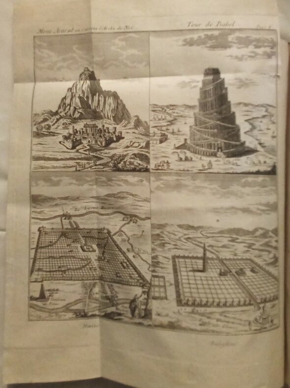
1784WOC-1027Lettres du P.Joseph-Romain Joly, de Saint-Claude, Capucin, de l'Académie des Arcades de Rome. Avec des planches et des cartes géographiques. Nouvelle édition augmentée d'une Table Géographique de tous les lieux dont il est fait mention dans la bible & de l'Histoire Naturelle de l'Écriture-Sainte; enrichie d'un grand nombre de planches. 15 planches & des cartes géographiques+1 carte du Temple de Salomon reliée à l'envers et 10 planches d'Histoire Naturelle de l'Écriture Sainte, cinq de végétaux & cinq d'animaux, la plupart des planches sont repliées. Paris, Chez Alexandre Jombert, Jeune, Libraire, rue Dauphine «Avec Approbation et Privilège du Roi»,1784. In-4 (26x4,5x20,5cm) de plein veau marbré d'époque, dos à 5 nerfs surlignés de 2 filets dorés, titre au dos doré sur maroquin rouge, petites fentes dans la charnière inférieure.IX-(3)389pp.-(3ff.,Errata et Approbations) et petit manque dans une marge verticale.
Carta tratta dalla "Geographia di Claudio Tolomeo", a cura di Girolamo Ruscelli, pubblicata in Venezia in più edizioni tra il 1561 ed il 1598. La carta più significativa dell'atlante di Ruscelli è proprio questa Septentrionalium Partium Nova Tabula, basata sulla carta di Zeno dell'Atlantico settentrionale, inclusa per la prima volta in un libro di viaggi del 1558 e che descrive un viaggio precolombiano nel Nuovo Mondo compiuto nel 1380 dai ventimigliesi Nicolò e Antonio Zeno. La mappa introduce in modo molto dettagliato molte nuove isole fittizie, tra cui la Frislandia (con 32 località nominate), Deogeo, Estotilandia, Estlandia e il monastero di S. Tomas in Groenlandia. Molte di queste isole e luoghi mitici furono rappresentati sulle carte geografiche per secoli, soprattutto perché Gerard Mercator accettò il viaggio di Zeno come autentico e ne adottò gran parte nel suo famoso mappamondo del 1569 e nella sua mappa del Polo Nord del 1595. Abraham Ortelius, a sua volta, utilizzò la mappa come prototipo per la sua mappa dell'Atlantico settentrionale; Frobisher e Davis la utilizzarono per le loro esplorazioni rispettivamente negli anni 1570 e 1580. Le mappe per la Geografia di Ruscelli vennero incise dai fratelli Livio e Giorgio Sanuto. La peculiarità di queste mappe è che sono incise due per lastra e successivamente tagliate; questo il motivo per cui il segno del rame appare solo in tre lati della mappa. Il testo del Ruscelli e le sue carte sono considerati come il miglior atlante moderno fino alla prima versione del Thatrum Orbis Terrarum di Ortelius, 1570. Solo la loro enorme diffusione ne impedisce una valutazione sostenuta nel mercato antiquario. L'opera infatti ebbe una prima stesura nel 1561, stampata da Vincenzo Valgrisi che ne curò anche la ristampa del 1562. Tre sono le edizioni firmate da Giordano Ziletti (due nel 1564 e una del 1574), mentre nel 1597 viene edita dai fratelli Calignani. Tutte queste edizioni contengono 64 tavole. Nel 1598 e 1599 vengono alla luce le due edizioni curate da Giuseppe Rosaccio e stampate dagli Eredi di Melchior Sessa. Queste ultime due edizioni comprendono 69 tavole; sono infatti aggiunte la carta del planisfero e dei continenti di Giuseppe Rosaccio. Bibliografia P. Burden, The Mapping of North America, 29; W. Ginsberg; Printed Maps of Scandinavia and the Arctic, 19. Early map of the North Atlantic Ocean depicting many fictions islands. Girolamo Ruscelli's edition of Ptolemy's Geographia included newly engraved copperplates by Giulio and Livio Sanuto. The most significant map in Ruscelli's atlas is his Septentrionalium Partium Nova Tabula map, which is based upon the Zeno map of the North Atlantic, first included in a 1558 travel book, which describes a pre-Columbian voyage to the New World in 1380 by Ventians Nicolo and Antonio Zeno. The map introduces many new fictitious islands in great detail, including Frisland (with 32 places named), Deogeo, Estotiland, Estland, and the monastery of S. Tomas in Greenland. Many of these mythical islands and places were depicted on maps for centuries, mainly because Gerard Mercator accepted Zeno's voyage as authentic and adopted much of it in his famous large 1569 world map and his 1595 map of the North Pole. Ortelius in turn used the map as a prototype for his map of the North Atlantic. Frobisher and Davis accepted the map for their explorations in the 1570's and 1580's, respectively. The map first appeared in the 1561 Ruscelli edition of Ptolemy's Geografia. Ruscelli edition of Ptolemy's "Geographia", printed in Venice from 1561 to 1598. Ruscelli's Atlas is an expanded edition of Gastaldi's Atlas of 1548, which has been called the most comprehensive atlas produced between Martin Waldseemüller's Geographiae of 1513, and the Abraham Ortelius Theatrum of 1570. Ruscelli and Gastaldi's maps were beautifully engraved on copper, marking a turning point in the history of cartography. From that point forward, the majority of cartographic works used this medium. As it was a harder material than wood it gave the engraver the ability to render more detail. Gastaldi sought the most up-to-date geographical information available, making the modern maps in Ruscelli's Geographia among the best modern maps of the period. The maps are engraved by the Sanuto borthers. A fine copy, in good condition. Bibliografia P. Burden, The Mapping of North America, 29; W. Ginsberg; Printed Maps of Scandinavia and the Arctic, 19.
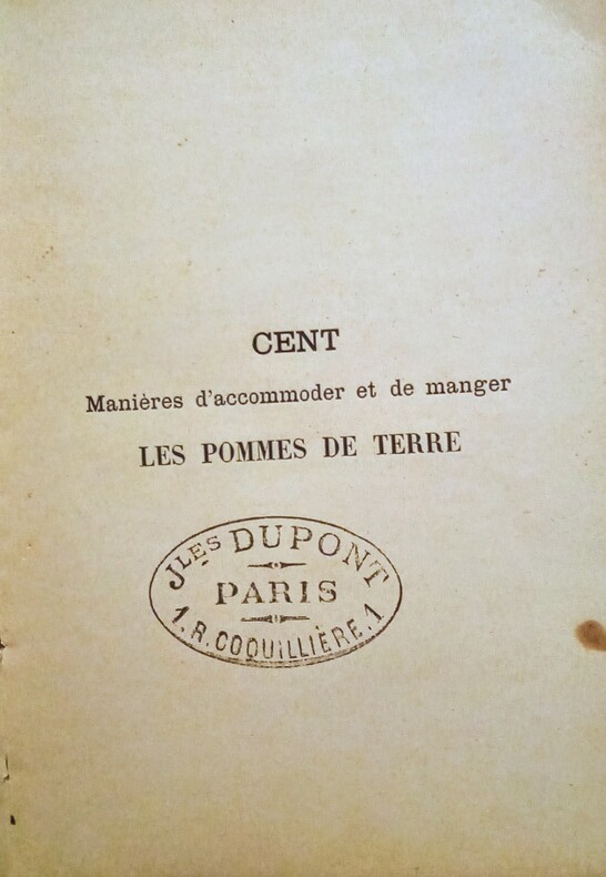
1891WOC-1743Petite Encyclopédie culinaire (Deuxième Série) ~ Cent Manières D' Accommoder et de Manger Les Pommes De Terre (Potage de pommes de terre; Pommes de terre bouillies, étuvées et rôties; Pommes de terre frites, gratinées et en ragoût; Pommes de terre en purée; Entremets sucrés de pommes de terre; Salades de pommes de terre: Appendice: Igname de Chine - Alcool de pommes de terre - Solanum Tuberosum - Fécule de pomme de terre). Dessins de Gérard Tantet, vignettes in-texte. Précédé d'une Notice biographique sur Parmentier. Paris, L' Art Culinaire, Frank & Dupont, 1891. In-12 (17,5x12,5) cartonnage éditeur illustré d'un portrait dessin de Parmentier par Gérard Tantet, dos toile verte. XXIIIpp, 71pp, et quelques pages non chiffrées (publicité et achevé d'imprimé,exemplaire avec en-tête 2ff de publicité (Encres Dragon Paris,etc.)
Due tomi in folio (cm 22,3 x 34,8), legature piena pelle coeva con titoli e fregi in oro al dorso, angoli consunti, tracce d'uso. Tomo primo: pp (70) , 444, (7) cc di tavole ripiegate: "Chorographia Terrae Sanctae in augustiorem formam redacta et ex variis auctoribus a multis erroribus expurgata"; tavola uno: splendida carta incisa in rame dalla nitida inchiostratura, di cm 89 x 43 corredata di una mappa di Gerusalemme e diciotto incisioncine che incorniciano la carta geografica della Terrasanta raffiguranti luoghi ed oggetti tipici delle Sacre Scritture e dei luoghi santi; seguono quattro tavole di alberi genealogici da Adamo ed Eva a Gesù; "Tabula vasorum et mensurarum; Tabula ponderum et monetarum"; volume secondo: 318, (254) . Testo su due colonne, frontespizi bicolori, grandi ornamenti silografici tipografici. Esemplare in buone condizioni, uniformi bruniture intense nel testo di alcune carte. Monumentale esegesi biblica del Tirinus (1580-1636), gesuita di Anversa, teologo. Commento "plus étendu que celui de Menochius... On y trouve à la fin un Index controversiarum, ouvrage méthodique et solide; et au commencement une bonne carte de la Terre Saintem une Chronologie distribuée d'une manière fort commode, des Prolégomènes sur les anciens poids et monnaies des Hébreux, des Grecs et des Romains, comparés à ceux des Italiens, des Espagnols, des Français, etc." (De Feller). Tre esemplari censiti in SBN. De Feller, Tome XII pp 126-127. Detta opera è citata anche sui siti ufologici e nelle relative bibliografie, in quanto citerebbe gli antichi avvistamenti già citati nella bibbia.
192214050Rolla MO: Missouri Bureau of Geology and Mines 1922. Text block clean and shaken at spine in moderately worn binding with moisture stain to lower back cover; rear end papers separated at gutters hinge intact; Fold-out maps and maps inside pocket at back cover; 284 pp. w/index. Cloth. Good. Illus. by B&W Illustrations. 4to - over 9¾" - 12" tall. Hard Cover. Missouri Bureau of Geology and Mines Hardcover
18687003Trévoux, J.C. Damour, 1868 ; quatre parties reliées en 5 volumes, in-4 ; demi-basane vert foncé, dos à nerfs, titre doré (reliure du XIXe) ; (8), 59, 574 ; 667 (1ere partie 1-388, 2e partie 389-667) ; 602 ; III, 372 pp.
IN-8°; pp. VIII; al frontespizio monogramma della società di gesù. Sommervogel I, 1804 n. 3. Cart. muto. Spiegazione sui colori dell’iride nel loro variare a seconda di come la luce del sole illumina ad esempio una goccia d’acqua. Orazio Borgondio (Brescia, 1675 – 1741) gesuita e matematico, fu professore di matematica nel Collegio Romano e maestro di Ruggero Giuseppe Boscovich, che gli successe nella carica alla sua morte. Fu anche custode del Museo Kircheriano del collegio a partire dal 1725, e a lui si deve l'allestimento di una sala dedicata agli strumenti di matematica, astronomia e fisica. fisica physics matematica mathematics società di gesù ottica optics colori iride colours iris esperimenti experiment
196569472Pasadena, California Institute of Technology, JET Propulsion Laboratory 1965. xi, 193 S., 19cm Karton 0
176320307Lyon, Benoit Duplain, 1763 (marque gravée au titre) ; in-8 (200 mm), veau marbré, dos à nerfs décoré et doré, pièce de titre grenat, tranches rouges (reliure de l’époque) ; XXIV, 496 pp.
Telephone Talk was the glossy bimonthly publication of the British Columbia Telephone Company. It was written by employees for employees to present information of interest to those engaged in the plant, traffic, commercial, operating, accounting and other departments of the service. Each issue is replete with black and white photos and information on topics such as: company, industry and technological news, traffic levels, expansion plans, personnel announcements, publicity and social events, deaths, weddings, lists of exchanges, and more. As such, these issues serve as a vital preserve of rare and fascinating British Columbia history. This volume covers topics including: Twentieth Year of Telephone Talk; P.A.B.X. for Telephone Company in Vancouver; When this magazine was a bab - by the first editor of Telephone Talk; North-west Telephone Company acquires Prince George System; Hard battle for phone men in rough country along Howe Sound; Christmas gale puts 75% of toll lines out of order; cover photo of 20 ton cable reel for use in Fraser River link in Vancouver-Victoria line; Preparatory work on new trans-gulf cable job nears completion; Speeding Aeroplanes can keep in touch with the earth - two; George Gaetz - Victoria 'heavy' gang foreman; Cover photo of woman demonstrating how to use dial phone; Full page photo of cable barge Brico; First section of new trans-gulf cable successfully laid - 6 pages with many photos; New construction in Victoria; Night work required to build line across Ladner Marsh; The Brico succeeds the Iwalani; Heavy Gang Foreman Andrew Bertram (Andy) Jackson; Land portion of new Victoria-Vancouver cable route now complete - 3 pages with many photos; New Traffic Headquarters in the Georgia Building - several photos; Richmond is thriving Neighbour of big coast cities - photos and text; Picture for Telephone Talk obtained via ship-to-shore phone call; Over half of Trans-Atlantic calls are with Great Britain; We can now talk with South America; Nanaimo heavy gang restores Nanaimo-Victoria service; Vancouver can talk to ship on the Atlantic; Wilfred Calman; 5 page illustrated article announcing completion of Vancouver-Victoria cable; B.C.'s first radiotelephone service now open; Second Calgary Circuit provides Windermere Valley connection; Cable to link Europe with North America; New type of conduit being used for underground work; Record load handled by New Westminster staff; Work on Victoria's central office equipment progressing - many photos; Nice cover photo of the Prince Henry, first passenger ship on the Pacific equipped with dial phone system; New type of pay telephone in Vancouver; Burnaby feature - rapidly industrializing; Bob Perry - Blaster - The Lone Canadian; Ruined Burrard Inlet cable to be replaced; Phone service now available to/from a train; Dunsmuir residence in Victoria speaks with London, England; Dials being placed on Victoria phones - 4 pages with photos; Direct coast and Alberta service now available for Revelstoke; Phone men fight fire which takes 5 buildings in Nanaimo; Dial demonstration popular at Victoria Exhibition; John (Jack) C. Miles; Prince George Reconstruction; Many photos of new Plant and Engineering building in Vancouver; Radiotelephone experiments at coast points successful - 6 pages with photos; William Palliser; Powell River System joins phone family; Trans-Gulf cable now in service; The Terminal and Repeater Equipment of the all-cable toll route - 4 pages with photos; Victoria now using new dial system - photos; Nanaimo high span replaced with submarine cable; Building the B.C. link of the Trans-Canada Line; 17,500 mile link connects Vancouver to Australia; and more. Half-leather binding. Average wear. Ink stamp of company executive E.P. LaBelle upon top edge of text else unmarked. Binding intact. Backstrip almost entirely loose. Book
1798g6145Edinburgh: William Creech. VG : in very good condition. Rebound with new eps. Some browning and offsetting. 1798. First Edition. Modern Quarter Calf with marbled boards. 240mm x 150mm 9" x 6". xiv 202pp. Fold out frontispiece map; single page map and copper plates. . William Creech hardcover
167914487Lyon, Claude La Roche, 1679 ; petit in-8 ; demi-basane fauve, titre doré (reliure du XIXe) ; (16), 497, (15) pp.
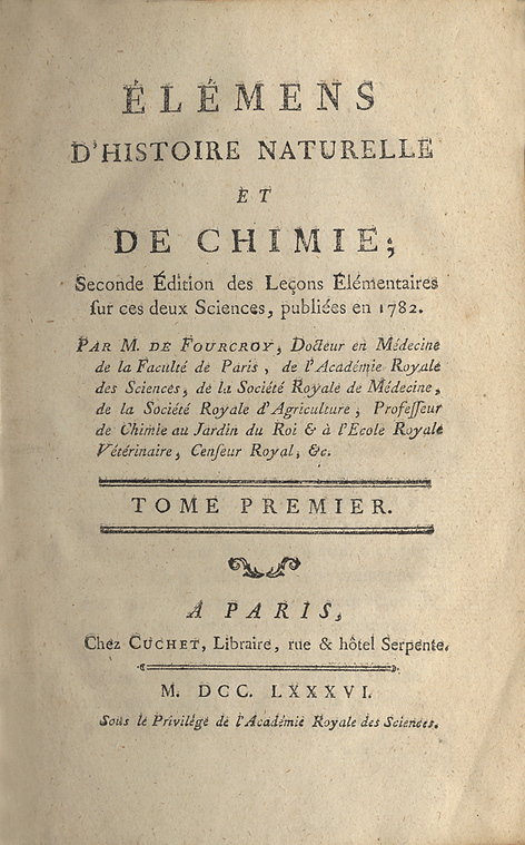
178616919Paris, Cuchet, 1786 ; 4 tomes in-8, veau fauve marbré, dos à nerfs décoré et doré, pièces de titre et de tomaison vert foncé (reliure de l'époque) ; 99, (1) errata, 426 ; 523 pp. , (1) f. d'errata ; 547 pp. , (1) f. d'errata ; 537, (1) pp. , 8 tableaux dépliants.
Anversa, 1632. Incisione in rame, b/n, cm 32,5 x 84,8 (la parte incisa). Veduta cartografica in oblungo, più volte ripiegata, raffigurante la Terra Santa, 18 piccoli riquadri ai margini mostrano il tempio e i suoi strumenti. Cartografata e stampata da Jacobus Tirinus (1580 - 1636), belga, gesuita e studioso biblico, la carta uscì ad Anversa nel 1632; al centro la pianta di Gerusalemme basata sul celebre modello di Villalpando, pubblicato nello "Hierosolymae Veteris Imago". Rara. Esemplare stampato su carta fine, carta velina applicata al verso, stretti margini, una piccola abrasione interessa la parte centrale del foglio e una, rimarginata, la parte sinistra dell'inciso da un terzo superiore del foglio fino al margine inferiore. Nell'insieme resta discreta la lettura della carta che si presenta con una buona impressione dell'inciso.
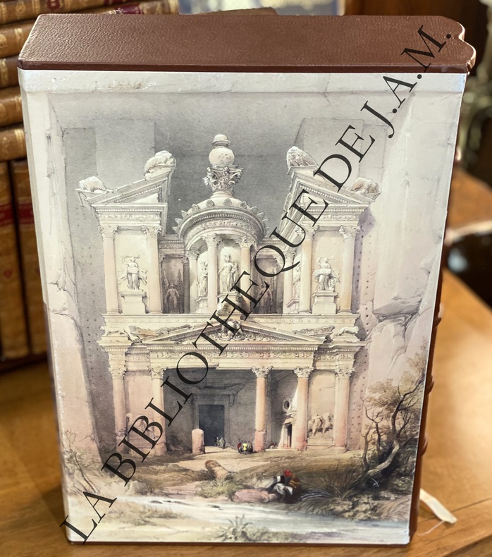
2014YRG-3172 volumes in-folio (27 x 39 cm). Reliures éditeur demi-cuir, dos à nerfs, plats parchemins ivoire titres dorés, cartonnage éditeur illustré sur les deux faces, tête et pied cuir, 256-288 pp., 275 illustrations en couleurs, table des lithographies reproduites. Exemplaire à l’état neuf. Tirage limité à 1000 exemplaires sur papier offset ivoiré. Citadelles & Mazenod. Paris
176624438Avignon Louis Chambeau 1766 in-4° (4)- 552 pp Mors fendu au quatrième plat sur toute la longueur, veau légèrement épidermé sur les plats. exceptionnel état de Fraicheur à l'intérieur. Recueil de divers mémoires de l'auteur
In-8 p. (mm. 202x124), 3 volumi, cartoncino coevo, tit. su etichetta al dorso, pp. CIX,277; (4),413; (4),370,8; con una bella e grande carta geografica del Mar Mediterraneo “dressée pour le voyage de Mr. de Chateaubriand” e un facsimile del contratto in arabo fatto tra Chateaubriand e il proprietario della barca che lo portò da Jaffa a Saint-Jean-d’Acre. "Prima edizione". Cfr. Gay “Bibl. des ouvrages relatifs a l’Afrique et a l’Arabie”,336: “Ouvrage réimprimé souvent depuis”. “François-Auguste-René de Chateaubriand (1768-1848), scrittore francese. Di nobile famiglia, iniziò giovanissimo la carriera militare, interrotta dalla Rivoluzione; compì un viaggio in America; combatté nell’esercito degli emigrati, poi andò esule, sino al 1800, in Inghilterra, dove pubblicò l’Essai historique sur les révolutions.. Mirando a un’arte cristiana che reggesse il confronto con la bellezza classica, scrisse poi un ampio poema in prosa, "Les Martyrs" (1809), servendosi di elementi raccolti durante un viaggio in Oriente ("itineraire de Paris a Jerusalem", 1811).. Il suo esempio non fu estraneo alla formazione artistica di Flaubert”, così Diz. Treccani,III, pp. 131-132. Rare e lievi fioriture, altrimenti esemplare ben conservato.
18360045371836 Paris, Adrien Leclère et Cie, [et] Laval, Genesley-Portier, 1836. Trois volumes in-8 (138 X 212 mm) maroquin aubergine foncé à grain long, plats décorés d'un double encadrement de jeu de quadruple filet doré, grand fleuron doré latéral et dans les angles, grand médaillon central à froid, dos lisse orné en long de filets et fleurons dorés, titre et tomaison dorés, coupes, coiffes et angles filetés, bordure intérieure, tranches dorées (Devers). Tome I : (1) f. blanc, frontispice, (2) ff., 400 pages - Tome II : (1) f. blanc, frontispice, 410 pages, (1) f. blanc - Tome III : (1) f. blanc, frontispice dépliant, (2) ff., 357 pages, 2 cartes dépliantes. Étiquette papier du relieur collée sur le premier contreplat de chaque volume : «Relié par Devers, rue Mercière, n°44, à Lyon ». Rousseurs, souvent fortes.
1973MS-4Beirut Lebanon: Al-Risalah 1973. Classic scholarly historical text contains early geographical writings from 800 to 1150 including descriptions of some localities in the Northern Hijaz by the Arab geographers of that period; descriptions of the pilgrim routes in that area; a general survey of information and characteristics; rise and decline of towns and villages in the Northern Hijaz; dependencies of Medina and Mecca; geographical poetry; etc. Includes a detailed fold-out map of the region. 486 pp. Dustjacket in mylar. Virtually no shelfwear. First Edition. Hard Cover. As New/As New. 8vo - over 7¾" - 9¾" tall. Al-Risalah Hardcover
1993GE-83U.K.: Chapman & Hall Ltd. 1993. Comprehensive reference text contains theoretical experimental and analytical procedures and results of applying seismic tomography from a global to a local scale. Includes uses for hydrocarbon mineral and geothermal exploitation. Includes sections on surface wave tomography teleseismic tomography tomography in zones of collisions refraction and wide-angle reflection tomography local earthquake tomography etc. 842 pp. Illustrated. Prior owner's nameplate on front endpaper. Pocket remnant on inside rear cover; small stamp on title page; small nick on front cover. Minimal shelfwear. Heavy Item. First Edition. Hard Cover. Very Good. 4to - over 9¾" - 12" tall. Ex-Professional Library. Chapman & Hall Ltd. Hardcover
1979GE-177New York: Plenum Press 1979. Classic comprehensive 3-volume reference text contains detailed technical papers presented by leading scientists and field experts at the first second and third International Symposium on the Scientific Basis for Nuclear Waste Management held in 1979 1980 and 1981 in Boston Mass. Diverse topics include: waste solidification; vitrification; ceramic and metal matrix forms; waste isolation and containment; treatment and isolation of other wastes; modeling and safety assessment; vitreous materials; ceramic materials; spent fuel; backfill barriers; container materials; effects on repository; transport of radionuclides in the geomedia; processing of nuclear wastes; crystalline materials; non-high-level wastes; leach studies; radiation effects; radionuclide migration; engineered barriers; performance assessment; etc. 2131 pp. collectively. Illustrated. Small stamps to endpapers and lower title page. spine labels neatly removed. Minimal shelfwear. Heavy item. First Edition. Hard Cover. Very Good. 4to - over 9¾" - 12" tall. Ex-Technical Library. Plenum Press Hardcover
1990CH-296New York: Marcel Dekker 1990. Comprehensive reference text examines new methods and existing technologies that assist in the development of unconventional worldwide fossil fuel resources; comparing petroleum to other fossil fuels such as tar sands coal shale bitumen heavy oils and natural gas. Includes detailed topics on the technological aspects of occurrence recovery conversion and utility of major fossil fuels; environmental issues; conversion of heavier feedstocks to liquid fuels; etc. 1193 pgs. Illustrated. Publisher's nameplate pastedown on front endpaper. Slight scratch on rear cover. Minimal shelfwear. Heavy item. First Edition. Hard Cover. Very Good. 8vo - over 7¾" - 9¾" tall. . Marcel Dekker Hardcover
1968GE-318Sacramento CA.: California Division of Mines and Geology 1968. This comprehensive atlas consists of 27 detailed maps which show the regional distribution and interrelationship of various rock units and the major geologic structures that are present in California. One hundred and twenty four cartographic units representing plutonic volcanic marine sedimentary and non-marine sedimentary rock types of different geologic ages are delineated in the atlas. The atlas sheets include: master legend; Alturas sheet 1958; Bakersfield sheet 1965; Chico sheet 1962; Death Valley sheet 1958; Fresno sheet 1966; Kingman sheet 1961; Long Beach sheet 1962; Los Angeles sheet; Mariposa sheet; Needles sheet 1964; Redding sheet 1962; Sacramento sheet 1966; Salton Sea sheet; San Bernardino sheet; San Diego-El Centro sheet 1962; San Francisco sheet 1961; San Jose sheet; San Luis Obispo sheet 1959; Santa Ana sheet 1966; Santa Cruz sheet 1959; Santa Maria sheet 1959; Santa Rosa sheet 1963; Trona sheet 1962; Ukiah sheet 1960; Walker Lake sheet 1963; Weed sheet 1964; Westwood sheet 1960. Some pages have marginal moisture damage/light stains to the lower outer margin edges; minimal if any penetration onto printed map areas- nearly all maps do not appear to be adversely affected. some minor slight scuffs to front & rear boards; some stray tiny edge tears on a few pages. Note: Los Angeles sheet is a new high quality color original reprint. Gilt spine and front cover. Minimal rubbing to corners and spine edges. Heavy item. Hard Cover Ring Bound. Good. Atlas Folio - over 23" - 25" tall. California Division of Mines and Geology hardcover
1908AUB-4635Paris, librairie universelle s.d.(vers 1908). 6 beaux volumes reliés, reliures demi cuir ornées d'éd., forts in-4, plus de 3500 pages.