Maillet, Benoit deBiblio.com

11 020 résultats
17481641Amsterdam: Chez l'honore et fils libraires 1748. First Edition. Hardcover. Very good. 2 vols. in one. 8vo. I: 10 cxix 7 208 pp. 1 f. "Errata" for Tom. 1. II: 2 231 pp. 1 f. "Addition" 1 f. "Errata" for Tom 1 sic. First title page with unobtrusive paper defect on lower margin not affecting text; this copy is lacking half-title and Errata leaf for Tom. 2. Very attractive 19th-century French red glazed boards red morocco spine lettered in gilt directly two insignificant worm-holes on lower hinge leading nowhere; trifle wear to binding extremities. Completely unsophisticated. First printing of "Telliamed" in every way a remarkable book. Disguised as an Oriental fantasy it contains perhaps the earliest appearance of one of the most important of all evolution speculations namely the so-called ultra-neptunian theory: that the entire Earth was and is a marine deposit and that all life on land originated from creatures of the sea. Maillet hypothesized that the earth was once entirely covered with water and that the water gradually evaporated into space causing land masses to appear. Maillet also created an ingenious methodology to calculate the age of the Earth: he concluded that the Earth is 2 billion years old evolutionists today consider this figure to be more like 4.5 billion. It is known that Buffon Lamark Cuvier and Darwin read this book and that they were very much influenced by Maillet's unorthodox "heretical" views. Well aware that such an immense figure would incur the wrath of the Church de Maillet presented his conclusions in the guise of a dialogue between a French missionary and an Eastern mystic named Telliamed an anagram for the author's last name i.e. de Maillet spelled backwards. The manuscript remained unpublished until a decade after Maillet's death. In order to present his radical conclusions in the guise of an Oriental tale Maillet interspersed monsters and mythological creatures into his text. Overtly anti-Christian "Telliamed" dismisses the Flood of the Old Testament as a fable because rainfall that lasted forty days would have been insignificant to submerge entire mountains. Maillet asserted that the Earth's history could not be read from the Bible but through the rocks themselves. <br /> <br /> ¶ With uncanny prescience Maillet describes how species have overlapping physical characteristics that suggested a common life origin namely the sea. Through a Oriental mystic we are told that: "The little Wings had under their Belly and which like their Fins helped them to walk in the Sea became Feet and served them to walk on Land." <br /> <br /> ¶ REFERENCES: Caillet No. 7009. Versins Utopie p. 640. LITERATURE: "Charles Darwin et ses Precurseurs francais Paris 1870 Chapter 1: "the moss-grown fragments from the ruins of another world." See also Albert Carozzi "De Maillet's 'Telliamed' 1748: An Ultra-Neptunian Theory of the Earth" in: Toward a History of Geology; Proceedings of the New Hampshire Inter-Disciplinary Conference on the History of Geology Sept. 7-12 1967. Mary Efrosini Gregory "Evolutionism in Eighteenth-century French Thought" Chapter 1. See also the article on Maillet in DSB IX pp. 26 et seq: "Maillet's ideas unquestionably influenced many leading naturalists for almost a century notably Buffon and Cuvier. Chez l'honore et fils, libraires hardcover
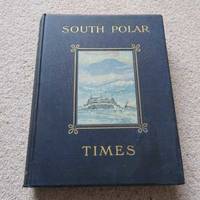
41Smith Elder London 1914. First Edition. Hardcover Original Cloth. Good Condition/No Dust Jacket. 1st Edition: Number 35 of a limited edition of 350. Original covers page edges gilt no dust jacket. PLEASE NOTE: Pages 16 3342434493125 and 148 are PHOTOCOPIES. Contents clean. Volume 1 & 2 were Scott's 1st "Discovery Expedition" whilst Volume 3 is from his 2nd "Terra Nova" Expedition. Although often sold as a set Volume 3 is a complete book in its' own right. The original broadsheets were produced at Cape Evans to amuse the men on the 'Terra Nova' Expedition. It was designed to be published separately from Volume 1 & 2. Cherry-Garrard was the Editor and typist and Wilson the main illustrator. The 1st issue was presented on Midwinter's Day 1911 the 2nd on 8th September and the 3rd on 15th October. Content included poetry humorous articles illustrations of sledging flags and caricatures. Includes Wilson's moving poem 'The Barrier Silence'. Copiously illustrated drawings in the text and full-page plates from sketches and paintings by E. Wilson H. Ponting and others. Spine shaken gutta-percha binding delicate some pages loose as is usual with the 1st Edition. This copy is still bright and handleable with care Gutta Percha was used as the binding glue in many early books it is not a difficult job to remove and reback using modern glues The South Polar Times was a magazine written and printed by the members of Antarctic Expeditions during the various voyages they undertook and forms what is perhaps the most personal of the printed documents to have come out of that most remarkable of periods of Antarctic adventures revealing so many often contradictory aspects of these men's various personalities. It contains a diary of the events of each month a record of the proceedings of the local Debating Society a monthly acrostic humorous notes besides articles of a more solid nature as well as stories sketches of various kinds and poems. One of the corner stones of an Antarctic collection. Quantity Available: 1. Shipped Weight: Under 5 kilogram. Category: Arctic & Antarctic; Exploration. Pictures of this item not already displayed here available upon request. Inventory No: 41. . This book is extra heavy and may involve extra shipping charges to some countries. Smith Elder hardcover
In folio (mm. 455x318), cartella editoriale in mz. tela con legacci (piatti con abras. e tracce d’uso), pp. (4),VIII,142,(6) a fogli sciolti, con 37 (su 57) figure nel testo e con 30 (su 37) tavole numerate in b.n. (1 a doppia pag.è parzialmente colorata, 9 sono magnifiche cromolitografie di cui 1 è pure a doppia pag.) che illustrano: “Plan et nivellement du Haram-ech-Chérif / Porte Occidentale / Porte Double / Porte Dorée / Substructions de l’angle sud-est / Temple de Salomon. Restauration d’après la Bible / Temple d’Hérode. Restauration du plan / Temple d’Hérode. Restauration / Plan du Haram-ech-Chérif / Qoubbet-es-Sakhrah (Mosquée d’Omar) / Mosquée El-Aksa / Araq-El Emir / Plan topographique et archéologique de Jérusalem” . Mancano: - alcune pagine di testo (da p. 32 a p. 72) che includono 27 figure, la parte finale del 3° capitolo ed i capitoli 4 e 5 + le tavole 2, 12, 24, 29, 32, 34 e 36. L’opera contiene: “Prèface - Description générale du Haram-ech-Chérif - Histoire du Temple - Description de l’ancien temple - L’enceinte du temple depuis la conquete musulmane (arabes et templiers) - Appendice: Topograhie de Jérusalem - Inscriptions antiques de Jérusalem”. Importante edizione dedicata al “nobile santuario” Haram-ech-Chérif, noto anche come la “spianata delle moschee”, che sorge nella città vecchia di Gerusalemme, sul colle noto come il “monte del tempio”. L’Autore “Melchior, marchese di Vogue (1829-1916), storico e diplomatico francese, diresse scavi in Palestina e in Siria (1853-1855), e fu ambasciatore a Costantinopoli e a Vienna”. Così “Diz. Larousse”,XV, p. 645. Piccole manc. margin. dell’occhietto e del fromntesp.; con lievi fioriture ntercalate nel testo e ai margini o al verso di alc. tavole, ma complessivam. buon esemplare.
17481641Amsterdam: Chez l'honore et fils libraires 1748. First Edition. Hardcover. Very good. 2 vols. in one. 8vo. I: 10 cxix 7 208 pp. 1 f. "Errata" for Tom. 1. II: 2 231 pp. 1 f. "Addition" 1 f. "Errata" for Tom 1 sic. First title page with unobtrusive paper defect on lower margin not affecting text; this copy is lacking half-title and Errata leaf for Tom. 2. Very attractive 19th-century French red glazed boards red morocco spine lettered in gilt directly two insignificant worm-holes on lower hinge leading nowhere; trifle wear to binding extremities. Completely unsophisticated. First printing of "Telliamed" in every way a remarkable book. Disguised as an Oriental fantasy it contains perhaps the earliest appearance of one of the most important of all evolution speculations namely the so-called ultra-neptunian theory: that the entire Earth was and is a marine deposit and that all life on land originated from creatures of the sea. Maillet hypothesized that the earth was once entirely covered with water and that the water gradually evaporated into space causing land masses to appear. Maillet also created an ingenious methodology to calculate the age of the Earth: he concluded that the Earth is 2 billion years old evolutionists today consider this figure to be more like 4.5 billion. It is known that Buffon Lamark Cuvier and Darwin read this book and that they were very much influenced by Maillet's unorthodox heretical views. Well aware that such an immense figure would incur the wrath of the Church de Maillet presented his conclusions in the guise of a dialogue between a French missionary and an Eastern mystic named Telliamed i.e. de Maillet spelled backwards. The manuscript remained unpublished until a decade after Maillet's death. In order to present his radical conclusions in the guise of an Oriental tale Maillet interspersed monsters and mythological creatures into his text. Overtly anti-Christian "Telliamed" dismisses the Flood of the Old Testament as a fable because rainfall that lasted forty days would have been insignificant to submerge entire mountains. Maillet asserted that the Earth's history could not be read from the Bible but through the rocks themselves. ¶ With uncanny prescience Maillet describes how species have overlapping physical characteristics that suggested a common life origin namely the sea. Through a Oriental mystic we are told that: "The little Wings had under their Belly and which like their Fins helped them to walk in the Sea became Feet and served them to walk on Land." ¶ REFERENCES: Caillet No. 7009. Versins Utopie p. 640. LITERATURE: "Charles Darwin et ses Precurseurs francais Paris 1870 Chapter 1: "the moss-grown fragments from the ruins of another world." See also Albert Carozzi "De Maillet's 'Telliamed' 1748: An Ultra-Neptunian Theory of the Earth" in: Toward a History of Geology; Proceedings of the New Hampshire Inter-Disciplinary Conference on the History of Geology Sept. 7-12 1967. Mary Efrosini Gregory "Evolutionism in Eighteenth-century French Thought" Chapter 1. See also the article on Maillet in DSB IX pp. 26 et seq: "Maillet's ideas unquestionably influenced many leading naturalists for almost a century notably Buffon and Cuvier. Chez l'honore et fils, libraires hardcover books
1693019562The Princes Arms in St. Paul's Churchyard: Sam Smith 1693. Second edition. With four engraved plates small octavo t.p. 201326 133-406 2-page publisher's catalogue browning and age-toning with occasional blotching a corner torn from the first blank a worm-hole in the margin of the early pages but only really noticeable on the first eleven pages tight internally original calf rubbed and pocked neatly re-backed with new unlettered leather spine the original endpapers retained. In Rays time understanding of creation was governed by the account in the Bible. It was thought that the earth dated from about 5000BC and that fossils were formed in nature as imitations of shells fish or other creatures but were not a genuine creature. Rays observations of the changing coastlines around Britain and his fossil excavations led him to question both of these. He published his work on Fossils in his Miscellaneous Discourses 1692. The work quickly sold out and a considerably enlarged second edition with a new title was published the next year which is the copy we offer here . In particular he put forward that fossils were the remains of creatures that were now extinct going against the commonly held view that all creatures that God created at the beginning still existed. Second edition. Full Leather. Good. Sam Smith Hardcover
1823018730London Dublin Edinburgh & New York: Printed for Sir Richard Phillips 1823. Six volumes small octavo pp 588; 600 15; 584 10 uncut a few pages unopened a little age-toning and marking one gathering 347-350 in Volume IV detached and gatherings towards the rear of the volume becoming a bit weak and loose Volume VI has extra bis pages 343 - 354; very well illustrated with 197 engraved or wood engraved plates of which 31 are folding and 50 coloured plates of which 2 are folding and 1 folding table; bound in the original pink boards a bit worn chipped and marked original printed paper labels on the spines the upper cover of Volume V detached otherwise firm and tight a neat signature on each front endpaper. Apparently lacking one plate in Volume 1 Relative Sizes of the Planets though there is no sign of this ever having been bound in. There are several extra plates to those listed and our copy would seem to agree with the set at auction at Christie's in 2006 which contained 246 of 248 plates. A work of considerable charm and interest and despite some faults as mentioned a remarkable set in original unsophisticated state. Simeon Ackroyd Shaw 1785 - 1859 was a 19th-century English scientific writer industrial historian and teacher. He spent his working life in the Staffordshire Potteries now the city of Stoke-on-Trent England. Shaw originated in Lancashire and as a young man he arrived in the Potteries to work on the Potteries Gazette and Newcastle-under-Lyme Advertiser newspaper. After some 20 years of newspaper and printing work living in Wolstanton he then went into teaching. He ran several teaching academies in the district. His first book was this 6-volume work which was based on his obviously very comprehensive series of popular short lectures on everything from natural species to meteorites. First Edition. Boards. Good. Printed for Sir Richard Phillips Hardcover
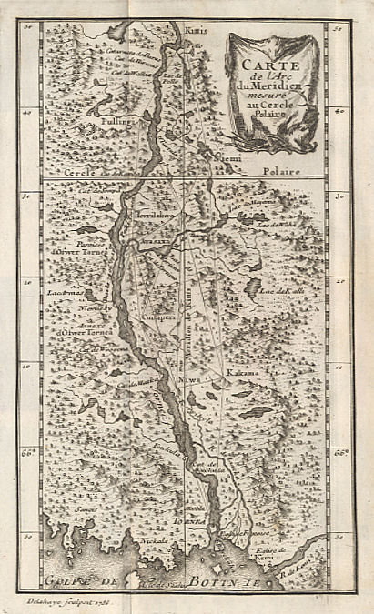
173814503Paris, Imprimerie Royale, 1738 ; in-8 ; plein veau brun marbré, dos à nerfs décoré et doré, pièce de titre grenat, tranches rouges (reliure de l'époque) ; XXIV, (4), 184 pp., carte de l'arc du Méridien mesuré au Cercle Polaire et 9 planches gravées dépliantes, de triangulations et calculs géométriques.
Quaderno manoscritto a penna e matita in 8, pp. (30) in parte scritte e in parte bb. con gora centrale non deturpante. Indicazione ms. all'ultima p.: quaderno delle sue casse porto Dseato (sic). Importante e raro autografo di questo Capitano ed esploratore al servizio del governo argentino. Di origini chiavaresi, dopo aver viaggiato al comando di un brigantino per i mari dell'estremo oriente, fu al servizio tra il 1875 e il 1885 del governo argentino nell'attivita' dell'eslporazione e dello sfruttamento delle sue terre australi. Nel 1883, su sua proposta, venne organizzata una missione esplorativa nell'area di Porto Deseado che duro' tra l'11 aprile e il 14 novembre. In questo periodo vennero effettuate tutte le misurazioni e i rilievi finalizzati allo stabilimento di una colonia, fatto che avvenne l'anno successivo. Questo importantissimo brogliaccio risale proprio agli ultimi giorni di questa missione, come testimoniano le date apposte a margine delle 4 liste dei materiali caricati alla volta di Buenos Aires sul piroscafo Bahia Blanca comandato dal Capitano Ferro (11, 12, 13 e 14 novembre 1883). Di grande interesse l'esame delle liste dei materiali, che vanno da materiale geodeico e da rilevamento a tende, letti e coperte, tende, arnesi da lavoro ecc. Le pagine iniziali, dedicate ad una sommaria descrizione della localita', riflettono quanto pubblicato nella relazione a stampa edita nel 1884 e qui acclusa. Nel manoscritto poi, compaiono ampie annotazioni a matita di altra mano e che potrebbero attribuirdi a tal Luis Marzano, uomo al servizio dello stesso Oneto. Occore anche annotare che Antonio Oneto si reco' l'anno successivo, con 24 famiglie di coloni, al fine di fondare la citta'. La raggiunse il 15 luglio 1884 ma il 21 giugno 1885 mori' senza veder completata la sua opera. Attualmente, ogni 15 luglio, la citta' rende omaggio alla memoria dell'Oneto con cortei alla sua tomba ed al suo monumento. C. De Negri, L'attivita' geografica di Antonio Oneto in: Annali di ricerche e studi di geografia. Marzo 1955.
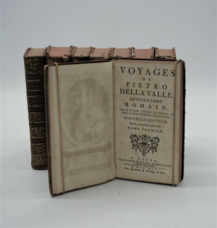
1745PHO-885Paris & Rouen , Nyon & Machuel ,1745. 8 volumes in-12 (170x100), plein veau époque , dos à nerfs avec pièces de titre et tomaison , tranches rouges , défauts d’usage (coiffes arasées , coins usés , reliures frottées , manque au dos Tome 7, etc) , Édition illustrée des portraits de l'auteur et de sa femme morte durant le voyage et 5 plans H.T. et une planche.
1018In 8 plein veau glacé lie de vin,dos à quatre nerfs, titre,fers,filets,roulette dorés.filet à froid;Plaque à froid sur les plats, grecque à froid et double filet doré en encadrement,roulette dorée sur coupe. Faux-titre,titre,VI,306 pages,1 feuillet ouvrages du même auteur Une lithographies en couleurs,hors-texte dépliante de Mermoz,tranches dorées, Germer Baillières 1846.édition originale rare.une trace de colle en marge inférieure de la page 111 légères rousseurs éparses sinon superbe exemplaire,belle et élégante reliure romantique;très rare dans cette condition,boîte étui postérieur.
1732PHO-2447A Paris : chez Nyon, Didot, Quillau, 1732, in-4 ° (25x20cm). Pages [2], XIV, 298, [2], 63, [1] vierges + 37 planches H.T., dont dépliantes, demi basane et coins, dos à nerfs avec pièce de titre et auteur, tranches rouges. Frottements au dos, coiffes abimées avec petits manque, coupes et coins dénudés, réparation à 2 feuillets, petites rousseurs.
Rarissima carta dell’isola, datata il lastra 1570. Rappresentata circondata dalla flotta di navi della Repubblica di Venezia la carta è orientata con il Sud in alto. Carta anonima e priva di dati editoriali, che segue nella morfologia la carta del monogrammista PS e tutte le sue derivazioni. L’aspetto interessante che mostra questa carta, è dovuto al contesto storico; l’isola è rappresentata con la flotta veneziana chierata a difesa contro gli assalti dei turchi. L’opera, datata al 1570, viene attribuita a Nicolò Nelli per evidenti ragioni stilistiche e per le analoghe carte su Cipro e Creta, che recano la sua firma. La mappa si trova inserita in alcune raccolte cinquecentesche, e viene di seguito pubblicata nel Isole che son da Venetia nella Dalmatia et per tutto l’arcipelago fino a Costantinopoli, edito da Simone Pinargenti a Venezia nel 1573. L’opera fu realizzata in stretta concorrenza con l’analoga raccolta del Camocio Isole Famose, e raccoglie carte incise da Nicolò Nelli, Natale Bonifacio e dal Pinargenti stesso. I pochi esemplari noti della raccolta sono spesso diversi tra loro, e contengono un numero variabile di carte. Magnifico esemplare, in straordinario stato conservativo. This very-rare loose-sheet map of Corfu carries at the lower right hand corner the date of the publication, 1570. Like the larger maps of The IATO these smaller ones were first issued for a loose sheet circulation, and then assembled in booklet form for interested customer. The island is shown surrounded by an armada of Venetian war ships. The map is oriented with south at the top and its shape is based on the Ferrando Bertelli map of Kerkyra (1564). Sometimes the map appear in the rare collection by Simone Pinargenti “Isole che son da Venetia nella Dalmatia et per tutto l’arcipelago fino a Costantinopoli” (1573). Nicolò Nelli (1530 ca – 1573) was venetian engraver of maps, portraits, religious subject and prints. He also traded in prints and published the works of Giovanni Battista Fontana and Giorgio Ghisi and had a business relationship with Bertelli en Zaltieri. Copperplate, with full margins, very good condition. Very rare. Tavernari (2014): n. 65; Zacharakis (1992): n. 1756; Zacharakis (2009): n. 2692.
Carta geografica dell’isola di Creta firmata e datata in lastra dal Nelli. La carta dell’isola di Creta di Nicolò Nelli è basata sul modello di Zorzi/Pagano del 1538. Differisce per l’orientazione, qui con l’est in alto come in molte altre carte veneziane del periodo. L’isola è rappresentata con la flotta veneziana chierata a difesa contro gli assalti dei turchi. La carta venne in seguito inserita nel Isole che son da Venetia nella Dalmatia et per tutto l’arcipelago fino a Costantinopoli, edito da Simone Pinargenti a Venezia nel 1573. L’opera fu realizzata in stretta concorrenza con l’analoga raccolta del Camocio Isole Famose, e raccoglie carte incise da Nicolò Nelli, Natale Bonifacio e dal Pinargenti stesso. I pochi esemplari noti della raccolta sono spesso diversi tra loro, e contengono un numero variabile di carte. Bellissima prova, impressa su carta vergata coeva con filigrana “sirena in uno scudo con stella”, in perfetto stato di conservazione. This very-rare loose-sheet map of Crete carries at the lower right hand corner the name of the Venetian engraver Nicolò Nelli, and the date of the publication, 1570. Like the larger maps of The IATO these smaller ones were first issued for a loose sheet circulation, and then assembled in booklet form for interested customer. The island is shown surrounded by an armada of Venetian war ships. The map is oriented with east at the top and its shape is based on the Matteo Pagano map of the island (1538). Sometimes the map appear in the rare collection by Simone Pinargenti “Isole che son da Venetia nella Dalmatia et per tutto l’arcipelago fino a Costantinopoli” (1573). Nicolò Nelli (1530 ca – 1573) was venetian engraver of maps, portraits, religious subject and prints. He also traded in prints and published the works of Giovanni Battista Fontana and Giorgio Ghisi and had a business relationship with Bertelli en Zaltieri. Copperplate, wide margins, perfect condition. Very rare. Tavernari (2014): n. 75; Zacharakis (1992): n. 1601; Zacharakis (2009): n. 2469.
In 16, cm 11 x 15,5, cc. 380 + (20), presente anche l'ultima carta bianca sovente mancante. Stemma del Valgrisi al frontespizio e al colophon. Firma di possesso al frontespizio. Piena pergamena settecentesca. Prima edizione in volgare nella traduzione di Fausto Longiano del quale e' anche la dedicatoria a Iulia Trivultia contessa di Misocco. L'edizione latina risale al 1506. Dotta cosmografia con ampia descrizione dell'Asia, dell'Europa, della guerra di Cipro e dell'Africa (con frontespizio a se stante) con, in aggiunta, una descrizione della Siria, Giudea, Samaria, Galilea, Phenicia, Mesopotamia, Caldea, Alessandria, Tempio di Gerusalemme ecc. In fine compare, ad opera del Longiano, una descrizione del Paradiso terrestre. Scafi, Finishing the unfinished: Paradise in Fausto Longiano vernacular translation of Piccolomini cosmographia (1544).
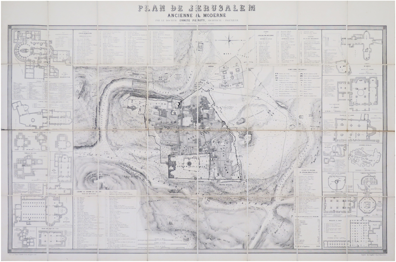
1860LBW-8069[1860]. En 32 sections montées sur toile et repliées, formant une carte de 638 x 961 mm.
9041138773New. Brand new and still unused unknown
186716491London: Cassell Petter & Glapin 1867. First edition. Hardcover. Very Good . Schedule of Ores Contributed by Sundry Persons to the Paris Universal Exposition of 1867. With some information about the region and its resources." Book is Signed inscribed to Colorado territorial governor John Evans by the author commissioner from the territory. Two fold-out black white & red maps and fold-out photograph of displayed ores at front of book. Booklets in three languages were published for the exposition. This book was apparently specially bound and contains the text in English 61 pgs French and German each 71 pgs. Full leather embossed and with raised bands all edges gilt marbled endpapers. Boards are rubbed at corners and folds. Cracks in the front endpapers at the gutter. Straight and tight. <br/><br/> Cassell, Petter, & Glapin hardcover
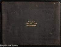
185034546Washington Dc:: Government Printing Office. Very Good with no dust jacket. 1850. First Edition. Flexible cloth. B/w/red; Oblong folio; 65 pages; 14.5" x 11". Front end paper with creases first three leaves with quite light and minor foxing. 100 partly color numerals maps 11 folding maps/charts all collated. These folding plates are quite large- often 20 x 30" or even larger and have occasional folds but seem free of tears. Bound in publisher's brown cloth with impressed design and gilt title. Sabin 22917. The author of this work James Pollard Espy nicknamed "The Storm King" for his classic book The Philosophy of Storms was the first Meteorologist of the US Government pioneering in the use of the telegraph to assemble weather observation data. Espy designed the first American weather map for a private scientific institute in 1838 before he moved to Washington. His first official meteorological report was published in 1843 but apparently included no maps. So the 100 "Charts" in this second report represent the first weather maps published by the US Government. . Government Printing Office hardcover
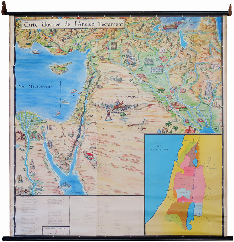
1950LBW-7220Hambourg, Éditions Ewald Becker, [circa 1950]. En 4 feuilles jointes formant une carte de 1,70 x 1,66 m ; montée sur toile, entre deux baguettes de bois avec liens de cuir.
1950LBW-7530Hambourg, Éditions Ewald Becker, [vers 1950]. En 4 feuilles jointes formant une carte de 1,70 x 1,66 m ; montée sur toile, entre deux baguettes de bois avec liens de cuir.
(4 ff.), 552 pp reliure de l'époque en veau marbré, dos à nerfs ornés de motifs floraux dorés, tranches rouges 1766, 1766, in-4, (4 ff.), 552 pp, reliure de l'époque en veau marbré, dos à nerfs ornés de motifs floraux dorés, tranches rouges, Première édition collective de ce recueil principalement consacré à la géologie, dû au naturaliste suisse Elie Bertrand (1713-1797), dédié au roi de Pologne Stanislas Auguste, dont Bertrand était membre du conseil privé. Composé de 9 neufs traités qui parurent séparément, et qui sont ici revus et corrigés par l'auteur, cet ouvrage est de fait plus complet et plus exact. Cet ouvrage contient notamment les "Mémoires sur la structure intérieure de la terre" (Heidegguer, Zurich, 1752) et les "Mémoires historiques et physiques sur les tremblements de terre" (Pierre Gosse junior, La Haye, 1757) ainsi qu'un mémoire sur les tremblements de terre et une minéralogie du Canton de Berne. Illustré de bandeaux gravés sur bois par Orcat, répétés à chaque partie. De la bibliothèque du malacologue Ernest Bucaille, avec étiquette ex-libris. Coins et mors émoussés. Intérieur frais, exceptés les 4 derniers feuillets légèrement brunis
18020041271802 Paris, Baudouin, 1802. In-quarto (208 X 261) demi-veau fauve, dos lisse, frise et deux filets dorés en place des nerfs, pièce de titre maroquin rouge, tranches jaspées (reliure de l'époque); (2) ff. blancs, (2) ff. de faux-titre et titre, III pages de table, 401 pages, (2) pages d'errata, (3) ff. blancs.
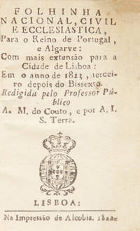
2404PG029<p>Com mais extensão para a cidade de Lisboa: Em o anno de 1823 terceiro depois do Bissexto. Redigida pelo Professor Público A. M. do Couto e por A. I. S. Terra. LISBOA: Na Impressão de Alcobia. 1822. </p>_x000d_<p>In 8.º de 99x58 cm. Com 200 iv págs. Encadernação inteira artística emm marroquim verde com ferros a ouro na lombada e nas pastas com uma moldura ornamentada com motivos vegetalistas e geométricos muito elaborados com as armas reais do Reino Unido de Portugal e do Brasil ao centro. Folhas de guarda em belo papel marmoreado da época. Cortes das folhas dourados. </p>_x000d_<p>Ilustrado na folha de rosto com as armas de Portugal de D. João VI: Com um mapa desdobrável de Portugal colorido a aguarela em extratexto. Impressão nítida em pequenos caracteres redondos e com itálicos em algumas linhas do calendário e da relação das feiras que se realizavam em todo o país. </p>_x000d_<p>As folhas finais contêm o índice e duas páginas em branco. </p>_x000d_<p>De excepcional raridade. Não referida por Inocêncio que no entanto consagra extensos artigos aos dois autores da obra. </p>_x000d_<p>Almanaque muito importante para o estudo da história e do funcionamento das instituições e da economia da época pelas numerosas informações que apresenta. Inocêncio elogia a sua utilidade literária com informações úteis e instrutivas. </p>_x000d_<p>É também muito importante para o estudo da luta entre liberais e absolutistas pois os autores que eram liberais tentam substituir o mesmo tempo de livros que estavam a ser publicados pelos Padres da Congregação do Oratório desde o tempo de D. João V dando a estas publicações um carácter mais próximo da sua ideologia. Nesse sentido inclui uma pormenorizada lista dos mosteiros e conventos masculinos com os números dos que podiam existir por cada ordem e das extinções e fusões dos conventos femininos que tinham sido ordenadas depois da Revolução Liberal de 1820. </p>_x000d_<p>Contém um calendário religioso uma pequena descrição de Portugal que nesta época e desde 1815 era designado por Reino Unido de Portugal e do Brasil e Algarves catálogos dos reis e das rainhas de Portugal uma notícia dos principais reinos da Europa uma lista dos cardeais os dias das audiências Reais os dias em que os tribunais funcionavam os dias em que não havia despacho nos tribunais os dias de Gala na Corte informações astronómicas as horas do nascimento e ocaso do Sol quadro com as enchentes e vazantes das marés a população de continentes e de países uma lista cronológica das feiras que se realizavam em Portugal e a estatística eclesiástica. As páginas finais 192 a 197 incluem a Provisão Real de 4 de Novembro de 1809 e o índice.</p>_x000d_<p>Antonio Maria do Couto Lisboa 1778 - Lisboa 1843 Professor régio de Língua Grega primeiro no antigo estabelecimento do bairro de Belém e depois no do Rossio. Esteve demitido por suas opiniões políticas desde o ano de 1828 até o de 1833 em que foi reintegrado. Ultimamente foi nomeado em 1840 Reitor do Liceu Nacional de Lisboa lugar que exerceu até o seu falecimento. É autor de mais de vinte obras publicadas entre 1806 e 1842 nomeadamente uma pequena biografia de Barbosa do Bocage muitas obras antinapoleónicas durante as invasões francesas obras satíricas e obras de polémica literária contra José Agostinho de Macedo. </p>_x000d_<p>Agostinho Inácio dos Santos Terra c. 1790 - c. 1850 Foi ourives da prata em Lisboa. É autor de uma obra do mesmo género também em parceria com António Maria do Couto que só é registada no volume XXII do Dicionário por Brito Aranha: <em>Folhinha ecclesiastico constitucional e civil para o anno de 1827</em> Na Typ. de Eugenio Augusto. Lisboa 1826. Inocêncio indica cerca de sete memórias e estudos sobre o Mercado do Terreiro Público em Lisboa publicadas entre 1821 e 1848 assim como uma obra não referida por Inocêncio - <em>Contrariedade ao folheto intitulado A razão e nada mais</em>. Na Tipografia Morandiana. Lisboa. 1820. </p>_x000d_<p>Ref: </p>_x000d_<p>Inocêncio I 197 e VIII 243. </p>_x000d_<p>Inocêncio I 16 e VIII 13 e XXII 27</p>_x000d_<p>Revista Universal Lisbonense vol. III pág. 47. </p>_x000d_<p><br /><br /></p> M-18-D-24 unknown
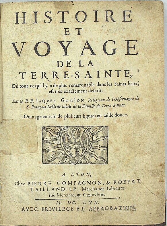
1670PHO-2212Lyon, Pierre Compagnon & Robert Taillandier, 1670. In-4° (240x185mm), 6ff.-358pp.-5ff., demi-cuir, dos à nerfs, reliure du XIXe siècle. Légers accrocs aux coiffes, rousseurs, légère mouillure. Restauration sur une carte, derniers feuillets abîmés au centre sans atteinte au texte, déchirure à une carte, taches brunes, coins effilochés sur 7 pages, cartes et planches renforcés, erreur de pagination (page 80) COMPLET avec sa carte et 16 gravures.
184339862Paris, Challamel, [1843]. Grand in-8 de (4)-228 pp. chiffrées par erreur 328, demi-maroquin vert, dos lisse, tête dorée, non rogné (relié vers 1880 par Thivet).