HISTOIRE SAINTE & RONJAT (Eugène)Livre Rare Book
11 020 résultats
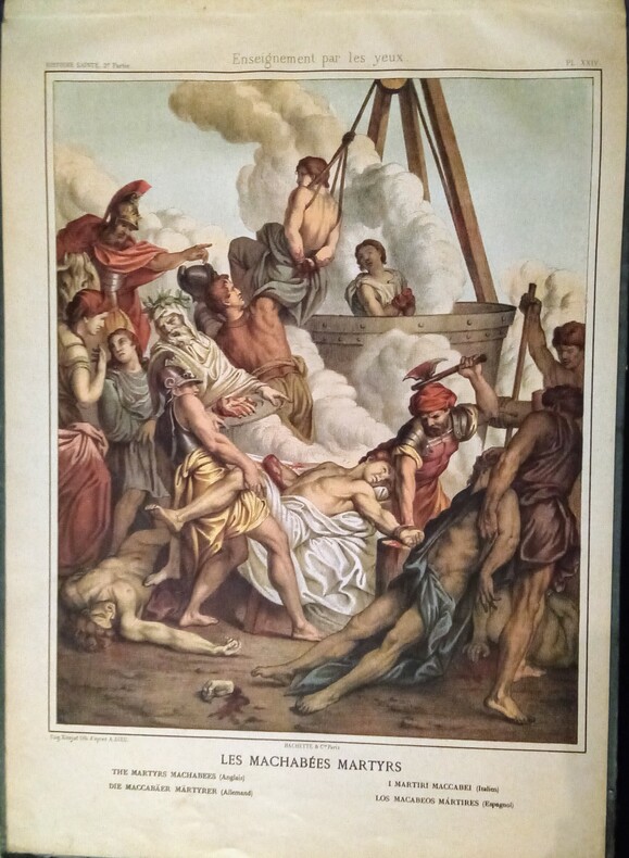
1870WOC-1833Enseignement par Les Yeux – Nouvelles Images à l'usage des Écoles maternelles et des Écoles élémentaires, accompagnées d'Histoires et de Leçons Explicatives – Histoire Sainte.- De la planche n°1 – L'homme au milieu de la création à la n°50 – Hérode Roi – Prise de Jérusalem. En deux parties de 25 planches chacune chaque volume, et pour un total de 50 planches en couleurs de lithographies de Eugène Ronjat, d'après les compositions d' Élias Redinger, Raphaël, Prud'hon, Girodet-Triosen, Poussin, etc. Avec les légendes explicatives en Français, Anglais, Allemand, Italien et Espagnol. Paris, Librairie Hachette & Cie, sans date vers (1870). 2 volumes in-folio oblong (49x35cm) de cartonnage bleu foncé, plat supérieur très orné d'une scène de vie paysanne et de la ferme, vignette blanche au milieu avec les légendes.
187786331877 percaline rouge éditeur, p. de t. vertes. 40 tomes en 20 volumes in-4, illustrés (oh combien!), P. Librairie Illustrée 1877-1897
In folio oblungo (55,5x47 cm); (42) cc. nn. Legatura coeva editoriale in mezza tela verde con titolo e fregio impreso in oro al piatto anteriore. Una piccolissima ed ininfluente mancanza di carta al margine esterno alto di carta 17. Qualche macchiolina di foxing, più intense al frontespizio ed alle prime pagine, dovute alla qualità della carta, alcuni piccoli forellini al margine bianco basso delle prime due carte, ininfluente e per il resto in buone condizioni di conservazione. Esemplare ancora in barbe. L’opera vene stampata su carta forte. Prima rara e completa edizione, ancor più rara a reperirsi completa dei piatti originali, di questo interessante studio illustrato dedicato alla storia, all’archeologia, ai costumi, festività ed ai monumenti degli ebrei e della terra di Israele. Il volume presenta 23 magnifiche e grandi tavole che riproducono templi , planimetrie, monumenti e avvenimenti legati alla storia del popolo ebraico. Il volume si apre con la storia di Mosè. Seguono poi capitoli dedicati a: Il tempio di Gerusalemme, Salomone, “Le Sanhedrin”, “Ville de Ninive”, “Tombeau de Rachel”, “Le Sabbat”, “La Paque”, “Rejouissances et Festins des Juits pendant la fete des Tabernacles”, “Repudation, Divorce”, “Ville de Nazareth”, Ceremonie du Mariage de la Sainte Vierge”, “Formule des contrats de Mariage des Hebreux”, “Transfiguration de N.=S. sur le Mont=Thabor”, “Sepulcre ou Tombeau de N. =S. Jesus=Christ”, “Montaigne des Oliviers”, “Explication de quelques Monnaies et medailles des Juifs” (con tavola delle monete). Alla fine del volume tavola cronologica della lista cronologica dei Re dei “Liste Chronologique des Rois des Hebreux, les israelites n’ont commence a avoir des Rois que depuis Saul”, “Rois de Juda”, “Rois d’Israel”, “Listes de s Macchabees, ou des PrincesAsmonees qui ont Gouverne la Republique des Juifs en qualite de Princes et de Grands Pretres Jusqu’au regne d’Herodote le Grand”, “Liste Chronologique des Grands Pretres des Hebreux”, “Table chronologique de l’Histoire de la creatione du Monde”. Le ultime quattro pagine sono infine dedicate alla spiegazione del calendario ebraico. Opera molto rara ed ancora in barbe. Le tavole illustrate sono opera di Aveline, Scotie ed altri.
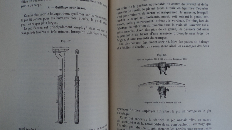
7152Publié par les soins du Comité central des Houillères de France. Paris, Librairie Polytechnique Ch. Béranger, éditeur, successeur de Baudry et Cie, 1905, reliure demi-chagrin, plats percaline, dos à 5 nerfs, titre doré, tête dorée, 17x25,5 cm, 684 pages, 281 figures in-texte, 51 planches dépliantes. Bon état (voir photos).
9 vols., roy 8vo., First Edition, with very numerous fine coloured photographs throughout; cloth, gilt backs, a near fine set in unclipped dustwrapper. The series comprises: Life on Earth (1979); The Living Planet (1984); The Trials of Life (1990); The Private Life of Plants (1994); The Life of Birds (1998); The Life of Mammals (2002); Life in the Undergrowth (2005); Life in Cold Blood (2007); Life on Earth (revised and expanded edition 2018). The encapsulation in print of Attenborough's 'Life' series, produced with the BBC over thirty-odd years and arguably the most outstanding and influential natural history broadcasts of all time.
Oversized hardcover quarter bound in black leather with red title piece and gilt bands to spine. Light green marbled paper sides. Text in Italian, 164pp, fold-out map (the first substantial study and reproduction of Fra Mauro's famous Mappa mundi, considered the supreme medieval map of the world and the "greatest memorial of medieval cartography") and illustrated plate at rear of book, both with minor foxing only. Piece of spine head strip is missing, spine sides are split, board edges and corners are bumped and papers sides are marked and scuffed. Internal pages are lightly foxed. The text remains clean and clear throughout. AD Used
Very Good Turkish, Ottoman (1500-1928) Contemporary red cloth. Roy. 8vo. (24 x 16 cm). In Ottoman script (Old Turkish with Arabic letters). [1], 229, [1] p., many b/w and color ills., 30 chromo-lithographed maps. Wear and fading on spine, some ex-library stamps on the colophon and several blank pages, ownership ink inscription and signature on the first page-overall a good copy. First edition of this rare Ottoman atlas for the primary schools in the late Ottoman Empire, including beautiful 30 chromo-lithographed maps of the Ottoman land according to administrative regions (provinces) and richly illustrated with b/w plates of the cities and provinces in the Middle East. Map list: 1. World map 2. Complete Imperial Ottoman 3. Arabian Peninsula 4. Anatolia 5. Asia Minor 6. Marmara and Black Sea 7. Aegean (The Archipelago) 8. Demography of Anatolia and Syria, Libya, etc 9. Administrative map of Anatolia 10. Map of mines of Anatolia 11. Agricultural map of the Imperial Ottoman 12. Arabian Peninsula 13. Map of the Edirne Vilayat [Adrianople Province of the Ottoman Empire] 14. Map of the Bosphorus 15. Map of the Hüdavendigâr Vilayat [Brusa Province] 16. Maps of Izmit and Biga Sanjaks 17. Map of Aydin Vilayat and Mentese Sanjak 18. Map of the Konya Vilayat 19. Maps of the Adana Vilayat and the Mediterranean Sea 20. Maps of the Erzurum and Ankara Vilayats 21. MAps of Kastamonu Vilayat and Bolu Sanjak 22. Map of the Trebizond Vilayat 23. Maps of the Van and Bitlis Vilayats 24. Maps of the Sivas and Harput Vilayats 25. Maps of the Bagdad and Basrah Vilayats 26. Map of the Mosul Vilayat and Day al-Zor Sanjak 27. Map of the Aleppo Vilayat and Urfa Sanjak 28. Map of the Syria and Beirut Vilayats 29. Map of the Arabia 30. Maps of the Yemen vilayat and Asir Sanjak. This atlas was printed four times for the different classes of the early Turkish / Ottoman schools, during World War 1 (two times in 1916) and the National Struggle (two times in 1921). Geylangil was born in Istanbul in 1887 and studied in Aleppo and Baghdad. Geylangil, who also studied economic geography, taught geography at many schools, including Galatasaray High School. Until his death, he wrote 14 books on geography, most of which were geographical atlases. In 1941, he was among the founding members of the Turkish Geographical Society. Özege 23216.; TBTK 11481.; We couldn't find any copy of this edition worldwide.
Very Good Turkish, Ottoman (1500-1928) Contemporary quarter leather bdg. Rebacked boards. Foolscap 8vo. (18 x 12 cm). In Ottoman script (Old Turkish with Arabic letters). 220 p. Very rare early book of the concise biographies of 137 people who served as admirals in the Ottoman Empire between 1352 and 1853, written by Mehmed Izzet Pasha (d. 1853), son of Turkish admiral Abdullah Râmiz Pasha (d. 1813). Ceridehâne Printing House was founded for publishing Ceride-i Havâdîs [i.e. The Journal of News], which was the first semi-official newspaper in the Ottoman Empire. This journal was published from 1840 to 1877 and was founded by William Nosworthy Churchill (1796-1846), a British-born journalist who moved to Turkey aged 19. He was the cause of a diplomatic incident that resulted in the temporary severance of diplomatic relations between Britain and the Ottoman Empire. Babinger p. 323/2.; Özege 6951.; Library of Congress. Karl Süssheim Collection, no. 1336., OCLC: 11810438, 880485954.
1784biblio48vo 190 x 120mm. pp. 18 511 with 3 engraved plates. Original calf gilt spine; lightly rubbed else fine. First edition. Marks of previous owner. Pictures on demand. Please contact me ramrozzi@yahoo.fr<br /> Cuchet
0719NX6ZTCJVery Good. SIGNED by the author unknown
Magnifico esemplare della importante carta delle regioni settentrionali di Willelm Blaeu.La carta raffigura le recenti scoperte riportate dalle esplorazioni al Polo Nord, tra la fine del XVI e l'inizio del XVII secolo. La Groenlandia presenta molti toponimi costieri e sono rappresentati sia lo Spitsberg che la Nova Zemla. Esemplare tratto da edizione tedesca dell'Atlas Major di Johannes Blaeu. Willem Janszoon Blaeu, avviò nel 1599 la sua attività di costruttore di globi e strumenti astronomici ad Amsterdam. Nel 1630, dopo aver comprato alcune lastre dell’atlante del Mercator da Jodocus Hondius II, fu in grado di pubblicare un volume di 60 mappe con il titolo di Atlantis Appendix. Cinque anni dopo, pubblicò i primi due volumi del suo atlante Atlas Novus o Theatrum Orbis Terrarum, in sei libri. Dopo la sua morte, Joan (Johannes) continuò l’opera paterna, completando l’intera serie di sei volume dell’Atlas Novus intorno al 1655. Fu inoltre autore di un Atlas Maior sive Cosmographia Blaviana, in 12 volumi pubblicati nel 1662 -72. Incisione in rame, bellissima coloritura coeva, in perfetto stato di conservazione. A nice example of Blaeu's signature map of the North Polar Regions, with several wonderful cartouches and decorative coat of arms. Wonderful detail, both real and imaginary, throughout the map. The discoveries of the late 16th and early 17th Centuries are plainly in evidence throughout Hudson's Baffin's and Buttons Bay, along with Davis Straits. Greenland has many bays named. Spitsberg and Nova Zemla are shown, but I not in a complete fashion. 8 compass roses and 4 sailing ships. The North Pole is the center of this map which shows the coastlines of the countries in the Artic Circle.The decorative title cartouche is in the upper part of the map with cherubs and personifications of the wind and winter. In the lower right is the map legend surrounded by two Eskimos, a polar bear and a fox. Willem Janszoon Blaeu, started in 1599 his business as a builder of globes and astronomical instruments in Amsterdam. In 1630, after buying some plates of the Mercator atlas from Jodocus Hondius II, he was able to publish a volume of 60 maps under the title Atlantis Appendix. Five years later, he published the first two volumes of his atlas Atlas Novus or Theatrum Orbis Terrarum, in six books. After his death, Joan (Johannes) continued his father's work, completing the entire six-volume Atlas Novus series around 1655. He was also the author of an Atlas Maior sive Cosmographia Blaviana, in 12 volumes published in 1662 -72. A nice old color example of this highly sought after map, taken from a German edition of “Atlas Major” by Johannes Blaeu.
Interessante mappa delle regioni polari artiche, basata su quella del Mercator del 1595.Il Polo Nord è mostrato come grande roccia circondata da quattro isole separate da fiumi. Il nord magnetico è rappresentato come una roccia isolata separata appena fuori dalla massa polare. Nell'America del Nord è riportato un riferimento alla California (California regio, sola fama Hispanis nota), curiosamente indicata a nord di El stretto de Anian. La mappa mostra i tentativi di Frobisher e Davis di individuare i passaggi settentrionali per Asia.La mappa è incorniciata da un disegno floreale con quattro cerchi posti uno in ogni angolo che contengono il titolo, le Isole Fær Øer, le Isole Shetland e la mitica isola della Frislanda. Important early map of the North Polar regions, based upon Mercator's map of 1595.The North Pole is shown according to legend as a large rock in a giant whirlpool and surrounded by four islands that are separated by rivers. The magnetic north is depicted as a separate island rock just outside the polar mass. In North America is an very early reference to California (California regio, sola fama Hispanis nota), curiously shown north of the El streto de Anian. The map depicts the attempts of Frobisher and Davis to locate the northern passages to Asia.The map image is surrounded by a floral design with four roundels in each corner. These contain the title, the Faeroe Isles, the Shetland Isles, and the mythical island of Frisland. Burden, P.D. 134; Meurer, P.H. (Cologne) Qua 79
19271720531927. TERRA Dino. L'Amico dell'Angelo. 93pp. 8vo. Publisher's photomontage illustrated wrappers. Rome: "La Ruota Dentata" 1927. A work by the Italian futurist poet Dino Terra which is distinguished by the splendid photomontage by Vinicio Paladini. Extremely rare. OCLC records only the copy in the BN. unknown
016371No place but Champaign Illinois: Privately Printed 1991. Very scarce said to be limited to only 6 copies. Appears unread. Fine condition. NOT a library discard. A bright clean square tight copy. Sharp corners. NO owner's name or bookplate. Pages are fresh crisp and unmarked. NO underlining. NO highlighting. NO margin notes. Oversize Hardcover. 8.75" wide by 11.25" tall by 1.75" thick. Posthumously printed memoirs of Ralph Early Grim 1902-1989 geologist and Research Professor Emeritus Department of Geology University of Illinois Urbana. The February 2009 newsletter of THE CLAY MINERALS SOCIETY photocopy laid-in contains a tribute to Grim from the University of New Mexico's Dewey Moore. In it Moore writes: "The contrast between his rather humble origins and his lofty reputation as a scientist and world traveler was perhaps the stimulant for him to write his memoirs. After his death his wife Frances E. Grim had them transcribed and a few perhaps 6 copies bound. The original copy of MEMOIRS OF RALPH EARLY GRIM is in the University of Illinois Main Library archives; one copy rests in the Clay Minerals Society's archives." Handsomely bound in the original maroon pebble-grain full leather stamped in shiny gold on the spine and front cover. From Dewey Moore's tribute: "In 1951 Grim shifted to the University of Illinois Geology Department. From this base Grim put his mark on the clay minerals profession: guidance at the 1951 meeting in St. Louis that served as the incubation for what was to become The Clay Minerals Society; his 1953 publication of CLAY MINERALOGY; and the publication of his APPLIED CLAY MINERALOGY 1962. From this point on most of us are familiar with Ralph Grim's history. His books proved to be the vehicles that carried clay science into maturity as a discipline. His professional activities led to many accolades from his peers. The ultimate honor for a mineralogist is to be awarded the Roebling Medal by the Mineralogical Society of America. Ralph Grim accepted this award in 1974. For what could be called the corresponding award for consulting the Ivory Coast in western Africa bestowed on Professor Grim in 1973 the title of Chevalier Knight. Ralph Grim earned this highest honor for a non-citizen for developing local professionals to take over the duties of the Ivory Coast Geological Survey during his 15 visits to the country and for discovering a huge iron deposit in the western part of the country." This large heavy book will require extra postage for Priority and International shipments but only the standard charge for media mail. First Edition 1 of only 6 copies. Oversize Hardcover. Fine condition/No jacket probably as issued. vi 689pp. Privately Printed Hardcover
Carta della Morea a firma di Orazio Bertelli. Sebbene priva di data l’opera può essere ricondotta a prima del 1568, in quanto compare occasionalmente in alcune copie della raccolta di carte di piccolo formato della famiglia Bertelli, il Civitatum aliquot insignorum et locorum magis monitorum exacta delineation cum additione aliquot Insularum principalium. Disegni di alcune più illustri città et fortezze del mondo con aggionta di alcune Isole principali edito da Ferrando Bertelli nel 1568. Ma la carta circolava già prima, come dimostra la sua presenza in alcune raccolte cinquecentesche di grande formato. Dal punto di vista cartografico la carta deriva dall’opera di Giacomo Gastaldi del 1560.La carta conosce una seconda stesura, anonima, profondamente modificata dalla scomparsa del cartiglio con il titolo. Esaminando bene gli esemplari di secondo stato si intravedon le scritte che compaiono nel primo. Tali prove, più comuni, sono inserite nella ristampa Civitatum aliquot insignorum et locorum curata da Donato Bertelli nel 1574.Stati & edizioni: 1°: come descritto.2°: abraso il cartiglio in basso a sinistra e la nave più grande; sono ancora visibili le tracce delle iscrizioni. Nel posto del cartiglio si legge ora MARE MEDITERRANEO. SECOND STATE, WITHOUT THE IMPRINTMap of Morea from the very rare Civitatum Aliquot insignorum et locorum… of Bertelli. The book, which describes the main cities, isles and remarkable places of the world, followed after only one year the analogous work published by Forlani (1567). It bears also the plates engraved by Forlani himself, by Zenoi and Bertelli. The first state of the map is with a cartouche ta the lower left, with the title "OREA peninsula anticame[n]nte detta poloponesso, apia, e pelagia. oratio berteli.". This second state have the cartouche (and some of the ships) erased where is now the inscription "Mare Mediterraneo".Copper engraving, with margins, in excellent condition. Meurer (2002): n. 65; Tavernari (2014): n. 116; Gallo (1950): p. 99, n. 25; Nordenskiöld (1981): n. 12 (62); Zacharakis (1992): nn. 197 & 2558; Zacharakis (2009): nn. 325-326
DQO-265Chez l'auteur, Collection Littérature, Paris, 1923, imprimé par les Presses du Montparnasse. Grand in-8, broché, 78 pages. Edition originale. Un des 200 exemplaires numérotés sur Offsett (tirage total à 240 exemplaires), avec, en frontispice, un portait de l'auteur, reproduction d'une eau-forte de Picasso.
1666LBW-7582Lutetiæ Parisiorum, Apud authorem, 1666. En deux feuilles pouvant être jointes pour former une carte de 746 x 523 mm.
197167954Pasadena, Jet Propulsion Laboratory 1971. Wissenstand 10.März 1971 (change 1) circa 200 S.;sehr große farbige Faltkarte; 30cm Ringordner [4 Warenabbildungen] 0
Questa bella mappa, pubblicata originariamente nel 1637, alla fine sostituì la mappa di Hondius del Polo Nord e divenne il prototipo per molte mappe successive, comprese quelle di Blaeu. La mappa incorpora le scoperte fatte dal capitano Thomas James lungo le coste meridionali e occidentali della Baia di Hudson nel 1631-2. La delineazione sulla costa artica della Russia è derivata dalle informazioni dell'esplorazione di Willem Barents del 1596-7. L'esploratore inglese Hugh Willoughby ha una piccola isola che porta il suo nome al largo della costa della Lapponia (Sir Hugo Willoughby's Landt). Willoughby capitanò una spedizione di tre navi per trovare un passaggio a nord-est nel 1553, ma due delle navi furono strappate via durante una tempesta. Willoughby e il suo equipaggio delle due navi morirono e furono ritrovati sulla Novaya Zemlja l'anno seguente, con il suo diario. La terza nave con il suo comandante in seconda Richard Chancellor arrivò in Russia. Le linee lossodromiche si irradiano dal Polo Nord e diverse rose di bussole abbelliscono la carta. Un grande cartiglio del titolo, con due figure e numerose teste di vento, nasconde convenientemente la costa nord-occidentale dell'America. La carta è ulteriormente decorata con navi e un cartiglio con l'imprint di Jansson, che raffigura uomini in parka, un orso polare e volpi. Questo esemplare è il quarto stato della lastra con Nova Zemlja collegata alla terraferma con un ponte terrestre e la costa di Spitzbergen completata. Joannes Janssonius, figlio dell'editore di Arnhem Jan Janssen, sposò Elisabeth Hondius, figlia di Jodocus Hondius, ad Amsterdam nel 1612. Dopo il suo matrimonio, si stabilì in questa città come libraio ed editore di materiale cartografico. Nel 1618 si stabilì ad Amsterdam accanto alla libreria di Willem Jansz. Blaeu, entrando in una seria competizione. Le sue attività non riguardavano solo la pubblicazione di atlanti e libri, ma anche di mappe singole e un vasto commercio di libri con filiali a Francoforte, Danzica, Stoccolma, Copenaghen, Berlino, Koningsbergen, Ginevra e Lione. Nel 1631 iniziò a pubblicare atlanti insieme a Henricus Hondius. Nei primi anni 1640 Henricus Hondius lasciò l'attività di pubblicazione di atlanti completamente a Janssonius. La concorrenza con Joan Blaeu, figlio e successore di Willem, nella produzione di atlanti spinse Janssonius ad ampliare il suo Atlas Novus finalmente in un'opera di sei volumi, in cui furono inseriti un atlante marino e un atlante del Vecchio Mondo. Dopo la morte di Joannes Janssonius, il negozio e la casa editrice furono continuati dagli eredi sotto la direzione di Johannes van Waesbergen (c. 1616-1681), genero di Joannes Janssonius. Le matrici degli atlanti di Janssonius furono in seguito vendute a Schenk e Valck. Incisione in rame, bellissima coloritura coeva, ottimo stato di conservazione. This beautiful map, originally published in 1637, eventually replaced Hondius' map of the North Pole and became the prototype for many later maps including those of Blaeu. This map incorporates the discoveries made by Captain Thomas James along the southern and western shores of Hudson Bay in 1631-2. The delineation on Russia's Arctic coast is derived from the information from Willem Barents' exploration of 1596-7. The English explorer Hugh Willoughby has a small island named after him off the coast of Lapland (Sir Hugo Willoughby's Landt). Willoughby captained an expedition of three ships to find a Northeast Passage in 1553, but two of the ships were ripped away during a storm. Willoughby and his crew from the two ships died and were found on Novaya Zemla the following year, with his journal. The third ship with his second-in-command Richard Chancellor made it to Russia. Rhumb lines radiate from the North Pole and several compass roses embellish the chart. A large title cartouche, with two figures and numerous wind heads, conveniently hide the northwest coast of America. Joannes Janssonius (Arnhem, 1588-1664), son of the Arnhem publisher Jan Janssen, married Elisabeth Hondius, daughter of Jodocus Hondius, in Amsterdam in 1612. After his marriage, he settled down in this town as a bookseller and publisher of cartographic material. In 1618 he established himself in Amsterdam next door to Blaeu’s book shop. He entered into serious competition with Willem Jansz. Blaeu.. His activities not only concerned the publication of atlases and books, but also of single maps and an extensive book trade with branches in Frankfurt, Danzig, Stockholm, Copenhagen, Berlin, Koningsbergen, Geneva, and Lyon. In 1631 he began publishing atlases together with Henricus Hondius. In the early 1640s Henricus Hondius left the atlas publishing business completely to Janssonius. Competition with Joan Blaeu, Willem’s son and successor, in atlas production prompted Janssonius to enlarge his Atlas Novus finally into a work of six volumes, into which a sea atlas and an atlas of the Old World were inserted. After the death of Joannes Janssonius, the shop and publishing firm were continued by the heirs under the direction of Johannes van Waesbergen (c. 1616-1681), son-in-law of Joannes Janssonius. The copperplates from Janssonius’s atlases were afterwards sold to Schenk and Valck. The map is further decorated with ships and a cartouche with Jansson’s imprint, which depicts men in parkas, a polar bear and foxes. This example is the fourth state of the plate with Nova Zemla connected to the mainland with a land bridge and the completed coastline of Spitzbergen. German text on verso. Very good condition.
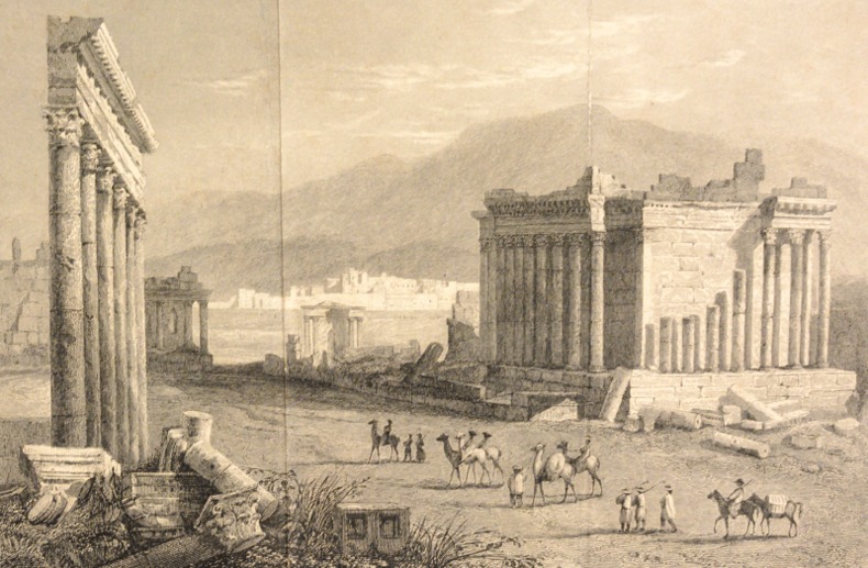
18370022921837 Paris, Chez Ladvocat, 1837-38. Cinq volumes in-8 (138 X 209) toile chagrinée vert lierre entièrement décorée d'entrelacs à froid, titre et tomaison dorés au dos, gardes papier jonquille (reliure de l'époque). Tome I : (2) ff. de faux-titre et titre, portrait frontispice, 402 pages ; Tome II : (2) ff. de faux-titre et titre, 396 pages, 1 carte et 4 vues dépliantes ; Tome III : (2) ff. de faux-titre et titre, 406 pages, (1) f. de table, 3 cartes et 7 vues ; Tome IV : (2) ff. de faux-titre et titre, 384 pages, 1 carte et une vue dépliantes ; Tome V : (2) ff. de faux-titre et titre, 372 pages, 3 cartes dépliantes. Habile restauration à l'angle inférieur du second plat du tome III, rousseurs claires éparses. Mention fictive de «Quatrième édition » sur le faux-titre des quatre premiers volumes, et de «Troisième édition » sur le titre du cinquième et dernier volume.
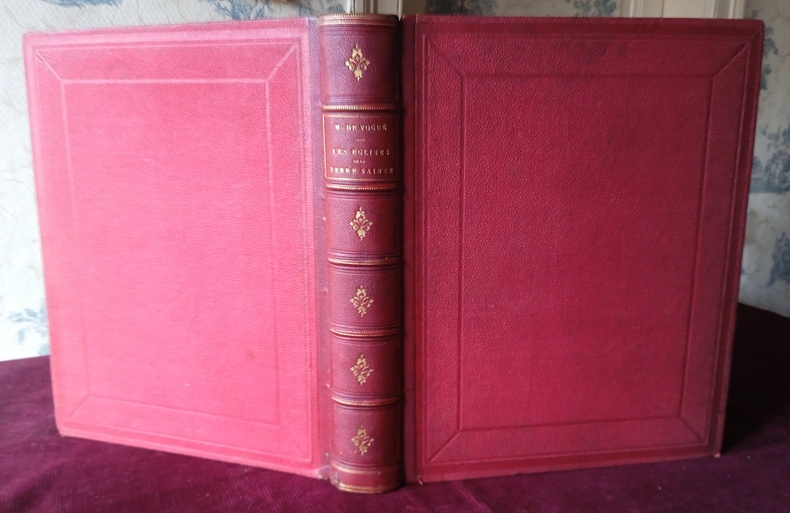
1860LR32-HN6Avec 23 planches de gravures sur cuivre (dont double pages) sous serpentes, 23 gravures sur bois et deux chromolithographies en fin de volumes. Reliure demi maroquin, 5 faux nerfs, fente de 4 cm en pied de mors du second plat, une fente de 1 cm au niveau de la coiffe inférieure, très légères traces d'épidermure sur les mors, percaline sur les plats un peu frottée sur les coins, in-4°, intérieur en bonne condition, rousseurs assez éparses, p. de faux titre, p. de titre, double planche formant frontispice, 463 p. errata. Sur la première garde, intéressant suivi de cet exemplaire au u troisième quart du vingtième siècle commençant par un ex-dono de Pierre de Vogüé (un cousin de l'auteur) à un prêtre de la paroisse de Saint Séverin puis son entrée dans la bibliothèque du marquis de Godefroy de Ménilglaise puis de son don à un vicaire de la paroisse de Sainte Clotilde.
197267953Pasadena, Jet Propulsion Laboratory 1972. Wissenstand 1.März 1972 circa 600 S.; 30cm Ringordner [5 Warenabbildungen] 0
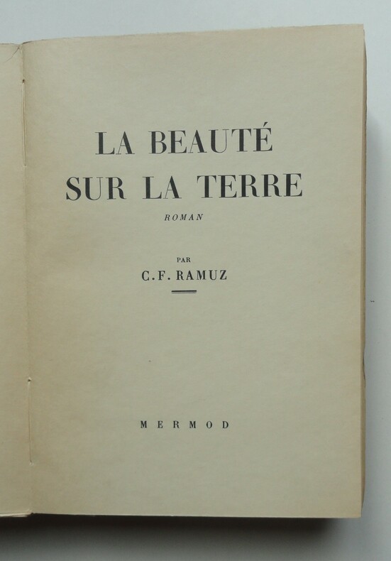
1927ZNC-605Genève, Mermod, 1927, in-8°, 274 pages, couverture rempliée imprimée sur japon.
189146401647Paris, l’Art culinaire, Frank, 1891 ; in-12, cartonnage illustré d’éditeur, dos de toile verte XXIII pp., 71 pp., 9 pp., non chiffrées (publicité et achevé d’imprimer).ÉDITION ORIGINALE DE TOUTE RARETÉ. Le seul autre exemplaire décrit figurait au _Catalogue Huchet n°6, n° 116._ 110 recettes de potages, pommes de terre bouillies, étuvées, rôties, frites, gratinées et en ragoût, purées, entremets et salades. En appendice : l’igname de Chine, l’alcool de pomme de terre, la fécule... Vignettes in-texte par G. Tantet.Exemplaire avec en-tête 2 ff. de publicité pour les éditions Michelet.
78902Hamburg Hamburg-South America Line and private German tourists 1929. Oblong folio 14.9 x 21.5 cm. Album with printed title page; and 18 cardboard leaves with 18 professional photos and 52 excellent amateur photos all mounted. Original Art Deco full cloth. = A highly interesting account with many unique original photos of a cruise in southernmost South America in particular Tierra del Fuego by a party of German tourists. Patagonia and Tierra del Fuego have become a very popular destinations for cruises today but this is a very early example of a cruise through this region showing the area as it was almost one hundred years ago and in many ways much changed since then but then again with many other places hardly altered as can be seen by comparing the photos of e.g. Harberton or Ushuaia with recent photos on the internet. Views include Magallanes Punta Arenas "Haberton" Harberton on the Beagle Canal Ushuaia Mount Darwin Bahia Garibaldi and the Garibaldi glacier the steamer Antonio Delfino the expedition ship Feuerland etc. The Antonio Delfino "was a Hamburg South America Line steamship built 1921 at Hamburg by Vulcan Werke. The ship was built to operate on the Hamburg - South America service. In 1932 the ship was chartered to the Norddeutscher Lloyd and renamed Sierra Nevada. In 1934 she was returned to the Hamburg South American Line and the name was changed back to Antonio Delfino. In 1940 she was requisitioned by the Kriegsmarine and used as a barracks ship at Kiel and from 1943 at Gdynia Gotenhafen. In 1944 she became a command ship for the Admiral of Submarines at Gotenhafen. In 1945 she was used to evacuate refugees and wounded military personnel from Gdynia carrying a total of 20522 people in five voyages. In May 1945 she was seized by British forces in Copenhagen. She was taken over by the Ministry of War Transport and managed by the Anchor Line. The ship was refitted as a troopship by John Brown & Co Clydebank. and renamed Empire Halladale. On August 31 1946 she inaugurated a troopship service between Tilbury and Cuxhaven during which period she also transported families of UK military personnel who were to live in Germany later serving in the Middle East and Far East. Laid up in October 1955 at Glasgow. Scrapped in February 1956 at Dalmuir West Dunbartonshire" Heritage Ships website. Very rare. We found no record of other copies of the printed edition. All photos in very good condition as are the original covers. hardcover