2 067 résultats
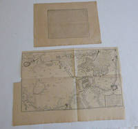
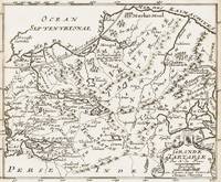
1700398AG1700. Paris c. 1700. Original copper engraved map. 16 cm wide x 13.2 cm high. Mounted on paper. Very good condition. From a wonderful collection of Maps from an old english library South Shields - with a tiny library stamp to the mounting paper The stamp is NOT on the Map. Nicolas de Fer 164625 October 1720 was a French cartographer and geographer. De Fer was the youngest of three sons of Antoine de Fer who was also a cartographer. When he was 12 he became the apprentice of Parisian engraver Louis Spirinx and made his first map of the Canal du Midi at the age of 23. After the death of his father in June 1673 his mother Geneviève initially took over the map making company which had begun to decline. She passed it and the atelier called Quai de L'Horloge on to Nicolas in 1687 because of her old age. De Fer was so successful at improving the firm that in 1690 he became the official geographer to Louis Dauphin of France. With support from the Spanish and French Royal Families de Fer also became official geographer for Philip V and Louis XIV the kings of Spain and France respectively. Because of this his maps became Bourbon propaganda endorsing French King Louis XIV. His business flourished producing town plans atlases wall maps and more than 600 sheet maps. He made maps of places in Europe and North America including New Spain places fortified by Vauban the Low Countries and the War of the Spanish Succession. In 1698 de Fer published a map of North America which included a depiction of beavers building dams near Niagara Falls. Seventeen years later Herman Moll published a map which plagiarized elements of de Fer's work particularly the beaver scene. It became known as the "Beaver map". De Fer became the official geographer for His Catholic Majesty in 1720. Two of his sons-in-law Guillaume Danet and Jaques-François Bénard continued the company after de Fer's death on 25 October of that year until around 1760. Wikipedia unknown
20192-0464121833Blurb 2019. Hardcover. New. 454 pages. Spanish language. 8.23x5.24x1.34 inches. Blurb hardcover
1994SONG1558062130Brand: Iron Crown Enterprises 1994-10-28. paperback. Used: Good. 11.02x8.54x0.39. Buy with confidence. Excellent Customer Service & Return policy. Brand: Iron Crown Enterprises paperback
62442810Taylor & Francis Group pp. 416 . Hardback. New. Taylor & Francis Group hardcover
2021x-3030707601Springer Nature 2021. Hardcover. New. 347 pages. 9.25x6.10x0.87 inches. Springer Nature hardcover
SONG0367137089Routledge 2019-06-25. 1. hardcover. Used: Good. 6.25x0.75x9.25. Buy with confidence. Excellent Customer Service & Return policy. Routledge hardcover
20192-036897443XBlurb 2019. Hardcover. New. 460 pages. Spanish language. 8.23x5.32x1.34 inches. Blurb hardcover
12941085-nnew. unknown
12941085like new. unknown
20192-0464011388Blurb 2019. Hardcover. New. 434 pages. Spanish language. 8.27x5.32x1.34 inches. Blurb hardcover
2023x-303130246XSpringer Nature 2023. Hardcover. New. 239 pages. 9.25x6.10x9.21 inches. Springer Nature hardcover
20192-0368968146Blurb 2019. Hardcover. New. 456 pages. Spanish language. 8.27x5.24x1.42 inches. Blurb hardcover
35379127like new. unknown
2006SONG0415372046Routledge 2006-03-09. 1. hardcover. Used: Good. 6.36x0.68x9.26. Buy with confidence. Excellent Customer Service & Return policy. Routledge hardcover
1908055962Galata - Constantinople: Imprimerie de Castro Constantinople Galata AH 1324 = 1908. 1908. 2nd Edition . Soft cover. Very Good. 4to - over 9¾ - 12" tall. Original greenish tan wrappers. 4to. 30 x 21 cm. Bilingual in Ottoman Turkish and French. 11 p. Occasional chippings on extremities of the front wrapper a couple of stamps were deleted on two pages. Else a very good copy. Scarce bilingual statutes in French and Ottoman Turkish of the Imperial Ottoman Baghdad Railway Company printed at the "De Castro" Press one of the earliest Jewish printing houses in Galata. This edition includes the second and third series together of the Emprunt Impérial Ottoman 4% du Chemin de Fer de Bagdad Ottoman Imperial Loan 4% of the Baghdad Railway and reflects the contractual framework of the railway's financing. The first series was originally issued in 1905. ON "DE CASTRO" PRINTING HOUSE: In 1808 a work titled Tikuney Zohar was printed at the Hebrew printing press established by Yitshak ben Avraham Castro in the same year. It appears that the press did not publish any works until 1823 when printing resumed. From that year onward books bore the imprint "Yitshak de Castro and Sons." The place of printing was recorded as "el Saray de Ingiliz the English Palace." Castro who did the typesetting of the books in his own home used the English Palace in Constantinople as the printing house. This press primarily published Ladino works translated from Hebrew. Among these were books such as Ben Sira Sefer ha-Yashar and Kav ha-Yashar along with various collections of responsa and sermons. The most remarkable works published by this press were two books written in opposition to Christianity and British missionary activities. The press remained active until 1848 closing after the death of Yitshak Castro. After 1849 two Hebrew printers were active in Istanbul: Nisim de Castro and Moshe de Castro. They are believed to have been the sons of Yitshak Castro and following their father's death each established his own independent printing house. Between 1849 and 1850 Nisim de Castro's press produced three books two in Hebrew and one in Ladino. Moshe de Castro's press issued two Hebrew works one in 1849 and another in 1862. This press continued to operate under the name "Castro Press" publishing two additional Ladino books in 1877 and 1925. In 1853 Leon Haim de Castro likely a descendant launched and edited Or Israël The Light of Israel the first Jewish newspaper published in Istanbul. Meral. As of May 2025 OCLC lists only two copies worldwide: one at the Staatsbibliothek zu Berlin Preußischer Kulturbesitz and another at the Universitätsbibliothek Bamberg 1158592367 and 634693982. No copies are recorded in U.S. libraries. <br/> <br/> Imprimerie de Castro, Constantinople, Galata, AH 1324 = 1908. paperback
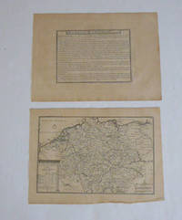
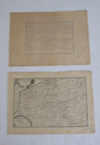
51-6443Paris: chez l'auteur dans l'Isle du Palais sur le quay de l'orloge a la Sphére Royale avec privilége du Roy 1715. Engraved text broadside 27.3 x 38cm. and engraved map 38 x 57cm. Top left trimmed to borderline. Contemporary laid paper uniformly time aged.Published in "L'atlas curieux ou Le monde reÌpreseÌnteÌ dans des cartes geÌneÌrales et particulieres du ciel et de la terre : diviseÌ tant en ses quatre principales parties que par eÌtats et provinces et orneÌ par des plans et descriptions des villes capitales et principales et des plus superbes edifices qui les embelissent comme sont les eglises les palais les maisons de plaisance les iardins les fontaines &c. ". OCLC Number / Unique Identifier:79022119.LThe Atlas Curieux is geographic encyclopedia of images and maps of France with detailed views of the grand waterworks at Marly views of the great palaces and chateaux views and plans of the Paris Observatory and samples of military architecture. Issued in six annual parts from 1700-1705 the maps are based on the new observations of the Académie des Sciences and drawn up with the assistance of Philipe de La Hire.Library of Congress:The French cartographer and engraver Nicolas de Fer was a master at creating maps that were works of art. The maps that he published were printed during the Baroque period when the decorative arts were characterized by ornate detail. De Fer’s detailed maps and atlases were valued more for their decorative content than their geographical accuracy.Nicolas de Fer was born in 1646. His father Antoine de Fer owned a mapmaking firm. At the age of twelve Nicolas was apprenticed to a Parisian engraver named Louis Spirinx. The family business was starting to decline when his father died in 1673. Nicolas de Fer’s mother Genevieve took over the business after the death of her husband. In 1687 the business was passed on to Nicolas and the profits increased after he took over the firm. Nicolas de Fer was a prolific cartographer who produced atlases and hundreds of single maps. He eventually became the official geographer to King Louis XIV of France and King Philip V of Spain.One of de Fer’s major works is an atlas titled L’atlas curieux The curious atlas. Paris: chez l'auteur dans l'Isle du Palais sur le quay de l'orloge a la Sphére Royale avec privilége du Roy, 1715 unknown
51-6450Paris: chez l'auteur dans l'Isle du Palais sur le quay de l'orloge a la Sphére Royale avec privilége du Roy 1705-1717. Engraved text broadside and engraved map.Each 27.3 x 38cm. Contemporary laid paper uniformly time aged.Published in "L'atlas curieux ou Le monde reÌpreseÌnteÌ dans des cartes geÌneÌrales et particulieres du ciel et de la terre : diviseÌ tant en ses quatre principales parties que par eÌtats et provinces et orneÌ par des plans et descriptions des villes capitales et principales et des plus superbes edifices qui les embelissent comme sont les eglises les palais les maisons de plaisance les iardins les fontaines &c. ". OCLC Number / Unique Identifier:79022119.LThe Atlas Curieux is geographic encyclopedia of images and maps of France with detailed views of the grand waterworks at Marly views of the great palaces and chateaux views and plans of the Paris Observatory and samples of military architecture. Issued in six annual parts from 1700-1705 the maps are based on the new observations of the Académie des Sciences and drawn up with the assistance of Philipe de La Hire.ibrary of Congress:The French cartographer and engraver Nicolas de Fer was a master at creating maps that were works of art. The maps that he published were printed during the Baroque period when the decorative arts were characterized by ornate detail. De Fer’s detailed maps and atlases were valued more for their decorative content than their geographical accuracy.Nicolas de Fer was born in 1646. His father Antoine de Fer owned a mapmaking firm. At the age of twelve Nicolas was apprenticed to a Parisian engraver named Louis Spirinx. The family business was starting to decline when his father died in 1673. Nicolas de Fer’s mother Genevieve took over the business after the death of her husband. In 1687 the business was passed on to Nicolas and the profits increased after he took over the firm. Nicolas de Fer was a prolific cartographer who produced atlases and hundreds of single maps. He eventually became the official geographer to King Louis XIV of France and King Philip V of Spain.One of de Fer’s major works is an atlas titled L’atlas curieux The curious atlas. Paris: chez l'auteur dans l'Isle du Palais sur le quay de l'orloge a la Sphére Royale avec privilége du Roy, 1705-1717 unknown
51-6442Paris: chez l'auteur dans l'Isle du Palais sur le quay de l'orloge a la Sphére Royale avec privilége du Roy 1705-1717. Engraved text broadside and engraved map.Each 27.3 x 38cm. Contemporary laid paper uniformly time aged.Published in "L'atlas curieux ou Le monde reÌpreseÌnteÌ dans des cartes geÌneÌrales et particulieres du ciel et de la terre : diviseÌ tant en ses quatre principales parties que par eÌtats et provinces et orneÌ par des plans et descriptions des villes capitales et principales et des plus superbes edifices qui les embelissent comme sont les eglises les palais les maisons de plaisance les iardins les fontaines &c. ". OCLC Number / Unique Identifier:79022119.LThe Atlas Curieux is geographic encyclopedia of images and maps of France with detailed views of the grand waterworks at Marly views of the great palaces and chateaux views and plans of the Paris Observatory and samples of military architecture. Issued in six annual parts from 1700-1705 the maps are based on the new observations of the Académie des Sciences and drawn up with the assistance of Philipe de La Hire.Library of Congress:The French cartographer and engraver Nicolas de Fer was a master at creating maps that were works of art. The maps that he published were printed during the Baroque period when the decorative arts were characterized by ornate detail. De Fer’s detailed maps and atlases were valued more for their decorative content than their geographical accuracy.Nicolas de Fer was born in 1646. His father Antoine de Fer owned a mapmaking firm. At the age of twelve Nicolas was apprenticed to a Parisian engraver named Louis Spirinx. The family business was starting to decline when his father died in 1673. Nicolas de Fer’s mother Genevieve took over the business after the death of her husband. In 1687 the business was passed on to Nicolas and the profits increased after he took over the firm. Nicolas de Fer was a prolific cartographer who produced atlases and hundreds of single maps. He eventually became the official geographer to King Louis XIV of France and King Philip V of Spain.One of de Fer’s major works is an atlas titled L’atlas curieux The curious atlas. Paris: chez l'auteur dans l'Isle du Palais sur le quay de l'orloge a la Sphére Royale avec privilége du Roy, 1705-1717 unknown
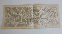
51-6447Paris: chez l'auteur dans l'Isle du Palais sur le quay de l'orloge a la Sphére Royale avec privilége du Roy 1705-1717. Engraved map. One fold. Worm holes in lower marginEach 27.3 x 64.2 cm. Contemporary laid paper uniformly time aged.Published in "L'atlas curieux ou Le monde reÌpreseÌnteÌ dans des cartes geÌneÌrales et particulieres du ciel et de la terre : diviseÌ tant en ses quatre principales parties que par eÌtats et provinces et orneÌ par des plans et descriptions des villes capitales et principales et des plus superbes edifices qui les embelissent comme sont les eglises les palais les maisons de plaisance les iardins les fontaines &c. ". OCLC Number / Unique Identifier:79022119.LThe Atlas Curieux is geographic encyclopedia of images and maps of France with detailed views of the grand waterworks at Marly views of the great palaces and chateaux views and plans of the Paris Observatory and samples of military architecture. Issued in six annual parts from 1700-1705 the maps are based on the new observations of the Académie des Sciences and drawn up with the assistance of Philipe de La Hire.ibrary of Congress:The French cartographer and engraver Nicolas de Fer was a master at creating maps that were works of art. The maps that he published were printed during the Baroque period when the decorative arts were characterized by ornate detail. De Fer’s detailed maps and atlases were valued more for their decorative content than their geographical accuracy.Nicolas de Fer was born in 1646. His father Antoine de Fer owned a mapmaking firm. At the age of twelve Nicolas was apprenticed to a Parisian engraver named Louis Spirinx. The family business was starting to decline when his father died in 1673. Nicolas de Fer’s mother Genevieve took over the business after the death of her husband. In 1687 the business was passed on to Nicolas and the profits increased after he took over the firm. Nicolas de Fer was a prolific cartographer who produced atlases and hundreds of single maps. He eventually became the official geographer to King Louis XIV of France and King Philip V of Spain.One of de Fer’s major works is an atlas titled L’atlas curieux The curious atlas. Paris: chez l'auteur dans l'Isle du Palais sur le quay de l'orloge a la Sphére Royale avec privilége du Roy, 1705-1717 unknown
188272074Boston:: Forbes Lithograph Company 1882. First edition. publisher's gilt-lettered cloth. A coin-sized dampstain affects the marginal fore-edge of several dozen leaves; one large folding diagram neatly reinforced with tissue at folds; cloth spotted and worn. . 8vo. Four folding diagrams. Forbes Lithograph Company, hardcover
18006Good. First edition. Good clean copy with a tight binding! Cover scratches mild shelf wear. unknown
184918614Albany: Published for the Convention 1849. 58 2 pp. Disbound with narrow band of wrapper remnant else Very Good. <br /> <br /> A call by industrialists for protection to the Iron Industry with Erastus Corning and other prominent representatives of the manufacturing interests participating. As the result of the current system's relaxed trade barriers "the poorest qualities of iron are largely introduced to the great injury of the country in place of the more useful and better qualities these being more highly priced." <br /> FIRST EDITION. Sabin 35099. Not in Eberstadt Decker. Published for the Convention unknown
1831231927Albany 1831. First. hardcover. very good-. Reports of Committees. On the Product and Manufacture of Iron and Steel. 32pp. Bound with: Proceedings of a Convention of Iron Workers Held at Albany N. Y. on the 12th day of Dec. 1849. 58 2pp. 8vo modern red cloth light foxing a few pages slightly underlined in pencil. New York and Albany 1831 1849. First Editions.<br/> <br/> unknown
7853Stamped 'ROBERT STEPHENSON & CO. LTD. LOCOMOTIVE WORKS 29 APR. 1907 DARLINGTON'. Detailed coloured hand-drawn plan of a broad gauge locomotive with dimensions on large piece of cloth headed 'F.C.G.O.A.' and text in Spanish and English designed by the Stephenson Locomotive Works for the Argentine Great Western Railway Company. An attractive item on one side of a piece of cloth roughly 57 x 94 cm. Good: lightly aged and creased. Side section of the engine roughly 21 x 61 cm with dimensions in grey outlines and other lines in purple one block in pink and red and a few small parts in blue. Also a cross-section from the front of the left side of the train only roughly 22 x 9.5 cm. Beneath the heading 'F.C.G.O.A. are six lines of neatly-written text the first reading 'Trocha de. 1676<> Gauge. 5'-6''.' and the last 'Capacidad del deposito de carbon 3-1715 Cubic Metres Fuel Space 112 Cub: feet.' The Argentine Great Western Railway was a British-owned company which operated a broad gauge 5ft 6in railway network in Argentina where it was known as the Ferrocarril Gran Oeste Argentino FCGOA. Image on request. Stamped 'ROBERT STEPHENSON & CO. LTD. | LOCOMOTIVE WORKS | 29 APR. 1907| DARLINGTON'. hardcover
0984702013. 352 pages with 115 colour and 160 black and white illustrations. Hardback 34 x 24cms. ISBN: 9788897684183 8897684181. The most exhaustive publication to date on the artist born in Valsesia in 1703 who trained in Milan and combined French rococo traits with influences from eighteenth-century Genoa and Venice and contemporary Milanese painting discussing his religious scenes alongside his still lifes and landscapes. Text in Italian. 2013. hardcover