Nicolas De FerBiblio.com
2 067 résultats
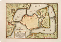
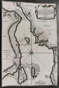
1700M10800Paris 1700. Very Good margins are trimmed. Notes: Map of Oresund strait between Denmark and Sweden. Size : 328x218 mm 12.91x8.58 Inches Coloring: Black & White Category: Maps Europe Scandinavia Countries; unknown
2010SKU-8044AA01904056Assn of Iron & Steel Engineers 2010. 4. Hardcover. Good. Good; Hardcover; 4th Edition; Clean covers with minor edgewear; Unblemished textblock edges; The endpapers and all text pages are clean and unmarked; The binding is excellent with a straight spine; This book will be shipped in a sturdy cardboard box with foam padding; Large Format Quatro 10.75" - 11.75" tall; Heavy 5.1 lbs; Dark blue covers with title in light blue lettering; 2010 Assn of Iron & Steel Engineers; 768 pages; "Lubrication Engineers Manual 4th Edition" by Association for Iron and Steel Technology. Assn of Iron & Steel Engineers hardcover
2013x-1447124278Springer 2013. Hardcover. New. 2013 edition. 370 pages. 9.53x6.38x0.94 inches. Springer hardcover
2019x-0367137089Taylor & Francis 2019. Hardcover. New. 293 pages. 9.25x6.25x0.75 inches. Taylor & Francis hardcover
20192-0464287111Blurb 2019. Hardcover. New. 480 pages. Spanish language. 8.23x5.32x1.50 inches. Blurb hardcover
3J6-00052CreateSpace Independent Publishing Platform 2015-01-01. paperback. New. 8x0x11. Ship within 24hrs. 100% Satisfaction is Our #1 Goal! CreateSpace Independent Publishing Platform paperback
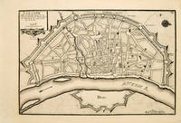
171753083Atlas Curieux ou le Monde. Paris 1717. Plan of Cologne with north to the right showing fortifications and old town. Title at top left. Includes accompanying text Copper engraving. Excellent condition good margins. Uncoloured. Size: 34.8 x 24 cm. 13½ x 9½ inches unknown
20112-1612093736Nova Science Pub Inc 2011. Hardcover. New. 183 pages. 10.25x7.25x0.75 inches. Nova Science Pub Inc hardcover
20192-0464120543Blurb 2019. Hardcover. New. 476 pages. Spanish language. 8.31x5.32x1.42 inches. Blurb hardcover
20192-0464010853Blurb 2019. Hardcover. New. 474 pages. Spanish language. 8.23x5.28x1.42 inches. Blurb hardcover
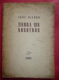
194742.264Santander : Proel 1947. 1ª ed. Rústica. 17.2x24. Proel paperback
2023__0323992374Academic Pr 2023. Hardcover. New. 422 pages. 9.00x6.00x0.75 inches. Academic Pr hardcover
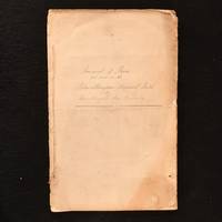
1849842F32Not Stated: None 1849-1851. Paperback. Very Good. 13.5" by 9". None. A fascinating handwritten mid-nineteenth century account of bores put down in the Scottish mining town of Dalmellington. A handwritten manuscript 'Journal of Bores Put Down in the Dalmellington Mineral Field' by the Dalmellington Iron Company between 1849 to 1851.The Dalmellington Ironworks were opened by The Dalmellington Iron Company in 1848 in the small Sottish market town of Dalmellington. Good quality coal was produced from surface workings and sent down the turnpike road to Galloway with the town growing after the completion of a local railway in 1858.This manuscript discusses the depth of boreholes made in the mid-glen Craigmark; Burnfoot Hill; Burnhead Glen and Lillyhole between 1849 and 1851 with note made of the depths and locations at which coal and ironstone were found.A wonderful insight into mines in mid-nineteenth century Scotland. In paper wraps with handwritten title to front wrap. Chipping small losses and discolouration to wrap perimeters. Internally firmly bound. Pages generally clean and bright. Very Good None paperback
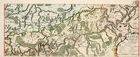
171752951Paris. 1717. An attractive map of part of Belgium showing forests and river valleys. 'de Fer's maps are popular despite or maybe because of their rather flamboyant decoration' Moreland & Bannister p130. Title at lower right. Atlas Curieux ou Le Monde. Copper engraving. Fine condition Original colour. Size: 59 x 23 cm. unknown
1705527391705. A plan of the town fortifications and surrounding area Copper engraving. Fine condition Later colouring. Size: 34 x 23 cm. 13½ x 9 inches unknown
19332111902160500667Not Available 1933. Soft Cover. Fine. Number of copies: Kaiseisha Not Available paperback
18912110502150905421Makura Yisai Zhuban 1891. Soft Cover. Fine. Number of books: 4 Makura Yisai Zhuban paperback
ria9780415140072_inpHardcover. New. New Book; Fast Shipping from UK; Not signed; Not First Edition; The first comprehensive synthesis and analysis of colonialism from its origins to the present. Using a non-Eurocentric approach Ferro compares all the European colonial powers as well as Arab Turk and Japanese colonialism. hardcover
137025New York: J.L. Mott Iron Works 1905. 4to card covers Very good. 131pp. Illustrations index. The covers are lightly soiled the spine is a bit twisted and has wear at the top and bottom including a one inch chip from the bottom. Trade Catalogs Hospital Equipment Plumbing Fixtures Trade Catalogs. J.L. Mott Iron Works Paperback
20192-036899614XBlurb 2019. Hardcover. New. 474 pages. Spanish language. 8.27x5.28x1.50 inches. Blurb hardcover
20192-0464004039Blurb 2019. Hardcover. New. 470 pages. Spanish language. 8.27x5.32x1.38 inches. Blurb hardcover
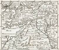
1700399AG1700. Paris c. 1700. Original copper engraved maps. 16 cm wide x 13.2 cm high. Mounted on paper. Very good condition. From a wonderful collection of Maps from an old english library South Shields - with a tiny library stamp to the mounting paper The stamp is NOT on the Map. Nicolas de Fer 164625 October 1720 was a French cartographer and geographer. De Fer was the youngest of three sons of Antoine de Fer who was also a cartographer. When he was 12 he became the apprentice of Parisian engraver Louis Spirinx and made his first map of the Canal du Midi at the age of 23. After the death of his father in June 1673 his mother Geneviève initially took over the map making company which had begun to decline. She passed it and the atelier called Quai de L'Horloge on to Nicolas in 1687 because of her old age. De Fer was so successful at improving the firm that in 1690 he became the official geographer to Louis Dauphin of France. With support from the Spanish and French Royal Families de Fer also became official geographer for Philip V and Louis XIV the kings of Spain and France respectively. Because of this his maps became Bourbon propaganda endorsing French King Louis XIV. His business flourished producing town plans atlases wall maps and more than 600 sheet maps. He made maps of places in Europe and North America including New Spain places fortified by Vauban the Low Countries and the War of the Spanish Succession. In 1698 de Fer published a map of North America which included a depiction of beavers building dams near Niagara Falls. Seventeen years later Herman Moll published a map which plagiarized elements of de Fer's work particularly the beaver scene. It became known as the "Beaver map". De Fer became the official geographer for His Catholic Majesty in 1720. Two of his sons-in-law Guillaume Danet and Jaques-François Bénard continued the company after de Fer's death on 25 October of that year until around 1760. Wikipedia unknown
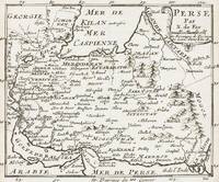
1700402AG1700. Paris c. 1700. Original copper engraved maps. 15.5 cm wide x 13 cm high. Mounted on paper. Very good condition. From a wonderful collection of Maps from an old english library South Shields - with a tiny library stamp to the mounting paper The stamp is NOT on the Map. Nicolas de Fer 164625 October 1720 was a French cartographer and geographer. De Fer was the youngest of three sons of Antoine de Fer who was also a cartographer. When he was 12 he became the apprentice of Parisian engraver Louis Spirinx and made his first map of the Canal du Midi at the age of 23. After the death of his father in June 1673 his mother Geneviève initially took over the map making company which had begun to decline. She passed it and the atelier called Quai de L'Horloge on to Nicolas in 1687 because of her old age. De Fer was so successful at improving the firm that in 1690 he became the official geographer to Louis Dauphin of France. With support from the Spanish and French Royal Families de Fer also became official geographer for Philip V and Louis XIV the kings of Spain and France respectively. Because of this his maps became Bourbon propaganda endorsing French King Louis XIV. His business flourished producing town plans atlases wall maps and more than 600 sheet maps. He made maps of places in Europe and North America including New Spain places fortified by Vauban the Low Countries and the War of the Spanish Succession. In 1698 de Fer published a map of North America which included a depiction of beavers building dams near Niagara Falls. Seventeen years later Herman Moll published a map which plagiarized elements of de Fer's work particularly the beaver scene. It became known as the "Beaver map". De Fer became the official geographer for His Catholic Majesty in 1720. Two of his sons-in-law Guillaume Danet and Jaques-François Bénard continued the company after de Fer's death on 25 October of that year until around 1760. Wikipedia unknown
1700403AG1700. Paris c. 1700. Original copper engraved maps. 15.5 cm wide x 13 cm high. Mounted on paper. Very good condition. From a wonderful collection of Maps from an old english library South Shields - with a tiny library stamp to the mounting paper The stamp is NOT on the Map. Nicolas de Fer 164625 October 1720 was a French cartographer and geographer. De Fer was the youngest of three sons of Antoine de Fer who was also a cartographer. When he was 12 he became the apprentice of Parisian engraver Louis Spirinx and made his first map of the Canal du Midi at the age of 23. After the death of his father in June 1673 his mother Geneviève initially took over the map making company which had begun to decline. She passed it and the atelier called Quai de L'Horloge on to Nicolas in 1687 because of her old age. De Fer was so successful at improving the firm that in 1690 he became the official geographer to Louis Dauphin of France. With support from the Spanish and French Royal Families de Fer also became official geographer for Philip V and Louis XIV the kings of Spain and France respectively. Because of this his maps became Bourbon propaganda endorsing French King Louis XIV. His business flourished producing town plans atlases wall maps and more than 600 sheet maps. He made maps of places in Europe and North America including New Spain places fortified by Vauban the Low Countries and the War of the Spanish Succession. In 1698 de Fer published a map of North America which included a depiction of beavers building dams near Niagara Falls. Seventeen years later Herman Moll published a map which plagiarized elements of de Fer's work particularly the beaver scene. It became known as the "Beaver map". De Fer became the official geographer for His Catholic Majesty in 1720. Two of his sons-in-law Guillaume Danet and Jaques-François Bénard continued the company after de Fer's death on 25 October of that year until around 1760. Wikipedia unknown
1896120209AB1896. London Hutchinson & Co 1896. 13.5 cm x 19.5 cm. Frontispiece XV 346 pages. Hardcover publisher's original cloth with gilt lettering and decoration on spine. Small embossment to front board. Deckled top edge. Very good condition with only minor signs of external wear. Minor bumps to board corners. Small cutout of old name on halftitle. Interior lightly tanned throughout but bright and clean. Binding is strong firm and square. Includes for example the following: Shadows from Child Life / Plans and Bushman-Paintings / Sunday Services / Bonaparte Blenkins Makes his Nest / Waldo's Stranger / Gregory Rose Finds his Affinity / A Boer-Wedding / Dreams etc. Olive Schreiner 24 March 1855 11 December 1920 was a South African author anti-war campaigner and intellectual. She is best remembered today for her novel The Story of an African Farm 1883 which has been highly acclaimed as one of the first feminist novels. It tells the story of a girl on an isolated farm on the veld who struggles for her independence in the face of rigid Boer social conventions. in doing so it deals boldly with such contemporary issues as agnosticism existential independence individualism the professional aspirations of women and the elemental nature of life on the colonial frontier. Since the late 20th century scholars have also credited Schreiner as an advocate for the Afrikaners and other South African groups who were excluded from political power for decades such as indigenous Blacks Jews and Indians. Although she showed interest in socialism pacifism vegetarianism and feminism amongst other topics her views escaped restrictive categorisations. Her published works and other surviving writings promote implicit values such as moderation friendship and understanding amongst all peoples and avoid the pitfalls of political radicalism which she consciously eschewed. Called a lifelong freethinker she also continued to adhere to the spirit of the Christian Bible and developed a secular version of the worldview of her missionary parents with mystical elements. Wikipedia hardcover