2 067 résultats
0260367494.Gpaperback. Good. Access codes and supplements are not guaranteed with used items. May be an ex-library book. paperback
2018x-0300237251Yale Univ Pr 2018. Hardcover. New. 192 pages. 10.50x8.40x1.00 inches. Yale Univ Pr hardcover
1935327135.Gperfect. Good. Access codes and supplements are not guaranteed with used items. May be an ex-library book. unknown
1864lib11199908909Bc18Habana Libreria imprenta el iris obispo 1864. Hardcover. Very Good. original plain two toned green boards some wear at edges otherwise very good solid and tight 3 parts in two books Habana Libreria imprenta el iris obispo hardcover
1332137067.Gpaperback. Good. Access codes and supplements are not guaranteed with used items. May be an ex-library book. paperback
0656395044.Ghardcover. Good. Access codes and supplements are not guaranteed with used items. May be an ex-library book. hardcover
1023655969.Ghardcover. Good. Access codes and supplements are not guaranteed with used items. May be an ex-library book. hardcover
1023912090.Ghardcover. Good. Access codes and supplements are not guaranteed with used items. May be an ex-library book. hardcover
50684047like new. unknown
129402888X.Gpaperback. Good. Access codes and supplements are not guaranteed with used items. May be an ex-library book. paperback
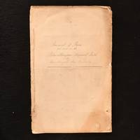
1849842F32Not Stated: None 1849-1851. Paperback. Very Good. 13.5" by 9". None. A fascinating handwritten mid-nineteenth century account of bores put down in the Scottish mining town of Dalmellington. A handwritten manuscript 'Journal of Bores Put Down in the Dalmellington Mineral Field' by the Dalmellington Iron Company between 1849 to 1851.The Dalmellington Ironworks were opened by The Dalmellington Iron Company in 1848 in the small Sottish market town of Dalmellington. Good quality coal was produced from surface workings and sent down the turnpike road to Galloway with the town growing after the completion of a local railway in 1858.This manuscript discusses the depth of boreholes made in the mid-glen Craigmark; Burnfoot Hill; Burnhead Glen and Lillyhole between 1849 and 1851 with note made of the depths and locations at which coal and ironstone were found.A wonderful insight into mines in mid-nineteenth century Scotland. In paper wraps with handwritten title to front wrap. Chipping small losses and discolouration to wrap perimeters. Internally firmly bound. Pages generally clean and bright. Very Good None paperback
1801209588.Gpaperback. Good. Access codes and supplements are not guaranteed with used items. May be an ex-library book. paperback
1801588023.Gpaperback. Good. Access codes and supplements are not guaranteed with used items. May be an ex-library book. paperback
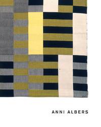
1993G0300055188I4N00Yale University Press 1993. Hardcover. Very Good. May have limited writing in cover pages. Pages are unmarked. ~ ThriftBooks: Read More Spend Less.Dust jacket quality is not guaranteed. Yale University Press hardcover
11637440-nnew. unknown
2022130568Metropolitan Museum of Art. New. 2022. Hardcover. 1588397483 . IN STOCK AND IMMEDIATELY AVAILABLE FOR SHIPMENT - Flawless copy brand new pristine never opened - - with a bonus offer--; 9.25 X 1 X 10.25 inches; 172 pages . Metropolitan Museum of Art hardcover
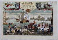
1725M4694Paris 1725. Excellent. Notes: A decorative and beautifully hand coloured title page of the important atlas L'Atlas Curieux ou Le Monde" by Nicholas de Fer. Size : 220x335 mm 8.625x13.125 Inches Coloring: Hand Colored Category: Maps Misc Curiosities Title Pages Games etc. unknown
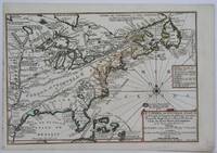
1705M4344Paris 1705. Excellent. Notes: This decorative map focuses on the French possessions in North America. The treatment of French Florida is intriguing. The map shows the United States of America and parts of Southern Canada East of the Mississippi river.<br>"Territorial expansion of New France had reached the Mississipi River with the establishment of the first European settlement at Fort Maurepas by Pierre Le Moyne d'Iberville in 1699 sixteen years after La Salle had reached the mouth of the river. This attractive map from 'L'Atlas Curieux ou le Monde' paris 1705 although containing geographical errors has many interesting historical notes" -The Macdonald Stewart Foundation Size : 232x342 mm 9.125x13.5 Inches Coloring: Hand Colored in Outline Reference: The Macdonald Stewart Foundation "La Decouverte du Monde Cartographes et Cosmographes" Map # 44; McCorkle 702.2 Category: ; Maps North America Great Lakes; Maps Canada; Maps Canada East; Maps United States East; Maps United States South unknown
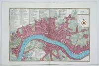
1705M4627Paris 1705. Very Good. Size : 230x340 mm 9x13.375 Inches Coloring: Hand Colored Category: Maps City Maps; Maps Europe United Kingdom England London unknown
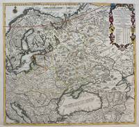
1711M4915Paris 1711. Very Good upper and lower margin have been extended. Laid on acid free paper for long term preservation. Notes: Stolen Size : 520x565 mm 20.5x22.25 Inches Coloring: Original Outline Coloring Category: ; Maps Europe Poland Lithuania; Maps Europe Ukraine unknown
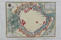
1705M4699Paris 1705. Excellent. Size : 245x340 mm 9.625x13.375 Inches Coloring: Hand Colored Category: Maps City Maps; Maps Europe Austria unknown
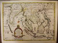
1700M6975London c. 1700. Very Good. Notes: A late 17th Century map of South East Asia by Edward Wells based upon the previous work by De Fer. <br><br>The cartouche has the dedication in the coat of arms to the Duke of Gloucester. Size : 367x487 mm 14.45x19.17 Inches Coloring: Original Outline Coloring Category: Maps Asia South East; Maps Asia Central India & Sri Lanka / Ceylon; unknown
2329295723.Gpaperback. Good. Access codes and supplements are not guaranteed with used items. May be an ex-library book. paperback
2329295731.Gpaperback. Good. Access codes and supplements are not guaranteed with used items. May be an ex-library book. paperback
32756516like new. unknown