De Fer MD FACP, Dr Thomas M M DBiblio.com

2 067 résultats
32756516-nnew. unknown
8417949151.Gpaperback. Good. Access codes and supplements are not guaranteed with used items. May be an ex-library book. paperback
1975113284.Gpaperback. Good. Access codes and supplements are not guaranteed with used items. May be an ex-library book. paperback
SKU0504285LWW 2018-07-18. Paperback. Good. Textbook May Have Highlights Notes and/or Underlining BOOK ONLYNO ACCESS CODE NO CD Ships with Emailed Tracking LWW paperback
DADAX1975113284Lippincott Williams & Wilkins 2018-07-18. Fifth. paperback. New. 4.30x0.60x7.10. Buy with confidence. Excellent Customer Service & Return policy. Lippincott Williams & Wilkins paperback
6204950738New. Brand new and still unused unknown
1705180573Paris: Published by the author 1705. First Edition . Hardcover. Very Good/No Jacket. Wide 8vo. An atlas comprising 19 maps 1. Des cercels de Longitude et de Latitude et des Diverses Positions de la Sphere; 2. Carte General du Globe Terrestre et Aquatiques ou Mappemonde en deux Plans-hemisphere 1705; 3. l'Europe Dresee sur diverse Relations; 4. L'Asie Dressee Sur Divers Relations 1705; 5. L'Aftique Dressez sur les dernieres Relations; 6. L'Amerique Meridionale; 7. L'Amerique Septentrionale et les Terres Polaires Arctique; 8. La France Avec Ses Acquisitions Insqu'a l'Annee 1705; 9. Les Environs de Paris 1705; 10. Les XVII Provinces des Pais Bas Divisees 1705; 11. Les Isles Britanniques ou Sont les Royaumes D'Angleterre D'Ecosse et D'Irleland avec les Costes Septentrionales de France et Celles de Pais Bas; 12. Suede Norvegue et Dannemarck 1705; 13. Les Estats de la Couronne de Pologne 1705; 14. L'Allemagne Divisee En Dix Cercles Dressee sur les Derniers memoires; 15. Estats du Grand Duc de Moscovie suivant les derniere relations; 16. Hongrie ou Partie Septent de la Turque en Europe; 17. L'Espagne Divisee en Galice Asturies Biscaye Navarre Leon Vielle et Nouvelle Castille Arragon Andalousie Mursie Valence et Catalogne avec Les Isles Majorque Minorque et Yvica au Roy d'Espagne; Le Portugal et L'Algarve avec Roy de Portugal; 18. L'Italie Divisee en ses Pricipaux Estats; 19. Partie Mediridionale de la Turquie D'Europe ou La Grece. Each map has a written descritpion in French. The first 2 pages are lacking the paper on the right-hand edge and have been repaired. The remainder of the maps and text are in very good original condition. A newer binding in 3/4 brown calf over brown boards with marbled endpapers with the bookplate of Antonio Barrette on the blank ffep. An excellent copy of a very scarce work. <br/> <br/> Published by the author hardcover
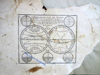
2n1783De Fer Paris um 1700. Maße: 27 cm x 195 cm. - Nicolas de Fer war einer der führenden französischen Kartographen und Kartenverleger - unknown
2n1782De Fer Paris um 1700. Maße: 285 cm x 203 cm. - Nicolas de Fer war einer der führenden französischen Kartographen und Kartenverleger - unknown
2n1770De Fer Paris 1692. Maße: 28 cm x 205 cm. - Nicolas de Fer war einer der führenden französischen Kartographen und Kartenverleger - unknown
2n1615ca. 1692. Blattgröße: 365 cm x 275 cm. - kräftiger Abdruck / sauberes Blatt - unknown
2n1775De Fer Paris 1705. Maße: 285 cm x 195 cm kleiner Einriß am oberen Blattrand. - Nicolas de Fer war einer der führenden französischen Kartographen und Kartenverleger - unknown
2n1616ca. 1692. Blattgröße: 365 cm x 275 cm. - kräftiger Abdruck / sauberes Blatt - unknown
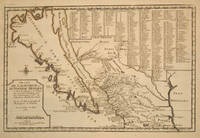
170015901Paris 1700. Early original color large map of California showing it as an island and based on the explorations of missionary Father Kino. From De Fer's Atlas Curieux. In great detail with 314 locations in New Mexico identified by a numbered key at the upper right portion of the map. Engraved by Charles Inselin. mage size: 13 1/2 x 8 7/8". Paper size: 16 1/2 x 11 1/2". With a small chip at lower edge; very faint damp staining at upper left corner toning to edges; otherwise very good. Tooley R. V. Amer P 126-7. unknown
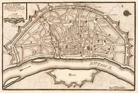
170219554Paris: N. de Fer 1702. Other. One old crease in the paper else in very good condition. 232 by 349mm 9 by 13 inches. 232 by 349mm 9 by 13 inches. Hand-Colored Original Copperplate Engraving by Nicolaus de Fer depicting Cologne. Published Paris N. de Fer 1702. Sheet: 232 by 349mm 9 by 13 inches. A fine and original hand-colored example of de Fer's celebrated cartographic work documenting this region of Germany with the precision and decorative artistry characteristic of the 17000s. Nicolaus de Fer was a cartographer active in the 1700s working in the tradition of European copper-engraved cartography. Their maps are valued by collectors for their historical accuracy and decorative quality.This original copperplate engraving with original hand coloring depicts the region of Cologne published in Paris N. de Fer 1702. The map records the political and geographic boundaries of the region as understood in 1702 offering a fascinating window into the history of German territorial organization. Sheet measures 232 by 349mm 9 by 13 inches. In excellent condition. Ready to frame. N. de Fer unknown
1705M1429A detailed map of Normandy also showing the islands of Guernsey Jersey and part of Brittany.<br /> From "L'Atlas Curieux ou le Monde Represente ans des Cartes Generales et Particulieres du Ciel et de la Terre..."
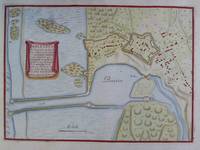
2n1779De Fer Paris um 1700. Maße: 26 cm x 19 cm. - Nicolas de Fer war einer der führenden französischen Kartographen und Kartenverleger - unknown
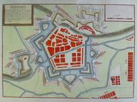
2n1784De Fer Paris um 1700. Maße: 25 cm x 17 cm. - Nicolas de Fer war einer der führenden französischen Kartographen und Kartenverleger - unknown
2n1781De Fer Paris um 1700. Maße: 28 cm x 205 cm. - Nicolas de Fer war einer der führenden französischen Kartographen und Kartenverleger - unknown
1104763567.Gpaperback. Good. Access codes and supplements are not guaranteed with used items. May be an ex-library book. paperback
1166040615.Gpaperback. Good. Access codes and supplements are not guaranteed with used items. May be an ex-library book. paperback
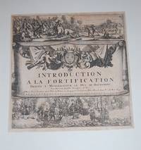
169315226Paris:: De Fer 1693. 19 x 20cm. Single leaf. Illustrated title page. Trimmed just outside borders clean. Mounted on larger plain leaf. Suitable for framing. De Fer, unknown
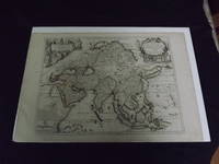
1722biblio10<p>Engraved double page map 28" x 20" wide margins hand colored in outline two uncolored pictorial cartouches. Expert and nearly invisible repairs along centerfold normal aging; about near fine. Impression is bright and clean. Nicholas De Fer 1646-1720 was a highly respected and prolific French cartographer whose maps were valued for their decorative appeal. Around 1690 he was made the geographer to the Dauphin and published his first atlas. He would become geographer to other high-ranking individuals in French and Spanish society. The present map is detailed and attractive map of Asia with a cartouche showing Chinese at the upper left and Indians in the upper right. The map covers a lot of territory showing Arabia and the Persian Empire in the West and Japan in the east but goes as far south as the Isle of Borneo and Java. Part of Eastern Europe is also visible. Library missouri website.</p>
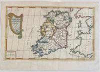
1689322292Paris: Nicolas De Fer 1689. unbound. Map. Engraving with original hand outline color. Sheet measures 13" x 9.5". Image measures 12.75" x 7.25".<br/> <br/> This is a lovely 1689 map of Ireland by Nicolas De Fer. Depicts the Emerald Isle in its entirety color coded and subdivided into its four provinces of Ulster Connacht Leinster and Munster. Parts of Scotland the Isle of Man and England and Wales are also visible. Major towns lakes rivers and islands are noted in Ireland and mountains beautifully rendered in profile. The title cartouche represents the Celtic Harp. The map is in good condition with minor toning along the original fold. Original platemark visible.<br> <br> Nicolas de Fer 1646-1720 was a prolific cartographer engraver and publisher who took over the family map business from his mother when she retired in 1687. The business flourished and he gained a great reputation in his lifetime and was appointed 'Geographer to the King' in 1690. This map demonstrates his skill and provides a curious yet alluring mixture of history and geography.<br/> <br/> Nicolas De Fer unknown
2n1772De Fer Paris um 1700. Maße: 26 cm x 18 cm. - Nicolas de Fer war einer der führenden französischen Kartographen und Kartenverleger - unknown