89 résultats
1898249679London: Rowland Ward 1898. First edition. Illustrated with photographs by the author and one folding map of two in back pocket. 506 pp. 1 vols. 8vo. Mulberry cloth titled in silver. Hinges cracked. Lacking one map. Good only. First edition. Illustrated with photographs by the author and one folding map of two in back pocket. 506 pp. 1 vols. 8vo. A lively account of the author's adventures during an eight-month shooting trip in Baltistan Ladakh and Kashmir.<br/><br/>The map of Jummoo and Kashmir with the author's travel route is present; the map of The Great Bend of the Indus is lacking. Czech Asia 58 Rowland Ward unknown books
188738873London: Republished by Field & Tuer 1887. Small 8vo 18.5 cm 7.25". 4 iv 7-29 2 pp. 4 ads ff.; 1 plt. col. illus. <br><br>Riddles and counting-out rhymes all part of a fun game whose instructions serve as a preface. The text is printed on one side of a leaf only and => each printed page has a hand-colored illustration.<br>Â Â Â Â The work was first printed by Dean & Munday in 1823 and is here presented as vol. II in the Leadenhall Press "Series of Forgotten Picture Books for Children."<br>Â Â Â Â Provenance: From the children's book collection of Albert A. Howard small booklabel "AHA" at rear. Buff-color printed wrappers with hand-colored vignette on front wrapper; stitched head and foot of spine chipped rear wrapper detached and reattached with archival tissue. A good copy. Republished by Field & Tuer unknown books
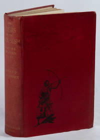
1896223413London.: Lawrence & Bullen Ltd. New Edition. 1896. Coloured folding map tipped in at rear 79 full page and text illustrations by A. D. McCormick xx 658pp original decorated polished red cloth spine gilt-lettered 24 x 15.5 cms front free endpaper browned neat inscription of a previous owner to the front pastedown manuscript short index tipped in by a previous owner at rear boards bumped and stained and spine a little sunned but a good complete copy. A distinguished soldier diplomat and Anglo-Indian administrator Sir George Scott Robertson 1852–1916 journeyed in Kafiristan in 1890-91 living for a year among the "wild" hillmen. <br>The Kafirs’ polytheistic religion and customs were rapidly disappearing by the time Robertson visited and his work served as one of the most important eyewitness accounts of the pre-Islamic cultures of the Hindu Kush and as valuable historical record of a culture that was quickly being assimilated into the broader Afghan Islamic state. It is one of the last detailed accounts of the Kafir people before they were forced into Islam or eradicated by Afghan forces. <br>Robertson’s book also provides important historical context for understanding the political dynamics of the Great Game. His observations of the Kafirs’ resistance to the Afghan Amir and his concerns about the potential spread of Islam in the region highlight the intersection of politics culture and religion in Central Asia during the 19th century. <br>The profuse illustrations are after sketches and watercolours by Arthur David McCormick who was artist on Sir Martin Conway's expedition to the Karakoram subrange of the Himalayas and in 1895 on Clinton T. Dent's expedition to the Caucasus Mountains. . Lawrence & Bullen Ltd. hardcover
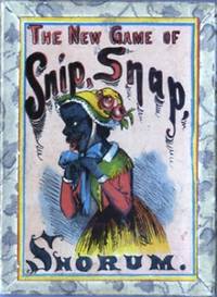
1890510171890. Deck of 20 illustrated playing cards 3 5/8 x 2 9/16 inches hand-colored with 2 card with printed game instructions. All housed in the original box with color printed label on the lid. A few cards have light soiling or foxing as does the blank paper of the box. Near fine. The game or Snip Snap Snorum has its roots in the late 18th century and was popular throughout the 19th century. It is basically a stops game in which cards are played in ascending sequence in suit. This version has five suits each containing four cards. Of these two suits depict stereotyped images of blacks with ridiculous racist names. unknown
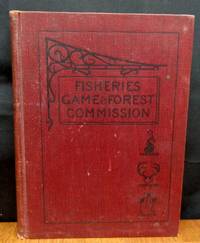
1898050957Wynkoop Hallenbeck Crawford Co. Good with no dust jacket. 1898. Hardcover. Hardcover. The front free endpaper has been SIGNED 'Compliments of Edward Thompson' who was one of the commissioners and authors. Red cloth boards show edge wear and soil. Sun darkened spine ends frayed. Text pages lightly tanned occasional finger soil rough edges. Includes 9 Denton color chromolithographic fish plates and 5 Ridgeway animal plates 1 Catchment Basins map which has a few closed tears plus many black and white photos and illustrations. Always carefully wrapped and shipped in cardboard boxes to protect your purchase. ; 4to 11" - 13" tall . Wynkoop Hallenbeck Crawford Co. hardcover
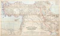
1899155664Dehra Dún India & Berlin: Photozincographed at the Office of the Trigonometrical Branch Survey of India & Dietrich Reimer 1899-1904. Remarkable assemblage of three important and superbly detailed maps A rare opportunity to acquire three exceptionally impressive and uncommon maps together forming the finest contemporary cartographic overview of the Great Game's central theatre. Spanning from the Mediterranean to Afghanistan and from the Caspian to Sir Baniyas Island they present a striking synoptic view of the region at a moment of intense strategic interest. All three share the same provenance each bearing the distinguished bookplate of the officers' mess library of the 85th Foot later part of The King's Light Infantry. Likely acquired as a group by an officer attuned to imperial affairs in the run-up to or immediate aftermath of the 1907 Anglo-Russian Convention they reflect the period's effort as Hopkirk notes to resolve regional rivalries and curb Germany's eastward ambitions. The Persia map is a landmark Survey of India production and the most comprehensive rendering of the region then available incorporating the latest British and Russian surveys and reconnoitres. Only 300 copies of this August 1904 issue were printed and institutional locations are limited to the British Library Deutsche Nationalbibliothek and Sächsische Landesbibliothek. The impressive wall map of Afghanistan June 1901 produced under Strahan and Gore and executed at the Frontier Drawing Office under Colonel R. A. Wahab is equally rare with copies recorded only at the British Library Wisconsin and the Bayerische Staatsbibliothek. Its authority rests on extensive British and Russian sources including work by Robertson Trotter Sykes Ney Elias and the Afghan Boundary Commission. These maps exemplify the Survey of India's exacting standards during the era of photozincographic production when officers were required to vet every detail under magnification. Kiepert's map of the Ottoman Empire complements the two Survey of India sheets representing the best contemporary mapping of a region Britain could not itself survey. Kiepert one of the foremost scholarly cartographers of the 19th century travelled widely in Ottoman territories producing clear and remarkably accurate maps that remain valuable records of the period. This map is comparatively well represented institutionally with around 17 holdings recorded in Europe the US and the UK. Persia: scale 1:1013760 six-sheet coloured map divided into four linen-backed quadrants each measuring approx. 976 x 963 mm when assembled measuring 1952 x 1926 mm North West North East South West South East each backed with Nonpareil pattern marbled paper each section dissected into 20; Afghanistan: scale 1:1013760 coloured map dissected into 45 sections linen backed measuring approx. 1035 x 1640 mm; Turkey: scale 1:1500000 coloured map dissected into 65 sections linen backed measuring approx. 1016 x 1700 mm; together with the "Apercu general" measuring 412 x 570 mm showing the administrative division of the same area intended to accompany the map; dissected into 10 sections linen backed. Each map housed in the original dull purple morocco-grain cloth case Stanford's printed label to front. Cases a little worn with some loss of fabric light toning to maps otherwise in excellent condition. Cases a little worn with some loss of fabric occasional light toning to maps otherwise in excellent condition. Kourosh Ahmadi Islands and International Politics in the Persian Gulf: Abu Musa and the Tunbs in Strategic Perspective 2008; Kyle J. Gardner The Frontier Complex: Geopolitics and the Making of the Indo-China Border 1846-1962 2021; Peter Hopkirk The Great Game: On Secret Service in High Asia 1992. hardcover
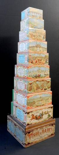
18823220299<i>A nest of nine wooden blocks ranging in size from 78 x78 x 46 mm to 182 x 182 x 60 mm each with a chromolithograph wrap-around illustration depicting European countries with statistical information; contained in the original box with a wrap around title label including four cartouche scenes printed in blue; with a sliding lid replaced.</i><br /><br />Each of the blocks is illustrated with a typical scene from European countries Russia the largest block showing a number of troikas in a winter landscape Germany & Austria with a view of Vienna Sweden and Denmark with mining for iron Turkey & Greece with a view of Istanbul etc. Also included are cartouches with basic information on the population and chief products of each country. <br /><br />The now ubiquitous graduated nested set of blocks for children was quite a late development in toy design with the earliest known patent being applied for in the US in 1881. Watilliaux's Tour of Babel was first marketed as interlocking jigsaw like pieces that could be joined together as hexagons and then stacked to form a tower that was issued at the time of the 1878 Paris Exposition here depicted as the illustration representing France. However when first American nested blocks began to appear Watilliaux evidently adapted the printed design and applied it to his own set of graduated blocks. Unfortunately this reworking did not quite fit the increased surface area of the blocks and a blank section has perforce had to be filled by a section of green glazed paper. It also necessitated the dropping the country of Switzerland and in that case the original pattern was too large to be adapted without their being some lose to the design.<br /><br />No doubt the original design had some educational value although this is somewhat lessened as there is no dexterity needed to correctly interlock the jigsaw pieces and instead only to stack and knock down the Tour de Babel.<br /><br />In 1874 Charles Watelliaux took over the publisher and manufacturer of many board games and toys Bernard Coudert and became a major producer until its sale in 1908 to Revenaz & Tabernat. Watilliaux, Editeur, Lith. J. Marie, Faub St Denis, 61.
189764124New York: Longmans Green & Co. 1897. Tall 8vo. 8 195 1 pp. Six plates. Pictorial green publisher’s cloth cover art of moose by Decorative Designers gilt lettering front cover & spine slight rubbing & scuffing to lower right fore-edge very minor dustsoiling still VG bright copy. First American edition of this excellent work incorporating big game hunting accounts of Lions in South Africa Hippopotamus Giraffe & Zebra hunting as well as Grizzlies in the Rocky Mountains and Moose. Longmans, Green & Co., hardcover
180950306London: Publisher for the Author. by W. & T. Darton 1809. Folding game 54 x 66 cm the map portion 49 x 43 cm not including margins dissected and backed on linen. Attractive contemporary hand colouring panels either side mostly in double column containing the instructions and a list of the places featuring in the game with brief descriptions. Some minor creasing to the edge of a few sections some soiling to the reverse. Original marbled case with a printed label a little rubbed overall a well preserved example. Whitehouse p.13. London: Publisher for the Author... by W. & T. Darton unknown
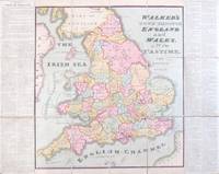
1802207728Lond. W. & T.Darton. 1802. Large folding hand-coloured map of England & Wales. 550x530cm when unfolded. Has 118 place markers on which counters can move when a totum is thrown. The counters can be purchased separately. The players commence in Maidstone no.1. and end in London No.118. Contained in a rubbed card case. Good copy. Scarce. The directions for playing s printed on the sides of the map. Lond. W. & T.Darton. unknown
18096214<p>This is an original linen-backed folding map game published in London in 1809 by William Darton.</p><p>Overall 25 1/2 x 21 inches. It is an early example of the "Cartographic Game" genre that became very popular in later Victorian England. The map folds and fits into the original slipcase with printed label. The rules are printed in columns at the sides. The object of the game is to move tokens originally in the shape of pyramids their landing place determined by use of a teetotum called a <em>totum </em>at that time and read about the region upon which one landed. It was both competitive and educational.</p><p>Early map games such as this have become very scarce. Most did not survive since they were children’s toys. This one is in remarkably good condition. There is a light stain in the lower left of the map part and general light age-toning but the colors are bright and crisp. The linen backing is sound and the folds are intact. The original slipcase has two printed paper labels.</p> Darton, William unknown books
1898NF0052WHERE TO HUNT AMERICAN GAME United States Cartridge Co.1898 first edition a bright vg copy in gold-gilt stamped pictorial with over 125 illustrations. United States Cartridge Co. 1898 unknown
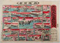
1898218612大阪. Osaka.: 東新太郎. Azuma Shintarō. Meiji 31 1898. Colour woodblock sugoroku 37.8 x 53cm a little light staining and soiling in margins very good. This vividly printed colour woodblock sugoroku game was published in 1898 and features major sites in Osaka. The game highlights entertainment districts such as Dōtonbori Shinsaibashi and the city’s red-light areas. It also includes the headquarters of Osaka Shōsen Kaisha OSK.<br><br>Known as the city of rivers canals and bridges Osaka is well represented in the game through depictions of several famous bridges. The goal of the game is the Osaka Army Headquarters located near Osaka Castle. Distances from Kōrai Bridge to various destinations are listed in the lower right corner. . 東新太郎. [Azuma Shintarō]. unknown
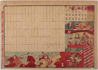
1892215726大野栄吉. Ōno Eikichi. Meiji 25 1892. Colour woodblock print 22.8 x 32.5cm evenly browned few chips in margins but overall very good. This colourful woodblock print serves as a point sheet for a horse racing board game. While the game rules are unclear the print vividly captures an exciting race scene featuring three horses and their jockeys. The race unfolds in a festive atmosphere complete with blossoms and lanterns while the spectators appear to include the Meiji Emperor and Empress along with their entourage. The Emperor is depicted in full military uniform and the Empress is shown in a traditional kimono. The print also displays the prizes for first through seventh place which include a silver cup a trophy a riding cap a scarf a shoe and a whip. Western-style horse racing began in Japan in the mid-19th century following the arrival of Westerners and became a high-class social event during the Meiji period. . 大野栄吉. [Ōno Eikichi]. unknown